Blackcat
Settlement in Essex Epping Forest
England
Blackcat

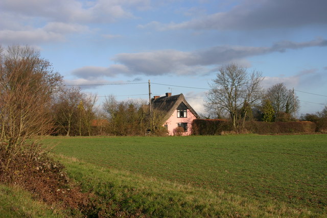
Blackcat, Essex is a small village located in the eastern part of England, within the county of Essex. Situated approximately 10 miles northeast of the town of Chelmsford, Blackcat is known for its picturesque countryside, historic buildings, and tranquil atmosphere.
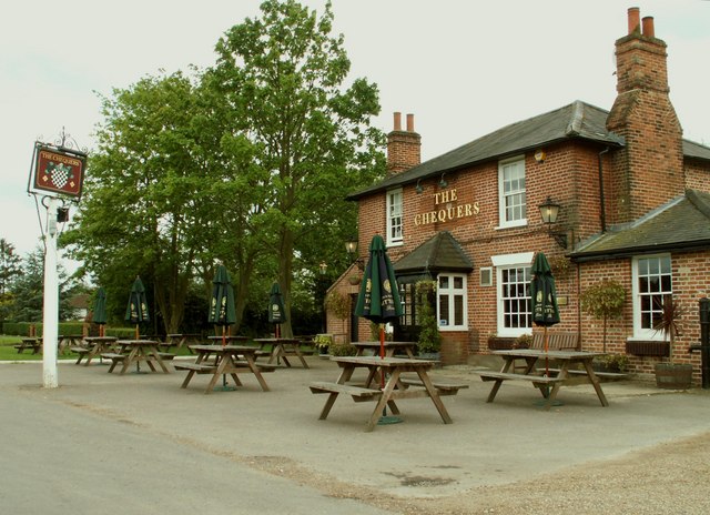
The village is home to a population of around 500 residents, who enjoy the benefits of a close-knit community. Blackcat boasts a charming village center, with a handful of local amenities including a post office, a small grocery store, and a traditional pub. The village is also served by a primary school, providing education for the local children.
Surrounded by rolling hills and scenic landscapes, Blackcat is a haven for nature lovers and outdoor enthusiasts. The nearby countryside offers plenty of opportunities for walking, cycling, and horse riding, with numerous footpaths and bridleways crisscrossing the area. Residents and visitors alike can enjoy the peacefulness and beauty of the surrounding countryside.
In terms of history, Blackcat has a rich heritage dating back centuries. Several historic buildings and landmarks can be found within the village, including a medieval church that stands as a reminder of the village's past. The church, dedicated to St. Mary, is an architectural gem and attracts visitors interested in historical and cultural heritage.
Overall, Blackcat, Essex presents an idyllic rural retreat, offering a slower pace of life and a strong sense of community. It is a place where residents can enjoy the beauty of nature, embrace the village's history, and find solace in the peacefulness of their surroundings.
If you have any feedback on the listing, please let us know in the comments section below.
Blackcat Images
Images are sourced within 2km of 51.764474/0.25092697 or Grid Reference TL5509. Thanks to Geograph Open Source API. All images are credited.


Blackcat is located at Grid Ref: TL5509 (Lat: 51.764474, Lng: 0.25092697)
Administrative County: Essex
District: Epping Forest
Police Authority: Essex
What 3 Words
///blunt.clock.admits. Near Hatfield Heath, Essex
Nearby Locations
Related Wikis

Little Laver
Little Laver is a village and a civil parish in the Epping Forest district of Essex, England. Little Laver's parish church is dedicated to St Mary the...
Abbess End
Abbess End is a hamlet in the Epping Forest district, close to the southern end of Abbess Roding, and north of the former site of the moated country house...

RAF Matching
Royal Air Force Matching or more simply RAF Matching is a former Royal Air Force station located 5 miles (8.0 km) east of Harlow, Essex and 22 miles (35...
Matching Green
Matching Green is a village and the largest settlement in the civil parish of Matching, in Essex, England. It is 3.0 miles (4.8 km) east of Harlow, 4.5...

Abbess Roding
Abbess Roding is a village and former civil parish, now in the parish of Abbess, Beauchamp and Berners Roding and the Epping Forest District of Essex,...

Beauchamp Roding
Beauchamp Roding ( BEECH-əm) is a village and former civil parish, now in the parish of Abbess, Beauchamp and Berners Roding, and in the Epping Forest...

Abbess, Beauchamp and Berners Roding
Abbess, Beauchamp and Berners Roding is a group of three small villages in the County of Essex, England. Collectively, they form one civil parish in the...

Manwood Green
Manwood Green is a hamlet in the Uttlesford district, in the county of Essex. Manwood Green was Man(e)wode(s)grene in 1272.It is on Sparrows Lane (a minor...
Nearby Amenities
Located within 500m of 51.764474,0.25092697Have you been to Blackcat?
Leave your review of Blackcat below (or comments, questions and feedback).