Black Heddon

Settlement in Northumberland

England

Black Heddon

Kyloe Hills Viewed from the west.
Kyloe Hills Credit: Ian Taylor

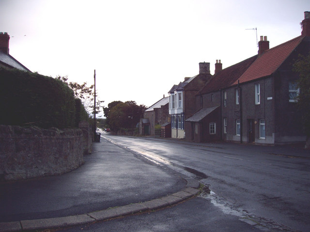
Black Heddon is a small village located in the county of Northumberland, in the northeast of England. Situated approximately 9 miles northwest of the town of Morpeth, it falls within the parliamentary constituency of Hexham. The village is nestled in a rural area, surrounded by picturesque countryside and farmland.

With a population of around 200 residents, Black Heddon maintains a close-knit community atmosphere. The village consists mainly of traditional stone-built houses, giving it a charming and timeless character. It offers a peaceful and tranquil environment, away from the hustle and bustle of larger towns and cities.

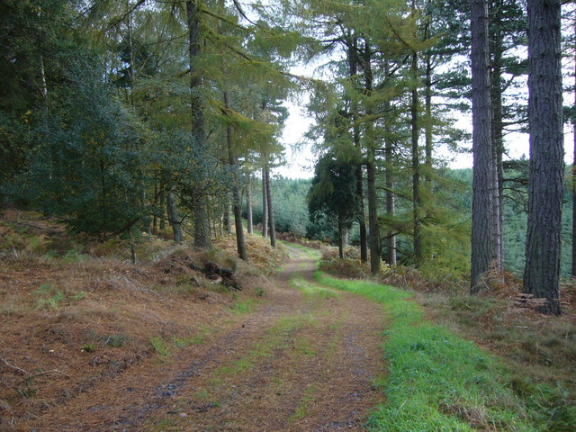
A notable feature of Black Heddon is its proximity to the River Wansbeck, which flows nearby. This river provides opportunities for leisure activities such as fishing, canoeing, and riverside walks. The surrounding countryside also offers ample opportunities for outdoor pursuits, including hiking, cycling, and horse riding.

While Black Heddon may be small in size, it benefits from its close proximity to larger towns and cities. The nearby town of Morpeth provides essential amenities such as shops, supermarkets, schools, and healthcare services. Additionally, the city of Newcastle upon Tyne is only a short drive away, offering a wider range of cultural, recreational, and employment opportunities.

In conclusion, Black Heddon is a charming village in Northumberland, offering a peaceful and rural lifestyle. With its picturesque surroundings, close-knit community, and easy access to essential amenities, it provides an idyllic setting for those seeking a quieter way of life.

If you have any feedback on the listing, please let us know in the comments section below.

Black Heddon Images

Images are sourced within 2km of 55.652297/-1.9445455 or Grid Reference NU0339. Thanks to Geograph Open Source API. All images are credited.

Kyloe Hills Viewed from the west.
Kyloe Hills
Viewed from the west.
Forest track in Kyloe Wood
Forest track near the top of Shepherdskirk Hill
Public footpath near Black Heddon This right of way route leads to the Kyloe Hills after three quarters of a mile and Bogle Houses after one and three quarter miles.
Public footpath near Black Heddon
This right of way route leads to the Kyloe Hills after three quarters of a mile and Bogle Houses after one and three quarter miles.
Farm storage building In the Kyloe Hills near Collar Heugh.
Farm storage building
In the Kyloe Hills near Collar Heugh.
Silos reflecting evening light Looking across the field to the Works; much of which has been screened by trees.
Silos reflecting evening light
Looking across the field to the Works; much of which has been screened by trees.
Lowick Castle This is considered to be the site of Lowick Castle.
For history and other picture <span class="nowrap"><a title="http://www.northofthetyne.co.uk/Motte%26Baileytraces.html" rel="nofollow ugc noopener" href="http://www.northofthetyne.co.uk/Motte%26Baileytraces.html">Link</a><img style="margin-left:2px;" alt="External link" title="External link - shift click to open in new window" src="https://s1.geograph.org.uk/img/external.png" width="10" height="10"/></span>
Lowick Castle
This is considered to be the site of Lowick Castle. For history and other picture LinkExternal link
The north end of Kyloe Crag A small, but perfectly-formed, outcrop of Northumbrian sandstone. This is a well-known climbing venue in the northeast of England, although most of the best climbing is further south along the outcrop, rather than here at the northern end.
The north end of Kyloe Crag
A small, but perfectly-formed, outcrop of Northumbrian sandstone. This is a well-known climbing venue in the northeast of England, although most of the best climbing is further south along the outcrop, rather than here at the northern end.
Quarried section on Kyloe Crag From nearby, this certainly appears to be a square-cut quarried section. None of the rest of the outcrop has been worked and remains in a natural state.
Quarried section on Kyloe Crag
From nearby, this certainly appears to be a square-cut quarried section. None of the rest of the outcrop has been worked and remains in a natural state.
Deception Crack A 35-foot route on 'C' Buttress of Kyloe Crag; it goes straight up the right-angled corner.
Deception Crack
A 35-foot route on 'C' Buttress of Kyloe Crag; it goes straight up the right-angled corner.
Flake Crack A 30-foot Mild Severe route on 'C' Buttress of Kyloe Crag; as the name suggests, the climb follows the flakes up the middle of the wall.
Flake Crack
A 30-foot Mild Severe route on 'C' Buttress of Kyloe Crag; as the name suggests, the climb follows the flakes up the middle of the wall.
'F' Buttress of Kyloe Crag An impressive-looking section of the crag, but it's actually only about 40' high, and split into two tiers by a ledge at half height. There are 3 or 4 recognised climbs on this buttress, most of them quite hard.
'F' Buttress of Kyloe Crag
An impressive-looking section of the crag, but it's actually only about 40' high, and split into two tiers by a ledge at half height. There are 3 or 4 recognised climbs on this buttress, most of them quite hard.
Main St, Lowick - Looking East View down Lowick Main Street, looking across at the Old Drapery. Once a shop, now a B&B.
Main St, Lowick - Looking East
View down Lowick Main Street, looking across at the Old Drapery. Once a shop, now a B&B.
Looking East down Main Street, Lowick Often known as 'Lang Lowick' locally, this is still an appropriate name for a quiet village that was originally no wider than the Main Street.
Looking East down Main Street, Lowick
Often known as 'Lang Lowick' locally, this is still an appropriate name for a quiet village that was originally no wider than the Main Street.
West Main Street, Lowick For better or worse, modern vehicles and gift shops drag a traditional farming village into the 21st Century.
West Main Street, Lowick
For better or worse, modern vehicles and gift shops drag a traditional farming village into the 21st Century.
Rainbow over The Kyloe Hills Rainbow over The Kyloe Hills, viewed from Kentstone
Rainbow over The Kyloe Hills
Rainbow over The Kyloe Hills, viewed from Kentstone
Farmland at Black Heddon Viewed from a public footpath with Black Heddon Farm in the background.
Farmland at Black Heddon
Viewed from a public footpath with Black Heddon Farm in the background.
Sheep pasture at Black Heddon Viewed from a public footpath with Black Heddon Farm in the background.
Sheep pasture at Black Heddon
Viewed from a public footpath with Black Heddon Farm in the background.
Show me another place!

Black Heddon is located at Grid Ref: NU0339 (Lat: 55.652297, Lng: -1.9445455)

Unitary Authority: Northumberland

Police Authority: Northumbria

What 3 Words

///protrude.sulky.later. Near Lowick, Northumberland

Nearby Locations

Black Heddon

Related Wikis

Kyloe

Kyloe is a civil parish in the county of Northumberland, about 8 miles (13 km) south-east of Berwick-upon-Tweed. According to the parish council, the main...

Lowick, Northumberland

Lowick () is a village in Northumberland, north east England. Lowick lies on the B6353 road, about 10 miles (16 km) south of Berwick-upon-Tweed. The Anglican...

Fenwick, Kyloe

Fenwick is a small hamlet in the civil parish of Kyloe near Berwick-upon-Tweed and has a population of approx 400. Fenwick lies only three miles from Holy...

Holburn

Holburn is a hamlet in the English county of Northumberland. Holburn is located between Lowick and Belford. == Governance == Holburn is in the parliamentary...

Nearby Amenities

Located within 500m of 55.652297,-1.9445455
The data included in this document is from www.openstreetmap.org. The data is made available under ODbL.

Have you been to Black Heddon?

Leave your review of Black Heddon below (or comments, questions and feedback).