Black Hill

Settlement in Warwickshire Stratford-on-Avon

England

Black Hill

Wyevale garden centre
Wyevale garden centre Credit: Steve Fareham

Black Hill is a small village located in the county of Warwickshire, England. Situated in the heart of the Midlands, it is positioned approximately 6 miles southeast of the historical town of Warwick. With a population of around 300 residents, Black Hill retains a charming rural character while being within close proximity to urban amenities.

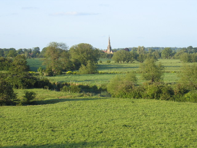
The village is nestled amidst picturesque rolling hills and sprawling farmland, offering breathtaking views of the surrounding countryside. It is renowned for its natural beauty, with an abundance of walking trails and outdoor activities available to both locals and visitors. The nearby Black Hill Nature Reserve is a popular spot for nature enthusiasts, boasting a diverse range of flora and fauna.

Despite its modest size, Black Hill boasts a strong sense of community, with a number of local events and activities taking place throughout the year. The village is home to a quaint church dating back to the 12th century, which serves as a focal point for the community. Additionally, there is a local pub and a few small businesses that cater to the needs of residents.

Black Hill's central location allows for easy access to nearby towns and cities. The M40 motorway is just a short drive away, providing convenient links to Birmingham, Coventry, and London. The village is also well-served by public transportation, with regular bus services connecting it to surrounding areas.

In conclusion, Black Hill is a charming Warwickshire village that offers a peaceful and idyllic setting amidst the beauty of the English countryside. With its strong sense of community and convenient location, it provides a desirable place to live for those seeking a rural retreat without sacrificing modern conveniences.

If you have any feedback on the listing, please let us know in the comments section below.
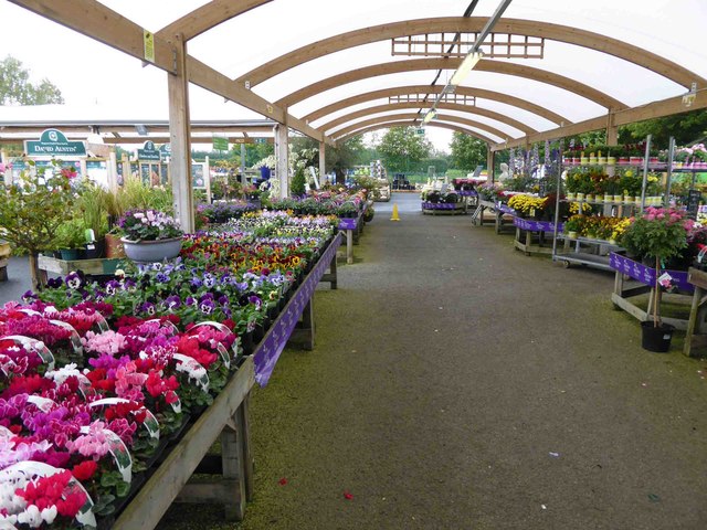
Black Hill Images

Images are sourced within 2km of 52.230937/-1.6585865 or Grid Reference SP2359. Thanks to Geograph Open Source API. All images are credited.

Wyevale garden centre
Flowers in the rain at Wyevale garden centre
Fields of oil seed rape The view north from Warwick Road towards Spring Farm.
Fields of oil seed rape
The view north from Warwick Road towards Spring Farm.
Lane to the Blackhill Industrial Estate
The A46 towards Warwick
Field and ditch from Warwick Road
Farm lane off Hatton Bank Lane Also used by a footpath, but the lane is not a public route for vehicles.
Farm lane off Hatton Bank Lane
Also used by a footpath, but the lane is not a public route for vehicles.
Wheat field by Hatton Bank Lane Looking from the slightly higher ground on Black Hill down towards the Avon valley.
Wheat field by Hatton Bank Lane
Looking from the slightly higher ground on Black Hill down towards the Avon valley.
Hatton Bank Lane Descending from Black Hill where there is a glimpse of Hatton Bank Farm through the foliage. There is also a distant view of the Cotswolds.
Hatton Bank Lane
Descending from Black Hill where there is a glimpse of Hatton Bank Farm through the foliage. There is also a distant view of the Cotswolds.
Wheat field by Hatton Bank Lane Looking down the gentle south-eastern slope of Black Hill.
Wheat field by Hatton Bank Lane
Looking down the gentle south-eastern slope of Black Hill.
Mercedes-Benz Stratford-upon-Avon A car dealership some way out of Stratford on the A439.
Mercedes-Benz Stratford-upon-Avon
A car dealership some way out of Stratford on the A439.
Former parkland at Snitterfield Until the early 19th century Snitterfield House overlooked this parkland at Snitterfield.  At present a crop of broad beans is growing on this field.
Former parkland at Snitterfield
Until the early 19th century Snitterfield House overlooked this parkland at Snitterfield. At present a crop of broad beans is growing on this field.
Footpath near Snitterfield Footpath running parallel with the A46 near Snitterfield.
Footpath near Snitterfield
Footpath running parallel with the A46 near Snitterfield.
Church Road, Snitterfield
A46 near Snitterfield I assume that the Pedestrians Crossing sign is because a footpath crosses the road ahead.
A46 near Snitterfield
I assume that the Pedestrians Crossing sign is because a footpath crosses the road ahead.
A46 bridge near Snitterfield Ingon Lane crosses.
A46 bridge near Snitterfield
Ingon Lane crosses.
Hatton Bank Lane Junction
View From Hatton Bank Lane Junction
Show me another place!

Black Hill is located at Grid Ref: SP2359 (Lat: 52.230937, Lng: -1.6585865)

Administrative County: Warwickshire

District: Stratford-on-Avon

Police Authority: Warwickshire

What 3 Words

///rental.recruiter.hoping. Near Wellesbourne Mountford, Warwickshire

Nearby Locations

Black Hill

Related Wikis

Fulbrook, Warwickshire

Fulbrook is a small parish and deserted village in Warwickshire, England, situated about 4 miles (6 km) north-east of Stratford upon Avon. Population details...

Snitterfield

Snitterfield is a village and civil parish in the Stratford on Avon district of Warwickshire, England, less than 1 mile (1.6 km) to the north of the A46...

Norton Lindsey

Norton Lindsey is a village and civil parish in Warwickshire, England, 3.5 miles south-west of the tourist and county town of Warwick and a mile west of...

Hemingford House

Hemingford House is a 19th-century house in Alveston near Stratford on Avon in Warwickshire, England. It is a Grade II listed building. == History... ==

Related Videos

ABI Windermere

Stunning holiday home on a quiet secluded pitch. Currently available for sale Subscribing to our channel will give you viewings to ...

Welcome to Stratford Parks

Take a look around our fantastic park and facilities. We have 2 owners only parks with a 10 month season (7th March - 7th ...

Nearby Amenities

Located within 500m of 52.230937,-1.6585865
Speed Camera
Source: survey
Lat/Long: 52.2339802/-1.6555222
Blackhill Crossroads
Naptan AtcoCode: 4200F164501
Naptan Bearing: NE
Naptan BusStopType: CUS
Naptan CommonName: Blackhill Crossroads
Naptan Indicator: Adj
Naptan Landmark: Speeds Garage
Naptan NaptanCode: warajpdg
Naptan Street: Warwick Road
Naptan Verified: no
Source: naptan_import
Lat/Long: 52.2307697/-1.6589307
Bus Stop
Blackhill Crossroads
Bench: no
Bin: no
Bus: yes
Covered: no
Naptan AtcoCode: 4200F164502
Naptan Bearing: SW
Naptan CommonName: Blackhill Crossroads
Naptan Indicator: Opp
Naptan Landmark: Speeds Garage
Naptan NaptanCode: warajpdj
Naptan Street: Warwick Road
Naptan Verified: no
Passenger Information Display: no
Public Transport: platform
Shelter: no
Source: naptan_import
Tactile Paving: no
Lat/Long: 52.2307144/-1.6587521
Operator: Royal Mail
Ref: CV37 41
Removed Amenity: post_box
Lat/Long: 52.2310645/-1.6585372
Give Way
Source: Warwicks CC Aerial Imagery 2013
Lat/Long: 52.2310353/-1.6585453
Give Way
Source: Warwicks CC Aerial Imagery 2013
Lat/Long: 52.2309213/-1.6585238
Black Hill
Place: hamlet
Lat/Long: 52.2305306/-1.65855
Frequency: 50
Material: wood
Operator: National Grid Electricity Distribution
Operator Wikidata: Q7988183
Power: pole
Ref: 931611
Source: wpd_opendata
Transformer: distribution
Voltage Primary: 11000
Voltage Secondary: 400
Lat/Long: 52.2299105/-1.6572216
Material: wood
Operator: National Grid Electricity Distribution
Operator Wikidata: Q7988183
Power: pole
Source: bing
Lat/Long: 52.2290825/-1.6581953
Material: wood
Operator: National Grid Electricity Distribution
Operator Wikidata: Q7988183
Power: pole
Source: bing
Lat/Long: 52.2284484/-1.6588873
Material: wood
Operator: National Grid Electricity Distribution
Operator Wikidata: Q7988183
Power: pole
Source: bing
Lat/Long: 52.2277978/-1.6596034
Material: wood
Operator: National Grid Electricity Distribution
Operator Wikidata: Q7988183
Power: pole
Source: bing
Lat/Long: 52.2271915/-1.6602927
The data included in this document is from www.openstreetmap.org. The data is made available under ODbL.

Have you been to Black Hill?

Leave your review of Black Hill below (or comments, questions and feedback).