Bishops Offley

Settlement in Staffordshire Stafford

England

Bishops Offley

Road from Woodwall Green to Croxton
Road from Woodwall Green to Croxton Credit: Mick Malpass

Bishops Offley is a small village located in the county of Staffordshire, England. Situated approximately 7 miles northeast of the town of Eccleshall, it falls within the Stafford Borough Council area. The village is nestled in a rural landscape, surrounded by picturesque countryside, and is known for its peaceful and tranquil atmosphere.

With a population of around 300 residents, Bishops Offley maintains a tight-knit community feel. The village is home to a number of charming historical buildings, including St. John the Baptist Church, which dates back to the 12th century. The church is a prominent feature of the village and serves as a focal point for both religious and community activities.

Despite its small size, Bishops Offley benefits from several local amenities. These include a village hall, which hosts a variety of social events and gatherings throughout the year, as well as a primary school that caters to the educational needs of the local children.

The surrounding countryside offers ample opportunities for outdoor activities, such as hiking, cycling, and horseback riding. The village is also conveniently located near the Shropshire Union Canal, providing residents with the chance to enjoy leisurely walks along its peaceful towpath.

Overall, Bishops Offley is a charming village that offers a tranquil and idyllic rural lifestyle. It is a place where residents can enjoy the beauty of the Staffordshire countryside while being part of a close-knit community.

If you have any feedback on the listing, please let us know in the comments section below.

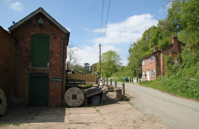
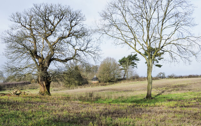
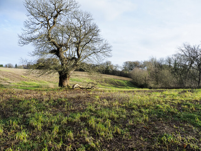
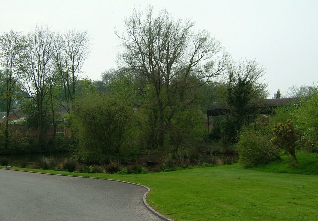
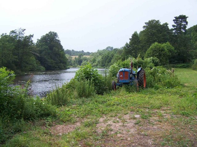
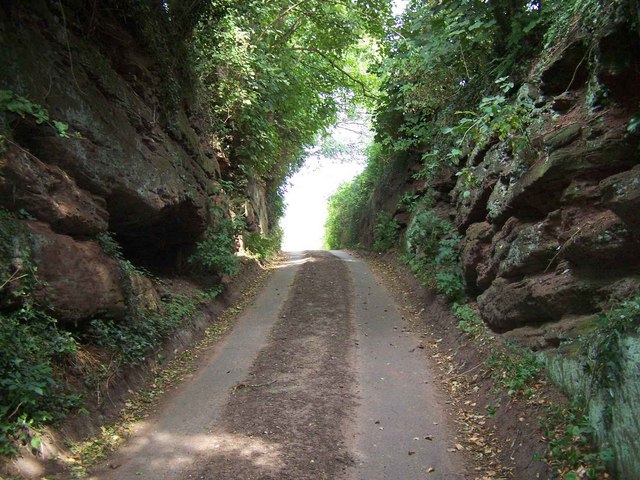
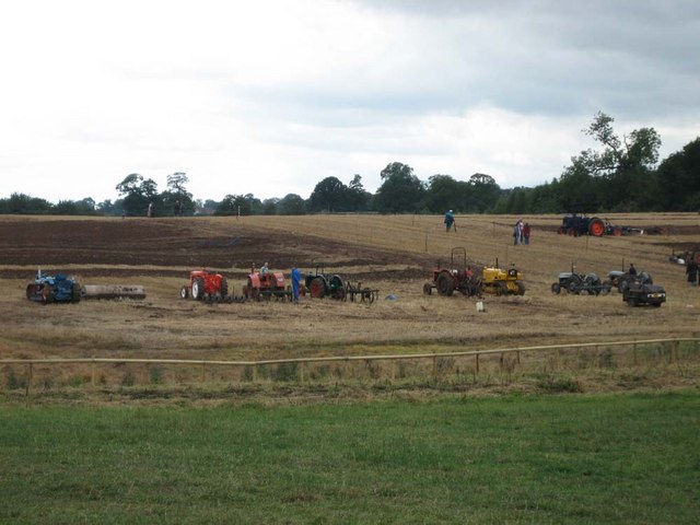
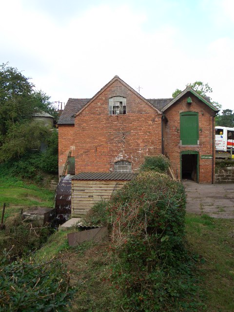
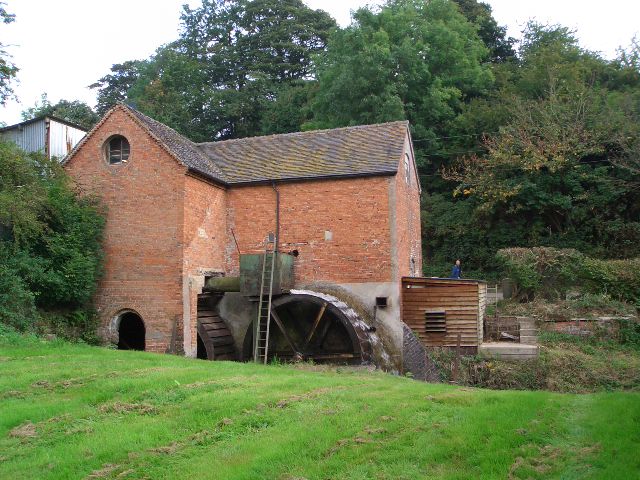
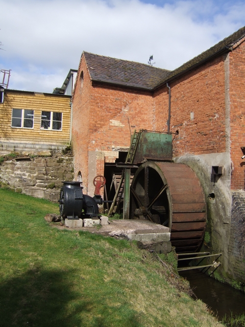
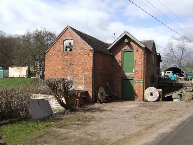
Bishops Offley Images

Images are sourced within 2km of 52.864202/-2.3253168 or Grid Reference SJ7829. Thanks to Geograph Open Source API. All images are credited.

Road from Woodwall Green to Croxton
Offley Brook Mill A commercially working watermill with two wheels and an auxiliary diesel alternator set. The mill house is opposite. This is a very rural location.
Offley Brook Mill
A commercially working watermill with two wheels and an auxiliary diesel alternator set. The mill house is opposite. This is a very rural location.
Small building at Sugnall Park Sugnall Park is an area of land below the farm at Sugnall and north of the lake at Cop Mere. The building resembles a turret and is fenced around within an area of woodland.
Small building at Sugnall Park
Sugnall Park is an area of land below the farm at Sugnall and north of the lake at Cop Mere. The building resembles a turret and is fenced around within an area of woodland.
Rutted mud of farm road The road, also the route of a bridleway, is descending to the west from a bend close to the local high point where there's the trig point known to the OS as Croxton.
Rutted mud of farm road
The road, also the route of a bridleway, is descending to the west from a bend close to the local high point where there's the trig point known to the OS as Croxton.
Land with lone tree in Sugnall Park Sugnall Park is an area of land below the farm at Sugnall and north of the lake at Cop Mere.
The land has held a crop recently, probably of maize.
Land with lone tree in Sugnall Park
Sugnall Park is an area of land below the farm at Sugnall and north of the lake at Cop Mere. The land has held a crop recently, probably of maize.
Hedge with embedded trig point The trig point is known to the OS as Croxton. It's embedded in a hedge which separates the field from a farm road which is also a bridleway.
Hedge with embedded trig point
The trig point is known to the OS as Croxton. It's embedded in a hedge which separates the field from a farm road which is also a bridleway.
Duck Pond A delightful area of Sugnall "des res" to the Ducks.
Duck Pond
A delightful area of Sugnall "des res" to the Ducks.
Mill Pond, Offleybrook
Sugnall Home Farm
Sugnall Home Farm
Cutting in Lane
Cutting in Lane
Sugnall Park Sugnall Park is the site of the annual Eccelshall Show as well as the Tern Valley Vintage Steam Fair which includes a ploughing display and competition.
Sugnall Park
Sugnall Park is the site of the annual Eccelshall Show as well as the Tern Valley Vintage Steam Fair which includes a ploughing display and competition.
Offley Mill Watermill still in regular use by its owners, the Howell family.
Offley Mill
Watermill still in regular use by its owners, the Howell family.
Water wheels at Offley Mill The right hand wheel is still in regular use, driving two pairs of millstones which, among other things, produce chappatti flour for the Asian population of the West Midlands and Staffordshire.
Water wheels at Offley Mill
The right hand wheel is still in regular use, driving two pairs of millstones which, among other things, produce chappatti flour for the Asian population of the West Midlands and Staffordshire.
Bridleway Near Croxton Croxton Windmill can be seen in the distance
Bridleway Near Croxton
Croxton Windmill can be seen in the distance
Waterwheels at Offley Mill The mill pool is fed by the River Sow.
Waterwheels at Offley Mill
The mill pool is fed by the River Sow.
Offley Mill Working watermill on the River Sow.
Offley Mill
Working watermill on the River Sow.
Mill Pool at Offley Mill The mill pool is fed by the River Sow.
Mill Pool at Offley Mill
The mill pool is fed by the River Sow.
River Sow downstream of the bridge at Blorepipe
Show me another place!

Bishops Offley is located at Grid Ref: SJ7829 (Lat: 52.864202, Lng: -2.3253168)

Administrative County: Staffordshire

District: Stafford

Police Authority: Staffordshire

What 3 Words

///triangles.locator.achieving. Near Eccleshall, Staffordshire

Related Wikis

Jackson's Coppice and Marsh

Jackson's Coppice and Marsh is a nature reserve of the Staffordshire Wildlife Trust. It is along the River Sow, near the village of Bishop's Offley and...

Outlands, Staffordshire

Outlands is a hamlet in the English county of Staffordshire. It lies 1 km eas of Bishop's Offley. == External links == Map sources for Outlands, Staffordshire

Offleyhay

Offleyhay is a village in Staffordshire, England. The population as taken at the 2011 census can be found under Eccleshall. == References ==

Cop Mere

Cop Mere is one of the largest natural bodies of water in Staffordshire, England, covering 42 acres (17 ha). It has been designated a SSSI as an oligotrophic...

Croxton, Staffordshire

Croxton is a village on the B5026 between Eccleshall and Loggerheads. Population details for the 2011 census can be found under Eccleshall. It is notable...

Armsdale

Armsdale is a village in Staffordshire, England. Population details for the 2011 census can be found under Eccleshall.

Tunstall, Stafford

Tunstall is a hamlet near Eccleshall in the borough of Stafford in Staffordshire, England. In 1870–72 it had a population of 72. Tunstall was recorded...

Adbaston

Adbaston is a village and a civil parish in the English county of Staffordshire. == Location == The village is 13 miles (20.9 km) north east of the town...

Related Videos

Holly & Paul | Sugnall Walled Gardens, Staffordshire wedding

Sugnall Walled Gardens wedding Vision Wave Weddings is a wedding video company based in Congleton, Cheshire. Perfectly ...

Nearby Amenities

Located within 500m of 52.864202,-2.3253168
Bus Stop
Brown Jug Inn PH
Naptan AtcoCode: 3800C700600
Naptan Bearing: NW
Naptan CommonName: Brown Jug Inn PH
Naptan Indicator: Opp
Naptan Landmark: Brown Jug Inn PH
Naptan Street: Main Rd
Naptan Verified: no
Source: naptan_import
Lat/Long: 52.8642929/-2.3264231
Bus Stop
Brown Jug Inn PH
Naptan AtcoCode: 3800C700601
Naptan Bearing: E
Naptan BusStopType: CUS
Naptan CommonName: Brown Jug Inn PH
Naptan Indicator: Adj
Naptan Landmark: Brown Jug Inn PH
Naptan Street: Main Rd
Naptan Verified: no
Source: naptan_import
Lat/Long: 52.8643208/-2.3260669
Bus Stop
Offley Rock
Bus: yes
Naptan AtcoCode: 3800C720100
Naptan Bearing: W
Naptan CommonName: Offley Rock
Naptan Indicator: Adj
Naptan Landmark: Offley Rock
Naptan Street: Main Rd
Naptan Verified: no
Public Transport: platform
Source: naptan_import
Lat/Long: 52.8642253/-2.3182082
Bus Stop
Offley Rock
Bus: yes
Naptan AtcoCode: 3800C720101
Naptan Bearing: E
Naptan BusStopType: CUS
Naptan CommonName: Offley Rock
Naptan Indicator: Opp
Naptan Landmark: Offley Rock
Naptan Street: Main Rd
Naptan Verified: no
Public Transport: platform
Source: naptan_import
Lat/Long: 52.8643337/-2.318001
Source: OS_OpenData_StreetView
Lat/Long: 52.8625446/-2.3250543
Source: OS_OpenData_StreetView
Lat/Long: 52.8622335/-2.3252505
Source: OS_OpenData_StreetView
Lat/Long: 52.8619285/-2.3258553
Source: OS_OpenData_StreetView
Lat/Long: 52.8615218/-2.326006
Source: OS_OpenData_StreetView
Lat/Long: 52.861207/-2.3261103
Source: OS_OpenData_StreetView
Lat/Long: 52.8604357/-2.3242808
Bishop's Offley
Place: hamlet
Source: NPE
Lat/Long: 52.8636387/-2.3256703
Post Box
Collection Times: Mo-Fr 09:00; Sa 07:00
Operator: Royal Mail
Operator Wikidata: Q638098
Post Box Mounting: pier
Post Box Type: lamp
Ref: ST21 390
Lat/Long: 52.8642252/-2.3249848
Fuel
Lat/Long: 52.8647019/-2.3271827
The data included in this document is from www.openstreetmap.org. The data is made available under ODbL.

Have you been to Bishops Offley?

Leave your review of Bishops Offley below (or comments, questions and feedback).