Belsyde

Settlement in West Lothian

Scotland

Belsyde

Manuelhaugh A field of ripening wheat beside the River Avon, with the railway viaduct in the background.
Manuelhaugh Credit: Anne Burgess

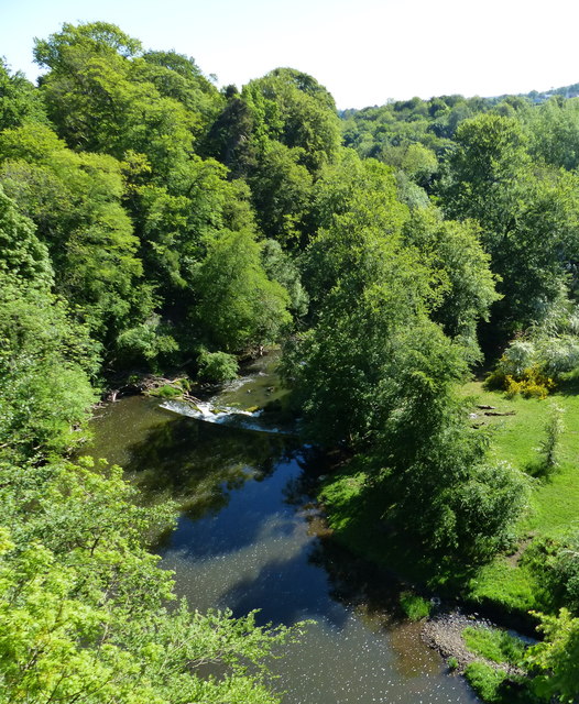
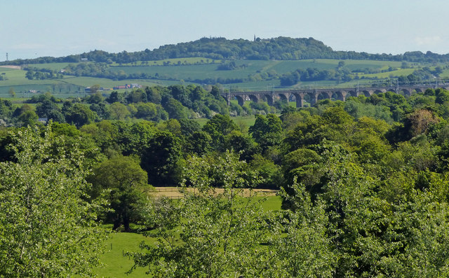
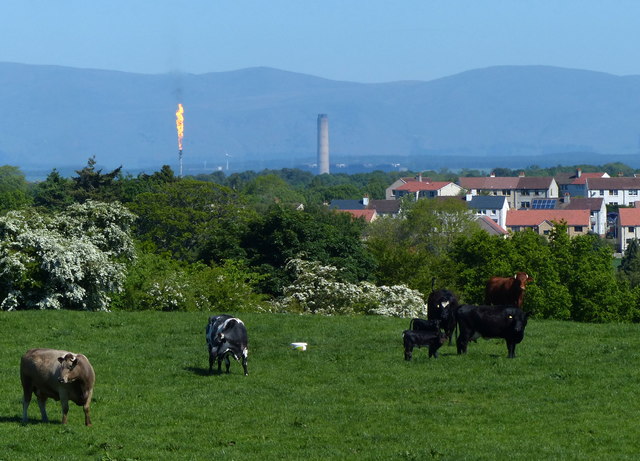
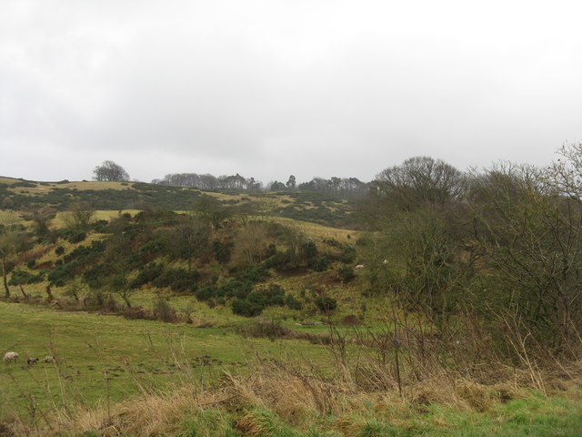
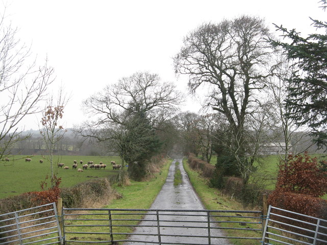
Belsyde is a small village located in West Lothian, Scotland. Situated just south of the town of Linlithgow, Belsyde is known for its picturesque countryside and historical significance. The village is surrounded by rolling hills and farmland, offering residents and visitors a tranquil and scenic environment.

One of the notable features of Belsyde is Belsyde House, a grand mansion that dates back to the 17th century. The house is a fine example of Scottish architecture and has been carefully preserved over the years. It now serves as a private residence, adding to the charm and character of the village.

In addition to its natural beauty, Belsyde also boasts a strong sense of community. The village has a small primary school, which plays a central role in the lives of local families. There are also several community groups and events that bring residents together, fostering a close-knit atmosphere.

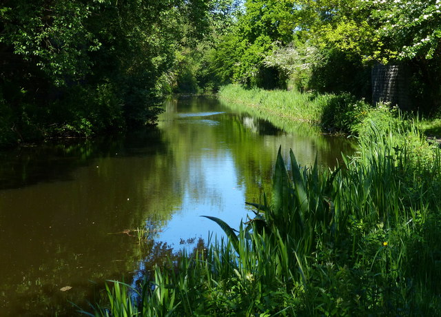
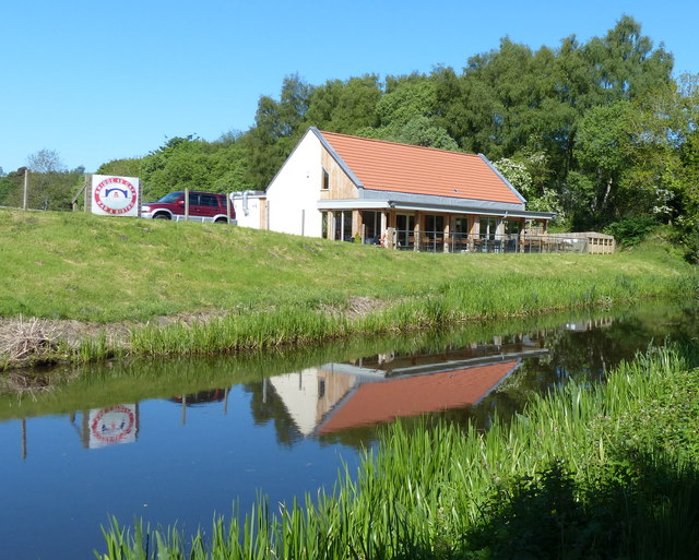
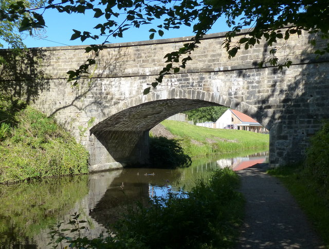
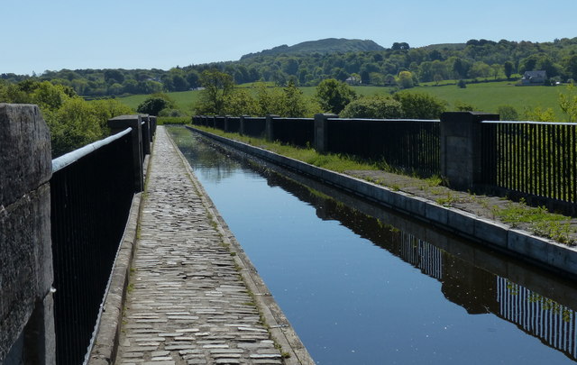
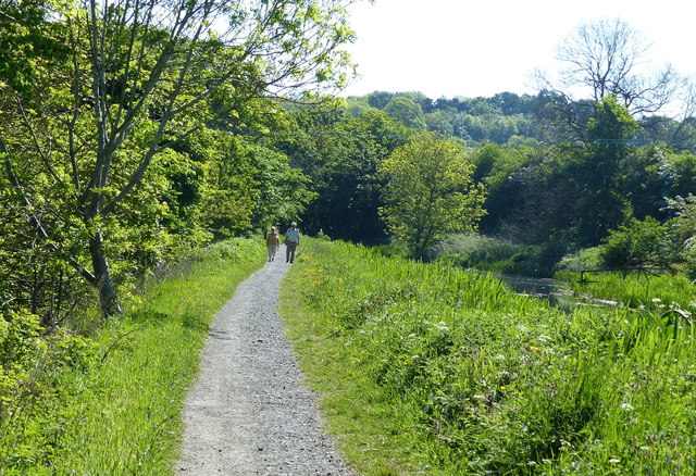
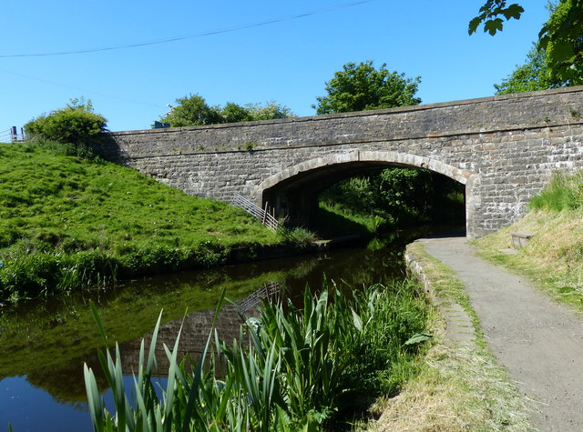
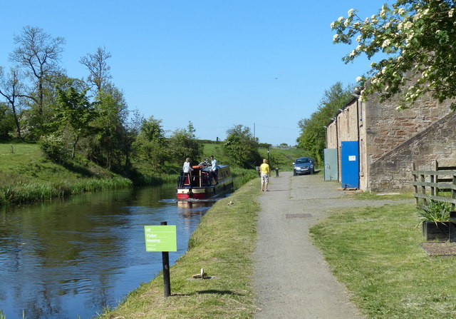
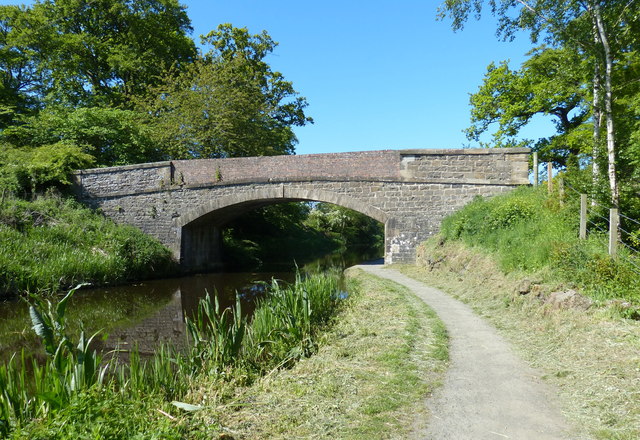
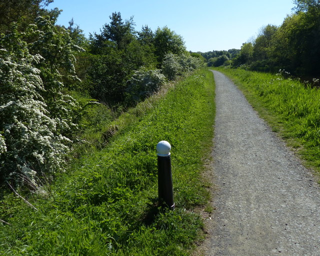
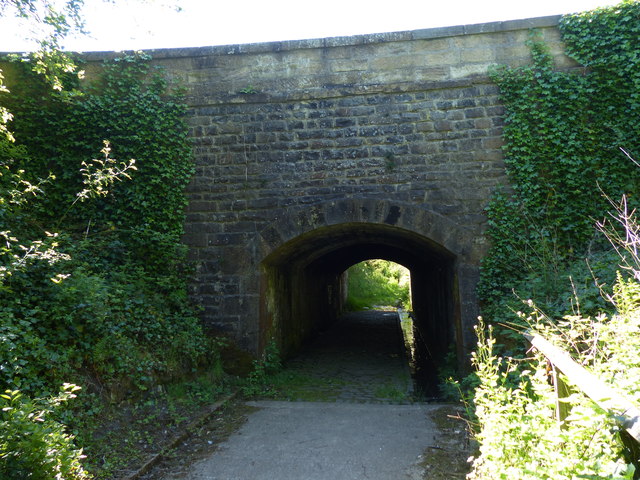
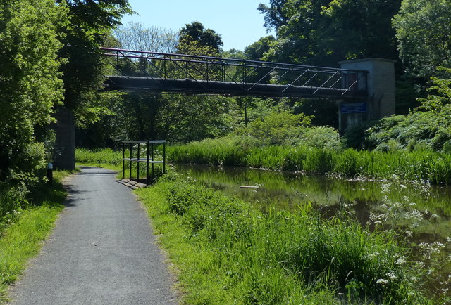
For those seeking outdoor activities, Belsyde offers plenty of opportunities. The surrounding countryside is ideal for walking, cycling, and horse riding, with numerous trails and paths to explore. The nearby Union Canal is also a popular spot for boating and fishing.

Despite its rural location, Belsyde benefits from its proximity to Linlithgow, which provides easy access to amenities such as shops, restaurants, and public transportation. Overall, Belsyde offers a peaceful and idyllic setting, making it an appealing place to live or visit for those looking to escape the hustle and bustle of city life.

If you have any feedback on the listing, please let us know in the comments section below.
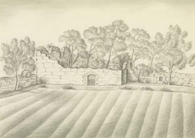
Belsyde Images

Images are sourced within 2km of 55.961366/-3.6435149 or Grid Reference NS9775. Thanks to Geograph Open Source API. All images are credited.

Manuelhaugh A field of ripening wheat beside the River Avon, with the railway viaduct in the background.
Manuelhaugh
A field of ripening wheat beside the River Avon, with the railway viaduct in the background.
Avon Aqueduct carries the Union Canal over the River Avon
The Union Canal at Almond Following the completion and opening of the Forth and Clyde Canal in 1790, it was not long before the idea arose of a canal to link Edinburgh to the west, and in particular to the coal mining areas in the west of Scotland, to enable coal to be supplied more cheaply to the capital. Other commodities suited for canal transport included building stone and lime. 

It took another two decades, however, before a survey was undertaken of a route that would link the proposed canal to the Forth and Clyde Canal at Falkirk. The necessary Act of Parliament authorising construction was passed in 1817, and work started at the Edinburgh end, at Port Hopetoun, the following year.

The canal was designed by Hugh Baird <span class="nowrap"><a title="http://en.wikipedia.org/wiki/Hugh_Baird_%28engineer%29" rel="nofollow ugc noopener" href="http://en.wikipedia.org/wiki/Hugh_Baird_%28engineer%29">Link</a><img style="margin-left:2px;" alt="External link" title="External link - shift click to open in new window" src="https://s1.geograph.org.uk/img/external.png" width="10" height="10"/></span> and Thomas Telford <span class="nowrap"><a title="http://en.wikipedia.org/wiki/Thomas_Telford" rel="nofollow ugc noopener" href="http://en.wikipedia.org/wiki/Thomas_Telford">Link</a><img style="margin-left:2px;" alt="External link" title="External link - shift click to open in new window" src="https://s1.geograph.org.uk/img/external.png" width="10" height="10"/></span> and <a title="https://www.geograph.org.uk/discuss/?action=vthread&forum=6&topic=5666" href="https://www.geograph.org.uk/discuss/?action=vthread&forum=6&topic=5666">Link</a> on behalf of the Edinburgh and Glasgow Union Canal Company, whose 384 shareholders included the Lord Provost of Edinburgh and a number of titled persons. 

The canal was originally 32 miles in length and 5 feet deep, and it is a contour canal, that is, it follows the 241 foot (73 metre) contour, except for three river valleys where major aqueducts had to be built to carry the canal across at this height. These are the Slateford Aqueduct over the Water of Leith, the Almond Aqueduct 75 feet (23 metres) above the River Almond at Lin's Mill, and the longest of all at 810 feet (250 metres), the Avon Aqueduct, 86 feet (36 metres) above  the River Avon near Linlithgow. 

Most of the 60-odd bridges are fixed, so neither locks nor opening bridges delayed navigation most of the way, though the aqueducts were only wide enough for boats and barges to travel in one direction at a time; oncoming vessels had to wait until the way was clear. 

A tunnel 690 yards (636 metres) in length was required near Falkirk because the owner of Callendar House, William Forbes,  refused to allow the canal to pass through his land, and this undertaking contributed to the final cost being almost double the original estimate of £240,500. The final bill of over £460,000 equates to anything between £2000 million and £380,000 million at 2014 prices, depending on how it is calculated. 

The water level is maintained from a reservoir in the Pentland Hills, a three-mile channel from the River Almond, and other feeders. 

At Falkirk the Union Canal was 110 feet (33 metres) above the level of the Forth and Clyde Canal, and a flight of eleven locks was built to link the two canals. 

Construction took just four years, and the canal opened for traffic in 1822. Tolls were charged for the carriage of goods, and fares for passengers. There was also income from wharfage. Maximum charges were laid down in the enabling Act of Parliament. The Company was required to pay duties on goods carried to the Burgh of Linlithgow and the City of Edinburgh because the canal took trade away from the turnpike roads maintained by the respective councils.

Early trade was brisk, but unfortunately its heyday lasted only about 20 years, until the Edinburgh and Glasgow Railway superseded it in 1842, and in 1849 the canal was acquired by the railway company. Its use declined steadily over the years, and in the 1930s the flight of eleven locks at Falkirk was filled in and built on. Other stretches of the canal in Edinburgh were also built on, including the Edinburgh terminus. The City Bypass cut the route west of Edinburgh, and the M8 motorway blocked it near Broxburn. The canal was officially closed in 1965, though various stretches were used recreationally, for example for rowing and angling.

Towards the end of the 20th century there was a revival of interest in canals, mainly for recreational use, and the restoration of the Forth and Clyde Canal and the Union Canal was mooted. The project was adopted as one of the major undertakings to mark the millennium, and obtained funding from the European Union and the Millennium Commission among others. A new terminus with associated new retail, residential and commercial buildings was created in Edinburgh and a new stretch of canal dug to replace the section built on at Wester Hailes. The Scott Russell Aqueduct (named after John Scott Russell, who first observed a soliton wave on the canal in 1834) now carries the canal over the City Bypass, and a diversion was built to pass beneath the M8 motorway. The final piece of the restoration was the unique Falkirk Wheel, at the end of an extension to the original canal at Falkirk, which lifts and lowers boats between the Union Canal and the Forth and Clyde Canal. 

The Millennium Link restoration cost some £84 million and the restored canal was opened in 2001. The Falkirk Wheel was opened by Her Majesty Queen Elizabeth the following year.
The Union Canal at Almond
Following the completion and opening of the Forth and Clyde Canal in 1790, it was not long before the idea arose of a canal to link Edinburgh to the west, and in particular to the coal mining areas in the west of Scotland, to enable coal to be supplied more cheaply to the capital. Other commodities suited for canal transport included building stone and lime. It took another two decades, however, before a survey was undertaken of a route that would link the proposed canal to the Forth and Clyde Canal at Falkirk. The necessary Act of Parliament authorising construction was passed in 1817, and work started at the Edinburgh end, at Port Hopetoun, the following year. The canal was designed by Hugh Baird LinkExternal link and Thomas Telford LinkExternal link and Link on behalf of the Edinburgh and Glasgow Union Canal Company, whose 384 shareholders included the Lord Provost of Edinburgh and a number of titled persons. The canal was originally 32 miles in length and 5 feet deep, and it is a contour canal, that is, it follows the 241 foot (73 metre) contour, except for three river valleys where major aqueducts had to be built to carry the canal across at this height. These are the Slateford Aqueduct over the Water of Leith, the Almond Aqueduct 75 feet (23 metres) above the River Almond at Lin's Mill, and the longest of all at 810 feet (250 metres), the Avon Aqueduct, 86 feet (36 metres) above the River Avon near Linlithgow. Most of the 60-odd bridges are fixed, so neither locks nor opening bridges delayed navigation most of the way, though the aqueducts were only wide enough for boats and barges to travel in one direction at a time; oncoming vessels had to wait until the way was clear. A tunnel 690 yards (636 metres) in length was required near Falkirk because the owner of Callendar House, William Forbes, refused to allow the canal to pass through his land, and this undertaking contributed to the final cost being almost double the original estimate of £240,500. The final bill of over £460,000 equates to anything between £2000 million and £380,000 million at 2014 prices, depending on how it is calculated. The water level is maintained from a reservoir in the Pentland Hills, a three-mile channel from the River Almond, and other feeders. At Falkirk the Union Canal was 110 feet (33 metres) above the level of the Forth and Clyde Canal, and a flight of eleven locks was built to link the two canals. Construction took just four years, and the canal opened for traffic in 1822. Tolls were charged for the carriage of goods, and fares for passengers. There was also income from wharfage. Maximum charges were laid down in the enabling Act of Parliament. The Company was required to pay duties on goods carried to the Burgh of Linlithgow and the City of Edinburgh because the canal took trade away from the turnpike roads maintained by the respective councils. Early trade was brisk, but unfortunately its heyday lasted only about 20 years, until the Edinburgh and Glasgow Railway superseded it in 1842, and in 1849 the canal was acquired by the railway company. Its use declined steadily over the years, and in the 1930s the flight of eleven locks at Falkirk was filled in and built on. Other stretches of the canal in Edinburgh were also built on, including the Edinburgh terminus. The City Bypass cut the route west of Edinburgh, and the M8 motorway blocked it near Broxburn. The canal was officially closed in 1965, though various stretches were used recreationally, for example for rowing and angling. Towards the end of the 20th century there was a revival of interest in canals, mainly for recreational use, and the restoration of the Forth and Clyde Canal and the Union Canal was mooted. The project was adopted as one of the major undertakings to mark the millennium, and obtained funding from the European Union and the Millennium Commission among others. A new terminus with associated new retail, residential and commercial buildings was created in Edinburgh and a new stretch of canal dug to replace the section built on at Wester Hailes. The Scott Russell Aqueduct (named after John Scott Russell, who first observed a soliton wave on the canal in 1834) now carries the canal over the City Bypass, and a diversion was built to pass beneath the M8 motorway. The final piece of the restoration was the unique Falkirk Wheel, at the end of an extension to the original canal at Falkirk, which lifts and lowers boats between the Union Canal and the Forth and Clyde Canal. The Millennium Link restoration cost some £84 million and the restored canal was opened in 2001. The Falkirk Wheel was opened by Her Majesty Queen Elizabeth the following year.
Bridge 49 Cafe Bar & Bistro Alongside the Union Canal at Almond.
Bridge 49 Cafe Bar & Bistro
Alongside the Union Canal at Almond.
Causeway End Bridge No 49 Carrying the B825 road across the Union Canal near Almond.
Causeway End Bridge No 49
Carrying the B825 road across the Union Canal near Almond.
River Avon viewed from the Avon Aqueduct The Avon Aqueduct carries the Union Canal over the River Avon near Linlithgow.
It was built between 1819 and 1821, and is a category A listed building.
The aqueduct is 810 feet (250 m) in length, and is 86 feet (26 m) in height.
River Avon viewed from the Avon Aqueduct
The Avon Aqueduct carries the Union Canal over the River Avon near Linlithgow. It was built between 1819 and 1821, and is a category A listed building. The aqueduct is 810 feet (250 m) in length, and is 86 feet (26 m) in height.
Union Canal crossing the Avon Aqueduct The Avon Aqueduct carries the Union Canal over the River Avon near Linlithgow.
It was built between 1819 and 1821, and is a category A listed building.
The aqueduct is 810 feet (250 m) in length, and is 86 feet (26 m) in height.
Union Canal crossing the Avon Aqueduct
The Avon Aqueduct carries the Union Canal over the River Avon near Linlithgow. It was built between 1819 and 1821, and is a category A listed building. The aqueduct is 810 feet (250 m) in length, and is 86 feet (26 m) in height.
View from the Avon Aqueduct
Towpath along the Union Canal Following the completion and opening of the Forth and Clyde Canal in 1790, it was not long before the idea arose of a canal to link Edinburgh to the west, and in particular to the coal mining areas in the west of Scotland, to enable coal to be supplied more cheaply to the capital. Other commodities suited for canal transport included building stone and lime. 

It took another two decades, however, before a survey was undertaken of a route that would link the proposed canal to the Forth and Clyde Canal at Falkirk. The necessary Act of Parliament authorising construction was passed in 1817, and work started at the Edinburgh end, at Port Hopetoun, the following year.

The canal was designed by Hugh Baird <span class="nowrap"><a title="http://en.wikipedia.org/wiki/Hugh_Baird_%28engineer%29" rel="nofollow ugc noopener" href="http://en.wikipedia.org/wiki/Hugh_Baird_%28engineer%29">Link</a><img style="margin-left:2px;" alt="External link" title="External link - shift click to open in new window" src="https://s1.geograph.org.uk/img/external.png" width="10" height="10"/></span> and Thomas Telford <span class="nowrap"><a title="http://en.wikipedia.org/wiki/Thomas_Telford" rel="nofollow ugc noopener" href="http://en.wikipedia.org/wiki/Thomas_Telford">Link</a><img style="margin-left:2px;" alt="External link" title="External link - shift click to open in new window" src="https://s1.geograph.org.uk/img/external.png" width="10" height="10"/></span> and <a title="https://www.geograph.org.uk/discuss/?action=vthread&forum=6&topic=5666" href="https://www.geograph.org.uk/discuss/?action=vthread&forum=6&topic=5666">Link</a> on behalf of the Edinburgh and Glasgow Union Canal Company, whose 384 shareholders included the Lord Provost of Edinburgh and a number of titled persons. 

The canal was originally 32 miles in length and 5 feet deep, and it is a contour canal, that is, it follows the 241 foot (73 metre) contour, except for three river valleys where major aqueducts had to be built to carry the canal across at this height. These are the Slateford Aqueduct over the Water of Leith, the Almond Aqueduct 75 feet (23 metres) above the River Almond at Lin's Mill, and the longest of all at 810 feet (250 metres), the Avon Aqueduct, 86 feet (36 metres) above  the River Avon near Linlithgow. 

Most of the 60-odd bridges are fixed, so neither locks nor opening bridges delayed navigation most of the way, though the aqueducts were only wide enough for boats and barges to travel in one direction at a time; oncoming vessels had to wait until the way was clear. 

A tunnel 690 yards (636 metres) in length was required near Falkirk because the owner of Callendar House, William Forbes,  refused to allow the canal to pass through his land, and this undertaking contributed to the final cost being almost double the original estimate of £240,500. The final bill of over £460,000 equates to anything between £2000 million and £380,000 million at 2014 prices, depending on how it is calculated. 

The water level is maintained from a reservoir in the Pentland Hills, a three-mile channel from the River Almond, and other feeders. 

At Falkirk the Union Canal was 110 feet (33 metres) above the level of the Forth and Clyde Canal, and a flight of eleven locks was built to link the two canals. 

Construction took just four years, and the canal opened for traffic in 1822. Tolls were charged for the carriage of goods, and fares for passengers. There was also income from wharfage. Maximum charges were laid down in the enabling Act of Parliament. The Company was required to pay duties on goods carried to the Burgh of Linlithgow and the City of Edinburgh because the canal took trade away from the turnpike roads maintained by the respective councils.

Early trade was brisk, but unfortunately its heyday lasted only about 20 years, until the Edinburgh and Glasgow Railway superseded it in 1842, and in 1849 the canal was acquired by the railway company. Its use declined steadily over the years, and in the 1930s the flight of eleven locks at Falkirk was filled in and built on. Other stretches of the canal in Edinburgh were also built on, including the Edinburgh terminus. The City Bypass cut the route west of Edinburgh, and the M8 motorway blocked it near Broxburn. The canal was officially closed in 1965, though various stretches were used recreationally, for example for rowing and angling.

Towards the end of the 20th century there was a revival of interest in canals, mainly for recreational use, and the restoration of the Forth and Clyde Canal and the Union Canal was mooted. The project was adopted as one of the major undertakings to mark the millennium, and obtained funding from the European Union and the Millennium Commission among others. A new terminus with associated new retail, residential and commercial buildings was created in Edinburgh and a new stretch of canal dug to replace the section built on at Wester Hailes. The Scott Russell Aqueduct (named after John Scott Russell, who first observed a soliton wave on the canal in 1834) now carries the canal over the City Bypass, and a diversion was built to pass beneath the M8 motorway. The final piece of the restoration was the unique Falkirk Wheel, at the end of an extension to the original canal at Falkirk, which lifts and lowers boats between the Union Canal and the Forth and Clyde Canal. 

The Millennium Link restoration cost some £84 million and the restored canal was opened in 2001. The Falkirk Wheel was opened by Her Majesty Queen Elizabeth the following year.
Towpath along the Union Canal
Following the completion and opening of the Forth and Clyde Canal in 1790, it was not long before the idea arose of a canal to link Edinburgh to the west, and in particular to the coal mining areas in the west of Scotland, to enable coal to be supplied more cheaply to the capital. Other commodities suited for canal transport included building stone and lime. It took another two decades, however, before a survey was undertaken of a route that would link the proposed canal to the Forth and Clyde Canal at Falkirk. The necessary Act of Parliament authorising construction was passed in 1817, and work started at the Edinburgh end, at Port Hopetoun, the following year. The canal was designed by Hugh Baird LinkExternal link and Thomas Telford LinkExternal link and Link on behalf of the Edinburgh and Glasgow Union Canal Company, whose 384 shareholders included the Lord Provost of Edinburgh and a number of titled persons. The canal was originally 32 miles in length and 5 feet deep, and it is a contour canal, that is, it follows the 241 foot (73 metre) contour, except for three river valleys where major aqueducts had to be built to carry the canal across at this height. These are the Slateford Aqueduct over the Water of Leith, the Almond Aqueduct 75 feet (23 metres) above the River Almond at Lin's Mill, and the longest of all at 810 feet (250 metres), the Avon Aqueduct, 86 feet (36 metres) above the River Avon near Linlithgow. Most of the 60-odd bridges are fixed, so neither locks nor opening bridges delayed navigation most of the way, though the aqueducts were only wide enough for boats and barges to travel in one direction at a time; oncoming vessels had to wait until the way was clear. A tunnel 690 yards (636 metres) in length was required near Falkirk because the owner of Callendar House, William Forbes, refused to allow the canal to pass through his land, and this undertaking contributed to the final cost being almost double the original estimate of £240,500. The final bill of over £460,000 equates to anything between £2000 million and £380,000 million at 2014 prices, depending on how it is calculated. The water level is maintained from a reservoir in the Pentland Hills, a three-mile channel from the River Almond, and other feeders. At Falkirk the Union Canal was 110 feet (33 metres) above the level of the Forth and Clyde Canal, and a flight of eleven locks was built to link the two canals. Construction took just four years, and the canal opened for traffic in 1822. Tolls were charged for the carriage of goods, and fares for passengers. There was also income from wharfage. Maximum charges were laid down in the enabling Act of Parliament. The Company was required to pay duties on goods carried to the Burgh of Linlithgow and the City of Edinburgh because the canal took trade away from the turnpike roads maintained by the respective councils. Early trade was brisk, but unfortunately its heyday lasted only about 20 years, until the Edinburgh and Glasgow Railway superseded it in 1842, and in 1849 the canal was acquired by the railway company. Its use declined steadily over the years, and in the 1930s the flight of eleven locks at Falkirk was filled in and built on. Other stretches of the canal in Edinburgh were also built on, including the Edinburgh terminus. The City Bypass cut the route west of Edinburgh, and the M8 motorway blocked it near Broxburn. The canal was officially closed in 1965, though various stretches were used recreationally, for example for rowing and angling. Towards the end of the 20th century there was a revival of interest in canals, mainly for recreational use, and the restoration of the Forth and Clyde Canal and the Union Canal was mooted. The project was adopted as one of the major undertakings to mark the millennium, and obtained funding from the European Union and the Millennium Commission among others. A new terminus with associated new retail, residential and commercial buildings was created in Edinburgh and a new stretch of canal dug to replace the section built on at Wester Hailes. The Scott Russell Aqueduct (named after John Scott Russell, who first observed a soliton wave on the canal in 1834) now carries the canal over the City Bypass, and a diversion was built to pass beneath the M8 motorway. The final piece of the restoration was the unique Falkirk Wheel, at the end of an extension to the original canal at Falkirk, which lifts and lowers boats between the Union Canal and the Forth and Clyde Canal. The Millennium Link restoration cost some £84 million and the restored canal was opened in 2001. The Falkirk Wheel was opened by Her Majesty Queen Elizabeth the following year.
Cattle next to the Union Canal The houses on the right are at Whitecross. The chimney is six miles away at the Longannet power Station. The flare is at the Grangemouth oil Refinery.
Cattle next to the Union Canal
The houses on the right are at Whitecross. The chimney is six miles away at the Longannet power Station. The flare is at the Grangemouth oil Refinery.
Woodcockdale Bridge No 48 The bridge carries the A706 across the Union Canal.
Woodcockdale Bridge No 48
The bridge carries the A706 across the Union Canal.
Visitor moorings on the Union Canal Following the completion and opening of the Forth and Clyde Canal in 1790, it was not long before the idea arose of a canal to link Edinburgh to the west, and in particular to the coal mining areas in the west of Scotland, to enable coal to be supplied more cheaply to the capital. Other commodities suited for canal transport included building stone and lime. 

It took another two decades, however, before a survey was undertaken of a route that would link the proposed canal to the Forth and Clyde Canal at Falkirk. The necessary Act of Parliament authorising construction was passed in 1817, and work started at the Edinburgh end, at Port Hopetoun, the following year.

The canal was designed by Hugh Baird <span class="nowrap"><a title="http://en.wikipedia.org/wiki/Hugh_Baird_%28engineer%29" rel="nofollow ugc noopener" href="http://en.wikipedia.org/wiki/Hugh_Baird_%28engineer%29">Link</a><img style="margin-left:2px;" alt="External link" title="External link - shift click to open in new window" src="https://s1.geograph.org.uk/img/external.png" width="10" height="10"/></span> and Thomas Telford <span class="nowrap"><a title="http://en.wikipedia.org/wiki/Thomas_Telford" rel="nofollow ugc noopener" href="http://en.wikipedia.org/wiki/Thomas_Telford">Link</a><img style="margin-left:2px;" alt="External link" title="External link - shift click to open in new window" src="https://s1.geograph.org.uk/img/external.png" width="10" height="10"/></span> and <a title="https://www.geograph.org.uk/discuss/?action=vthread&forum=6&topic=5666" href="https://www.geograph.org.uk/discuss/?action=vthread&forum=6&topic=5666">Link</a> on behalf of the Edinburgh and Glasgow Union Canal Company, whose 384 shareholders included the Lord Provost of Edinburgh and a number of titled persons. 

The canal was originally 32 miles in length and 5 feet deep, and it is a contour canal, that is, it follows the 241 foot (73 metre) contour, except for three river valleys where major aqueducts had to be built to carry the canal across at this height. These are the Slateford Aqueduct over the Water of Leith, the Almond Aqueduct 75 feet (23 metres) above the River Almond at Lin's Mill, and the longest of all at 810 feet (250 metres), the Avon Aqueduct, 86 feet (36 metres) above  the River Avon near Linlithgow. 

Most of the 60-odd bridges are fixed, so neither locks nor opening bridges delayed navigation most of the way, though the aqueducts were only wide enough for boats and barges to travel in one direction at a time; oncoming vessels had to wait until the way was clear. 

A tunnel 690 yards (636 metres) in length was required near Falkirk because the owner of Callendar House, William Forbes,  refused to allow the canal to pass through his land, and this undertaking contributed to the final cost being almost double the original estimate of £240,500. The final bill of over £460,000 equates to anything between £2000 million and £380,000 million at 2014 prices, depending on how it is calculated. 

The water level is maintained from a reservoir in the Pentland Hills, a three-mile channel from the River Almond, and other feeders. 

At Falkirk the Union Canal was 110 feet (33 metres) above the level of the Forth and Clyde Canal, and a flight of eleven locks was built to link the two canals. 

Construction took just four years, and the canal opened for traffic in 1822. Tolls were charged for the carriage of goods, and fares for passengers. There was also income from wharfage. Maximum charges were laid down in the enabling Act of Parliament. The Company was required to pay duties on goods carried to the Burgh of Linlithgow and the City of Edinburgh because the canal took trade away from the turnpike roads maintained by the respective councils.

Early trade was brisk, but unfortunately its heyday lasted only about 20 years, until the Edinburgh and Glasgow Railway superseded it in 1842, and in 1849 the canal was acquired by the railway company. Its use declined steadily over the years, and in the 1930s the flight of eleven locks at Falkirk was filled in and built on. Other stretches of the canal in Edinburgh were also built on, including the Edinburgh terminus. The City Bypass cut the route west of Edinburgh, and the M8 motorway blocked it near Broxburn. The canal was officially closed in 1965, though various stretches were used recreationally, for example for rowing and angling.

Towards the end of the 20th century there was a revival of interest in canals, mainly for recreational use, and the restoration of the Forth and Clyde Canal and the Union Canal was mooted. The project was adopted as one of the major undertakings to mark the millennium, and obtained funding from the European Union and the Millennium Commission among others. A new terminus with associated new retail, residential and commercial buildings was created in Edinburgh and a new stretch of canal dug to replace the section built on at Wester Hailes. The Scott Russell Aqueduct (named after John Scott Russell, who first observed a soliton wave on the canal in 1834) now carries the canal over the City Bypass, and a diversion was built to pass beneath the M8 motorway. The final piece of the restoration was the unique Falkirk Wheel, at the end of an extension to the original canal at Falkirk, which lifts and lowers boats between the Union Canal and the Forth and Clyde Canal. 

The Millennium Link restoration cost some £84 million and the restored canal was opened in 2001. The Falkirk Wheel was opened by Her Majesty Queen Elizabeth the following year.
Visitor moorings on the Union Canal
Following the completion and opening of the Forth and Clyde Canal in 1790, it was not long before the idea arose of a canal to link Edinburgh to the west, and in particular to the coal mining areas in the west of Scotland, to enable coal to be supplied more cheaply to the capital. Other commodities suited for canal transport included building stone and lime. It took another two decades, however, before a survey was undertaken of a route that would link the proposed canal to the Forth and Clyde Canal at Falkirk. The necessary Act of Parliament authorising construction was passed in 1817, and work started at the Edinburgh end, at Port Hopetoun, the following year. The canal was designed by Hugh Baird LinkExternal link and Thomas Telford LinkExternal link and Link on behalf of the Edinburgh and Glasgow Union Canal Company, whose 384 shareholders included the Lord Provost of Edinburgh and a number of titled persons. The canal was originally 32 miles in length and 5 feet deep, and it is a contour canal, that is, it follows the 241 foot (73 metre) contour, except for three river valleys where major aqueducts had to be built to carry the canal across at this height. These are the Slateford Aqueduct over the Water of Leith, the Almond Aqueduct 75 feet (23 metres) above the River Almond at Lin's Mill, and the longest of all at 810 feet (250 metres), the Avon Aqueduct, 86 feet (36 metres) above the River Avon near Linlithgow. Most of the 60-odd bridges are fixed, so neither locks nor opening bridges delayed navigation most of the way, though the aqueducts were only wide enough for boats and barges to travel in one direction at a time; oncoming vessels had to wait until the way was clear. A tunnel 690 yards (636 metres) in length was required near Falkirk because the owner of Callendar House, William Forbes, refused to allow the canal to pass through his land, and this undertaking contributed to the final cost being almost double the original estimate of £240,500. The final bill of over £460,000 equates to anything between £2000 million and £380,000 million at 2014 prices, depending on how it is calculated. The water level is maintained from a reservoir in the Pentland Hills, a three-mile channel from the River Almond, and other feeders. At Falkirk the Union Canal was 110 feet (33 metres) above the level of the Forth and Clyde Canal, and a flight of eleven locks was built to link the two canals. Construction took just four years, and the canal opened for traffic in 1822. Tolls were charged for the carriage of goods, and fares for passengers. There was also income from wharfage. Maximum charges were laid down in the enabling Act of Parliament. The Company was required to pay duties on goods carried to the Burgh of Linlithgow and the City of Edinburgh because the canal took trade away from the turnpike roads maintained by the respective councils. Early trade was brisk, but unfortunately its heyday lasted only about 20 years, until the Edinburgh and Glasgow Railway superseded it in 1842, and in 1849 the canal was acquired by the railway company. Its use declined steadily over the years, and in the 1930s the flight of eleven locks at Falkirk was filled in and built on. Other stretches of the canal in Edinburgh were also built on, including the Edinburgh terminus. The City Bypass cut the route west of Edinburgh, and the M8 motorway blocked it near Broxburn. The canal was officially closed in 1965, though various stretches were used recreationally, for example for rowing and angling. Towards the end of the 20th century there was a revival of interest in canals, mainly for recreational use, and the restoration of the Forth and Clyde Canal and the Union Canal was mooted. The project was adopted as one of the major undertakings to mark the millennium, and obtained funding from the European Union and the Millennium Commission among others. A new terminus with associated new retail, residential and commercial buildings was created in Edinburgh and a new stretch of canal dug to replace the section built on at Wester Hailes. The Scott Russell Aqueduct (named after John Scott Russell, who first observed a soliton wave on the canal in 1834) now carries the canal over the City Bypass, and a diversion was built to pass beneath the M8 motorway. The final piece of the restoration was the unique Falkirk Wheel, at the end of an extension to the original canal at Falkirk, which lifts and lowers boats between the Union Canal and the Forth and Clyde Canal. The Millennium Link restoration cost some £84 million and the restored canal was opened in 2001. The Falkirk Wheel was opened by Her Majesty Queen Elizabeth the following year.
Kettlestoun Bridge No 47 Crossing the Union Canal near Woodcockdale.
Kettlestoun Bridge No 47
Crossing the Union Canal near Woodcockdale.
Towpath along the Union Canal near Linlithgow Following the completion and opening of the Forth and Clyde Canal in 1790, it was not long before the idea arose of a canal to link Edinburgh to the west, and in particular to the coal mining areas in the west of Scotland, to enable coal to be supplied more cheaply to the capital. Other commodities suited for canal transport included building stone and lime. 

It took another two decades, however, before a survey was undertaken of a route that would link the proposed canal to the Forth and Clyde Canal at Falkirk. The necessary Act of Parliament authorising construction was passed in 1817, and work started at the Edinburgh end, at Port Hopetoun, the following year.

The canal was designed by Hugh Baird <span class="nowrap"><a title="http://en.wikipedia.org/wiki/Hugh_Baird_%28engineer%29" rel="nofollow ugc noopener" href="http://en.wikipedia.org/wiki/Hugh_Baird_%28engineer%29">Link</a><img style="margin-left:2px;" alt="External link" title="External link - shift click to open in new window" src="https://s1.geograph.org.uk/img/external.png" width="10" height="10"/></span> and Thomas Telford <span class="nowrap"><a title="http://en.wikipedia.org/wiki/Thomas_Telford" rel="nofollow ugc noopener" href="http://en.wikipedia.org/wiki/Thomas_Telford">Link</a><img style="margin-left:2px;" alt="External link" title="External link - shift click to open in new window" src="https://s1.geograph.org.uk/img/external.png" width="10" height="10"/></span> and <a title="https://www.geograph.org.uk/discuss/?action=vthread&forum=6&topic=5666" href="https://www.geograph.org.uk/discuss/?action=vthread&forum=6&topic=5666">Link</a> on behalf of the Edinburgh and Glasgow Union Canal Company, whose 384 shareholders included the Lord Provost of Edinburgh and a number of titled persons. 

The canal was originally 32 miles in length and 5 feet deep, and it is a contour canal, that is, it follows the 241 foot (73 metre) contour, except for three river valleys where major aqueducts had to be built to carry the canal across at this height. These are the Slateford Aqueduct over the Water of Leith, the Almond Aqueduct 75 feet (23 metres) above the River Almond at Lin's Mill, and the longest of all at 810 feet (250 metres), the Avon Aqueduct, 86 feet (36 metres) above  the River Avon near Linlithgow. 

Most of the 60-odd bridges are fixed, so neither locks nor opening bridges delayed navigation most of the way, though the aqueducts were only wide enough for boats and barges to travel in one direction at a time; oncoming vessels had to wait until the way was clear. 

A tunnel 690 yards (636 metres) in length was required near Falkirk because the owner of Callendar House, William Forbes,  refused to allow the canal to pass through his land, and this undertaking contributed to the final cost being almost double the original estimate of £240,500. The final bill of over £460,000 equates to anything between £2000 million and £380,000 million at 2014 prices, depending on how it is calculated. 

The water level is maintained from a reservoir in the Pentland Hills, a three-mile channel from the River Almond, and other feeders. 

At Falkirk the Union Canal was 110 feet (33 metres) above the level of the Forth and Clyde Canal, and a flight of eleven locks was built to link the two canals. 

Construction took just four years, and the canal opened for traffic in 1822. Tolls were charged for the carriage of goods, and fares for passengers. There was also income from wharfage. Maximum charges were laid down in the enabling Act of Parliament. The Company was required to pay duties on goods carried to the Burgh of Linlithgow and the City of Edinburgh because the canal took trade away from the turnpike roads maintained by the respective councils.

Early trade was brisk, but unfortunately its heyday lasted only about 20 years, until the Edinburgh and Glasgow Railway superseded it in 1842, and in 1849 the canal was acquired by the railway company. Its use declined steadily over the years, and in the 1930s the flight of eleven locks at Falkirk was filled in and built on. Other stretches of the canal in Edinburgh were also built on, including the Edinburgh terminus. The City Bypass cut the route west of Edinburgh, and the M8 motorway blocked it near Broxburn. The canal was officially closed in 1965, though various stretches were used recreationally, for example for rowing and angling.

Towards the end of the 20th century there was a revival of interest in canals, mainly for recreational use, and the restoration of the Forth and Clyde Canal and the Union Canal was mooted. The project was adopted as one of the major undertakings to mark the millennium, and obtained funding from the European Union and the Millennium Commission among others. A new terminus with associated new retail, residential and commercial buildings was created in Edinburgh and a new stretch of canal dug to replace the section built on at Wester Hailes. The Scott Russell Aqueduct (named after John Scott Russell, who first observed a soliton wave on the canal in 1834) now carries the canal over the City Bypass, and a diversion was built to pass beneath the M8 motorway. The final piece of the restoration was the unique Falkirk Wheel, at the end of an extension to the original canal at Falkirk, which lifts and lowers boats between the Union Canal and the Forth and Clyde Canal. 

The Millennium Link restoration cost some £84 million and the restored canal was opened in 2001. The Falkirk Wheel was opened by Her Majesty Queen Elizabeth the following year.
Towpath along the Union Canal near Linlithgow
Following the completion and opening of the Forth and Clyde Canal in 1790, it was not long before the idea arose of a canal to link Edinburgh to the west, and in particular to the coal mining areas in the west of Scotland, to enable coal to be supplied more cheaply to the capital. Other commodities suited for canal transport included building stone and lime. It took another two decades, however, before a survey was undertaken of a route that would link the proposed canal to the Forth and Clyde Canal at Falkirk. The necessary Act of Parliament authorising construction was passed in 1817, and work started at the Edinburgh end, at Port Hopetoun, the following year. The canal was designed by Hugh Baird LinkExternal link and Thomas Telford LinkExternal link and Link on behalf of the Edinburgh and Glasgow Union Canal Company, whose 384 shareholders included the Lord Provost of Edinburgh and a number of titled persons. The canal was originally 32 miles in length and 5 feet deep, and it is a contour canal, that is, it follows the 241 foot (73 metre) contour, except for three river valleys where major aqueducts had to be built to carry the canal across at this height. These are the Slateford Aqueduct over the Water of Leith, the Almond Aqueduct 75 feet (23 metres) above the River Almond at Lin's Mill, and the longest of all at 810 feet (250 metres), the Avon Aqueduct, 86 feet (36 metres) above the River Avon near Linlithgow. Most of the 60-odd bridges are fixed, so neither locks nor opening bridges delayed navigation most of the way, though the aqueducts were only wide enough for boats and barges to travel in one direction at a time; oncoming vessels had to wait until the way was clear. A tunnel 690 yards (636 metres) in length was required near Falkirk because the owner of Callendar House, William Forbes, refused to allow the canal to pass through his land, and this undertaking contributed to the final cost being almost double the original estimate of £240,500. The final bill of over £460,000 equates to anything between £2000 million and £380,000 million at 2014 prices, depending on how it is calculated. The water level is maintained from a reservoir in the Pentland Hills, a three-mile channel from the River Almond, and other feeders. At Falkirk the Union Canal was 110 feet (33 metres) above the level of the Forth and Clyde Canal, and a flight of eleven locks was built to link the two canals. Construction took just four years, and the canal opened for traffic in 1822. Tolls were charged for the carriage of goods, and fares for passengers. There was also income from wharfage. Maximum charges were laid down in the enabling Act of Parliament. The Company was required to pay duties on goods carried to the Burgh of Linlithgow and the City of Edinburgh because the canal took trade away from the turnpike roads maintained by the respective councils. Early trade was brisk, but unfortunately its heyday lasted only about 20 years, until the Edinburgh and Glasgow Railway superseded it in 1842, and in 1849 the canal was acquired by the railway company. Its use declined steadily over the years, and in the 1930s the flight of eleven locks at Falkirk was filled in and built on. Other stretches of the canal in Edinburgh were also built on, including the Edinburgh terminus. The City Bypass cut the route west of Edinburgh, and the M8 motorway blocked it near Broxburn. The canal was officially closed in 1965, though various stretches were used recreationally, for example for rowing and angling. Towards the end of the 20th century there was a revival of interest in canals, mainly for recreational use, and the restoration of the Forth and Clyde Canal and the Union Canal was mooted. The project was adopted as one of the major undertakings to mark the millennium, and obtained funding from the European Union and the Millennium Commission among others. A new terminus with associated new retail, residential and commercial buildings was created in Edinburgh and a new stretch of canal dug to replace the section built on at Wester Hailes. The Scott Russell Aqueduct (named after John Scott Russell, who first observed a soliton wave on the canal in 1834) now carries the canal over the City Bypass, and a diversion was built to pass beneath the M8 motorway. The final piece of the restoration was the unique Falkirk Wheel, at the end of an extension to the original canal at Falkirk, which lifts and lowers boats between the Union Canal and the Forth and Clyde Canal. The Millennium Link restoration cost some £84 million and the restored canal was opened in 2001. The Falkirk Wheel was opened by Her Majesty Queen Elizabeth the following year.
Kettlestoun Aqueduct in Linlithgow This aqueduct along the Union Canal is on the south-western edge of Linlithgow.
Kettlestoun Aqueduct in Linlithgow
This aqueduct along the Union Canal is on the south-western edge of Linlithgow.
Pipebridge crossing the Union Canal in Linlithgow Following the completion and opening of the Forth and Clyde Canal in 1790, it was not long before the idea arose of a canal to link Edinburgh to the west, and in particular to the coal mining areas in the west of Scotland, to enable coal to be supplied more cheaply to the capital. Other commodities suited for canal transport included building stone and lime. 

It took another two decades, however, before a survey was undertaken of a route that would link the proposed canal to the Forth and Clyde Canal at Falkirk. The necessary Act of Parliament authorising construction was passed in 1817, and work started at the Edinburgh end, at Port Hopetoun, the following year.

The canal was designed by Hugh Baird <span class="nowrap"><a title="http://en.wikipedia.org/wiki/Hugh_Baird_%28engineer%29" rel="nofollow ugc noopener" href="http://en.wikipedia.org/wiki/Hugh_Baird_%28engineer%29">Link</a><img style="margin-left:2px;" alt="External link" title="External link - shift click to open in new window" src="https://s1.geograph.org.uk/img/external.png" width="10" height="10"/></span> and Thomas Telford <span class="nowrap"><a title="http://en.wikipedia.org/wiki/Thomas_Telford" rel="nofollow ugc noopener" href="http://en.wikipedia.org/wiki/Thomas_Telford">Link</a><img style="margin-left:2px;" alt="External link" title="External link - shift click to open in new window" src="https://s1.geograph.org.uk/img/external.png" width="10" height="10"/></span> and <a title="https://www.geograph.org.uk/discuss/?action=vthread&forum=6&topic=5666" href="https://www.geograph.org.uk/discuss/?action=vthread&forum=6&topic=5666">Link</a> on behalf of the Edinburgh and Glasgow Union Canal Company, whose 384 shareholders included the Lord Provost of Edinburgh and a number of titled persons. 

The canal was originally 32 miles in length and 5 feet deep, and it is a contour canal, that is, it follows the 241 foot (73 metre) contour, except for three river valleys where major aqueducts had to be built to carry the canal across at this height. These are the Slateford Aqueduct over the Water of Leith, the Almond Aqueduct 75 feet (23 metres) above the River Almond at Lin's Mill, and the longest of all at 810 feet (250 metres), the Avon Aqueduct, 86 feet (36 metres) above  the River Avon near Linlithgow. 

Most of the 60-odd bridges are fixed, so neither locks nor opening bridges delayed navigation most of the way, though the aqueducts were only wide enough for boats and barges to travel in one direction at a time; oncoming vessels had to wait until the way was clear. 

A tunnel 690 yards (636 metres) in length was required near Falkirk because the owner of Callendar House, William Forbes,  refused to allow the canal to pass through his land, and this undertaking contributed to the final cost being almost double the original estimate of £240,500. The final bill of over £460,000 equates to anything between £2000 million and £380,000 million at 2014 prices, depending on how it is calculated. 

The water level is maintained from a reservoir in the Pentland Hills, a three-mile channel from the River Almond, and other feeders. 

At Falkirk the Union Canal was 110 feet (33 metres) above the level of the Forth and Clyde Canal, and a flight of eleven locks was built to link the two canals. 

Construction took just four years, and the canal opened for traffic in 1822. Tolls were charged for the carriage of goods, and fares for passengers. There was also income from wharfage. Maximum charges were laid down in the enabling Act of Parliament. The Company was required to pay duties on goods carried to the Burgh of Linlithgow and the City of Edinburgh because the canal took trade away from the turnpike roads maintained by the respective councils.

Early trade was brisk, but unfortunately its heyday lasted only about 20 years, until the Edinburgh and Glasgow Railway superseded it in 1842, and in 1849 the canal was acquired by the railway company. Its use declined steadily over the years, and in the 1930s the flight of eleven locks at Falkirk was filled in and built on. Other stretches of the canal in Edinburgh were also built on, including the Edinburgh terminus. The City Bypass cut the route west of Edinburgh, and the M8 motorway blocked it near Broxburn. The canal was officially closed in 1965, though various stretches were used recreationally, for example for rowing and angling.

Towards the end of the 20th century there was a revival of interest in canals, mainly for recreational use, and the restoration of the Forth and Clyde Canal and the Union Canal was mooted. The project was adopted as one of the major undertakings to mark the millennium, and obtained funding from the European Union and the Millennium Commission among others. A new terminus with associated new retail, residential and commercial buildings was created in Edinburgh and a new stretch of canal dug to replace the section built on at Wester Hailes. The Scott Russell Aqueduct (named after John Scott Russell, who first observed a soliton wave on the canal in 1834) now carries the canal over the City Bypass, and a diversion was built to pass beneath the M8 motorway. The final piece of the restoration was the unique Falkirk Wheel, at the end of an extension to the original canal at Falkirk, which lifts and lowers boats between the Union Canal and the Forth and Clyde Canal. 

The Millennium Link restoration cost some £84 million and the restored canal was opened in 2001. The Falkirk Wheel was opened by Her Majesty Queen Elizabeth the following year.
Pipebridge crossing the Union Canal in Linlithgow
Following the completion and opening of the Forth and Clyde Canal in 1790, it was not long before the idea arose of a canal to link Edinburgh to the west, and in particular to the coal mining areas in the west of Scotland, to enable coal to be supplied more cheaply to the capital. Other commodities suited for canal transport included building stone and lime. It took another two decades, however, before a survey was undertaken of a route that would link the proposed canal to the Forth and Clyde Canal at Falkirk. The necessary Act of Parliament authorising construction was passed in 1817, and work started at the Edinburgh end, at Port Hopetoun, the following year. The canal was designed by Hugh Baird LinkExternal link and Thomas Telford LinkExternal link and Link on behalf of the Edinburgh and Glasgow Union Canal Company, whose 384 shareholders included the Lord Provost of Edinburgh and a number of titled persons. The canal was originally 32 miles in length and 5 feet deep, and it is a contour canal, that is, it follows the 241 foot (73 metre) contour, except for three river valleys where major aqueducts had to be built to carry the canal across at this height. These are the Slateford Aqueduct over the Water of Leith, the Almond Aqueduct 75 feet (23 metres) above the River Almond at Lin's Mill, and the longest of all at 810 feet (250 metres), the Avon Aqueduct, 86 feet (36 metres) above the River Avon near Linlithgow. Most of the 60-odd bridges are fixed, so neither locks nor opening bridges delayed navigation most of the way, though the aqueducts were only wide enough for boats and barges to travel in one direction at a time; oncoming vessels had to wait until the way was clear. A tunnel 690 yards (636 metres) in length was required near Falkirk because the owner of Callendar House, William Forbes, refused to allow the canal to pass through his land, and this undertaking contributed to the final cost being almost double the original estimate of £240,500. The final bill of over £460,000 equates to anything between £2000 million and £380,000 million at 2014 prices, depending on how it is calculated. The water level is maintained from a reservoir in the Pentland Hills, a three-mile channel from the River Almond, and other feeders. At Falkirk the Union Canal was 110 feet (33 metres) above the level of the Forth and Clyde Canal, and a flight of eleven locks was built to link the two canals. Construction took just four years, and the canal opened for traffic in 1822. Tolls were charged for the carriage of goods, and fares for passengers. There was also income from wharfage. Maximum charges were laid down in the enabling Act of Parliament. The Company was required to pay duties on goods carried to the Burgh of Linlithgow and the City of Edinburgh because the canal took trade away from the turnpike roads maintained by the respective councils. Early trade was brisk, but unfortunately its heyday lasted only about 20 years, until the Edinburgh and Glasgow Railway superseded it in 1842, and in 1849 the canal was acquired by the railway company. Its use declined steadily over the years, and in the 1930s the flight of eleven locks at Falkirk was filled in and built on. Other stretches of the canal in Edinburgh were also built on, including the Edinburgh terminus. The City Bypass cut the route west of Edinburgh, and the M8 motorway blocked it near Broxburn. The canal was officially closed in 1965, though various stretches were used recreationally, for example for rowing and angling. Towards the end of the 20th century there was a revival of interest in canals, mainly for recreational use, and the restoration of the Forth and Clyde Canal and the Union Canal was mooted. The project was adopted as one of the major undertakings to mark the millennium, and obtained funding from the European Union and the Millennium Commission among others. A new terminus with associated new retail, residential and commercial buildings was created in Edinburgh and a new stretch of canal dug to replace the section built on at Wester Hailes. The Scott Russell Aqueduct (named after John Scott Russell, who first observed a soliton wave on the canal in 1834) now carries the canal over the City Bypass, and a diversion was built to pass beneath the M8 motorway. The final piece of the restoration was the unique Falkirk Wheel, at the end of an extension to the original canal at Falkirk, which lifts and lowers boats between the Union Canal and the Forth and Clyde Canal. The Millennium Link restoration cost some £84 million and the restored canal was opened in 2001. The Falkirk Wheel was opened by Her Majesty Queen Elizabeth the following year.
Scrubby hillside at Carribber The edge of the Bathgate Hills, looking east from the A706.
Scrubby hillside at Carribber
The edge of the Bathgate Hills, looking east from the A706.
Track to Carribber Mill
Show me another place!

Belsyde is located at Grid Ref: NS9775 (Lat: 55.961366, Lng: -3.6435149)

Unitary Authority: West Lothian

Police Authority: The Lothians and Scottish Borders

What 3 Words

///repeat.dial.legroom. Near Linlithgow, West Lothian

Nearby Locations

Blue Brae Belsyde

Related Wikis

Muiravonside Country Park

Muiravonside Country Park is 170 acres of woodland and parkland open to the public all year round with marked trails, picnic sites and a play area. It...
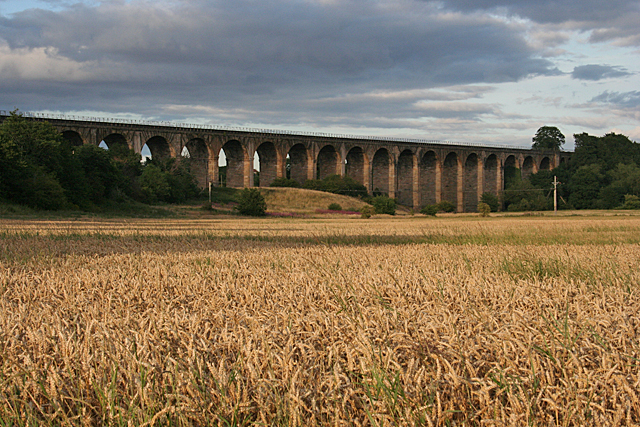
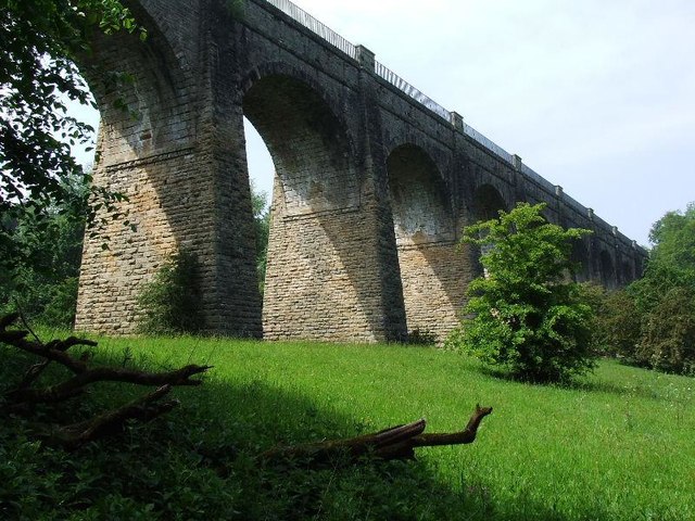
Avon Aqueduct

The Avon Aqueduct is a navigable aqueduct that carries the Union Canal over the River Avon, near Linlithgow, Scotland. == History == The aqueduct was built...

Carribber Castle

Carribber Castle, also known as Carriber Castle or Rob Gibb's Castle, is a ruined castle located near Linlithgow in West Lothian, Scotland. == Description... ==

Battle of Linlithgow Bridge

The Battle of Linlithgow Bridge is a battle that took place on 4 September 1526 in the village of Linlithgow Bridge, outside the Scottish town of Linlithgow...

Nearby Amenities

Located within 500m of 55.961366,-3.6435149
Barrier: cattle_grid
Lat/Long: 55.9640381/-3.6474259
Lumsdaine House
Addr Postcode: EH49 6QE
Addr Street: Lanark Road
Tourism: guest_house
Lat/Long: 55.9652983/-3.6447703
Power: pole
Lat/Long: 55.9653249/-3.6471751
Power: pole
Lat/Long: 55.9645307/-3.6473817
Power: pole
Lat/Long: 55.9642176/-3.6474714
Power: pole
Lat/Long: 55.9635413/-3.6476697
Power: pole
Lat/Long: 55.9632657/-3.6470374
Power: pole
Lat/Long: 55.962809/-3.6460586
Power: pole
Lat/Long: 55.9622845/-3.6449297
Power: pole
Lat/Long: 55.9617951/-3.644097
Power: pole
Lat/Long: 55.9615743/-3.6439739
Power: pole
Lat/Long: 55.9614411/-3.6444852
Power: pole
Lat/Long: 55.9613944/-3.6446604
Power: pole
Lat/Long: 55.9610755/-3.6458479
Power: pole
Lat/Long: 55.9607122/-3.6471876
Power: pole
Lat/Long: 55.9609634/-3.6480537
Power: pole
Lat/Long: 55.9612098/-3.6489416
Power: pole
Lat/Long: 55.9614873/-3.649936
Power: pole
Lat/Long: 55.9617711/-3.6509106
Power: pole
Lat/Long: 55.9607099/-3.6471709
Power: pole
Lat/Long: 55.9601667/-3.6474067
Power: pole
Lat/Long: 55.9596328/-3.6476071
Power: pole
Lat/Long: 55.9612005/-3.6414613
Power: pole
Lat/Long: 55.9613313/-3.6419496
Power: pole
Lat/Long: 55.9615042/-3.6426821
Power: pole
Lat/Long: 55.9619767/-3.6361711
Power: pole
Lat/Long: 55.960902/-3.6425089
Power: pole
Lat/Long: 55.9601719/-3.6420143
Power: pole
Lat/Long: 55.9600575/-3.6406307
Power: pole
Lat/Long: 55.9599652/-3.6395247
Power: pole
Lat/Long: 55.9598612/-3.6382976
Power: pole
Lat/Long: 55.9597456/-3.6369704
Craig's Lodges
Addr City: Linlithgow
Addr Postcode: EH49 6QF
Addr Street: Williamscraigs
Email: info@craigslodges.com
Operator: Alba Holiday Cottages
Phone: +441360660008
Tourism: chalet
Website: https://albaholidaycottages.co.uk/accomodations/linlithgowlodges/
Lat/Long: 55.963005/-3.6364798
The data included in this document is from www.openstreetmap.org. The data is made available under ODbL.

Have you been to Belsyde?

Leave your review of Belsyde below (or comments, questions and feedback).