Beercrocombe

Settlement in Somerset South Somerset

England

Beercrocombe

Hatch Beauchamp : Hatch Court Park A track leads to the church.
Hatch Beauchamp : Hatch Court Park Credit: Lewis Clarke

Beercrocombe is a small village located in the county of Somerset, England. Situated approximately 12 miles west of Taunton, the village is nestled in the picturesque countryside of the Blackdown Hills, an Area of Outstanding Natural Beauty.

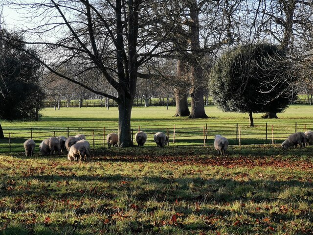
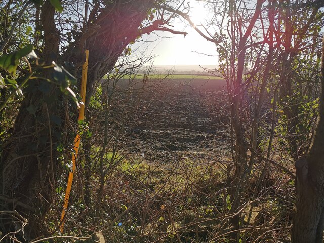
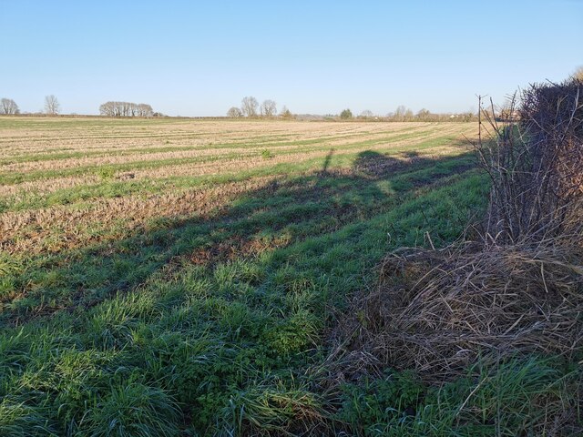
With a population of around 250 residents, Beercrocombe exudes a quintessentially English charm. The village is characterized by its idyllic surroundings, including rolling hills, lush meadows, and ancient woodlands. The landscape offers breathtaking views and ample opportunities for outdoor activities such as hiking, cycling, and horse riding.

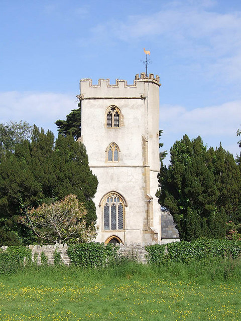
The heart of Beercrocombe is its historic church, St. James’ Church, which dates back to the 13th century and is a Grade II listed building. Its stunning architecture and peaceful atmosphere make it a popular destination for both locals and visitors alike.

Despite its small size, Beercrocombe has a strong sense of community. The village holds regular events and activities, including fairs, festivals, and fundraising initiatives. The local pub, The Old Forge Inn, serves as a gathering place for residents, offering a warm and friendly atmosphere.

Beercrocombe benefits from its proximity to nearby amenities and attractions. The market town of Ilminster is just a short drive away, providing residents with access to shops, supermarkets, and other essential services. Additionally, the stunning Jurassic Coastline is within easy reach, offering sandy beaches and charming seaside towns.

In conclusion, Beercrocombe is a tranquil village in Somerset, known for its natural beauty, rich history, and close-knit community. It offers a peaceful retreat for those seeking a slower pace of life and a deep appreciation for the English countryside.

If you have any feedback on the listing, please let us know in the comments section below.

Beercrocombe Images

Images are sourced within 2km of 50.979014/-2.9654116 or Grid Reference ST3220. Thanks to Geograph Open Source API. All images are credited.

Hatch Beauchamp : Hatch Court Park A track leads to the church.
Hatch Beauchamp : Hatch Court Park
A track leads to the church.
Hatch Beauchamp : Hatch Court Park Sheep in a field at Hatch Court Park.
Hatch Beauchamp : Hatch Court Park
Sheep in a field at Hatch Court Park.
Hatch Beauchamp : Hatch Court Built in about 1755 in the Palladian style with Bath Stone by the wool merchant John Collins to the design of Thomas Prowse. The site had been occupied since the mediaeval era by various forms of the manor house of the manor of Hatch, the caput of an important feudal barony first held by the Anglo-Norman de Beauchamp family in the 11th century
Hatch Beauchamp : Hatch Court
Built in about 1755 in the Palladian style with Bath Stone by the wool merchant John Collins to the design of Thomas Prowse. The site had been occupied since the mediaeval era by various forms of the manor house of the manor of Hatch, the caput of an important feudal barony first held by the Anglo-Norman de Beauchamp family in the 11th century
Hatch Beauchamp : Grassy Field Looking across a field.
Hatch Beauchamp : Grassy Field
Looking across a field.
Hatch Beauchamp : Frost Street Looking along Frost Street.
Hatch Beauchamp : Frost Street
Looking along Frost Street.
Hatch Beauchamp : Grassy Field A field beyond the open gates.
Hatch Beauchamp : Grassy Field
A field beyond the open gates.
Hatch Beauchamp : Grassy Field & Gate Looking beyond the gate and into the field.
Hatch Beauchamp : Grassy Field & Gate
Looking beyond the gate and into the field.
Curry Mallet : Grassy Field Looking across the field.
Curry Mallet : Grassy Field
Looking across the field.
Curry Mallet : Grassy Field Looking across the countryside.
Curry Mallet : Grassy Field
Looking across the countryside.
Curry Mallet : Countryside Scenery Looking towards Beercrocombe.
Curry Mallet : Countryside Scenery
Looking towards Beercrocombe.
Curry Mallet : Fieldgate Lane Looking along the country lane.
Curry Mallet : Fieldgate Lane
Looking along the country lane.
Curry Mallet : Silver Street Looking along Silver Street, passing Beer Cottage.
Curry Mallet : Silver Street
Looking along Silver Street, passing Beer Cottage.
Curry Mallet : Muddy Field A muddy field in the countryside.
Curry Mallet : Muddy Field
A muddy field in the countryside.
Curry Mallet : Beercrocombe Scenery Looking towards the village of Beer Crocombe. A helicopter hovers above, as it had done for more than an hour.
Curry Mallet : Beercrocombe Scenery
Looking towards the village of Beer Crocombe. A helicopter hovers above, as it had done for more than an hour.
Curry Mallet : Muddy Field Looking into a field.
Curry Mallet : Muddy Field
Looking into a field.
Curry Mallet : Muddy Field Looking out into a muddy field.
Curry Mallet : Muddy Field
Looking out into a muddy field.
Curry Mallet : Grassy Field A field in the countryside.
Curry Mallet : Grassy Field
A field in the countryside.
Curry Mallet : Silver Street Looking along Silver Street.
Curry Mallet : Silver Street
Looking along Silver Street.
Show me another place!

Beercrocombe is located at Grid Ref: ST3220 (Lat: 50.979014, Lng: -2.9654116)

Administrative County: Somerset

District: South Somerset

Police Authority: Avon and Somerset

What 3 Words

///motive.acclaim.packages. Near Ilminster, Somerset

Nearby Locations

Beer Crocombe Beercrocombe

Related Wikis

Beercrocombe

Beercrocombe (also known as Beer Crocombe) is a village and civil parish in Somerset, England, 1 mile (1.6 km) south of Curry Mallet and 7 miles (11.3...

Church of St James, Beercrocombe

The Church of St James in Beercrocombe, Somerset, England, dates from the 13th century but the current building is predominantly from the 15th. It was...

Curry Mallet

Curry Mallet (anciently "Cory Mallett") is a village and parish in Somerset, England. It is on the Fivehead River (also known as the River Ile), 7 miles...

Church of St James, Curry Mallet

The Church of St James is a Church of England parish church in Curry Mallet, Somerset. It has 13th-century origins and has been designated as a Grade I...

Hatch Beauchamp

Hatch Beauchamp is a village and civil parish in Somerset, England, situated 5 miles (8.0 km) south east of Taunton. The village has a population of 620...
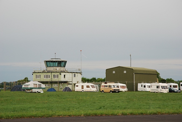
RNAS Merryfield

Royal Naval Air Station Merryfield, commonly known as RNAS Merryfield, is an air station of the Royal Navy's Fleet Air Arm located 2.7 miles (4 kilometres...
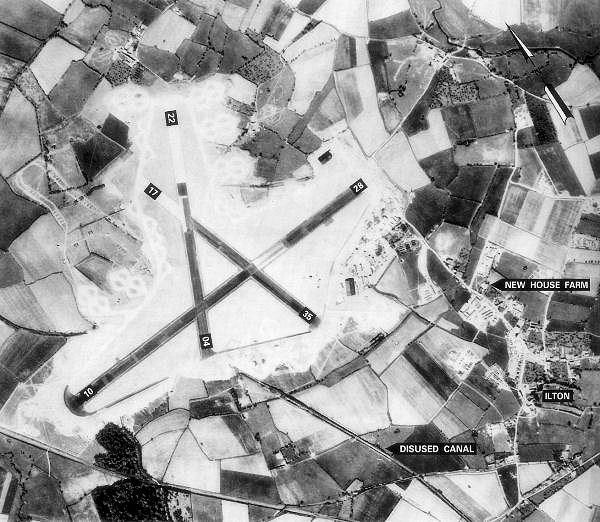
RAF Merryfield

Royal Air Force Merryfield or more simply RAF Merryfield (also known as Isle Abbotts) is a former Royal Air Force station in the village of Ilton near...

Fivehead Arable Fields

Fivehead Arable Fields (grid reference ST337224) is a 10.3 hectare (25.4 acre) biological Site of Special Scientific Interest near the village of Fivehead...

Nearby Amenities

Located within 500m of 50.979014,-2.9654116
Beercrocombe
Place: hamlet
Lat/Long: 50.9788504/-2.9654731
Bus Stop
Beercrocombe
Bench: yes
Bus: yes
Naptan AtcoCode: 3600SOB20368
Naptan Bearing: W
Naptan CommonName: Beercrocombe
Naptan Indicator: W-bound
Naptan NaptanCode: sotapjgw
Naptan Street: Broadmead Road
Naptan Verified: no
Public Transport: platform
Shelter: yes
Lat/Long: 50.9787061/-2.9653213
Public Bookcase
Booth: K6
Description: Disused phone box. Now used as village book swap
Disused Amenity: telephone
Man Made: telephone_box
Public Bookcase Type: phone_box
Lat/Long: 50.9786891/-2.9652566
Post Box
Brand: Royal Mail
Brand Wikidata: Q638098
Collection Times: Mo-Fr 09:00; Sa 07:00
Drive Through: no
Operator: Royal Mail
Operator Wikidata: Q638098
Post Box Mounting: stone_wall
Post Box Type: wall
Ref: TA3 117
Royal Cypher: EIIR
Royal Cypher Wikidata: Q33102113
Lat/Long: 50.9787162/-2.9653444
Turning Loop
Lat/Long: 50.9789131/-2.9622797
Information: guidepost
Tourism: information
Lat/Long: 50.9787535/-2.9653802
Bench
Lat/Long: 50.9787485/-2.9654453
Power: pole
Source: bing
Lat/Long: 50.9803915/-2.9694816
Power: pole
Source: bing
Lat/Long: 50.9770833/-2.9673252
Power: pole
Source: bing
Lat/Long: 50.9815736/-2.9699698
Power: pole
Source: bing
Lat/Long: 50.979434/-2.9690257
Power: pole
Source: bing
Lat/Long: 50.9778112/-2.9680091
Power: pole
Source: bing
Lat/Long: 50.9754012/-2.9658633
Power: pole
Source: bing
Lat/Long: 50.9756562/-2.9682612
Power: pole
Source: bing
Lat/Long: 50.9762896/-2.9666331
Power: pole
Source: bing
Lat/Long: 50.977264/-2.9659063
Power: pole
Source: bing
Lat/Long: 50.9829346/-2.9687333
Power: pole
Source: bing
Lat/Long: 50.9831018/-2.967006
Power: pole
Source: bing
Lat/Long: 50.9832715/-2.9653336
The data included in this document is from www.openstreetmap.org. The data is made available under ODbL.

Have you been to Beercrocombe?

Leave your review of Beercrocombe below (or comments, questions and feedback).