Beaver

Settlement in Kent Ashford

England

Beaver

Field, Long Length It looks so peaceful but for how long? However, there don’t seem to be development plans to ruin it, at the moment.
Field, Long Length Credit: John Baker

Beaver, Kent is a small village located in the county of Kent, England. Situated approximately 14 miles southeast of the city of Canterbury, Beaver is nestled in the picturesque Kentish countryside. The village is part of the civil parish of Ash-next-Sandwich and falls within the administrative district of Dover.

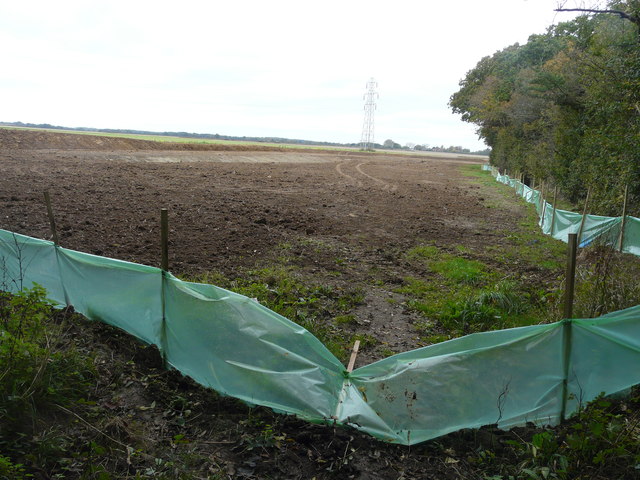
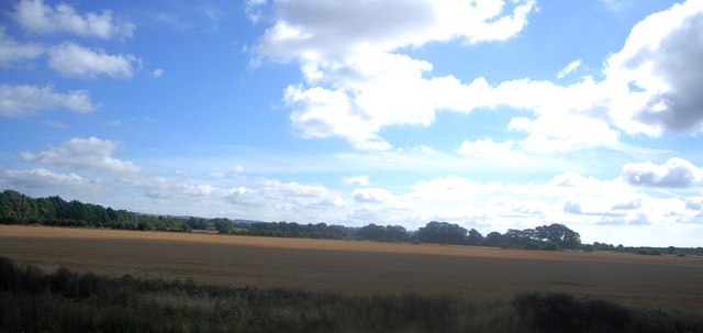
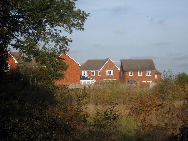
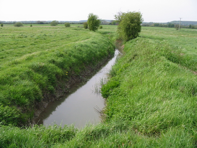
With a population of around 200 residents, Beaver offers a tranquil and idyllic setting for those seeking a peaceful rural lifestyle. The village is characterized by its quaint, traditional architecture, including a charming village church dating back to the 12th century. The surrounding landscape is predominantly agricultural, with lush green fields and rolling hills providing a scenic backdrop.

Despite its small size, Beaver benefits from excellent transport links. The nearby A256 road connects the village to the larger towns of Sandwich and Deal, as well as providing easy access to the bustling city of Dover. Canterbury, renowned for its historic cathedral and vibrant cultural scene, is also within a short driving distance.

The village itself offers limited amenities, with a small local pub and a village hall serving as the focal points of community life. However, a wider range of facilities, including shops, schools, and healthcare services, can be found in the neighboring towns.

Beaver, Kent appeals to those seeking a peaceful rural retreat, surrounded by natural beauty and countryside charm. Its close proximity to larger towns and cities ensures that residents can easily access a wider range of amenities, while still enjoying the tranquility of village life.

If you have any feedback on the listing, please let us know in the comments section below.

Beaver Images

Images are sourced within 2km of 51.135546/0.86413862 or Grid Reference TR0041. Thanks to Geograph Open Source API. All images are credited.

Field, Long Length It looks so peaceful but for how long? However, there don’t seem to be development plans to ruin it, at the moment.
Field, Long Length
It looks so peaceful but for how long? However, there don’t seem to be development plans to ruin it, at the moment.
Farmland, Long Length The green polythene, affixed to the stakes, and the earth bank are the first signs of the vast development, to be known as Chilmington Green, which will one day be visible from this location. 

Planning permission has been granted by Ashford Borough Council under application number 12/00400/AS. This is  an “outline application for a Comprehensive Mixed Use Development comprising: up to 5,750 residential units, in a mix of sizes, types and tenures; up to 10,000 m² (gross external floor space) of Class Bl use; up to 9,000 m² (gross external floor space) of Class Al to A5 uses; Education (including a secondary school of up to 8 ha and up to four primary schools of up to 2.1 ha each); Community Uses (class Dl) up to 7,000 m² (gross external floor space); Leisure Uses (class D2) up to 6,000 m² (gross external floor space); Provision of local recycling facilities; Provision of areas of formal and informal open space; Installation of appropriate utilities infrastructure as required to serve the development, including flood attenuation works, SUDS, water supply and wastewater infrastructure, gas supply, electricity supply (including substations), telecommunications infrastructure and renewable energy infrastructure (including CHP in the District Centre); Transport infrastructure, including provision of three accesses on to the A28, an access on to Coulter Road/Cuckoo Lane, other connections on to the local road network, and a network of internal roads, footpaths and cycle routes; New planting and landscaping, both within the Proposed Development and on its boundaries, and ecological enhancement works; and associated ground works where appearance, landscaping, layout and scale are reserved for future approval and where access is reserved for future approval with the exception of the three accesses on to the A28 and the access on to Coulter Road/Cuckoo Lane”.    

Nearly all traces of the footpath, which once crossed this field, have been obliterated.
Farmland, Long Length
The green polythene, affixed to the stakes, and the earth bank are the first signs of the vast development, to be known as Chilmington Green, which will one day be visible from this location. Planning permission has been granted by Ashford Borough Council under application number 12/00400/AS. This is an “outline application for a Comprehensive Mixed Use Development comprising: up to 5,750 residential units, in a mix of sizes, types and tenures; up to 10,000 m² (gross external floor space) of Class Bl use; up to 9,000 m² (gross external floor space) of Class Al to A5 uses; Education (including a secondary school of up to 8 ha and up to four primary schools of up to 2.1 ha each); Community Uses (class Dl) up to 7,000 m² (gross external floor space); Leisure Uses (class D2) up to 6,000 m² (gross external floor space); Provision of local recycling facilities; Provision of areas of formal and informal open space; Installation of appropriate utilities infrastructure as required to serve the development, including flood attenuation works, SUDS, water supply and wastewater infrastructure, gas supply, electricity supply (including substations), telecommunications infrastructure and renewable energy infrastructure (including CHP in the District Centre); Transport infrastructure, including provision of three accesses on to the A28, an access on to Coulter Road/Cuckoo Lane, other connections on to the local road network, and a network of internal roads, footpaths and cycle routes; New planting and landscaping, both within the Proposed Development and on its boundaries, and ecological enhancement works; and associated ground works where appearance, landscaping, layout and scale are reserved for future approval and where access is reserved for future approval with the exception of the three accesses on to the A28 and the access on to Coulter Road/Cuckoo Lane”. Nearly all traces of the footpath, which once crossed this field, have been obliterated.
Farmland, Long Length In the distance, work was being carried out to transform a corner of the field and the result can be seen in this image of <a href="https://www.geograph.org.uk/photo/5583007">TQ9939 : Farmland, Long Length</a>. This was one of the first signs of the vast development, to be known as Chilmington Green, which will one day be visible from this location.
 
Planning permission has been granted by Ashford Borough Council under application number 12/00400/AS. This is  an “outline application for a Comprehensive Mixed Use Development comprising: up to 5,750 residential units, in a mix of sizes, types and tenures; up to 10,000 m² (gross external floor space) of Class Bl use; up to 9,000 m² (gross external floor space) of Class Al to A5 uses; Education (including a secondary school of up to 8 ha and up to four primary schools of up to 2.1 ha each); Community Uses (class Dl) up to 7,000 m² (gross external floor space); Leisure Uses (class D2) up to 6,000 m² (gross external floor space); Provision of local recycling facilities; Provision of areas of formal and informal open space; Installation of appropriate utilities infrastructure as required to serve the development, including flood attenuation works, SUDS, water supply and wastewater infrastructure, gas supply, electricity supply (including substations), telecommunications infrastructure and renewable energy infrastructure (including CHP in the District Centre); Transport infrastructure, including provision of three accesses on to the A28, an access on to Coulter Road/Cuckoo Lane, other connections on to the local road network, and a network of internal roads, footpaths and cycle routes; New planting and landscaping, both within the Proposed Development and on its boundaries, and ecological enhancement works; and associated ground works where appearance, landscaping, layout and scale are reserved for future approval and where access is reserved for future approval with the exception of the three accesses on to the A28 and the access on to Coulter Road/Cuckoo Lane”.
Farmland, Long Length
In the distance, work was being carried out to transform a corner of the field and the result can be seen in this image of TQ9939 : Farmland, Long Length. This was one of the first signs of the vast development, to be known as Chilmington Green, which will one day be visible from this location. Planning permission has been granted by Ashford Borough Council under application number 12/00400/AS. This is an “outline application for a Comprehensive Mixed Use Development comprising: up to 5,750 residential units, in a mix of sizes, types and tenures; up to 10,000 m² (gross external floor space) of Class Bl use; up to 9,000 m² (gross external floor space) of Class Al to A5 uses; Education (including a secondary school of up to 8 ha and up to four primary schools of up to 2.1 ha each); Community Uses (class Dl) up to 7,000 m² (gross external floor space); Leisure Uses (class D2) up to 6,000 m² (gross external floor space); Provision of local recycling facilities; Provision of areas of formal and informal open space; Installation of appropriate utilities infrastructure as required to serve the development, including flood attenuation works, SUDS, water supply and wastewater infrastructure, gas supply, electricity supply (including substations), telecommunications infrastructure and renewable energy infrastructure (including CHP in the District Centre); Transport infrastructure, including provision of three accesses on to the A28, an access on to Coulter Road/Cuckoo Lane, other connections on to the local road network, and a network of internal roads, footpaths and cycle routes; New planting and landscaping, both within the Proposed Development and on its boundaries, and ecological enhancement works; and associated ground works where appearance, landscaping, layout and scale are reserved for future approval and where access is reserved for future approval with the exception of the three accesses on to the A28 and the access on to Coulter Road/Cuckoo Lane”.
Long Length It may appear as an idyllic country lane but the farmland, beyond the trees on the right, is already showing signs of the vast development, to be known as Chilmington Green, which may change the appearance of this lane one day.  
 
Planning permission has been granted by Ashford Borough Council under application number 12/00400/AS. This is  an “outline application for a Comprehensive Mixed Use Development comprising: up to 5,750 residential units, in a mix of sizes, types and tenures; up to 10,000 m² (gross external floor space) of Class Bl use; up to 9,000 m² (gross external floor space) of Class Al to A5 uses; Education (including a secondary school of up to 8 ha and up to four primary schools of up to 2.1 ha each); Community Uses (class Dl) up to 7,000 m² (gross external floor space); Leisure Uses (class D2) up to 6,000 m² (gross external floor space); Provision of local recycling facilities; Provision of areas of formal and informal open space; Installation of appropriate utilities infrastructure as required to serve the development, including flood attenuation works, SUDS, water supply and wastewater infrastructure, gas supply, electricity supply (including substations), telecommunications infrastructure and renewable energy infrastructure (including CHP in the District Centre); Transport infrastructure, including provision of three accesses on to the A28, an access on to Coulter Road/Cuckoo Lane, other connections on to the local road network, and a network of internal roads, footpaths and cycle routes; New planting and landscaping, both within the Proposed Development and on its boundaries, and ecological enhancement works; and associated ground works where appearance, landscaping, layout and scale are reserved for future approval and where access is reserved for future approval with the exception of the three accesses on to the A28 and the access on to Coulter Road/Cuckoo Lane”.
Long Length
It may appear as an idyllic country lane but the farmland, beyond the trees on the right, is already showing signs of the vast development, to be known as Chilmington Green, which may change the appearance of this lane one day. Planning permission has been granted by Ashford Borough Council under application number 12/00400/AS. This is an “outline application for a Comprehensive Mixed Use Development comprising: up to 5,750 residential units, in a mix of sizes, types and tenures; up to 10,000 m² (gross external floor space) of Class Bl use; up to 9,000 m² (gross external floor space) of Class Al to A5 uses; Education (including a secondary school of up to 8 ha and up to four primary schools of up to 2.1 ha each); Community Uses (class Dl) up to 7,000 m² (gross external floor space); Leisure Uses (class D2) up to 6,000 m² (gross external floor space); Provision of local recycling facilities; Provision of areas of formal and informal open space; Installation of appropriate utilities infrastructure as required to serve the development, including flood attenuation works, SUDS, water supply and wastewater infrastructure, gas supply, electricity supply (including substations), telecommunications infrastructure and renewable energy infrastructure (including CHP in the District Centre); Transport infrastructure, including provision of three accesses on to the A28, an access on to Coulter Road/Cuckoo Lane, other connections on to the local road network, and a network of internal roads, footpaths and cycle routes; New planting and landscaping, both within the Proposed Development and on its boundaries, and ecological enhancement works; and associated ground works where appearance, landscaping, layout and scale are reserved for future approval and where access is reserved for future approval with the exception of the three accesses on to the A28 and the access on to Coulter Road/Cuckoo Lane”.
Farmland, Long Length The green polythene seen in the image of <a href="https://www.geograph.org.uk/photo/5583007">TQ9939 : Farmland, Long Length</a> has been removed, while the entrance to the field now has a fence across it. The farmland will eventually become part of a vast development, to be known as Chilmington Green. 

Planning permission has been granted by Ashford Borough Council under application number 12/00400/AS, for an “outline application for a Comprehensive Mixed Use Development comprising: up to 5,750 residential units, in a mix of sizes, types and tenures; up to 10,000 m² (gross external floor space) of Class Bl use; up to 9,000 m² (gross external floor space) of Class Al to A5 uses; Education (including a secondary school of up to 8 ha and up to four primary schools of up to 2.1 ha each); Community Uses (class Dl) up to 7,000 m² (gross external floor space); Leisure Uses (class D2) up to 6,000 m² (gross external floor space); Provision of local recycling facilities; Provision of areas of formal and informal open space; Installation of appropriate utilities infrastructure as required to serve the development, including flood attenuation works, SUDS, water supply and wastewater infrastructure, gas supply, electricity supply (including substations), telecommunications infrastructure and renewable energy infrastructure (including CHP in the District Centre); Transport infrastructure, including provision of three accesses on to the A28, an access on to Coulter Road/Cuckoo Lane, other connections on to the local road network, and a network of internal roads, footpaths and cycle routes; New planting and landscaping, both within the Proposed Development and on its boundaries, and ecological enhancement works; and associated ground works where appearance, landscaping, layout and scale are reserved for future approval and where access is reserved for future approval with the exception of the three accesses on to the A28 and the access on to Coulter Road/Cuckoo Lane”.
Farmland, Long Length
The green polythene seen in the image of TQ9939 : Farmland, Long Length has been removed, while the entrance to the field now has a fence across it. The farmland will eventually become part of a vast development, to be known as Chilmington Green. Planning permission has been granted by Ashford Borough Council under application number 12/00400/AS, for an “outline application for a Comprehensive Mixed Use Development comprising: up to 5,750 residential units, in a mix of sizes, types and tenures; up to 10,000 m² (gross external floor space) of Class Bl use; up to 9,000 m² (gross external floor space) of Class Al to A5 uses; Education (including a secondary school of up to 8 ha and up to four primary schools of up to 2.1 ha each); Community Uses (class Dl) up to 7,000 m² (gross external floor space); Leisure Uses (class D2) up to 6,000 m² (gross external floor space); Provision of local recycling facilities; Provision of areas of formal and informal open space; Installation of appropriate utilities infrastructure as required to serve the development, including flood attenuation works, SUDS, water supply and wastewater infrastructure, gas supply, electricity supply (including substations), telecommunications infrastructure and renewable energy infrastructure (including CHP in the District Centre); Transport infrastructure, including provision of three accesses on to the A28, an access on to Coulter Road/Cuckoo Lane, other connections on to the local road network, and a network of internal roads, footpaths and cycle routes; New planting and landscaping, both within the Proposed Development and on its boundaries, and ecological enhancement works; and associated ground works where appearance, landscaping, layout and scale are reserved for future approval and where access is reserved for future approval with the exception of the three accesses on to the A28 and the access on to Coulter Road/Cuckoo Lane”.
Long Length towards Ashford Near Court Lodge Farm.
Long Length towards Ashford
Near Court Lodge Farm.
Farmland near Ashford
Approaching roundabout near Ashford
Former Kingsnorth Post Office Stores, Church Hill Planning permission was granted by Ashford Borough Council under application number 12/00343/AS for "change of use of post office to residential, bay window to front elevation and alteration of door to window”
Former Kingsnorth Post Office Stores, Church Hill
Planning permission was granted by Ashford Borough Council under application number 12/00343/AS for "change of use of post office to residential, bay window to front elevation and alteration of door to window”
Lucilla Avenue, Kingsnorth This gridsquare was open fields until fairly recently but its north-western corner has now been largely built over as Ashford continues to expand. The building on the left is part of the electricity distribution network of EDF Energy. Taken from Pound Lane which still forms a border with open country.
Lucilla Avenue, Kingsnorth
This gridsquare was open fields until fairly recently but its north-western corner has now been largely built over as Ashford continues to expand. The building on the left is part of the electricity distribution network of EDF Energy. Taken from Pound Lane which still forms a border with open country.
Housing Estate at Stanhope New housing on the edge of the Stanhope area of Ashford. The fields to the North side of Pound Lane are repidly disappearing as the estate encroaches on the village of Kingsnorth, which will soon be swallowed up and become just another area of Ashford.
Housing Estate at Stanhope
New housing on the edge of the Stanhope area of Ashford. The fields to the North side of Pound Lane are repidly disappearing as the estate encroaches on the village of Kingsnorth, which will soon be swallowed up and become just another area of Ashford.
Entrance to Willowbed Farm As seen from Long Length road.
Entrance to Willowbed Farm
As seen from Long Length road.
The Greensand Way crosses Long Length The long distance path heads right to Chilmington Green or left to Pound Lane.
The Greensand Way crosses Long Length
The long distance path heads right to Chilmington Green or left to Pound Lane.
Stile and footbridge on the Greensand Way The long distance path heads from the fields of Court Lodge Farm towards Long Length road. It passes over a field ditch.
Stile and footbridge on the Greensand Way
The long distance path heads from the fields of Court Lodge Farm towards Long Length road. It passes over a field ditch.
Three stiles and farm bridge on the Greensand Way The long distance path heads from Long Length towards Pound Lane through Court Lodge Farm.
Three stiles and farm bridge on the Greensand Way
The long distance path heads from Long Length towards Pound Lane through Court Lodge Farm.
Barns of Court Lodge Farm As seen from the Greensand Way (long distance path).
Barns of Court Lodge Farm
As seen from the Greensand Way (long distance path).
Footbridge on the Greensand Way near Pound Lane The long distance path heads from Court Lodge Farm fields towards the lane. It crosses over a deep field ditch that leads into the East Stour.
Footbridge on the Greensand Way near Pound Lane
The long distance path heads from Court Lodge Farm fields towards the lane. It crosses over a deep field ditch that leads into the East Stour.
Greensand Way on Pound Lane The long distance path heads right across Court Lodge Farm fields towards Long Length. It also heads straight on along the lane towards Kingsnorth crossroads.
Greensand Way on Pound Lane
The long distance path heads right across Court Lodge Farm fields towards Long Length. It also heads straight on along the lane towards Kingsnorth crossroads.
Show me another place!

Beaver is located at Grid Ref: TR0041 (Lat: 51.135546, Lng: 0.86413862)

Administrative County: Kent

District: Ashford

Police Authority: Kent

What 3 Words

///fault.ranks.manage. Near Ashford, Kent

Related Wikis

Norman Cycles

Norman Cycles was a British bicycle, autocycle, moped, and motorcycle manufacturer in Ashford, Kent, England. The company and its products are remembered...

Ashford College

Ashford College is a further education college in Ashford, Kent founded in August 2014. It has been run by EKC Group since April 2020, when it was acquired...

Whitewater Dyke

Whitewater Dyke is a tributary of the Great Stour river, joining with the East Stour and then the Great Stour at Pledge's Mill at the bottom of East Hill...

Christ Church, Ashford

Christ Church is in the town of Ashford, Kent, England. It is an active Anglican parish church in the deanery of Ashford, the archdeaconry of Maidstone...

Aylesford Stream

The Aylesford Stream is a 5.4 kilometre long tributary of the East Stour, itself a tributary of the Great Stour in Kent. The stream's source is north of...

Stanhope, Kent

Stanhope is a civil parish and suburb of Ashford in the Borough of Ashford in Kent, England. It was built in the 1960s on the southern edge of the town...

Ashford Designer Outlet

The Ashford Designer Outlet is a shopping centre in Ashford, Kent, England. The McArthurGlen Ashford Designer Outlet was designed by the Richard Rogers...

Ashford Green Corridors

Ashford Green Corridors is a 47.4-hectare (117-acre) Local Nature Reserve in Ashford in Kent, England. It is owned and managed by Ashford Borough Council...

Nearby Amenities

Located within 500m of 51.135546,0.86413862
Traffic Signals
Lat/Long: 51.1358193/0.8640788
Traffic Signals
Lat/Long: 51.1366836/0.8679239
Place Of Worship
Cade Road United Reformed & Methodist Church
Denomination: united_reformed;methodist
Postal Code: TN23 6JE
Religion: christian
Lat/Long: 51.1346033/0.8640899
Turning Circle
Lat/Long: 51.1388066/0.8625914
Noexit: yes
Lat/Long: 51.1355078/0.859922
Source: guess
Lat/Long: 51.1347331/0.8702552
Halfords
Addr City: Ashford
Addr Housenumber: Unit 2
Addr Street: Gallagher Retail Park
Brand: Halfords
Brand Wikidata: Q3398786
Brand Wikipedia: en:Halfords
Phone: +44 1233 667320
Postal Code: TN23 7DH
Service Bicycle Repair: yes
Service Bicycle Retail: yes
Shop: car_parts
Source: local_knowledge
Toilets Wheelchair: no
Website: https://www.halfords.com/locations/ashford-store/
Wheelchair: yes
Lat/Long: 51.1352347/0.8704304
Crossing
Crossing: uncontrolled
Crossing Ref: zebra
Lat/Long: 51.1334607/0.863033
Crossing
Crossing: traffic_signals
Crossing Ref: pelican
Lat/Long: 51.1357307/0.8641234
Crossing
Crossing: traffic_signals
Crossing Island: yes
Crossing Ref: pelican
Tactile Paving: yes
Lat/Long: 51.1357919/0.8638279
Bus Stop
Cade Road
Bus: yes
Naptan AtcoCode: 240099758
Naptan Bearing: NE
Naptan CommonName: Cade Road
Naptan Indicator: opp
Naptan Landmark: Ponica Road
Naptan NaptanCode: kntgpgwt
Naptan PlusbusZoneRef: ASHFKY
Naptan Street: Kingsnorth Road
Naptan Verified: no
Public Transport: platform
Source: naptan_import
Lat/Long: 51.1351863/0.8638606
Bus Stop
Kingsnorth Road Post Office
Bus: yes
Naptan AtcoCode: 240099760
Naptan Bearing: NE
Naptan CommonName: Kingsnorth Road Post Office
Naptan Indicator: adj
Naptan Landmark: Post Office
Naptan NaptanCode: kntgpwjm
Naptan PlusbusZoneRef: ASHFKY
Naptan Street: Kingsnorth Road
Naptan Verified: no
Public Transport: platform
Source: naptan_import
Lat/Long: 51.1338808/0.8631793
Bus Stop
Grantley Close
Bus: yes
Naptan AtcoCode: 240099764
Naptan Bearing: SE
Naptan CommonName: Grantley Close
Naptan Indicator: opp
Naptan Landmark: Grantley Close
Naptan NaptanCode: kntgpwjt
Naptan PlusbusZoneRef: ASHFKY
Naptan Street: Bond Road
Naptan Verified: no
Public Transport: platform
Source: naptan_import
Lat/Long: 51.1383078/0.8656838
Bus Stop
South Kent College
Bus: yes
Naptan AtcoCode: 240099766
Naptan Bearing: S
Naptan CommonName: South Kent College
Naptan Indicator: opp
Naptan Landmark: South Kent College
Naptan NaptanCode: kntgpwgt
Naptan PlusbusZoneRef: ASHFKY
Naptan Street: Jemmett Road
Naptan Verified: no
Public Transport: platform
Source: naptan_import
Lat/Long: 51.1391045/0.8618013
Bus Stop
Langholm Road
Bus: yes
Naptan AtcoCode: 240099768
Naptan Bearing: S
Naptan CommonName: Langholm Road
Naptan Indicator: adj
Naptan Landmark: Langholm Road
Naptan NaptanCode: kntgtagm
Naptan PlusbusZoneRef: ASHFKY
Naptan Street: Jemmett Road
Naptan Verified: no
Public Transport: platform
Source: naptan_import
Lat/Long: 51.1378507/0.8608741
Bus Stop
Langholm Road
Bus: yes
Naptan AtcoCode: 240099770
Naptan Bearing: N
Naptan CommonName: Langholm Road
Naptan Indicator: opp
Naptan Landmark: Langholm Road
Naptan NaptanCode: kntgtdga
Naptan PlusbusZoneRef: ASHFKY
Naptan Street: Jemmett Road
Naptan Verified: no
Public Transport: platform
Source: naptan_import
Lat/Long: 51.137472/0.8605136
Bus Stop
B & Q
Bus: yes
Naptan AtcoCode: 240099778
Naptan Bearing: E
Naptan CommonName: B & Q
Naptan Indicator: adj
Naptan Landmark: B & Q
Naptan NaptanCode: kntgpwga
Naptan PlusbusZoneRef: ASHFKY
Naptan Street: Norman Road
Naptan Verified: no
Public Transport: platform
Source: naptan_import
Lat/Long: 51.1364007/0.8705503
Bus Stop
Arcon Road
Bench: yes
Bin: no
Bus: yes
Lit: no
Naptan AtcoCode: 2400A026210A
Naptan Bearing: E
Naptan CommonName: Arcon Road
Naptan Indicator: opp
Naptan Landmark: Arcon Road
Naptan NaptanCode: kntdatpj
Naptan PlusbusZoneRef: ASHFKY
Naptan Street: Beaver Lane
Naptan Verified: no
Public Transport: platform
Shelter: yes
Source: naptan_import
Tactile Paving: no
Lat/Long: 51.1368817/0.8589044
Bus Stop
Arcon Road
Bus: yes
Naptan AtcoCode: 2400A026220A
Naptan Bearing: W
Naptan CommonName: Arcon Road
Naptan Indicator: adj
Naptan Landmark: Arcon Road
Naptan NaptanCode: kntdatpm
Naptan PlusbusZoneRef: ASHFKY
Naptan Street: Beaver Lane
Naptan Verified: no
Public Transport: platform
Shelter: yes
Source: naptan_import
Lat/Long: 51.1366654/0.8592914
Bus Stop
Beaver Inn
Bench: no
Bin: no
Bus: yes
Lit: yes
Naptan AtcoCode: 2400A026230A
Naptan Bearing: NE
Naptan CommonName: Beaver Inn
Naptan Indicator: adj
Naptan Landmark: Park Place
Naptan NaptanCode: kntdatpt
Naptan PlusbusZoneRef: ASHFKY
Naptan Street: Beaver Road
Naptan Verified: no
Public Transport: platform
Shelter: no
Source: naptan_import
Tactile Paving: no
Lat/Long: 51.1364546/0.8653259
Bus Stop
Bond Road
Bus: yes
Naptan AtcoCode: 2400A026240A
Naptan Bearing: NE
Naptan CommonName: Bond Road
Naptan Indicator: adj
Naptan Landmark: Bond Road
Naptan NaptanCode: kntdatpw
Naptan PlusbusZoneRef: ASHFKY
Naptan Street: Beaver Road
Naptan Verified: no
Public Transport: platform
Source: naptan_import
Lat/Long: 51.1380949/0.8688589
Bus Stop
Bond Road
Bus: yes
Naptan AtcoCode: 2400A026270A
Naptan Bearing: SW
Naptan CommonName: Bond Road
Naptan Indicator: opp
Naptan Landmark: Bond Road
Naptan NaptanCode: kntdatwg
Naptan PlusbusZoneRef: ASHFKY
Naptan Street: Beaver Road
Naptan Verified: no
Public Transport: platform
Source: naptan_import
Lat/Long: 51.1373445/0.8683743
Bus Stop
Beaver Inn
Bench: no
Bin: no
Bus: yes
Lit: yes
Naptan AtcoCode: 2400A026280A
Naptan Bearing: SW
Naptan CommonName: Beaver Inn
Naptan Indicator: opp
Naptan Landmark: Park Place
Naptan NaptanCode: kntdatwj
Naptan PlusbusZoneRef: ASHFKY
Naptan Street: Beaver Road
Naptan Verified: no
Public Transport: platform
Shelter: no
Source: naptan_import
Tactile Paving: no
Lat/Long: 51.136421/0.8655955
Bus Stop
Cade Road
Bus: yes
Naptan AtcoCode: 2400A026290A
Naptan Bearing: SW
Naptan CommonName: Cade Road
Naptan Indicator: adj
Naptan Landmark: Church
Naptan NaptanCode: kntdatwm
Naptan PlusbusZoneRef: ASHFKY
Naptan Street: Kingsnorth Road
Naptan Verified: no
Public Transport: platform
Source: naptan_import
Lat/Long: 51.1346406/0.863741
Bus Stop
Kingsnorth Road Post Office
Bus: yes
Naptan AtcoCode: 2400A026300A
Naptan Bearing: SW
Naptan CommonName: Kingsnorth Road Post Office
Naptan Indicator: opp
Naptan Landmark: Post Office
Naptan NaptanCode: kntdatwp
Naptan PlusbusZoneRef: ASHFKY
Naptan Street: Kingsnorth Road
Naptan Verified: no
Public Transport: platform
Source: naptan_import
Lat/Long: 51.13316/0.8628631
Bus Stop
Bramley Gardens
Bus: yes
Naptan AtcoCode: 2400A026480A
Naptan Bearing: NE
Naptan CommonName: Bramley Gardens
Naptan Indicator: opp
Naptan Landmark: Bramley Gardens
Naptan NaptanCode: kntdawgm
Naptan PlusbusZoneRef: ASHFKY
Naptan Street: Kingsnorth Road
Naptan Verified: no
Public Transport: platform
Source: naptan_import
Lat/Long: 51.1315897/0.861608
Bus Stop
B&Q
Bus: yes
Naptan AtcoCode: 2400A026650A
Naptan Bearing: W
Naptan CommonName: B&Q
Naptan Indicator: opp
Naptan Landmark: B&Q
Naptan NaptanCode: kntdawmw
Naptan PlusbusZoneRef: ASHFKY
Naptan Street: Norman Road
Naptan Verified: no
Public Transport: platform
Source: naptan_import
Lat/Long: 51.1362526/0.8702601
Bus Stop
South Kent College
Bus: yes
Naptan AtcoCode: 2400A071640A
Naptan Bearing: N
Naptan CommonName: South Kent College
Naptan Indicator: adj
Naptan Landmark: RTI
Naptan NaptanCode: kntgdpdt
Naptan PlusbusZoneRef: ASHFKY
Naptan Street: Jemmett Road
Naptan Verified: no
Public Transport: platform
Source: naptan_import
Lat/Long: 51.1392171/0.8616081
Bus Stop
Francis Road
Bus: yes
Naptan AtcoCode: 2400A073720A
Naptan Bearing: NW
Naptan CommonName: Francis Road
Naptan Indicator: opp
Naptan Landmark: Francis Road
Naptan NaptanCode: kntgjdjd
Naptan PlusbusZoneRef: ASHFKY
Naptan Street: Bond Road
Naptan Verified: no
Public Transport: platform
Source: naptan_import
Lat/Long: 51.1374684/0.8676334
Bus Stop
Grantley Close
Bus: yes
Naptan AtcoCode: 2400A073721A
Naptan Bearing: NW
Naptan CommonName: Grantley Close
Naptan Indicator: adj
Naptan Landmark: Grantley Close
Naptan NaptanCode: kntgjdjg
Naptan PlusbusZoneRef: ASHFKY
Naptan Street: Bond Road
Naptan Verified: no
Public Transport: platform
Source: naptan_import
Lat/Long: 51.1384846/0.8649483
Costcutter
Addr Housenumber: 101-103
Addr Postcode: TN23 5NU
Addr Street: Beaver Lane
Brand: Costcutter
Brand Wikidata: Q5175072
Brand Wikipedia: en:Costcutter
Contact Website: https://store-locator.costcutter.co.uk/costcutter-5086f08378b2
Operator: Costcutter
Shop: convenience
Lat/Long: 51.1373996/0.8577613
Bicycle Parking
Access: private
Bicycle Parking: stands
Capacity: 40
Covered: yes
Lat/Long: 51.1381418/0.8585415
Turning Circle
Lat/Long: 51.1351441/0.8628616
Post Office
Kingsnorth Road Post Office
Addr Postcode: TN23 6HZ
Branch: Kingsnorth Road
Brand: Post Office
Brand Wikidata: Q1783168
Check Date: 2020-02-20
Contact Website: https://www.postoffice.co.uk/branch-finder/1429256/kingsnorth-road
Ref Pol Id: 2618
Lat/Long: 51.133708/0.8628272
Post Box
Post Box Type: pillar
Royal Cypher: EIIR
Royal Cypher Wikidata: Q33102113
Lat/Long: 51.13369/0.8630832
Post Box
Collection Plate: CP1D
Collection Times: Mo-Fr 09:00; Sa 07:00
Old Ref: TN23 276
Operator: Royal Mail
Operator Wikidata: Q638098
Post Box Mounting: brick_pillar
Post Box Type: wall
Ref: TN23 276D
Royal Cypher: EIIR
Source: survey
Survey Date: 2023-09-23
Lat/Long: 51.1348081/0.8579922
Post Box
Ref: TN23 227
Lat/Long: 51.1358572/0.8628985
Paul Simon
Shop: bed
Lat/Long: 51.1352416/0.8701832
Bicycle Parking
Bicycle Parking: stands
Capacity: 14
Covered: no
Cyclestreets Id: 46987
Source: survey
Lat/Long: 51.135498/0.8701183
Turning Circle
Lat/Long: 51.1367975/0.8617944
Turning Circle
Lat/Long: 51.137016/0.8609168
Crossing
Crossing: uncontrolled
Crossing Island: yes
Crossing Ref: island
Lat/Long: 51.1366268/0.8596671
Cycleway: asl
Lat/Long: 51.1356517/0.8641396
Cycleway: asl
Lat/Long: 51.1357912/0.8637593
Cycleway: asl
Lat/Long: 51.1358886/0.8642269
Crossing
Crossing: unmarked
Crossing Markings: no
Lat/Long: 51.1330154/0.8583617
Traffic Calming: table
Lat/Long: 51.1313321/0.8638811
Traffic Calming: table
Lat/Long: 51.1352246/0.8596026
Bicycle Parking
Bicycle Parking: stands
Capacity: 14
Covered: no
Cyclestreets Id: 46986
Source: survey
Lat/Long: 51.1354296/0.8712269
Traffic Calming: choker
Lat/Long: 51.1396961/0.8619107
Currys
Brand: currys
Brand Wikidata: Q3246464
Brand Wikipedia: en:Currys
Contact Website: https://www.currys.co.uk/store-finder/ashford-1618.html
Shop: electronics
Toilets Wheelchair: no
Wheelchair: yes
Lat/Long: 51.135187/0.8711131
Bicycle Parking
Bicycle Parking: stands
Capacity: 16
Covered: yes
Cyclestreets Id: 46989
Lat/Long: 51.1368742/0.8705408
Barrier: bollard
Lat/Long: 51.1328294/0.8655697
Barrier: bollard
Lat/Long: 51.1331499/0.865293
Barrier: bollard
Lat/Long: 51.1333701/0.8646643
Barrier: bollard
Lat/Long: 51.1364078/0.8665113
Barrier: bollard
Bollard: fixed
Lat/Long: 51.1365137/0.866491
Pets at Home
Brand: Pets at Home
Brand Wikidata: Q7179258
Brand Wikipedia: en:Pets at Home
Shop: pet
Source: local knowlage
Toilets Wheelchair: no
Website: https://community.petsathome.com/store/ashford/
Wheelchair: yes
Lat/Long: 51.1352053/0.8707857
Generator Method: photovoltaic
Generator Output Electricity: yes
Generator Source: solar
Generator Type: solar_photovoltaic_panel
Location: roof
Power: generator
Lat/Long: 51.1375286/0.8601469
Generator Method: photovoltaic
Generator Output Electricity: yes
Generator Source: solar
Generator Type: solar_photovoltaic_panel
Location: roof
Power: generator
Lat/Long: 51.1375235/0.8602139
Generator Method: photovoltaic
Generator Output Electricity: yes
Generator Source: solar
Generator Type: solar_photovoltaic_panel
Location: roof
Power: generator
Lat/Long: 51.1374545/0.8601496
Generator Method: photovoltaic
Generator Output Electricity: yes
Generator Source: solar
Generator Type: solar_photovoltaic_panel
Location: roof
Power: generator
Lat/Long: 51.1374411/0.8600798
Generator Method: photovoltaic
Generator Output Electricity: yes
Generator Source: solar
Generator Type: solar_photovoltaic_panel
Location: roof
Power: generator
Lat/Long: 51.1356941/0.8575961
Generator Method: photovoltaic
Generator Output Electricity: yes
Generator Source: solar
Generator Type: solar_photovoltaic_panel
Location: roof
Power: generator
Lat/Long: 51.1356739/0.8598974
Generator Method: photovoltaic
Generator Output Electricity: yes
Generator Source: solar
Generator Type: solar_photovoltaic_panel
Location: roof
Power: generator
Lat/Long: 51.1339709/0.860159
Generator Method: photovoltaic
Generator Output Electricity: yes
Generator Source: solar
Generator Type: solar_photovoltaic_panel
Location: roof
Power: generator
Lat/Long: 51.133976/0.8602146
Generator Method: photovoltaic
Generator Output Electricity: yes
Generator Source: solar
Generator Type: solar_photovoltaic_panel
Location: roof
Power: generator
Lat/Long: 51.1340986/0.8636257
Generator Method: photovoltaic
Generator Output Electricity: yes
Generator Source: solar
Generator Type: solar_photovoltaic_panel
Location: roof
Power: generator
Lat/Long: 51.1331456/0.8606509
Generator Method: photovoltaic
Generator Output Electricity: yes
Generator Source: solar
Generator Type: solar_photovoltaic_panel
Location: roof
Power: generator
Lat/Long: 51.1326511/0.8594656
Generator Method: photovoltaic
Generator Output Electricity: yes
Generator Source: solar
Generator Type: solar_photovoltaic_panel
Location: roof
Power: generator
Lat/Long: 51.1325611/0.8600812
Post Box
Operator: Royal Mail
Operator Wikidata: Q638098
Ref: TN23 226
Lat/Long: 51.1363905/0.8659223
Entrance: yes
Lat/Long: 51.1367874/0.8648158
Entrance: yes
Gate Type: double
Lat/Long: 51.1394273/0.8642328
Power: substation
Lat/Long: 51.1386663/0.8599909
Generator Method: photovoltaic
Generator Output Electricity: yes
Generator Source: solar
Generator Type: solar_photovoltaic_panel
Location: roof
Power: generator
Lat/Long: 51.135578/0.8591625
Generator Method: photovoltaic
Generator Output Electricity: yes
Generator Source: solar
Generator Type: solar_photovoltaic_panel
Location: roof
Power: generator
Lat/Long: 51.1345648/0.8693026
Generator Method: photovoltaic
Generator Output Electricity: yes
Generator Source: solar
Generator Type: solar_photovoltaic_panel
Location: roof
Power: generator
Lat/Long: 51.1343477/0.8629226
Generator Method: photovoltaic
Generator Output Electricity: yes
Generator Source: solar
Generator Type: solar_photovoltaic_panel
Location: roof
Power: generator
Lat/Long: 51.1329856/0.86467
Generator Method: photovoltaic
Generator Output Electricity: yes
Generator Solar Modules: 16
Generator Source: solar
Generator Type: solar_photovoltaic_panel
Location: roof
Power: generator
Lat/Long: 51.1327268/0.8634809
Generator Method: photovoltaic
Generator Output Electricity: yes
Generator Solar Modules: 5
Generator Source: solar
Generator Type: solar_photovoltaic_panel
Location: roof
Power: generator
Lat/Long: 51.1362337/0.860222
Generator Method: photovoltaic
Generator Output Electricity: yes
Generator Source: solar
Generator Type: solar_photovoltaic_panel
Location: roof
Power: generator
Lat/Long: 51.1362315/0.8602878
Generator Method: photovoltaic
Generator Output Electricity: yes
Generator Source: solar
Generator Type: solar_photovoltaic_panel
Location: roof
Power: generator
Lat/Long: 51.1362333/0.8603679
Generator Method: photovoltaic
Generator Output Electricity: yes
Generator Solar Modules: 5
Generator Source: solar
Generator Type: solar_photovoltaic_panel
Location: roof
Power: generator
Lat/Long: 51.1361115/0.8608496
Generator Method: photovoltaic
Generator Output Electricity: yes
Generator Source: solar
Generator Type: solar_photovoltaic_panel
Location: roof
Power: generator
Lat/Long: 51.136162/0.8608952
Generator Method: photovoltaic
Generator Output Electricity: yes
Generator Source: solar
Generator Type: solar_photovoltaic_panel
Location: roof
Power: generator
Lat/Long: 51.1361822/0.8607772
Generator Method: photovoltaic
Generator Output Electricity: yes
Generator Solar Modules: 12
Generator Source: solar
Generator Type: solar_photovoltaic_panel
Location: roof
Power: generator
Lat/Long: 51.136056/0.8613378
Generator Method: photovoltaic
Generator Output Electricity: yes
Generator Source: solar
Generator Type: solar_photovoltaic_panel
Location: roof
Power: generator
Lat/Long: 51.1326579/0.8628386
Traffic Signals
Traffic Signals: junction
Traffic Signals Direction: forward
Lat/Long: 51.1364871/0.8677699
Traffic Signals
Traffic Signals: junction
Traffic Signals Direction: forward
Lat/Long: 51.1365797/0.8683855
Traffic Signals
Traffic Signals: junction
Traffic Signals Direction: backward
Lat/Long: 51.1366864/0.8673503
Traffic Signals
Traffic Signals: junction
Traffic Signals Direction: backward
Lat/Long: 51.1369522/0.8679095
Crossing
Crossing: unmarked
Crossing Markings: no
Lat/Long: 51.1393938/0.8617141
CTD Tiles
Addr City: Ashford
Addr Housename: CTD Tiles
Addr Housenumber: Unit E3 Beaver Industrial Estate
Addr Postcode: TN23 7SH
Addr Street: Beaver Road
Brand: CTD Tiles
Brand Wikidata: Q100295826
Operator: CTD Tiles
Phone: +44 1233 650 480
Shop: tiles
Website: https://www.ctdtiles.co.uk/t-tile-showroom-ashford.aspx
Lat/Long: 51.1356489/0.8677641
Crossing
Crossing: unmarked
Crossing Markings: no
Lat/Long: 51.1326756/0.8606298
Barrier: bollard
Lat/Long: 51.1324767/0.8662988
Crossing
Crossing: unmarked
Crossing Markings: no
Lat/Long: 51.1335356/0.8589022
Crossing
Lat/Long: 51.1335396/0.8596445
Crossing
Crossing: unmarked
Crossing Island: no
Tactile Paving: yes
Lat/Long: 51.1360313/0.8628044
Crossing
Crossing: unmarked
Crossing Island: yes
Tactile Paving: yes
Lat/Long: 51.1360068/0.8625469
Entrance: main
Lat/Long: 51.136747/0.8642689
Entrance: yes
Lat/Long: 51.1346552/0.8627287
Entrance: yes
Lat/Long: 51.1346346/0.8628225
Entrance: yes
Lat/Long: 51.1347061/0.8626503
Entrance: yes
Lat/Long: 51.1347594/0.8625817
Crossing
Crossing: unmarked
Crossing Markings: no
Lat/Long: 51.1342/0.8634661
Crossing
Crossing: unmarked
Crossing Markings: no
Lat/Long: 51.1314476/0.8615621
Crossing
Crossing: unmarked
Crossing Markings: no
Lat/Long: 51.1322274/0.8621302
Crossing
Crossing: unmarked
Crossing Markings: no
Lat/Long: 51.1322831/0.8623251
Entrance: yes
Lat/Long: 51.1346599/0.8642078
Crossing
Crossing: unmarked
Lat/Long: 51.134801/0.8638633
Crossing
Crossing: unmarked
Lat/Long: 51.1347377/0.863703
Entrance: yes
Lat/Long: 51.136678/0.8605985
Entrance: yes
Lat/Long: 51.1367509/0.8606377
Entrance: yes
Lat/Long: 51.1368247/0.8606772
Entrance: yes
Lat/Long: 51.1368922/0.8607129
Entrance: yes
Lat/Long: 51.1369687/0.8607532
Entrance: yes
Lat/Long: 51.1370427/0.860792
Entrance: yes
Lat/Long: 51.136951/0.861054
Entrance: yes
Lat/Long: 51.1368922/0.8610237
Entrance: yes
Lat/Long: 51.1368238/0.8609888
Entrance: yes
Lat/Long: 51.1367605/0.8609557
Entrance: yes
Lat/Long: 51.1366939/0.8609203
Crossing
Crossing: unmarked
Lat/Long: 51.1362419/0.8616421
Crossing
Crossing: unmarked
Lat/Long: 51.1364468/0.8606268
Entrance: yes
Lat/Long: 51.1364895/0.8615732
Entrance: yes
Lat/Long: 51.1366425/0.8616204
Entrance: yes
Lat/Long: 51.1367131/0.8616402
Entrance: yes
Lat/Long: 51.1365005/0.861879
Entrance: yes
Lat/Long: 51.1365734/0.8619017
Entrance: yes
Lat/Long: 51.1367686/0.86196
Entrance: yes
Lat/Long: 51.1364395/0.8628011
Entrance: yes
Lat/Long: 51.1363731/0.8627778
Entrance: yes
Lat/Long: 51.1365015/0.8628223
Entrance: yes
Lat/Long: 51.1365506/0.8628873
Generator Method: photovoltaic
Generator Output Electricity: yes
Generator Source: solar
Generator Type: solar_photovoltaic_panel
Power: generator
Lat/Long: 51.1361202/0.8610776
Generator Method: photovoltaic
Generator Output Electricity: yes
Generator Source: solar
Generator Type: solar_photovoltaic_panel
Power: generator
Lat/Long: 51.1360697/0.8610857
Barrier: yes
Lat/Long: 51.132133/0.8610378
Traffic Signals
Lat/Long: 51.136768/0.8677973
Davies family bakery
Addr Housename: 258
Phone: 01233620279
Shop: bakery
Lat/Long: 51.1367137/0.866716
The data included in this document is from www.openstreetmap.org. The data is made available under ODbL.

Have you been to Beaver?

Leave your review of Beaver below (or comments, questions and feedback).