Beasley's Ait

Settlement in Middlesex Spelthorne

England

Beasley's Ait

Sunbury Lock
Sunbury Lock Credit: Alex McGregor

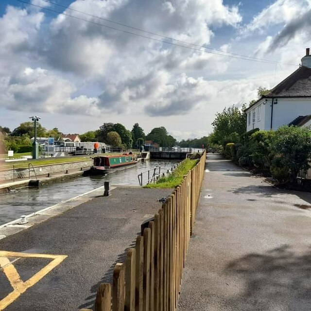
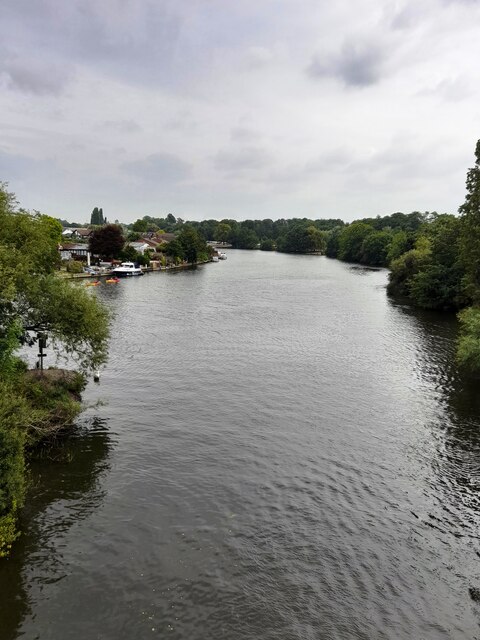
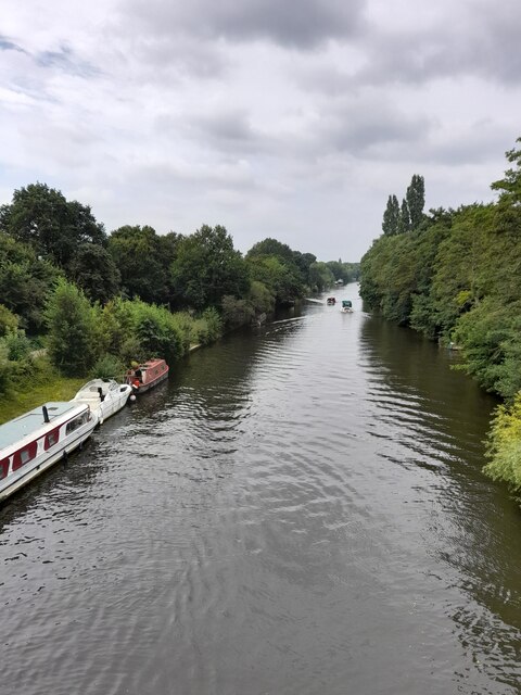
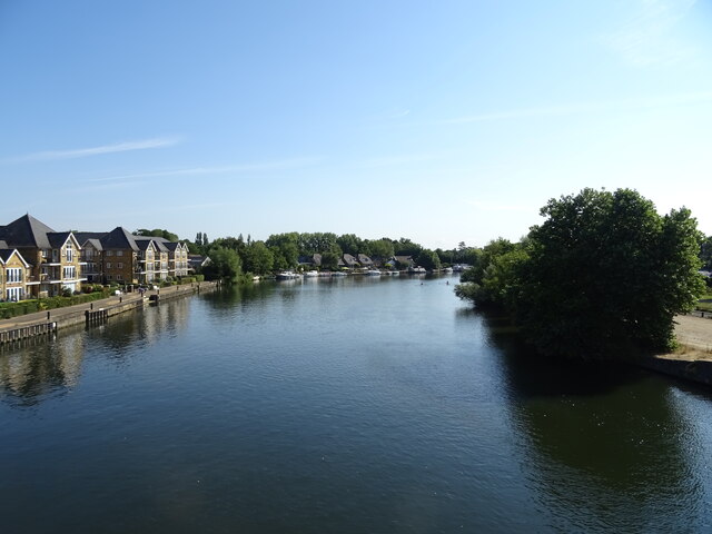
Beasley's Ait is a small island located in the River Thames, in the county of Middlesex, England. Situated between the towns of Hampton and Sunbury-on-Thames, this picturesque island spans approximately 1.5 acres in size.

The history of Beasley's Ait can be traced back to the 18th century when it was used as a fishing spot due to its strategic location and abundant fish population in the river. Over the years, it has undergone several changes and developments. In the 19th century, a boatyard was established on the island, facilitating the construction and repair of boats.

Today, Beasley's Ait serves as a recreational area for locals and visitors alike. Accessible only by boat, the island offers a tranquil escape from the bustling city life. Its lush greenery and scenic beauty make it a popular spot for picnics, birdwatching, and leisurely walks along the riverbank. The island is also known for its diverse wildlife, including various bird species and riverine creatures.

Although small in size, Beasley's Ait holds historical significance as it is one of the few remaining islands on the Thames that has retained its natural charm amidst urbanization. Its unique location, coupled with its rich history and natural beauty, continue to attract nature enthusiasts and those seeking a peaceful retreat in the heart of Middlesex.

If you have any feedback on the listing, please let us know in the comments section below.

Beasley's Ait Images

Images are sourced within 2km of 51.394081/-0.42077479 or Grid Reference TQ0967. Thanks to Geograph Open Source API. All images are credited.

Sunbury Lock
Sunbury Lock
Ambleside Avenue, Walton-on-Thames Mini-roundabout on Ambleside Avenue.
Ambleside Avenue, Walton-on-Thames
Mini-roundabout on Ambleside Avenue.
Desborough Water Works
River Thames
River Thames
River Thames
River Thames
Bishop Duppas Recreation Ground Midium sized park of Lower Halliford.
Bishop Duppas Recreation Ground
Midium sized park of Lower Halliford.
Houses on Cliveden Place, Shepperton
Cliveden Place, Shepperton
Halliford School, Shepperton
Bus stop on Russell Road (B375)
Walton Bridge Garage
Walton Bridge Road (A244)
Roundabout on Walton Bridge Road (A244)
Flats beside the River Thames
River Thames, Walton Bridge
Walton Bridge Walton Bridge Road (A244) crossing the River Thames.
Walton Bridge
Walton Bridge Road (A244) crossing the River Thames.
Travelodge Walton-on-Thames Central Travelodge is the second largest budget hotel chain in the UK, with over 450 budget hotels.
Website: <span class="nowrap"><a title="http://www.travelodge.co.uk/" rel="nofollow ugc noopener" href="http://www.travelodge.co.uk/">Link</a><img style="margin-left:2px;" alt="External link" title="External link - shift click to open in new window" src="https://s1.geograph.org.uk/img/external.png" width="10" height="10"/></span> 
Wikipedia: <span class="nowrap"><a title="http://en.wikipedia.org/wiki/Travelodge_UK" rel="nofollow ugc noopener" href="http://en.wikipedia.org/wiki/Travelodge_UK">Link</a><img style="margin-left:2px;" alt="External link" title="External link - shift click to open in new window" src="https://s1.geograph.org.uk/img/external.png" width="10" height="10"/></span>
Travelodge Walton-on-Thames Central
Travelodge is the second largest budget hotel chain in the UK, with over 450 budget hotels. Website: LinkExternal link Wikipedia: LinkExternal link
Show me another place!

Beasley's Ait is located at Grid Ref: TQ0967 (Lat: 51.394081, Lng: -0.42077479)

Administrative County: Surrey

District: Spelthorne

Police Authority: Surrey

What 3 Words

///horses.steer.envy. Near Walton-on-Thames, Surrey

Related Wikis

Thames Valley Skiff Club

Thames Valley Skiff Club is an English skiff and punting club, which was founded in 1923. It is based on the River Thames in England, on the Surrey bank...

St George's College Boat Club

St George's College Boat Club is a rowing club on the River Thames, based at Sunbury Lane, Walton-on-Thames, Elmbridge, Surrey. == History == The club...

Walton Rowing Club

Walton Rowing Club is an amateur rowing club, on the River Thames in England. Its large, modern, combined club and boat house is on the Surrey bank of...

Wheatley's Ait

Wheatley's Ait or Wheatley Eyot is an ait (island) in the River Thames of approximately 8 hectares (20 acres) on the reach above Sunbury Lock, close to...

Walton & Hersham F.C.

Walton & Hersham Football Club is a semi-professional football club based in Walton-on-Thames, Surrey. Founded in 1945 following the amalgamation of Walton...

Walton Casuals F.C.

Walton Casuals Football Club was a football club based in Walton-on-Thames, Surrey. Founded in 1948, the club was affiliated to the Surrey County Football...

No. 2 New Zealand General Hospital

The No. 2 New Zealand General Hospital was a World War I military hospital in Walton-on-Thames, England. The hospital opened in 1915 by requisitioning...

Walton Studios

Walton Studios, previously named Hepworth Studios and Nettlefold Studios, was a film production studio in Walton-on-Thames in Surrey, England. Hepworth...

Nearby Amenities

Located within 500m of 51.394081,-0.42077479
Pub
The Anglers
Created By: xybot
Note: with riverside outdoor seating
Lat/Long: 51.3902487/-0.4224129
Arts Centre
Riverhouse Community Arts Centre
Wheelchair: yes
Lat/Long: 51.3902727/-0.4214949
Bus Stop
Fordbridge Caravan Park
Naptan AtcoCode: 40004402182A
Naptan Bearing: NW
Naptan CommonName: Fordbridge Park
Naptan Indicator: Opp
Naptan Landmark: Fordbridge Caravan Park
Naptan NaptanCode: surdwgwt
Naptan Street: Beasleys Ait Lane
Naptan Verified: no
Public Transport: platform
Source: naptan_import
Lat/Long: 51.3959281/-0.4234184
Cafe
Description: inside riverhouse barn arts centre
Lat/Long: 51.3902094/-0.4214985
Mini Roundabout
Direction: clockwise
Lat/Long: 51.389624/-0.4202552
Turning Circle
Lat/Long: 51.3955274/-0.4152946
Barrier: lift_gate
Bicycle: yes
Foot: yes
Horse: yes
Motorcar: yes
Motorcycle: yes
Lat/Long: 51.3924159/-0.4245072
Barrier: bollard
Lat/Long: 51.394222/-0.4181557
Barrier: swing_gate
Lat/Long: 51.3921039/-0.4265628
Give Way
Direction: backward
Source: Surrey-Air_Survey
Lat/Long: 51.3925415/-0.4158336
Barrier: bollard
Bollard: fixed
Lat/Long: 51.3898509/-0.4231152
Barrier: bollard
Lat/Long: 51.3956929/-0.4171869
Barrier: bollard
Lat/Long: 51.3958038/-0.4170765
Noexit: yes
Lat/Long: 51.3963942/-0.4184117
Barrier: lift_gate
Lat/Long: 51.3958098/-0.4258158
Barrier: lift_gate
Foot: yes
Motor Vehicle: private
Lat/Long: 51.3959048/-0.4232643
Post Box
Post Box Type: lamp
Royal Cypher: EIIR
Royal Cypher Wikidata: Q33102113
Lat/Long: 51.3905416/-0.4243
Entrance: yes
Lat/Long: 51.3954501/-0.4169537
Barrier: bollard
Lat/Long: 51.3920991/-0.4166452
Turning Circle
Lat/Long: 51.3916509/-0.4227192
Fountain
Lat/Long: 51.3927281/-0.4253552
Post Box
Collection Plate: CP1D
Collection Times: Mo-Fr 09:00; Sa 07:00
Operator: Royal Mail
Post Box Design: type_b
Post Box Type: pillar
Ref: KT12 165D
Royal Cypher: GVIR
Royal Cypher Wikidata: Q33102169
Lat/Long: 51.3922282/-0.4189676
Defibrillator
Emergency: defibrillator
Indoor: no
Lat/Long: 51.3952262/-0.4172879
The data included in this document is from www.openstreetmap.org. The data is made available under ODbL.

Have you been to Beasley's Ait?

Leave your review of Beasley's Ait below (or comments, questions and feedback).