Beaconside

Settlement in Staffordshire Stafford

England

Beaconside

Gate Guardian At RAF Stafford
Gate Guardian Credit: Andy and Hilary

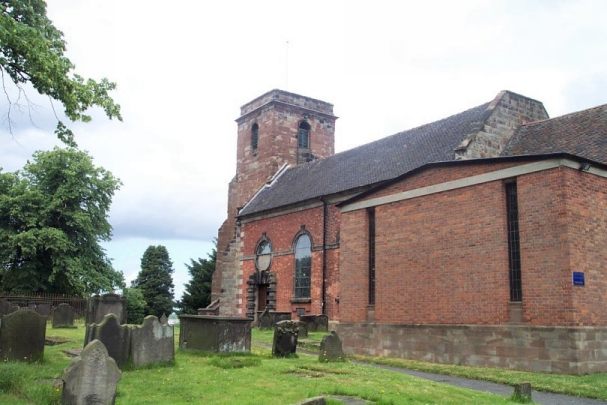
Beaconside is a small village located in the county of Staffordshire, England. Situated approximately 2 miles east of the town of Stafford, it is a predominantly residential area with a population of around 1,500 people.

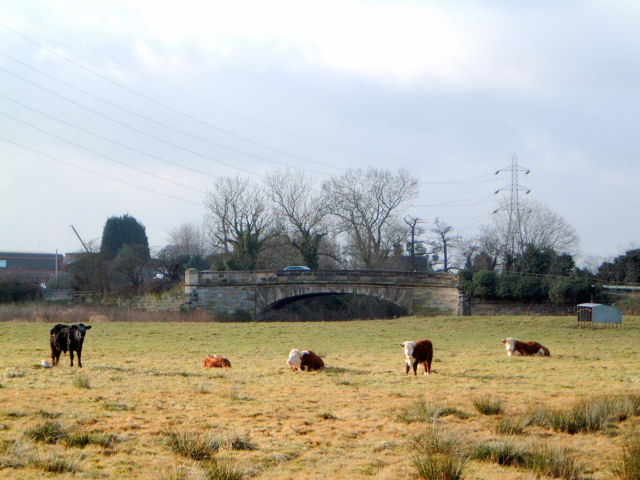
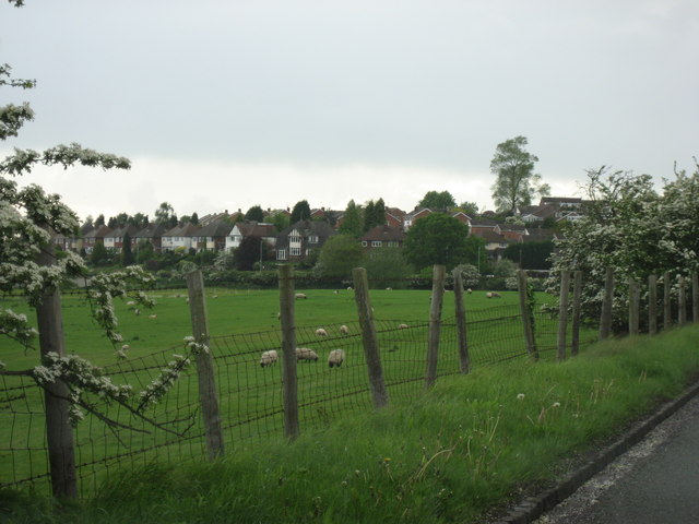
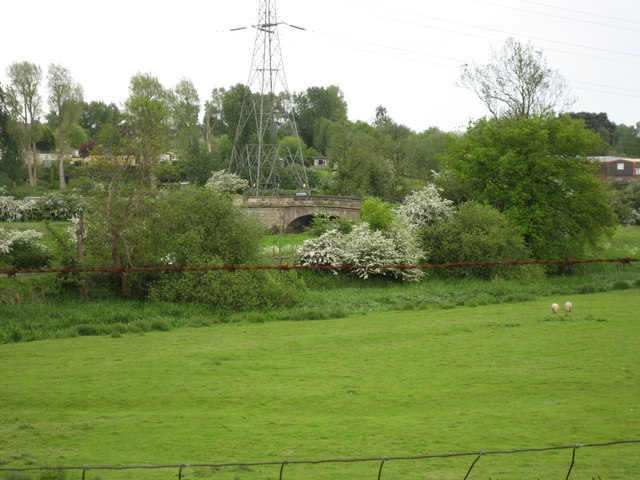
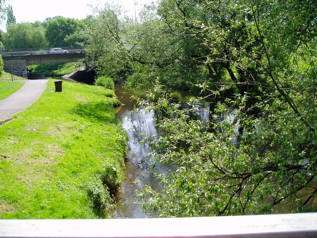
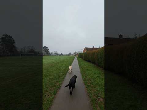
The village is known for its picturesque surroundings and idyllic countryside views. It is surrounded by lush green fields and is nestled between the River Penk and the Staffordshire and Worcestershire Canal, offering residents and visitors plenty of opportunities for outdoor activities such as walking, cycling, and fishing.

Beaconside is well-connected, with easy access to the nearby A34 road, providing convenient links to the wider region. The village also benefits from a regular bus service to Stafford, making it easily accessible for those without private transportation.

Despite its small size, Beaconside has a strong sense of community, with a range of amenities and facilities. The village is home to a primary school, providing education for local children, and there are several parks and playgrounds for families to enjoy. Additionally, there are a few local shops and businesses, including a post office and a convenience store, catering to the daily needs of residents.

For those seeking more extensive amenities, the town of Stafford is just a short distance away. Here, one can find a wide range of shops, restaurants, and leisure facilities, as well as excellent transport links to other major cities, including Birmingham and Manchester.

Overall, Beaconside offers a peaceful and scenic setting, making it an attractive place to live for those seeking a quiet rural lifestyle within easy reach of urban amenities.

If you have any feedback on the listing, please let us know in the comments section below.
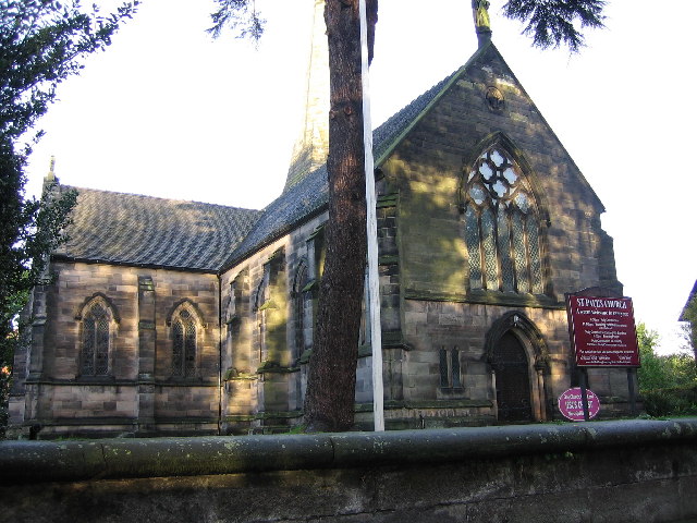
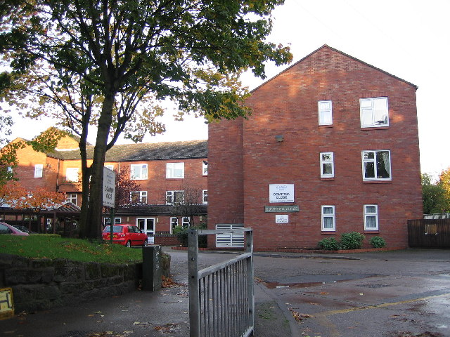
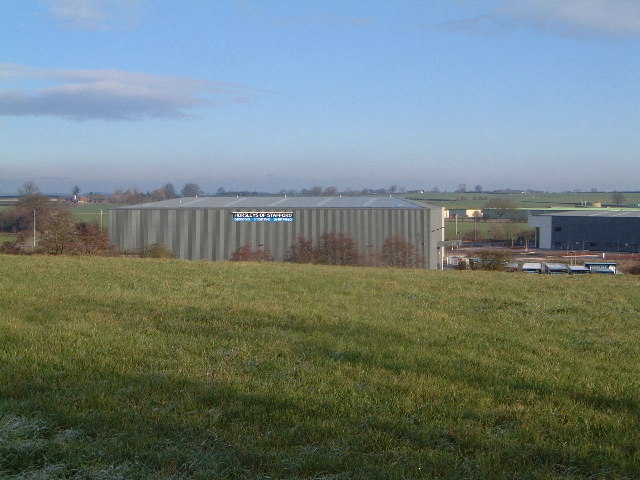
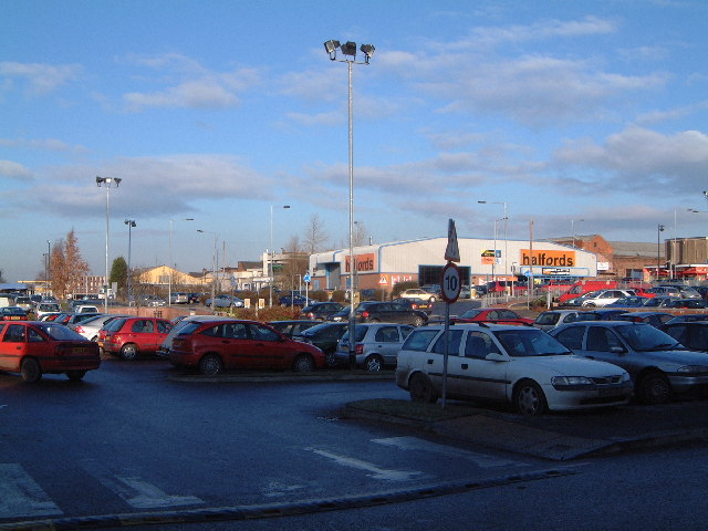
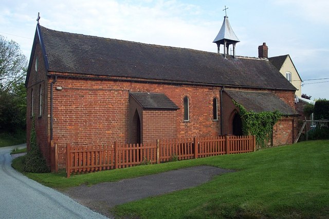
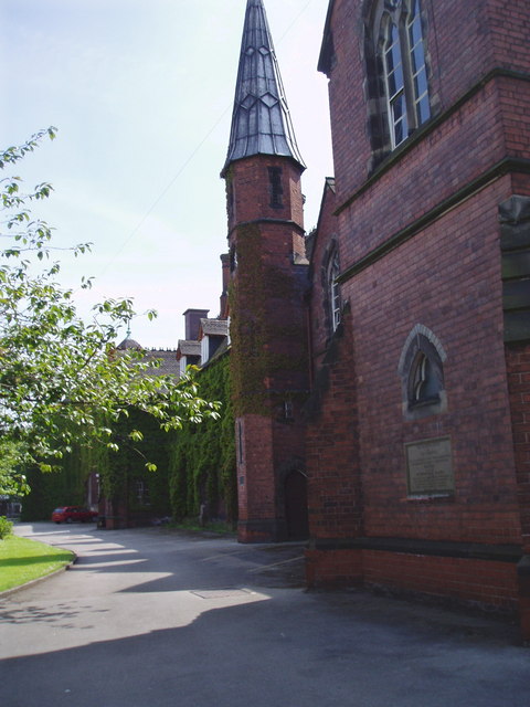
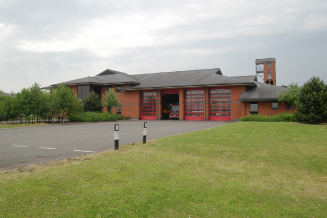
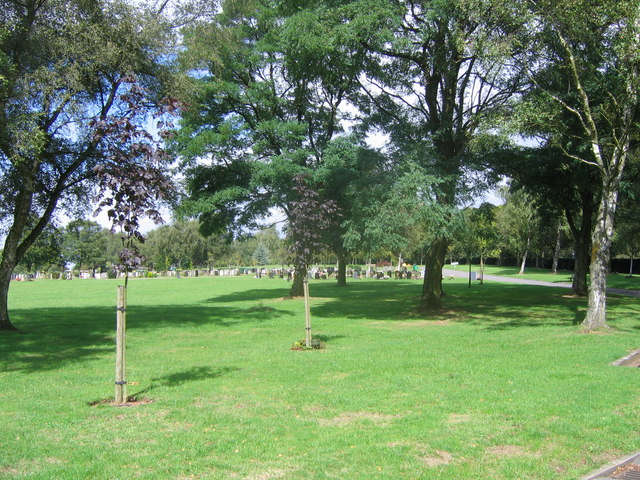
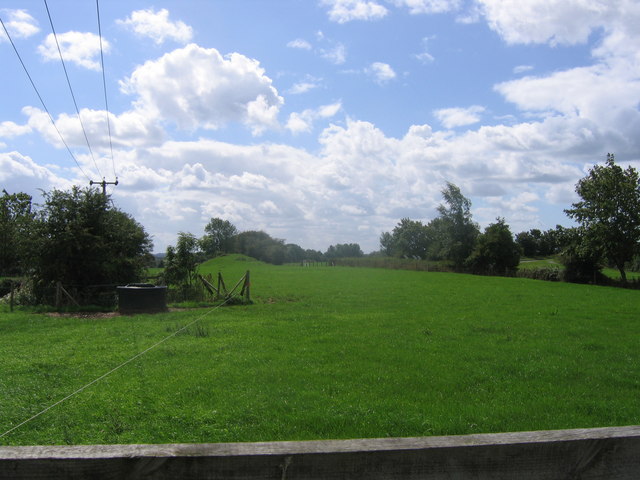
Beaconside Images

Images are sourced within 2km of 52.815364/-2.0971265 or Grid Reference SJ9324. Thanks to Geograph Open Source API. All images are credited.

Gate Guardian At RAF Stafford
Gate Guardian
At RAF Stafford
Town centre, Stafford Built in 1596 using local oak by John Dorrington the building in the left foreground is said to be the largest timber framed town house in England.
Town centre, Stafford
Built in 1596 using local oak by John Dorrington the building in the left foreground is said to be the largest timber framed town house in England.
Katherine House Hospice Hospice in Stafford, preparing for charity bike ride.
Katherine House Hospice
Hospice in Stafford, preparing for charity bike ride.
The Hop Pole Sandon Road, Stafford
The Hop Pole
Sandon Road, Stafford
St. Paul's Church, Forebridge, Stafford This church is sited on the busy A34.
St. Paul's Church, Forebridge, Stafford
This church is sited on the busy A34.
Compton Close, near Stafford This development is one of many being used to fill in small unused spaces. It is not far from the large electrical works which used to be GEC.
Compton Close, near Stafford
This development is one of many being used to fill in small unused spaces. It is not far from the large electrical works which used to be GEC.
New industrial units, Beaconside The green fields of Stafford are slowly disappearing, not that this was good land though.
New industrial units, Beaconside
The green fields of Stafford are slowly disappearing, not that this was good land though.
Retail Park This is on the site of the old Stafford hospital
Retail Park
This is on the site of the old Stafford hospital
Bridge over the River Penk , Baswich Road I believe this is one of Telford's bridges
Bridge over the River Penk , Baswich Road
I believe this is one of Telford's bridges
Holy Trinity, Baswich <span class="nowrap"><a title="http://www.achurchnearyou.com/berkswich-holy-trinity/" rel="nofollow ugc noopener" href="http://www.achurchnearyou.com/berkswich-holy-trinity/">Link</a><img style="margin-left:2px;" alt="External link" title="External link - shift click to open in new window" src="https://s1.geograph.org.uk/img/external.png" width="10" height="10"/></span>
Holy Trinity, Baswich
Looking across the fields to the Houses At the edge of Stafford
Looking across the fields to the Houses
At the edge of Stafford
Fields at St Thomas Looking towards the bridge over the Penk. In the Spring, on a wet day.
Fields at St Thomas
Looking towards the bridge over the Penk. In the Spring, on a wet day.
Hopton Church Dedicated to St. Peter
Hopton Church
Dedicated to St. Peter
Chetwynd Centre, Stafford In its first incarnation, it was the King Edward VI Grammar School, Stafford
Chetwynd Centre, Stafford
In its first incarnation, it was the King Edward VI Grammar School, Stafford
River Sow, Stafford The river Sow is a tributary of the river Trant.
River Sow, Stafford
The river Sow is a tributary of the river Trant.
Stafford fire station Stafford fire station, Beaconside, Stafford, Staffordshire.
Stafford fire station
Stafford fire station, Beaconside, Stafford, Staffordshire.
Stafford Crematorium Stafford Crematorium
Stafford Crematorium
Disappearing railway The railway line from Stafford to Uttoxeter used to cross this field on an embankment and then bridge the road the photographer is standing on. Now all that remains is the grassy mound in the background.
Disappearing railway
The railway line from Stafford to Uttoxeter used to cross this field on an embankment and then bridge the road the photographer is standing on. Now all that remains is the grassy mound in the background.
Show me another place!

Beaconside is located at Grid Ref: SJ9324 (Lat: 52.815364, Lng: -2.0971265)

Administrative County: Staffordshire

District: Stafford

Police Authority: Staffordshire

What 3 Words

///vibes.venues.proud. Near Stafford, Staffordshire

Nearby Locations

Beaconside

Related Wikis

Stafford Hospital scandal

The Stafford Hospital scandal concerns poor care and high mortality rates amongst patients at the Stafford Hospital, Stafford, England, during the first...

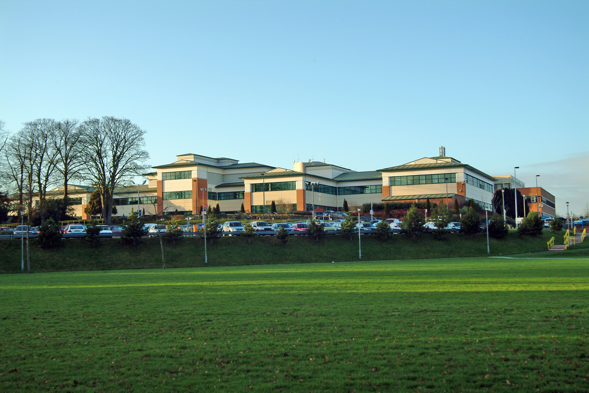
County Hospital, Stafford

County Hospital is an acute hospital with less than 200 inpatient beds, opened in 1983. It is the main hospital in Stafford, England. The hospital is managed...

Beaconside

Beaconside is an area in Stafford, Staffordshire, England. The district is home to the Stafford branch of Staffordshire University along with the Ministry...

Mid Staffordshire Postgraduate Medical Centre

Mid Staffordshire Postgraduate Medical Centre is a Medical Education establishment situated in Stafford, England. The Centre is located in the grounds...

Littleworth, Stafford

Littleworth is a former village now forming part of the eastern end of the county town of Stafford in the English county of Staffordshire. Littleworth...
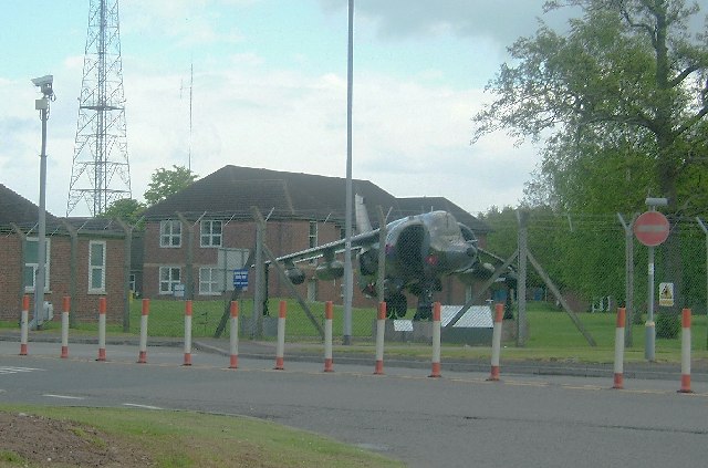
Beacon Barracks

Ministry of Defence Stafford otherwise known as MOD Stafford, Stafford Station or Beacon Barracks is a Ministry of Defence site in Stafford, in England...

RAF Stafford

Royal Air Force Stafford or more simply RAF Stafford was a non-flying Royal Air Force station in Stafford, Staffordshire, England. == History == The station...

Astonfields Balancing Lakes

Astonfields Balancing Lakes is a local nature reserve on the north-eastern edge of Stafford, in Staffordshire, England. The main purpose of the balancing...

Related Videos

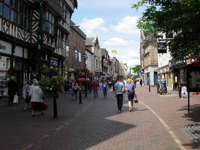
A Walk Down Stafford High Street, UK in 4K

Stafford High Street. February 2024 #walk #stafford #staffordhighstreet.

Choo Choo to Isabel Trail parkrun tourism adventure

I was joined by Ewan rather than Iona this week for our parkrun tourism adventure and we visited Isabel Trail parkrun in Stafford.

Weekend walk: what interesting things you will see in Stafford

What is the town of Stafford county Staffordshire, in the West Midlands region of England. It lies about 15 miles north of ...

Maximum video zoom on @OPPOglobal find x7 ultra

check this out oppo find X7 ultra maximum zoom during recording 18x Stick around because I will be making a full camera review ...

Nearby Amenities

Located within 500m of 52.815364,-2.0971265
Bus Stop
Pike Close
Bus: yes
Naptan AtcoCode: 3800C709600
Naptan Bearing: NE
Naptan CommonName: Pike Close
Naptan Indicator: Adj
Naptan Landmark: Pike Close
Naptan PlusbusZoneRef: STAFFRD
Naptan Street: Trenchard Avenue
Naptan Verified: no
Public Transport: platform
Source: naptan_import
Lat/Long: 52.816471/-2.0985686
Bus Stop
Stafford General Hospital
Bus: yes
Naptan AtcoCode: 3800C712000
Naptan Bearing: E
Naptan CommonName: Stafford General Hospital
Naptan Indicator: Adj
Naptan Landmark: General Hospital
Naptan PlusbusZoneRef: STAFFRD
Naptan Street: Weston Rd
Naptan Verified: no
Public Transport: platform
Source: naptan_import
Lat/Long: 52.8115189/-2.097148
Bus Stop
Tedder Road
Bus: yes
Naptan AtcoCode: 3800C732801
Naptan Bearing: SW
Naptan CommonName: Tedder Road
Naptan Indicator: Adj
Naptan Landmark: Tedder Road
Naptan PlusbusZoneRef: STAFFRD
Naptan Street: Trenchard Avenue
Naptan Verified: no
Public Transport: platform
Source: naptan_import
Lat/Long: 52.814906/-2.0995295
Bus Stop
Tedder Road
Bus: yes
Naptan AtcoCode: 3800C732802
Naptan Bearing: NE
Naptan CommonName: Tedder Road
Naptan Indicator: Opp
Naptan Landmark: Tedder Road
Naptan PlusbusZoneRef: STAFFRD
Naptan Street: Trenchard Avenue
Naptan Verified: no
Public Transport: platform
Source: naptan_import
Lat/Long: 52.8151807/-2.0994597
Bus Stop
Spar Shop
Bus: yes
Naptan AtcoCode: 3800C732901
Naptan Bearing: NW
Naptan CommonName: Spar Shop
Naptan Indicator: Adj
Naptan Landmark: Spar Shop
Naptan PlusbusZoneRef: STAFFRD
Naptan Street: Tedder Road
Naptan Verified: no
Public Transport: platform
Source: naptan_import
Lat/Long: 52.8148712/-2.0981495
Bus Stop
Ellington Avenue
Bus: yes
Naptan AtcoCode: 3800C733001
Naptan Bearing: NW
Naptan CommonName: Ellington Avenue
Naptan Indicator: Adj
Naptan Landmark: Ellington Avenue
Naptan PlusbusZoneRef: STAFFRD
Naptan Street: Tedder Road
Naptan Verified: no
Public Transport: platform
Source: naptan_import
Lat/Long: 52.8140916/-2.0951507
Bus Stop
Portal Road
Bus: yes
Naptan AtcoCode: 3800C733002
Naptan Bearing: SW
Naptan CommonName: Portal Road
Naptan Indicator: Adj
Naptan Landmark: Portal Road
Naptan PlusbusZoneRef: STAFFRD
Naptan Street: Ellington Road
Naptan Verified: no
Public Transport: platform
Source: naptan_import
Lat/Long: 52.8152167/-2.0932985
Bus Stop
Newall Avenue
Bus: yes
Naptan AtcoCode: 3800C733101
Naptan Bearing: SE
Naptan CommonName: Newall Avenue
Naptan Indicator: Opp
Naptan Landmark: Newall Avenue
Naptan PlusbusZoneRef: STAFFRD
Naptan Street: Portal Road
Naptan Verified: no
Public Transport: platform
Source: naptan_import
Lat/Long: 52.8162035/-2.0960011
Bus Stop
Trenchard Avenue
Bus: yes
Naptan AtcoCode: 3800C760401
Naptan Bearing: NW
Naptan CommonName: Trenchard Avenue
Naptan Indicator: Adj
Naptan Landmark: Trenchard Ave
Naptan PlusbusZoneRef: STAFFRD
Naptan Street: Prescott Ave
Naptan Verified: no
Public Transport: platform
Source: naptan_import
Lat/Long: 52.8123878/-2.1008442
Bus Stop
Knight Avenue
Bus: yes
Naptan AtcoCode: 3800C760402
Naptan Bearing: SE
Naptan CommonName: Knight Avenue
Naptan Indicator: Adj
Naptan Landmark: Knight Avenue
Naptan PlusbusZoneRef: STAFFRD
Naptan Street: Prescott Avenue
Naptan Verified: no
Public Transport: platform
Source: naptan_import
Lat/Long: 52.812397/-2.100592
Bus Stop
Read Avenue
Bus: yes
Naptan AtcoCode: 3800C760701
Naptan Bearing: SE
Naptan CommonName: Read Avenue
Naptan Indicator: Opp
Naptan Landmark: Read Ave
Naptan PlusbusZoneRef: STAFFRD
Naptan Street: Douglas Road West
Naptan Verified: no
Public Transport: platform
Source: naptan_import
Lat/Long: 52.8150191/-2.1039958
Bus Stop
Embry Avenue
Bus: yes
Naptan AtcoCode: 3800C791200
Naptan Bearing: SE
Naptan CommonName: Embry Avenue
Naptan Indicator: Adj
Naptan Landmark: Embry Ave
Naptan PlusbusZoneRef: STAFFRD
Naptan Street: Douglas Road West
Naptan Verified: no
Public Transport: platform
Source: naptan_import
Lat/Long: 52.8144724/-2.1020063
Mini Roundabout
Direction: clockwise
Lat/Long: 52.8121106/-2.1000164
Salisbury Rd
Power: substation
Ref: 961351
Lat/Long: 52.812706/-2.0943175
Beaconside Close
Power: substation
Ref: 45174
Lat/Long: 52.8169851/-2.099441
Newall Avenue
Power: substation
Ref: 861633 ?
Lat/Long: 52.8159307/-2.096999
Post Box
Post Box Type: pillar
Ref: ST16 425
Royal Cypher: GVIR
Royal Cypher Wikidata: Q33102169
Lat/Long: 52.8147648/-2.0973396
Salmond Avenue
Power: substation
Ref: 06/1661
Lat/Long: 52.8132245/-2.096632
Post Box
Post Box Type: pillar
Ref: ST16 28
Royal Cypher: EIIR
Royal Cypher Wikidata: Q33102113
Lat/Long: 52.8131026/-2.1028787
Tedder Road
Power: substation
Ref: 96/1406
Lat/Long: 52.8144356/-2.0951301
Entrance: main
Lat/Long: 52.8109792/-2.0979147
Barrier: lift_gate
Lat/Long: 52.8109495/-2.0960242
Barrier: lift_gate
Lat/Long: 52.811048/-2.0957726
Barrier: lift_gate
Lat/Long: 52.8113836/-2.0971566
Barrier: lift_gate
Lat/Long: 52.8114646/-2.0969221
Entrance: main
Lat/Long: 52.8115247/-2.0976501
Charging Station
Capacity: 2
Fee: yes
Operator: evolt
Lat/Long: 52.8111969/-2.0954283
Bench
Lat/Long: 52.8114512/-2.0961426
Bench
Lat/Long: 52.811556/-2.0973874
Crossing: uncontrolled
Lat/Long: 52.8115846/-2.0968924
Bicycle Parking
Covered: yes
Lat/Long: 52.8117234/-2.0977822
Bench
Lat/Long: 52.8119311/-2.0973427
Crossing: uncontrolled
Lat/Long: 52.8119624/-2.0971854
Crossing: uncontrolled
Lat/Long: 52.8110085/-2.0971553
Generator Method: photovoltaic
Generator Output Electricity: yes
Generator Source: solar
Generator Type: solar_photovoltaic_panel
Location: roof
Power: generator
Lat/Long: 52.8131171/-2.0931691
Generator Method: photovoltaic
Generator Output Electricity: yes
Generator Source: solar
Generator Type: solar_photovoltaic_panel
Location: roof
Power: generator
Lat/Long: 52.8135418/-2.0936197
Generator Method: photovoltaic
Generator Output Electricity: yes
Generator Source: solar
Generator Type: solar_photovoltaic_panel
Location: roof
Power: generator
Lat/Long: 52.8136666/-2.0911333
Generator Method: photovoltaic
Generator Output Electricity: yes
Generator Source: solar
Generator Type: solar_photovoltaic_panel
Location: roof
Power: generator
Lat/Long: 52.8141335/-2.0916858
Generator Method: photovoltaic
Generator Output Electricity: yes
Generator Source: solar
Generator Type: solar_photovoltaic_panel
Location: roof
Power: generator
Lat/Long: 52.8140817/-2.0900497
Generator Method: photovoltaic
Generator Output Electricity: yes
Generator Source: solar
Generator Type: solar_photovoltaic_panel
Location: roof
Power: generator
Lat/Long: 52.8146247/-2.0898807
Generator Method: photovoltaic
Generator Output Electricity: yes
Generator Source: solar
Generator Type: solar_photovoltaic_panel
Location: roof
Power: generator
Lat/Long: 52.8179139/-2.1004647
Barrier: gs
Lat/Long: 52.8184907/-2.1009293
Crossing
Lat/Long: 52.8196815/-2.0988466
Give Way
Direction: forward
Lat/Long: 52.8140089/-2.1002644
Give Way
Direction: backward
Lat/Long: 52.8133497/-2.1007562
Traffic Calming: hump
Lat/Long: 52.8126671/-2.101202
Give Way
Direction: forward
Lat/Long: 52.8125536/-2.1012983
Give Way
Direction: backward
Lat/Long: 52.8124071/-2.1016866
Traffic Calming: hump
Lat/Long: 52.8122467/-2.1018603
Give Way
Direction: backward
Lat/Long: 52.815235/-2.0993153
Give Way
Direction: backward
Lat/Long: 52.8143528/-2.1017655
Give Way
Direction: backward
Lat/Long: 52.8144215/-2.1017503
The data included in this document is from www.openstreetmap.org. The data is made available under ODbL.

Have you been to Beaconside?

Leave your review of Beaconside below (or comments, questions and feedback).