Bauds of Cullen

Settlement in Banffshire

Scotland

Bauds of Cullen

Coast path, Banffshire Well surfaced but not tarred section of the cycle route. It runs through a barley field by Tronach Head. A line on the horizon may be the haar, out at sea but ready to return.
Coast path, Banffshire Credit: Richard Webb

Bauds of Cullen is a small coastal village located in the historical county of Banffshire, Scotland. Situated on the northeastern coast of the country, it lies approximately 17 miles east of the town of Buckie and 8 miles west of the larger town of Portsoy. The village is nestled between the rugged cliffs of the Moray Firth and the fertile farmland of the surrounding countryside.

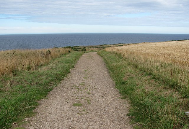
Bauds of Cullen is known for its stunning natural beauty and picturesque setting. It boasts a long sandy beach, which stretches for several miles and offers breathtaking views of the North Sea. The area is a popular destination for outdoor enthusiasts, with opportunities for walking, birdwatching, and even surfing.

The village itself is small and tightly-knit, with a close community feel. It features a handful of traditional cottages and houses, many of which have been lovingly preserved and maintained. There is a local pub and a small convenience store, providing the basic amenities for both residents and visitors.

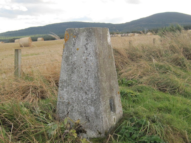
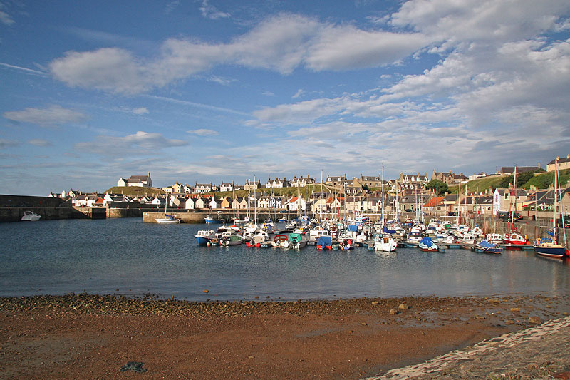
Bauds of Cullen is steeped in history, with evidence of human settlement dating back thousands of years. Nearby archaeological sites, such as the Hill of Cullen, offer a glimpse into the area's ancient past. The village also has strong links to the fishing industry, which has played a significant role in the local economy for centuries.

Overall, Bauds of Cullen offers a tranquil and scenic retreat for those seeking a peaceful coastal getaway in the beautiful region of Banffshire.

If you have any feedback on the listing, please let us know in the comments section below.

Bauds of Cullen Images

Images are sourced within 2km of 57.687409/-2.8888206 or Grid Reference NJ4766. Thanks to Geograph Open Source API. All images are credited.

Coast path, Banffshire Well surfaced but not tarred section of the cycle route. It runs through a barley field by Tronach Head. A line on the horizon may be the haar, out at sea but ready to return.
Coast path, Banffshire
Well surfaced but not tarred section of the cycle route. It runs through a barley field by Tronach Head. A line on the horizon may be the haar, out at sea but ready to return.
Sandy Creek, Findochty A view from the cycle path.
Sandy Creek, Findochty
A view from the cycle path.
Station Road, Findochty Caithness on the horizon. Morven appears to get closer as you travel westward along the coast.
Station Road, Findochty
Caithness on the horizon. Morven appears to get closer as you travel westward along the coast.
Moray Coast Railway The trackbed is now a cycle path (NCN1). A long focus view towards Buckie.
Moray Coast Railway
The trackbed is now a cycle path (NCN1). A long focus view towards Buckie.
Moor of Scotstown View from the railway path, over a barley field towards Bin of Cullen.
Moor of Scotstown
View from the railway path, over a barley field towards Bin of Cullen.
The Salvation Army, Findochty View of this interesting building in Chapel Street.
The Salvation Army, Findochty
View of this interesting building in Chapel Street.
Triangulation Pillar S7179 at Portknockie
Triangulation Pillar S7218 at Strathlene Golf Course
War Memorial with Gull - Findochty
Ordnance Survey Cut Mark This mark can be found on the boundary wall of Hillhead Cemetery.
For more detail see : <span class="nowrap"><a title="http://www.bench-marks.org.uk/bm45914" rel="nofollow ugc noopener" href="http://www.bench-marks.org.uk/bm45914">Link</a><img style="margin-left:2px;" alt="External link" title="External link - shift click to open in new window" src="https://s1.geograph.org.uk/img/external.png" width="10" height="10"/></span>
Ordnance Survey Cut Mark
This mark can be found on the boundary wall of Hillhead Cemetery. For more detail see : LinkExternal link
Millennium milepost On the coast path with a view over to Caithness.
Millennium milepost
On the coast path with a view over to Caithness.
Ruins, Mains of Findochty
Moray Coast Railway The trackbed is now a foot or cycle path.
Moray Coast Railway
The trackbed is now a foot or cycle path.
Sandy Creek, Findochty
Houses at Findochty This was viewed from a dismantled railway line which is now a coastal path.
Houses at Findochty
This was viewed from a dismantled railway line which is now a coastal path.
A Millennium milepost This national cycle network post is on the coast path between Findochty and Portknockie.
A Millennium milepost
This national cycle network post is on the coast path between Findochty and Portknockie.
Triple Chapels On the left is the Salvation Army Chapel, which was originally a Methodist chapel. To its right is a Gospel Hall, and looking down from above is the new <a href="https://www.geograph.org.uk/photo/3922530">NJ4667 : Methodist Church</a> that replaced the one now in use by the Salvation Army. This little cul-de-sac is called Chapel Street with good reason.
Triple Chapels
On the left is the Salvation Army Chapel, which was originally a Methodist chapel. To its right is a Gospel Hall, and looking down from above is the new NJ4667 : Methodist Church that replaced the one now in use by the Salvation Army. This little cul-de-sac is called Chapel Street with good reason.
Gospel Hall If The Lord Will, the Word of God will be Preached Each Lord's Day at 6 pm in the meeting hall on the first floor, reached by an outside stair and curious little porch.
Gospel Hall
If The Lord Will, the Word of God will be Preached Each Lord's Day at 6 pm in the meeting hall on the first floor, reached by an outside stair and curious little porch.
Show me another place!

Bauds of Cullen is located at Grid Ref: NJ4766 (Lat: 57.687409, Lng: -2.8888206)

Unitary Authority: Moray

Police Authority: North East

What 3 Words

///immediate.riverside.trees. Near Findochty, Moray

Nearby Locations

Bauds of Cullen Bauds Wood

Related Wikis

Findochty railway station

Findochty railway station was a railway station in the small fishing village of Findochty, Moray about 3 miles to the east of Buckie. The railway station...

Findochty

Findochty (pronounced , Scots: Finichty, Scottish Gaelic: Am Fionn Ochdamh) is a village in Moray, Scotland, on the shores of the Moray Firth; historically...

Findochty Castle

Findochty Castle is a ruined 16th century L-plan tower house, near Findochty, Moray, Scotland, about 2.5 miles (4.0 km) north-east of Buckie, and about...

Strathlene Golf Course

Strathlene at Findochty, near Buckie, is one of the oldest golf courses in Scotland. It was established in 1877 and is home to Strathlene Buckie Golf Club...

Nearby Amenities

Located within 500m of 57.687409,-2.8888206
Power: pole
Lat/Long: 57.6835406/-2.8881715
Power: pole
Lat/Long: 57.6840483/-2.8874071
Power: pole
Lat/Long: 57.6845664/-2.8865986
Power: pole
Lat/Long: 57.6849014/-2.8854053
Power: pole
Lat/Long: 57.6852459/-2.8841749
Power: pole
Lat/Long: 57.6855497/-2.8830557
Power: pole
Lat/Long: 57.6858479/-2.882023
Power: pole
Lat/Long: 57.6861367/-2.8809832
Power: pole
Lat/Long: 57.68583/-2.8845703
Power: pole
Lat/Long: 57.6864264/-2.8849745
Power: pole
Lat/Long: 57.6870039/-2.8853735
Power: pole
Lat/Long: 57.6875012/-2.8857336
Power: pole
Lat/Long: 57.6879985/-2.8860725
Power: pole
Lat/Long: 57.6884854/-2.8864115
Power: pole
Lat/Long: 57.688976/-2.8867575
Power: pole
Lat/Long: 57.6892563/-2.8878714
Power: pole
Lat/Long: 57.6895186/-2.8889288
Power: pole
Lat/Long: 57.6898016/-2.8900498
Power: pole
Lat/Long: 57.6899828/-2.8823178
Power: pole
Lat/Long: 57.6897969/-2.8832234
Power: pole
Lat/Long: 57.689628/-2.8840672
Power: pole
Lat/Long: 57.6894289/-2.8850487
Power: pole
Lat/Long: 57.6892157/-2.8861078
Power: pole
Lat/Long: 57.687655/-2.8873506
Power: pole
Lat/Long: 57.6873946/-2.8882933
Power: pole
Lat/Long: 57.6872558/-2.8888988
Power: pole
Lat/Long: 57.6871209/-2.8896684
Power: pole
Lat/Long: 57.6868888/-2.8904575
Power: pole
Lat/Long: 57.6866434/-2.8912749
Power: pole
Lat/Long: 57.6865274/-2.8919369
Power: pole
Lat/Long: 57.6862433/-2.8928919
Power: pole
Lat/Long: 57.6857441/-2.8945477
Power: pole
Lat/Long: 57.6860244/-2.8949043
Power: pole
Lat/Long: 57.6866547/-2.8954939
Power: pole
Lat/Long: 57.6872766/-2.8960659
Power: pole
Lat/Long: 57.687571/-2.8964101
The data included in this document is from www.openstreetmap.org. The data is made available under ODbL.

Have you been to Bauds of Cullen?

Leave your review of Bauds of Cullen below (or comments, questions and feedback).