Baughton Hill

Settlement in Worcestershire Malvern Hills

England

Baughton Hill

The old main road The old A4104 has now become a parking lot and storage space at this end. Still a right of way, but barely accessible over a large mound of earth.
The old main road Credit: Trevor Rickard

Baughton Hill is a small village located in the county of Worcestershire, England. It is situated within the district of Wychavon, approximately 4 miles south of the market town of Pershore.

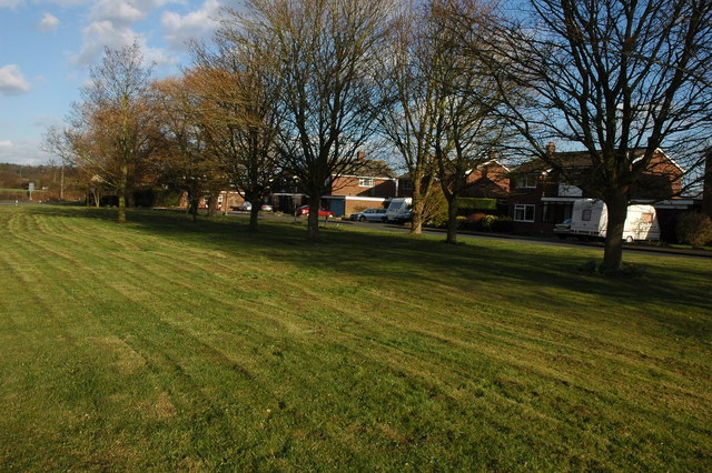
The village is set on a picturesque hillside, offering stunning views of the surrounding countryside. Baughton Hill is known for its rural charm and tranquility, making it an attractive destination for nature lovers and those seeking a peaceful retreat.

The village is home to a small community of residents, with a population of around 200 people. The houses in Baughton Hill are predominantly traditional in style, reflecting the village's rich history. Many of the buildings date back several centuries and exhibit a range of architectural features.

A notable landmark in Baughton Hill is the St. Leonard's Church, a beautiful medieval church that stands at the heart of the village. The church is known for its impressive stained glass windows and intricate stone carvings, attracting visitors from near and far.

Despite its small size, Baughton Hill boasts a strong sense of community spirit. The village holds regular events and activities, including a summer fete and a Christmas fair, which bring residents together and create a close-knit atmosphere.

The surrounding area offers plenty of opportunities for outdoor pursuits, with numerous footpaths and bridleways crisscrossing the countryside. Baughton Hill is also conveniently located near to the River Avon, providing additional recreational options such as fishing and boating.

Overall, Baughton Hill is a charming village that offers a peaceful and idyllic setting, making it a desirable place to live or visit for those seeking a slice of rural English life.

If you have any feedback on the listing, please let us know in the comments section below.

Baughton Hill Images

Images are sourced within 2km of 52.074929/-2.1554011 or Grid Reference SO8941. Thanks to Geograph Open Source API. All images are credited.

The old main road The old A4104 has now become a parking lot and storage space at this end. Still a right of way, but barely accessible over a large mound of earth.
The old main road
The old A4104 has now become a parking lot and storage space at this end. Still a right of way, but barely accessible over a large mound of earth.
Landing strip near Woodmancote This marker denotes the eastern end of the private grass landing strip to the north of the village. Large barns serving as hangars on the left. The Malvern Hills in the distance (the Worcestershire Beacon is just above the wind sock).
See <a href="https://www.geograph.org.uk/photo/2448255">SO9043 : Landing strip near Woodmancote</a> for the reverse view.
Landing strip near Woodmancote
This marker denotes the eastern end of the private grass landing strip to the north of the village. Large barns serving as hangars on the left. The Malvern Hills in the distance (the Worcestershire Beacon is just above the wind sock). See SO9043 : Landing strip near Woodmancote for the reverse view.
Seat at the end of the landing strip At the west end of the light aircraft landing strip is a seat with a view across flat farmland to the Malvern Hills.
Seat at the end of the landing strip
At the west end of the light aircraft landing strip is a seat with a view across flat farmland to the Malvern Hills.
Landing strip near Woodmancote View east from the end of the grass runway. The large barns serving as hangars are beyond the oilseed rape crop on the right. 
See <a href="https://www.geograph.org.uk/photo/2446965">SO9143 : Landing strip near Woodmancote</a> for the other end of the strip.
Landing strip near Woodmancote
View east from the end of the grass runway. The large barns serving as hangars are beyond the oilseed rape crop on the right. See SO9143 : Landing strip near Woodmancote for the other end of the strip.
Track north of Woodmancote Heading north to the landing strip hangars just behind the farmhouse.
Track north of Woodmancote
Heading north to the landing strip hangars just behind the farmhouse.
Sheep pasture at Strensham Looking north across lush sheep pasture to the River Avon. On the left is one of the large radar dishes of the Defford satellite communications site.
Sheep pasture at Strensham
Looking north across lush sheep pasture to the River Avon. On the left is one of the large radar dishes of the Defford satellite communications site.
Trig point at Strensham Looking north-west across sheep pasture to the northern Malvern Hills.
Trig point at Strensham
Looking north-west across sheep pasture to the northern Malvern Hills.
Site of Strensham Castle Looking west towards the well-preserved moat around the site of what was once a moated manor house. The original manor house was fortified in 1388 and was probably destroyed in the 17th century after the Civil War as it was a Royalist stronghold. Moat Farm is just in view on the left and houses at Lower Strensham are on the right.
Site of Strensham Castle
Looking west towards the well-preserved moat around the site of what was once a moated manor house. The original manor house was fortified in 1388 and was probably destroyed in the 17th century after the Civil War as it was a Royalist stronghold. Moat Farm is just in view on the left and houses at Lower Strensham are on the right.
Moat at Strensham Castle Looking east to Strensham Church on the hill.
Moat at Strensham Castle
Looking east to Strensham Church on the hill.
A4104 at the turning for Defford
Slip road at Elm Lodge Farm Somewhat unusually, a dedicated east to south slip road exists at the junction of the A4104 and Bourne Road.
Slip road at Elm Lodge Farm
Somewhat unusually, a dedicated east to south slip road exists at the junction of the A4104 and Bourne Road.
Bourne Road
Bourne Road
Bourne Road and adjoining farmland
Bourne Road approaching Bourne Farm
Bourne Road at Bourne Farm
View to Bredon Hill View to Bredon Hill from meadowland beside the River Avon.  The village of Eckington can be seen in the middle distance.
View to Bredon Hill
View to Bredon Hill from meadowland beside the River Avon. The village of Eckington can be seen in the middle distance.
Summerhouse overlooking the Avon Summerhouse overlooking the Avon at Strensham.
Summerhouse overlooking the Avon
Summerhouse overlooking the Avon at Strensham.
Electricity power lines Electricity power lines crossing meadowland beside the River Avon at Eckington.
Electricity power lines
Electricity power lines crossing meadowland beside the River Avon at Eckington.
Show me another place!

Baughton Hill is located at Grid Ref: SO8941 (Lat: 52.074929, Lng: -2.1554011)

Administrative County: Worcestershire

District: Malvern Hills

Police Authority: West Merica

What 3 Words

///hangs.unfocused.lyricist. Near Eckington, Worcestershire

Nearby Locations

Baughton Hill

Related Wikis

Dunstall Common

Dunstall Common is a village in Worcestershire, England.

Baughton

Baughton is a hamlet in Worcestershire, England. The Population of Baughton is 193. The population as a whole is older than the national average and the...

Hill Croome

Hill Croome is a village, and a civil parish which covers 1000 acres, in the Malvern Hills District in the county of Worcestershire, England. Historically...

St John the Baptist's Church, Strensham

St John the Baptist's Church is a redundant Anglican church in the village of Strensham, Worcestershire, England. It is recorded in the National Heritage...

Nearby Amenities

Located within 500m of 52.074929,-2.1554011
Strensham Turn A4104
Naptan AtcoCode: 2000G323287
Naptan Bearing: SW
Naptan BusStopType: CUS
Naptan CommonName: Strensham Turn A4104
Naptan Indicator: adj
Naptan Landmark: Baughton Hill road
Naptan NaptanCode: wocdtwag
Naptan Street: A4104
Naptan Verified: no
Source: naptan_import
Lat/Long: 52.076125/-2.1587161
Marsh Common
Naptan AtcoCode: 2000G673008
Naptan Bearing: NE
Naptan BusStopType: CUS
Naptan CommonName: Marsh Common
Naptan Indicator: Adj
Naptan Landmark: Mill Pond Avon Farm
Naptan NaptanCode: wocdawag
Naptan Street: A4104
Naptan Verified: no
Source: naptan_import
Lat/Long: 52.0790171/-2.1569685
Strensham Turn- A4104
Naptan AtcoCode: 2000G673016
Naptan Bearing: NE
Naptan BusStopType: CUS
Naptan CommonName: Strensham Turn- A4104
Naptan Indicator: opp
Naptan Landmark: Baughton Hill road
Naptan NaptanCode: wocdawdj
Naptan Street: A4104
Naptan Verified: no
Source: naptan_import
Lat/Long: 52.0764385/-2.1584645
Baughton Hill
Natural: peak
Source: NPE
Lat/Long: 52.0742901/-2.1590776
Mill Pond Avon Farm
Power: pole
Transformer: distribution
Voltage Primary: 11000
Lat/Long: 52.0794022/-2.1547218
Power: pole
Lat/Long: 52.0788161/-2.154813
Power: pole
Lat/Long: 52.0782161/-2.1549015
Power: pole
Lat/Long: 52.0772592/-2.1558429
Power: pole
Lat/Long: 52.0776936/-2.1552864
Power: pole
Lat/Long: 52.0770383/-2.1561353
Power: pole
Lat/Long: 52.0767267/-2.1565752
Power: pole
Lat/Long: 52.0763385/-2.1571143
Power: pole
Lat/Long: 52.0759701/-2.1576588
Power: pole
Lat/Long: 52.0755851/-2.1583334
Power: pole
Lat/Long: 52.0751853/-2.1591903
Power: pole
Lat/Long: 52.0740956/-2.1584634
Power: pole
Lat/Long: 52.071879/-2.1546882
Power: pole
Lat/Long: 52.0709475/-2.1544965
Power: pole
Lat/Long: 52.0725517/-2.1548224
Power: pole
Lat/Long: 52.0730228/-2.1559435
Power: pole
Lat/Long: 52.0734032/-2.1568233
Power: pole
Lat/Long: 52.0737667/-2.1576776
Power: pole
Lat/Long: 52.0745226/-2.1595068
Power: pole
Lat/Long: 52.074746/-2.1600352
Baughton Hill West
Power: pole
Transformer: distribution
Voltage Primary: 11000
Lat/Long: 52.0742951/-2.160923
Power: pole
Lat/Long: 52.0739811/-2.1615158
Power: pole
Lat/Long: 52.073709/-2.162063
Material: wood
Power: pole
Lat/Long: 52.0732227/-2.1621421
The data included in this document is from www.openstreetmap.org. The data is made available under ODbL.

Have you been to Baughton Hill?

Leave your review of Baughton Hill below (or comments, questions and feedback).