Barugh

Settlement in Cumberland Allerdale

England

Barugh

Blaithwaite House driveway In early May the trees are coming in to leaf and have not yet achieved their darker summer green.
Blaithwaite House driveway Credit: Adrian Taylor

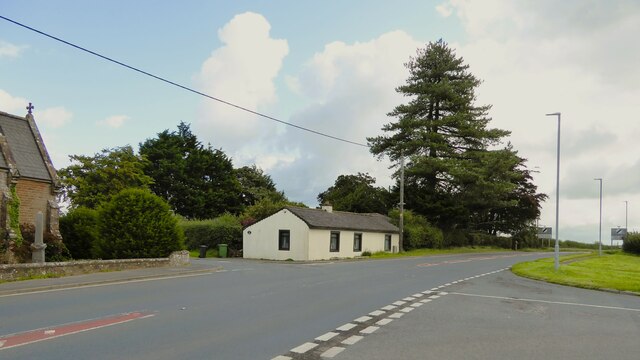
Barugh is a small village located in the county of Cumberland, England. It is situated in the picturesque countryside, surrounded by rolling hills and green fields. The village is part of the larger civil parish of Barugh, which includes several other nearby hamlets.

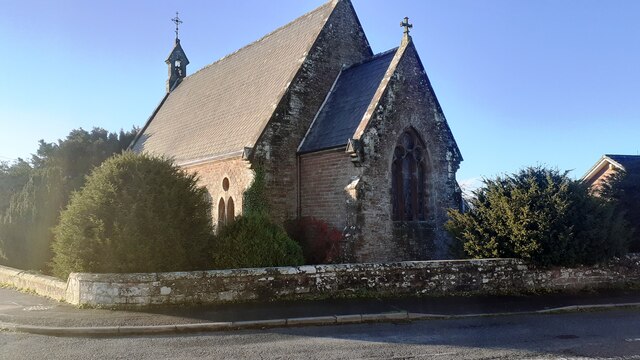
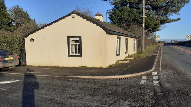
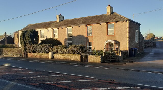
In terms of size, Barugh is relatively small, with a population of around 200 residents. The village is characterized by its charming, traditional architecture, with many houses dating back several centuries. The centerpiece of Barugh is the St. Michael and All Angels Church, a beautiful medieval structure that stands as a testament to the village's rich history.

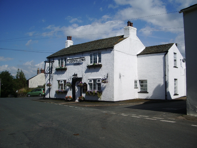
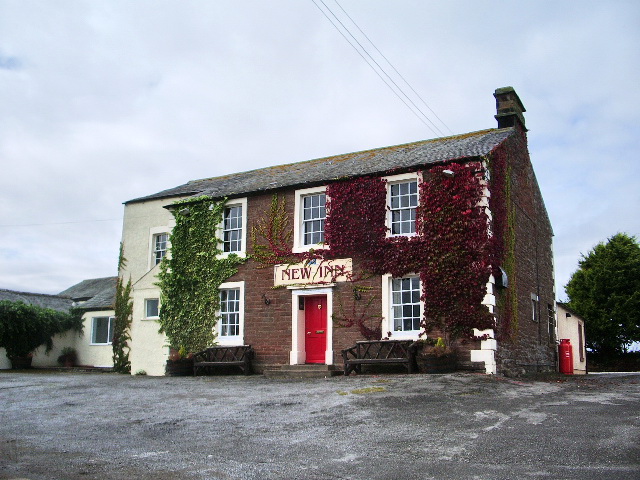
Despite its small size, Barugh offers a range of amenities for its residents. There is a local pub, The Barugh Green Inn, where locals can gather for a pint or enjoy a meal. The village also has a primary school, providing education for the younger residents.

The surrounding area is ideal for outdoor enthusiasts, with numerous walking and cycling trails crisscrossing the countryside. The picturesque landscape is dotted with farms and offers breathtaking views at every turn.

Barugh is well-connected to the nearby towns and cities, with good road links allowing for easy access to amenities and services. The village provides a peaceful and tranquil living environment, perfect for those seeking a rural escape.

If you have any feedback on the listing, please let us know in the comments section below.
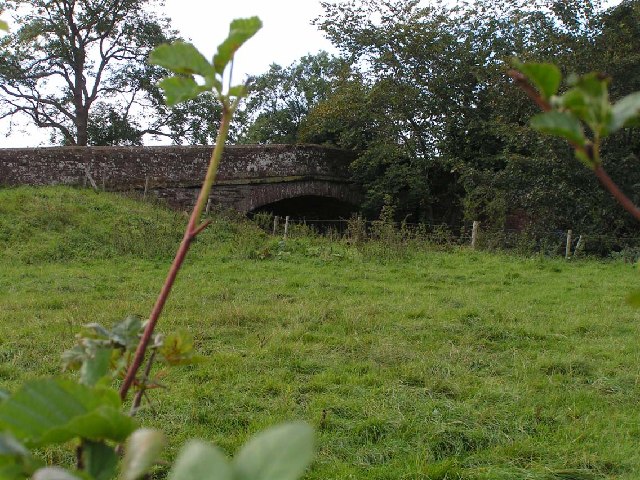
Barugh Images

Images are sourced within 2km of 54.808118/-3.2106806 or Grid Reference NY2246. Thanks to Geograph Open Source API. All images are credited.

Blaithwaite House driveway In early May the trees are coming in to leaf and have not yet achieved their darker summer green.
Blaithwaite House driveway
In early May the trees are coming in to leaf and have not yet achieved their darker summer green.
Benchmark, Woodrow House Detail of the Ordnance Survey cut benchmark on the north face, north east corner of Woodrow House.  The benchmark marks a height of 58.8645m above mean sea level (Ordnance Datum Newlyn) last verified in 1971.
Benchmark, Woodrow House
Detail of the Ordnance Survey cut benchmark on the north face, north east corner of Woodrow House. The benchmark marks a height of 58.8645m above mean sea level (Ordnance Datum Newlyn) last verified in 1971.
Toll Bar Cottage At the cross roads but without the usual jutting out toll booth windows that allow the view along the road
Toll Bar Cottage
At the cross roads but without the usual jutting out toll booth windows that allow the view along the road
Railway heading towards Aspatria View from Barugh rail bridge
Railway heading towards Aspatria
View from Barugh rail bridge
Railway heading towards Wigton View from the Barugh rail bridge
Railway heading towards Wigton
View from the Barugh rail bridge
Woodrow Hall View across the fields of the property that has outbuildings without roof tiles and at the other extreme solar panels on the house roof
Woodrow Hall
View across the fields of the property that has outbuildings without roof tiles and at the other extreme solar panels on the house roof
Old Milestone by the A596 in Waverton Carved stone post by the A596, in parish of WAVERTON (ALLERDALE District), North side of village, by a farm house, in pavement with back to low stone wall with garden hedge, on North side of road. Wigton curved red stone, erected by the Cockermouth & Maryport turnpike trust in the 19th century. 

Inscription reads:-
WORKINGTON
21
WIGTON
2 
Carved benchmark and rivet on top.

Milestone Society National ID: CU_WGWO02
Old Milestone by the A596 in Waverton
Carved stone post by the A596, in parish of WAVERTON (ALLERDALE District), North side of village, by a farm house, in pavement with back to low stone wall with garden hedge, on North side of road. Wigton curved red stone, erected by the Cockermouth & Maryport turnpike trust in the 19th century. Inscription reads:- WORKINGTON 21 WIGTON 2 Carved benchmark and rivet on top. Milestone Society National ID: CU_WGWO02
Old Milestone by the A596, southwest of Wigton Carved stone post by the A596, in parish of Bromfield (Allerdale District), North of Aikbank, on grass verge, on North side of road. Wigton curved red stone, erected by the Cockermouth & Maryport turnpike trust in the 19th century. 

Inscription reads:-
WORKINGTON
20
WIGTON
3 
Rivet benchmark on top. 

Surveyed

Milestone Society National ID: CU_WGWO03
Old Milestone by the A596, southwest of Wigton
Carved stone post by the A596, in parish of Bromfield (Allerdale District), North of Aikbank, on grass verge, on North side of road. Wigton curved red stone, erected by the Cockermouth & Maryport turnpike trust in the 19th century. Inscription reads:- WORKINGTON 20 WIGTON 3 Rivet benchmark on top. Surveyed Milestone Society National ID: CU_WGWO03
Benchmark on NE face, east angle of Christ Church Ordnance Survey cut mark benchmark levelled at 38.355m above Newlyn Datum verified 1970
Benchmark on NE face, east angle of Christ Church
Ordnance Survey cut mark benchmark levelled at 38.355m above Newlyn Datum verified 1970
Christ Church at western quadrant of crossroads in Waverton There is an Ordnance Survey benchmark <a href="https://www.geograph.org.uk/photo/7667771">NY2247 : Benchmark on NE face, east angle of Christ Church</a> on the near corner, right hand face, of the church
Christ Church at western quadrant of crossroads in Waverton
There is an Ordnance Survey benchmark NY2247 : Benchmark on NE face, east angle of Christ Church on the near corner, right hand face, of the church
Toll Bar Cottage on north side of A596 A benchmark was levelled on the toll house at 131.219 feet above Liverpool Datum as Mark 332 during the 1843-1844 Kendal to Carlisle 1GL Survey. The surveyor's description was 'Mark on South-east corner of Waverton Toll-house ; 6.48 ft above surface'. The mark is also shown on the 1892-1914 25" Map when the building was described as a post office.
The building has Milestone Society National ID: CB.WAV
Toll Bar Cottage on north side of A596
A benchmark was levelled on the toll house at 131.219 feet above Liverpool Datum as Mark 332 during the 1843-1844 Kendal to Carlisle 1GL Survey. The surveyor's description was 'Mark on South-east corner of Waverton Toll-house ; 6.48 ft above surface'. The mark is also shown on the 1892-1914 25" Map when the building was described as a post office. The building has Milestone Society National ID: CB.WAV
Milestone with benchmark on top on north side of A596 Ordnance Survey rivet benchmark levelled at 33.073m above Newlyn Datum verified 1970. The mark was previously levelled at 106.712 feet above Liverpool Datum as Mark 330 during the 1843/4 Kendal to Carlisle 1GL Survey. The surveyor's description was 'Mark on top of the 2d milestone from Wigton ; 2.76 ft. above surface'
Milestone with benchmark on top on north side of A596
Ordnance Survey rivet benchmark levelled at 33.073m above Newlyn Datum verified 1970. The mark was previously levelled at 106.712 feet above Liverpool Datum as Mark 330 during the 1843/4 Kendal to Carlisle 1GL Survey. The surveyor's description was 'Mark on top of the 2d milestone from Wigton ; 2.76 ft. above surface'
A596 heading west through Waverton There is a milestone <a href="https://www.geograph.org.uk/photo/7668282">NY2247 : Milestone with benchmark on top on north side of A596</a> against the boundary wall of Milestone Cottage on the right hand side of the road
A596 heading west through Waverton
There is a milestone NY2247 : Milestone with benchmark on top on north side of A596 against the boundary wall of Milestone Cottage on the right hand side of the road
Footpath/farm track passing stone gateposts NW of Waverton
Milestone House and Milestone Cottage on north side of A596 Houses named after milestone <a href="https://www.geograph.org.uk/photo/7668282">NY2247 : Milestone with benchmark on top on north side of A596</a> against wall fronting the houses
Milestone House and Milestone Cottage on north side of A596
Houses named after milestone NY2247 : Milestone with benchmark on top on north side of A596 against wall fronting the houses
Field with muddy entrance northwest of Waverton
Muddy farm track/footpath heading east towards Waverton
Stream flowing alongside farm track/footpath NW of Waverton
Show me another place!

Barugh is located at Grid Ref: NY2246 (Lat: 54.808118, Lng: -3.2106806)

Administrative County: Cumbria

District: Allerdale

Police Authority: Cumbria

What 3 Words

///flippers.nerves.treatable. Near Wigton, Cumbria

Nearby Locations

Barugh

Related Wikis

Waverton, Cumbria

Waverton is a linear village and civil parish in the Allerdale borough of Cumbria, England. Waverton lies on the main A596 road east of a bridge over the...

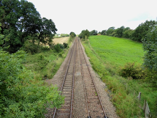
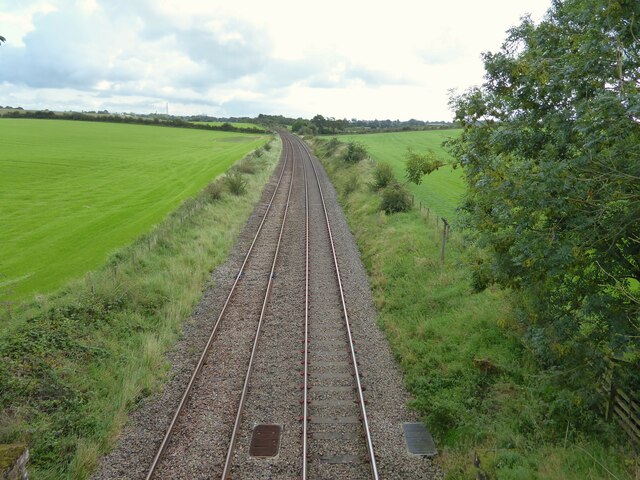
Leegate railway station

Leegate was a railway station on the Maryport and Carlisle Railway (M&CR) and served this rural district in Cumbria. The station was opened by the M&CR...

Brookfield railway station (England)

Brookfield (Cumbria) railway station was a short-lived railway station that served Brookfield School (or Brookfield Academy), a Quaker school situated...

Wigton School

Wigton School (also called Brookfield School or Friends' School) was an independent boarding school on the outskirts of Wigton, Cumbria. The school was...

High Blaithwaite railway station

High Blaithwaite railway station was in the former county of Cumberland, now Cumbria, England. It was a stop on the Bolton Loop (sometimes referred to...

Waverbridge

Waverbridge is a hamlet in the civil parish of Dundraw, right on the boundary with the civil parish of Waverton in Cumbria, United Kingdom. It is located...

Bolton Low Houses

Bolton Low Houses is a small village in Cumbria, England. Historically part of Cumberland, it is located 3.1 miles (5.0 km) by road to the southwest of...

Blencogo

Blencogo is a small farming village and former civil parish, now in the parish of Bromfield, in the Cumberland district, in the ceremonial county of Cumbria...

Nearby Amenities

Located within 500m of 54.808118,-3.2106806
Barugh Cottages
Place: locality
Lat/Long: 54.8049088/-3.2076409
Barugh
Place: locality
Lat/Long: 54.8095381/-3.2078543
Ford: yes
Lat/Long: 54.8066732/-3.2143636
Generator Output Electricity: yes
Generator Source: solar
Generator Type: solar_photovoltaic_panel
Location: roof
Power: generator
Lat/Long: 54.8106713/-3.2067043
Power: pole
Lat/Long: 54.8037727/-3.2100098
Power: pole
Lat/Long: 54.8045647/-3.2101379
Power: pole
Lat/Long: 54.8057558/-3.210342
Power: pole
Lat/Long: 54.8071308/-3.2105916
Power: pole
Lat/Long: 54.8076538/-3.2109064
Power: pole
Lat/Long: 54.8082819/-3.2099708
Power: pole
Lat/Long: 54.809329/-3.2097081
Power: pole
Lat/Long: 54.8094879/-3.209669
Power: pole
Lat/Long: 54.8100421/-3.2095127
Power: pole
Lat/Long: 54.8104662/-3.2071204
Power: pole
Lat/Long: 54.8103373/-3.2077977
Power: pole
Lat/Long: 54.810181/-3.2087334
Power: pole
Lat/Long: 54.8100233/-3.210266
Power: pole
Lat/Long: 54.8100021/-3.2109824
Power: pole
Lat/Long: 54.8099871/-3.2116705
Power: pole
Lat/Long: 54.809967/-3.2123587
Power: pole
Lat/Long: 54.8099533/-3.2130316
The data included in this document is from www.openstreetmap.org. The data is made available under ODbL.

Have you been to Barugh?

Leave your review of Barugh below (or comments, questions and feedback).