Bardister

Settlement in Shetland

Scotland

Bardister

Ollaberry Shop at Hogaland
Ollaberry Shop at Hogaland Credit: Mike Pennington

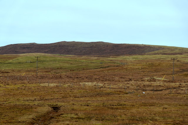
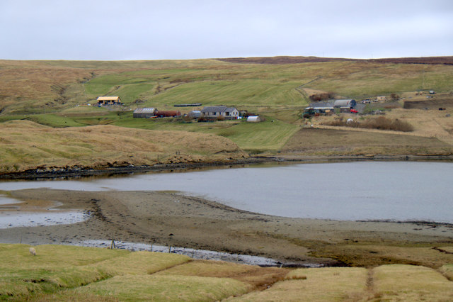
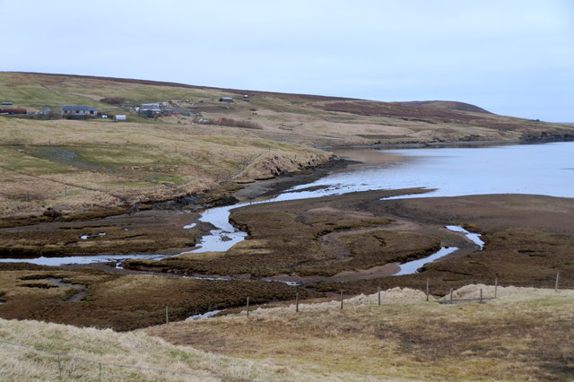
Bardister is a small hamlet located on the island of Shetland, which is part of Scotland. Situated on the west side of the mainland, Bardister is surrounded by picturesque landscapes, with rolling hills and breathtaking views of the North Atlantic Ocean. The hamlet lies about 9 miles northwest of the capital town of Lerwick.

Despite its small size, Bardister has a rich history. It is believed that the area has been inhabited since prehistoric times, evidenced by the ancient archaeological sites found in the vicinity. The name Bardister is derived from the Old Norse language, indicating its Viking heritage.

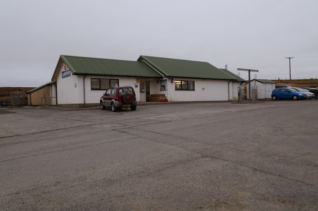
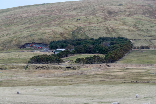
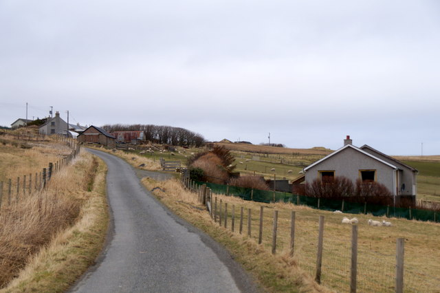
Today, Bardister is primarily a residential area, with a handful of traditional Shetland houses scattered across the landscape. The community is tightly knit, with friendly locals who take pride in their heritage and natural surroundings. The area is perfect for those seeking a tranquil and idyllic lifestyle away from the hustle and bustle of urban areas.

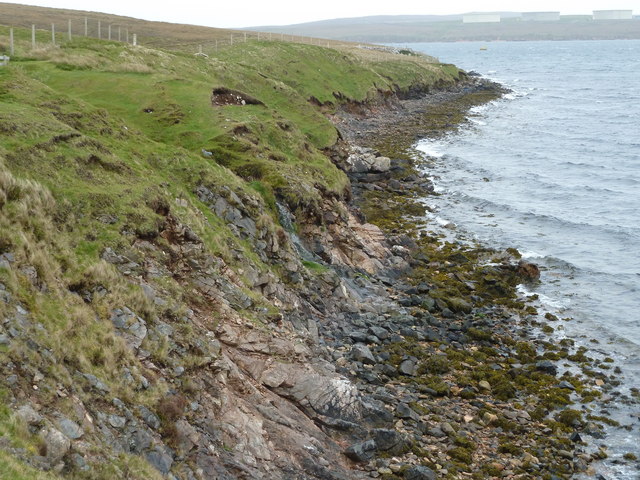
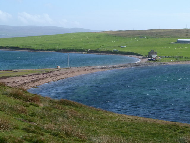
Nature enthusiasts will find Bardister to be a haven, with ample opportunities for outdoor activities. The nearby coastline offers stunning cliff walks, where visitors can spot various seabirds and marine wildlife. The surrounding hills provide excellent hiking and wildlife-watching opportunities, with the chance to see Shetland ponies and rare bird species. The hamlet also benefits from its proximity to beautiful beaches, where visitors can relax and enjoy the peaceful atmosphere.

Although Bardister may be small in size, its natural beauty and historical significance make it a charming destination for those seeking a peaceful retreat in the heart of Shetland.

If you have any feedback on the listing, please let us know in the comments section below.
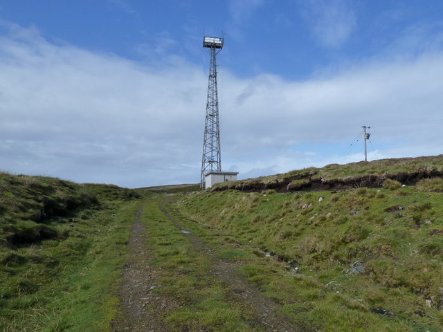
Bardister Images

Images are sourced within 2km of 60.478247/-1.3497633 or Grid Reference HU3577. Thanks to Geograph Open Source API. All images are credited.

Ollaberry Shop at Hogaland
Moorland above North Gluss Looking towards Yamna Field.
Moorland above North Gluss
Looking towards Yamna Field.
Waterside, Gluss, and Sullom Voe from Turvister From the hill above Gluss Voe looking across the house on the tombolo at Gluss Isle towards Sullom Voe Terminal.
Waterside, Gluss, and Sullom Voe from Turvister
From the hill above Gluss Voe looking across the house on the tombolo at Gluss Isle towards Sullom Voe Terminal.
Waterside, Gluss House at the Mainland end of the tombolo joining Gluss Isle to the rest of Shetland.
Waterside, Gluss
House at the Mainland end of the tombolo joining Gluss Isle to the rest of Shetland.
The tombolo at Gluss Isle
Navigation light on Gluss Isle
The head of Gluss Voe at Bardister
East Burn flowing into the head of Gluss Voe at Bardister
Knowes, Gluss
Knowes, Gluss
North Gluss
North Gluss
Gluss Voe shoreline Quiet havens, not easily attained from the land, invite landing by small boat; but only when the wind is right!
Gluss Voe shoreline
Quiet havens, not easily attained from the land, invite landing by small boat; but only when the wind is right!
Light with attitude Once on the line between, or anywhere due North, of the tower, one can see the purpose.
The huge and powerful light strikes out to sea.  When placed precisely behind the Fore-light <a href="https://www.geograph.org.uk/photo/2428624">HU3779 : Gluss Isle leading light</a>  a safe line is drawn for shipping to follow to the pilot station.
Then, when a Pilot is aboard and tugs in attendance, the approach to Sullom Voe Terminal can be completed.
Light with attitude
Once on the line between, or anywhere due North, of the tower, one can see the purpose. The huge and powerful light strikes out to sea. When placed precisely behind the Fore-light HU3779 : Gluss Isle leading light a safe line is drawn for shipping to follow to the pilot station. Then, when a Pilot is aboard and tugs in attendance, the approach to Sullom Voe Terminal can be completed.
Gluss Isle Shoreline A bleak-looking shoreline.  But there are two waterfalls and lots of signs that Otter frequent these parts
Gluss Isle Shoreline
A bleak-looking shoreline. But there are two waterfalls and lots of signs that Otter frequent these parts
Gluss Isle Sheep shelter These old sheep pens are well weathered but still useful as lambing shelters.
New tension-fencing encloses most of this south-eastern corner.
Gluss Isle Sheep shelter
These old sheep pens are well weathered but still useful as lambing shelters. New tension-fencing encloses most of this south-eastern corner.
Gluss Isle Tombolo There must be many occasions when the Isle is an isle proper but the tombolo seems stable enough to withstand most weather-assults.
In any case, I think 'Harbours' might keep it open to allow service vehicles access to the Leading-light towers.
For the juxta-view and loads of cool Shetland links, see here
<span class="nowrap"><a title="http://shetlopedia.com/Gluss_Isle" rel="nofollow ugc noopener" href="http://shetlopedia.com/Gluss_Isle">Link</a><img style="margin-left:2px;" alt="External link" title="External link - shift click to open in new window" src="https://s1.geograph.org.uk/img/external.png" width="10" height="10"/></span>
Gluss Isle Tombolo
There must be many occasions when the Isle is an isle proper but the tombolo seems stable enough to withstand most weather-assults. In any case, I think 'Harbours' might keep it open to allow service vehicles access to the Leading-light towers. For the juxta-view and loads of cool Shetland links, see here LinkExternal link
Gluss Isle Leading light Only when you get to the tower might you see that it is the after-most light tower of two. Just within the square by less than 50 metres, it dominates the view.
The leading lights are used to assist incoming tankers (to Sullom Voe) in taking a safe line to the Pilot Station, before entering the potentially hazardous approach to the Oil Terminal.
The photo gives the impression that the tower leans - it doesn't!
Gluss Isle Leading light
Only when you get to the tower might you see that it is the after-most light tower of two. Just within the square by less than 50 metres, it dominates the view. The leading lights are used to assist incoming tankers (to Sullom Voe) in taking a safe line to the Pilot Station, before entering the potentially hazardous approach to the Oil Terminal. The photo gives the impression that the tower leans - it doesn't!
Gluss resurgence This pool and its short feeder, is the product of an upper pool, shown on the (much) larger scale map. The stream from the upper one is marked 'Sinks' (disappears) by OS.
It re-emerges lower down and forms this pool.
Resurgence is classically associated with Limestone country; here - <a href="https://www.geograph.org.uk/photo/306605">ST4653 : Resurgence stream</a> and <a href="https://www.geograph.org.uk/photo/1022817">NC2717 : Dry Waterfall at head of Allt nan Uamh Valley</a>
Gluss resurgence
This pool and its short feeder, is the product of an upper pool, shown on the (much) larger scale map. The stream from the upper one is marked 'Sinks' (disappears) by OS. It re-emerges lower down and forms this pool. Resurgence is classically associated with Limestone country; here - ST4653 : Resurgence stream and NC2717 : Dry Waterfall at head of Allt nan Uamh Valley
Track to Gluss Leading Light The service track up to the aftermost of the leading lights on Gluss Isle.
Track to Gluss Leading Light
The service track up to the aftermost of the leading lights on Gluss Isle.
Show me another place!

Bardister is located at Grid Ref: HU3577 (Lat: 60.478247, Lng: -1.3497633)

Unitary Authority: Shetland Islands

Police Authority: Highlands and Islands

What 3 Words

///shook.boring.chipper. Near Toft, Shetland Islands

Nearby Locations

Ramah Bardister

Related Wikis

Eela Water

Eela Water is a freshwater loch (lake) in Northmavine, part of the mainland of Shetland in Scotland. Besides being a freshwater fishing location, the site...

Ollaberry

Ollaberry (Old Norse: Olafrsberg, meaning Olaf's Hill) is a village on Mainland, Shetland, Scotland on the west shore of Yell Sound, 10.9 miles (17.5 km...

Punds Water

Punds Water is a freshwater loch near Mangaster in Northmavine, Shetland. It also gives its name to a nearby Neolithic heel-shaped cairn. == Heel-shaped... ==

Sullom Voe

Sullom Voe is an inlet of the North Sea between the parishes of Delting and Northmavine in Shetland, Scotland. It is a location of the Sullom Voe oil terminal...

Northmavine

Northmavine or Northmaven (Old Norse: Norðan Mæfeið, meaning ‘the land north of the Mavis Grind’) is a peninsula in northwest Mainland Shetland in Scotland...

Sullom

Sullom is a village on the Shetland peninsula of Northmavine, between Haggrister and Bardister. It lies on the northwest side of Sullom Voe, to which it...

RAF Sullom Voe

Royal Air Force Sullom Voe or more simply RAF Sullom Voe is a former Royal Air Force station near the village of Brae, in the Shetland Isles of Scotland...

Sullom Voe Terminal

The Sullom Voe Terminal is an oil and gas terminal at Sullom Voe in the Shetland Islands of Scotland. It handles production from oilfields in the North...

Nearby Amenities

Located within 500m of 60.478247,-1.3497633
Bardister
Is In: GB
Place: hamlet
Lat/Long: 60.4777918/-1.3507972
Power: pole
Lat/Long: 60.4793193/-1.3580887
Power: pole
Lat/Long: 60.4792201/-1.3575255
Power: pole
Lat/Long: 60.4790476/-1.3566004
Power: pole
Lat/Long: 60.478828/-1.3553829
Power: pole
Lat/Long: 60.478678/-1.3546208
Power: pole
Lat/Long: 60.4785705/-1.3539809
Power: pole
Lat/Long: 60.4783414/-1.3527418
Power: pole
Lat/Long: 60.478169/-1.3517664
Power: pole
Lat/Long: 60.4779612/-1.3506423
Power: pole
Lat/Long: 60.4778136/-1.3498323
Power: pole
Lat/Long: 60.4775561/-1.3484183
Power: pole
Lat/Long: 60.4773329/-1.3471936
Power: pole
Lat/Long: 60.4771061/-1.3459593
Power: pole
Lat/Long: 60.4768711/-1.3446771
Power: pole
Lat/Long: 60.4766113/-1.3432775
Power: pole
Lat/Long: 60.4764448/-1.3423571
Power: pole
Lat/Long: 60.4772053/-1.3490869
Power: pole
Lat/Long: 60.4768558/-1.3497795
Power: pole
Lat/Long: 60.4765723/-1.3503356
The data included in this document is from www.openstreetmap.org. The data is made available under ODbL.

Have you been to Bardister?

Leave your review of Bardister below (or comments, questions and feedback).