Banc y Darren

Settlement in Cardiganshire

Wales

Banc y Darren

The lower lane in Dollwen Goginan is a hamlet on the A44 road in the valley of the Afon Melindwr - most visitors pass at 40mph on the main road, maybe stopping at<a href="https://www.geograph.org.uk/photo/148055">SN6881 : The Druid Inn, Goginan</a> for a pint on the way through. Dollwen lies 150' below it in the valley; a collection of houses and cottages, plus two currently derelict old chapels.
The lower lane in Dollwen Credit: Richard Law

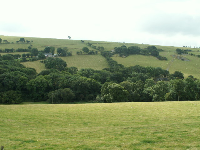
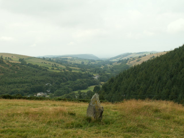
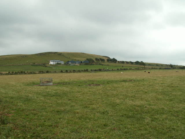
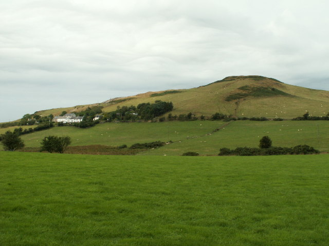
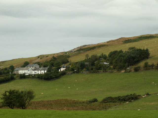
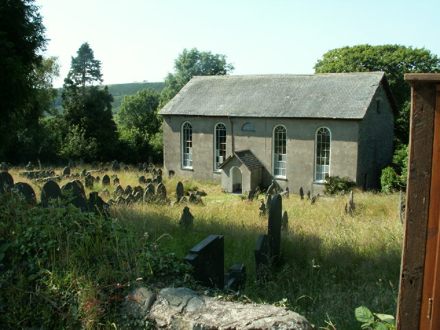
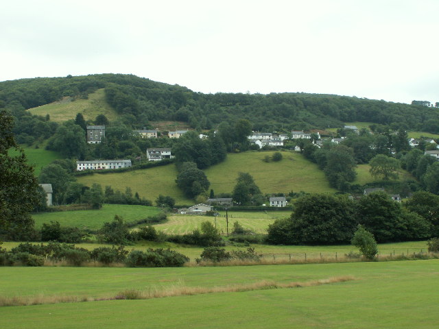
Banc y Darren is a small village located in the county of Cardiganshire, Wales. Situated in the beautiful countryside, it is surrounded by rolling hills and offers stunning views of the Welsh landscape. The village is nestled in a valley, adding to its charm and tranquility.

With a population of around 500 residents, Banc y Darren is a close-knit community that prides itself on its strong sense of community spirit. The village is known for its friendly and welcoming residents, who are always eager to lend a helping hand.

Despite its small size, Banc y Darren offers a range of amenities to its residents. There is a local village shop that caters to everyday needs, ensuring that residents have easy access to essentials. Additionally, the village is serviced by a regular bus service, providing convenient transportation links to nearby towns and cities.

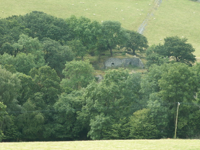
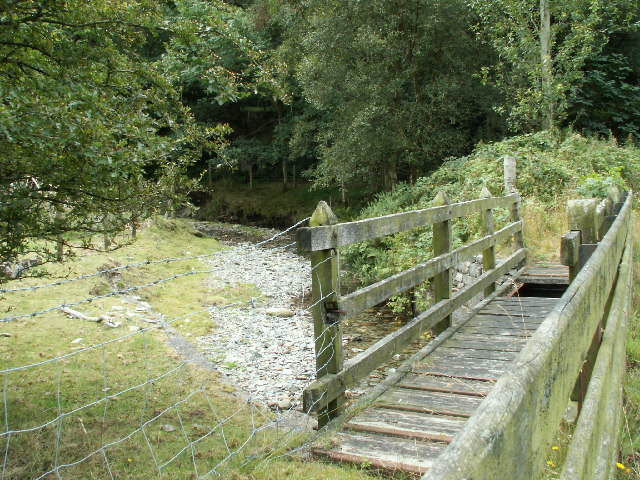
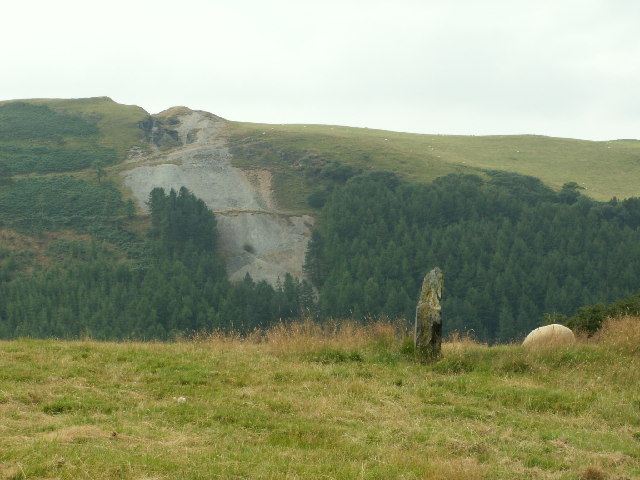
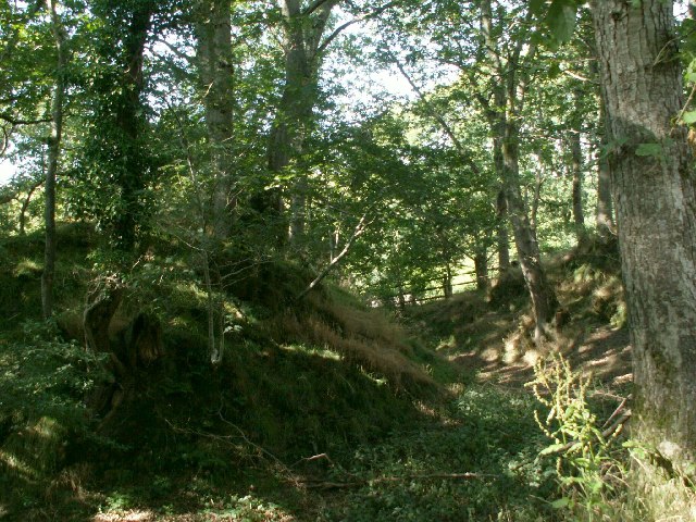
Nature enthusiasts will find themselves in paradise in Banc y Darren. The surrounding countryside offers picturesque walking trails, perfect for outdoor activities such as hiking and cycling. The village is also in close proximity to several nature reserves, allowing residents to explore and appreciate the abundant wildlife in the area.

Overall, Banc y Darren is a peaceful and picturesque village that offers a close-knit community atmosphere and easy access to stunning natural surroundings. It is a place where residents can enjoy a slower pace of life while still having access to essential amenities and beautiful outdoor spaces.

If you have any feedback on the listing, please let us know in the comments section below.

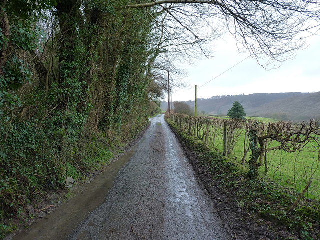
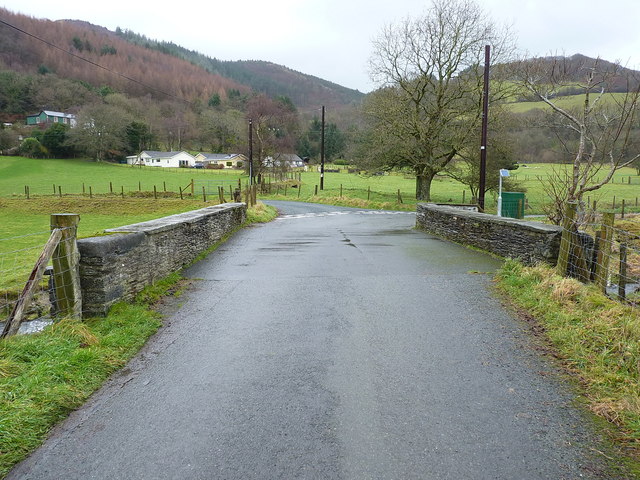
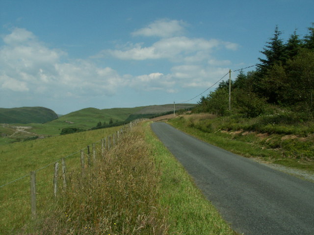
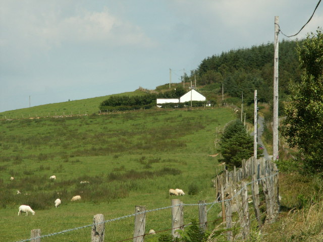
Banc y Darren Images

Images are sourced within 2km of 52.426689/-3.9493467 or Grid Reference SN6782. Thanks to Geograph Open Source API. All images are credited.

The lower lane in Dollwen Goginan is a hamlet on the A44 road in the valley of the Afon Melindwr - most visitors pass at 40mph on the main road, maybe stopping at<a href="https://www.geograph.org.uk/photo/148055">SN6881 : The Druid Inn, Goginan</a> for a pint on the way through. Dollwen lies 150' below it in the valley; a collection of houses and cottages, plus two currently derelict old chapels.
The lower lane in Dollwen
Goginan is a hamlet on the A44 road in the valley of the Afon Melindwr - most visitors pass at 40mph on the main road, maybe stopping atSN6881 : The Druid Inn, Goginan for a pint on the way through. Dollwen lies 150' below it in the valley; a collection of houses and cottages, plus two currently derelict old chapels.
Old barns at Troedrhiwcastell Vernacular buildings at a farm in the Melindwr valley.
Old barns at Troedrhiwcastell
Vernacular buildings at a farm in the Melindwr valley.
Pont Ysgubor Newydd A mid 19th century Grade II listed <span class="nowrap"><a title="https://www.britishlistedbuildings.co.uk/300082813-pont-ysgubor-newydd-melindwr#.WlMnCvll-M8" rel="nofollow ugc noopener" href="https://www.britishlistedbuildings.co.uk/300082813-pont-ysgubor-newydd-melindwr#.WlMnCvll-M8">Link</a><img style="margin-left:2px;" alt="External link" title="External link - shift click to open in new window" src="https://s1.geograph.org.uk/img/external.png" width="10" height="10"/></span> bridge over the Afon Melindwr, the listing being given in 2004.
Pont Ysgubor Newydd
A mid 19th century Grade II listed LinkExternal link bridge over the Afon Melindwr, the listing being given in 2004.
The lower lane in Dollwen, Christmas Day 2018 More or less the same place as <a href="https://www.geograph.org.uk/photo/5639292">SN6881 : The lower lane in Dollwen</a>, but looking in the opposite direction along the lane. Dogs need to be walked, even on Christmas Day.
The lower lane in Dollwen, Christmas Day 2018
More or less the same place as SN6881 : The lower lane in Dollwen, but looking in the opposite direction along the lane. Dogs need to be walked, even on Christmas Day.
Up the lane towards Coed Penbryn A view from the southern side of Dollwen village, towards the hillside carrying the A44 Aberystwyth to Llangurig road.
Up the lane towards Coed Penbryn
A view from the southern side of Dollwen village, towards the hillside carrying the A44 Aberystwyth to Llangurig road.
Banc Clawddmelyn The road along Banc Clawddmelyn, looking E. towards the Nant-y-moch area.
Banc Clawddmelyn
The road along Banc Clawddmelyn, looking E. towards the Nant-y-moch area.
Pasture, Llwyn Prysg Pasture, house and forestry by the roadside near Llwyn Prysg
Pasture, Llwyn Prysg
Pasture, house and forestry by the roadside near Llwyn Prysg
Nant Silo Looking S across Nant Silo, remains of Bron Flwyd (Bronllwyd) leadmine on right
Nant Silo
Looking S across Nant Silo, remains of Bron Flwyd (Bronllwyd) leadmine on right
Bron Floyd leadmine Remains of part of the Bron Floyd (Bronllwyd) lead mine. Originally worked c. 1600 and re-opened for a while in mid 1800s.
Bron Floyd leadmine
Remains of part of the Bron Floyd (Bronllwyd) lead mine. Originally worked c. 1600 and re-opened for a while in mid 1800s.
Footbridge, Pen-bont Rhydybeddau Footbridge (disused?) across Nant Silo next to modern road bridge that replaces the original ford.
Footbridge, Pen-bont Rhydybeddau
Footbridge (disused?) across Nant Silo next to modern road bridge that replaces the original ford.
Cerrig-yr-Wyn One of the two standing stones called 'Cerrig-yr-Wyn', each about three ft high and about 200yds apart. Looking SW. The scar on the hillside opposite is the old Darren metal mine (in SN6782), which was originally worked in the mid 16th Cent. There is also the remains of a hill fort on top of the hill.
Cerrig-yr-Wyn
One of the two standing stones called 'Cerrig-yr-Wyn', each about three ft high and about 200yds apart. Looking SW. The scar on the hillside opposite is the old Darren metal mine (in SN6782), which was originally worked in the mid 16th Cent. There is also the remains of a hill fort on top of the hill.
Gatepost and standing stone Old stone gatepost and one of the two standing stones (in the middle of the field) that make up 'Cerrig-yr-Wyn'. Looking S.
Gatepost and standing stone
Old stone gatepost and one of the two standing stones (in the middle of the field) that make up 'Cerrig-yr-Wyn'. Looking S.
Cerrig yr Wyn One of the two standing stones called Cerrig yr Wyn, looking West up the valley of Nant Silo and Clarach to Clarach bay on the coast in the distance (the obvious headland is the S shore of the bay, about 10km away)
Cerrig yr Wyn
One of the two standing stones called Cerrig yr Wyn, looking West up the valley of Nant Silo and Clarach to Clarach bay on the coast in the distance (the obvious headland is the S shore of the bay, about 10km away)
Moelfryn Pasture surrounding Moelfryn farm, looking SE. Altitude approx 280m.
Moelfryn
Pasture surrounding Moelfryn farm, looking SE. Altitude approx 280m.
Cwmerfyn Small modern roadbridge across a stream with Cwmerfyn beyond. Spoil heap from former mine just visible on L. Looking E.
Cwmerfyn
Small modern roadbridge across a stream with Cwmerfyn beyond. Spoil heap from former mine just visible on L. Looking E.
Goginan and Dollwen The village of Goginan on the A44. Looking S, the A44 runs along the top line of houses.
Goginan and Dollwen
The village of Goginan on the A44. Looking S, the A44 runs along the top line of houses.
Banc y Darren The hamlet of Darren below the hill of Banc y Darren. There is a fort on top of the hill. Looking NW.
Banc y Darren
The hamlet of Darren below the hill of Banc y Darren. There is a fort on top of the hill. Looking NW.
Darren Closer view of the houses and some of the old mine workings at Darren.
Darren
Closer view of the houses and some of the old mine workings at Darren.
Show me another place!

Banc y Darren is located at Grid Ref: SN6782 (Lat: 52.426689, Lng: -3.9493467)

Unitary Authority: Ceredigion

Police Authority: Dyfed Powys

What 3 Words

///monks.risk.emeralds. Near Bow Street, Ceredigion

Related Wikis

Daren

Daren is a hamlet bach in the community of Trefeurig, Ceredigion, Wales, which is 73.2 miles (117.7 km) from Cardiff and 174.5 miles (280.8 km) from London...

Pen-bont-rhyd-y-beddau

Pen-bont-rhyd-y-beddau is a small village in the community of Trefeurig, Ceredigion, Wales, which is 73.7 miles (118.6 km) from Cardiff and 174.8 miles...

Pen-Rhiw-Newydd

Penrhiwnewydd is a hamlet in the community of Trefeurig, Ceredigion, Wales, which is 74.1 miles (119.2 km) from Cardiff and 175.3 miles (282 km) from London...

Salem, Ceredigion

Salem is a small Welsh village in Ceredigion, located between the Afon Stewi and Nant Seilo rivers. The closest village is Penrhyn-coch. The Salem Independent...

Dollwen

Dollwen is a hamlet in the community of Melindwr, Ceredigion, Wales, which is 72.1 miles (116 km) from Cardiff and 173.6 miles (279.4 km) from London...

Goginan

Goginan is a small village in Ceredigion, about 7 miles outside Aberystwyth on the A44 between Ponterwyd and Capel Bangor. The Afon Melindwr runs through...

Broginin

Broginin is a hamlet in the community of Trefeurig, Ceredigion, Wales, which is 74.6 miles (120 km) from Cardiff and 175.7 miles (282.8 km) from London...

Ystrad Peithyll

Ystrad Peithyll (also known as Stradpeithyll in the Brut y Tywysogion and Rhosgoch Motte) is the remains of a small 12th-century motte-and-bailey castle...

Nearby Amenities

Located within 500m of 52.426689,-3.9493467
Post Box
Operator: Royal Mail
Ref: SY23 20
Lat/Long: 52.4277347/-3.9468589
Place: farm
Lat/Long: 52.4263648/-3.9501493
Building: yes
Lat/Long: 52.426789/-3.9493032
The data included in this document is from www.openstreetmap.org. The data is made available under ODbL.

Have you been to Banc y Darren?

Leave your review of Banc y Darren below (or comments, questions and feedback).