Balvaird

Settlement in Ross-shire

Scotland

Balvaird

Muir of Ord Looking up to the railway station from the crossroads in the centre of the village.
Muir of Ord Credit: Richard Webb

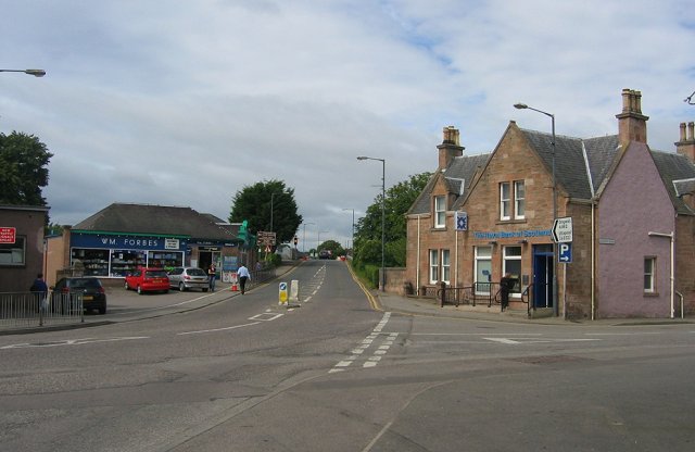
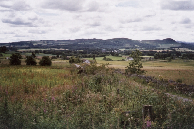
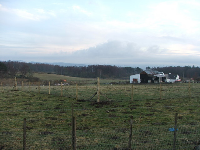
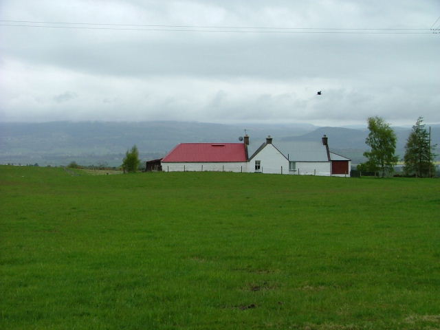
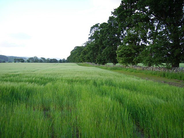
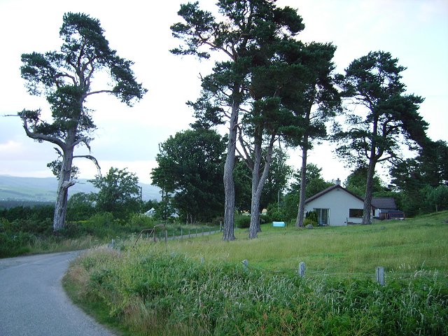
Balvaird is a small rural village located in the county of Ross-shire, Scotland. Situated in the northern part of the country, it lies approximately 15 miles northwest of the town of Dingwall and 25 miles northeast of the city of Inverness. Nestled in the picturesque Scottish Highlands, Balvaird is surrounded by stunning landscapes and offers a tranquil setting for its residents.

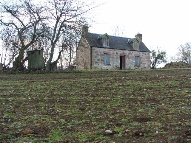
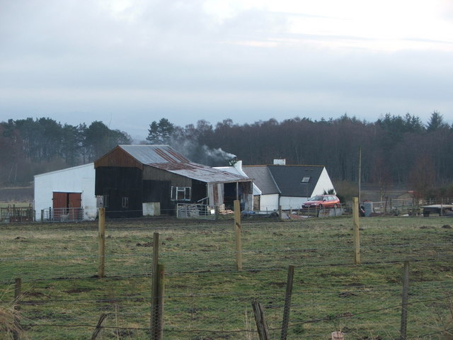
The village itself is characterized by its small size and close-knit community. It is home to a population of around 200 people, who enjoy a peaceful lifestyle in this idyllic countryside setting. The local economy primarily relies on farming and agriculture, with some residents also commuting to nearby towns for work.

Despite its size, Balvaird has a few notable amenities for its residents. These include a village hall, where community events and gatherings are held, and a small primary school that caters to the educational needs of local children. For additional services and amenities, residents often travel to neighboring towns.

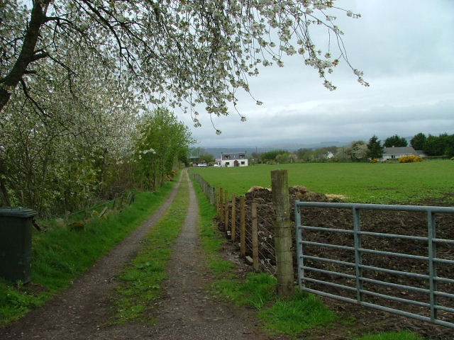
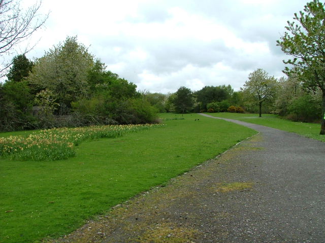
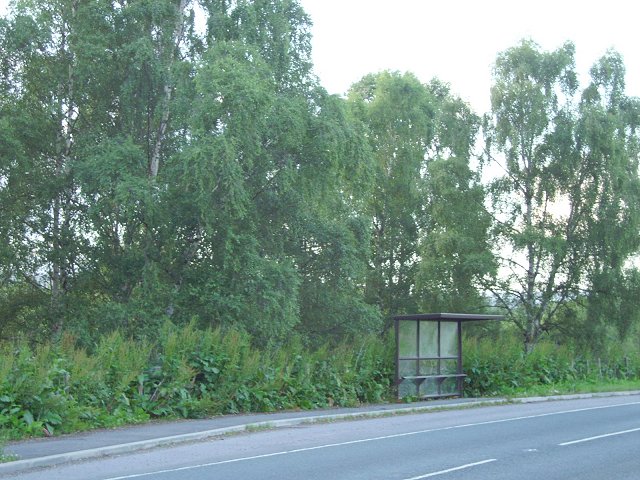
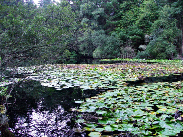
For outdoor enthusiasts, Balvaird offers easy access to a range of recreational activities. The surrounding area is ideal for walking, hiking, and cycling, with numerous trails and paths to explore. The village is also in close proximity to several rivers and lochs, providing opportunities for fishing and other water-based activities.

In conclusion, Balvaird is a charming village located in the beautiful countryside of Ross-shire, Scotland. With its peaceful atmosphere, stunning natural surroundings, and close community ties, it offers an appealing place to reside for those seeking a rural lifestyle.

If you have any feedback on the listing, please let us know in the comments section below.

Balvaird Images

Images are sourced within 2km of 57.532505/-4.4452827 or Grid Reference NH5351. Thanks to Geograph Open Source API. All images are credited.

Muir of Ord Looking up to the railway station from the crossroads in the centre of the village.
Muir of Ord
Looking up to the railway station from the crossroads in the centre of the village.
Crofts, Balvaird by Muir of Ord Looking SW across most of this square. It comprises of fairly typical croft land for this fertile area of Ross Shire.
Crofts, Balvaird by Muir of Ord
Looking SW across most of this square. It comprises of fairly typical croft land for this fertile area of Ross Shire.
Winnie's This old house has lain empty since the previous occupant died in the 1990s. Her name was Winnie Campbell and had lived in this house for many many years. The house is still locally known as "Winnie's"
Winnie's
This old house has lain empty since the previous occupant died in the 1990s. Her name was Winnie Campbell and had lived in this house for many many years. The house is still locally known as "Winnie's"
Loch-na-Mhoid This croft and outbuildings make up part of the croft called Loch-na Mhoid.
Loch-na-Mhoid
This croft and outbuildings make up part of the croft called Loch-na Mhoid.
Loch-na-Mhoid The croft Loch-na-Mhoid has now been split up and there are a few new houses where once there were fields. The croft had until recently been occupied by the Maclennan family and their history here can be traced back 200+ years.
Loch-na-Mhoid
The croft Loch-na-Mhoid has now been split up and there are a few new houses where once there were fields. The croft had until recently been occupied by the Maclennan family and their history here can be traced back 200+ years.
Farm Track Leading to Highfield Park.
Farm Track
Leading to Highfield Park.
"Woodlands" North east of Muir of Ord.
"Woodlands"
North east of Muir of Ord.
Tarradale Park Muir of Ord
Tarradale Park
Muir of Ord
Conon flood plain At the mouth of Strathconon and head of the Cromarty Firth there is a large area of flat land which is largely used for growing malting barley.
Conon flood plain
At the mouth of Strathconon and head of the Cromarty Firth there is a large area of flat land which is largely used for growing malting barley.
Bus shelter, Highfield The old A9, just north of Muir of Ord, still carries the bus routes north from Inverness to the Easter Ross coastal towns.
Bus shelter, Highfield
The old A9, just north of Muir of Ord, still carries the bus routes north from Inverness to the Easter Ross coastal towns.
Dyke, Newmore When the fields were cleared of stones, the stones were used to build this unusually thick drystane dyke.
Dyke, Newmore
When the fields were cleared of stones, the stones were used to build this unusually thick drystane dyke.
Bishop Kinkell Very much commuter country up here on the less fertile sandy soils. New houses everywhere.
Bishop Kinkell
Very much commuter country up here on the less fertile sandy soils. New houses everywhere.
Railway cutting, Balvail Railway from Inverness to Dingwall in a wooded cutting.
Railway cutting, Balvail
Railway from Inverness to Dingwall in a wooded cutting.
Oldmill Track to Oldmill through dense woodland.
Oldmill
Track to Oldmill through dense woodland.
Honeysuckle, Balvaird Wood. A lovely smell on a summer evening. Honeysuckle (Lonicera periclymenum) on the roadside.
Honeysuckle, Balvaird Wood.
A lovely smell on a summer evening. Honeysuckle (Lonicera periclymenum) on the roadside.
War Memorial on the B9169 Taken from the road.
War Memorial on the B9169
Taken from the road.
Lily pond Although situated beside the railway line and main road from Muir of Ord to Conon Bridge, this beautiful lily pond is quite secluded.
Lily pond
Although situated beside the railway line and main road from Muir of Ord to Conon Bridge, this beautiful lily pond is quite secluded.
Lily pond Although situated beside the railway line and main road from Muir of Ord to Conon Bridge, this beautiful lily pond is quite secluded.
Lily pond
Although situated beside the railway line and main road from Muir of Ord to Conon Bridge, this beautiful lily pond is quite secluded.
Show me another place!

Balvaird is located at Grid Ref: NH5351 (Lat: 57.532505, Lng: -4.4452827)

Unitary Authority: Highland

Police Authority: Highlands and Islands

What 3 Words

///cracks.vaulting.swimsuits. Near Muir of Ord, Highland

Nearby Locations

Balvaird

Related Wikis

Bishop Kinkell

Bishop Kinkell is a small scattered crofting hamlet 1.5 miles south of Conon Bridge in Inverness-shire, Scottish Highlands and is in the Scottish council...

Muir of Tarradale

Muir of Tarradale is a scattered crofting township, lying 1.5 miles east of Muir of Ord on the western side of the Black Isle, in Ross-shire, Scottish...

Muir of Ord

Muir of Ord (Scottish Gaelic: Am Blàr Dubh) is a village in Easter Ross, in the Highland council area of Scotland. It is situated near the western end...

Muir of Ord railway station

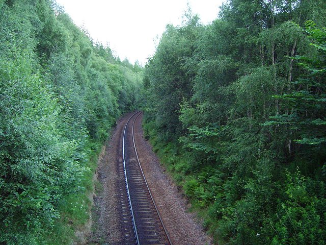
Muir of Ord railway station is a railway station on the Kyle of Lochalsh Line and the Far North Line, serving the village of Muir of Ord in the Highland...

Battle of Logiebride

The Battle of Logiebride or Logie-Riach, also known as a Tumult in Ross was more of a small skirmish rather than an actual battle. The disturbance is said...

Glen Ord Distillery

Glen Ord distillery is a whisky distillery in the Scottish Highlands and is the only remaining single malt scotch whisky distillery on the Black Isle.Glen...

Muir of Allangrange

Muir of Allangrange is a scattered crofting township, lying 3 miles northeast of Muir of Ord on the western side of the Black Isle, in Ross-shire, Scottish...

Dunglass Island

Dunglass Island is an uninhabited island in the River Conon south-west of the village of Conon Bridge in the Highlands of Scotland. At approximately 40...

Nearby Amenities

Located within 500m of 57.532505,-4.4452827
Balvaird
Place: locality
Source: OS OpenData Streetview
Lat/Long: 57.5309187/-4.4475391
Power: pole
Lat/Long: 57.5310648/-4.4393027
Power: pole
Lat/Long: 57.5323836/-4.4391192
Power: pole
Lat/Long: 57.5336293/-4.4389357
Power: pole
Lat/Long: 57.535964/-4.44229
Power: pole
Lat/Long: 57.5364844/-4.4417742
Power: pole
Lat/Long: 57.5358808/-4.443388
Power: pole
Lat/Long: 57.5361054/-4.4427637
Power: pole
Lat/Long: 57.5330064/-4.4451611
Power: pole
Lat/Long: 57.5334176/-4.4450903
Power: pole
Lat/Long: 57.5345084/-4.4450261
Power: pole
Lat/Long: 57.5347259/-4.4458429
Power: pole
Lat/Long: 57.535301/-4.4480123
Power: pole
Lat/Long: 57.5348304/-4.4483444
Power: pole
Lat/Long: 57.5357893/-4.4475342
Power: pole
Lat/Long: 57.5362397/-4.447087
Power: pole
Lat/Long: 57.5366912/-4.4466509
Power: pole
Lat/Long: 57.5311538/-4.4509808
Power: pole
Lat/Long: 57.5311561/-4.4520633
Power: pole
Lat/Long: 57.5314984/-4.4532897
Power: pole
Lat/Long: 57.5288946/-4.4476626
Power: pole
Lat/Long: 57.5291109/-4.4483532
Power: pole
Lat/Long: 57.5293331/-4.4489664
Power: pole
Lat/Long: 57.5295922/-4.4496349
Power: pole
Lat/Long: 57.5300426/-4.4504761
Power: pole
Lat/Long: 57.5305608/-4.4514125
Power: pole
Lat/Long: 57.5299535/-4.4518441
Power: pole
Lat/Long: 57.531666/-4.4506089
Power: pole
Lat/Long: 57.5321995/-4.450226
Power: pole
Lat/Long: 57.5328109/-4.4497799
Power: pole
Lat/Long: 57.5338091/-4.4490826
Power: pole
Lat/Long: 57.5343367/-4.4487129
The data included in this document is from www.openstreetmap.org. The data is made available under ODbL.

Have you been to Balvaird?

Leave your review of Balvaird below (or comments, questions and feedback).