Balmore

Settlement in Inverness-shire

Scotland

Balmore

Abriachan Gardens Abriachan Gardens with Loch Ness behind.
Abriachan Gardens Credit: Jonathan Venn

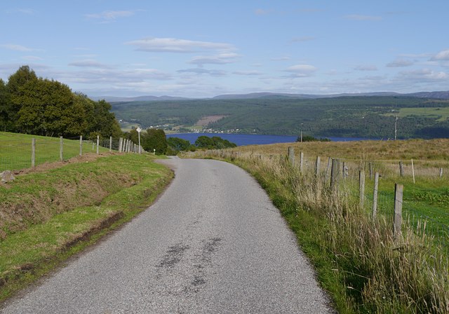
Balmore is a small village located in the county of Inverness-shire, Scotland. Situated in the highlands, it is nestled between the scenic mountains and the picturesque Loch Ness. The village is part of the larger Inverness area and is approximately 17 miles southwest of the city center.

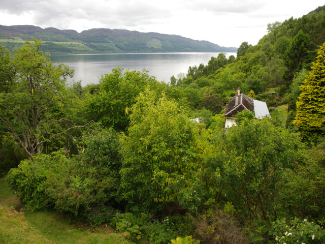
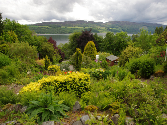
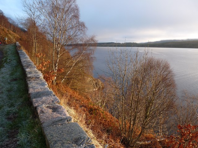
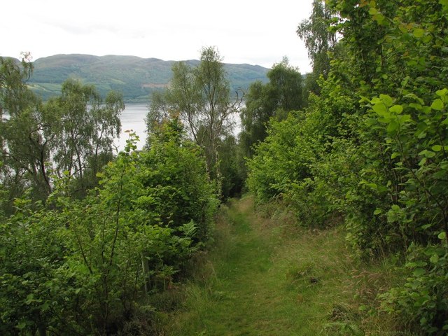
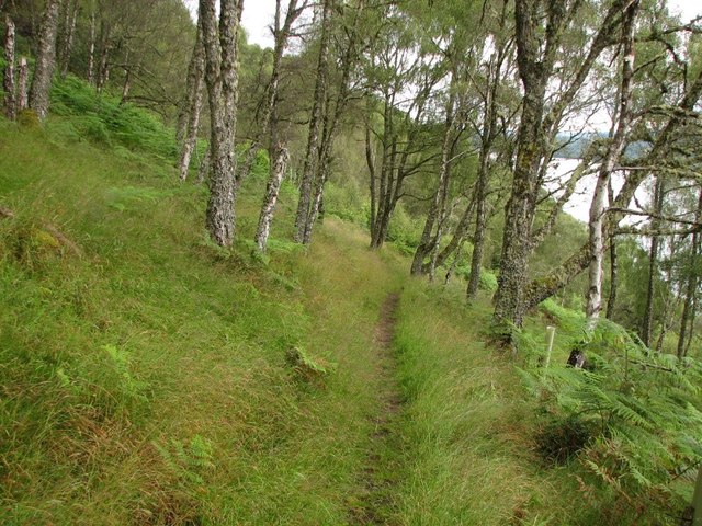
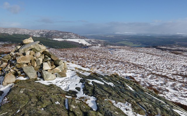
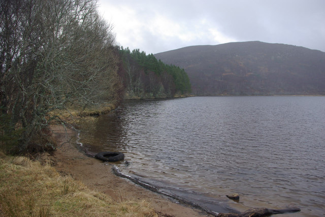
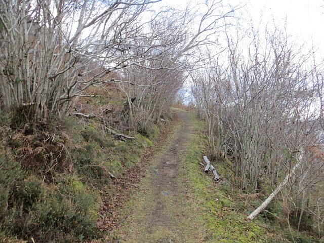
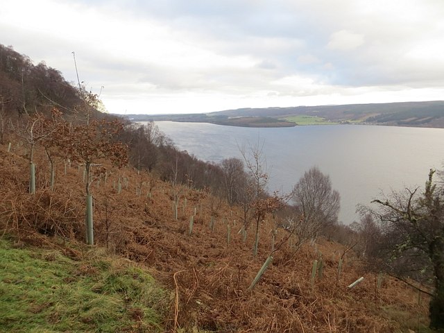
Balmore is known for its breathtaking natural beauty, with the surrounding landscape offering a haven for outdoor enthusiasts. The area is renowned for its hiking trails and opportunities for mountain biking, with stunning views of the mountains and the vast Loch Ness. Wildlife lovers can also enjoy birdwatching and spotting various animals, including deer and otters.

Despite its small size, Balmore boasts a strong sense of community, with a close-knit population that takes pride in its heritage. The village is home to a few amenities, including a local pub and a small convenience store, catering to the needs of residents and visitors alike.

The village is also in close proximity to other attractions in the Inverness-shire region, such as Urquhart Castle, a medieval fortress overlooking Loch Ness, and the Caledonian Canal, a man-made waterway connecting various lochs in the Highlands.

Overall, Balmore offers a tranquil and idyllic retreat for those seeking a peaceful escape in the heart of the Scottish highlands, coupled with easy access to the vibrant city of Inverness and its wider attractions.

If you have any feedback on the listing, please let us know in the comments section below.
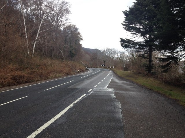
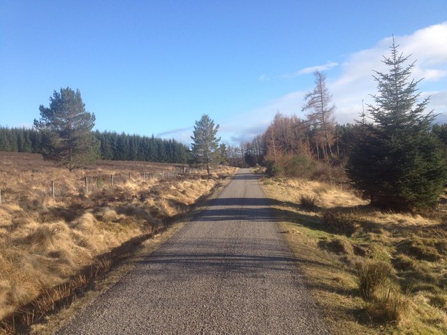
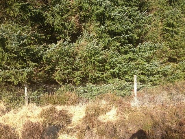
Balmore Images

Images are sourced within 2km of 57.384854/-4.391162 or Grid Reference NH5635. Thanks to Geograph Open Source API. All images are credited.

Abriachan Gardens Abriachan Gardens with Loch Ness behind.
Abriachan Gardens
Abriachan Gardens with Loch Ness behind.
Abriachan Gardens Abriachan Gardens with Loch Ness behind.
Abriachan Gardens
Abriachan Gardens with Loch Ness behind.
Looking down on Loch Ness from the A82 Leafless trees give the more open winter view and more colour too.
Looking down on Loch Ness from the A82
Leafless trees give the more open winter view and more colour too.
Roadside waterfalls near Abriachan Gardens
Coffin Road Path linking the Clansman Hotel on the shore of Loch Ness with Balchraggan.
It was once used as a 'coffin road', used to carry local people to their final resting place.
Coffin Road
Path linking the Clansman Hotel on the shore of Loch Ness with Balchraggan. It was once used as a 'coffin road', used to carry local people to their final resting place.
Woodland path Path in Abriachan Wood.
Woodland path
Path in Abriachan Wood.
Summit of Carn na Leitire The summit of this small hill is marked by a stone cairn, on top of a slab of rock.
Looking north-east across snow covered moorland, with the end of Loch Ness visible beyond.
Summit of Carn na Leitire
The summit of this small hill is marked by a stone cairn, on top of a slab of rock. Looking north-east across snow covered moorland, with the end of Loch Ness visible beyond.
Loch Laide This boathouse stands on the shore of Loch Laide close to the road.
Loch Laide
This boathouse stands on the shore of Loch Laide close to the road.
Loch Laide Looking along the shore of Loch Laide from close to the boathouse.
Loch Laide
Looking along the shore of Loch Laide from close to the boathouse.
Minor road near Abriachan
A82 near Abriachan
A82 near Abriachan
Track to Abriachan woodland walks
A82 near the Clansman Hotel
Minor road near Abriachan
Forestry boundary fence near Abriachan
Road descending from Abriachan This minor road with passing places runs through the scattered settlement of Abriachan, heading down a steep hill towards Loch Ness.
The village of Dores is visible on the opposite shore of the loch, and a wind farm on the distant hills to the right.
Road descending from Abriachan
This minor road with passing places runs through the scattered settlement of Abriachan, heading down a steep hill towards Loch Ness. The village of Dores is visible on the opposite shore of the loch, and a wind farm on the distant hills to the right.
Path, Abriachan Woods An old path up to Abriachan from the shore of Loch Ness at Brachla. It makes a good, but arduous return route to Abriachan if you have descended to the loch.
Path, Abriachan Woods
An old path up to Abriachan from the shore of Loch Ness at Brachla. It makes a good, but arduous return route to Abriachan if you have descended to the loch.
Abriachan Wood A steep and craggy slope above Loch Ness.
Abriachan Wood
A steep and craggy slope above Loch Ness.
Show me another place!

Balmore is located at Grid Ref: NH5635 (Lat: 57.384854, Lng: -4.391162)

Unitary Authority: Highland

Police Authority: Highlands and Islands

What 3 Words

///circling.constrain.initial. Near Drumnadrochit, Highland

Nearby Locations

Balmore

Related Wikis

Abriachan

Abriachan (; Gaelic: Obar Itheachan), is a village in the Highland council area of Scotland. It is situated high above the western shore of Loch Ness,...

RockNess

RockNess was an annual music festival which took place in Scotland at Clune Farm, Dores, on the banks of Loch Ness near Inverness in the Scottish Highlands...

Dores, Highland

Dores (Scottish Gaelic: Duras) is a village located on the east shore of Loch Ness, 10 km south west of the city of Inverness, in the Highland council...

Aldourie

Aldourie (Scottish Gaelic: Allt Dobharaidh meaning dark water or stream water) is an historic Estate on the east shore of Loch Ness. It lies about 7 miles...

Lochend (Loch Ness)

Lochend (Scottish Gaelic: Ceann Loch) is a settlement that lies at the start of the Caledonian Canal, at the head of Loch Ness in Inverness-shire, Scottish...

Aldourie Castle

Aldourie Castle is in Scotland, situated on Strath Dore, between the southern banks of Loch Ness and the Glen leading onto Drumashie Moor. The parkland...

Moniack Mhor

Moniack Mhor is a creative writing centre in Scotland. Based in the Scottish Highlands, Moniack Mhor is fourteen miles from Inverness. The centre is a...

Loch Dochfour

Loch Dochfour is a freshwater loch in the Scottish Highlands southwest of Inverness, part of the Great Glen. The southern end flows in through the Bona...

Nearby Amenities

Located within 500m of 57.384854,-4.391162
Power: pole
Lat/Long: 57.3807572/-4.3927432
Power: pole
Lat/Long: 57.3814125/-4.3931444
Power: pole
Lat/Long: 57.3820726/-4.3932103
Power: pole
Lat/Long: 57.3812995/-4.3919782
Power: pole
Lat/Long: 57.3811591/-4.3908613
Power: pole
Lat/Long: 57.3810154/-4.3895887
Power: pole
Lat/Long: 57.3806789/-4.3891171
Power: pole
Lat/Long: 57.3811736/-4.3887278
Power: pole
Lat/Long: 57.3813503/-4.3877128
Power: pole
Lat/Long: 57.3807128/-4.3902534
Power: pole
Lat/Long: 57.3825318/-4.3937493
Power: pole
Lat/Long: 57.3830596/-4.394423
Power: pole
Lat/Long: 57.3838868/-4.3954471
Power: pole
Lat/Long: 57.3842039/-4.3965505
Power: pole
Lat/Long: 57.3845146/-4.3976554
Power: pole
Lat/Long: 57.3847647/-4.3985372
Power: pole
Lat/Long: 57.3848132/-4.3987214
Power: pole
Lat/Long: 57.388839/-4.3884882
Power: pole
Lat/Long: 57.3882323/-4.3885471
Power: pole
Lat/Long: 57.38763/-4.3886227
Power: pole
Lat/Long: 57.3870876/-4.3886781
Power: pole
Lat/Long: 57.3844117/-4.3905778
Power: pole
Lat/Long: 57.3840214/-4.3907357
The data included in this document is from www.openstreetmap.org. The data is made available under ODbL.

Have you been to Balmore?

Leave your review of Balmore below (or comments, questions and feedback).