Balmellie Crofts

Settlement in Aberdeenshire

Scotland

Balmellie Crofts

Turriff Golf Club, 12th Hole, Railway The long twelfth hole at Turriff, looking to the green.
Turriff Golf Club, 12th Hole, Railway Credit: Scott Cormie

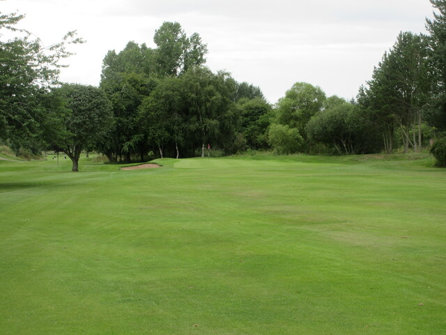
Balmellie Crofts is a picturesque rural area located in Aberdeenshire, Scotland. Nestled in the heart of the countryside, it offers a tranquil and idyllic setting for residents and visitors alike. The crofts are surrounded by rolling hills, lush green fields, and meandering streams, providing a perfect escape from the hustle and bustle of city life.

The area is renowned for its natural beauty, with stunning landscapes that attract nature enthusiasts, hikers, and photographers. Balmellie Crofts is home to a diverse range of wildlife, including deer, rabbits, and various bird species, making it a haven for animal lovers.

The crofts themselves consist of charming traditional cottages, many of which have been lovingly restored and maintained. These cottages are adorned with colorful gardens and flowerbeds, adding to the overall charm and character of the area.

Despite its rural setting, Balmellie Crofts is conveniently located close to amenities and services. The nearby town of Turriff offers a range of shops, restaurants, and schools, ensuring that residents have access to everything they need.

Visitors to Balmellie Crofts can enjoy a range of outdoor activities, such as walking, cycling, and fishing. The area boasts numerous walking trails and cycling routes, allowing visitors to explore the stunning surroundings at their own pace.

Overall, Balmellie Crofts is a hidden gem in Aberdeenshire, offering a tranquil and beautiful setting for those seeking a rural escape. With its stunning landscapes, charming cottages, and abundant wildlife, it is a must-visit destination for nature lovers and those looking to immerse themselves in the Scottish countryside.

If you have any feedback on the listing, please let us know in the comments section below.

Balmellie Crofts Images

Images are sourced within 2km of 57.537298/-2.4425685 or Grid Reference NJ7349. Thanks to Geograph Open Source API. All images are credited.

Turriff Golf Club, 12th Hole, Railway The long twelfth hole at Turriff, looking to the green.
Turriff Golf Club, 12th Hole, Railway
The long twelfth hole at Turriff, looking to the green.
Turriff Golf Club, 13th Hole, Bridge The thirteenth hole at Turriff, looking to the green.
Turriff Golf Club, 13th Hole, Bridge
The thirteenth hole at Turriff, looking to the green.
Turriff Primary School Looking south-west to Turriff Primary School on the northern outskirts of the town.
Turriff Primary School
Looking south-west to Turriff Primary School on the northern outskirts of the town.
Market Street, Turriff Looking south down Market Street in Turriff.
Market Street, Turriff
Looking south down Market Street in Turriff.
Markethill Trig Pillar The triangulation pillar hidden away on the north side of a water treatment compound at Markethill on the north-east outskirts of Turriff.
Markethill Trig Pillar
The triangulation pillar hidden away on the north side of a water treatment compound at Markethill on the north-east outskirts of Turriff.
The Turra Coo The Turra Coo (Doric for "the Turriff Cow") was a white Ayrshire-Shorthorn cross dairy cow which lived near the Aberdeenshire town of Turriff in north-east Scotland in the early twentieth century. The cow became famous following a dispute between her owner, supported by local people, against the government over taxes and compulsory national insurance.
The Turra Coo
The Turra Coo (Doric for "the Turriff Cow") was a white Ayrshire-Shorthorn cross dairy cow which lived near the Aberdeenshire town of Turriff in north-east Scotland in the early twentieth century. The cow became famous following a dispute between her owner, supported by local people, against the government over taxes and compulsory national insurance.
Forest Friends 
Art Trail 


Hare, there and everywhere!
Clan Cancer Support, the north-east’s leading cancer support charity, has partnered with Wild in Art once again to bring an exciting new art trail to the north-east, Moray, Orkney and Shetland.

The Big Hop Trail will take the public on another cultural tour of the north-east and the islands from July to September 2023, with hare sculptures designed and created by some of the country’s most talented artists.

The trail coincides with Clan’s 40th anniversary, with the 40 hares being the focal point to celebrate the charity’s commitment to supporting people affected by cancer. 

We chose the hare sculpture as they are an indigenous animal found in all parts of Clan’s geography. Much like our clients during their cancer journey, hares have to navigate rough and difficult terrain in order to survive. They are also adaptable, like our services team who deliver support to anyone affected by cancer. Most importantly, hares have incredible hearing. What better way to depict our lifeline listening and support service and the importance of being heard?
Forest Friends
Art Trail Hare, there and everywhere! Clan Cancer Support, the north-east’s leading cancer support charity, has partnered with Wild in Art once again to bring an exciting new art trail to the north-east, Moray, Orkney and Shetland. The Big Hop Trail will take the public on another cultural tour of the north-east and the islands from July to September 2023, with hare sculptures designed and created by some of the country’s most talented artists. The trail coincides with Clan’s 40th anniversary, with the 40 hares being the focal point to celebrate the charity’s commitment to supporting people affected by cancer. We chose the hare sculpture as they are an indigenous animal found in all parts of Clan’s geography. Much like our clients during their cancer journey, hares have to navigate rough and difficult terrain in order to survive. They are also adaptable, like our services team who deliver support to anyone affected by cancer. Most importantly, hares have incredible hearing. What better way to depict our lifeline listening and support service and the importance of being heard?
Turra Display A display by the White Helmets team during the annual Turriff Show at the Haughs.
Turra Display
A display by the White Helmets team during the annual Turriff Show at the Haughs.
Sulkies at Turriff Sulky racing in the showground at the Haughs during Turriff's annual show.
Sulkies at Turriff
Sulky racing in the showground at the Haughs during Turriff's annual show.
Steam Up The more commercial side of Turriff Show.
Steam Up
The more commercial side of Turriff Show.
St Andrew's Church Hall The church hall on Ballmellie Road was used as an auxiliary hospital during the Great War.
St Andrew's Church Hall
The church hall on Ballmellie Road was used as an auxiliary hospital during the Great War.
Mercat cross, Turriff Dating from 1865 in a prominent location at the end of the High Street and replacing the medieval original.  Listed building designation LB42167: <span class="nowrap"><a title="http://portal.historicenvironment.scot/designation/LB42167" rel="nofollow ugc noopener" href="http://portal.historicenvironment.scot/designation/LB42167">Link</a><img style="margin-left:2px;" alt="External link" title="External link - shift click to open in new window" src="https://s1.geograph.org.uk/img/external.png" width="10" height="10"/></span> .
Mercat cross, Turriff
Dating from 1865 in a prominent location at the end of the High Street and replacing the medieval original. Listed building designation LB42167: LinkExternal link .
Putachie Path, Turriff The unusually-named street plunges sharply down past the early 19th Century C-listed cottages: <span class="nowrap"><a title="http://portal.historicenvironment.scot/designation/LB42165" rel="nofollow ugc noopener" href="http://portal.historicenvironment.scot/designation/LB42165">Link</a><img style="margin-left:2px;" alt="External link" title="External link - shift click to open in new window" src="https://s1.geograph.org.uk/img/external.png" width="10" height="10"/></span> (listed building designation LB42165).
Putachie Path, Turriff
The unusually-named street plunges sharply down past the early 19th Century C-listed cottages: LinkExternal link (listed building designation LB42165).
St Congan's auld kirk, Turriff Originating in perhaps the 12th or 13th Century, the building was last used for worship in 1795 and consists of east gable-end and north and south walls.  The double bellcote from 1635 is 'the finest of its type in Scotland' (Buildings of Scotland guide) and the clock was installed in 1828.  A-listed (LB42163): <span class="nowrap"><a title="http://portal.historicenvironment.scot/designation/LB42163" rel="nofollow ugc noopener" href="http://portal.historicenvironment.scot/designation/LB42163">Link</a><img style="margin-left:2px;" alt="External link" title="External link - shift click to open in new window" src="https://s1.geograph.org.uk/img/external.png" width="10" height="10"/></span> .
St Congan's auld kirk, Turriff
Originating in perhaps the 12th or 13th Century, the building was last used for worship in 1795 and consists of east gable-end and north and south walls. The double bellcote from 1635 is 'the finest of its type in Scotland' (Buildings of Scotland guide) and the clock was installed in 1828. A-listed (LB42163): LinkExternal link .
Enigmatic sculpture Carved panel in the east end of St Congan's kirk and said to come from St Congan's Hospital (almshouse).  The centre head could be King Alexander III (<span class="nowrap"><a title="https://en.wikipedia.org/wiki/Alexander_III_of_Scotland" rel="nofollow ugc noopener" href="https://en.wikipedia.org/wiki/Alexander_III_of_Scotland">Link</a><img style="margin-left:2px;" alt="External link" title="External link - shift click to open in new window" src="https://s1.geograph.org.uk/img/external.png" width="10" height="10"/></span> ) (Buildings of Scotland guide) or Robert the Bruce (Jervise: Aberdeenshire epitaphs), who might have witnessed the foundation of the hospital in the late 13th Century.
Enigmatic sculpture
Carved panel in the east end of St Congan's kirk and said to come from St Congan's Hospital (almshouse). The centre head could be King Alexander III (LinkExternal link ) (Buildings of Scotland guide) or Robert the Bruce (Jervise: Aberdeenshire epitaphs), who might have witnessed the foundation of the hospital in the late 13th Century.
Barclay of Towie monument, St Congan's kirk, Turriff Dated 1636, located on the north wall of the ruined kirk and exposed to the elements.  According to Jervise (Epitaphs and Inscriptions of the Northeast of Scotland, vol. 2, p. 221, publ. 1879), the arms are those of Barclay impaling Drummond but they are now almost worn away.  The splendid inscription reads:  Here lies Barclay, the glory of the Towie family, to which five centuries have given old renown. Calculus cut him off in his prime, after thrice three lustra (i.e.: 45 years), nor were the resources of the healing art of any avail. The earth covers his bones; his spirit, which was of celestial origin, is the tenant of a mansion beyond the skies.
Barclay of Towie monument, St Congan's kirk, Turriff
Dated 1636, located on the north wall of the ruined kirk and exposed to the elements. According to Jervise (Epitaphs and Inscriptions of the Northeast of Scotland, vol. 2, p. 221, publ. 1879), the arms are those of Barclay impaling Drummond but they are now almost worn away. The splendid inscription reads: Here lies Barclay, the glory of the Towie family, to which five centuries have given old renown. Calculus cut him off in his prime, after thrice three lustra (i.e.: 45 years), nor were the resources of the healing art of any avail. The earth covers his bones; his spirit, which was of celestial origin, is the tenant of a mansion beyond the skies.
Skein monument, St Congan's kirk, Turriff Monument to Andrew Skein, minister of the kirk from 1661-1678. The sandstone edifice is severely eroded, but 150 years' ago or so, the inscription was recorded and translated by Jervise as: Mr Andrew Skein, a man distinguished for his candour, very mighty in word and deed, the glory of the pulpit of Turriff, laid down in hope the remains of mortality, besides which he had nothing mortal, in April, 1678. This monument, such as it is, his most tender spouse, Joanna Coutts, caused to be erected as a pledge of her lasting affection.  The Coutts arms are now illegible but the Skein (or Skene) arms are just legible: gules three skenes, or daggers, paleways in fess argent hiltcd and pommelled or, on the point of each a wolf's head couped of the third.
Skein monument, St Congan's kirk, Turriff
Monument to Andrew Skein, minister of the kirk from 1661-1678. The sandstone edifice is severely eroded, but 150 years' ago or so, the inscription was recorded and translated by Jervise as: Mr Andrew Skein, a man distinguished for his candour, very mighty in word and deed, the glory of the pulpit of Turriff, laid down in hope the remains of mortality, besides which he had nothing mortal, in April, 1678. This monument, such as it is, his most tender spouse, Joanna Coutts, caused to be erected as a pledge of her lasting affection. The Coutts arms are now illegible but the Skein (or Skene) arms are just legible: gules three skenes, or daggers, paleways in fess argent hiltcd and pommelled or, on the point of each a wolf's head couped of the third.
Irvine monument, St Congan's kirk, Turriff On the south wall of the ruined nave.  Note the fine memento mori.
Irvine monument, St Congan's kirk, Turriff
On the south wall of the ruined nave. Note the fine memento mori.
Show me another place!

Balmellie Crofts is located at Grid Ref: NJ7349 (Lat: 57.537298, Lng: -2.4425685)

Unitary Authority: Aberdeenshire

Police Authority: North East

What 3 Words

///gestures.respects.shoulders. Near Turriff, Aberdeenshire

Nearby Locations

Balmellie Crofts

Related Wikis

Turriff Cottage Hospital

Turriff Cottage Hospital is a community hospital in Turriff, Aberdeenshire, Scotland. It is managed by NHS Grampian. == History == The hospital was designed...

Turriff Academy

Turriff Academy is a non denominational comprehensive co-educational secondary school located in Turriff, Aberdeenshire, Scotland. It serves a large catchment...

Turriff

Turriff (from Scottish Gaelic Torraibh 'place of round hills') is a town and civil parish in Aberdeenshire in Scotland. It lies on the River Deveron,...

Turriff railway station

Turriff railway station was a railway station in Turriff, Aberdeenshire, Scotland. It was opened in 1857 by the Banff Macduff & Turriff Junction Railway...

Turriff Castle

Turriff Castle was a tower house, on Castlegate, Turriff, north of Idoch Water, Aberdeenshire, Scotland. The castle was also called Tower of Torrey of...

Turriff United F.C.

Turriff United Football Club are a senior football club currently playing in the Highland Football League in Scotland. They play their matches at The Haughs...

Delgatie Castle

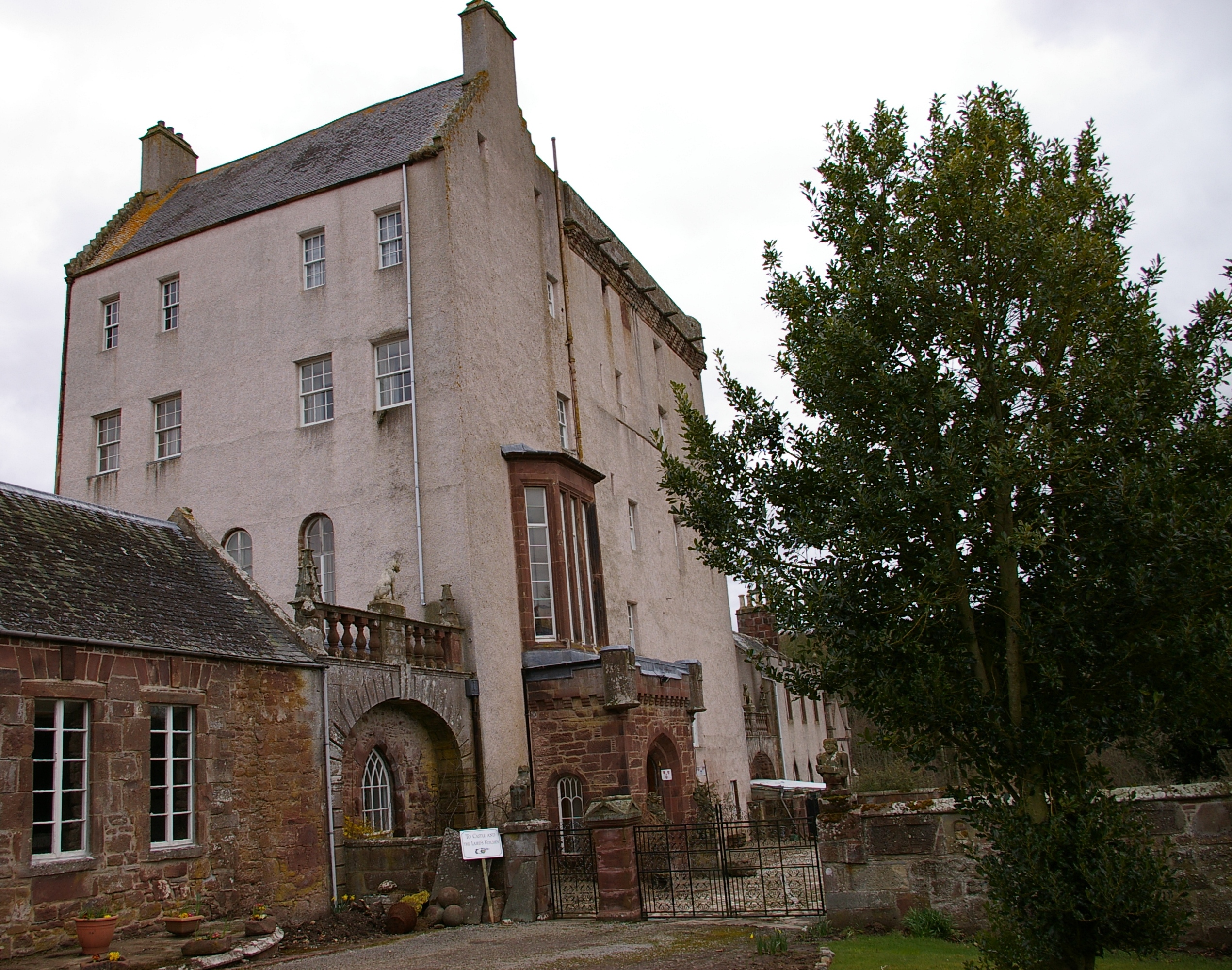
Delgatie Castle is a castle near Turriff, in Aberdeenshire, Scotland. A castle has stood on the site of Delgatie Castle since the year 1030 AD, although...

Idoch Castle

Idoch Castle was a 14th-century castle about 3 miles (4.8 km) east of Turriff, Aberdeenshire Scotland, near Idoch Water, a tributary of the River Deveron...

Nearby Amenities

Located within 500m of 57.537298,-2.4425685
Noexit: yes
Lat/Long: 57.5380182/-2.4441951
Noexit: yes
Lat/Long: 57.538291/-2.4440034
Noexit: yes
Lat/Long: 57.5376086/-2.4451487
Noexit: yes
Lat/Long: 57.537528/-2.4447423
Noexit: yes
Lat/Long: 57.5374467/-2.4443333
Noexit: yes
Lat/Long: 57.5374201/-2.4439605
Cemetery: grave
Lat/Long: 57.5352057/-2.4490748
Cemetery: grave
Lat/Long: 57.5351028/-2.4489467
Cemetery: grave
Lat/Long: 57.5353879/-2.4480408
Cemetery: grave
Lat/Long: 57.5353868/-2.4480528
Cemetery: grave
Lat/Long: 57.5353785/-2.4480609
Cemetery: grave
Lat/Long: 57.5353814/-2.448087
Cemetery: grave
Lat/Long: 57.5353774/-2.4481112
Cemetery: grave
Lat/Long: 57.5357014/-2.4478409
Cemetery: grave
Lat/Long: 57.5356971/-2.4478269
Cemetery: grave
Lat/Long: 57.5356945/-2.4478054
Cemetery: grave
Lat/Long: 57.5356902/-2.4477772
Cemetery: grave
Lat/Long: 57.5356902/-2.4477558
Cemetery: grave
Lat/Long: 57.5356902/-2.447733
Cemetery: grave
Lat/Long: 57.5356873/-2.4476894
Cemetery: grave
Lat/Long: 57.5356783/-2.4476472
Cemetery: grave
Lat/Long: 57.5356783/-2.4476042
Cemetery: grave
Lat/Long: 57.5356744/-2.4475754
Cemetery: grave
Lat/Long: 57.5356729/-2.4475553
Cemetery: grave
Lat/Long: 57.5356675/-2.4475358
Cemetery: grave
Lat/Long: 57.5356668/-2.4475191
Cemetery: grave
Lat/Long: 57.535606/-2.4475358
Cemetery: grave
Lat/Long: 57.5356078/-2.4475674
Cemetery: grave
Lat/Long: 57.5356118/-2.4475881
Cemetery: grave
Lat/Long: 57.5356179/-2.4476505
Cemetery: grave
Lat/Long: 57.5356189/-2.4476586
Cemetery: grave
Lat/Long: 57.5356222/-2.4476746
Cemetery: grave
Lat/Long: 57.5356229/-2.4476934
Cemetery: grave
Lat/Long: 57.5356251/-2.4477243
Cemetery: grave
Lat/Long: 57.5356247/-2.4477384
Cemetery: grave
Lat/Long: 57.5356283/-2.4477611
Cemetery: grave
Lat/Long: 57.5356326/-2.4478007
Cemetery: grave
Lat/Long: 57.5356369/-2.4480428
Cemetery: grave
Lat/Long: 57.5356362/-2.4481004
Cemetery: grave
Lat/Long: 57.5356564/-2.4480978
Cemetery: grave
Lat/Long: 57.5356539/-2.4480555
Cemetery: grave
Lat/Long: 57.5356495/-2.448026
Cemetery: grave
Lat/Long: 57.5356492/-2.4480025
Cemetery: grave
Lat/Long: 57.5356485/-2.4479791
Cemetery: grave
Lat/Long: 57.5356413/-2.4479509
Cemetery: grave
Lat/Long: 57.5356413/-2.4479281
Cemetery: grave
Lat/Long: 57.5356391/-2.4479093
Cemetery: grave
Lat/Long: 57.5356377/-2.4478651
Cemetery: grave
Lat/Long: 57.5355632/-2.4478074
Cemetery: grave
Lat/Long: 57.5355408/-2.4478725
Cemetery: grave
Lat/Long: 57.5355315/-2.4479013
Cemetery: grave
Lat/Long: 57.5355228/-2.4479469
Cemetery: grave
Lat/Long: 57.5355171/-2.447971
Cemetery: grave
Lat/Long: 57.535489/-2.4481353
Cemetery: grave
Lat/Long: 57.5354915/-2.4481112
Cemetery: grave
Lat/Long: 57.5354948/-2.4480723
Cemetery: grave
Lat/Long: 57.5355013/-2.4480441
Cemetery: grave
Lat/Long: 57.5355495/-2.4481367
Cemetery: grave
Lat/Long: 57.5355542/-2.4481065
Cemetery: grave
Lat/Long: 57.5355646/-2.4480642
Cemetery: grave
Lat/Long: 57.5355689/-2.4480435
Cemetery: grave
Lat/Long: 57.5355696/-2.4480207
Cemetery: grave
Lat/Long: 57.5355876/-2.4479704
Cemetery: grave
Lat/Long: 57.5355941/-2.4479509
Cemetery: grave
Lat/Long: 57.5355999/-2.4479355
Cemetery: grave
Lat/Long: 57.5355135/-2.4477595
Cemetery: grave
Lat/Long: 57.5354977/-2.4477984
Cemetery: grave
Lat/Long: 57.5354905/-2.4478131
Cemetery: grave
Lat/Long: 57.5354852/-2.4478292
Cemetery: grave
Lat/Long: 57.5354798/-2.4478446
Cemetery: grave
Lat/Long: 57.5354752/-2.4478597
Cemetery: grave
Lat/Long: 57.5354674/-2.447902
Cemetery: grave
Lat/Long: 57.5354581/-2.4479543
Cemetery: grave
Lat/Long: 57.5354491/-2.4479885
Cemetery: grave
Lat/Long: 57.5354469/-2.4480126
Cemetery: grave
Lat/Long: 57.5354465/-2.44803
Cemetery: grave
Lat/Long: 57.535439/-2.4480549
Cemetery: grave
Lat/Long: 57.5354383/-2.4480911
Cemetery: grave
Lat/Long: 57.5354361/-2.4481078
Cemetery: grave
Lat/Long: 57.5354307/-2.4481346
Cemetery: grave
Lat/Long: 57.5354282/-2.4481528
Cemetery: grave
Lat/Long: 57.5354314/-2.4481729
Cemetery: grave
Lat/Long: 57.5353828/-2.4494308
Cemetery: grave
Lat/Long: 57.5353828/-2.4494147
Cemetery: grave
Lat/Long: 57.53538/-2.449396
Cemetery: grave
Lat/Long: 57.5353774/-2.4493644
Cemetery: grave
Lat/Long: 57.5353699/-2.4492853
Cemetery: grave
Lat/Long: 57.5353648/-2.4492297
Cemetery: grave
Lat/Long: 57.5353627/-2.4492136
Cemetery: grave
Lat/Long: 57.5353627/-2.4491914
Cemetery: grave
Lat/Long: 57.5353612/-2.449176
Cemetery: grave
Lat/Long: 57.5353612/-2.4491398
Cemetery: grave
Lat/Long: 57.5353544/-2.4490721
Cemetery: grave
Lat/Long: 57.5354213/-2.4490587
Cemetery: grave
Lat/Long: 57.5354177/-2.4490225
Cemetery: grave
Lat/Long: 57.5354159/-2.4489956
Cemetery: grave
Lat/Long: 57.5354127/-2.4489614
Cemetery: grave
Lat/Long: 57.5354116/-2.4489219
Cemetery: grave
Lat/Long: 57.5354037/-2.4488769
Cemetery: grave
Lat/Long: 57.5353951/-2.4487777
Cemetery: grave
Lat/Long: 57.5353951/-2.4487274
Cemetery: grave
Lat/Long: 57.5353846/-2.4486838
Cemetery: grave
Lat/Long: 57.535385/-2.4486087
Cemetery: grave
Lat/Long: 57.535358/-2.4482949
Cemetery: grave
Lat/Long: 57.535367/-2.448368
Cemetery: grave
Lat/Long: 57.5353677/-2.4483874
Cemetery: grave
Lat/Long: 57.5353677/-2.4484029
Cemetery: grave
Lat/Long: 57.5353681/-2.4484203
Cemetery: grave
Lat/Long: 57.5353695/-2.4484364
Cemetery: grave
Lat/Long: 57.5353764/-2.448488
Cemetery: grave
Lat/Long: 57.5353771/-2.4485108
Cemetery: grave
Lat/Long: 57.53538/-2.4485571
Cemetery: grave
Lat/Long: 57.5353191/-2.4486195
Cemetery: grave
Lat/Long: 57.5353213/-2.4486604
Cemetery: grave
Lat/Long: 57.5353018/-2.4484102
Cemetery: grave
Lat/Long: 57.5353054/-2.4484894
Cemetery: grave
Lat/Long: 57.5353072/-2.4485142
Cemetery: grave
Lat/Long: 57.5353119/-2.4485417
Cemetery: grave
Lat/Long: 57.5353134/-2.4485658
Cemetery: grave
Lat/Long: 57.5353155/-2.4485846
Cemetery: grave
Lat/Long: 57.5353036/-2.4489205
Cemetery: grave
Lat/Long: 57.5353465/-2.4489997
Cemetery: grave
Lat/Long: 57.5353425/-2.4489648
Cemetery: grave
Lat/Long: 57.5353404/-2.4489266
Cemetery: grave
Lat/Long: 57.53534/-2.4489105
Cemetery: grave
Lat/Long: 57.5353368/-2.4488796
Cemetery: grave
Lat/Long: 57.5353234/-2.4487046
Cemetery: grave
Lat/Long: 57.5353267/-2.4487428
Cemetery: grave
Lat/Long: 57.535327/-2.4487811
Cemetery: grave
Lat/Long: 57.5352957/-2.4487891
Cemetery: grave
Lat/Long: 57.5353764/-2.4481675
Cemetery: grave
Lat/Long: 57.5356809/-2.4483526
Cemetery: grave
Lat/Long: 57.5356981/-2.4485128
Cemetery: grave
Lat/Long: 57.5357017/-2.448549
Cemetery: grave
Lat/Long: 57.5357035/-2.4485806
Cemetery: grave
Lat/Long: 57.5357075/-2.4486101
Cemetery: grave
Lat/Long: 57.5357151/-2.4486932
Cemetery: grave
Lat/Long: 57.5358004/-2.4488642
Cemetery: grave
Lat/Long: 57.5362744/-2.4488401
Cemetery: grave
Lat/Long: 57.5362729/-2.4488655
Cemetery: grave
Lat/Long: 57.5362719/-2.4488837
Cemetery: grave
Lat/Long: 57.5362755/-2.4489024
Cemetery: grave
Lat/Long: 57.5362848/-2.4489903
Cemetery: grave
Lat/Long: 57.5362863/-2.4490104
Cemetery: grave
Lat/Long: 57.5362927/-2.4490265
Cemetery: grave
Lat/Long: 57.5362888/-2.4490493
Cemetery: grave
Lat/Long: 57.5362895/-2.4490681
Cemetery: grave
Lat/Long: 57.536292/-2.4490848
Cemetery: grave
Lat/Long: 57.5362945/-2.4491076
Cemetery: grave
Lat/Long: 57.5362949/-2.4491277
Cemetery: grave
Lat/Long: 57.5362978/-2.4491499
Cemetery: grave
Lat/Long: 57.5363014/-2.44917
Cemetery: grave
Lat/Long: 57.536305/-2.4491894
Cemetery: grave
Lat/Long: 57.5363122/-2.4492236
Cemetery: grave
Lat/Long: 57.5363154/-2.4492491
Noexit: yes
Lat/Long: 57.5378481/-2.4444948
Power: pole
Lat/Long: 57.5378119/-2.4349386
Power: pole
Lat/Long: 57.5378706/-2.436181
Power: pole
Lat/Long: 57.5379151/-2.4371482
Power: pole
Lat/Long: 57.5379792/-2.4381053
Power: pole
Lat/Long: 57.5380737/-2.4391879
Power: pole
Lat/Long: 57.5381149/-2.4398435
Power: pole
Lat/Long: 57.5381627/-2.4406064
Power: pole
Lat/Long: 57.5382225/-2.4414684
Power: pole
Lat/Long: 57.5384896/-2.4424558
Power: pole
Lat/Long: 57.5387557/-2.4434676
Power: pole
Lat/Long: 57.539024/-2.4444773
Power: pole
Lat/Long: 57.5392846/-2.4454789
Power: pole
Lat/Long: 57.5395029/-2.4463126
Power: pole
Lat/Long: 57.5333658/-2.4428797
Power: pole
Lat/Long: 57.5340479/-2.4426835
Power: pole
Lat/Long: 57.5346844/-2.4424973
Power: pole
Lat/Long: 57.5349255/-2.4424265
Power: pole
Lat/Long: 57.5350798/-2.4423779
Power: pole
Lat/Long: 57.5332322/-2.4413358
Power: pole
Lat/Long: 57.5331018/-2.4398304
Power: pole
Lat/Long: 57.5354795/-2.4375762
Power: pole
Lat/Long: 57.5355055/-2.4367567
Power: pole
Lat/Long: 57.5355436/-2.4355244
The data included in this document is from www.openstreetmap.org. The data is made available under ODbL.

Have you been to Balmellie Crofts?

Leave your review of Balmellie Crofts below (or comments, questions and feedback).