Balhall

Settlement in Angus

Scotland

Balhall

Disused church, Kirkton of Menmuir The building is still shown as a church on the OS map, but it is no longer used for services and has become a store. The reason for stopping here was to find a Pictish cross slab, which was unsuccessful. I suspect it was at the west end of the building amongst scaffolding and builders material. An odd looking sculptured stone was found in the churchyard however.
Disused church, Kirkton of Menmuir Credit: Gordon Hatton

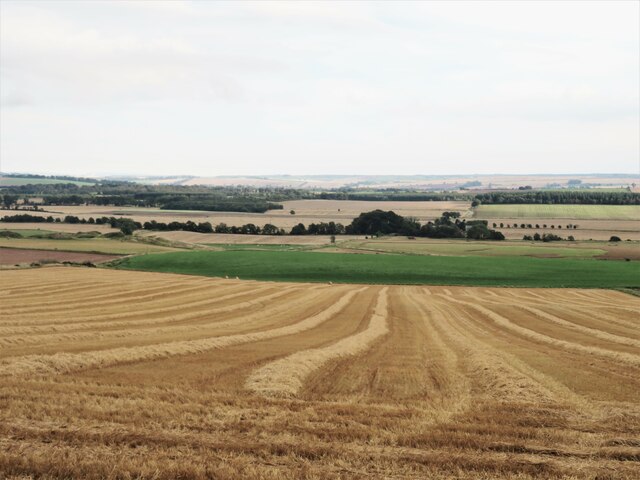
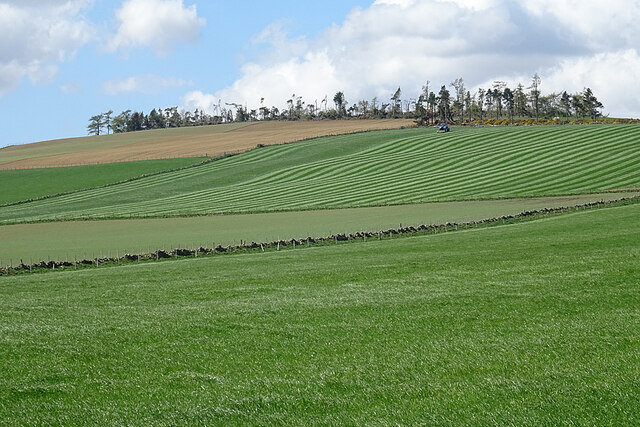
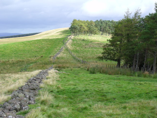
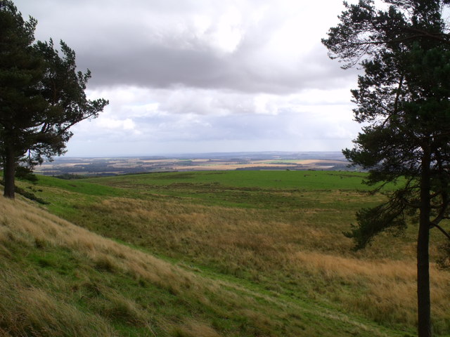
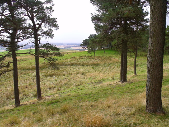
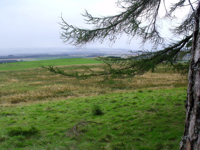
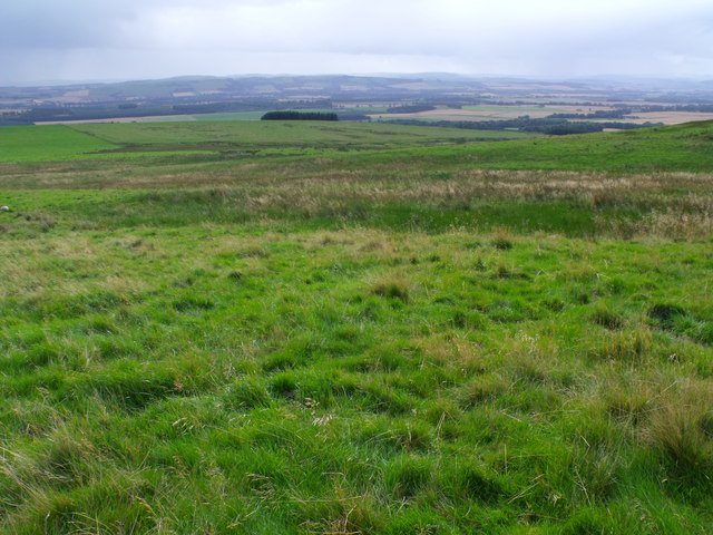
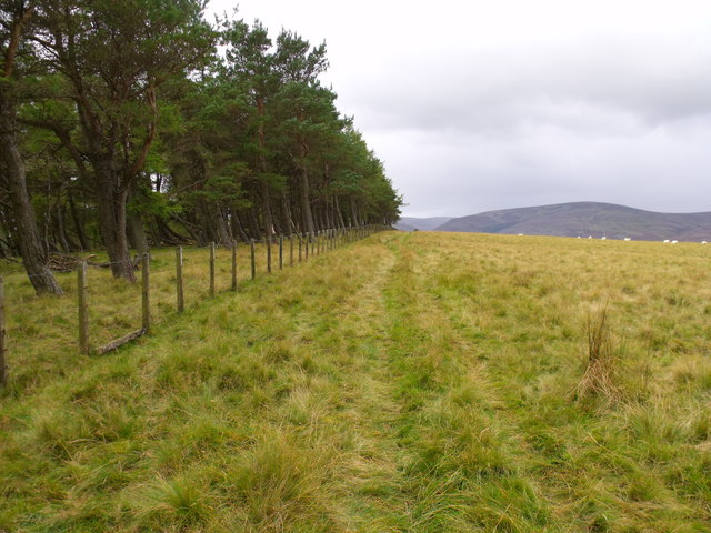
Balhall is a small village located in the Angus region of Scotland. Situated about 8 miles northwest of Forfar, it lies in a rural setting amidst the picturesque landscapes of the Scottish countryside. The village is surrounded by rolling hills and farmland, offering stunning views of the Angus Glens and nearby Grampian Mountains.

With a population of around 200 residents, Balhall is a close-knit community that prides itself on its friendly atmosphere and strong community spirit. The village is known for its traditional stone-built houses, which add to its charm and character. The local economy is mainly centered around agriculture, with many residents involved in farming or related industries.

Despite its small size, Balhall offers a range of amenities to its residents. These include a primary school, a village hall, and a local pub where residents can gather and socialize. The village is also well-connected to neighboring towns and cities, with good road links and public transportation options.

Nature enthusiasts and outdoor lovers will find plenty to explore in the surrounding area. Balhall is close to several nature reserves and walking trails, providing opportunities for hiking, cycling, and wildlife spotting. Additionally, the nearby Angus Glens offer a wealth of outdoor activities such as fishing, shooting, and hillwalking.

In summary, Balhall is a peaceful and picturesque village in Angus, Scotland. Its beautiful rural setting, strong community spirit, and proximity to natural attractions make it an appealing place to live or visit for those seeking a tranquil countryside experience.

If you have any feedback on the listing, please let us know in the comments section below.

Balhall Images

Images are sourced within 2km of 56.763043/-2.793984 or Grid Reference NO5163. Thanks to Geograph Open Source API. All images are credited.

Disused church, Kirkton of Menmuir The building is still shown as a church on the OS map, but it is no longer used for services and has become a store. The reason for stopping here was to find a Pictish cross slab, which was unsuccessful. I suspect it was at the west end of the building amongst scaffolding and builders material. An odd looking sculptured stone was found in the churchyard however.
Disused church, Kirkton of Menmuir
The building is still shown as a church on the OS map, but it is no longer used for services and has become a store. The reason for stopping here was to find a Pictish cross slab, which was unsuccessful. I suspect it was at the west end of the building amongst scaffolding and builders material. An odd looking sculptured stone was found in the churchyard however.
Sculptured stone in Kirkton of Menmuir churchyard I may have not found the Pictish cross slab, but I did find this curious carved stone in the churchyard. An internet search would suggest that this is a Pictish stone that was found when a wall was demolished in 1844, but it appears to have been erected sideways.
Sculptured stone in Kirkton of Menmuir churchyard
I may have not found the Pictish cross slab, but I did find this curious carved stone in the churchyard. An internet search would suggest that this is a Pictish stone that was found when a wall was demolished in 1844, but it appears to have been erected sideways.
Arable land near Bogton of Balhall Looking south from the minor road across arable land at the edge of the wide and fertile Strathmore.
Arable land near Bogton of Balhall
Looking south from the minor road across arable land at the edge of the wide and fertile Strathmore.
Menmuir Parish Kirkyard Some of the gravestones in Menmuir Kirkyard are elaborately carved and remarkably well preserved. The nearest grave is that of the family of David Lighton and Ann Skair, who died in 1753 and 1774 respectively.
Menmuir Parish Kirkyard
Some of the gravestones in Menmuir Kirkyard are elaborately carved and remarkably well preserved. The nearest grave is that of the family of David Lighton and Ann Skair, who died in 1753 and 1774 respectively.
Bizarre Topiary This yew has been clipped into a very curious shape, for all the world like a still for producing whisky!
Bizarre Topiary
This yew has been clipped into a very curious shape, for all the world like a still for producing whisky!
Katherine Fairweather's Gravestone This stone, commemorating a death in 1702, is singled out for individual mention in the Listed Building description of the kirkyard at Menmuir.
Katherine Fairweather's Gravestone
This stone, commemorating a death in 1702, is singled out for individual mention in the Listed Building description of the kirkyard at Menmuir.
Barns at Balfour Large relatively modern buildings at Balfour Farm. It must have changed out of all recognition since my 6th-great-grandparents farmed here 300 years ago.
Barns at Balfour
Large relatively modern buildings at Balfour Farm. It must have changed out of all recognition since my 6th-great-grandparents farmed here 300 years ago.
Christmas Tree Nursery I'm fairly sure that these are Norway Spruce being grown as Christmas trees, though it may be a year or two before they are ready to cut.
Christmas Tree Nursery
I'm fairly sure that these are Norway Spruce being grown as Christmas trees, though it may be a year or two before they are ready to cut.
Balfour Farm The sign stands out against the dark background of a corrugated iron store, presumably for grain.
Balfour Farm
The sign stands out against the dark background of a corrugated iron store, presumably for grain.
Balfour Farm There's obviously work in progress in the farm yard beside the road at Balfour. Beyond it is a glimpse of the farm house, which is a replacement, almost certainly built in the late 19th century, for the house my 6th-great-grandparents occupied here 300 years ago.
Balfour Farm
There's obviously work in progress in the farm yard beside the road at Balfour. Beyond it is a glimpse of the farm house, which is a replacement, almost certainly built in the late 19th century, for the house my 6th-great-grandparents occupied here 300 years ago.
Menmuir Hall A community facility for the people of Menmuir.
Menmuir Hall
A community facility for the people of Menmuir.
Making Stripes A tractor rolling a field of grass creates a set of regular stripes on the brae above Knowehead.
Making Stripes
A tractor rolling a field of grass creates a set of regular stripes on the brae above Knowehead.
Tullo Hill from Shandford Hill near Brechin
View to the east from slopes of Tullo Hill near Brechin
Little woodland bay on Tullo Hill near Brechin
Rough pasture and reedy hollow south of Tullo Hill near Brechin
Rough pasture south of Tullo Hill near Brechin
Summit of Tullo Hill near Brechin
Show me another place!

Balhall is located at Grid Ref: NO5163 (Lat: 56.763043, Lng: -2.793984)

Unitary Authority: Angus

Police Authority: Tayside

What 3 Words

///dividing.shares.adjuster. Near Brechin, Angus

Nearby Locations

Balhall

Related Wikis

Menmuir

Menmuir is a parish in the county of Angus in Scotland. Kirkton of Menmuir consists of only three houses (the Old Schoolhouse, the Manse, the Old Inn)...

Careston railway station

Careston railway station served the hamlet of Careston, Angus, Scotland, from 1895 to 1964 on the Forfar and Brechin Railway. == History == The station...
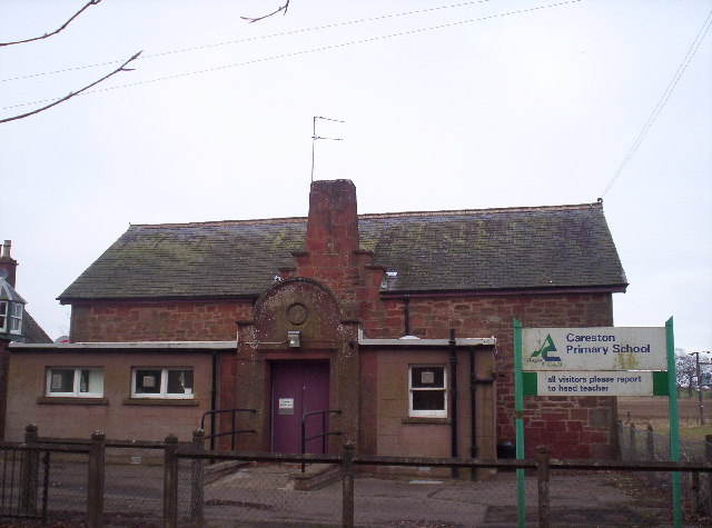
Careston

Careston is a hamlet in Angus, Scotland that is in the parish of the same name, 5 miles west of Brechin. The parish and hamlet supposedly took their name...

Caterthun

Caterthun, or the Caterthuns, is a ridge of hills near the city of Brechin in Angus, Scotland. The Caterthuns are notable for being the site of two Iron...

Careston Castle

Careston Castle, also known as Caraldston Castle, is an L-plan tower house dating from the 16th century, on a 1,528-acre estate, in Careston parish, Angus...

Auchnacree

Auchnacree is an estate in Angus, Scotland, five miles north of Forfar.In 1921 the estate overseer, Mr Frank Rae, discovered what is now called the Auchnacree...

Noranside

Noranside is a hamlet in Angus, Scotland, located at 56° 44' 0" North, 2° 52' 0" West,. The prison HMP Noranside was operated there from 1966 to 2011....

Tannadice railway station

Tannadice railway station served the village of Tannadice, Angus, Scotland, from 1895 to 1952 on the Forfar and Brechin Railway. == History == The station...

Nearby Amenities

Located within 500m of 56.763043,-2.793984
Bus Stop
Balhall Crescent
Naptan AtcoCode: 6490IM1076
Naptan Bearing: NE
Naptan BusStopType: CUS
Naptan CommonName: Balhall Crescent
Naptan Indicator: towards Menmuir
Naptan Landmark: Balhall Crescent
Naptan NaptanCode: 26423646
Naptan Verified: no
Source: naptan_import
Lat/Long: 56.7632511/-2.7929312
Bus Stop
Balhall Crescent
Naptan AtcoCode: 6490IM1111
Naptan Bearing: W
Naptan BusStopType: CUS
Naptan CommonName: Balhall Crescent
Naptan Indicator: towards Fern
Naptan Landmark: Balhall Crescent
Naptan NaptanCode: 26426529
Naptan Street: Unclassified Road
Naptan Verified: no
Source: naptan_import
Lat/Long: 56.7631541/-2.7929875
Balhall Lodge
Place: isolated_dwelling
Lat/Long: 56.7668209/-2.798128
Balhall
Place: village
Lat/Long: 56.7634111/-2.7917651
Booth: K6
Removed Amenity: telephone
Lat/Long: 56.7630678/-2.793941
Grit Bin
Lat/Long: 56.7632482/-2.7929741
Mains of Balhall
Place: hamlet
Lat/Long: 56.7601869/-2.792328
Site of former well
Natural: spring
Lat/Long: 56.7641567/-2.7907491
Site of former well
Natural: spring
Lat/Long: 56.767052/-2.7960852
Power: pole
Lat/Long: 56.7628256/-2.7861749
Power: pole
Lat/Long: 56.7627701/-2.7874121
Power: pole
Lat/Long: 56.7627171/-2.7886352
Power: pole
Lat/Long: 56.7619525/-2.7889133
Power: pole
Lat/Long: 56.7611942/-2.7891819
Power: pole
Lat/Long: 56.760436/-2.7894341
Power: pole
Lat/Long: 56.7597798/-2.7896391
Power: pole
Lat/Long: 56.7590047/-2.7908245
Power: pole
Lat/Long: 56.7595162/-2.7916564
Power: pole
Lat/Long: 56.7598676/-2.7924058
Power: pole
Lat/Long: 56.760104/-2.7929124
Power: pole
Lat/Long: 56.7603016/-2.7933461
Power: pole
Lat/Long: 56.7666194/-2.796772
Power: pole
Lat/Long: 56.7662862/-2.7961428
Power: pole
Lat/Long: 56.7659853/-2.7955678
Power: pole
Lat/Long: 56.7654557/-2.7947241
Power: pole
Lat/Long: 56.7649391/-2.7939276
Power: pole
Lat/Long: 56.7645322/-2.7932889
Power: pole
Lat/Long: 56.7640789/-2.7926008
Power: pole
Lat/Long: 56.7636462/-2.7919433
Power: pole
Lat/Long: 56.7633736/-2.7915144
Power: pole
Lat/Long: 56.7630352/-2.7905694
Power: pole
Lat/Long: 56.7626968/-2.7897045
Post Box
Operator: Royal Mail
Post Box Mounting: pier
Post Box Type: lamp
Ref: DD9 55
Royal Cypher: scottish_crown
Lat/Long: 56.7630693/-2.7939574
The data included in this document is from www.openstreetmap.org. The data is made available under ODbL.

Have you been to Balhall?

Leave your review of Balhall below (or comments, questions and feedback).