Balgowan

Settlement in Perthshire

Scotland

Balgowan

Sheep in the sun Looking southwards from the roadside near Blaewanders to a large field of sheep.
Sheep in the sun Credit: Scott Cormie

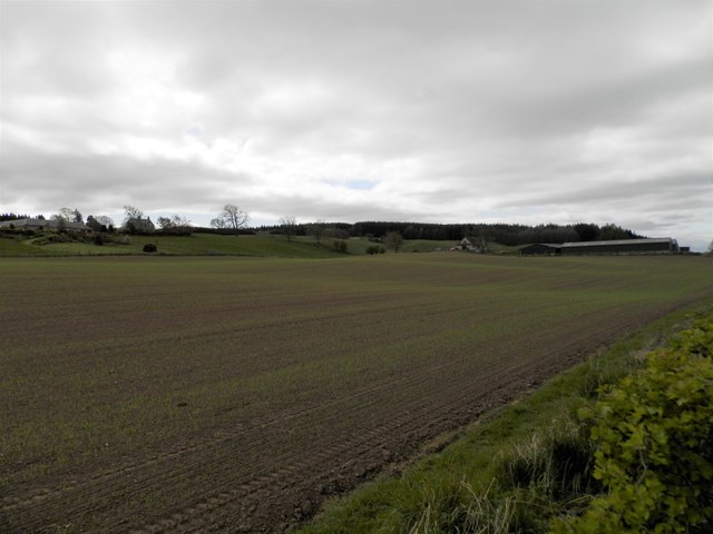
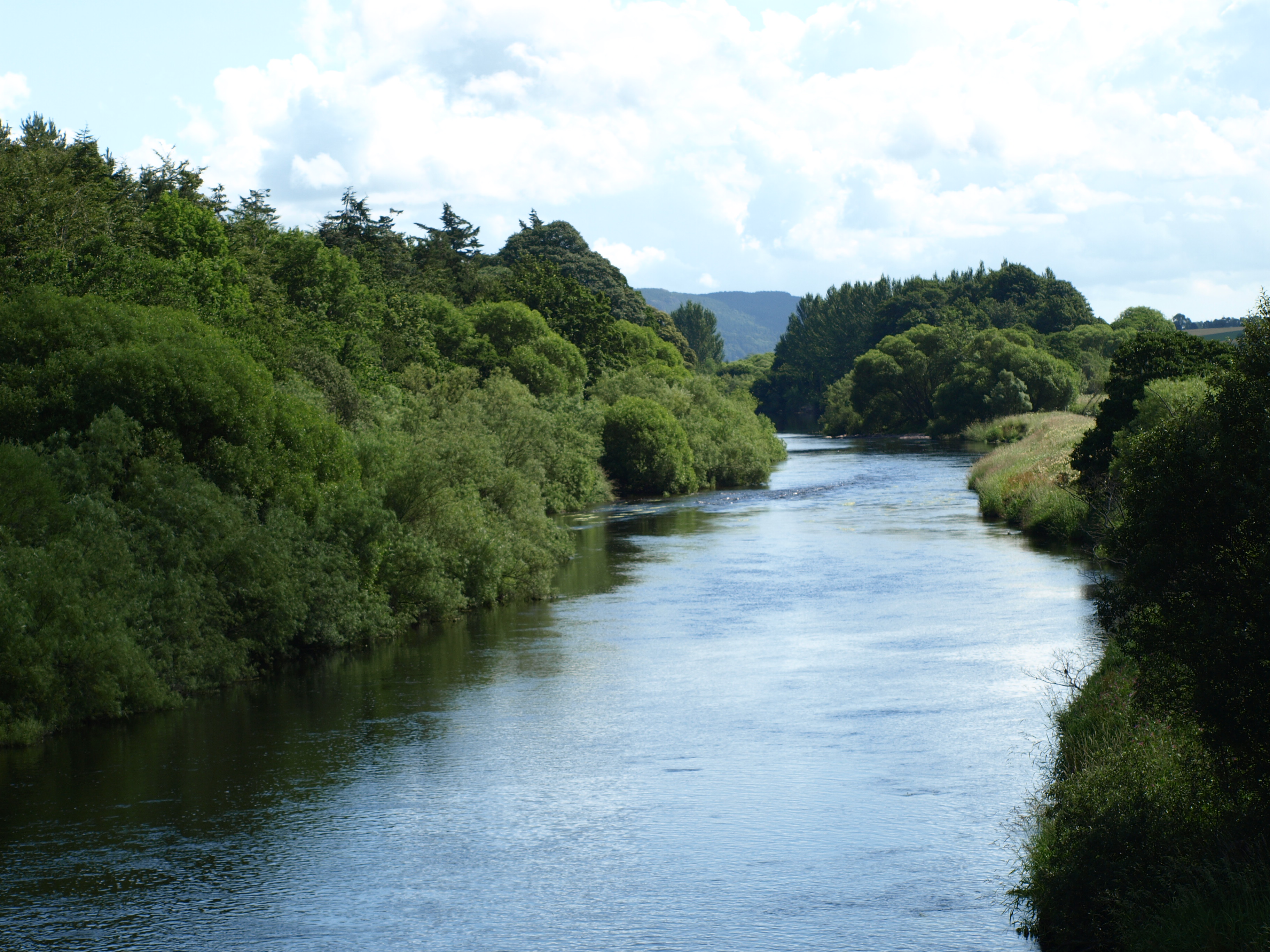
Balgowan is a small village located in the heart of Perthshire, Scotland. Situated near the banks of the River Tay, it is surrounded by picturesque countryside and offers stunning views of the nearby hills and mountains.

The village is known for its tranquil and peaceful atmosphere, making it an ideal destination for those seeking a break from the hustle and bustle of city life. Balgowan is home to a tight-knit community, with a population of around 300 residents. The village boasts a charming mix of traditional stone cottages and modern houses, adding to its unique character.

The surrounding area provides ample opportunities for outdoor activities and exploration. For nature enthusiasts, there are numerous walking trails and cycling paths, allowing visitors to soak in the natural beauty of the region. The nearby Grampian Mountains offer a range of hiking routes, catering to all levels of experience.

Balgowan is also conveniently located close to several notable attractions. The historic town of Dunkeld, with its stunning cathedral and quaint streets, is just a short drive away. In addition, the famous Birnam Oak, mentioned in Shakespeare's Macbeth, can be found nearby, providing a glimpse into Scotland's rich literary history.

Overall, Balgowan offers a serene and idyllic setting, making it a popular destination for those seeking a peaceful retreat in the heart of Perthshire.

If you have any feedback on the listing, please let us know in the comments section below.

Balgowan Images

Images are sourced within 2km of 56.383273/-3.6350004 or Grid Reference NN9922. Thanks to Geograph Open Source API. All images are credited.

Sheep in the sun Looking southwards from the roadside near Blaewanders to a large field of sheep.
Sheep in the sun
Looking southwards from the roadside near Blaewanders to a large field of sheep.
Feeding sheep Sheep at a feeder in a field south of the road near Blaewanders.
Feeding sheep
Sheep at a feeder in a field south of the road near Blaewanders.
Redhills viewed from near Balgowan A distant view of the farm at Redhills from the roadside to the south-east near Balgowan.
Redhills viewed from near Balgowan
A distant view of the farm at Redhills from the roadside to the south-east near Balgowan.
Balgowan from the south Looking north from the Findo Gask road down the hill to the growing hamlet of Balgowan.
Balgowan from the south
Looking north from the Findo Gask road down the hill to the growing hamlet of Balgowan.
Ploughed field near Innergask Looking across a ploughed field west of Innergask, with Westmuir Wood beyond.
Ploughed field near Innergask
Looking across a ploughed field west of Innergask, with Westmuir Wood beyond.
Farmland above Cowgask Burn
Crossroad at Balgowan
Field at Balgowan The first signs of new growth appear in the field.
Field at Balgowan
The first signs of new growth appear in the field.
New housing at Balgowan
Morning mist in Westmuir Wood
Bales and stubble at Innergask
Field at Balgowan
Field at Balgowan
Roadside arable at Williamston
Play area, Balgowan Part of a new residential area.
Play area, Balgowan
Part of a new residential area.
Eden Square, Balgowan Part of a new residential area.
Eden Square, Balgowan
Part of a new residential area.
Gates to pumping station I am assuming this is a pumping station - for either water or gas, but I cannot find out anything about it.
Gates to pumping station
I am assuming this is a pumping station - for either water or gas, but I cannot find out anything about it.
Pumping station I am assuming this is a pumping station - for either water or gas, but I cannot find out anything about it.
Pumping station
I am assuming this is a pumping station - for either water or gas, but I cannot find out anything about it.
Field edge, Williamston Nothing seems to have grown in this field this year. Weeds have been topped, but no sign of grass or other crops.
Field edge, Williamston
Nothing seems to have grown in this field this year. Weeds have been topped, but no sign of grass or other crops.
Show me another place!

Balgowan is located at Grid Ref: NN9922 (Lat: 56.383273, Lng: -3.6350004)

Unitary Authority: Perth and Kinross

Police Authority: Tayside

What 3 Words

///tingled.pace.gong. Near Methven, Perth & Kinross

Nearby Locations

Balgowan Westmuir Wood

Related Wikis

Balgowan railway station

Balgowan railway station served the village of Balgowan, in the Scottish county of Perth and Kinross. == History == Opened on 21 May 1866 by the Crieff...

Balgowan, Perth and Kinross

Balgowan is a village in Perth and Kinross, Scotland, approximately 5 miles (8 kilometres) west of Perth. The village is located near the junctions of...

Strathearn distillery

Strathearn is a single malt Scotch whisky distillery near Methven in Scotland. == History == The distillery commenced production in 2013 under the ownership...

RAF Findo Gask

RAF Findo Gask was a Royal Air Force satellite station located 7 mi (11 km) west of Perth, Scotland used during the Second World War. == History == RAF...

Findo Gask

Findo Gask is a small village in Perth and Kinross in Scotland, just off the main A9 road. It is in Strathearn. There are nearby remains associated with...

Madderty railway station

Madderty railway station served the locality of Madderty in Perthshire, Scotland. The village of St. Davids is around one mile to the south. == History... ==

Inchaffray Abbey

Inchaffray Abbey was situated by the village of Madderty, midway between Perth and Crieff in Strathearn, Scotland. The only traces now visible are an earth...

Methven Junction railway station

Methven Junction railway station opened in 1866, following the extension of the already existing Perth, Almond Valley and Methven Railway line which terminated...

Nearby Amenities

Located within 500m of 56.383273,-3.6350004
Balgowan
Name Gd: Baile a' Ghobhainn
Place: village
Source: npe
Lat/Long: 56.3835787/-3.634336
Balgowan
Historic Railway: station
Railway: site
Wikidata: Q4850795
Wikipedia: en:Balgowan railway station
Lat/Long: 56.3854488/-3.6367534
Post Box
Collection Times: Mo-Fr 09:00; Sa 07:00
Operator: Royal Mail
Post Box Design: LB3426
Post Box Mounting: pier
Post Box Type: lamp
Ref: PH1 100
Royal Cypher: scottish_crown
Source: survey;local knowledge
Lat/Long: 56.3844334/-3.6320208
Direction: 240
Generator Method: photovoltaic
Generator Output Electricity: yes
Generator Source: solar
Generator Type: solar_photovoltaic_panel
Power: generator
Lat/Long: 56.384684/-3.6363702
Direction: 150
Generator Method: photovoltaic
Generator Output Electricity: yes
Generator Source: solar
Generator Type: solar_photovoltaic_panel
Power: generator
Lat/Long: 56.3835733/-3.634628
Direction: 150
Generator Method: photovoltaic
Generator Output Electricity: yes
Generator Source: solar
Generator Type: solar_photovoltaic_panel
Power: generator
Lat/Long: 56.3835784/-3.6351686
Direction: 150
Generator Method: photovoltaic
Generator Output Electricity: yes
Generator Source: solar
Generator Type: solar_photovoltaic_panel
Power: generator
Lat/Long: 56.3843515/-3.6356697
Power: pole
Lat/Long: 56.3828043/-3.6427154
Power: pole
Lat/Long: 56.3831723/-3.6420014
Power: pole
Lat/Long: 56.3835497/-3.6412938
Power: pole
Lat/Long: 56.38392/-3.6405647
Power: pole
Lat/Long: 56.3842951/-3.6398787
Power: pole
Lat/Long: 56.3845689/-3.6390765
Power: pole
Lat/Long: 56.3848416/-3.6383151
Power: pole
Lat/Long: 56.3851178/-3.6375366
Power: pole
Lat/Long: 56.3827424/-3.6415798
Power: pole
Lat/Long: 56.3823578/-3.6407454
Power: pole
Lat/Long: 56.3819077/-3.6397432
Power: pole
Lat/Long: 56.3815207/-3.6388119
Power: pole
Lat/Long: 56.3813028/-3.6334062
Power: pole
Lat/Long: 56.3808962/-3.6330137
Power: pole
Lat/Long: 56.3808563/-3.6322717
Power: pole
Lat/Long: 56.3803907/-3.6348009
Power: pole
Lat/Long: 56.3806396/-3.6339321
Power: pole
Lat/Long: 56.3806837/-3.6293963
Power: pole
Lat/Long: 56.3812755/-3.6295189
Power: pole
Lat/Long: 56.3818887/-3.6296436
Power: pole
Lat/Long: 56.3825638/-3.6297877
Power: pole
Lat/Long: 56.3833485/-3.6299512
Power: pole
Lat/Long: 56.3839879/-3.6300867
Power: pole
Lat/Long: 56.3847011/-3.6302308
Power: pole
Lat/Long: 56.3854643/-3.6310416
Power: pole
Lat/Long: 56.3861977/-3.6318567
Power: pole
Lat/Long: 56.387149/-3.6326417
Power: pole
Lat/Long: 56.3822804/-3.6310803
Power: pole
Lat/Long: 56.3820185/-3.6322868
The data included in this document is from www.openstreetmap.org. The data is made available under ODbL.

Have you been to Balgowan?

Leave your review of Balgowan below (or comments, questions and feedback).