Bailey's Hard

Settlement in Hampshire New Forest

England

Bailey's Hard
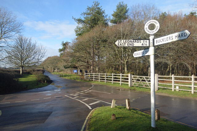
Road Junction, Bucklers Hard By the entrance to the museum village at Bucklers Hard.
Road Junction, Bucklers Hard Credit: Des Blenkinsopp

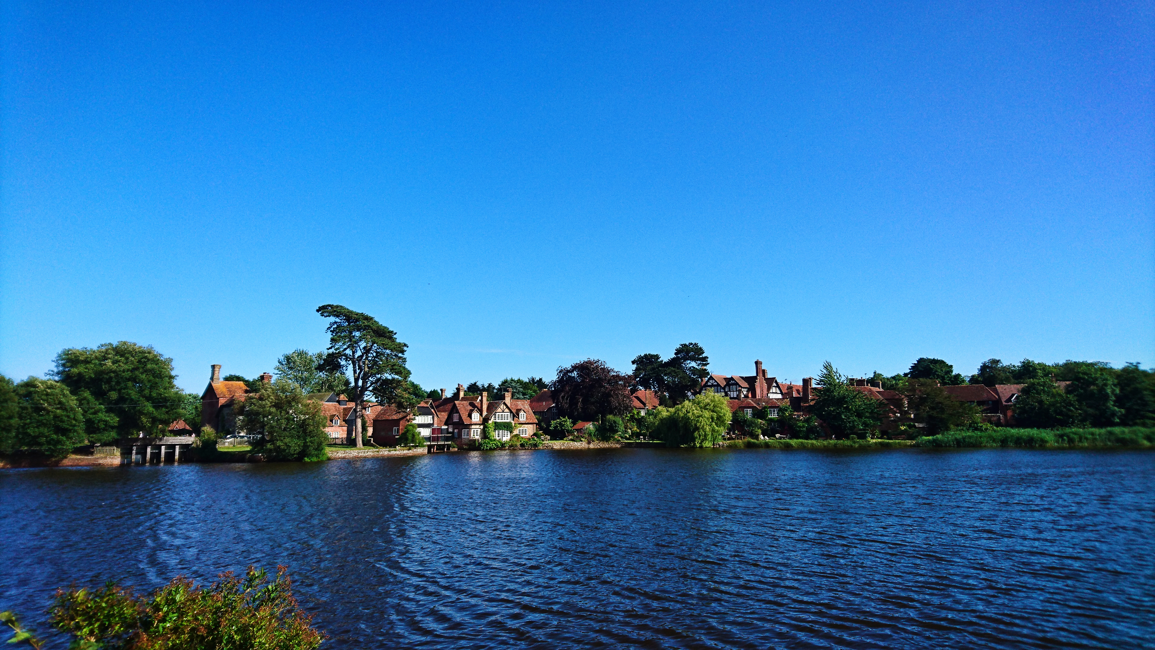
Bailey's Hard is a historic waterfront village located in Hampshire, England. Situated on the Beaulieu River, it is well-known for its maritime heritage and picturesque surroundings. The village is part of the wider Beaulieu Estate, which has been owned by the Montagu family for over four centuries.

Bailey's Hard is renowned for its shipbuilding past, particularly during the 18th and 19th centuries. It served as a major shipbuilding center, producing vessels for the Royal Navy. Today, remnants of the shipbuilding industry can still be seen in the form of old slipways and boatyards, adding to the area's charm and historical appeal.

The village is a popular destination for visitors, offering a range of attractions and activities. The historic waterfront provides a picturesque setting for leisurely walks, with stunning views of the river and surrounding woodland. The area is also home to the Maritime Museum, which showcases the rich maritime history of the region and offers insights into the shipbuilding industry.

For nature enthusiasts, Bailey's Hard offers ample opportunities for wildlife spotting and birdwatching. The Beaulieu River is a designated Site of Special Scientific Interest (SSSI), home to a diverse array of flora and fauna. Boat trips along the river are available, allowing visitors to explore the waterways and enjoy the natural beauty of the area.

In addition to its natural and historical attractions, Bailey's Hard has a charming café and a riverside pub, where visitors can relax and enjoy a meal or a drink while taking in the tranquil surroundings. Overall, Bailey's Hard is a captivating destination that seamlessly combines its maritime heritage with natural beauty, making it a must-visit location in Hampshire.

If you have any feedback on the listing, please let us know in the comments section below.

Bailey's Hard Images

Images are sourced within 2km of 50.809835/-1.4396276 or Grid Reference SU3901. Thanks to Geograph Open Source API. All images are credited.
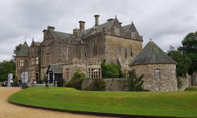
Road Junction, Bucklers Hard By the entrance to the museum village at Bucklers Hard.
Road Junction, Bucklers Hard
By the entrance to the museum village at Bucklers Hard.
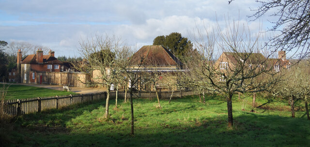
Orchard at Bucklers Hard At the museum village of Bucklers Hard where wooden ships were built at one time.
Apples were grown and stored by the villagers as an important part of their diet. Now the fruit is harvested to make a local brand of apple juice.
Orchard at Bucklers Hard
At the museum village of Bucklers Hard where wooden ships were built at one time. Apples were grown and stored by the villagers as an important part of their diet. Now the fruit is harvested to make a local brand of apple juice.
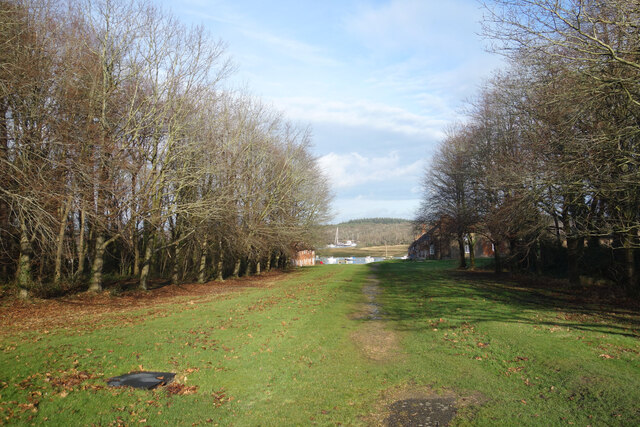
The old village street, Bucklers Hard A wide avenue from the main road down to the old shipbuilding village of Bucklers Hard. Nowadays it's just a grassy public footpath. Entry to the village is on foot from the car park off to the right.
The old village street, Bucklers Hard
A wide avenue from the main road down to the old shipbuilding village of Bucklers Hard. Nowadays it's just a grassy public footpath. Entry to the village is on foot from the car park off to the right.
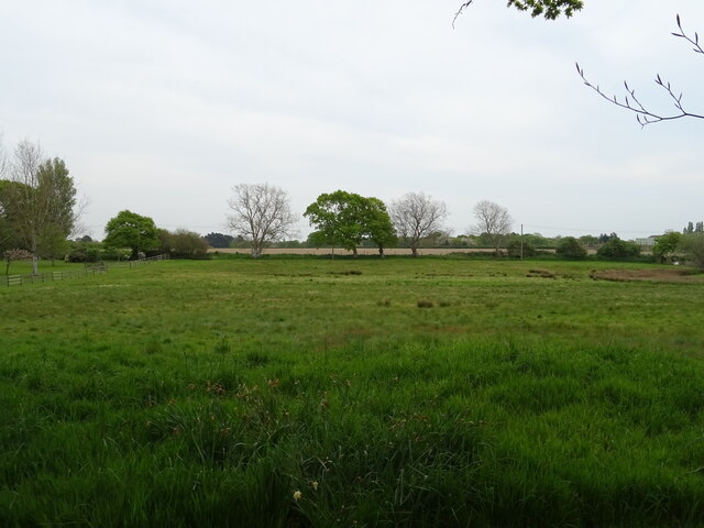
Rough grazing, Clobb
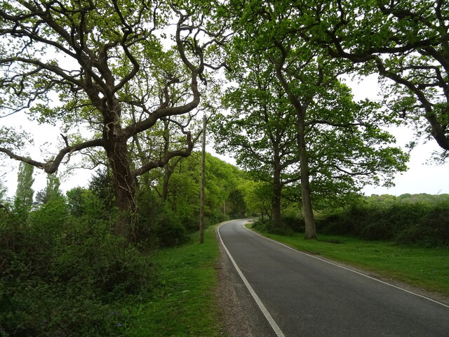
Minor road, Clobb
Minor road, Clobb
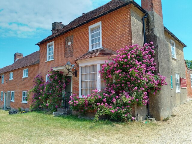
Museum end, Bucklers Hard The west end of the museum in Bucklers Hard.
Museum end, Bucklers Hard
The west end of the museum in Bucklers Hard.
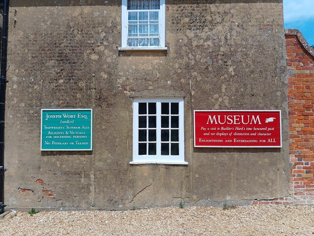
Bucklers Hard signs Signs on the end of a house in Bucklers Hard.
Bucklers Hard signs
Signs on the end of a house in Bucklers Hard.
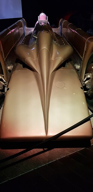
Golden Arrow at the National Motor Museum, Beaulieu There are of course dozens of remarkable vehicles on show at the National Motor Museum, Beaulieu - but this is still one of the sleekest - at nearly 100 years old. 
Golden Arrow, driven by Henry Segrave on the 11th March 1929 at Daytona Beach broke the land speed record clocking 231.446mph (372.459 km/h) on the 'flying mile'; Segrave was knighted for this achievement. The record held for nearly two years up to February 5, 1931.
Golden Arrow has a 23.9 Litre (1,460 in³) W12 Napier Lion aero engine (used in Supermarine aeroplanes).
Wikipedia article: <span class="nowrap"><a title="https://en.wikipedia.org/wiki/Golden_Arrow_(car)" rel="nofollow ugc noopener" href="https://en.wikipedia.org/wiki/Golden_Arrow_(car)">Link</a><img style="margin-left:2px;" alt="External link" title="External link - shift click to open in new window" src="https://s1.geograph.org.uk/img/external.png" width="10" height="10"/></span>
Cf. Basher's side view from 10 years ago <a href="https://www.geograph.org.uk/photo/2669999">SU3802 : Lord Montagu's Wonderful Collection (166)</a>
Golden Arrow at the National Motor Museum, Beaulieu
There are of course dozens of remarkable vehicles on show at the National Motor Museum, Beaulieu - but this is still one of the sleekest - at nearly 100 years old. Golden Arrow, driven by Henry Segrave on the 11th March 1929 at Daytona Beach broke the land speed record clocking 231.446mph (372.459 km/h) on the 'flying mile'; Segrave was knighted for this achievement. The record held for nearly two years up to February 5, 1931. Golden Arrow has a 23.9 Litre (1,460 in³) W12 Napier Lion aero engine (used in Supermarine aeroplanes). Wikipedia article: LinkExternal link Cf. Basher's side view from 10 years ago SU3802 : Lord Montagu's Wonderful Collection (166)
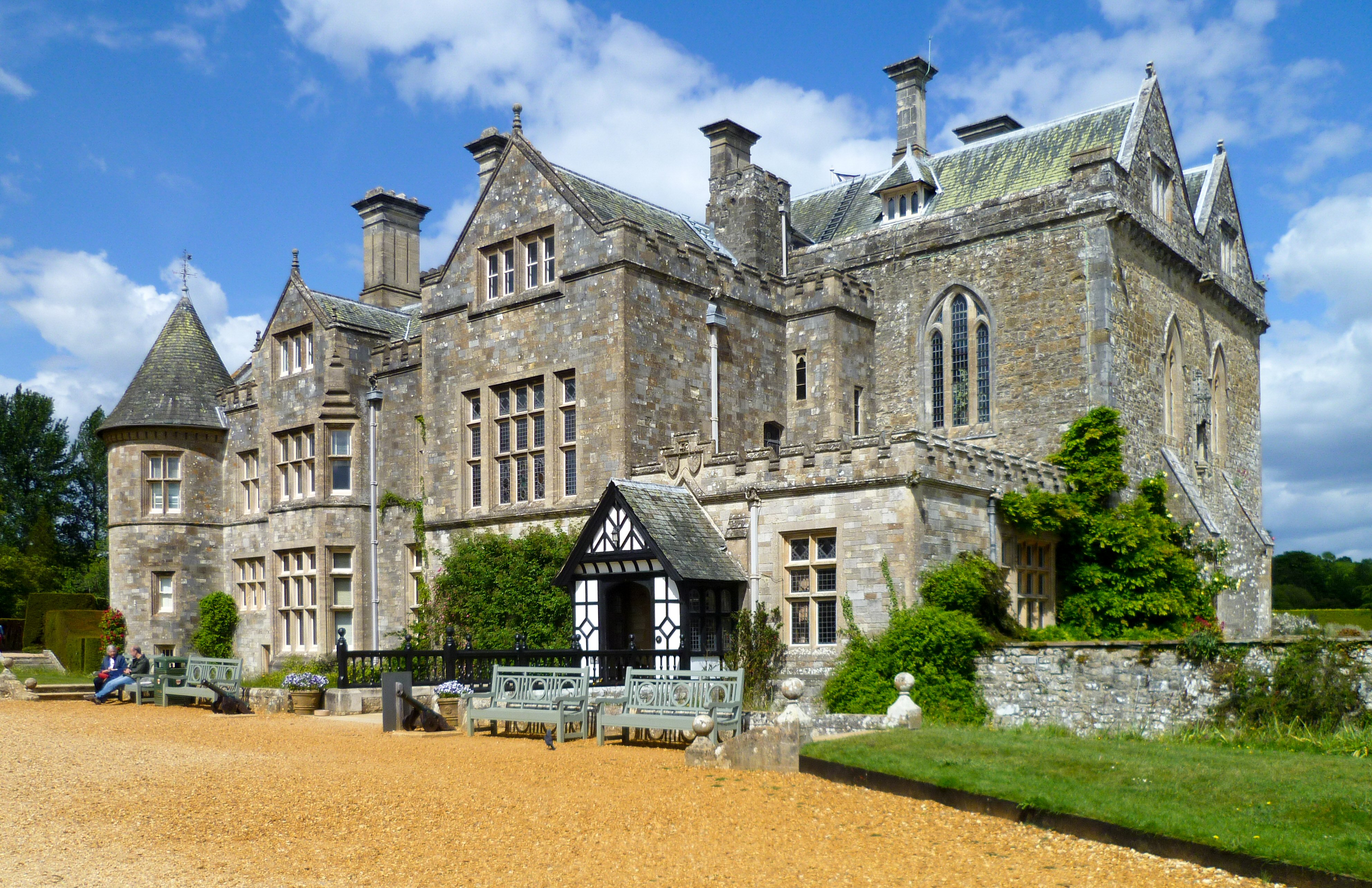
Beaulieu - The Palace House The Palace House at Beaulieu as seen today dates mostly from the C18th with a restoration and enlargement of 1872. However it incorporates a Mid C14th gatehouse which had been converted to a hunting lodge c.1540 for Lord Wriothesley.
It has been the (not always primary) residence of the Montagu family for generations, see <span class="nowrap"><a title="https://www.beaulieu.co.uk/about-us" rel="nofollow ugc noopener" href="https://www.beaulieu.co.uk/about-us">Link</a><img style="margin-left:2px;" alt="External link" title="External link - shift click to open in new window" src="https://s1.geograph.org.uk/img/external.png" width="10" height="10"/></span>
Full EH Grade I listing here: <span class="nowrap"><a title="https://historicengland.org.uk/listing/the-list/list-entry/1094430" rel="nofollow ugc noopener" href="https://historicengland.org.uk/listing/the-list/list-entry/1094430">Link</a><img style="margin-left:2px;" alt="External link" title="External link - shift click to open in new window" src="https://s1.geograph.org.uk/img/external.png" width="10" height="10"/></span>
Their own website here: <span class="nowrap"><a title="https://www.beaulieu.co.uk/attractions/palace-house-gardens" rel="nofollow ugc noopener" href="https://www.beaulieu.co.uk/attractions/palace-house-gardens">Link</a><img style="margin-left:2px;" alt="External link" title="External link - shift click to open in new window" src="https://s1.geograph.org.uk/img/external.png" width="10" height="10"/></span>
Beaulieu - The Palace House
The Palace House at Beaulieu as seen today dates mostly from the C18th with a restoration and enlargement of 1872. However it incorporates a Mid C14th gatehouse which had been converted to a hunting lodge c.1540 for Lord Wriothesley. It has been the (not always primary) residence of the Montagu family for generations, see LinkExternal link Full EH Grade I listing here: LinkExternal link Their own website here: LinkExternal link
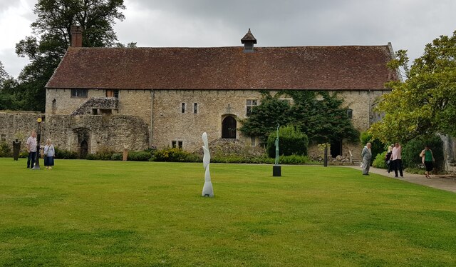
Beaulieu - The Domus The Domus is one of only two buildings of the original Cistercian abbey to have survived the Dissolution of the Monasteries in the C16th. It dates from the early C13th and was originally the Lay Brothers' Dormitory. It is now used by the estate for various functions e.g. conferences or "Medieval Banquets" - see <span class="nowrap"><a title="https://www.beaulieu.co.uk/corporate-and-weddings/our-venues/the-domus-conference-meeting-facility" rel="nofollow ugc noopener" href="https://www.beaulieu.co.uk/corporate-and-weddings/our-venues/the-domus-conference-meeting-facility">Link</a><img style="margin-left:2px;" alt="External link" title="External link - shift click to open in new window" src="https://s1.geograph.org.uk/img/external.png" width="10" height="10"/></span>
The Domus adjoins the (ruined) cloisters on their western side. The photograph was taken from the eastern side of these cloisters.
It is EH Grade I listed <span class="nowrap"><a title="https://historicengland.org.uk/listing/the-list/list-entry/1156631" rel="nofollow ugc noopener" href="https://historicengland.org.uk/listing/the-list/list-entry/1156631">Link</a><img style="margin-left:2px;" alt="External link" title="External link - shift click to open in new window" src="https://s1.geograph.org.uk/img/external.png" width="10" height="10"/></span>
Beaulieu - The Domus
The Domus is one of only two buildings of the original Cistercian abbey to have survived the Dissolution of the Monasteries in the C16th. It dates from the early C13th and was originally the Lay Brothers' Dormitory. It is now used by the estate for various functions e.g. conferences or "Medieval Banquets" - see LinkExternal link The Domus adjoins the (ruined) cloisters on their western side. The photograph was taken from the eastern side of these cloisters. It is EH Grade I listed LinkExternal link
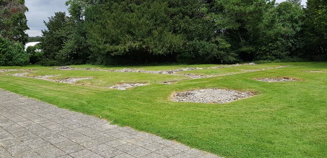
Beaulieu - foundations of former abbey church Before the Dissolution of the Monasteries in the C16th there had been a Cistercian abbey here at Beaulieu with a large and magnificent abbey church. All that remains of that church now is the rocks of its foundations, some of which can be seen here.
The abbey was 'dissolved' in April 1538, one of the earliest monasteries to close. It passed into the possession of Thomas Wriothesley, 1st Earl of Southampton (1505-50). Soon after this date the stone of most of the abbey was 'quarried' for building stones for other buildings.
See extensive EH Ancient Monument write-up here: <span class="nowrap"><a title="https://historicengland.org.uk/listing/the-list/list-entry/1003450" rel="nofollow ugc noopener" href="https://historicengland.org.uk/listing/the-list/list-entry/1003450">Link</a><img style="margin-left:2px;" alt="External link" title="External link - shift click to open in new window" src="https://s1.geograph.org.uk/img/external.png" width="10" height="10"/></span>
See also <a href="https://www.geograph.org.uk/photo/6942218">SU3802 : Beaulieu - Northern Cloister wall</a> which adjoins it and has a separate EH listing.
Beaulieu - foundations of former abbey church
Before the Dissolution of the Monasteries in the C16th there had been a Cistercian abbey here at Beaulieu with a large and magnificent abbey church. All that remains of that church now is the rocks of its foundations, some of which can be seen here. The abbey was 'dissolved' in April 1538, one of the earliest monasteries to close. It passed into the possession of Thomas Wriothesley, 1st Earl of Southampton (1505-50). Soon after this date the stone of most of the abbey was 'quarried' for building stones for other buildings. See extensive EH Ancient Monument write-up here: LinkExternal link See also SU3802 : Beaulieu - Northern Cloister wall which adjoins it and has a separate EH listing.
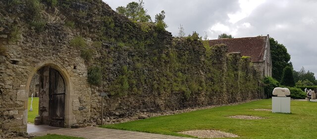
Beaulieu - Northern Cloister wall A view along the northern wall of the former cloisters of Beaulieu Abbey. This wall would also effectively have been the southern wall of the nave of the former abbey church which has otherwise completely disappeared other than its foundations (see <a href="https://www.geograph.org.uk/photo/6942213">SU3802 : Beaulieu - foundations of former abbey church</a>)
The gateway seen on the left was the monks' entrance into the church from the cloister.
See EH Grade I listing: <span class="nowrap"><a title="https://historicengland.org.uk/listing/the-list/list-entry/1094429" rel="nofollow ugc noopener" href="https://historicengland.org.uk/listing/the-list/list-entry/1094429">Link</a><img style="margin-left:2px;" alt="External link" title="External link - shift click to open in new window" src="https://s1.geograph.org.uk/img/external.png" width="10" height="10"/></span>
Beaulieu - Northern Cloister wall
A view along the northern wall of the former cloisters of Beaulieu Abbey. This wall would also effectively have been the southern wall of the nave of the former abbey church which has otherwise completely disappeared other than its foundations (see SU3802 : Beaulieu - foundations of former abbey church) The gateway seen on the left was the monks' entrance into the church from the cloister. See EH Grade I listing: LinkExternal link
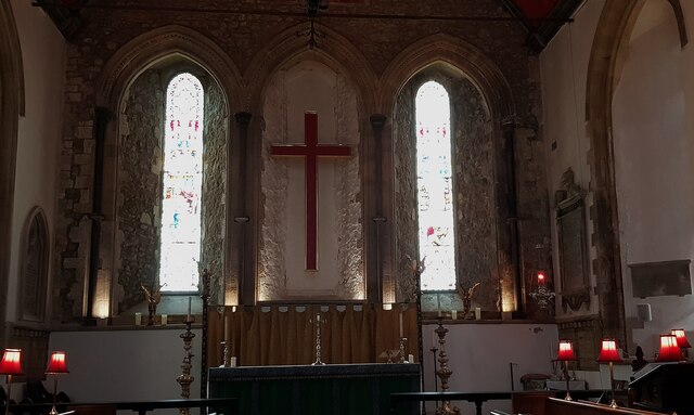
Beaulieu - Parish church (former frater) - Altar The Church of the Blessed Virgin and Child (formerly listed by EH as Parish Church) occupies the building that was originally the frater (the dining room or refectory of a monastery) of the Cistercian abbey of Beaulieu.
The abbey was founded in 1204 in the reign of King John, and the windows seen here to either side of the altar are clearly of the simple Early English Gothic style of that period.
Along with most of the abbey remains, this church is EH Grade I listed <span class="nowrap"><a title="https://historicengland.org.uk/listing/the-list/list-entry/1156943" rel="nofollow ugc noopener" href="https://historicengland.org.uk/listing/the-list/list-entry/1156943">Link</a><img style="margin-left:2px;" alt="External link" title="External link - shift click to open in new window" src="https://s1.geograph.org.uk/img/external.png" width="10" height="10"/></span> but interestingly is specifically excluded (along with its churchyard) from the Ancient Monument scheduling.
Note that to get the windows vertical in this image, the altar is seen to lean - the walls of the church lean outwards quite noticeably and are supported by huge external buttresses (see <a href="https://www.geograph.org.uk/photo/2124322">SU3802 : Beaulieu: parish church of the Blessed Virgin and Holy Child</a> for a good external view).
Beaulieu - Parish church (former frater) - Altar
The Church of the Blessed Virgin and Child (formerly listed by EH as Parish Church) occupies the building that was originally the frater (the dining room or refectory of a monastery) of the Cistercian abbey of Beaulieu. The abbey was founded in 1204 in the reign of King John, and the windows seen here to either side of the altar are clearly of the simple Early English Gothic style of that period. Along with most of the abbey remains, this church is EH Grade I listed LinkExternal link but interestingly is specifically excluded (along with its churchyard) from the Ancient Monument scheduling. Note that to get the windows vertical in this image, the altar is seen to lean - the walls of the church lean outwards quite noticeably and are supported by huge external buttresses (see SU3802 : Beaulieu: parish church of the Blessed Virgin and Holy Child for a good external view).
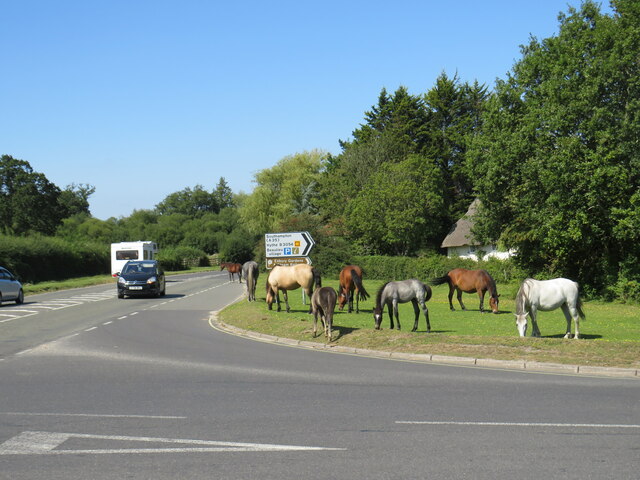
Horses grazing, Beaulieu Horses grazing by the roadside in Beaulieu, in The New Forest.  The road junction in the foreground forms the junction of the B3056, which starts/ends here, and the B3054.
Horses grazing, Beaulieu
Horses grazing by the roadside in Beaulieu, in The New Forest. The road junction in the foreground forms the junction of the B3056, which starts/ends here, and the B3054.
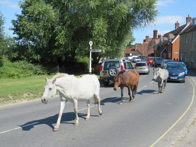
Ponies in the road, Beaulieu New Forest ponies wandering in the road in the village of Beaulieu.  The road forms part of the route of the B3054 which links the towns of Lymington and Hythe.
Ponies in the road, Beaulieu
New Forest ponies wandering in the road in the village of Beaulieu. The road forms part of the route of the B3054 which links the towns of Lymington and Hythe.
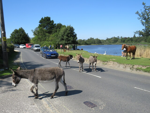
Horses in the road, Beaulieu Horses wandering along Palace Lane, in the village of Beaulieu.  A queue of cars has formed behind the animals.

Palace Lane forms part of the route of the B3054 road which links the towns of Lymington and Hythe.
Horses in the road, Beaulieu
Horses wandering along Palace Lane, in the village of Beaulieu. A queue of cars has formed behind the animals. Palace Lane forms part of the route of the B3054 road which links the towns of Lymington and Hythe.
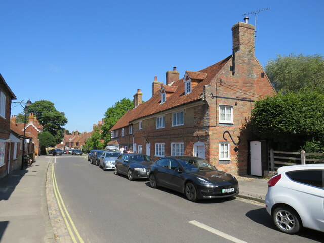
High Street, Beaulieu High Street in the village of Beaulieu, in The New Forest.
High Street, Beaulieu
High Street in the village of Beaulieu, in The New Forest.
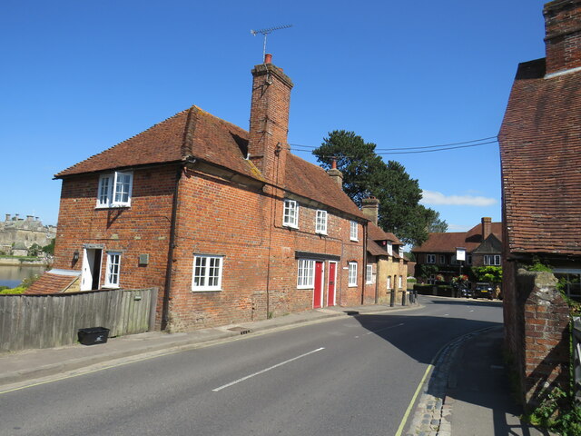
Palace Lane, Beaulieu Palace Lane in the village of Beaulieu, in The New Forest.  This road forms part of the route of the B3054 which links the towns of Lymington and Hythe.
Palace Lane, Beaulieu
Palace Lane in the village of Beaulieu, in The New Forest. This road forms part of the route of the B3054 which links the towns of Lymington and Hythe.
Show me another place!

Bailey's Hard is located at Grid Ref: SU3901 (Lat: 50.809835, Lng: -1.4396276)

Administrative County: Hampshire

District: New Forest

Police Authority: Hampshire

What 3 Words

///deed.marker.texts. Near Hythe, Hampshire

Related Wikis

Beaulieu, Hampshire

Beaulieu ( BEW-lee) is a small village located on the southeastern edge of the New Forest national park in Hampshire, England, and home to both Palace...

Beaulieu Palace House

Beaulieu Palace House ( BEW-lee) is a 13th-century house in Beaulieu, Hampshire, United Kingdom. Originally part of Beaulieu Abbey, the estate was bought...

Beaulieu Abbey

Beaulieu Abbey was a Cistercian abbey in Hampshire, England. It was founded in 1203–1204 by King John and (uniquely in Britain) populated by 30 monks sent...

Buckler's Hard

Buckler's Hard is a hamlet on the banks of the Beaulieu River in the English county of Hampshire. With its Georgian cottages running down to the river...

National Motor Museum, Beaulieu

The National Motor Museum (originally the Montagu Motor Museum) is a museum in the village of Beaulieu, set in the heart of the New Forest, in the English...

National Motor Museum Monorail

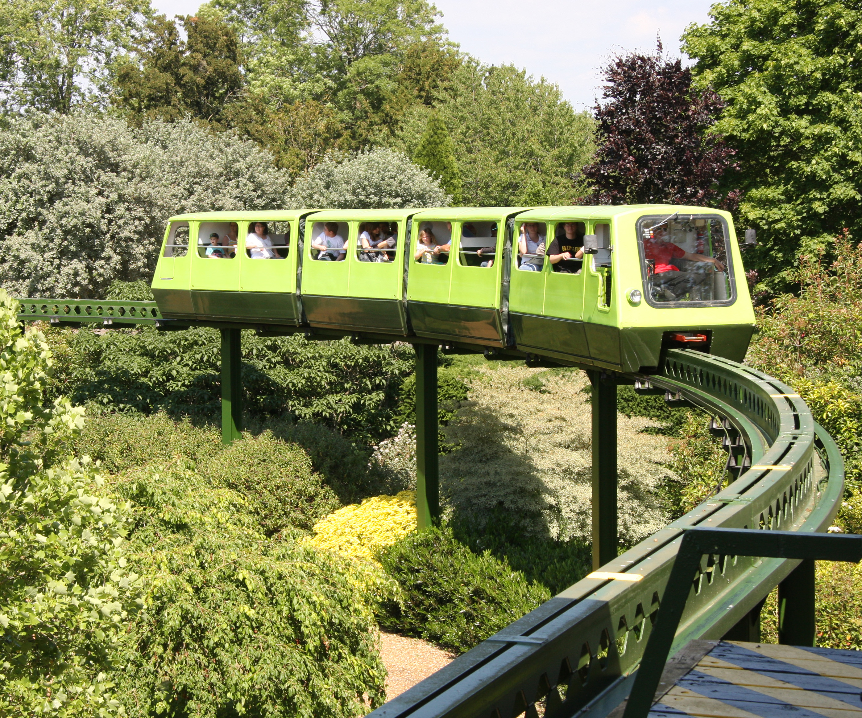
The Beaulieu Monorail is England's first monorail, linking the National Motor Museum to the Beaulieu Palace House. the monorail line passes through the...

New Forest East (UK Parliament constituency)

New Forest East is a constituency in Hampshire represented in the House of Commons of the UK Parliament since its creation in 1997 by Julian Lewis of the...

East Boldre

East Boldre is a linear village and civil parish situated near Lymington, Hampshire, England. East Boldre is surrounded by the New Forest and forms part...

Nearby Amenities

Located within 500m of 50.809835,-1.4396276
Seamark Type: wreck
Seamark Wreck Category: hull_showing
Lat/Long: 50.8107958/-1.4383185
Waste Basket
Lat/Long: 50.8102094/-1.4415415
Barrier: swing_gate
Lat/Long: 50.8093557/-1.4400041
Bench
Backrest: no
Material: wood
Lat/Long: 50.8075371/-1.4344205
Board Type: nature
Information: board
Tourism: information
Lat/Long: 50.8075194/-1.4343334
Board Type: history
Information: board
Tourism: information
Lat/Long: 50.8101539/-1.4410319
Barrier: swing_gate
Lat/Long: 50.8101759/-1.4413598
Parking
Access: customers
Parking: surface
Lat/Long: 50.8098426/-1.4412511
Yachtsmans Cabins
Lat/Long: 50.8098501/-1.4393082
The data included in this document is from www.openstreetmap.org. The data is made available under ODbL.

Have you been to Bailey's Hard?

Leave your review of Bailey's Hard below (or comments, questions and feedback).