Axeford Estate

Settlement in Somerset South Somerset

England

Axeford Estate

Forde Abbey Beautiful house and gardens.
Forde Abbey Credit: Trevor Harris

Axeford Estate is a picturesque countryside location situated in Somerset, England. Nestled amidst rolling hills and lush greenery, this estate spans over acres of pristine land, offering a tranquil and idyllic retreat.

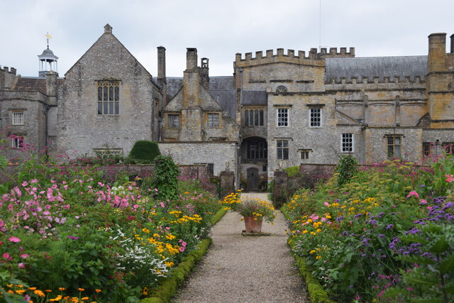
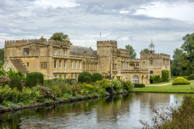
The estate boasts a rich history dating back several centuries, with its origins traced to the medieval period. It has witnessed numerous transformations over the years, evolving into a well-preserved heritage site that showcases a blend of architectural styles. The main manor house, a prominent feature of Axeford Estate, displays a stunning combination of Tudor and Georgian architectural elements.

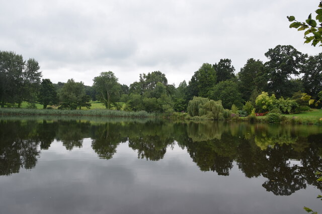
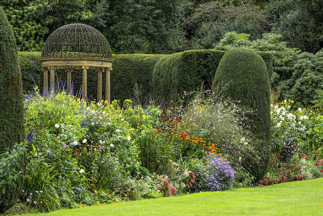
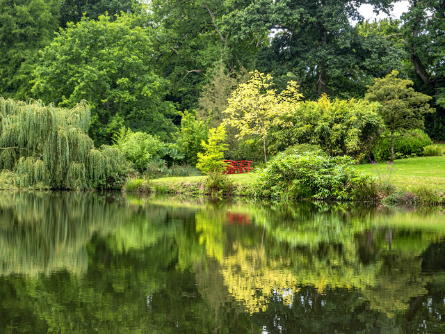
The estate is renowned for its expansive gardens and parkland, which have been meticulously maintained, offering visitors a delightful visual treat. These gardens feature a diverse range of flora and fauna, including vibrant flower beds, towering trees, and well-manicured lawns. The parkland also includes several walking trails, allowing visitors to explore the estate's natural beauty at their leisure.

Axeford Estate is not only an aesthetically pleasing destination but also offers a range of recreational activities. It is home to a golf course, providing golf enthusiasts with a challenging yet scenic experience. Additionally, the estate offers horse riding facilities, providing visitors with the opportunity to explore the surrounding countryside on horseback.

The estate also hosts various events throughout the year, including art exhibitions, cultural festivals, and outdoor concerts. These events attract a diverse crowd, adding vibrancy to the already enchanting atmosphere of Axeford Estate.

Overall, Axeford Estate is a captivating destination that combines natural beauty, historical charm, and recreational activities, making it an appealing place for both locals and tourists alike.

If you have any feedback on the listing, please let us know in the comments section below.

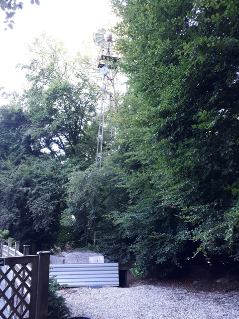
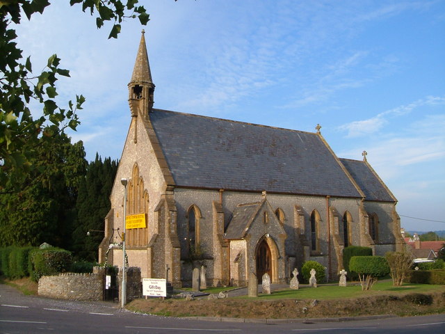
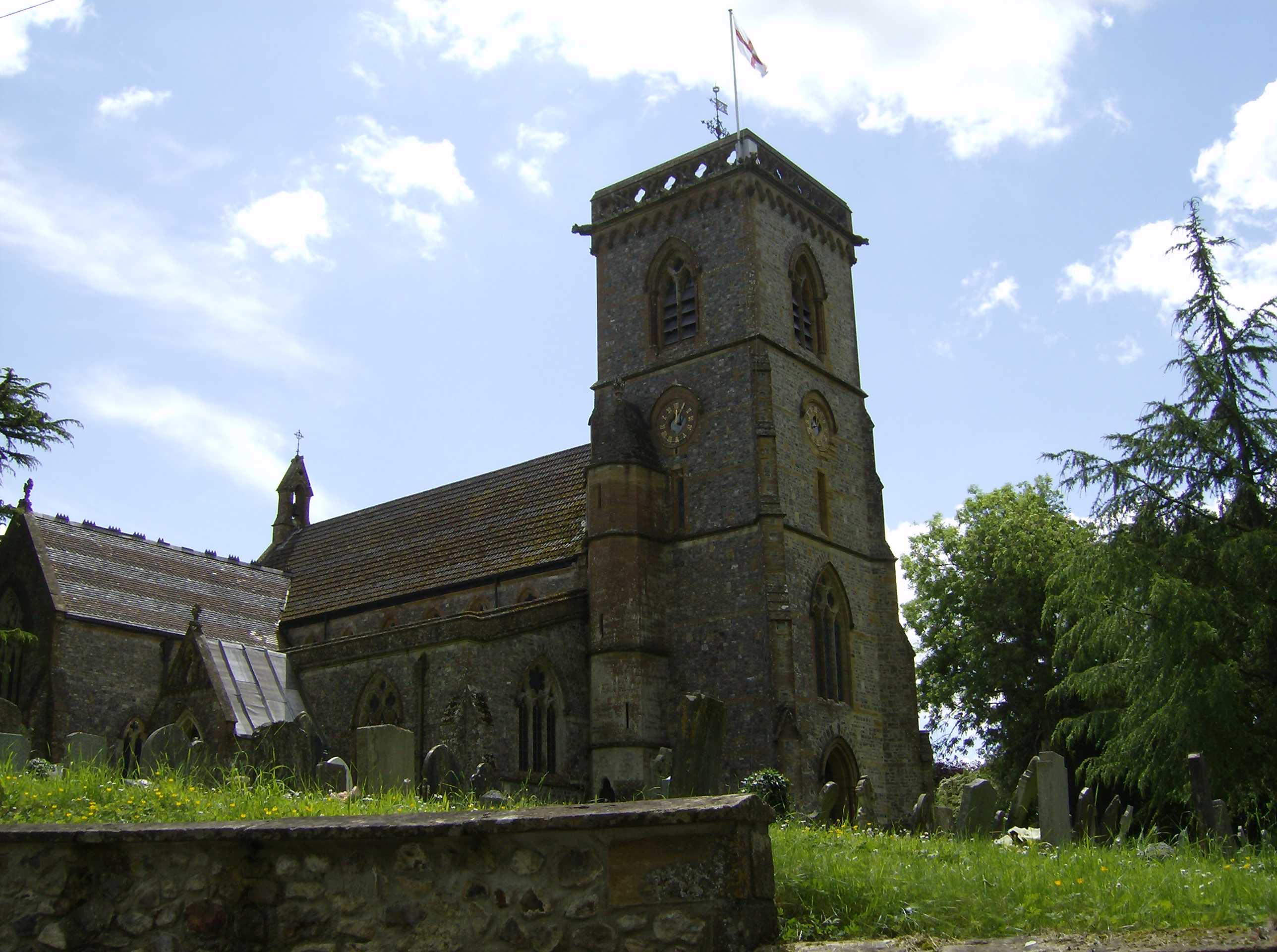
Axeford Estate Images

Images are sourced within 2km of 50.841507/-2.9390505 or Grid Reference ST3305. Thanks to Geograph Open Source API. All images are credited.

Forde Abbey Beautiful house and gardens.
Forde Abbey
Beautiful house and gardens.
The Great Pond. Forde Abbey A delightful spot in the beautiful grounds of Forde Abbey.
The Great Pond. Forde Abbey
A delightful spot in the beautiful grounds of Forde Abbey.
The Old Poppe Inn Beside the A358 at Tatworth
The Old Poppe Inn
Beside the A358 at Tatworth
Windpump on top of pillbox, Forton See also <a href="https://www.geograph.org.uk/photo/7254831">ST3407 : WWII pillbox, Forton, with windpump on top</a>.
Windpump on top of pillbox, Forton
WWII pillbox, Forton, with windpump on top See also <a href="https://www.geograph.org.uk/photo/7254829">ST3407 : Windpump on top of pillbox, Forton</a>.
WWII pillbox, Forton, with windpump on top
Windpump on top of pillbox, Forton
Forde Abbey Viewed from across the Long Pond which is bordered by a vast bed of herbaceous plants and clipped yews.
Forde Abbey
Viewed from across the Long Pond which is bordered by a vast bed of herbaceous plants and clipped yews.
Herbaceous border and temple The gardens at Forde Abbey are privately owned.
Herbaceous border and temple
The gardens at Forde Abbey are privately owned.
View across The Great Pond Trees are beginning to take on autumnal hues at Forde Abbey Gardens.
View across The Great Pond
Trees are beginning to take on autumnal hues at Forde Abbey Gardens.
Tangled branches Across a secluded corner of the Great Pond at Forde Abbey Gardens.
Tangled branches
Across a secluded corner of the Great Pond at Forde Abbey Gardens.
St John the Evangelist, Tatworth, Somerset
St. John the Evangelist, Tatworth, Somerset The Chancery and Apse
St. John the Evangelist, Tatworth, Somerset
The Chancery and Apse
St. John the Evangelist, Tatworth, Somerset View of the Western end
St. John the Evangelist, Tatworth, Somerset
View of the Western end
St. John the Evangelist, Tatworth, Somerset The Font
St. John the Evangelist, Tatworth, Somerset
The Font
Old Milestone by A358, village of Tatworth, opposite Ye Olde Pop Inn PH The Milestone is located set into wall, beside footpath, in front of orchard on the East of the road.  Parish of Tatworth And Forton (South Somerset District). Stone post (plate lost), Axminster pillar iron plate design, erected by the Chard turnpike trust in the 19th century. A later photograph can be found here: <a title="https://www.geograph.org.uk/photo/6050447" href="https://www.geograph.org.uk/photo/6050447">Link</a> 

Inscription reads:-  
(CHARD / 2) : : (AXMINSTER / 5) 

Milestone Society National ID: SO_CHAX02
Old Milestone by A358, village of Tatworth, opposite Ye Olde Pop Inn PH
The Milestone is located set into wall, beside footpath, in front of orchard on the East of the road.  Parish of Tatworth And Forton (South Somerset District). Stone post (plate lost), Axminster pillar iron plate design, erected by the Chard turnpike trust in the 19th century. A later photograph can be found here: Link Inscription reads:- (CHARD / 2) : : (AXMINSTER / 5) Milestone Society National ID: SO_CHAX02
Perry Street Works, Tatworth This is operated by Swiss Tulle and is making plain lace netting or bobbinet on machinery that has changed little in over a century. I knew of this place and suddenly realised I was nearby so drove over for a few exteriors in the drizzle.
Perry Street Works, Tatworth
This is operated by Swiss Tulle and is making plain lace netting or bobbinet on machinery that has changed little in over a century. I knew of this place and suddenly realised I was nearby so drove over for a few exteriors in the drizzle.
Show me another place!

Axeford Estate is located at Grid Ref: ST3305 (Lat: 50.841507, Lng: -2.9390505)

Administrative County: Somerset

District: South Somerset

Police Authority: Avon and Somerset

What 3 Words

///originals.muscular.smarting. Near Chard, Somerset

Related Wikis

Chard Junction railway station

Chard Junction railway station was situated on the London and South Western Railway’s West of England Main Line about 1 mile (1.6 km) southeast of the...

Stowell Meadow

Stowell Meadow (grid reference ST333062) is a 2.8 hectare (6.9 acre) biological Site of Special Scientific Interest near Tatworth in Somerset, notified...

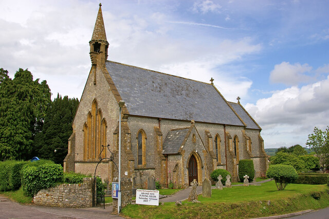
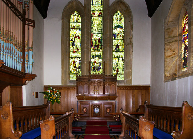
Church of St John the Evangelist, Tatworth

The Church of St John the Evangelist is a Church of England parish church in Tatworth, Somerset, England. It was built in 1850–51 to the design of Charles...

Tatworth

Tatworth is a village 2 miles (3 km) south of Chard in the South Somerset district of the county of Somerset, England. It is within Tatworth and Forton...

Leigh House

Leigh House is 16th- or 17th-century house in Winsham, Somerset, England. It is a Grade II* listed building.The site was previously part of the Forde Abbey...

Forde Abbey

Forde Abbey is a privately owned former Cistercian monastery in Dorset, England, with a postal address in Chard, Somerset. The house and gardens are run...

Tytherleigh

Tytherleigh is a village in the civil parish of Chardstock in Devon, England (historically in Dorset), close to the borders with Dorset and Somerset on...

Chardstock

Chardstock is a village and civil parish located on the eastern border of Devon, England off the A358 road between Chard and Axminster. The parish population...

Nearby Amenities

Located within 500m of 50.841507,-2.9390505
Railway: switch
Lat/Long: 50.840136/-2.93494
Chard Junction
Place: village
Lat/Long: 50.8397623/-2.936804
Railway: level_crossing
Lat/Long: 50.8393979/-2.9367003
Railway: level_crossing
Lat/Long: 50.8394252/-2.9367306
Railway: switch
Lat/Long: 50.837541/-2.940116
Railway: switch
Lat/Long: 50.8378088/-2.9396121
Railway: switch
Lat/Long: 50.8379125/-2.939438
Railway: switch
Lat/Long: 50.8380791/-2.9391712
Railway: crossing
Lat/Long: 50.8384051/-2.9384892
Power: pole
Lat/Long: 50.8376733/-2.9425308
Power: pole
Lat/Long: 50.8442874/-2.9444432
Power: pole
Lat/Long: 50.8437726/-2.9439899
Power: pole
Source: bing
Lat/Long: 50.8407552/-2.9416577
Power: pole
Source: bing
Lat/Long: 50.8413006/-2.9419689
Power: pole
Source: bing
Lat/Long: 50.8430291/-2.9420668
Power: pole
Source: bing
Lat/Long: 50.8424261/-2.9414982
Power: pole
Source: bing
Switch: yes
Lat/Long: 50.8418011/-2.940554
Power: pole
Source: bing
Transformer: distribution
Lat/Long: 50.8412388/-2.9396662
Power: pole
Lat/Long: 50.8427276/-2.9431343
Power: pole
Lat/Long: 50.8418943/-2.9430002
Power: pole
Lat/Long: 50.8407459/-2.942901
Power: pole
Lat/Long: 50.839711/-2.9427373
Power: pole
Source: bing
Lat/Long: 50.8378055/-2.9357502
Power: pole
Source: bing
Lat/Long: 50.8384728/-2.9353157
Power: pole
Source: bing
Lat/Long: 50.8392571/-2.933583
Power: pole
Lat/Long: 50.8394705/-2.9329419
Chard Junction
Historic Railway: station
Railway: site
Wikidata: Q5074192
Wikipedia: en:Chard Junction railway station
Lat/Long: 50.839271/-2.9370562
Power: pole
Source: bing
Lat/Long: 50.8394612/-2.9384378
Power: pole
Source: bing
Lat/Long: 50.8400362/-2.9398258
Power: pole
Source: bing
Lat/Long: 50.8439267/-2.9439765
Power: pole
Source: bing
Lat/Long: 50.8433746/-2.9434817
Power: pole
Source: bing
Lat/Long: 50.8427428/-2.9429291
Power: pole
Source: bing
Lat/Long: 50.8420179/-2.942441
Cables: 3
Poles: bipole
Power: pole
Source: bing
Transformer: distribution
Lat/Long: 50.8436794/-2.9426327
Power: pole
Source: bing
Lat/Long: 50.8441697/-2.9439886
Chard Junction
Historic Railway: junction
Railway: site
Lat/Long: 50.8392444/-2.9371124
Railway: crossing
Lat/Long: 50.838428/-2.9385131
The data included in this document is from www.openstreetmap.org. The data is made available under ODbL.

Have you been to Axeford Estate?

Leave your review of Axeford Estate below (or comments, questions and feedback).