Auchmaliddie

Settlement in Aberdeenshire

Scotland

Auchmaliddie

Auchmaliddie Recumbent Stone Circle (1) These two white quartz blocks are all that remains of the circle. If all the stones were originally of the same white quartz, it must have been a particularly imposing and dramatic structure. The nearer block is the recumbent, which has fallen to the right, and behind it is the west flanker, fallen the other way.  See <span class="nowrap"><a title="http://canmore.rcahms.gov.uk/en/site/19879/details/auchmaliddie/" rel="nofollow ugc noopener" href="http://canmore.rcahms.gov.uk/en/site/19879/details/auchmaliddie/">Link</a><img style="margin-left:2px;" alt="External link" title="External link - shift click to open in new window" src="https://s1.geograph.org.uk/img/external.png" width="10" height="10"/></span> for more information. <a href="https://www.geograph.org.uk/photo/4468342">NJ8844 : Auchmaliddie Recumbent Stone Circle (2)</a>
Auchmaliddie Recumbent Stone Circle (1) Credit: Anne Burgess

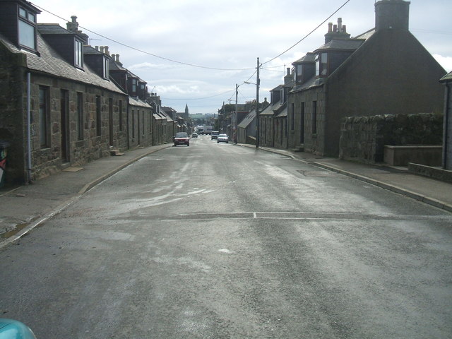
Auchmaliddie is a small village located in Aberdeenshire, Scotland. Situated in the northeast of the country, it is about 15 miles north of the city of Aberdeen. The village is surrounded by picturesque countryside and offers a peaceful and rural setting for its residents.

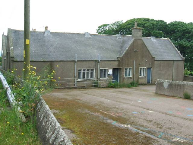
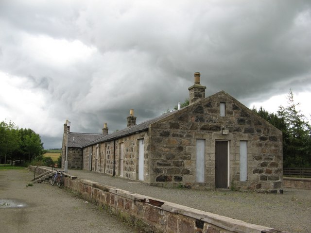
Auchmaliddie is known for its rich history, dating back to ancient times. The area has been inhabited for thousands of years, with evidence of Pictish settlements and ancient forts in the vicinity. The village itself has a charming and traditional feel, with many stone-built houses and buildings that reflect its historical heritage.

Despite its small size, Auchmaliddie has a strong sense of community. The villagers take pride in maintaining the local environment and ensuring the preservation of their cultural traditions. The village is also home to a close-knit community center that serves as a hub for social activities and events.

Agriculture plays a significant role in the local economy, with farming being a common occupation among the villagers. The fertile land surrounding Auchmaliddie allows for the cultivation of crops and the rearing of livestock.

Although Auchmaliddie may be considered remote by some, its proximity to Aberdeen ensures convenient access to amenities and services. Residents can easily reach the city for shopping, healthcare, and employment opportunities.

In summary, Auchmaliddie is a small and historic village in Aberdeenshire, Scotland. It offers a tranquil rural lifestyle and a strong sense of community, with a rich heritage and a connection to the surrounding countryside.

If you have any feedback on the listing, please let us know in the comments section below.

Auchmaliddie Images

Images are sourced within 2km of 57.49326/-2.1967367 or Grid Reference NJ8844. Thanks to Geograph Open Source API. All images are credited.

Auchmaliddie Recumbent Stone Circle (1) These two white quartz blocks are all that remains of the circle. If all the stones were originally of the same white quartz, it must have been a particularly imposing and dramatic structure. The nearer block is the recumbent, which has fallen to the right, and behind it is the west flanker, fallen the other way.  See <span class="nowrap"><a title="http://canmore.rcahms.gov.uk/en/site/19879/details/auchmaliddie/" rel="nofollow ugc noopener" href="http://canmore.rcahms.gov.uk/en/site/19879/details/auchmaliddie/">Link</a><img style="margin-left:2px;" alt="External link" title="External link - shift click to open in new window" src="https://s1.geograph.org.uk/img/external.png" width="10" height="10"/></span> for more information. <a href="https://www.geograph.org.uk/photo/4468342">NJ8844 : Auchmaliddie Recumbent Stone Circle (2)</a>
Auchmaliddie Recumbent Stone Circle (1)
These two white quartz blocks are all that remains of the circle. If all the stones were originally of the same white quartz, it must have been a particularly imposing and dramatic structure. The nearer block is the recumbent, which has fallen to the right, and behind it is the west flanker, fallen the other way. See LinkExternal link for more information. NJ8844 : Auchmaliddie Recumbent Stone Circle (2)
Auchmaliddie Recumbent Stone Circle (2) These two white quartz blocks are all that remains of the circle. If all the stones were originally of the same white quartz, it must have been a particularly imposing and dramatic structure. The nearer stone is the west flanker, which has fallen towards the camera position, and the other is the recumbent, which has fallen away from the camera.  See <span class="nowrap"><a title="http://canmore.rcahms.gov.uk/en/site/19879/details/auchmaliddie/" rel="nofollow ugc noopener" href="http://canmore.rcahms.gov.uk/en/site/19879/details/auchmaliddie/">Link</a><img style="margin-left:2px;" alt="External link" title="External link - shift click to open in new window" src="https://s1.geograph.org.uk/img/external.png" width="10" height="10"/></span> for more information. <a href="https://www.geograph.org.uk/photo/4468345">NJ8844 : Auchmaliddie Recumbent Stone Circle (3)</a>
Auchmaliddie Recumbent Stone Circle (2)
These two white quartz blocks are all that remains of the circle. If all the stones were originally of the same white quartz, it must have been a particularly imposing and dramatic structure. The nearer stone is the west flanker, which has fallen towards the camera position, and the other is the recumbent, which has fallen away from the camera. See LinkExternal link for more information. NJ8844 : Auchmaliddie Recumbent Stone Circle (3)
Auchmaliddie Recumbent Stone Circle (3) These two white quartz blocks are all that remains of the circle. If all the stones were originally of the same white quartz, it must have been a particularly imposing and dramatic structure. The stone on the right is the west flanker, which has fallen to the right, and the recumbent, on the left has fallen to the left. See <span class="nowrap"><a title="http://canmore.rcahms.gov.uk/en/site/19879/details/auchmaliddie/" rel="nofollow ugc noopener" href="http://canmore.rcahms.gov.uk/en/site/19879/details/auchmaliddie/">Link</a><img style="margin-left:2px;" alt="External link" title="External link - shift click to open in new window" src="https://s1.geograph.org.uk/img/external.png" width="10" height="10"/></span> for more information. <a href="https://www.geograph.org.uk/photo/1304261">NJ8844 : Rocking Stones</a>
Auchmaliddie Recumbent Stone Circle (3)
These two white quartz blocks are all that remains of the circle. If all the stones were originally of the same white quartz, it must have been a particularly imposing and dramatic structure. The stone on the right is the west flanker, which has fallen to the right, and the recumbent, on the left has fallen to the left. See LinkExternal link for more information. NJ8844 : Rocking Stones
Overton of Knaven Overton seen against a field of ripening barley.
Overton of Knaven
Overton seen against a field of ripening barley.
Crossroads, New Deer
Departing storm, Bedlam
Round bales and storm, Myre of Bedlam
Wheat, Knaps of Bedlam
Beside the B9170, south of Bedlam
Middlemuir
Middlemuir
B9170 departs New Deer
Moss-side
Moss-side
B9170, Middlemuir
B9170, Middlemuir
New Deer, The Earl of Aberdeen Arms Hotel ...but known to everybody as 'The Howe' being situated at the bottom of a hill
New Deer, The Earl of Aberdeen Arms Hotel
...but known to everybody as 'The Howe' being situated at the bottom of a hill
Power lines Near Myre of Bedlam
Power lines
Near Myre of Bedlam
Overton
Overton
View at Overton Looking northwest
View at Overton
Looking northwest
Track to North Bedlam View south
Track to North Bedlam
View south
Show me another place!

Auchmaliddie is located at Grid Ref: NJ8844 (Lat: 57.49326, Lng: -2.1967367)

Unitary Authority: Aberdeenshire

Police Authority: North East

What 3 Words

///airfields.whistling.couches. Near New Pitsligo, Aberdeenshire

Nearby Locations

Auchmaliddie

Related Wikis

New Deer

New Deer (Scottish Gaelic: Achadh Reite) is a settlement in Aberdeenshire, North East Scotland, which lies in the valley of Deer. It is located at the...

Cairnorrie

Cairnorrie is a rural settlement in the Formartine area of Aberdeenshire, Scotland, situated on the B9170 road between Methlick and New Deer. The primary...

Maud F.C.

Maud Football Club are a Scottish football club from the village of Maud, Aberdeenshire. Members of the Scottish Junior Football Association, they currently...

Maud Hospital

Maud Hospital was a small hospital providing psychogeriatric services in Maud, Aberdeenshire. It was managed by NHS Grampian. == History == The hospital...

Maud Junction railway station

Maud Junction railway station was a railway station in Maud, Aberdeenshire, Scotland, now housing the Maud Railway Museum. It was a junction where the...

Maud, Aberdeenshire

Maud (Scottish Gaelic: Am Mòd) is a village in the Buchan area of the Scottish county of Aberdeenshire, with a population of 780 (2006 estimate). Located...

Clackriach Castle

Clackriach Castle was a 16th-century tower house, about 11 miles (18 km) north of Ellon, Aberdeenshire, Scotland, and 1 mile (1.6 km) south-east of Maud...

Auchnagatt railway station

Auchnagatt railway station was a railway station in Auchnagatt, Aberdeenshire. Before its closure, services ran to Fraserburgh, Peterhead and Aberdeen...

Nearby Amenities

Located within 500m of 57.49326,-2.1967367
Design: barrel
Power: tower
Lat/Long: 57.4962576/-2.1975066
Design: barrel
Power: tower
Lat/Long: 57.4959005/-2.1914578
Power: pole
Lat/Long: 57.4897512/-2.2010162
Power: pole
Lat/Long: 57.4900754/-2.1954452
Power: pole
Lat/Long: 57.4894584/-2.1951409
Power: pole
Lat/Long: 57.4947803/-2.1899077
Power: pole
Lat/Long: 57.4973822/-2.1960171
Power: pole
Lat/Long: 57.4976026/-2.1972796
Auchmaliddie
Alt Name: Rocking Stones
Archaeological Site: megalith
Description: Remains of stone circle comprised of a recumbent and pillar stone.
Historic: archaeological_site
Megalith Type: stone_circle
Ref Canmore: 19879
Wikidata: Q56665677
Lat/Long: 57.4937729/-2.1992625
The data included in this document is from www.openstreetmap.org. The data is made available under ODbL.

Have you been to Auchmaliddie?

Leave your review of Auchmaliddie below (or comments, questions and feedback).