Auchingoul

Settlement in Banffshire

Scotland

Auchingoul

Bellman's Wood Recumbent Stone Circle (1) There are just three stones of this circle left, and they are partly obscured by stones gathered from the fields and dumped there. The nearest one is the west flanker, which has slipped down the slight slope before toppling. To its right is the east flanker, which has fallen forwards, and in the corner of the fence is what may have been a kerb stone. See <span class="nowrap"><a title="https://canmore.org.uk/site/18427/bellmans-wood" rel="nofollow ugc noopener" href="https://canmore.org.uk/site/18427/bellmans-wood">Link</a><img style="margin-left:2px;" alt="External link" title="External link - shift click to open in new window" src="https://s1.geograph.org.uk/img/external.png" width="10" height="10"/></span> for more information. <a href="https://www.geograph.org.uk/photo/4743220">NJ6050 : Bellman's Wood Recumbent Stone Circle (2)</a>
Bellman's Wood Recumbent Stone Circle (1) Credit: Anne Burgess

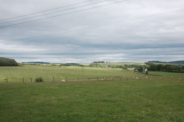
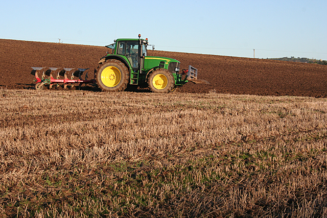
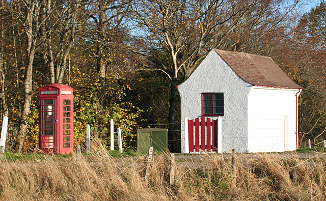
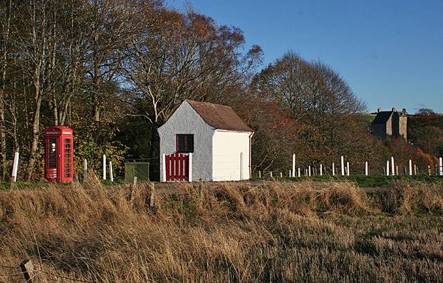
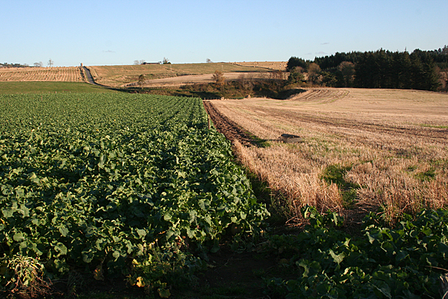
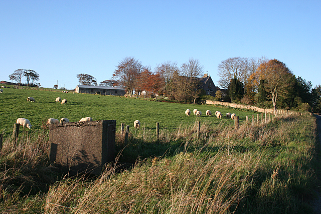
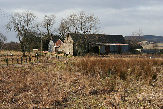
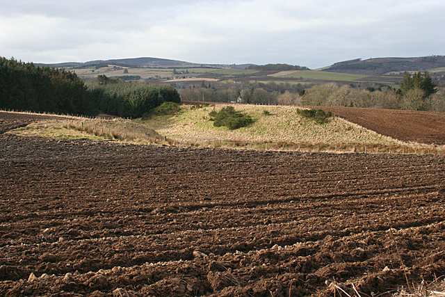
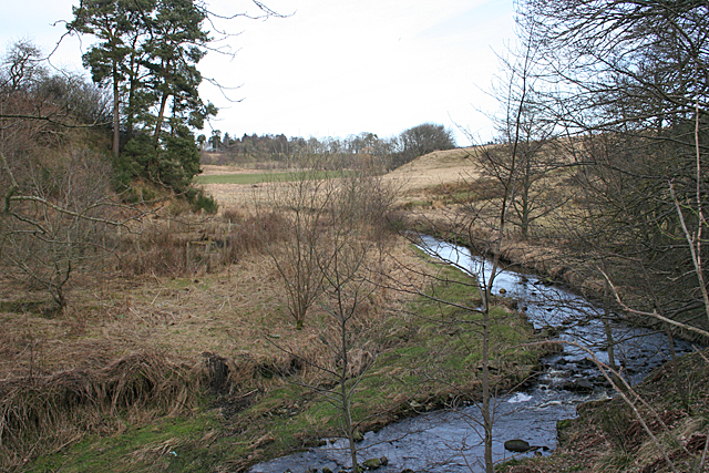
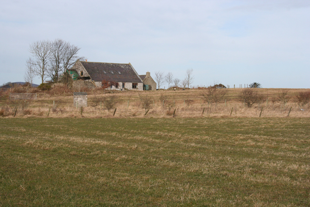
Auchingoul is a small village located in the historic county of Banffshire, Scotland. Situated in the northeast of the country, it lies approximately 50 miles northwest of Aberdeen. The village is nestled amidst the picturesque countryside, surrounded by rolling hills and farmland.

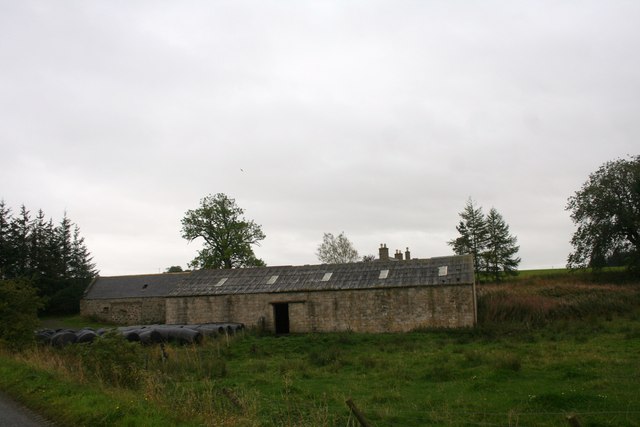
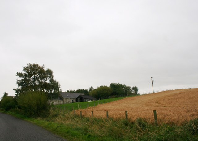
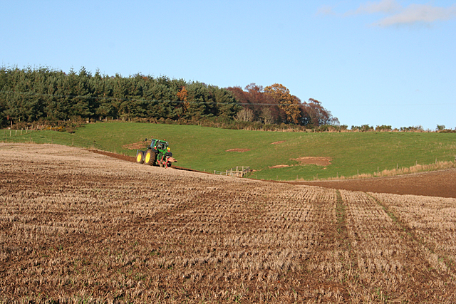
Auchingoul has a rich history dating back many centuries. It was established as a farming community and has retained its rural character over the years. The village is known for its traditional stone houses, which add to its charm and character.

In terms of amenities, Auchingoul offers a few essential services to its residents. There is a local primary school that serves the village and the surrounding areas. Additionally, there is a small shop where villagers can purchase basic groceries and essentials. For more extensive shopping needs, residents typically travel to nearby towns or cities.

The village is also well-positioned for outdoor enthusiasts. Its location provides easy access to the scenic landscapes of the Aberdeenshire countryside. There are several walking and hiking trails in the vicinity, allowing visitors to explore the surrounding natural beauty.

Auchingoul is a close-knit community where residents often engage in social activities. The village hosts various events throughout the year, including local festivals and gatherings. These events provide an opportunity for villagers to come together and celebrate their shared heritage.

Overall, Auchingoul offers a peaceful and idyllic setting for those seeking a rural lifestyle in the stunning Scottish countryside.

If you have any feedback on the listing, please let us know in the comments section below.

Auchingoul Images

Images are sourced within 2km of 57.526663/-2.6517478 or Grid Reference NJ6148. Thanks to Geograph Open Source API. All images are credited.

Bellman's Wood Recumbent Stone Circle (1) There are just three stones of this circle left, and they are partly obscured by stones gathered from the fields and dumped there. The nearest one is the west flanker, which has slipped down the slight slope before toppling. To its right is the east flanker, which has fallen forwards, and in the corner of the fence is what may have been a kerb stone. See <span class="nowrap"><a title="https://canmore.org.uk/site/18427/bellmans-wood" rel="nofollow ugc noopener" href="https://canmore.org.uk/site/18427/bellmans-wood">Link</a><img style="margin-left:2px;" alt="External link" title="External link - shift click to open in new window" src="https://s1.geograph.org.uk/img/external.png" width="10" height="10"/></span> for more information. <a href="https://www.geograph.org.uk/photo/4743220">NJ6050 : Bellman's Wood Recumbent Stone Circle (2)</a>
Bellman's Wood Recumbent Stone Circle (1)
There are just three stones of this circle left, and they are partly obscured by stones gathered from the fields and dumped there. The nearest one is the west flanker, which has slipped down the slight slope before toppling. To its right is the east flanker, which has fallen forwards, and in the corner of the fence is what may have been a kerb stone. See LinkExternal link for more information. NJ6050 : Bellman's Wood Recumbent Stone Circle (2)
Bellman's Wood Recumbent Stone Circle (2) In the foreground is the east flanker, which has toppled towards the camera position. At extreme left is the west flanker, which has slipped down the slope before falling over. The other stones are mostly boulders collected from the field, though one of them may be a kerb stone. See <span class="nowrap"><a title="https://canmore.org.uk/site/18427/bellmans-wood" rel="nofollow ugc noopener" href="https://canmore.org.uk/site/18427/bellmans-wood">Link</a><img style="margin-left:2px;" alt="External link" title="External link - shift click to open in new window" src="https://s1.geograph.org.uk/img/external.png" width="10" height="10"/></span> for more information. <a href="https://www.geograph.org.uk/photo/4743224">NJ6050 : Bellman's Wood Recumbent Stone Circle (3)</a>
Bellman's Wood Recumbent Stone Circle (2)
In the foreground is the east flanker, which has toppled towards the camera position. At extreme left is the west flanker, which has slipped down the slope before falling over. The other stones are mostly boulders collected from the field, though one of them may be a kerb stone. See LinkExternal link for more information. NJ6050 : Bellman's Wood Recumbent Stone Circle (3)
Bellman's Wood Recumbent Stone Circle (3) In the foreground is the fallen east flanker, the base of which (on the right) is in its original position. The other large stone is the west flanker, which has slid out of position before falling. Above the right-hand end of the east flanker is the tip of a stone which may have been a kerb stone of a now-vanished cairn. See <span class="nowrap"><a title="https://canmore.org.uk/site/18427/bellmans-wood" rel="nofollow ugc noopener" href="https://canmore.org.uk/site/18427/bellmans-wood">Link</a><img style="margin-left:2px;" alt="External link" title="External link - shift click to open in new window" src="https://s1.geograph.org.uk/img/external.png" width="10" height="10"/></span> for more information. <a href="https://www.geograph.org.uk/photo/4743229">NJ6050 : Bellman's Wood Recumbent Stone Circle (4)</a>
Bellman's Wood Recumbent Stone Circle (3)
In the foreground is the fallen east flanker, the base of which (on the right) is in its original position. The other large stone is the west flanker, which has slid out of position before falling. Above the right-hand end of the east flanker is the tip of a stone which may have been a kerb stone of a now-vanished cairn. See LinkExternal link for more information. NJ6050 : Bellman's Wood Recumbent Stone Circle (4)
Bellman's Wood Recumbent Stone Circle (4) This Ordnance Survey bench mark has been carved, in what archaeologists have described as an act of vandalism, on the upper surface of the fallen west flanker of the stone circle. See <span class="nowrap"><a title="https://canmore.org.uk/site/18427/bellmans-wood" rel="nofollow ugc noopener" href="https://canmore.org.uk/site/18427/bellmans-wood">Link</a><img style="margin-left:2px;" alt="External link" title="External link - shift click to open in new window" src="https://s1.geograph.org.uk/img/external.png" width="10" height="10"/></span> for more information. <a href="https://www.geograph.org.uk/photo/4743217">NJ6050 : Bellman's Wood Recumbent Stone Circle (1)</a>
Bellman's Wood Recumbent Stone Circle (4)
This Ordnance Survey bench mark has been carved, in what archaeologists have described as an act of vandalism, on the upper surface of the fallen west flanker of the stone circle. See LinkExternal link for more information. NJ6050 : Bellman's Wood Recumbent Stone Circle (1)
View over the fields Typical rolling hills in this part of Aberdeenshire.
View over the fields
Typical rolling hills in this part of Aberdeenshire.
Former tollhouse Surveyed by the Milestone Society.  This old toll house is on the A97 from Huntly to Aberchirder at Bridge of Marnoch. It is on the west side of the road just south of the bridge over the River Deveron.  The safety barrier at the low stone bridge can just be seen in the photograph.  The single storey house has been modernised with the addition of dormer windows but it is the classic shape of a tollhouse and is another 'guarding' a bridge.
Former tollhouse
Surveyed by the Milestone Society. This old toll house is on the A97 from Huntly to Aberchirder at Bridge of Marnoch. It is on the west side of the road just south of the bridge over the River Deveron. The safety barrier at the low stone bridge can just be seen in the photograph. The single storey house has been modernised with the addition of dormer windows but it is the classic shape of a tollhouse and is another 'guarding' a bridge.
Woodhead Steading Woodhead Farm by Auchingoul.
Woodhead Steading
Woodhead Farm by Auchingoul.
Wardwell Farm A farm by Auchingoul.
Wardwell Farm
A farm by Auchingoul.
Ploughing below Bellman's Wood Bellman's Wood occupies the top of the slope above the B9117 near Marnoch.
Ploughing below Bellman's Wood
Bellman's Wood occupies the top of the slope above the B9117 near Marnoch.
Ploughing at Marnoch A tractorman ploughs meticulous furrows in a field by the B9117 at Marnoch.
Ploughing at Marnoch
A tractorman ploughs meticulous furrows in a field by the B9117 at Marnoch.
Telecommunications A tiny whitewashed exchange and a traditional red telephone kiosk. I wonder how many people use kiosks these days?
Telecommunications
A tiny whitewashed exchange and a traditional red telephone kiosk. I wonder how many people use kiosks these days?
Telephone Exchange and Castle The ancient castle of Kinnairdy in the background, and the now redundant Bridge of Marnoch telephone exchange in the foreground.
Telephone Exchange and Castle
The ancient castle of Kinnairdy in the background, and the now redundant Bridge of Marnoch telephone exchange in the foreground.
Contrasting Crops On the left, the green leaves of a crop of brassicas; to the right, the gold of cereal stubble.
Contrasting Crops
On the left, the green leaves of a crop of brassicas; to the right, the gold of cereal stubble.
Myreside Sheep in a field beside the A97 near Bridge of Marnoch.
Myreside
Sheep in a field beside the A97 near Bridge of Marnoch.
Mosshead Farm buildings beside a minor road at Kinnairdy.
Mosshead
Farm buildings beside a minor road at Kinnairdy.
Glacial Landforms The hollow is almost certainly a relic of the glaciers of the last Ice Age, carved by melting water.
Glacial Landforms
The hollow is almost certainly a relic of the glaciers of the last Ice Age, carved by melting water.
Burn of Auchintoul Looking upstream from the bridge at Mill of Kinnairdy. Compare with <a href="https://www.geograph.org.uk/photo/354007">NJ6150 : A chicken run on the banks of the burn by Mill of Kinnairdy.</a> taken eight years earlier, and note that the chicken run seems to have fallen into disuse.
Burn of Auchintoul
Looking upstream from the bridge at Mill of Kinnairdy. Compare with NJ6150 : A chicken run on the banks of the burn by Mill of Kinnairdy. taken eight years earlier, and note that the chicken run seems to have fallen into disuse.
Blackhillock Blackhillock seems to be in course of renovation.
Blackhillock
Blackhillock seems to be in course of renovation.
Show me another place!

Auchingoul is located at Grid Ref: NJ6148 (Lat: 57.526663, Lng: -2.6517478)

Unitary Authority: Aberdeenshire

Police Authority: North East

What 3 Words

///ample.afford.camcorder. Near Aberchirder, Aberdeenshire

Nearby Locations

Auchingoul

Related Wikis

Inverkeithny

Inverkeithny is a village in the Formartine area of Aberdeenshire, Scotland. The village lies near where the Burn of Forgue flows into the River Deveron...

Yonder Bognie

Yonder Bognie is a stone circle in Aberdeenshire, Scotland. It is located in an agricultural field under private ownership and is a scheduled monument...

Aberchirder

Aberchirder (Scots: Fogieloan, Scottish Gaelic: Obar Chiardair) known locally as Foggieloan or Foggie, is a village in Aberdeenshire, Scotland, situated...

Bognie Castle

Bognie Castle (also called Conzie Castle) is a ruined castle near Huntly and Banff in the Aberdeenshire region of Scotland. It was built in the 17th century...

Bogniebrae

Bogniebrae () is a small rural settlement in Aberdeenshire, Scotland. It is located at the junction of the A97 and B9001 roads, six miles (ten kilometres...

Forgue

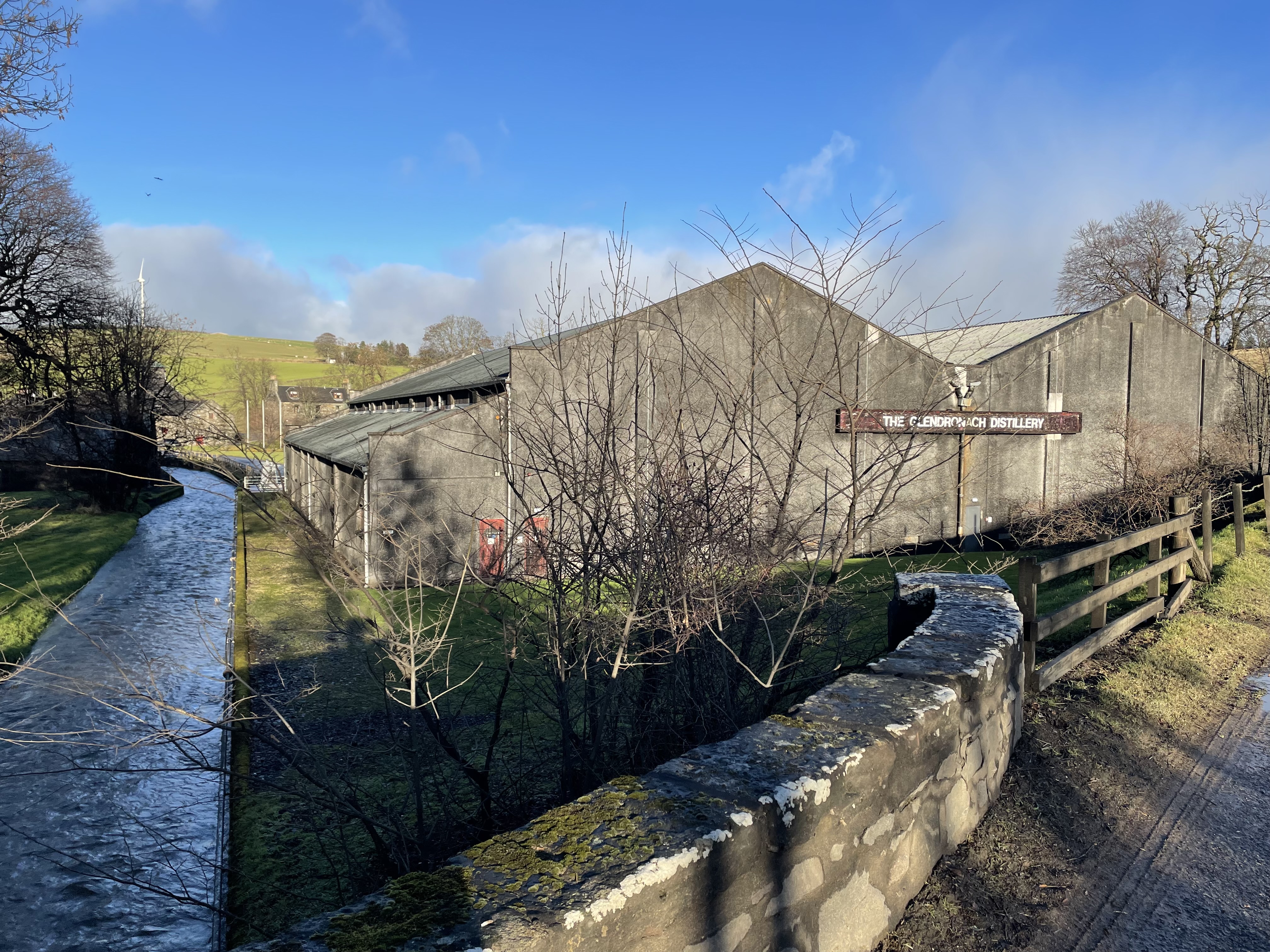
Forgue is a hamlet in Aberdeenshire. It lies 35 miles (56 km) northwest of Aberdeen and 8 miles (13 km) northeast of Huntly. The Glendronach distillery...

Glendronach distillery

Glendronach distillery is a Scottish whisky distillery located near Forgue, by Huntly, Aberdeenshire, in the Highland whisky district. It was owned by...

Fourman Hill

Fourman Hill is a hill located west of Bogniebrae, Aberdeenshire, Scotland. It has an elevation of 1,127 feet (344 m). A cairn near the summit marked the...

Nearby Amenities

Located within 500m of 57.526663,-2.6517478
Power: pole
Lat/Long: 57.5302684/-2.6477904
Power: pole
Lat/Long: 57.5295169/-2.6475079
Power: pole
Lat/Long: 57.5288815/-2.6472712
Power: pole
Lat/Long: 57.528406/-2.6472355
Power: pole
Lat/Long: 57.5279059/-2.6471999
Power: pole
Lat/Long: 57.5271147/-2.6471515
Power: pole
Lat/Long: 57.5266528/-2.6471185
Power: pole
Lat/Long: 57.5261199/-2.6478489
Power: pole
Lat/Long: 57.5256265/-2.6485157
Power: pole
Lat/Long: 57.5253888/-2.6486761
Power: pole
Lat/Long: 57.5245838/-2.6491927
Power: pole
Lat/Long: 57.5237639/-2.6497323
Power: pole
Lat/Long: 57.5230286/-2.6501904
Power: pole
Lat/Long: 57.5223221/-2.6506613
Power: pole
Lat/Long: 57.5296862/-2.6465444
Power: pole
Lat/Long: 57.5274544/-2.6500389
Power: pole
Lat/Long: 57.5269416/-2.6491932
Power: pole
Lat/Long: 57.5264557/-2.6483974
Power: pole
Lat/Long: 57.5255733/-2.6468384
Power: pole
Lat/Long: 57.5251409/-2.6460157
Power: pole
Lat/Long: 57.5246075/-2.6449936
Power: pole
Lat/Long: 57.5280947/-2.6510629
Power: pole
Lat/Long: 57.5286394/-2.6519738
Power: pole
Lat/Long: 57.5291129/-2.6527561
Power: pole
Lat/Long: 57.5294475/-2.6532931
Power: pole
Lat/Long: 57.5299365/-2.6541023
Power: pole
Lat/Long: 57.5303926/-2.6548463
Power: pole
Lat/Long: 57.5236762/-2.6574946
Power: pole
Lat/Long: 57.5241673/-2.6586931
The data included in this document is from www.openstreetmap.org. The data is made available under ODbL.

Have you been to Auchingoul?

Leave your review of Auchingoul below (or comments, questions and feedback).