Astley Burf

Settlement in Worcestershire Malvern Hills

England

Astley Burf

Looking southwest from the B4196 in 1987
Looking southwest from the B4196 in 1987 Credit: John Baker

Astley Burf is a small village located in the county of Worcestershire, England. Situated on the banks of the River Severn, it lies approximately 6 miles southeast of the town of Stourport-on-Severn and 9 miles north of the city of Worcester. The village is part of the Wyre Forest District and falls within the civil parish of Areley Kings.

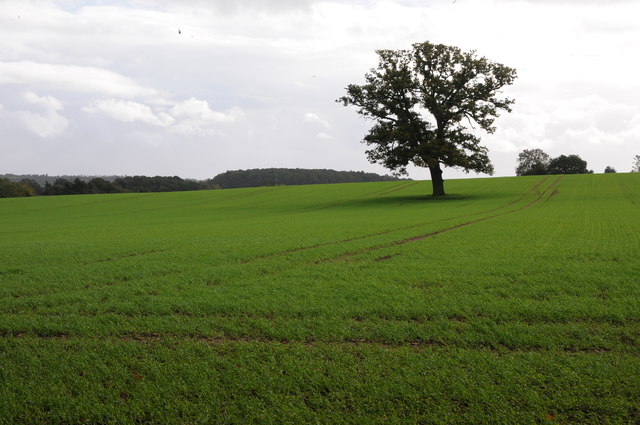
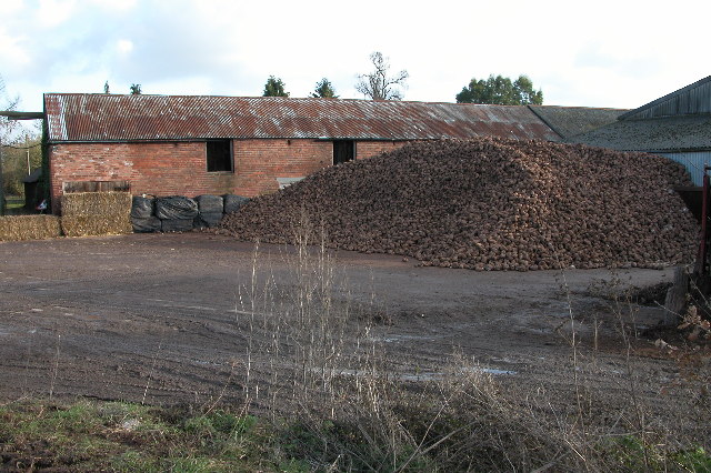
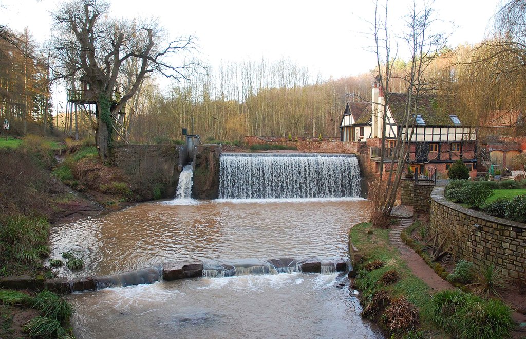
Astley Burf is renowned for its picturesque setting and tranquil atmosphere. The village is surrounded by lush green fields, rolling hills, and dense woodlands, making it an ideal location for those seeking a peaceful and rural lifestyle. The River Severn is a prominent feature of the area, offering stunning views and opportunities for boating and fishing.

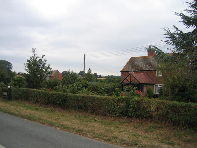
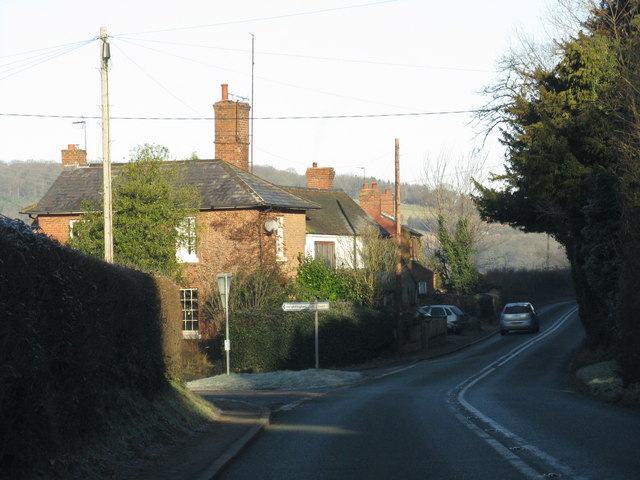
The village itself is characterized by a mix of traditional and modern architecture. It features a handful of historic buildings, including St. Peter's Church, which dates back to the 12th century and boasts beautiful stained glass windows. There are also several charming cottages and houses that add to the village's charm.

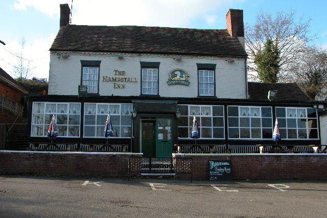
Although small in size, Astley Burf is a close-knit community with a strong sense of community spirit. The village has a local pub, The Hampstall Inn, which serves as a meeting point for locals and visitors alike. It also benefits from being in close proximity to a range of amenities and services, with larger towns and cities easily accessible for additional facilities.

Overall, Astley Burf offers a peaceful and idyllic lifestyle with its beautiful surroundings, historic buildings, and strong community spirit. It is a place where residents can enjoy the tranquility of rural living while still being within reach of necessary amenities.

If you have any feedback on the listing, please let us know in the comments section below.
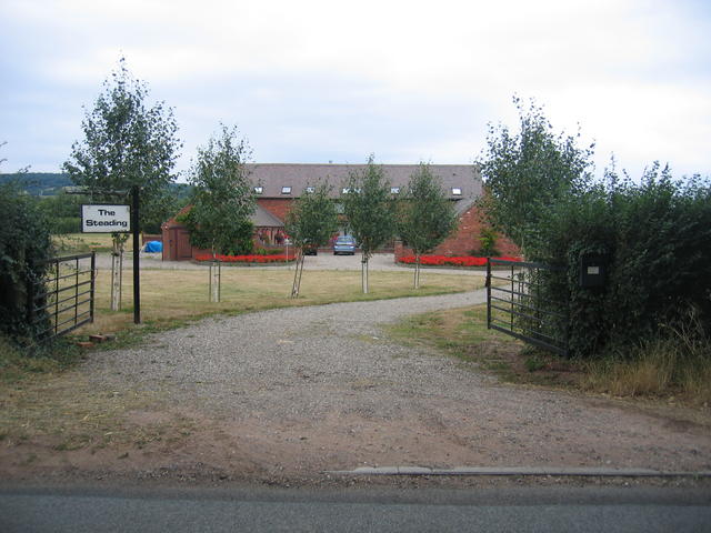
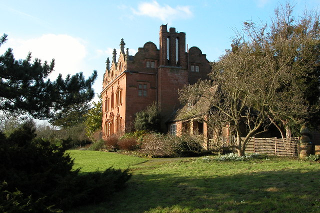
Astley Burf Images

Images are sourced within 2km of 52.309071/-2.283079 or Grid Reference SO8067. Thanks to Geograph Open Source API. All images are credited.

Looking southwest from the B4196 in 1987
Oak tree in an arable field Oak tree in an arable field between Astely Cross and Dunley.
Oak tree in an arable field
Oak tree in an arable field between Astely Cross and Dunley.
Poplars looking straight up at the sky in the middle of a group of very tall straight poplar trees
Poplars
looking straight up at the sky in the middle of a group of very tall straight poplar trees
Glazen Bridge On the turnpike from Bewdley to Worcester and rebuilt by the county council in 1925 with an iron balustrade.Not a particularly distinguished bridge (in my opinion) but selected for a mention in Fred Brook, The Industrial Archaeology of the British Isles, 1 West Midlands (1977). This crosses the Dick Brook.
Glazen Bridge
On the turnpike from Bewdley to Worcester and rebuilt by the county council in 1925 with an iron balustrade.Not a particularly distinguished bridge (in my opinion) but selected for a mention in Fred Brook, The Industrial Archaeology of the British Isles, 1 West Midlands (1977). This crosses the Dick Brook.
Tree surgeon performing delicate operation over greenhouse Behind the New Inn, Shrawley, Worcestershire
Tree surgeon performing delicate operation over greenhouse
Behind the New Inn, Shrawley, Worcestershire
New Inn Lane, Shrawley Lane running behind the New Inn
New Inn Lane, Shrawley
Lane running behind the New Inn
Sign for the New Inn, Noutard's Green Shrawley, Worcestershire
Sign for the New Inn, Noutard's Green
Shrawley, Worcestershire
Horses in pasture Taken from the B4196 near Shrawley, Worcestershire
Horses in pasture
Taken from the B4196 near Shrawley, Worcestershire
Gateway to the dream of country living Off B4196, near the New Inn, Noutard's Green, Worcestershire
Gateway to the dream of country living
Off B4196, near the New Inn, Noutard's Green, Worcestershire
The New Inn, Shrawley The New Inn in Shrawley is situated on the B4196.
The New Inn, Shrawley
The New Inn in Shrawley is situated on the B4196.
Pool House, Astley Grade II listed Gothic Revival country house in the village of Astley, near Stourport-on-Severn
Pool House, Astley
Grade II listed Gothic Revival country house in the village of Astley, near Stourport-on-Severn
Pound Farm, Astley Astley Farm with a large mound of root Crop, probably turnips for winter feed in the yard.
Pound Farm, Astley
Astley Farm with a large mound of root Crop, probably turnips for winter feed in the yard.
New Barns Farm The old farmhouse is on the right and the barns, now converted into <a href="https://www.geograph.org.uk/photo/218662">SO7969 : The Steadings</a> can be seen in the distance.  Behind the photographer the urban development of <a href="https://www.geograph.org.uk/photo/218636">SO7969 : Edge of Areley Kings</a> and Stourport and then much of the West Midlands commences.
New Barns Farm
The old farmhouse is on the right and the barns, now converted into SO7969 : The Steadings can be seen in the distance. Behind the photographer the urban development of SO7969 : Edge of Areley Kings and Stourport and then much of the West Midlands commences.
Edge of Areley Kings Looking the other way from <a href="https://www.geograph.org.uk/photo/218563">SO7969 : New Barns Farm</a> towards the edge of the Areley Kings area of Stourport.
Edge of Areley Kings
Looking the other way from SO7969 : New Barns Farm towards the edge of the Areley Kings area of Stourport.
The Steadings The converted barns at New Barns Farm on the edge of Stourport-on-Severn. These are the barns just visible from near <a href="https://www.geograph.org.uk/photo/218563">SO7969 : New Barns Farm</a> farmhouse.
The Steadings
The converted barns at New Barns Farm on the edge of Stourport-on-Severn. These are the barns just visible from near SO7969 : New Barns Farm farmhouse.
Field patterns at Astley Oil seed rape and ploughed fields at Astley.
Field patterns at Astley
Oil seed rape and ploughed fields at Astley.
Bridleway To Astley Hall
Lane To Astley
Lane To Astley
Show me another place!

Astley Burf is located at Grid Ref: SO8067 (Lat: 52.309071, Lng: -2.283079)

Administrative County: Worcestershire

District: Malvern Hills

Police Authority: West Merica

What 3 Words

///duos.toys.leaflet. Near Stourport-on-Severn, Worcestershire

Related Wikis

Astley Burf

Astley Burf is a hamlet in the parish of Astley, Worcestershire, England, on the banks of the River Severn. Within the hamlet there is one riverside public...

Astley Hall, Stourport-on-Severn

Astley Hall is a country house in Astley near Stourport-on-Severn, Worcestershire, England. The hall was the home of Prime Minister Stanley Baldwin from...

Pool House, Worcestershire

Pool House is a Grade II* listed house in Astley, in the county of Worcestershire, England.In the area close to Stourport-on-Severn, there are several...

Dick Brook

Dick Brook is small tributary stream of the River Severn that flows through Worcestershire, England.The brook is formed from two small unnamed streams...

Noutard's Green

Noutard's Green is a hamlet within the civil parish of Shrawley in Worcestershire, England. == References ==

Astley Cross

Astley Cross is a village in Worcestershire, England, located on the outskirts of Stourport-on-Severn. The village lies 1 mile (1.6 km) south of the centre...

Astley, Worcestershire

Astley is a village, and a civil parish (with Dunley) in Worcestershire, England, about two miles outside Stourport-on-Severn and seven miles south-west...

Dunley, Worcestershire

Dunley is a village, and a civil parish (with Astley), in the administrative district of Malvern Hills in the county of Worcestershire, England. ��2�...

Related Videos

A Bluebell walk in Shrawley

It's Bluebell season and Charlotte and I explored one of our local hotspots for Bluebell activity, Shrawley wood. Situated not far ...

Denzil Danter Waltzer at Stourport carnival fun fair.2023

Running well at the riverside meadows, Stourport on Severn, Worcestershire. The full vlog is already up on the channel,like and ...

Cab view. Denzil Danter Waltzer.

kind permission to film the 2015 Fairtrade waltzer owned by Denzil Danter at the Stourport on Severn funfair at Stourport carnival ...

Nearby Amenities

Located within 500m of 52.309071,-2.283079
Bus Stop
Telephone Box
Bus: yes
Naptan AtcoCode: 2000G046200
Naptan Bearing: E
Naptan CommonName: Telephone Box
Naptan Indicator: Adj
Naptan Landmark: opposite Woodlands Farm
Naptan NaptanCode: wocdjmpa
Naptan Street: Hampstall Lane
Naptan Verified: no
Public Transport: platform
Source: naptan_import
Lat/Long: 52.3071815/-2.2789845
Post Box
Collection Times: Mo-Fr 16:30; Sa 09:15
Post Box Type: lamp
Ref: DY13 85
Royal Cypher: EIIR
Royal Cypher Wikidata: Q33102113
Lat/Long: 52.3070844/-2.2778514
Telephone
Booth: KX100
Covered: booth
Phone: +44 1299 822616
Lat/Long: 52.3070812/-2.2785468
Post Box
Collection Times: Mo-Fr 16:30; Sa 09:15
Ref: DY13 76
Lat/Long: 52.3089792/-2.2829437
Barrier: stile
Lat/Long: 52.3107261/-2.2896812
Barrier: stile
Lat/Long: 52.3090162/-2.2828359
Astley Burf
Is In: Worcestershire
Place: hamlet
Lat/Long: 52.3073972/-2.2781474
Barrier: stile
Lat/Long: 52.312917/-2.2838194
Barrier: kissing_gate
Lat/Long: 52.3098544/-2.2788247
New house
Power: pole
Transformer: distribution
Voltage Primary: 11000
Lat/Long: 52.3055549/-2.2876668
Power: pole
Lat/Long: 52.3058128/-2.287463
Astley Burf West
Power: pole
Transformer: distribution
Voltage Primary: 11000
Lat/Long: 52.3073885/-2.2836904
Power: pole
Lat/Long: 52.3056275/-2.2867039
Power: pole
Lat/Long: 52.3062634/-2.285743
Power: pole
Lat/Long: 52.3064898/-2.2846185
Power: pole
Lat/Long: 52.3067386/-2.2834148
Power: pole
Lat/Long: 52.3071667/-2.2832532
Power: pole
Lat/Long: 52.3074754/-2.2831265
Astley Burf
Power: pole
Transformer: distribution
Voltage Primary: 11000
Lat/Long: 52.3076656/-2.2819349
Power: pole
Lat/Long: 52.3077898/-2.2810451
Astley Burf Cottage
Power: pole
Transformer: distribution
Voltage Primary: 11000
Lat/Long: 52.3079485/-2.2799052
Power: pole
Lat/Long: 52.3080412/-2.2792051
Power: pole
Lat/Long: 52.3079731/-2.2788021
Power: pole
Lat/Long: 52.308643/-2.2784883
Astley Burf East
Power: pole
Transformer: distribution
Voltage Primary: 11000
Lat/Long: 52.3075947/-2.2761306
Power: pole
Lat/Long: 52.3084065/-2.2760421
Hampstall Inn
Power: pole
Transformer: distribution
Voltage Primary: 11000
Lat/Long: 52.3088337/-2.2757404
Power: pole
Lat/Long: 52.3088722/-2.2759952
Power: pole
Lat/Long: 52.3090542/-2.2771002
Power: pole
Lat/Long: 52.3092281/-2.2782321
Power: pole
Lat/Long: 52.3093453/-2.2781798
Power: pole
Lat/Long: 52.3098151/-2.2782134
Power: pole
Lat/Long: 52.3103276/-2.2787538
Astley Burf North
Power: pole
Transformer: distribution
Voltage Primary: 11000
Lat/Long: 52.3109245/-2.2787149
Weather Lane Farm
Power: pole
Transformer: distribution
Voltage Primary: 11000
Lat/Long: 52.3105432/-2.287994
Location Transition: yes
Power: pole
Lat/Long: 52.310549/-2.2854687
Astley Burf School Camp
Power: pole
Transformer: distribution
Voltage Primary: 11000
Lat/Long: 52.3098619/-2.2835147
Location Transition: yes
Power: pole
Lat/Long: 52.3106457/-2.2841169
Weather Lane Farm East
Power: pole
Transformer: distribution
Voltage Primary: 11000
Lat/Long: 52.3106933/-2.2834182
Power: pole
Lat/Long: 52.310847/-2.2826075
Power: pole
Lat/Long: 52.3110106/-2.2817183
Power: pole
Lat/Long: 52.3111557/-2.2809143
Power: pole
Lat/Long: 52.3113082/-2.2800869
Power: pole
Lat/Long: 52.3115239/-2.2786975
Power: pole
Lat/Long: 52.3122052/-2.2786653
Scots Cottage
Power: pole
Transformer: distribution
Voltage Primary: 11000
Lat/Long: 52.3125496/-2.2784776
Grit Bin
Lat/Long: 52.3072161/-2.2790663
The data included in this document is from www.openstreetmap.org. The data is made available under ODbL.

Have you been to Astley Burf?

Leave your review of Astley Burf below (or comments, questions and feedback).