Burf, The

Settlement in Worcestershire Malvern Hills

England

Burf, The

Looking southwest from the B4196 in 1987
Looking southwest from the B4196 in 1987 Credit: John Baker

Burf, The, Worcestershire is a small picturesque village located in the county of Worcestershire, England. Situated in the Vale of Evesham, it is nestled amidst the rolling hills and verdant countryside that characterizes this region. With a population of around 500 residents, Burf exudes a tranquil and idyllic charm that attracts visitors seeking a peaceful retreat.

The village dates back to medieval times, and its history is reflected in its architecture. The centerpiece of Burf is the St. Mary's Church, a beautiful Grade I listed building that dates back to the 12th century. Its stunning Norman architecture and intricate stained glass windows make it a must-visit for history enthusiasts.

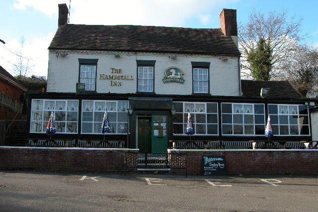
The village itself offers a range of amenities, including a local pub, The Burf Inn, which serves traditional English fare and offers a cozy atmosphere for locals and tourists alike. There is also a village shop, providing essential groceries and serving as a social hub for the community.

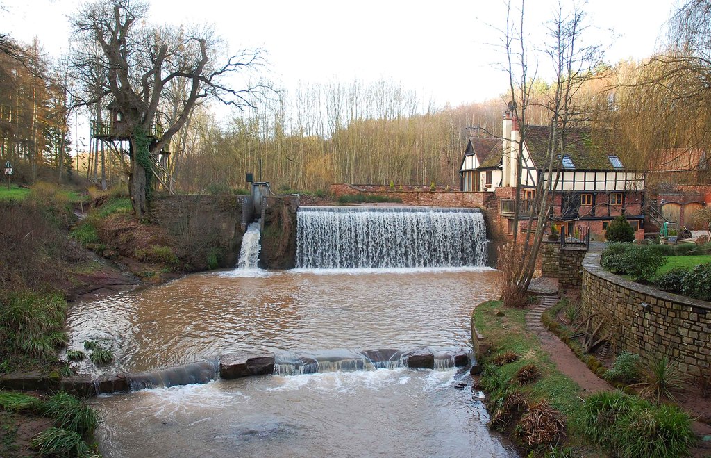
Nature lovers will appreciate the surrounding countryside, which offers ample opportunities for scenic walks and exploration. The nearby Burf Forest is a popular spot for outdoor activities such as hiking and picnicking, with its extensive network of trails and breathtaking views.

Overall, Burf, The, Worcestershire is a hidden gem in the heart of England, offering a charming blend of history, natural beauty, and a close-knit community. It is a destination that allows visitors to escape the hustle and bustle of modern life and immerse themselves in the tranquility of the English countryside.

If you have any feedback on the listing, please let us know in the comments section below.

Burf, The Images

Images are sourced within 2km of 52.305235/-2.287429 or Grid Reference SO8067. Thanks to Geograph Open Source API. All images are credited.

Looking southwest from the B4196 in 1987
The former Rose & Crown (1), at Shrawley, Worcs This former public house closed over a year ago and permission has now been given to convert it into private residential accommodation. It used to be a Marston's house and the building itself is Grade II listed. It dates from the early 19th century with parts dating from the 20th century. It started life as a house, then became licensed premises and will shortly revert to residential use, so it has in effect come full circle. A sad loss to local amenities, but fortunately the village still has the New Inn and nearby is the Lenchford Inn.

<a href="https://www.geograph.org.uk/photo/3431892">SO7965 : The former Rose & Crown (2), at Shrawley, Worcs</a>.
The former Rose & Crown (1), at Shrawley, Worcs
This former public house closed over a year ago and permission has now been given to convert it into private residential accommodation. It used to be a Marston's house and the building itself is Grade II listed. It dates from the early 19th century with parts dating from the 20th century. It started life as a house, then became licensed premises and will shortly revert to residential use, so it has in effect come full circle. A sad loss to local amenities, but fortunately the village still has the New Inn and nearby is the Lenchford Inn. SO7965 : The former Rose & Crown (2), at Shrawley, Worcs.
The former Rose & Crown (2), at Shrawley, Worcs This former pub is on the B4196 road, which runs through the straggly village of Shrawley. It used to have a traditional hanging sign outside but that has already gone and it now awaits conversion into residential accommodation. See also:- <a href="https://www.geograph.org.uk/photo/3431880">SO7965 : The former Rose & Crown (1), at Shrawley, Worcs</a>.
The former Rose & Crown (2), at Shrawley, Worcs
This former pub is on the B4196 road, which runs through the straggly village of Shrawley. It used to have a traditional hanging sign outside but that has already gone and it now awaits conversion into residential accommodation. See also:- SO7965 : The former Rose & Crown (1), at Shrawley, Worcs.
The B4196 road near the former Rose & Crown pub, Shrawley, Worcs The road is heading in the direction of Stourport-on-Severn. The former pub is behind the temporary fencing on the left.

<a href="https://www.geograph.org.uk/photo/3431880">SO7965 : The former Rose & Crown (1), at Shrawley, Worcs</a>.
The B4196 road near the former Rose & Crown pub, Shrawley, Worcs
The road is heading in the direction of Stourport-on-Severn. The former pub is behind the temporary fencing on the left. SO7965 : The former Rose & Crown (1), at Shrawley, Worcs.
Access road to the church etc., Astley, Worcs The road on the left gives access to St. Peter's Church, its small car park and a couple of other properties. The road in the foreground is Church Lane.
Access road to the church etc., Astley, Worcs
The road on the left gives access to St. Peter's Church, its small car park and a couple of other properties. The road in the foreground is Church Lane.
St. Peter's Church, Astley, Worcs The church dates from Norman times, probably mid-12th century. The aisle was rebuilt and widened in 1837-8, and there was a major restoration with substantial alterations in the very early years of the 20th century. Currently the church is fund raising for essential works. The church was originally built as the church for a Benedictine priory which was attached to the Abbey of St. Taurin near Rouen in France. As an "alien" foundation, the priory was suppressed in 1414, over a hundred years before King Henry VIII closed all the other remaining religious houses. Fortunately the church survived and contains a number of interesting monuments.

<a href="https://www.geograph.org.uk/photo/3856068">SO7867 : Porch of St. Peter's Church, Astley, Worcs</a>.
St. Peter's Church, Astley, Worcs
The church dates from Norman times, probably mid-12th century. The aisle was rebuilt and widened in 1837-8, and there was a major restoration with substantial alterations in the very early years of the 20th century. Currently the church is fund raising for essential works. The church was originally built as the church for a Benedictine priory which was attached to the Abbey of St. Taurin near Rouen in France. As an "alien" foundation, the priory was suppressed in 1414, over a hundred years before King Henry VIII closed all the other remaining religious houses. Fortunately the church survived and contains a number of interesting monuments. SO7867 : Porch of St. Peter's Church, Astley, Worcs.
Porch of St. Peter's Church, Astley, Worcs The porch was rebuilt in 1903-4, at the time of a major restoration of the church by the rector, the Rev. Martin Brereton Buckle.

<a href="https://www.geograph.org.uk/photo/3855997">SO7867 : St. Peter's Church, Astley, Worcs</a>.
Porch of St. Peter's Church, Astley, Worcs
The porch was rebuilt in 1903-4, at the time of a major restoration of the church by the rector, the Rev. Martin Brereton Buckle. SO7867 : St. Peter's Church, Astley, Worcs.
Old graveyard at St. Peter's Church, Astley, Worcs The graves here seem quite old and are showing the ravages of time. It is located opposite the church and next to the car park.
Old graveyard at St. Peter's Church, Astley, Worcs
The graves here seem quite old and are showing the ravages of time. It is located opposite the church and next to the car park.
Looking towards Church Lane, Astley, Worcs Looking from the access road which serves the church and a couple of other properties.
Looking towards Church Lane, Astley, Worcs
Looking from the access road which serves the church and a couple of other properties.
St. Peter's Church Restoration Fund information board, Astley, Worcs Located at the side of the car park.
St. Peter's Church Restoration Fund information board, Astley, Worcs
Located at the side of the car park.
Church Lane, Astley, Worcs The main road in the straggly village of Astley.
Church Lane, Astley, Worcs
The main road in the straggly village of Astley.
End of access road, Astley, Worcs Just past St. Peter's Church the access road ends here, with entrances to two residential properties.

<a href="https://www.geograph.org.uk/photo/3855968">SO7867 : Access road to the church etc., Astley, Worcs</a>.
End of access road, Astley, Worcs
Just past St. Peter's Church the access road ends here, with entrances to two residential properties. SO7867 : Access road to the church etc., Astley, Worcs.
Track to Glasshampton Monastery The track is a little rough, consisting of stones and old bricks embedded in the red soil. Looking the other way it provides a distant view of the Monastery.
Track to Glasshampton Monastery
The track is a little rough, consisting of stones and old bricks embedded in the red soil. Looking the other way it provides a distant view of the Monastery.
The view from the porch at Astley Church A damp misty morning
The view from the porch at Astley Church
A damp misty morning
Poplars looking straight up at the sky in the middle of a group of very tall straight poplar trees
Poplars
looking straight up at the sky in the middle of a group of very tall straight poplar trees
Church at Astley Seen from the car park. Money is being collected for the inevitable repairs. The church car park was one of the few places I could park in order to photograph a nearby former water mill.
Church at Astley
Seen from the car park. Money is being collected for the inevitable repairs. The church car park was one of the few places I could park in order to photograph a nearby former water mill.
Glazen Bridge On the turnpike from Bewdley to Worcester and rebuilt by the county council in 1925 with an iron balustrade.Not a particularly distinguished bridge (in my opinion) but selected for a mention in Fred Brook, The Industrial Archaeology of the British Isles, 1 West Midlands (1977). This crosses the Dick Brook.
Glazen Bridge
On the turnpike from Bewdley to Worcester and rebuilt by the county council in 1925 with an iron balustrade.Not a particularly distinguished bridge (in my opinion) but selected for a mention in Fred Brook, The Industrial Archaeology of the British Isles, 1 West Midlands (1977). This crosses the Dick Brook.
Tree surgeon performing delicate operation over greenhouse Behind the New Inn, Shrawley, Worcestershire
Tree surgeon performing delicate operation over greenhouse
Behind the New Inn, Shrawley, Worcestershire
Show me another place!

Burf, The is located at Grid Ref: SO8067 (Lat: 52.305235, Lng: -2.287429)

Administrative County: Worcestershire

District: Malvern Hills

Police Authority: West Mercia

What 3 Words

///symphony.thudding.embraced. Near Stourport-on-Severn, Worcestershire

Related Wikis

Astley Burf

Astley Burf is a hamlet in the parish of Astley, Worcestershire, England, on the banks of the River Severn. Within the hamlet there is one riverside public...

Astley Hall, Stourport-on-Severn

Astley Hall is a country house in Astley near Stourport-on-Severn, Worcestershire, England. The hall was the home of Prime Minister Stanley Baldwin from...

Dick Brook

Dick Brook is small tributary stream of the River Severn that flows through Worcestershire, England.The brook is formed from two small unnamed streams...

Noutard's Green

Noutard's Green is a hamlet within the civil parish of Shrawley in Worcestershire, England. == References ==

Pool House, Worcestershire

Pool House is a Grade II* listed house in Astley, in the county of Worcestershire, England.In the area close to Stourport-on-Severn, there are several...

Astley, Worcestershire

Astley is a village, and a civil parish (with Dunley) in Worcestershire, England, about two miles outside Stourport-on-Severn and seven miles south-west...

Frog Pool

Frog Pool is a hamlet within the civil parish of Shrawley in Worcestershire, England. == References ==

Astley Cross

Astley Cross is a village in Worcestershire, England, located on the outskirts of Stourport-on-Severn. The village lies 1 mile (1.6 km) south of the centre...

Nearby Amenities

Located within 500m of 52.305235,-2.287429
Wood Green East
Power: pole
Transformer: distribution
Voltage Primary: 11000
Lat/Long: 52.3036283/-2.2926451
Power: pole
Lat/Long: 52.3037078/-2.2938668
Barrier: stile
Lat/Long: 52.3044192/-2.2820702
Barrier: stile
Lat/Long: 52.306205/-2.2938051
New house
Power: pole
Transformer: distribution
Voltage Primary: 11000
Lat/Long: 52.3055549/-2.2876668
Astley Hall
Power: pole
Transformer: distribution
Voltage Primary: 11000
Lat/Long: 52.3076275/-2.2933625
Power: pole
Lat/Long: 52.3072651/-2.2922413
Power: pole
Lat/Long: 52.3067091/-2.2905234
Power: pole
Lat/Long: 52.3061441/-2.2887947
Power: pole
Lat/Long: 52.3058128/-2.287463
Astley Burf West
Power: pole
Transformer: distribution
Voltage Primary: 11000
Lat/Long: 52.3073885/-2.2836904
Power: pole
Lat/Long: 52.3056275/-2.2867039
Power: pole
Lat/Long: 52.3062634/-2.285743
Power: pole
Lat/Long: 52.3064898/-2.2846185
Power: pole
Lat/Long: 52.3067386/-2.2834148
Power: pole
Lat/Long: 52.3071667/-2.2832532
Power: pole
Lat/Long: 52.3074754/-2.2831265
Astley Burf
Power: pole
Transformer: distribution
Voltage Primary: 11000
Lat/Long: 52.3076656/-2.2819349
The data included in this document is from www.openstreetmap.org. The data is made available under ODbL.

Have you been to Burf, The?

Leave your review of Burf, The below (or comments, questions and feedback).