Aspley

Settlement in Yorkshire

England

Aspley

Huddersfield narrow Canal approaching Birkhouse Lane The tall structure is the riveting tower of the former Birkhouse Boiler Works. The Huddersfield Narrow Canal was derelict when I used to play alongside it but as can be seen it is now a functional pleasure waterway.
Huddersfield narrow Canal approaching Birkhouse Lane Credit: Chris Allen

Aspley is a quaint village located in the county of Yorkshire, England. Situated in the heart of the picturesque Yorkshire Dales, it is known for its stunning natural beauty and rich historical heritage. With a population of around 500 residents, Aspley exudes a charming small-town atmosphere.

The village is characterized by its traditional stone-built houses, which are a testament to its historical significance. Aspley dates back to the medieval period and has a strong agricultural heritage, with farming playing a vital role in the local economy.

Nature lovers are drawn to Aspley for its breathtaking landscapes. Surrounded by rolling hills, lush green meadows, and meandering rivers, the village offers an ideal setting for outdoor activities such as hiking, cycling, and fishing. The vast expanse of the Yorkshire Dales National Park is just a stone's throw away, providing further opportunities for exploration and adventure.

Aspley boasts a close-knit community, with several local amenities catering to the needs of its residents. A village hall serves as a hub for social gatherings and events, fostering a sense of community spirit. Additionally, Aspley has a charming village pub and a handful of small shops, providing essential services and a place for locals to connect.

Overall, Aspley is a hidden gem nestled within the idyllic Yorkshire countryside. Its combination of natural beauty, historical significance, and welcoming community make it a truly special place to visit or call home.

If you have any feedback on the listing, please let us know in the comments section below.
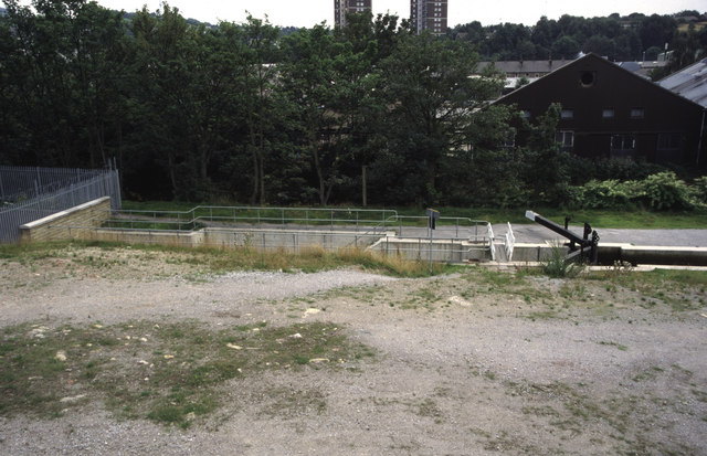
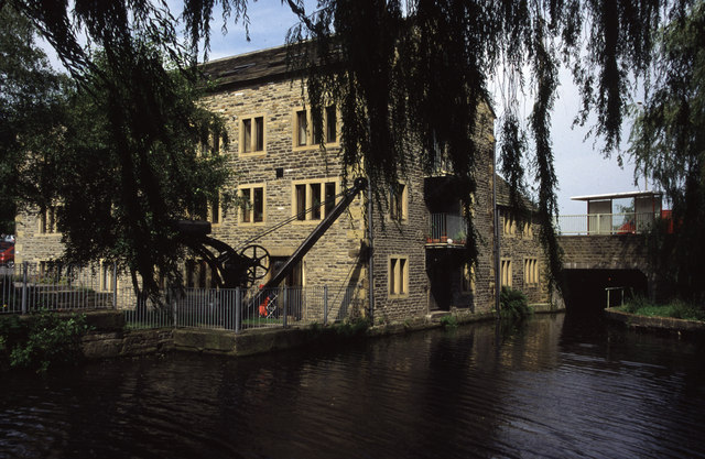
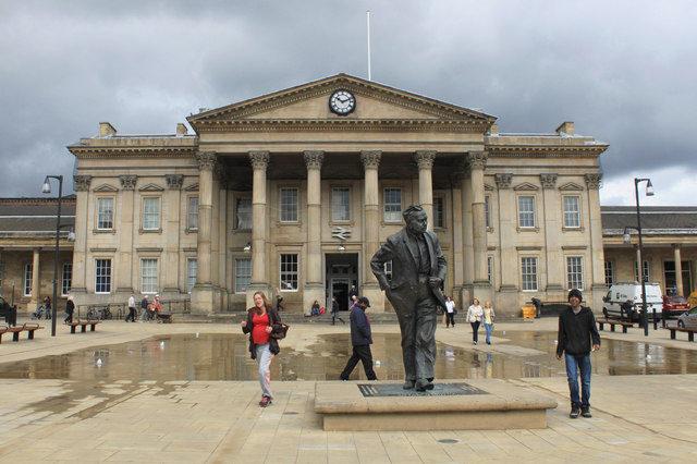
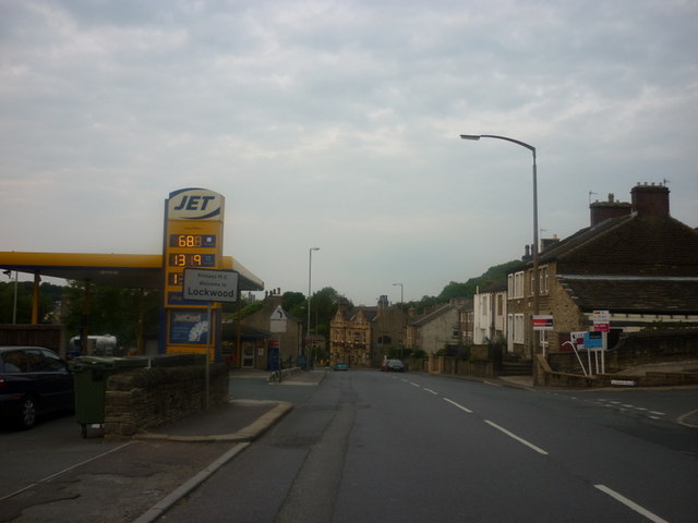
Aspley Images

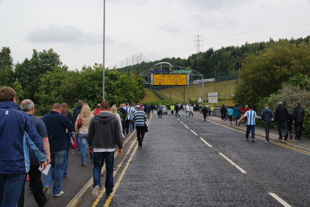
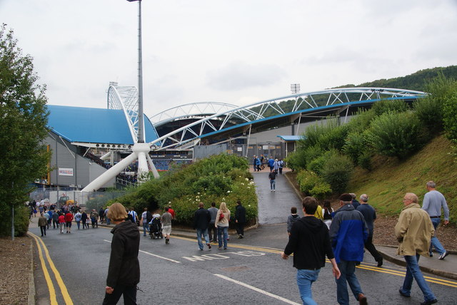
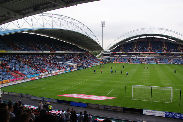
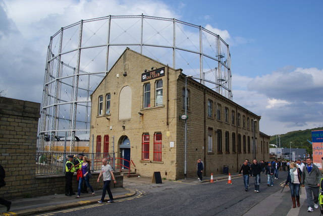
Images are sourced within 2km of 53.643225/-1.7752632 or Grid Reference SE1416. Thanks to Geograph Open Source API. All images are credited.

Huddersfield narrow Canal approaching Birkhouse Lane The tall structure is the riveting tower of the former Birkhouse Boiler Works. The Huddersfield Narrow Canal was derelict when I used to play alongside it but as can be seen it is now a functional pleasure waterway.
Huddersfield narrow Canal approaching Birkhouse Lane
The tall structure is the riveting tower of the former Birkhouse Boiler Works. The Huddersfield Narrow Canal was derelict when I used to play alongside it but as can be seen it is now a functional pleasure waterway.
Huddersfield Narrow Canal, Paddock Foot Longroyd Lane is on the left and Manchester Road (A62) is crossing the canal just beyond the lock. The distant church spire is on a church that was associated with a huge textile complex (Starkey's Mill) that was demolished before I thought of photographing it. I grew up in this area.
Huddersfield Narrow Canal, Paddock Foot
Longroyd Lane is on the left and Manchester Road (A62) is crossing the canal just beyond the lock. The distant church spire is on a church that was associated with a huge textile complex (Starkey's Mill) that was demolished before I thought of photographing it. I grew up in this area.
Huddersfield Narrow Canal from Manchester Road Seen from the A62. This is where the canal emerges from a long tunnel under what was the works of Sellers Engineers. The company was to move to new premises in the spring of 2011 and a major waterfront redevelopment is to occur. This may see the canal re-exposed. Somebody please photograph this if it happens!

The canal was re-exposed and has been photographed - <a href="https://www.geograph.org.uk/photo/3683200">SE1416 : New length of canal beside Kirklees College</a>.
Huddersfield Narrow Canal from Manchester Road
Seen from the A62. This is where the canal emerges from a long tunnel under what was the works of Sellers Engineers. The company was to move to new premises in the spring of 2011 and a major waterfront redevelopment is to occur. This may see the canal re-exposed. Somebody please photograph this if it happens! The canal was re-exposed and has been photographed - SE1416 : New length of canal beside Kirklees College.
Huddersfield Narrow Canal The canal is behind the fence and is entering a tunnel under Sellers Engineers. Sellers is a firm of specialist textile engineers and was founded in 1912. In spring 2011 it was due to move to new premises and the site was to be part of a £150 million waterfront redevelopment. The white tower is a water tower associated with water company offices and a nuclear bunker (so I've been told).
Huddersfield Narrow Canal
The canal is behind the fence and is entering a tunnel under Sellers Engineers. Sellers is a firm of specialist textile engineers and was founded in 1912. In spring 2011 it was due to move to new premises and the site was to be part of a £150 million waterfront redevelopment. The white tower is a water tower associated with water company offices and a nuclear bunker (so I've been told).
Queen Street South This bridge carries Queen Street South over the Huddersfield Narrow Canal. the canal proceeds in a tunnel under Fairfield Mills which are seen in the centre of the picture.
Queen Street South
This bridge carries Queen Street South over the Huddersfield Narrow Canal. the canal proceeds in a tunnel under Fairfield Mills which are seen in the centre of the picture.
Huddersfield Narrow Canal behind Firth Street The restored canal with evidence of some serious modern civil engineering. The mill in the distance has been reused by Huddersfield University (an ex-polytechnic).
Huddersfield Narrow Canal behind Firth Street
The restored canal with evidence of some serious modern civil engineering. The mill in the distance has been reused by Huddersfield University (an ex-polytechnic).
Converted warehouse, Aspley This former warehouse and preserved crane are alongside the restored Huddersfield Narrow Canal. The bridge in the background carries a main road out of Huddersfield and its reinstatement was a major piece of enabling work. Beyond it is the Aspley Basin which is also the start of the Broad Canal (Sir John Ramsden's Canal).
Converted warehouse, Aspley
This former warehouse and preserved crane are alongside the restored Huddersfield Narrow Canal. The bridge in the background carries a main road out of Huddersfield and its reinstatement was a major piece of enabling work. Beyond it is the Aspley Basin which is also the start of the Broad Canal (Sir John Ramsden's Canal).
Huddersfield station and statue of Harold Wilson One of the premier station frontages in England forms the backcloth to a statue of a famous former premier of Britain. The statue is located in the restored St Georges Square.
Huddersfield station and statue of Harold Wilson
One of the premier station frontages in England forms the backcloth to a statue of a famous former premier of Britain. The statue is located in the restored St Georges Square.
Entering Lockwood
Entering Lockwood
The junction of Chapel Hill with Queensgate
The A62, Leeds Road
The A62, Leeds Road
Huddersfield Train Station
Matchday parking off St Andrew's Road This is an official pay-and-display car park.
Matchday parking off St Andrew's Road
This is an official pay-and-display car park.
Walking to the Galpharm Stadium The road crosses the River Colne just here.
Walking to the Galpharm Stadium
The road crosses the River Colne just here.
The Galpharm Stadium The approach from the south west end. I understand that the stadium was going to be renamed a couple of years ago because Galpharm were taken over, but nothing appears to have happened since.
The Galpharm Stadium
The approach from the south west end. I understand that the stadium was going to be renamed a couple of years ago because Galpharm were taken over, but nothing appears to have happened since.
Before the match in the Galpharm Stadium The first match of the new season. Huddersfield Town FC are the League One title favourites, but were disappointed by a draw in this match.
Before the match in the Galpharm Stadium
The first match of the new season. Huddersfield Town FC are the League One title favourites, but were disappointed by a draw in this match.
Gasworks Street Aptly named street with the gasholder still in use.
Gasworks Street
Aptly named street with the gasholder still in use.
Leeds Road, Huddersfield This is the A62 shortly before it reaches the inner ring road.
Leeds Road, Huddersfield
This is the A62 shortly before it reaches the inner ring road.
Show me another place!

Aspley is located at Grid Ref: SE1416 (Lat: 53.643225, Lng: -1.7752632)

Division: West Riding

Unitary Authority: Kirklees

Police Authority: West Yorkshire

What 3 Words

///spit.stay.love. Near Huddersfield, West Yorkshire

Related Wikis

St Paul's Street drill hall, Huddersfield

The St Paul's Street drill hall is a military installation in Huddersfield, West Yorkshire. It is a Grade II listed building. == History == The building...

University of Huddersfield

The University of Huddersfield (informally Huddersfield University) is a public research university located in Huddersfield, West Yorkshire, England. It...

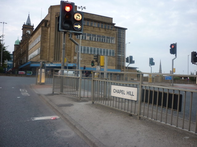
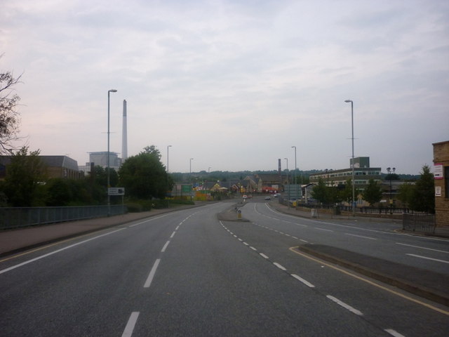
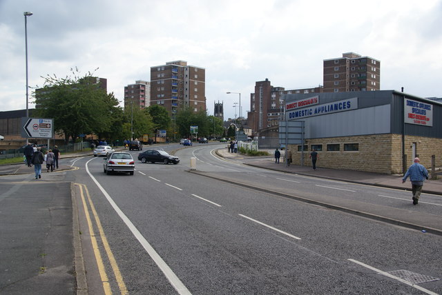
Aspley, Huddersfield

Aspley is an area adjacent to the ring road around Huddersfield, Kirklees, West Yorkshire, England. It comprises a mixture of independent shops, commercial...

MIAMI Facilities

The MIAMI facility (acronym for Microscopes and Ion Accelerators for Materials Investigation) is a scientific laboratory located within the Ion Beam Centre...

Huddersfield

Huddersfield is a market town in the Kirklees district in West Yorkshire, England. It is the administrative centre and largest settlement in the Kirklees...

Kingsgate, Huddersfield

The Kingsgate Shopping Centre is a shopping centre in Huddersfield located to the west of Shorehead Roundabout and East of the junction of King Street...

Lawrence Batley Theatre

Lawrence Batley Theatre is a theatre in Huddersfield, West Yorkshire, England which offers drama, music, dance and comedy. The theatre is named after Lawrence...

Piazza Centre

The Piazza Centre is a shopping centre in Huddersfield, West Yorkshire, England. == History == The Piazza Centre was built on the site of the Market Hall...

Nearby Amenities

Located within 500m of 53.643225,-1.7752632
Traffic Signals
Lat/Long: 53.6452777/-1.7768288
Traffic Signals
Lat/Long: 53.645622/-1.7772096
Traffic Signals
Lat/Long: 53.6450837/-1.7775088
Traffic Signals
Crossing: traffic_signals
Crossing Ref: pelican
Lat/Long: 53.6441824/-1.779297
Traffic Signals
Crossing: traffic_signals
Crossing Ref: pelican
Lat/Long: 53.6438923/-1.7803582
Traffic Signals
Crossing: traffic_signals
Crossing Ref: pelican
Lat/Long: 53.6430663/-1.7808211
Crossing
Crossing: traffic_signals
Crossing Ref: pelican
Lat/Long: 53.6441344/-1.7791317
Traffic Signals
Crossing: traffic_signals
Crossing Ref: pelican
Lat/Long: 53.6439367/-1.7800713
Crossing
Crossing: traffic_signals
Crossing Ref: pelican
Tactile Paving: yes
Lat/Long: 53.6431231/-1.7806321
Crossing
Crossing: uncontrolled
Crossing Island: no
Crossing Ref: zebra
Tactile Paving: yes
Traffic Calming: table
Lat/Long: 53.6404167/-1.7788387
Traffic Signals
Lat/Long: 53.645731/-1.7771384
Traffic Signals
Crossing: traffic_signals
Crossing Ref: pelican
Kerb: lowered
Tactile Paving: yes
Lat/Long: 53.6428935/-1.7681967
Foot Asylum
Addr City: Huddersfield
Addr Housenumber: 36
Addr Postcode: HD1 2QB
Addr Street: Cross Church Street
Shop: shoes
Source: survey
Lat/Long: 53.6457919/-1.780693
Seamark Type: gate
Waterway: lock_gate
Lat/Long: 53.6420522/-1.777443
Traffic Signals
Lat/Long: 53.6425053/-1.7824916
Traffic Signals
Lat/Long: 53.6451838/-1.7773135
Traffic Signals
Lat/Long: 53.6451596/-1.7767086
Crossing
Crossing: traffic_signals
Lat/Long: 53.6450834/-1.7772405
Pub
BrewDog Huddersfield
Addr City: Huddersfield
Addr Country: GB
Addr Housenumber: 29
Addr Postcode: HD1 2RD
Addr Street: Queensgate
Food: yes
Old Name: The Zetland
Lat/Long: 53.6444833/-1.7792205
Pub
The Warehouse
Addr City: Huddersfield
Addr Country: GB
Addr Housenumber: 12
Addr Postcode: HD1 2RA
Addr Street: Zetland Street
Fhrs Id: 226551
Source Addr: FHRS Open Data
Lat/Long: 53.6450055/-1.7793883
Pub
The Cotton Factory
Cuisine: pizza
Lat/Long: 53.6454668/-1.7791412
Pub
Varsity
Created By: Potlatch 0.10f
Lat/Long: 53.6446081/-1.7791355
Pub
The Lord Wilson
Addr City: Huddersfield
Brand: Wetherspoon
Brand Wikidata: Q6109362
Brand Wikipedia: en:Wetherspoons
Contact Website: https://www.jdwetherspoon.com/pubs/all-pubs/england/west-yorkshire/the-lord-wilson-huddersfield
Food: yes
Real Ale: Usual Wetherspoons variety
Lat/Long: 53.6456567/-1.7792157
TUI
Addr City: Huddersfield
Addr Street: Kingsgate
Addr Unit: 41
Brand: TUI
Brand Wikidata: Q7795876
Shop: travel_agency
Lat/Long: 53.6457588/-1.7803004
Pub
Rock Cafe
Addr City: Huddersfield
Addr Country: GB
Addr Housenumber: 11-13
Addr Postcode: HD1 2SX
Addr Street: Ramsden Street
Fhrs Id: 226765
Source Addr: FHRS Open Data
Lat/Long: 53.6444335/-1.7821018
Bank
Skipton Building Society
Addr City: Huddersfield
Addr Housenumber: 11
Addr Street: Ramsden Street
Brand: Skipton Building Society
Brand Wikidata: Q16931747
Brand Wikipedia: en:Skipton Building Society
Lat/Long: 53.6443706/-1.7822268
Pub
Parish
Addr City: Huddersfield
Addr Housename: The Old Courthouse
Addr Postcode: HD1 2SP
Addr Street: Queen Street
Contact Facebook: https://www.facebook.com/ParishHudd/
Contact Instagram: https://www.instagram.com/parishhudd/
Contact Twitter: https://twitter.com/parishhudd
Live Music: yes
Phone: +44 1484 361932
Website: https://parishpub.co.uk/
Lat/Long: 53.6447387/-1.7801776
Bicycle Parking
Lat/Long: 53.6432911/-1.7820122
Parking
Created By: Potlatch 0.10f
Lat/Long: 53.6465725/-1.7793025
Traffic Signals
Lat/Long: 53.6423656/-1.7821216
Traffic Signals
Lat/Long: 53.6425661/-1.7825188
Traffic Signals
Lat/Long: 53.6457483/-1.7769031
Waterway: weir
Lat/Long: 53.6421016/-1.7743099
Crossing
Crossing: uncontrolled
Crossing Island: no
Crossing Ref: zebra
Traffic Calming: table
Lat/Long: 53.642151/-1.7765834
Crossing
Crossing: uncontrolled
Crossing Island: no
Crossing Ref: zebra
Kerb: flush
Tactile Paving: yes
Traffic Calming: table
Lat/Long: 53.6416531/-1.7771914
Atm
Operator: Sainsburys
Wheelchair: yes
Lat/Long: 53.646386/-1.7755068
Bus Stop
R2 Southgate
Bench: yes
Bin: yes
Check Date Shelter: 2023-06-29
Lit: yes
Local Ref: 45016745
Naptan AtcoCode: 450016745
Naptan Bearing: SE
Naptan CommonName: R2
Naptan Crossing: Wakefield Road
Naptan Indicator: Stop 45016745
Naptan Landmark: Sainsbury
Naptan PlusbusZoneRef: LEEDS
Naptan ShortCommonName: Southgate R2
Naptan Street: Southgate
Naptan Verified: yes
Public Transport: platform
Shelter: yes
Source: naptan_import;survey
Tactile Paving: no
Towards: Almondbury, Dalton, Farnley Tyas, Kirkheaton, Rawthorpe, Stocksmoor
Lat/Long: 53.6459487/-1.7770194
Bus Stop
R3 Southgate
Bench: yes
Bin: yes
Check Date Shelter: 2023-06-29
Lit: yes
Local Ref: 45016746
Naptan AtcoCode: 450016746
Naptan Bearing: SE
Naptan CommonName: R3 Southgate
Naptan Crossing: Wakefield Road
Naptan Indicator: Stop 45016746
Naptan Landmark: Sainsbury
Naptan PlusbusZoneRef: LEEDS
Naptan ShortCommonName: Southgate R3
Naptan Street: Southgate
Naptan Verified: yes
Public Transport: platform
Shelter: yes
Source: naptan_import;survey
Tactile Paving: no
Lat/Long: 53.645799/-1.7768529
Bus Stop
Wakefield Road St Andrews Road
Bench: yes
Bin: yes
Bus: yes
Lit: yes
Local Ref: 45016747
Naptan AtcoCode: 450016747
Naptan Bearing: SE
Naptan CommonName: Wakefield Road St Andrews Road
Naptan Crossing: St Andrews Road
Naptan Indicator: Stop 45016747
Naptan Landmark: Chamber of Commerce
Naptan PlusbusZoneRef: LEEDS
Naptan ShortCommonName: St. Andrews Road
Naptan Street: Wakefield Road
Naptan Verified: no
Public Transport: platform
Shelter: yes
Source: naptan_import
Tactile Paving: no
Lat/Long: 53.6439754/-1.7734754
Bus Stop
Wakefield Road St Andrews Road
Bench: yes
Bin: no
Bus: yes
Lit: yes
Local Ref: 45016748
Naptan AtcoCode: 450016748
Naptan Bearing: SE
Naptan CommonName: Wakefield Road St Andrews Road
Naptan Crossing: St Andrews Road
Naptan Indicator: Stop 45016748
Naptan Landmark: Chamber of Commerce
Naptan PlusbusZoneRef: LEEDS
Naptan ShortCommonName: St. Andrews Road
Naptan Street: Wakefield Road
Naptan Verified: no
Public Transport: platform
Shelter: yes
Source: naptan_import
Tactile Paving: no
Lat/Long: 53.6438399/-1.7731585
Bus Stop
Wakefield Road Carr Pit Road
Bus: yes
Local Ref: 45016749
Naptan AtcoCode: 450016749
Naptan Bearing: E
Naptan CommonName: Wakefield Road Carr Pit Road
Naptan Crossing: Carr Pit Road
Naptan Indicator: Stop 45016749
Naptan PlusbusZoneRef: LEEDS
Naptan ShortCommonName: Carr Pit Road
Naptan Street: Wakefield Road
Naptan Verified: no
Public Transport: platform
Source: naptan_import
Lat/Long: 53.6434595/-1.7716327
Bus Stop
Wakefield Road Smithy Lane
Bench: yes
Bin: yes
Bus: yes
Lit: yes
Local Ref: 45016750
Naptan AtcoCode: 450016750
Naptan Bearing: E
Naptan CommonName: Wakefield Road Smithy Lane
Naptan Crossing: Smithy Lane
Naptan Indicator: Stop 45016750
Naptan PlusbusZoneRef: LEEDS
Naptan ShortCommonName: Smithy Lane
Naptan Street: Wakefield Road
Naptan Verified: no
Public Transport: platform
Shelter: yes
Source: naptan_import
Tactile Paving: no
Lat/Long: 53.643059/-1.7690028
Bus Stop
Wakefield Road Smithy Lane
Bus: yes
Local Ref: 45017235
Naptan AtcoCode: 450017235
Naptan Bearing: W
Naptan CommonName: Wakefield Road Smithy Lane
Naptan Crossing: Smithy Lane
Naptan Indicator: Stop 45017235
Naptan Notes: OSR taken place 151205
Naptan PlusbusZoneRef: LEEDS
Naptan ShortCommonName: Smithy Lane
Naptan Street: Wakefield Road
Naptan Verified: no
Public Transport: platform
Source: naptan_import
Lat/Long: 53.6428896/-1.7696996
Bus Stop
Wakefield Road Kings Mill Lane
Bus: yes
Local Ref: 45017236
Naptan AtcoCode: 450017236
Naptan Bearing: NW
Naptan CommonName: Wakefield Road Kings Mill Lane
Naptan Crossing: Kings Mill Road
Naptan Indicator: Stop 45017236
Naptan Landmark: Chamber of Commerce
Naptan PlusbusZoneRef: LEEDS
Naptan ShortCommonName: Kings Mill Lane
Naptan Street: Wakefield Road
Naptan Verified: no
Public Transport: platform
Source: naptan_import
Lat/Long: 53.6433991/-1.7729339
Bus Stop
Wakefield Road Sand Street
Bus: yes
Local Ref: 45017237
Naptan AtcoCode: 450017237
Naptan Bearing: NW
Naptan CommonName: Wakefield Road Sand Street
Naptan Crossing: Sand Street
Naptan Indicator: Stop 45017237
Naptan PlusbusZoneRef: LEEDS
Naptan ShortCommonName: Sand Street
Naptan Street: Wakefield Road
Naptan Verified: no
Public Transport: platform
Source: naptan_import
Lat/Long: 53.6444442/-1.7752661
Bus Stop
R1
Local Ref: 45017238
Naptan AtcoCode: 450017238
Naptan Bearing: NW
Naptan CommonName: R1 Southgate
Naptan Crossing: Queensgate
Naptan Indicator: Stop 45017238
Naptan Landmark: Sainsbury
Naptan PlusbusZoneRef: LEEDS
Naptan ShortCommonName: Southgate R1
Naptan Street: Southgate
Naptan Verified: yes
Public Transport: platform
Shelter: yes
Source: naptan_import;survey
Lat/Long: 53.6459526/-1.7777163
Bus Stop
Huddersfield Town Centre, Peel Street (Stop H3)
Bench: yes
Bin: yes
Bus: yes
Local Ref: 45017571
Naptan AtcoCode: 450017571
Naptan Bearing: S
Naptan CommonName: H3 Peel Street
Naptan Crossing: Ramsden Street
Naptan Indicator: Stop 45017571
Naptan Landmark: Town Hall
Naptan Notes: Advert panels added to TF shelter awaiting photos
Naptan PlusbusZoneRef: LEEDS
Naptan ShortCommonName: Peel Street H3
Naptan Street: Peel Street
Naptan Verified: yes
Network: WY Metro
Operator: WY Metro
Public Transport: platform
Shelter: yes
Source: naptan_import;survey
Tactile Paving: no
Lat/Long: 53.6439288/-1.7822795
Bus Stop
H4 Peel Street
Bench: yes
Bin: yes
Check Date Shelter: 2023-06-02
Local Ref: 45017572
Naptan AtcoCode: 450017572
Naptan Bearing: S
Naptan CommonName: H4 Peel Street
Naptan Crossing: Princess Street
Naptan Indicator: Stop 45017572
Naptan Landmark: Town Hall
Naptan Notes: Advert panels added to TF shelter awaiting photos
Naptan PlusbusZoneRef: LEEDS
Naptan ShortCommonName: Peel Street H4
Naptan Street: Peel Street
Naptan Verified: yes
Public Transport: platform
Shelter: yes
Source: naptan_import;survey
Tactile Paving: no
Lat/Long: 53.6436235/-1.7824323
Bus Stop
Q1 Queensgate
Local Ref: 45017573
Naptan AtcoCode: 450017573
Naptan Bearing: N
Naptan CommonName: Q1 Queensgate
Naptan Indicator: Stop 45017573
Naptan Landmark: Queensgate Market
Naptan PlusbusZoneRef: LEEDS
Naptan ShortCommonName: Queensgate Q1
Naptan Street: Queensgate
Naptan Verified: yes
Public Transport: platform
Shelter: no
Source: naptan_import;survey
Lat/Long: 53.6433689/-1.7808302
Bus Stop
Q2 Queensgate
Local Ref: 45017574
Naptan AtcoCode: 450017574
Naptan Bearing: NE
Naptan CommonName: Q2 Queensgate
Naptan Crossing: Bradley Street
Naptan Indicator: Stop 45017574
Naptan Landmark: Yates Wine Lodge
Naptan PlusbusZoneRef: LEEDS
Naptan ShortCommonName: Queensgate Q2
Naptan Street: Queensgate
Naptan Verified: yes
Public Transport: platform
Shelter: no
Source: naptan_import;survey
Lat/Long: 53.6446588/-1.7781637
Bus Stop
Q3 Queensgate
Bus: yes
Local Ref: 45017576
Naptan AtcoCode: 450017576
Naptan Bearing: SW
Naptan CommonName: Q3 Queensgate
Naptan Crossing: Bradley Street
Naptan Indicator: Stop 45017576
Naptan Landmark: Huddersfield University
Naptan PlusbusZoneRef: LEEDS
Naptan ShortCommonName: Queensgate Q3
Naptan Street: Queensgate
Naptan Verified: yes
Public Transport: platform
Shelter: yes
Source: naptan_import;survey
Lat/Long: 53.6444483/-1.7781206
Bus Stop
Somerset Road Wakefield Road
Bus: yes
Local Ref: 45020891
Naptan AtcoCode: 450020891
Naptan Bearing: SE
Naptan CommonName: Somerset Road Wakefield Road
Naptan Crossing: Mulberry Street
Naptan Indicator: Stop 45020891
Naptan Landmark: St Josephs Church
Naptan PlusbusZoneRef: LEEDS
Naptan ShortCommonName: Mulberry Street
Naptan Street: Somerset Road
Naptan Verified: no
Public Transport: platform
Source: naptan_import
Lat/Long: 53.6425319/-1.7706848
Bus Stop
Somerset Road Wakefield Road
Bus: yes
Local Ref: 45020892
Naptan AtcoCode: 450020892
Naptan Bearing: NW
Naptan CommonName: Somerset Road Wakefield Road
Naptan Crossing: Mulberry Street
Naptan Indicator: Stop 45020892
Naptan Landmark: Church
Naptan PlusbusZoneRef: LEEDS
Naptan ShortCommonName: Mulberry Street
Naptan Street: Somerset Road
Naptan Verified: no
Public Transport: platform
Source: naptan_import
Lat/Long: 53.6424873/-1.7708363
Bus Stop
Somerset Road Dog Kennel Bank
Bus: yes
Local Ref: 45020893
Naptan AtcoCode: 450020893
Naptan Bearing: E
Naptan CommonName: Somerset Road Dog Kennel Bank
Naptan Crossing: Dog Kennel Bank
Naptan Indicator: Stop 45020893
Naptan PlusbusZoneRef: LEEDS
Naptan ShortCommonName: Dog Kennel Bank
Naptan Street: Somerset Road
Naptan Verified: no
Public Transport: platform
Source: naptan_import
Lat/Long: 53.6418545/-1.7690094
Bus Stop
Somerset Road Dog Kennel Bank
Bus: yes
Local Ref: 45020894
Naptan AtcoCode: 450020894
Naptan Bearing: W
Naptan CommonName: Somerset Road Dog Kennel Bank
Naptan Crossing: Dog Kennel Bank
Naptan Indicator: Stop 45020894
Naptan PlusbusZoneRef: LEEDS
Naptan ShortCommonName: Dog Kennel Bank
Naptan Street: Somerset Road
Naptan Verified: no
Public Transport: platform
Source: naptan_import
Lat/Long: 53.6416743/-1.7687684
Bus Stop
Kings Mill Lane Cornrace View
Local Ref: 45026471
Naptan AtcoCode: 450026471
Naptan Bearing: NE
Naptan CommonName: Kings Mill Lane Cornrace View
Naptan Crossing: Cornrace View
Naptan Indicator: Stop 45026471
Naptan PlusbusZoneRef: LEEDS
Naptan ShortCommonName: Cornrace View
Naptan Street: Kings Mill Lane
Naptan Verified: no
Source: naptan_import
Lat/Long: 53.6398188/-1.7761749
Bus Stop
H2a Peel Street
Bench: no
Bin: no
Check Date Shelter: 2023-06-02
Lit: no
Local Ref: 45028021
Naptan AtcoCode: 450028021
Naptan Bearing: S
Naptan CommonName: H2a Peel Street
Naptan Crossing: High Street
Naptan Indicator: Stop 45028021
Naptan Landmark: Town Hall
Naptan PlusbusZoneRef: LEEDS
Naptan ShortCommonName: Peel Street H2A
Naptan Street: Peel Street
Naptan Verified: yes
Public Transport: platform
Shelter: no
Source: naptan_import;survey
Tactile Paving: no
Lat/Long: 53.6441173/-1.7821726
Bus Stop
C1 Queen Street
Local Ref: 45028022
Naptan AtcoCode: 450028022
Naptan Bearing: N
Naptan CommonName: C1 Queen Street
Naptan Crossing: Queensgate
Naptan Indicator: Stop 45028022
Naptan Landmark: Unknown
Naptan PlusbusZoneRef: LEEDS
Naptan ShortCommonName: Queen Street C1
Naptan Street: Queen Street
Naptan Verified: yes
Public Transport: platform
Shelter: no
Source: naptan_import;survey
Lat/Long: 53.6443119/-1.7804018
Bus Stop
C2 Queen Street
Check Date Shelter: 2022-09-19
Local Ref: 45028023
Naptan AtcoCode: 450028023
Naptan Bearing: N
Naptan CommonName: C2 Queen Street
Naptan Crossing: King Street
Naptan Indicator: Stop 45028023
Naptan Landmark: Unknown
Naptan PlusbusZoneRef: LEEDS
Naptan ShortCommonName: Queen Street C2
Naptan Street: Queen Street
Naptan Verified: yes
Public Transport: platform
Shelter: no
Source: naptan_import;survey
Lat/Long: 53.6455797/-1.7806523
Traffic Signals
Crossing: traffic_signals
Crossing Ref: pelican
Lat/Long: 53.6429975/-1.7806885
Barrier: bollard
Lat/Long: 53.6412469/-1.7791727
Traffic Signals
Lat/Long: 53.6426178/-1.7822511
Traffic Signals
Lat/Long: 53.6425963/-1.7823349
Traffic Signals
Lat/Long: 53.6470781/-1.7786313
Traffic Signals
Crossing: traffic_signals
Crossing Ref: pelican
Kerb: lowered
Tactile Paving: yes
Lat/Long: 53.6462638/-1.7776242
Traffic Signals
Crossing: traffic_signals
Crossing Ref: pelican
Kerb: lowered
Tactile Paving: yes
Lat/Long: 53.6463222/-1.7779021
Traffic Signals
Check Date Tactile Paving: 2023-06-29
Crossing: traffic_signals
Crossing Ref: pelican
Kerb: lowered
Tactile Paving: yes
Lat/Long: 53.6428208/-1.7683096
Traffic Signals
Lat/Long: 53.6430687/-1.7702852
Traffic Signals
Crossing: traffic_signals
Crossing Ref: pelican
Lat/Long: 53.6432791/-1.7710048
Traffic Signals
Lat/Long: 53.643009/-1.771032
Traffic Signals
Lat/Long: 53.6432902/-1.7705036
Traffic Signals
Lat/Long: 53.6432517/-1.7711576
Crossing
Crossing: unmarked
Crossing Island: yes
Crossing Markings: no
Lat/Long: 53.64167/-1.7689413
Post Box
Brand: Royal Mail
Brand Wikidata: Q638098
Brand Wikipedia: en:Royal Mail
Operator: Royal Mail
Operator Wikidata: Q638098
Lat/Long: 53.6443453/-1.7699705
Post Box
Brand: Royal Mail
Brand Wikidata: Q638098
Brand Wikipedia: en:Royal Mail
Operator: Royal Mail
Operator Wikidata: Q638098
Lat/Long: 53.6444152/-1.7699549
Parking
Access: permissive
Lat/Long: 53.6439691/-1.7719832
Barrier: bollard
Lat/Long: 53.6429507/-1.77506
Leisure: playground
Lat/Long: 53.6425439/-1.773296
Barrier: lift_gate
Lat/Long: 53.6405815/-1.7783722
Barrier: block
Lat/Long: 53.6401697/-1.7778568
Crossing
Crossing: uncontrolled
Crossing Island: no
Crossing Ref: zebra
Tactile Paving: yes
Traffic Calming: table
Lat/Long: 53.6412496/-1.7776685
Seamark Type: gate
Waterway: lock_gate
Lat/Long: 53.6422072/-1.777191
Asda
Addr City: Huddersfield
Addr Country: GB
Addr Housenumber: 5
Addr Postcode: HD5 9AD
Addr Street: Carr Pit Road
Addr Suburb: Moldgreen
Brand: Asda
Brand Wikidata: Q297410
Brand Wikipedia: en:Asda
Contact Website: https://storelocator.asda.com/yorkshire-&-humber/huddersfield/carr-pit-road-aspley
Fhrs Id: 228876
Operator: Asda Stores Ltd
Shop: supermarket
Source: survey
Source Addr: FHRS Open Data
Lat/Long: 53.6443176/-1.7721217
Barrier: lift_gate
Lat/Long: 53.6436948/-1.7790991
Crossing
Crossing: traffic_signals
Crossing Ref: pelican
Lat/Long: 53.6440842/-1.7789734
Traffic Signals
Crossing: traffic_signals
Crossing Ref: pelican
Lat/Long: 53.6440183/-1.7790821
Traffic Signals
Lat/Long: 53.6442194/-1.7788663
Barrier: door
Lat/Long: 53.6439322/-1.7771216
Barrier: door
Lat/Long: 53.6438139/-1.776674
Barrier: block
Lat/Long: 53.6430976/-1.7804766
Traffic Signals
Lat/Long: 53.644213/-1.7791616
Barrier: lift_gate
Lat/Long: 53.6426584/-1.7795066
Crossing
Crossing: uncontrolled
Crossing Markings: yes
Crossing Ref: zebra
Traffic Calming: table
Lat/Long: 53.6431169/-1.7754009
Post Box
Operator: Royal Mail
Operator Wikidata: Q638098
Lat/Long: 53.6437809/-1.7774135
Landuse: allotments
Lat/Long: 53.6464356/-1.7702427
Traffic Signals
Crossing: traffic_signals
Crossing Ref: pelican
Kerb: lowered
Tactile Paving: yes
Lat/Long: 53.6463735/-1.7775291
Traffic Signals
Button Operated: yes
Check Date Tactile Paving: 2023-06-29
Crossing: traffic_signals
Crossing Ref: pelican
Kerb: lowered
Tactile Paving: yes
Traffic Signals Sound: no
Traffic Signals Vibration: yes
Lat/Long: 53.6462932/-1.7773898
Crossing
Crossing Island: yes
Crossing Ref: pelican
Kerb: lowered
Tactile Paving: yes
Lat/Long: 53.6462068/-1.7767981
Barrier: lift_gate
Motorcar: yes
Lat/Long: 53.6460437/-1.7766374
Crossing
Crossing: zebra
Lat/Long: 53.6453256/-1.7759352
Top Spot Snooker Club
Leisure: sports_centre
Phone: +44 1484 513456
Source: photgraph
Sport: billiards
Lat/Long: 53.6443255/-1.7751668
Bench
Backrest: no
Lat/Long: 53.6442448/-1.7817263
Barrier: kerb
Kerb: lowered
Tactile Paving: yes
Lat/Long: 53.646304/-1.7775025
Barrier: kerb
Kerb: lowered
Tactile Paving: yes
Lat/Long: 53.6463473/-1.7775031
Waste Basket
Source: photo
Lat/Long: 53.6463726/-1.7780309
Barrier: kerb
Kerb: lowered
Tactile Paving: yes
Lat/Long: 53.6463091/-1.7774458
Waste Basket
Lat/Long: 53.6458408/-1.7768206
Waste Basket
Lat/Long: 53.6459894/-1.7769939
Pharmacy
Boots
Addr City: Huddersfield
Addr Country: GB
Addr Housenumber: 22
Addr Postcode: HD1 2QE
Addr Street: King Street
Brand: Boots
Brand Wikidata: Q6123139
Brand Wikipedia: en:Boots (company)
Dispensing: yes
Fhrs Id: 226843
Healthcare: pharmacy
Source Addr: FHRS Open Data
Website: https://www.boots.com/stores/530-huddersfield-king-street-hd1-2qe
Lat/Long: 53.6454644/-1.7813247
Telephone
Amenity 1: atm
Booth: KX100
Check Date: 2022-09-19
Lat/Long: 53.6456589/-1.7806298
Pub
Yates
Source: photgraph
Lat/Long: 53.6455914/-1.779771
Fast Food
Subway
Addr City: Huddersfield
Addr Country: GB
Addr Housenumber: 34
Addr Postcode: HD1 2QT
Addr Street: King Street
Brand: Subway
Brand Wikidata: Q244457
Brand Wikipedia: en:Subway (restaurant)
Contact Website: https://restaurants.subway.com/united-kingdom/en/huddersfield/34-king-street
Cuisine: sandwich
Fhrs Id: 227827
Source: photgraph
Takeaway: yes
Lat/Long: 53.6455757/-1.7800453
Pronuptia
Shop: clothes
Source: photgraph
Lat/Long: 53.6455446/-1.7798098
Waste Basket
Check Date: 2022-09-19
Source: photgraph
Lat/Long: 53.6456223/-1.7804137
Crossing
Crossing: unmarked
Kerb: lowered
Tactile Paving: yes
Lat/Long: 53.6457657/-1.7805788
Entrance: yes
Lat/Long: 53.6458439/-1.7779623
Waste Basket
Lat/Long: 53.6459334/-1.7777065
Restaurant
Oriental Kitchen
Alcohol: yes
Cuisine: thai;chinese;malaysian
Source: photgraph
Lat/Long: 53.6455892/-1.780157
Post Box
Brand: Royal Mail
Brand Wikidata: Q638098
Brand Wikipedia: en:Royal Mail
Collection Times: Mo-Fr 17:00; Sa 12:30
Operator: Royal Mail
Operator Wikidata: Q638098
Post Box Type: pillar
Ref: HD1 3
Royal Cypher: EIIR
Royal Cypher Wikidata: Q33102113
Source: photgraph
Lat/Long: 53.6456248/-1.7803868
Reliant Domestic Services
Shop: electronics
Source: photgraph
Lat/Long: 53.6441429/-1.7746769
Pet Warehouse
Shop: pet
Lat/Long: 53.6420992/-1.7823985
Restaurant
The Aspley
Brand: Table Table
Brand Wikidata: Q16952586
Cuisine: british
Website: https://www.tabletable.co.uk/en-gb/locations/yorkshire/the-aspley
Lat/Long: 53.6449021/-1.7742751
Premier Inn Huddersfield Central
Brand: Premier Inn
Brand Wikidata: Q2108626
Internet Access: wlan
Internet Access Fee: customers
Internet Access Operator: Virgin Media
Internet Access Ssid: Premier Inn Free Wi-Fi
Tourism: hotel
Lat/Long: 53.6446972/-1.7739943
Parking
Access: permissive
Parking: surface
Surface: asphalt
Lat/Long: 53.6448352/-1.7739352
Bench
Lat/Long: 53.6476662/-1.7753704
Entrance: yes
Lat/Long: 53.6429737/-1.7760118
Entrance: main
Lat/Long: 53.6433935/-1.7759736
Cafe
Coffeevolution
Addr City: Huddersfield
Addr Country: GB
Addr Housenumber: 8
Addr Postcode: HD1 1DD
Addr Street: Church Street
Fhrs Id: 226276
Source Addr: FHRS Open Data
Lat/Long: 53.6457791/-1.7813343
Entrance: yes
Lat/Long: 53.6422085/-1.7768366
Access: customers
Door: hinged
Entrance: yes
Wheelchair: yes
Lat/Long: 53.6401046/-1.7792696
Crossing
Lat/Long: 53.6423632/-1.782216
Aspley Marina
Leisure: marina
Seamark Harbour Category: marina
Seamark Type: harbour
Source: Bing
Lat/Long: 53.6445463/-1.7742816
Parking
Access: permissive
Operator: University of Huddersfield
Parking: surface
Source: survey
Lat/Long: 53.6421621/-1.7761329
Shop: tyres
Lat/Long: 53.6436742/-1.7750196
Fast Food
Cuisine: asian
Source: survey
Lat/Long: 53.6438105/-1.7738702
Fast Food
Cuisine: pizza
Source: survey
Lat/Long: 53.643844/-1.7739475
Fast Food
Cuisine: chinese
Source: survey
Lat/Long: 53.6440903/-1.7745684
Iceland
Addr City: Huddersfield
Addr Country: GB
Addr Housenumber: 5
Addr Postcode: HD5 9AD
Addr Street: Carr Pit Road
Addr Suburb: Moldgreen
Brand: Iceland
Brand Wikidata: Q721810
Contact Website: https://www.iceland.co.uk/store-finder/store?StoreID=37&StoreName=HUDDERSFIELD
Fhrs Id: 227857
Shop: supermarket
Source: survey
Source Addr: FHRS Open Data
Lat/Long: 53.644246/-1.771655
Fast Food
Greggs
Addr City: Huddersfield
Addr Country: GB
Addr Housenumber: 5
Addr Postcode: HD5 9AD
Addr Street: Carr Pit Road
Addr Suburb: Moldgreen
Brand: Greggs
Brand Wikidata: Q3403981
Brand Wikipedia: en:Greggs
Contact Website: https://www.greggs.co.uk/shop-finder?shop-code=1802
Cuisine: sandwich;bakery
Fhrs Id: 227123
Source: survey
Source Addr: FHRS Open Data
Takeaway: yes
Lat/Long: 53.6442679/-1.7718357
Vanilla
Shop: hairdresser
Lat/Long: 53.6432621/-1.7700694
Fast Food
KFC
Addr City: Huddersfield
Addr Country: GB
Addr Housenumber: 47-49
Addr Postcode: HD5 9AB
Addr Street: Wakefield Road
Addr Suburb: Moldgreen
Alt Name: Kentucky Fried Chicken
Brand: KFC
Brand Wikidata: Q524757
Brand Wikipedia: en:KFC
Contact Website: https://www.kfc.co.uk/kfc-near-me/huddersfield-wakefield-road
Cuisine: chicken
Drive Through: no
Fhrs Id: 229149
Source Addr: FHRS Open Data
Takeaway: yes
Lat/Long: 53.6434843/-1.7716553
Fast Food
Subway
Addr City: Huddersfield
Addr Country: GB
Addr Housenumber: 61
Addr Postcode: HD5 9AB
Addr Street: Wakefield Road
Addr Suburb: Moldgreen
Brand: Subway
Brand Wikidata: Q244457
Brand Wikipedia: en:Subway (restaurant)
Contact Website: https://restaurants.subway.com/united-kingdom/en/huddersfield/61-wakefield-road
Cuisine: sandwich
Fhrs Id: 229556
Source Addr: FHRS Open Data
Takeaway: yes
Lat/Long: 53.6433897/-1.7711041
Traffic Signals
Lat/Long: 53.6439062/-1.7738518
Traffic Signals
Lat/Long: 53.6439614/-1.7743169
Traffic Signals
Lat/Long: 53.644109/-1.7737105
Traffic Signals
Lat/Long: 53.6441907/-1.7738539
Traffic Signals
Crossing: traffic_signals
Crossing Ref: pelican
Lat/Long: 53.6442121/-1.7745091
Traffic Signals
Crossing: traffic_signals
Crossing Ref: pelican
Lat/Long: 53.6442907/-1.7744192
Barrier: lift_gate
Motorcar: yes
Lat/Long: 53.6452587/-1.7750464
Wood Pipe Organ Builders
Addr City: Huddersfield
Addr Postcode: HD5 9AG
Addr Street: Silver Street
Craft: organ_builder
Website: https://www.woodofhuddersfield.com/
Lat/Long: 53.644123/-1.7709022
Man Made: chimney
Material: stone
Lat/Long: 53.6412807/-1.7777318
Crossing
Lat/Long: 53.6425968/-1.7824568
Crossing
Lat/Long: 53.6425831/-1.7822242
Crossing
Lat/Long: 53.6424987/-1.7822973
Crossing
Lat/Long: 53.6425668/-1.7823471
Barrier: block
Lat/Long: 53.6422746/-1.7812104
Leisure: slipway
Lat/Long: 53.6440872/-1.7762994
Heritage Quay
Contact Facebook: http://facebook.com/HeritageQuay
Contact Twitter: https://twitter.com/Heritage_Quay
Email: archives@hud.ac.uk
Fee: no
Museum: local
Opening Hours: Mo-Fr 08:00-19:00; Sa 09:00-17:00
Operator: University of Huddersfield
Operator Type: university
Phone: +44 1484 473 168
Tourism: museum
Website: https://heritagequay.org/
Lat/Long: 53.6437531/-1.7768955
Huddersfield Taxis
Source: hudd
Taxi: taxi
Taxi 1: office
Lat/Long: 53.6434131/-1.7712618
The Piazza
Leisure: park
Lat/Long: 53.6443016/-1.7810714
WHSmith
Addr City: Huddersfield
Addr Country: GB
Addr Housenumber: 1
Addr Postcode: HD1 2QJ
Addr Street: The Shambles
Brand: WHSmith
Brand Wikidata: Q1548712
Brand Wikipedia: en:WHSmith
Fhrs Id: 228262
Shop: newsagent
Source Addr: FHRS Open Data
Lat/Long: 53.6455673/-1.7808086
Toyland
Addr City: Huddersfield
Addr Housenumber: 31
Addr Street: King Street
Opening Hours: Mo-Sa 09:30-17:00; Su 11:00-16:00
Phone: +44 1484 544664
Shop: toys
Website: https://www.toylandtoyshop.co.uk/
Lat/Long: 53.6458126/-1.7809594
Bodycare
Brand: Bodycare
Brand Wikidata: Q99938329
Shop: chemist
Lat/Long: 53.6443239/-1.7805993
Superdrug
Brand: Superdrug
Brand Wikidata: Q7643261
Brand Wikipedia: en:Superdrug
Shop: chemist
Lat/Long: 53.6440154/-1.7811841
USC
Brand: USC
Brand Wikidata: Q7866331
Brand Wikipedia: en:USC (clothing retailer)
Shop: clothes
Lat/Long: 53.6440407/-1.781345
Dorothy Perkins
Brand: Dorothy Perkins
Brand Wikidata: Q5298588
Brand Wikipedia: en:Dorothy Perkins
Shop: clothes
Lat/Long: 53.6440243/-1.7821254
Evans
Brand: Evans
Brand Wikidata: Q5415877
Brand Wikipedia: en:Evans (retailer)
Clothes: women
Shop: clothes
Lat/Long: 53.6441397/-1.7819556
New Look
Addr City: Huddersfield
Addr Housenumber: 21
Addr Postcode: HD1 2QB
Addr Street: Kingsgate Centre
Brand: New Look
Brand Wikidata: Q12063852
Clothes: women
Shop: clothes
Lat/Long: 53.6455801/-1.7781878
Stormfront
Addr City: Huddersfield
Addr Housenumber: 19
Addr Postcode: HD1 2QB
Addr Street: Kingsgate Centre
Shop: electronics
Lat/Long: 53.645685/-1.7782817
The Entertainer
Addr City: Huddersfield
Addr Postcode: HD1 2QB
Addr Street: Kingsgate Centre
Brand: The Entertainer
Brand Wikidata: Q7732289
Brand Wikipedia: en:The Entertainer (retailer)
Shop: toys
Lat/Long: 53.6457914/-1.7784484
Roman
Addr City: Huddersfield
Addr Housenumber: 16
Addr Postcode: HD1 2QB
Addr Street: Kingsgate Centre
Brand: Roman Originals
Brand Wikidata: Q94579553
Clothes: women
Shop: clothes
Lat/Long: 53.6458941/-1.7785601
Waterstones
Addr City: Huddersfield
Addr Housenumber: 13
Addr Postcode: HD1 2QB
Addr Street: Kingsgate Centre
Addr Unit: 12/13
Brand: Waterstones
Brand Wikidata: Q151779
Brand Wikipedia: en:Waterstones
Shop: books
Website: https://www.waterstones.com/bookshops/huddersfield
Lat/Long: 53.6460805/-1.7787629
Next
Addr City: Huddersfield
Addr Postcode: HD1 2QB
Addr Street: Kingsgate Centre
Brand: Next
Brand Wikidata: Q246655
Brand Wikipedia: en:Next plc
Shop: clothes
Lat/Long: 53.646259/-1.7790408
JD Sports
Addr City: Huddersfield
Addr Street: Kingsgate Centre
Brand: JD Sports
Brand Wikidata: Q6108019
Brand Wikipedia: en:JD Sports
Shop: sports
Lat/Long: 53.6459233/-1.7803417
Game
Addr City: Huddersfield
Addr Postcode: HD1 2QB
Addr Street: Kingsgate Centre
Brand: Game
Brand Wikidata: Q5519813
Brand Wikipedia: en:Game (retailer)
Shop: video_games
Lat/Long: 53.645997/-1.780111
TK Maxx
Addr City: Huddersfield
Addr Postcode: HD1 2QB
Addr Street: Kingsgate Centre
Brand: TK Maxx
Brand Wikidata: Q23823668
Brand Wikipedia: en:TK Maxx
Shop: department_store
Lat/Long: 53.645855/-1.7800685
Fast Food
Greggs
Addr City: Huddersfield
Addr Country: GB
Addr Housenumber: Unit 39
Addr Postcode: HD1 2QB
Addr Street: Kingsgate Centre
Addr Unit: Unit 39
Brand: Greggs
Brand Wikidata: Q3403981
Brand Wikipedia: en:Greggs
Contact Website: https://www.greggs.co.uk/shop-finder?shop-code=1413
Cuisine: sandwich;bakery
Fhrs Id: 229580
Source Addr: FHRS Open Data
Takeaway: yes
Lat/Long: 53.6459246/-1.7798389
Three.
Addr City: Huddersfield
Addr Postcode: HD1 2QB
Addr Street: Kingsgate Centre
Brand: Three
Brand Wikidata: Q407009
Brand Wikipedia: en:3 (telecommunications)
Contact Website: https://locator.three.co.uk/midlands/huddersfield/unit-38-kingsgate
Shop: mobile_phone
Lat/Long: 53.6459565/-1.7797336
Vodafone
Addr City: Huddersfield
Addr Postcode: HD1 2QB
Addr Street: Kingsgate Centre
Brand: Vodafone
Brand Wikidata: Q122141
Brand Wikipedia: en:Vodafone
Shop: mobile_phone
Lat/Long: 53.6460228/-1.7795151
Sports Direct
Addr City: Huddersfield
Addr Postcode: HD1 2QB
Addr Street: Kingsgate Centre
Brand: Sports Direct
Brand Wikidata: Q7579661
Brand Wikipedia: en:SportsDirect.com
Shop: sports
Lat/Long: 53.6460602/-1.7793918
F.Hinds
Addr City: Huddersfield
Addr Postcode: HD1 2QB
Addr Street: Kingsgate Centre
Brand: F.Hinds
Brand Wikidata: Q5423915
Brand Wikipedia: en:F. Hinds
Shop: jewelry
Lat/Long: 53.6461248/-1.7791227
Card Factory
Addr City: Huddersfield
Addr Postcode: HD1 2QB
Addr Street: Kingsgate Centre
Brand: Card Factory
Brand Wikidata: Q5038192
Brand Wikipedia: en:Card Factory
Shop: gift
Lat/Long: 53.6460206/-1.7789812
HMV
Addr City: Huddersfield
Addr Housenumber: Unit 28
Addr Postcode: HD1 2QB
Addr Street: Kingsgate Centre
Brand: HMV
Brand Wikidata: Q10854572
Brand Wikipedia: en:HMV
Shop: music
Lat/Long: 53.6458811/-1.7788366
Mini Roundabout
Direction: clockwise
Lat/Long: 53.6466461/-1.7773729
Parking
Access: permissive
Parking: surface
Wheelchair: yes
Lat/Long: 53.646728/-1.7771532
Crossing
Crossing: zebra
Lat/Long: 53.6454353/-1.7758623
Entrance: yes
Lat/Long: 53.6463126/-1.7760399
Crossing
Crossing: zebra
Lat/Long: 53.6461918/-1.77616
Mobalpa
Addr City: Huddersfield
Addr Housenumber: Unit 1, Wakefield Road Retail Park
Addr Postcode: HD5 9AN
Addr Street: Wakefield Road
Branch: Huddersfield
Brand: Mobalpa
Brand Wikidata: Q3317571
Shop: kitchen
Lat/Long: 53.6430624/-1.7679363
The Body Shop
Addr City: Huddersfield
Addr Postcode: HD1 2QB
Addr Street: Kingsgate Centre
Addr Unit: 3
Brand: The Body Shop
Brand Wikidata: Q837851
Brand Wikipedia: en:The Body Shop
Shop: cosmetics
Lat/Long: 53.6460337/-1.779996
River Island
Addr City: Huddersfield
Addr Postcode: HD1 2QB
Addr Street: Kingsgate Centre
Addr Unit: 4-5
Brand: River Island
Brand Wikidata: Q2670328
Brand Wikipedia: en:River Island
Contact Website: https://www.riverisland.com/how-can-we-help/find-a-store/huddersfield
Shop: clothes
Lat/Long: 53.6460779/-1.7798577
O2
Addr City: Huddersfield
Addr Housenumber: Unit 6
Addr Postcode: HD1 2QB
Addr Street: Kingsgate Centre
Addr Unit: 6
Brand: O2
Brand Wikidata: Q1759255
Shop: mobile_phone
Website: https://stores.o2.co.uk/o2-store-huddersfield
Lat/Long: 53.6461226/-1.7797178
Addr City: Huddersfield
Addr Housenumber: 7
Addr Postcode: HD1 2QB
Addr Street: Kingsgate Centre
Check Date: 2022-07-31
Disused Shop: yes
Lat/Long: 53.6461566/-1.7796115
Smiggle
Addr City: Huddersfield
Addr Housenumber: 8
Addr Postcode: HD1 2QB
Addr Street: Kingsgate Centre
Addr Unit: 8
Brand: Smiggle
Brand Wikidata: Q7544536
Brand Wikipedia: en:Smiggle
Shop: stationery
Lat/Long: 53.6461929/-1.7794978
Sit and Sleep
Addr City: Huddersfield
Addr Housenumber: 9
Addr Street: Kingsgate Centre
Shop: furniture
Lat/Long: 53.6462261/-1.7793937
Clintons
Addr City: Huddersfield
Addr Housenumber: 10
Addr Postcode: HD1 2QB
Addr Street: Kingsgate Centre
Brand: Clintons
Brand Wikidata: Q5134299
Brand Wikipedia: en:Clintons
Shop: gift
Lat/Long: 53.6462078/-1.7789014
Office
Addr City: Huddersfield
Addr Housenumber: 15
Addr Postcode: HD1 2QB
Addr Street: Kingsgate Centre
Brand: Office
Brand Wikidata: Q7079121
Brand Wikipedia: en:Office Holdings
Shop: shoes
Lat/Long: 53.6459617/-1.7786337
Independent Quarter
Addr City: Huddersfield
Addr Postcode: HD1 2QB
Addr Street: Kingsgate Centre
Operator: Artisan Shops
Shop: yes
Lat/Long: 53.6458159/-1.778769
Fragrance Shop
Addr City: Huddersfield
Addr Postcode: HD1 2QB
Addr Street: Kingsgate Centre
Shop: perfumery
Lat/Long: 53.6457351/-1.7786852
Deichmann
Addr City: Huddersfield
Addr Postcode: HD1 2QB
Addr Street: Kingsgate Centre
Brand: Deichmann
Brand Wikidata: Q664543
Shop: shoes
Lat/Long: 53.6459529/-1.778911
claire's
Addr City: Huddersfield
Addr Postcode: HD1 2QB
Addr Street: Kingsgate Centre
Addr Unit: 31
Brand: claire's
Brand Wikidata: Q2974996
Brand Wikipedia: en:Claire's
Contact Website: https://stores.claires.com/gb-kir/huddersfield/290.html
Shop: fashion_accessories
Lat/Long: 53.6460826/-1.7790455
Newspoint
Addr City: Huddersfield
Addr Postcode: HD1 2QB
Addr Street: Kingsgate Centre
Shop: newsagent
Lat/Long: 53.6460977/-1.7792679
Baggage World
Addr City: Huddersfield
Addr Housenumber: 37
Addr Postcode: HD1 2QB
Addr Street: Kingsgate Centre
Addr Unit: 37
Shop: fashion_accessories
Lat/Long: 53.6459877/-1.7796307
Cafe
Panini Shack
Addr City: Huddersfield
Addr Country: GB
Addr Postcode: HD1 2QB
Addr Street: Kingsgate Centre
Addr Unit: Unit 40
Fhrs Id: 227056
Source Addr: FHRS Open Data
Lat/Long: 53.6458937/-1.7799408
Perfume Shop
Addr City: Huddersfield
Addr Street: Kingsgate
Shop: perfumery
Lat/Long: 53.6458129/-1.7802072
Halo Nails and Spa
Addr City: Huddersfield
Addr Housenumber: 4
Addr Postcode: HD1 2RT
Addr Street: Pack Horse Walk
Beauty: nails
Shop: beauty
Lat/Long: 53.6460355/-1.7810763
Pub
Source: survey
Lat/Long: 53.6446474/-1.7783797
Yorkshire Blinds & Shutters
Addr City: Huddersfield
Addr Housenumber: 6
Addr Postcode: HD1 2SQ
Addr Street: Queen Street
Email: info@yorkshire-blinds.co.uk
Opening Hours: Mo-Su 08:00-21:00
Phone: +44 1484 945505
Shop: window_blind
Start Date: 2010
Website: http://www.yorkshireblindscompany.co.uk
Lat/Long: 53.6453817/-1.7802857
Barrier: bollard
Foot: yes
Lat/Long: 53.643412/-1.7736624
Pub
The Flyboat
Disused Amenity: yes
Lat/Long: 53.6432135/-1.7741902
Aspley
Place: suburb
Lat/Long: 53.6439251/-1.7741675
Pub
The Albert
Operator: Stonegate
Operator Wikidata: Q7619176
Website: https://www.craftunionpubs.com/the-albert-huddersfield
Lat/Long: 53.6445964/-1.782037
Poundland
Brand: Poundland
Brand Wikidata: Q1434528
Brand Wikipedia: en:Poundland
Shop: variety_store
Lat/Long: 53.6447173/-1.7819834
Savers
Brand: Savers
Brand Wikidata: Q7428189
Brand Wikipedia: en:Savers (UK retailer)
Official Name: Savers Health & Beauty
Shop: chemist
Lat/Long: 53.6448413/-1.7819002
Peacocks
Addr City: Huddersfield
Addr Housenumber: 24
Addr Postcode: HD1 2QF
Addr Street: Victoria Lane
Brand: Peacocks
Brand Wikidata: Q7157762
Shop: clothes
Lat/Long: 53.6449287/-1.78186
Argos
Brand: Argos
Brand Wikidata: Q4789707
Brand Wikipedia: en:Argos (retailer)
Shop: catalogue
Lat/Long: 53.6468466/-1.7764052
Cafe
Cafe Cali
Addr City: Huddersfield
Phone: +44 1484 539693
Lat/Long: 53.6449844/-1.7812458
Boots Opticians
Addr City: Huddersfield
Addr Housenumber: 22
Addr Street: King Street
Brand: Boots Opticians
Brand Wikidata: Q4944037
Brand Wikipedia: en:Boots Opticians
Shop: optician
Short Name: Boots
Lat/Long: 53.6456252/-1.7811143
Description: 32 panels
Generator Method: photovoltaic
Generator Output Electricity: yes
Generator Source: solar
Generator Type: solar_photovoltaic_panel
Note: roof
Power: generator
Lat/Long: 53.6443434/-1.7742128
Huddersfield Lighting
Addr City: Huddersfield
Shop: yes
Lat/Long: 53.6440082/-1.7810174
Card Factory
Addr City: Huddersfield
Brand: Card Factory
Brand Wikidata: Q5038192
Brand Wikipedia: en:Card Factory
Shop: gift
Lat/Long: 53.6442388/-1.7806378
Fast Food
Greggs
Addr City: Huddersfield
Brand: Greggs
Brand Wikidata: Q3403981
Brand Wikipedia: en:Greggs
Cuisine: sandwich;bakery
Takeaway: yes
Lat/Long: 53.6441442/-1.7806848
Merrie England
Addr City: Huddersfield
Addr Housenumber: 2
Addr Postcode: HD1 2RT
Addr Street: Pack Horse Walk
Shop: coffee
Lat/Long: 53.6459622/-1.7810843
Wildwick
Addr City: Huddersfield
Addr Housenumber: 6
Addr Postcode: HD1 2RT
Addr Street: Pack Horse Walk
Shop: yes
Lat/Long: 53.6460938/-1.7810957
Ramsdens
Addr City: Huddersfield
Addr Housenumber: 1
Addr Postcode: HD1 2RT
Addr Street: Pack Horse Walk
Brand: Ramsdens
Brand Wikidata: Q99938502
Shop: pawnbroker
Lat/Long: 53.6459699/-1.7812681
Greenwoods
Addr City: Huddersfield
Addr Street: King Street
Shop: clothes
Lat/Long: 53.6459105/-1.7812727
Entrance: yes
Lat/Long: 53.6458277/-1.7811927
Atm
Brand: Yorkshire Bank
Brand Wikidata: Q8055678
Brand Wikipedia: en:Yorkshire Bank
Drive Through: no
Operator: Yorkshire Bank
Operator Wikidata: Q8055678
Lat/Long: 53.6456575/-1.7786502
Pink
Addr City: Huddersfield
Addr Street: Kingsgate Centre
Brand: Pink
Brand Wikidata: Q20716793
Brand Wikipedia: en:Pink (Victoria's Secret)
Clothes: underwear;women
Shop: clothes
Lat/Long: 53.6460179/-1.7786948
Bank
HSBC UK
Addr City: Huddersfield
Addr Housenumber: 11-12
Addr Street: Kingsgate Centre
Atm: yes
Brand: HSBC UK
Brand Wikidata: Q64767453
Lat/Long: 53.6461486/-1.778837
EE
Addr City: Huddersfield
Addr Housenumber: 35
Addr Street: Kingsgate Centre
Brand: EE
Brand Wikidata: Q5322942
Brand Wikipedia: en:EE Limited
Shop: mobile_phone
Lat/Long: 53.6460443/-1.7794441
Barrier: bollard
Lat/Long: 53.6417018/-1.7783279
Entrance: yes
Lat/Long: 53.6415538/-1.7787566
Entrance: yes
Lat/Long: 53.6417787/-1.7796856
Entrance: yes
Lat/Long: 53.6420866/-1.7782772
Entrance: yes
Level: 1
Lat/Long: 53.6414695/-1.7781501
Entrance: yes
Level: 1
Lat/Long: 53.6414907/-1.7780977
Entrance: yes
Level: 0
Lat/Long: 53.6411649/-1.7782071
Entrance: yes
Level: 0
Lat/Long: 53.641086/-1.7781364
Entrance: yes
Level: 0
Lat/Long: 53.6416182/-1.7774189
Entrance: yes
Level: 0
Lat/Long: 53.6417956/-1.7768
Entrance: yes
Level: 0
Lat/Long: 53.6412464/-1.7775445
Description: Door between Lockside and Haslett Building
Door: yes
Indoor: door
Level: 1
Lat/Long: 53.6418349/-1.7774576
Barrier: bollard
Bollard: unremovable
Lat/Long: 53.641852/-1.7781656
Door: automatic
Entrance: emergency
Lat/Long: 53.6418811/-1.778259
Entrance: yes
Level: 0
Lat/Long: 53.6426849/-1.7782615
Entrance: yes
Level: 0
Lat/Long: 53.6429223/-1.7782648
Entrance: yes
Level: 0
Lat/Long: 53.64306/-1.7783255
Entrance: yes
Lat/Long: 53.6429909/-1.7798619
Entrance: yes
Lat/Long: 53.6429852/-1.7796489
Entrance: yes
Lat/Long: 53.6437345/-1.7788121
Entrance: emergency
Lat/Long: 53.6435124/-1.7782387
Entrance: yes
Lat/Long: 53.6438486/-1.7778847
Entrance: yes
Lat/Long: 53.6441633/-1.7776538
Leisure: outdoor_seating
Operator: University of Huddersfield
Lat/Long: 53.643538/-1.776522
Entrance: yes
Lat/Long: 53.6433813/-1.7787166
Entrance: yes
Lat/Long: 53.6430768/-1.7788679
Entrance: yes
Lat/Long: 53.643631/-1.7785311
Entrance: yes
Lat/Long: 53.6435863/-1.7786018
Entrance: yes
Lat/Long: 53.6463246/-1.7759349
Drinking Water
Access: customers
Bottle: yes
Fee: no
Operator: Kingsgate Centre
Wheelchair: yes
Lat/Long: 53.6462548/-1.7793041
Crossing
Crossing: traffic_signals
Tactile Paving: yes
Lat/Long: 53.642836/-1.768465
Crossing
Lat/Long: 53.6429104/-1.7683535
Crossing
Lat/Long: 53.643924/-1.7738909
Crossing
Lat/Long: 53.6440665/-1.7738619
Crossing
Lat/Long: 53.6432407/-1.7707162
Crossing
Lat/Long: 53.6431466/-1.7708794
Cycleway: asl
Lat/Long: 53.6429222/-1.7684823
Cycleway: asl
Lat/Long: 53.6428077/-1.7679258
Barrier: lift_gate
Lat/Long: 53.6423048/-1.7796381
Barrier: bollard
Lat/Long: 53.6427131/-1.7748473
Noexit: yes
Lat/Long: 53.6437821/-1.7741372
Entrance: yes
Lat/Long: 53.6448933/-1.7787635
Entrance: yes
Lat/Long: 53.6450247/-1.7788934
Barrier: height_restrictor
Lat/Long: 53.644783/-1.77882
Parking Entrance
Lat/Long: 53.6449131/-1.7781153
Bicycle Parking
Bicycle Parking: stands
Capacity: 6
Lat/Long: 53.6442522/-1.7819724
Bicycle Parking
Bicycle Parking: stands
Capacity: 5
Covered: yes
Lat/Long: 53.6419226/-1.7761704
Bicycle Parking
Bicycle Parking: stands
Capacity: 5
Lat/Long: 53.6410431/-1.7811864
Bicycle Parking
Bicycle Parking: stands
Lat/Long: 53.6463475/-1.7767908
Crossing
Lat/Long: 53.6430209/-1.7708532
Give Way
Direction: forward
Lat/Long: 53.6440736/-1.7801399
Crossing
Crossing Island: yes
Lat/Long: 53.6418859/-1.7695787
Crossing
Crossing: unmarked
Crossing Island: yes
Crossing Markings: no
Lat/Long: 53.641692/-1.7681879
Traffic Calming: table
Lat/Long: 53.6415833/-1.774355
Bicycle Parking
Access: yes
Bicycle Parking: stands
Capacity: 2
Covered: no
Fee: no
Lat/Long: 53.6456221/-1.7806264
Crossing
Crossing: unmarked
Lat/Long: 53.6432424/-1.7808821
Barrier: kerb
Kerb: flush
Tactile Paving: yes
Lat/Long: 53.6430557/-1.7807833
Barrier: kerb
Kerb: flush
Tactile Paving: yes
Lat/Long: 53.6431315/-1.7806833
Barrier: kerb
Kerb: flush
Tactile Paving: yes
Lat/Long: 53.6430857/-1.7809016
Barrier: kerb
Kerb: flush
Tactile Paving: yes
Lat/Long: 53.6431157/-1.7805872
Crossing
Lat/Long: 53.6427518/-1.780697
Traffic Calming: island
Lat/Long: 53.6417932/-1.7811219
Attire
Addr City: Huddersfield
Addr Housenumber: 17
Addr Postcode: HD1 2QB
Addr Street: Kingsgate Centre
Clothes: men
Shop: clothes
Lat/Long: 53.6458442/-1.778514
Cafe
Costa
Addr City: Huddersfield
Addr Postcode: HD1 2QB
Addr Street: Kingsgate Centre
Brand: Costa
Brand Wikidata: Q608845
Cuisine: coffee_shop
Takeaway: yes
Lat/Long: 53.6455825/-1.7785046
Fast Food
Bagel Factory
Addr City: Huddersfield
Addr Postcode: HD1 2QB
Addr Street: Kingsgate Centre
Lat/Long: 53.6456031/-1.7784303
Clarks
Addr City: Huddersfield
Addr Housenumber: 22
Addr Postcode: HD1 2QB
Addr Street: Kingsgate Centre
Brand: Clarks
Brand Wikidata: Q1095857
Shop: shoes
Lat/Long: 53.6454502/-1.7780782
Pandora
Addr City: Huddersfield
Addr Housenumber: 23
Addr Postcode: HD1 2QB
Addr Street: Kingsgate Centre
Brand: Pandora
Brand Wikidata: Q2241604
Contact Website: https://stores.pandora.net/gb-khl/huddersfield/pandora-jewellery-gb64efc609.html
Shop: jewelry
Lat/Long: 53.6454997/-1.7787049
Swarovski
Addr City: Huddersfield
Addr Postcode: HD1 2QB
Addr Street: Kingsgate Centre
Brand: Swarovski
Brand Wikidata: Q611115
Shop: jewelry
Lat/Long: 53.6455402/-1.7786973
Post Box
Brand: Royal Mail
Brand Wikidata: Q638098
Collection Times: Mo-Fr 17:00; Sa 10:30
Operator: Royal Mail
Operator Wikidata: Q638098
Post Box Type: pillar
Ref: HD1 44
Royal Cypher: GR
Royal Cypher Wikidata: Q33102273
Lat/Long: 53.6448757/-1.7811968
Parking
Access: customers
Lat/Long: 53.6421812/-1.7823963
Cycleway: asl
Lat/Long: 53.6463103/-1.7776674
Distinctive Chesterfields
Shop: furniture
Lat/Long: 53.6421605/-1.7820495
Turning Circle
Lat/Long: 53.6460189/-1.777903
Hidden Wardrobe
Addr City: Huddersfield
Addr Housenumber: 12
Addr Street: The Shambles
Phone: +44 1484 451511
Shop: clothes
Lat/Long: 53.6451861/-1.7812128
The Balloon People
Addr City: Huddersfield
Addr Housenumber: 14
Addr Street: The Shambles
Phone: +44 1484 547777
Shop: party
Lat/Long: 53.6451127/-1.7812266
Entrance: service
Lat/Long: 53.6462008/-1.7807454
Charging Station
Operator: GeniePoint
Operator Wikidata: Q111363966
Lat/Long: 53.6469534/-1.7787267
Savers
Addr City: Huddersfield
Addr Housenumber: 22
Addr Postcode: HD1 2QF
Addr Street: Victoria Lane
Brand: Savers
Brand Wikidata: Q7428189
Official Name: Savers Health & Beauty
Shop: chemist
Lat/Long: 53.6450781/-1.7817937
Kandy Land
Addr City: Huddersfield
Addr Street: King Street
Shop: confectionery
Lat/Long: 53.6458586/-1.7812633
Defibrillator
Access: customers
Check Date: 2023-03-15
Defibrillator Location En: On wall near travel money kiosk.
Emergency: defibrillator
Indoor: yes
Level: 0
Lat/Long: 53.6464278/-1.7759542
Entrance: main
Lat/Long: 53.6438669/-1.7757821
Barrier: bollard
Bollard: fixed
Lat/Long: 53.6412244/-1.7777563
The data included in this document is from www.openstreetmap.org. The data is made available under ODbL.

Have you been to Aspley?

Leave your review of Aspley below (or comments, questions and feedback).