Aske

Settlement in Yorkshire Richmondshire

England

Aske

Pasture and woodland, Gilling The public bridleway follows the edge of The Ashes to the west of Gillingwood Hall.
Pasture and woodland, Gilling Credit: Andrew Smith

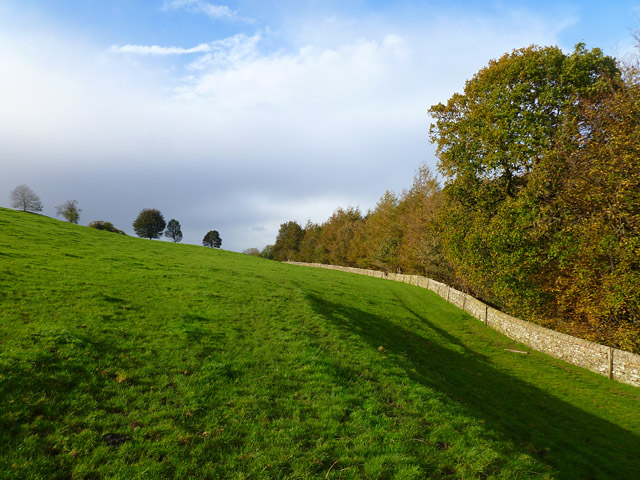
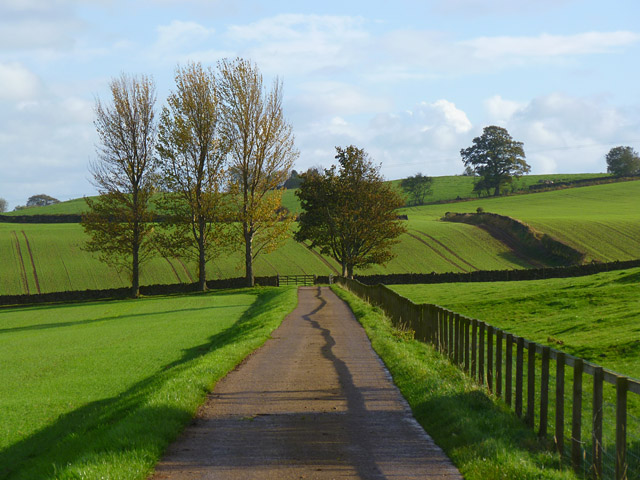
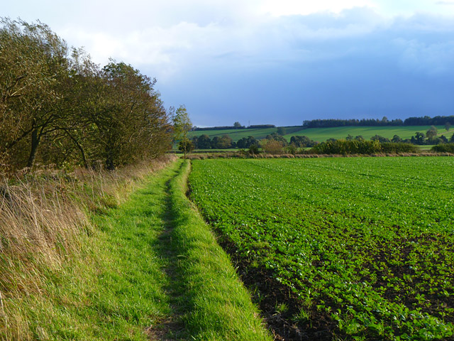
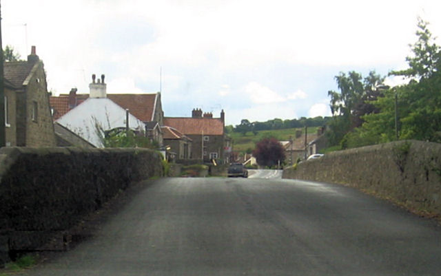
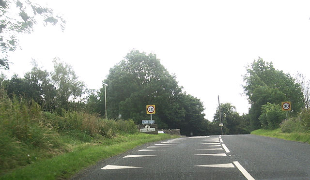
Aske is a small village located in the Richmondshire district of North Yorkshire, England. Situated in the picturesque Yorkshire Dales, it lies approximately 3 miles southwest of the market town of Richmond. The village is nestled amidst rolling hills, offering stunning views of the surrounding countryside.

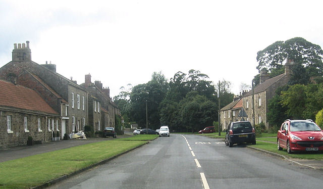
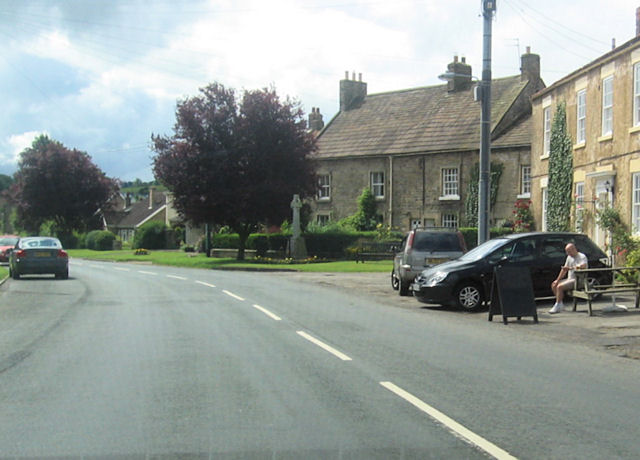
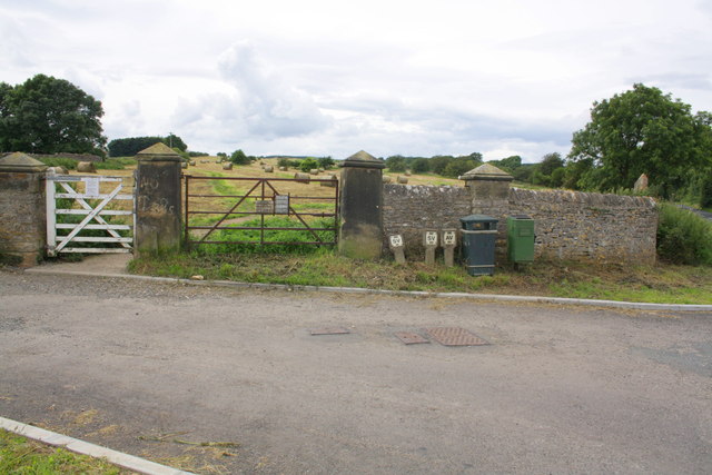
With a population of around 150 residents, Aske is a quiet and close-knit community. The village is known for its charming rural character, with traditional stone-built houses and a peaceful ambiance. Its quaint setting attracts visitors seeking a tranquil escape from the hustle and bustle of city life.

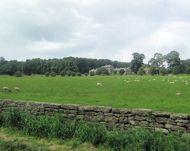
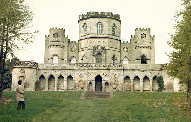
Notable landmarks in Aske include the historic Aske Hall, a Grade I listed country house. Built in the 18th century, the hall is renowned for its architectural beauty and extensive gardens. These gardens are often open to the public, allowing visitors to explore the well-maintained grounds and admire the stunning landscape.

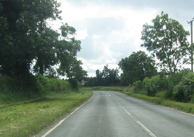
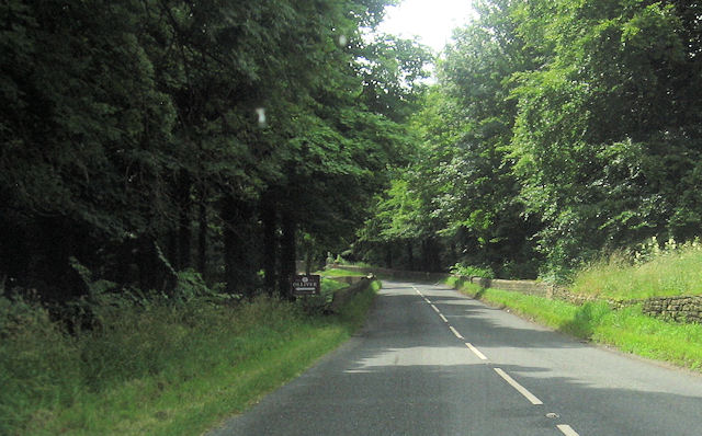
The village is surrounded by picturesque walking trails, making it a popular destination for hikers and nature enthusiasts. The nearby River Swale offers opportunities for fishing and boating, adding to the village's appeal for outdoor enthusiasts.

Despite its small size, Aske benefits from its proximity to Richmond, which provides a range of amenities such as shops, restaurants, and schools. The village also enjoys good transport links, with easy access to major road networks connecting it to other parts of Yorkshire and beyond.

Overall, Aske offers a serene and idyllic setting, making it a charming place to visit or call home for those seeking a peaceful retreat in the heart of the Yorkshire countryside.

If you have any feedback on the listing, please let us know in the comments section below.
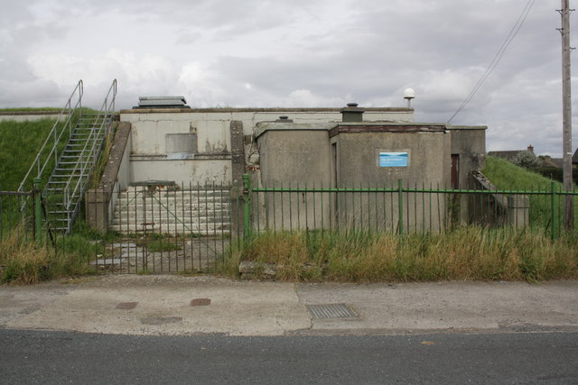
Aske Images

Images are sourced within 2km of 54.427243/-1.7276877 or Grid Reference NZ1703. Thanks to Geograph Open Source API. All images are credited.

Pasture and woodland, Gilling The public bridleway follows the edge of The Ashes to the west of Gillingwood Hall.
Pasture and woodland, Gilling
The public bridleway follows the edge of The Ashes to the west of Gillingwood Hall.
Farm road and farmland, Gilling The public bridleway heading away from Gillingwood Hall.
Farm road and farmland, Gilling
The public bridleway heading away from Gillingwood Hall.
Farmland, Gilling The footpath heading towards Skeeby beside a crop of oil-seed rape.
Farmland, Gilling
The footpath heading towards Skeeby beside a crop of oil-seed rape.
Road through Gilling West
Crossing Gilling bridge
Gilling West From south of The White Swan
Gilling West
From south of The White Swan
B6274 at double bends South of Gilling West
B6274 at double bends
South of Gilling West
Grazing land by B6274 Aske Hall in the background
Grazing land by B6274
Aske Hall in the background
B6274 approaching Aske Bridge Gates to Aske Hall and to Olliver cottages here
B6274 approaching Aske Bridge
Gates to Aske Hall and to Olliver cottages here
B6274 approaching Richmond
Benchmark on wall pier at entrance to Richmond Racecourse Ordnance Survey cut mark benchmark described on the Bench Mark Database at <span class="nowrap"><a title="http://www.bench-marks.org.uk/bm44924" rel="nofollow ugc noopener" href="http://www.bench-marks.org.uk/bm44924">Link</a><img style="margin-left:2px;" alt="External link" title="External link - shift click to open in new window" src="https://s1.geograph.org.uk/img/external.png" width="10" height="10"/></span>
Benchmark on wall pier at entrance to Richmond Racecourse
Ordnance Survey cut mark benchmark described on the Bench Mark Database at LinkExternal link
Whashton Road entrance to Richmond Racecourse The former racecourse now provides walking and dog exercising opportunities. There is an OS benchmark <a href="https://www.geograph.org.uk/photo/3152032">NZ1702 : Benchmark on wall pier at entrance to Richmond Racecourse</a> on the wall pier behind the dog waste bin.
Whashton Road entrance to Richmond Racecourse
The former racecourse now provides walking and dog exercising opportunities. There is an OS benchmark NZ1702 : Benchmark on wall pier at entrance to Richmond Racecourse on the wall pier behind the dog waste bin.
Benchmark on former barracks, Beechfield Road Ordnance Survey cut mark benchmark described on the Bench Mark Database at <span class="nowrap"><a title="http://www.bench-marks.org.uk/bm44983" rel="nofollow ugc noopener" href="http://www.bench-marks.org.uk/bm44983">Link</a><img style="margin-left:2px;" alt="External link" title="External link - shift click to open in new window" src="https://s1.geograph.org.uk/img/external.png" width="10" height="10"/></span>
Benchmark on former barracks, Beechfield Road
Ordnance Survey cut mark benchmark described on the Bench Mark Database at LinkExternal link
Former barracks at junction of Beechfield Road and Galloway There is an OS benchmark <a href="https://www.geograph.org.uk/photo/3209029">NZ1701 : Benchmark on former barracks, Beechfield Road</a> on the corner of the building
Former barracks at junction of Beechfield Road and Galloway
There is an OS benchmark NZ1701 : Benchmark on former barracks, Beechfield Road on the corner of the building
Benchmark on wall angle next to #21 Beechfield Road The Ordnance Survey cut mark benchmark is on an inscribed stone (the last word is 'SOUTH') and is described on the Bench Mark Database at <span class="nowrap"><a title="http://www.bench-marks.org.uk/bm44984" rel="nofollow ugc noopener" href="http://www.bench-marks.org.uk/bm44984">Link</a><img style="margin-left:2px;" alt="External link" title="External link - shift click to open in new window" src="https://s1.geograph.org.uk/img/external.png" width="10" height="10"/></span>
Benchmark on wall angle next to #21 Beechfield Road
The Ordnance Survey cut mark benchmark is on an inscribed stone (the last word is 'SOUTH') and is described on the Bench Mark Database at LinkExternal link
Housing provided by converted barracks, Beechfield Road There is an OS benchmark <a href="https://www.geograph.org.uk/photo/3209091">NZ1701 : Benchmark on wall angle next to #21 Beechfield Road</a> on the inscribed stone inserted in the wall end near the right hand side of the image
Housing provided by converted barracks, Beechfield Road
There is an OS benchmark NZ1701 : Benchmark on wall angle next to #21 Beechfield Road on the inscribed stone inserted in the wall end near the right hand side of the image
High Zone - Coalsgarth covered reservoir, Whashton Road The white mushroom-like instrument on the top right of the reservoir is an Ordnance Survey active triangulation station, <span class="nowrap"><a title="http://trigpointinguk.com/trigs/trig-details.php?t=7385" rel="nofollow ugc noopener" href="http://trigpointinguk.com/trigs/trig-details.php?t=7385">Link</a><img style="margin-left:2px;" alt="External link" title="External link - shift click to open in new window" src="https://s1.geograph.org.uk/img/external.png" width="10" height="10"/></span>
High Zone - Coalsgarth covered reservoir, Whashton Road
The white mushroom-like instrument on the top right of the reservoir is an Ordnance Survey active triangulation station, LinkExternal link
Benchmarked inscribed stone in wall of Cutpurse Lane The wall is the north west angle of the boundary wall of the former barracks, and the inscription is 'No. 2 FACE OF WALL NORTH WEST'. The Ordnance Survey cut mark benchmark is described on the Bench Mark Database at <span class="nowrap"><a title="http://www.bench-marks.org.uk/bm45609" rel="nofollow ugc noopener" href="http://www.bench-marks.org.uk/bm45609">Link</a><img style="margin-left:2px;" alt="External link" title="External link - shift click to open in new window" src="https://s1.geograph.org.uk/img/external.png" width="10" height="10"/></span>
Benchmarked inscribed stone in wall of Cutpurse Lane
The wall is the north west angle of the boundary wall of the former barracks, and the inscription is 'No. 2 FACE OF WALL NORTH WEST'. The Ordnance Survey cut mark benchmark is described on the Bench Mark Database at LinkExternal link
Show me another place!

Aske is located at Grid Ref: NZ1703 (Lat: 54.427243, Lng: -1.7276877)

Division: North Riding

Administrative County: North Yorkshire

District: Richmondshire

Police Authority: North Yorkshire

What 3 Words

///serves.cleanest.ranges. Near Richmond, North Yorkshire

Related Wikis

Aske, North Yorkshire

Aske is a civil parish in the Richmondshire district of North Yorkshire, England, about two miles north of Richmond. According to the 2001 census it had...

Aske Hall

Aske Hall is a Georgian country house, with parkland attributed to Capability Brown, 1.5 miles (2.4 km) north of Richmond, North Yorkshire, England. It...

Gilling West

Gilling West is a village about 3.5 miles (5.6 km) north of Richmond in the Richmondshire district of North Yorkshire, England. It is located in the civil...

Richmond Barracks, North Yorkshire

Richmond Barracks was a military installation in Richmond, North Yorkshire. == History == The barracks were built as the depot of the two battalions of...

Richmond Racecourse

Richmond Racecourse was a British horse racing track situated at Richmond, North Yorkshire at first High Moor, then Low Moor, from 1765 to 1776. It was...

St Francis Xavier School, North Yorkshire

St. Francis Xavier School is a coeducational secondary school situated on Darlington Road, Richmond, North Yorkshire, England. It is a joint Roman Catholic...

Richmond School

Richmond School & Sixth Form College, often referred to simply as Richmond School, is a coeducational secondary school located in North Yorkshire, England...

Victoria Hospital, Richmond

The Victoria Hospital was a health facility in Queen's Road, Richmond, North Yorkshire, England. It is now used as a funeral director's offices and remains...

Nearby Amenities

Located within 500m of 54.427243,-1.7276877
Barrier: yes
Lat/Long: 54.4266328/-1.7257652
Aske Estate
Place: locality
Lat/Long: 54.4265103/-1.7288562
The data included in this document is from www.openstreetmap.org. The data is made available under ODbL.

Have you been to Aske?

Leave your review of Aske below (or comments, questions and feedback).