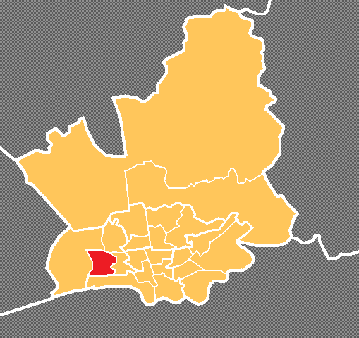
Ashton Bank

Settlement in Lancashire Preston

England

Ashton Bank

The River Ribble northwest of Nabsack Planting
The River Ribble northwest of Nabsack Planting Credit: Colin Park

Ashton Bank is a small village located in the county of Lancashire, England. Situated near the town of Preston, it is part of the civil parish of Lea and Cottam. The village is characterized by its peaceful and rural setting, nestled amidst picturesque countryside.

The area around Ashton Bank has a rich historical background, dating back to medieval times. The village is home to several historic buildings, including Ashton Bank House, a Grade II listed Georgian mansion. This elegant house, with its distinctive architecture and well-manicured gardens, stands as a testament to the area's past prosperity.

The village itself is predominantly residential, with a close-knit community of residents. The locals enjoy a close proximity to nature, as Ashton Bank is surrounded by beautiful woodlands and fields. The nearby River Ribble provides opportunities for outdoor activities such as fishing and boating.

Despite its tranquil ambiance, Ashton Bank benefits from its proximity to larger towns and cities. The bustling city of Preston is just a short drive away, offering a wide range of amenities, including shopping centers, restaurants, and entertainment venues. The village also benefits from good transport links, with regular bus services connecting it to nearby towns.

Overall, Ashton Bank offers a charming countryside lifestyle, with its historical charm, natural beauty, and convenient access to urban amenities. It is a place that appeals to those seeking a peaceful and idyllic retreat, while still being within reach of modern conveniences.

If you have any feedback on the listing, please let us know in the comments section below.

Ashton Bank Images

Images are sourced within 2km of 53.764583/-2.7487772 or Grid Reference SD5030. Thanks to Geograph Open Source API. All images are credited.

The River Ribble northwest of Nabsack Planting
Old Milestone Marker 54-03 F (between bridges 18-17), Lancaster Canal Old Milestone located by the side of the Lancaster Canal
This milestone is 3 miles from the centre of Preston and 54 miles from Kendal

Inscription reads:- 
Preston / 3 :: Garstang / 14 

Milestone Society National ID: LAN-03
Old Milestone Marker 54-03 F (between bridges 18-17), Lancaster Canal
Old Milestone located by the side of the Lancaster Canal This milestone is 3 miles from the centre of Preston and 54 miles from Kendal Inscription reads:- Preston / 3 :: Garstang / 14 Milestone Society National ID: LAN-03
Track through wasteland south of Riversway Motor Park
Riversway heading towards Preston
By The River Ribble The two sets of power lines are very much part of the landscape here. Viewed on a bright mid-February morning.
By The River Ribble
The two sets of power lines are very much part of the landscape here. Viewed on a bright mid-February morning.
Riverside View Looking upstream from the Ribble Way on the Penwortham side towards the old dock at Preston.
Riverside View
Looking upstream from the Ribble Way on the Penwortham side towards the old dock at Preston.
Beside The Pylons Viewed at a junction of paths right beside one of the power lines that are such a prominent feature of the landscape here.
Beside The Pylons
Viewed at a junction of paths right beside one of the power lines that are such a prominent feature of the landscape here.
The River Ribble Viewed from the Ribble Way where a double power line crosses the river. The power lines are a prominent feature of the landscape here.
The River Ribble
Viewed from the Ribble Way where a double power line crosses the river. The power lines are a prominent feature of the landscape here.
Ribble Shore The northern shore of the River Ribble, approximately 1000 yards downstream of Preston Docks.
Ribble Shore
The northern shore of the River Ribble, approximately 1000 yards downstream of Preston Docks.
Old Milestone Marker 55-02 F (between bridges 15-14), Lancaster Canal (between bridges old marker) Old Milestone located by the side of the Lancaster Canal
This milestone is 2 miles from the centre of Preston and 55 miles from Kendal

Inscription reads:- 
Preston / 2 :: Garstang / 15 (missing) 

Milestone Society National ID: LAN-02
Old Milestone Marker 55-02 F (between bridges 15-14), Lancaster Canal (between bridges old marker)
Old Milestone located by the side of the Lancaster Canal This milestone is 2 miles from the centre of Preston and 55 miles from Kendal Inscription reads:- Preston / 2 :: Garstang / 15 (missing) Milestone Society National ID: LAN-02
Milestone Marker 55-02 F (between bridges 15-14), Lancaster Canal Milestone located by the side of the Lancaster Canal
This milestone is 2 miles from the centre of Preston and 55 miles from Kendal

Inscription reads:- 
Preston / 2 :: Garstang / 15 

Milestone Society National ID: LAN-02R
Milestone Marker 55-02 F (between bridges 15-14), Lancaster Canal
Milestone located by the side of the Lancaster Canal This milestone is 2 miles from the centre of Preston and 55 miles from Kendal Inscription reads:- Preston / 2 :: Garstang / 15 Milestone Society National ID: LAN-02R
Milestone Marker 56-01 F (between bridges 11-10), Lancaster Canal Milestone located by the side of the Lancaster Canal
This milestone is 1 miles from the centre of Preston and 56 miles from Kendal

Inscription reads:- 

Preston / 1 :: Garstang / 16 
Milestone Society National ID: LAN-01R
Milestone Marker 56-01 F (between bridges 11-10), Lancaster Canal
Milestone located by the side of the Lancaster Canal This milestone is 1 miles from the centre of Preston and 56 miles from Kendal Inscription reads:- Preston / 1 :: Garstang / 16 Milestone Society National ID: LAN-01R
Ingol Social Club It is something of a mystery as to why these sort of places invariably look so unprepossessing from the outside. Ingol Social Club on Whitby Avenue, with its stained brickwork, 1960s-style windows and fascia, solid doors, old bin, and weeds growing up from the bottom of the wall, is no exception. Apparently it has been refurbished to 'a very high standard' - it's a pity they didn't knock it down and start again. The club first opened as the Ingol Labour Club in 1968.
Ingol Social Club
It is something of a mystery as to why these sort of places invariably look so unprepossessing from the outside. Ingol Social Club on Whitby Avenue, with its stained brickwork, 1960s-style windows and fascia, solid doors, old bin, and weeds growing up from the bottom of the wall, is no exception. Apparently it has been refurbished to 'a very high standard' - it's a pity they didn't knock it down and start again. The club first opened as the Ingol Labour Club in 1968.
Whitby Avenue, Ingol Preston began to expand into the Ingol area in the early 1960s and the housing stock here is of its time.
Whitby Avenue, Ingol
Preston began to expand into the Ingol area in the early 1960s and the housing stock here is of its time.
Backs of houses on Dalmore Road, Ingol This potholed roadway leads off Barry Avenue into a yard at the back of a terrace of houses on Dalmore Road.
Backs of houses on Dalmore Road, Ingol
This potholed roadway leads off Barry Avenue into a yard at the back of a terrace of houses on Dalmore Road.
Barry Avenue, Ingol Cottam Avenue leads off to the left down to the Lancaster Canal at the southern tip of the Ingol built-up area.
Barry Avenue, Ingol
Cottam Avenue leads off to the left down to the Lancaster Canal at the southern tip of the Ingol built-up area.
Lancaster Canal, Ingol This is the view looking down from Cottam Mill Bridge towards the end of the canal at Ashton Basin just over a mile away.
Lancaster Canal, Ingol
This is the view looking down from Cottam Mill Bridge towards the end of the canal at Ashton Basin just over a mile away.
Show me another place!

Ashton Bank is located at Grid Ref: SD5030 (Lat: 53.764583, Lng: -2.7487772)

Administrative County: Lancashire

District: Preston

Police Authority: Lancashire

What 3 Words

///olive.divisions.then. Near Preston, Lancashire

Related Wikis

Ashton Park

Ashton Park is situated in Ashton-on-Ribble to the west of Preston, Lancashire, England. It has one bowling green, two play areas, with swings, roundabouts...

Riversway

Riversway was an electoral ward in Preston, Lancashire, England. The ward was named for its location close to the River Ribble, and the historical links...

Ashton Community Science College

Ashton Community Science College is a coeducational secondary school located in the Ashton-on-Ribble area of Preston in the English county of Lancashire...

Larches, Preston

Larches is one of the districts of Preston, Lancashire, England. The area, north-west of Preston city centre, is a mix of social and private housing,...

Nearby Amenities

Located within 500m of 53.764583,-2.7487772
Larches
Place: neighbourhood
Lat/Long: 53.7659997/-2.7547182
Post Box
Collection Times: Mo-Fr 17:30; Sa 10:30
Operator: Royal Mail
Post Box Type: pillar
Ref: PR2 511
Royal Cypher: EIIR
Royal Cypher Wikidata: Q33102113
Lat/Long: 53.7611189/-2.744044
Post Box
Collection Times: Mo-Fr 17:30
Operator: Royal Mail
Post Box Type: meter
Ref: PR2 512
Lat/Long: 53.7611286/-2.744003
Railway: buffer_stop
Lat/Long: 53.7610887/-2.7475287
Turning Circle
Lat/Long: 53.764427/-2.753091
Turning Circle
Lat/Long: 53.7667199/-2.7525267
Turning Circle
Lat/Long: 53.7679193/-2.7503329
Historic Railway: level_crossing
Lat/Long: 53.7613566/-2.7476182
Cafe
Take Five Coffee Shop
Addr City: Preston
Addr Postcode: PR2 2PD
Addr Street: Chain Caul Road
Fhrs Id: 89190
Source: GPS
Lat/Long: 53.7606711/-2.7496639
Addr Housenumber: 2
Lat/Long: 53.7669369/-2.7549144
Addr Housenumber: 18
Lat/Long: 53.7662176/-2.7548301
Valerie Lodge
Addr Housenumber: 18
Addr Street: Elswick Road
Shop: hairdresser
Source: Bing
Lat/Long: 53.7662364/-2.7548073
Fast Food
Harbour City
Addr City: Preston
Addr Housenumber: 16
Addr Postcode: PR2 1NT
Addr Street: Elswick Road
Cuisine: fish_and_chips
Source: Bing
Lat/Long: 53.7662863/-2.7548233
Pharmacy
Rowlands Pharmacy
Addr City: Preston
Addr Country: GB
Addr Housenumber: 14
Addr Postcode: PR2 1NT
Addr Street: Elswick Road
Brand: Rowlands Pharmacy
Brand Wikidata: Q62663235
Dispensing: yes
Healthcare: pharmacy
Source: Bing
Website: https://rowlandspharmacy.co.uk/find-local-pharmacy#!/l/preston/14-elswick-road/1478
Lat/Long: 53.7663536/-2.7548255
Post Office
Larches Post Office
Addr City: Preston
Addr Housenumber: 8
Addr Postcode: PR2 1NT
Addr Street: Elswick Road
Addr Suburb: Ashton-on-Ribble
Fhrs Id: 1025379
Opening Hours: Mo-Sa 07:00-20:00; Su 09:00-14:00
Ref Pol Id: 7365
Source: pol_branch_list_2018-02
Lat/Long: 53.7665759/-2.7548506
Addr Housenumber: 2
Lat/Long: 53.7673398/-2.7517117
Addr Housenumber: 16
Lat/Long: 53.7673252/-2.7526523
Addr Housenumber: 2
Lat/Long: 53.7662158/-2.7556052
Addr Housenumber: 4
Lat/Long: 53.7664092/-2.7556668
Bench
Source: gps
Lat/Long: 53.7683816/-2.748535
Crossing
Crossing: uncontrolled
Lat/Long: 53.7685735/-2.7508767
Barrier: bollard
Lat/Long: 53.7686065/-2.750847
Crossing
Crossing: uncontrolled
Lat/Long: 53.7686662/-2.7500729
Crossing
Crossing: uncontrolled
Lat/Long: 53.7686289/-2.7508929
Crossing
Crossing: uncontrolled
Lat/Long: 53.7687214/-2.750092
Barrier: bollard
Lat/Long: 53.7686937/-2.7501067
Barrier: bollard
Lat/Long: 53.7687048/-2.7500397
Post Box
Collection Times: Mo-Fr 09:00; Sa 07:00
Operator: Royal Mail
Post Box Type: pillar
Ref: PR2 379
Royal Cypher: EIIR
Royal Cypher Wikidata: Q33102113
Lat/Long: 53.7645968/-2.7543844
Post Box
Collection Times: Mo-Fr 09:00; Sa 07:00
Ref: PR2 330
Lat/Long: 53.7634325/-2.7479376
Post Box
Collection Times: Mo-Fr 16:45; Sa 10:45
Ref: PR2 372
Lat/Long: 53.7666141/-2.7547888
Fast Food
Snax
Addr City: Preston
Addr Housenumber: 10
Addr Postcode: PR2 1NT
Addr Street: Elswick Road
Cuisine: sandwich
Fhrs Id: 106673
Lat/Long: 53.7664618/-2.754825
Discount Booze and Wines
Addr City: Preston
Addr Housenumber: 6
Addr Postcode: PR2 1NT
Addr Street: Elswick Road
Fhrs Id: 1103949
Shop: alcohol
Lat/Long: 53.7667535/-2.754871
Bus Stop
Bus: yes
Public Transport: platform
Lat/Long: 53.7679963/-2.7511796
Bus Stop
Bus: yes
Public Transport: platform
Lat/Long: 53.76812/-2.7513231
Bus Stop
Bus: yes
Public Transport: platform
Lat/Long: 53.7656401/-2.751595
Bus Stop
Bus: yes
Public Transport: platform
Lat/Long: 53.7656966/-2.7517556
Lustalux at Home
Addr City: Preston
Addr Postcode: PR2 2YL
Addr Street: Chain Caul Way
Addr Unit: A3 Anchorage Business Park
Office: company
Opening Hours: Mo-Fr 09:00-17:00
Lat/Long: 53.7608329/-2.7513926
The data included in this document is from www.openstreetmap.org. The data is made available under ODbL.

Have you been to Ashton Bank?

Leave your review of Ashton Bank below (or comments, questions and feedback).