Ashtead Common

Settlement in Surrey Mole Valley

England

Ashtead Common

Field south of Ashtead Woods Road
Field south of Ashtead Woods Road Credit: James Emmans

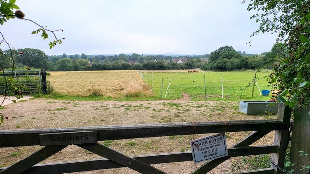
Ashtead Common is a vast area of natural beauty situated in Surrey, England. Covering over 500 acres, it is a designated Site of Special Scientific Interest (SSSI) due to its diverse range of habitats and rich biodiversity. The common is managed by the National Trust and offers a tranquil escape from the bustling city life.

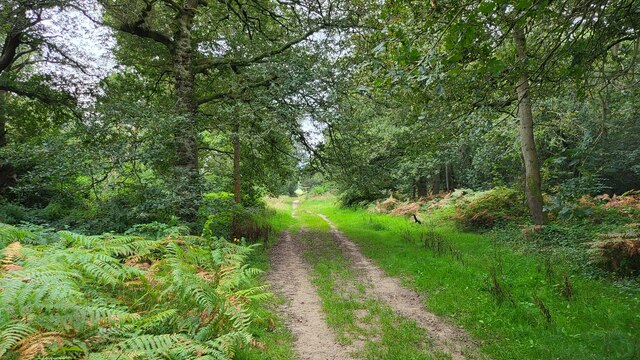
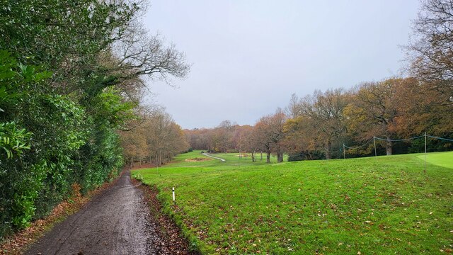
The landscape of Ashtead Common is predominantly woodland, with a mix of ancient oak and beech trees, providing a haven for various bird species and small mammals. The woodland floor is adorned with a vibrant array of wildflowers in the spring and summer months, creating a picturesque setting for visitors.

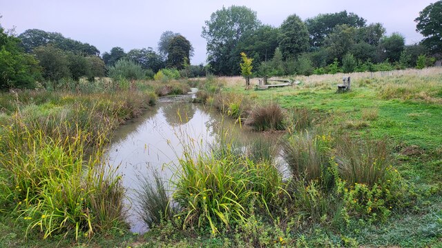
The common also boasts several ponds and wetland areas, which attract an abundance of wildlife, including dragonflies, water voles, and amphibians. These wetland habitats are carefully preserved to maintain their ecological importance.

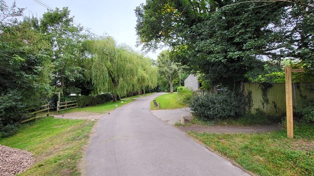
Ashtead Common offers a variety of walking trails and footpaths, allowing visitors to explore the natural wonders of the area. The well-marked paths cater to different levels of difficulty, making it accessible for all ages and abilities. Interpretive panels are strategically placed throughout the common, providing information about the flora, fauna, and historical significance of the site.

Additionally, Ashtead Common is a popular spot for recreational activities such as picnicking, dog walking, and nature photography. The tranquil surroundings and peaceful atmosphere make it an ideal location for those seeking solace in nature.

Overall, Ashtead Common stands as a testament to the natural beauty of Surrey, providing a haven for wildlife and a peaceful retreat for visitors to enjoy.

If you have any feedback on the listing, please let us know in the comments section below.

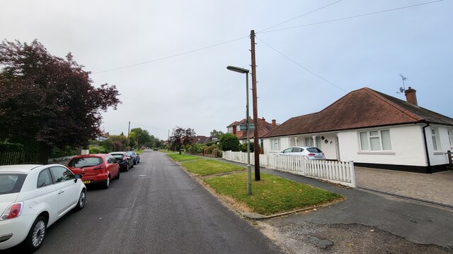
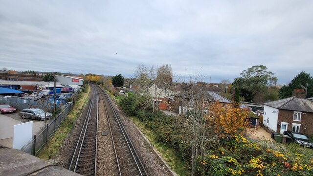
Ashtead Common Images

Images are sourced within 2km of 51.319494/-0.32154724 or Grid Reference TQ1759. Thanks to Geograph Open Source API. All images are credited.

Field south of Ashtead Woods Road
Ashtead - Craddocks Avenue Residential road near Ashtead Station.
Ashtead - Craddocks Avenue
Residential road near Ashtead Station.
Bramley Way Junction with Cray Avenue and Berry Meade.
Bramley Way
Junction with Cray Avenue and Berry Meade.
Woodland track on Ashtead Common 495 acres common and national nature reserve, owned and run by the City of London Corporation. SSSI status due to rear invertebrates and an important breeding area for birds
Woodland track on Ashtead Common
495 acres common and national nature reserve, owned and run by the City of London Corporation. SSSI status due to rear invertebrates and an important breeding area for birds
Footpath crossing Ashstead Woods Road
Rye Meadows Wetlands Managed area next to the Rye Brook to improve wildlife and reduce flooding.

<span class="nowrap"><a title="https://www.ryemeadows.org.uk/" rel="nofollow ugc noopener" href="https://www.ryemeadows.org.uk/">Link</a><img style="margin-left:2px;" alt="External link" title="External link - shift click to open in new window" src="https://s1.geograph.org.uk/img/external.png" width="10" height="10"/></span>
Rye Meadows Wetlands
Managed area next to the Rye Brook to improve wildlife and reduce flooding. LinkExternal link
Bramley Way junction with Stonny Croft
Bramley Grove Housing infill development on a school site.
Bramley Grove
Housing infill development on a school site.
West Farm Avenue Residential street with post box on the corner to West Farm Close.
West Farm Avenue
Residential street with post box on the corner to West Farm Close.
Northern end of West Farm Avenue
Railway line towards Leatherhead Station Photo taken from the railway bridge for the Kingston Road which was a part of an improved road becoming the B2430. The original road was a narrow windy road with a railway crossing.
Railway line towards Leatherhead Station
Photo taken from the railway bridge for the Kingston Road which was a part of an improved road becoming the B2430. The original road was a narrow windy road with a railway crossing.
The Leatherhead Golf Club The golf club is on the parkland of Pachesham Manor.
The Leatherhead Golf Club
The golf club is on the parkland of Pachesham Manor.
Leatherhead Community Hub Located beside Kingston Road.
Leatherhead Community Hub
Located beside Kingston Road.
The Molebridge Practice Located beside Kingston Road.
The Molebridge Practice
Located beside Kingston Road.
Leatherhead B&Q Located between Oxshott Road and Kingston Road, the latter truncated by the building of the M25 Motorway.
Leatherhead B&Q
Located between Oxshott Road and Kingston Road, the latter truncated by the building of the M25 Motorway.
Leatherhead Tesco Located beside Oxshott Road.
Leatherhead Tesco
Located beside Oxshott Road.
M25 Motorway Seen from Oxshott Road, close to junction 9.
M25 Motorway
Seen from Oxshott Road, close to junction 9.
Fire and Iron Gallery Fire and Iron Gallery was founded in 1982 as part of Rowhurst Forge.

Fire and Iron represents 200 British and international makers working in technically diverse ways with iron, steel, stainless steel, aluminium, zinc, copper, bronze, brass, tin, pewter, silver, gold, titanium and scrap metal.
Fire and Iron Gallery
Fire and Iron Gallery was founded in 1982 as part of Rowhurst Forge. Fire and Iron represents 200 British and international makers working in technically diverse ways with iron, steel, stainless steel, aluminium, zinc, copper, bronze, brass, tin, pewter, silver, gold, titanium and scrap metal.
Show me another place!

Ashtead Common is located at Grid Ref: TQ1759 (Lat: 51.319494, Lng: -0.32154724)

Administrative County: Surrey

District: Mole Valley

Police Authority: Surrey

What 3 Words

///breed.nature.pace. Near Ashtead, Surrey

Related Wikis

Ashtead Common

Ashtead Common, nearly 495 acres (c. 200 ha), is a wooded area open to the public, to the north of the village of Ashtead in Surrey, England. It is owned...

Ashtead railway station

Ashtead railway station is in Ashtead, Surrey, England. It is 16 miles 19 chains (26.1 km) down the line from London Waterloo. == History == Designed by...

Epsom and Ashtead Commons

Epsom and Ashtead Commons are a 360.4-hectare (891-acre) biological Site of Special Scientific Interest on the outskirts of Epsom and Ashtead in Surrey...

Prince's Coverts

Prince's Coverts is an area of 864 acres (3.50 km2; 1.350 sq mi) of managed woodland in Oxshott, Surrey, England, to which there is public access. It is...

Therfield School

Therfield School is a coeducational secondary school and sixth form located in Leatherhead, Surrey, England. Therfield School sixth form teaches courses...

Epsom Rural District

Epsom was a rural district of Surrey from 1894 to 1933. It was created in 1894 and covered the area of the formed Epsom Rural Sanitary District – i.e....

Parsons Mead School

Parsons Mead School was a private girls school founded by Jessie Elliston in Ashtead, Surrey, England, which existed from 1897 to 2006. == Founder == Jessie...

Ashtead

Ashtead is a large village in the Mole Valley district of Surrey, England, approximately 15.5 mi (25 km) south of central London. Primarily a commuter...

Nearby Amenities

Located within 500m of 51.319494,-0.32154724
Barrier: kissing_gate
Lat/Long: 51.3205668/-0.3212678
Barrier: stile
Lat/Long: 51.3180516/-0.319586
Map board
Tourism: information
Lat/Long: 51.3206452/-0.321321
Power: tower
Lat/Long: 51.3162077/-0.3184826
Post Box
Collection Times: Mo-Fr 09:00; Sa 07:00
Operator: Royal Mail
Post Box Mounting: lamp_post
Post Box Type: lamp
Ref: KT21 79D
Royal Cypher: EIIR
Royal Cypher Wikidata: Q33102113
Lat/Long: 51.320071/-0.3152782
The data included in this document is from www.openstreetmap.org. The data is made available under ODbL.

Have you been to Ashtead Common?

Leave your review of Ashtead Common below (or comments, questions and feedback).