Ashmore Lake

Settlement in Staffordshire

England

Ashmore Lake

Council Housing - Castlebridge Estate Wednesfield UDC developed the Castlebridge Estate in the early 1950s with a cluster of four storey blocks beside the Wyley & Essington Canal.
Council Housing - Castlebridge Estate Credit: John M

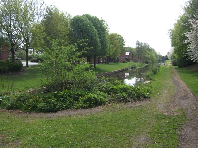
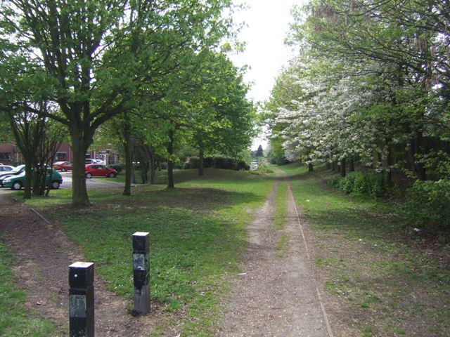
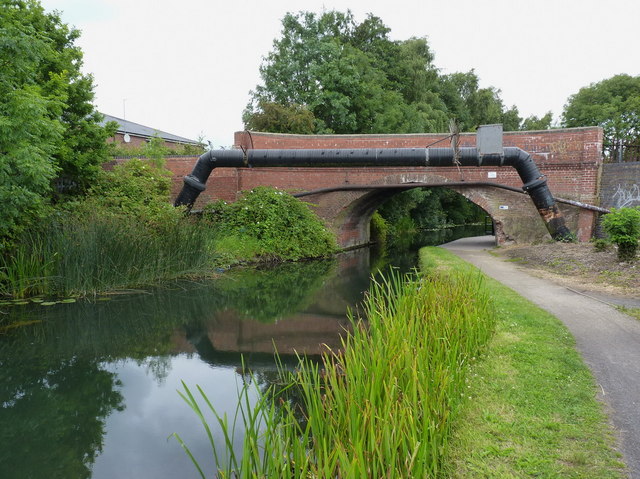
Ashmore Lake is a serene and picturesque body of water located in the county of Staffordshire, England. Situated in the small village of Wombourne, this man-made lake covers an area of approximately 11 acres, making it a popular recreational spot for locals and visitors alike.

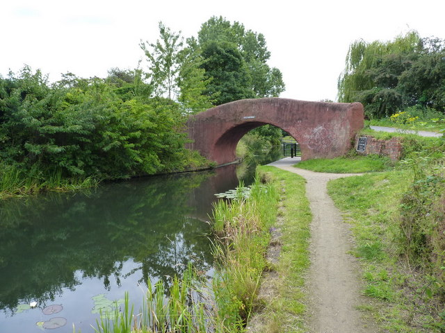
Originally created as a reservoir to supply water to the nearby Wombourne Canal, Ashmore Lake has evolved into a tranquil oasis surrounded by lush greenery and wildlife. Its calm and inviting waters attract anglers, who can often be seen casting their lines in search of carp, bream, and tench.

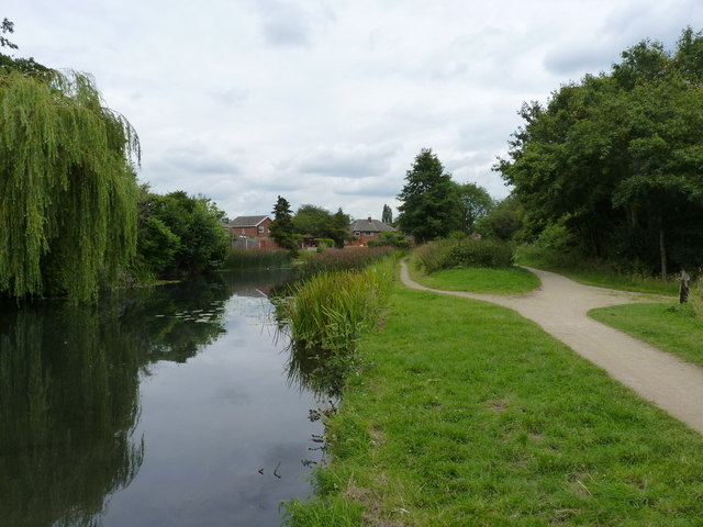
The lake is also a haven for birdwatchers, as it provides a habitat for a diverse range of avian species. Visitors may spot graceful swans gliding across the water, ducks paddling merrily, and various songbirds flitting through the trees. In the spring and summer months, the area bursts into color with vibrant wildflowers and blooming water lilies, creating a picturesque backdrop for nature enthusiasts and photographers.

Ashmore Lake boasts well-maintained walking paths that encircle the lake, offering a leisurely stroll for those seeking a peaceful escape. Additionally, there are several benches and picnic spots along the way, providing a perfect spot to relax and enjoy the tranquil ambiance.

With its natural beauty and tranquil atmosphere, Ashmore Lake provides a welcome respite from the hustle and bustle of everyday life, making it a beloved spot for locals and visitors seeking solace in nature.

If you have any feedback on the listing, please let us know in the comments section below.
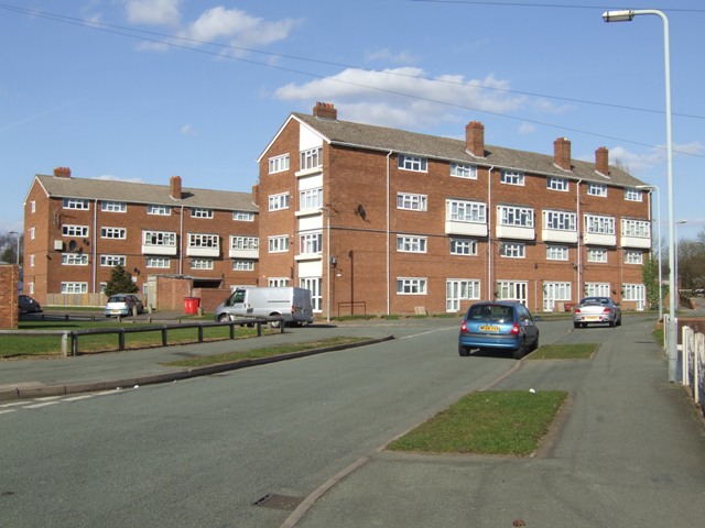
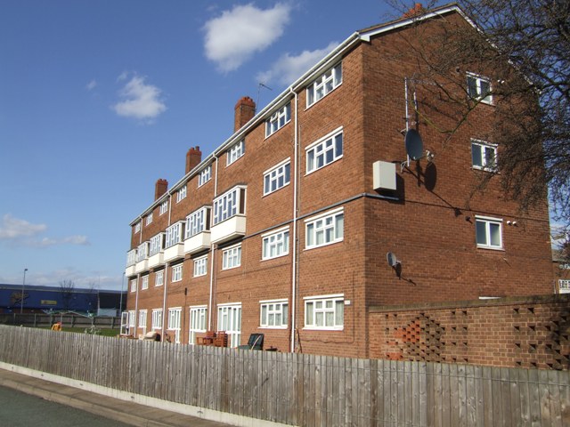
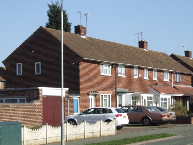
Ashmore Lake Images

Images are sourced within 2km of 52.598842/-2.0516453 or Grid Reference SJ9600. Thanks to Geograph Open Source API. All images are credited.

Council Housing - Castlebridge Estate Wednesfield UDC developed the Castlebridge Estate in the early 1950s with a cluster of four storey blocks beside the Wyley & Essington Canal.
Council Housing - Castlebridge Estate
Wednesfield UDC developed the Castlebridge Estate in the early 1950s with a cluster of four storey blocks beside the Wyley & Essington Canal.
Council Housing - Castlebridge Estate Wednesfield UDC developed the Castlebridge Estate in the early 1950s. This block comprises sixteen flats.
Council Housing - Castlebridge Estate
Wednesfield UDC developed the Castlebridge Estate in the early 1950s. This block comprises sixteen flats.
Council Housing - Merrick Road Post war housing built for Wednesfield UDC on the early 1950s Castlebridge Estate.
Council Housing - Merrick Road
Post war housing built for Wednesfield UDC on the early 1950s Castlebridge Estate.
Short Heath Basin Built in 1906 by the Hollybank Colliery as a colliery wharf and landsale. A mineral railway was constructed directly from the pit in Essington to eliminate the locks on the Wyrley Branch of the Curly Wyrley. The facility remained in use until the closure of the Hilton Main Colliery in the late 1960s.

A landsale was a site where coal was stockpiled to meet seasonal demand with local sale to coal merchants.
Short Heath Basin
Built in 1906 by the Hollybank Colliery as a colliery wharf and landsale. A mineral railway was constructed directly from the pit in Essington to eliminate the locks on the Wyrley Branch of the Curly Wyrley. The facility remained in use until the closure of the Hilton Main Colliery in the late 1960s. A landsale was a site where coal was stockpiled to meet seasonal demand with local sale to coal merchants.
Short Heath Landsale Following the former colliery railway to the landsale and basin at Short Heath.

A landsale was a site where coal was stockpiled to meet seasonal demand with local sale to coal merchants.
Short Heath Landsale
Following the former colliery railway to the landsale and basin at Short Heath. A landsale was a site where coal was stockpiled to meet seasonal demand with local sale to coal merchants.
Telecommunications mast, Ezekiel Lane
Ashmore Park Health Centre
The Corpus Christi Catholic Church, Ashmore Park Located at the southern end of Ashmore Avenue, at the junction with Griffiths Drive
The Corpus Christi Catholic Church, Ashmore Park
Located at the southern end of Ashmore Avenue, at the junction with Griffiths Drive
Moathouse Lane bridge over the Essington and Wyrley canal No longer a drivable road; the bridge now carries a cycleway and footpath.
Moathouse Lane bridge over the Essington and Wyrley canal
No longer a drivable road; the bridge now carries a cycleway and footpath.
The Essington and Wyrley canal near Wood End
Devil's Elbow bridge Presumably it takes its name from the sharp (for a canal) bend just this side of the bridge.
Devil's Elbow bridge
Presumably it takes its name from the sharp (for a canal) bend just this side of the bridge.
The church of Jesus Christ of the Latter Day Saints, Linthouse Lane
St Alban's C of E Church, Griffiths Drive, Ashmore Park
Baptist Church, Griffiths Drive, Ashmore Park
The moat of Ashmore Park Farm There's very little left of the moat, apart from this slightly depressed area of grass (where the two girls are walking) but it represents the remains of a moated medieval farm settlement, which also had a fishpond just outside the moat. A later (19th Century) farm building just to the south was demolished in the 1950s, at roughly the time that the Ashmore Park estate was being built.
The moat of Ashmore Park Farm
There's very little left of the moat, apart from this slightly depressed area of grass (where the two girls are walking) but it represents the remains of a moated medieval farm settlement, which also had a fishpond just outside the moat. A later (19th Century) farm building just to the south was demolished in the 1950s, at roughly the time that the Ashmore Park estate was being built.
The Square - a small shopping parade A collection of shops and small businesses (there's also a Co-op supermarket just off-shot to the left) on the Lichfield Road in New Invention.
The Square - a small shopping parade
A collection of shops and small businesses (there's also a Co-op supermarket just off-shot to the left) on the Lichfield Road in New Invention.
Victory Club - New Invention The Working Mens club in New Invention, presumably closely associated with the former Squire Locks factory that occupied the nearby site, but which has now moved to the Hilton Cross Business Park in nearby Essington.
Victory Club - New Invention
The Working Mens club in New Invention, presumably closely associated with the former Squire Locks factory that occupied the nearby site, but which has now moved to the Hilton Cross Business Park in nearby Essington.
The New Invention Infant School
Show me another place!

Ashmore Lake is located at Grid Ref: SJ9600 (Lat: 52.598842, Lng: -2.0516453)

Unitary Authority: Walsall

Police Authority: West Midlands

What 3 Words

///trick.chill.normal. Near Willenhall, West Midlands

Nearby Locations

Ashmore Lake Perry Hall

Related Wikis

Pool Hayes Academy

Pool Hayes Academy is a mixed secondary school and sixth form located in Willenhall, in the West Midlands of England. It is one of the biggest secondary...

Ashmore Park

Ashmore Park is a large housing estate in Wednesfield, England. It has been part of the city of Wolverhampton, West Midlands since 1966, when the majority...

Short Heath railway station

Short Heath railway station was a station built by the Wolverhampton and Walsall Railway in 1872, and was operated by the Midland Railway from 1876 onwards...

Lodge Farm

The Lodge Farm estate is located in the area of Short Heath in the town of Willenhall, which is in the Metropolitan Borough of Walsall. The estate is centred...

Short Heath, Willenhall

Short Heath is a residential area situated north of the market town of Willenhall, in the Metropolitan Borough of Walsall, West Midlands, England. Short...

Sporting Khalsa F.C.

Sporting Khalsa Football Club are a football club, formed in 1991, members of the Northern Premier League Division One Midlands, who play their home games...

Willenhall Stafford Street railway station

Willenhall Stafford Street railway station was a station built by the Wolverhampton and Walsall Railway in 1872, and was operated by the Midland Railway...

Coppice Performing Arts School

Coppice Performing Arts School is an 11–18 mixed secondary school and sixth form with academy status in Wednesfield, Wolverhampton, West Midlands, England...

Related Videos

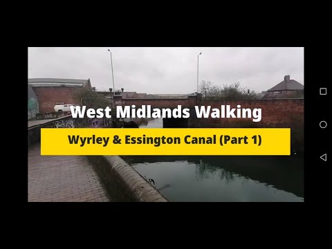
Walking The Wyrley & Essington Canal (Part 1)

A walk along the towpath of the Wyrley and Essington Canal. Starting at Horseley Fields Junction where the canal meets the ...

BABY PUSHING STROLLER|DOLL IN STROLLER|BABY DOLL IN BUGGY|CUTE BABY |BABY|BABY IN BUGGY |SHORTS FEED

CUTE BABY PUSHING STROLLER |BABY STROLLER |STROLLER BABY |BABY DOLLS |BABY PUSHING |CUTE BABY GIRL ...

Nearby Amenities

Located within 500m of 52.598842,-2.0516453
Bus Stop
Ashmore Lake Rd / Cross Keys Inn
Bus: yes
Naptan AtcoCode: 43000782101
Naptan Bearing: NE
Naptan BusStopType: MKD
Naptan CommonName: Cross Keys Inn
Naptan Indicator: adj
Naptan NaptanCode: nwmjpjaw
Naptan PlusbusZoneRef: BHAMNWS
Naptan Status: ACT
Naptan StopType: BCT
Naptan Street: ASHMORE LAKE RD
Naptan Towards: New Invention
Naptan Verified: no
Public Transport: platform
Route Ref: 41
Source: WMCA
Lat/Long: 52.5955121/-2.050874
Bus Stop
Ashmore Lake Rd / Cross Keys Inn
Bus: yes
Naptan AtcoCode: 43000782102
Naptan Bearing: SW
Naptan BusStopType: CUS
Naptan CommonName: Cross Keys Inn
Naptan Indicator: after
Naptan NaptanCode: nwmjpjda
Naptan PlusbusZoneRef: BHAMNWS
Naptan Status: ACT
Naptan StopType: BCT
Naptan Street: ASHMORE LAKE RD
Naptan Towards: Willenhall
Naptan Verified: no
Public Transport: platform
Source: WMCA
Lat/Long: 52.5954852/-2.0507264
Bus Stop
Ashmore Lake Rd / Spring Lane
Bus: yes
Naptan AtcoCode: 43000782201
Naptan Bearing: SW
Naptan BusStopType: MKD
Naptan CommonName: Spring Lane
Naptan Indicator: adj
Naptan NaptanCode: nwmjpjdg
Naptan PlusbusZoneRef: BHAMNWS
Naptan Status: ACT
Naptan StopType: BCT
Naptan Street: ASHMORE LAKE RD
Naptan Towards: Willenhall
Naptan Verified: no
Public Transport: platform
Route Ref: 41
Source: WMCA
Lat/Long: 52.5970338/-2.0482997
Bus Stop
Ashmore Lake Rd / Spring Lane
Bus: yes
Naptan AtcoCode: 43000782202
Naptan Bearing: E
Naptan BusStopType: MKD
Naptan CommonName: Spring Lane
Naptan Indicator: opp
Naptan NaptanCode: nwmjpjdj
Naptan PlusbusZoneRef: BHAMNWS
Naptan Status: ACT
Naptan StopType: BCT
Naptan Street: ASHMORE LAKE RD
Naptan Towards: New Invention
Naptan Verified: no
Public Transport: platform
Route Ref: 41
Source: WMCA
Lat/Long: 52.5971224/-2.048366
Bus Stop
Lucknow Rd / Cornwall Gate
NaPTANAreaCode: 43000782301
Bus: yes
Naptan AtcoCode: 43000782301
Naptan Bearing: S
Naptan BusStopType: MKD
Naptan CommonName: Cornwall Gate
Naptan Indicator: adj
Naptan NaptanCode: nwmjpjdm
Naptan PlusbusZoneRef: BHAMNWS
Naptan Status: ACT
Naptan StopType: BCT
Naptan Street: LUCKNOW RD
Naptan Towards: Willenhall
Naptan Verified: no
Public Transport: platform
Route Ref: 41
Shelter: yes
Shelter Ref: 202234
Source: WMCA
Lat/Long: 52.5999547/-2.0470994
Bus Stop
Lucknow Rd / Cornwall Gate
NaPTANAreaCode: 43000782302
Bus: yes
Naptan AtcoCode: 43000782302
Naptan Bearing: N
Naptan BusStopType: MKD
Naptan CommonName: Cornwall Gate
Naptan Indicator: opp
Naptan NaptanCode: nwmjpjdp
Naptan PlusbusZoneRef: BHAMNWS
Naptan Status: ACT
Naptan StopType: BCT
Naptan Street: LUCKNOW RD
Naptan Towards: New Invention
Naptan Verified: no
Public Transport: platform
Route Ref: 41
Shelter: yes
Shelter Ref: 202275
Source: WMCA
Lat/Long: 52.5991634/-2.0476744
Ashmore Lake
Place: suburb
Source: OS _OpenData _StreetView
Lat/Long: 52.5973796/-2.0504981
Turning Circle
Source: bing
Lat/Long: 52.5981292/-2.0523308
Crossing
Crossing: traffic_signals
Lat/Long: 52.5993479/-2.04755
Premier
Addr Postcode: WV12 4QY
Brand: Premier
Brand Wikidata: Q7240340
Brand Wikipedia: en:Premier Stores
Fhrs Id: 194113
Shop: convenience
Website: https://www.premier-stores.co.uk/our-stores/brothers-convenience-store-0
Lat/Long: 52.6001405/-2.0504671
Fast Food
Lat/Long: 52.5994058/-2.0478492
Crossing
Crossing: uncontrolled
Lat/Long: 52.5999287/-2.0504536
Source: bing
Traffic Calming: bump
Lat/Long: 52.5996404/-2.0502765
Pool Hayes
Place: neighbourhood
Lat/Long: 52.6005136/-2.0520086
Generator Method: photovoltaic
Generator Output Electricity: yes
Generator Source: solar
Generator Type: solar_photovoltaic_panel
Power: generator
Lat/Long: 52.5979469/-2.0446426
Generator Method: photovoltaic
Generator Output Electricity: yes
Generator Source: solar
Generator Type: solar_photovoltaic_panel
Location: roof
Power: generator
Lat/Long: 52.5999393/-2.0538586
The data included in this document is from www.openstreetmap.org. The data is made available under ODbL.

Have you been to Ashmore Lake?

Leave your review of Ashmore Lake below (or comments, questions and feedback).