Ashfield

Settlement in Worcestershire Malvern Hills

England

Ashfield

Winwoodhill Coppice
Winwoodhill Coppice Credit: P Gaskell

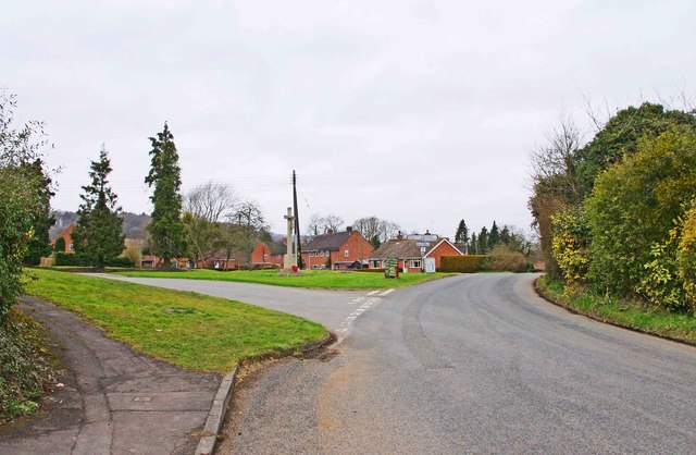
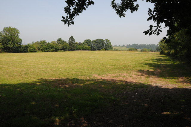
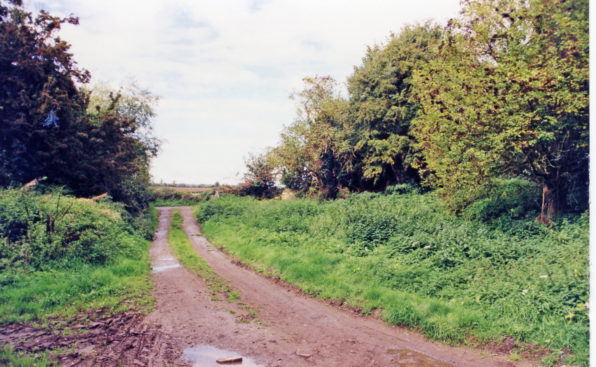
Ashfield is a quaint village located in the county of Worcestershire, England. Situated in the picturesque Vale of Evesham, it enjoys a tranquil and idyllic setting. The village is nestled amidst rolling hills and lush green valleys, offering breathtaking views of the surrounding countryside.

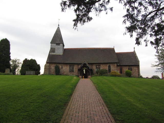
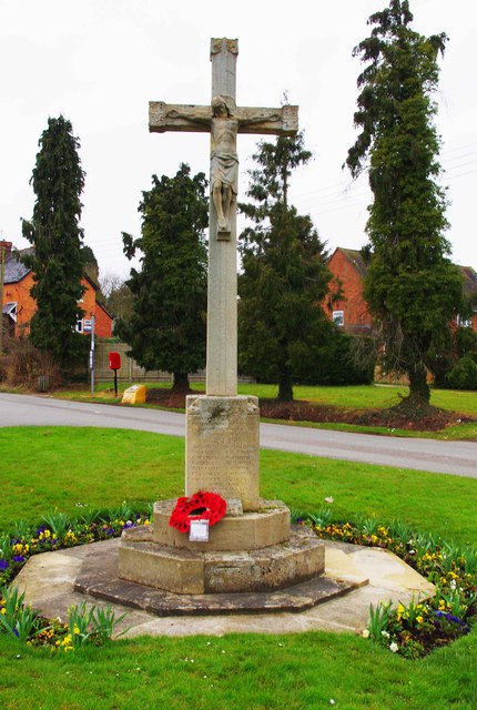
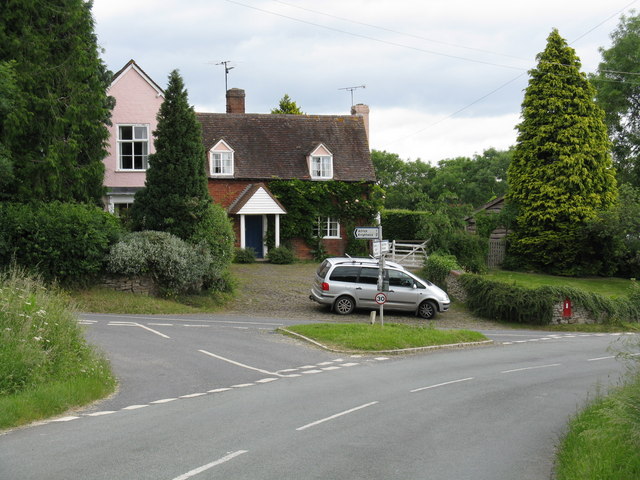
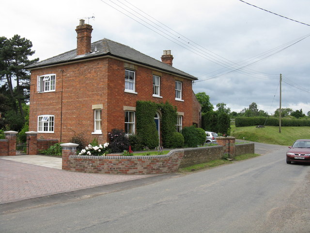
Ashfield is characterized by its charming architecture, with many of its buildings dating back centuries. The village center features a beautiful medieval church, St. Mary's, which is a significant historical landmark. The church's exquisite stained glass windows and intricate stonework attract visitors from near and far.

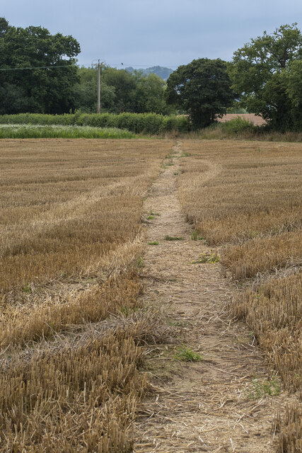
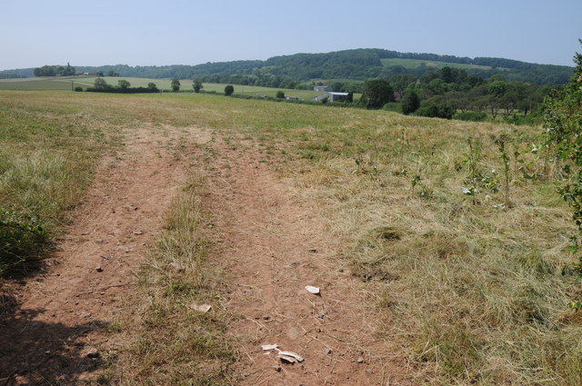
Agriculture plays a vital role in the local economy, and Ashfield is no exception. The village is predominantly surrounded by farmland, where crops such as wheat, barley, and vegetables are cultivated. The fertile soil and favorable climate contribute to the success of the agricultural industry in the region.

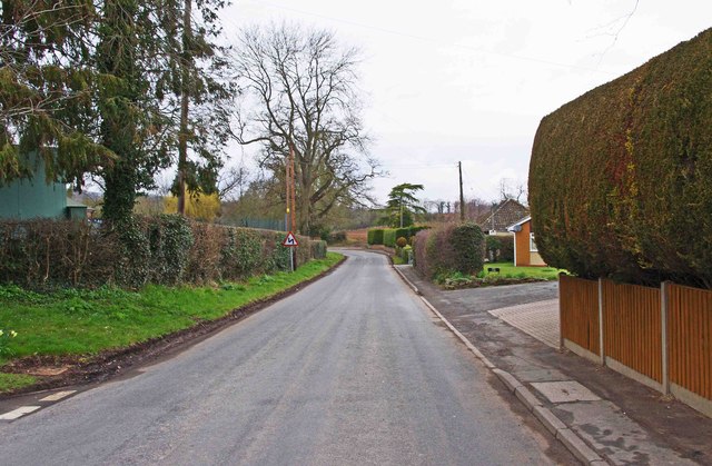
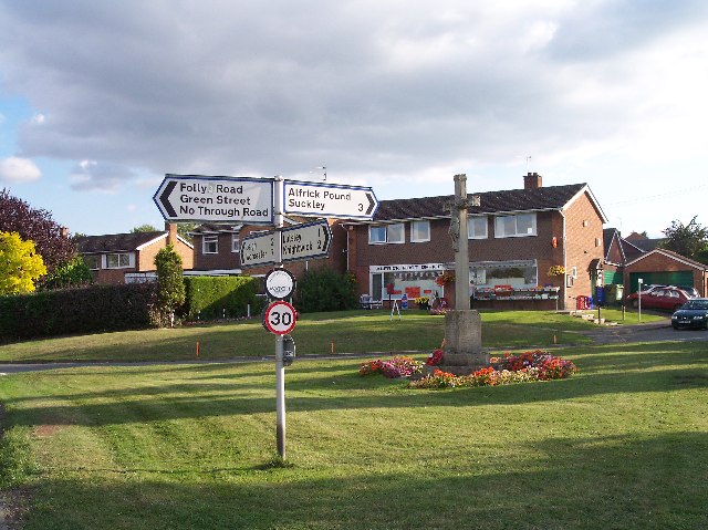
Despite its rural charm, Ashfield benefits from good transport links. It is conveniently situated near major road networks, allowing easy access to nearby towns and cities. The village also benefits from a regular bus service, connecting it to the wider area.

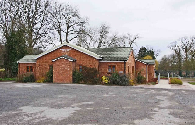
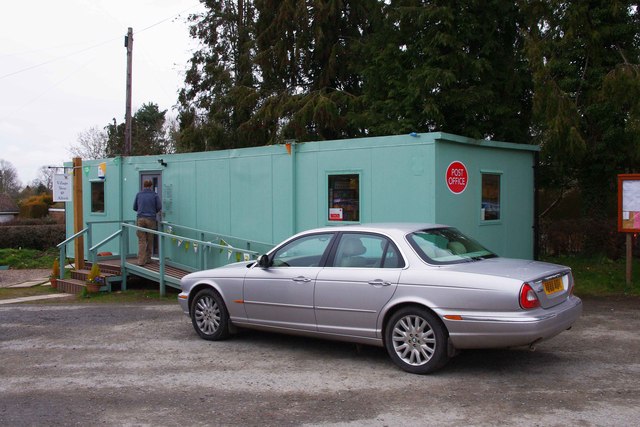
Residents of Ashfield can enjoy a close-knit community spirit, as the village is home to a friendly and welcoming population. Local amenities include a village hall, a small convenience store, and a traditional pub, providing essential services and a gathering place for locals.

For those seeking outdoor activities, Ashfield offers numerous opportunities. The village is surrounded by scenic walking trails, perfect for exploring the stunning countryside. Additionally, the nearby River Avon provides opportunities for fishing and boating enthusiasts.

In summary, Ashfield is a charming Worcestershire village that boasts a rich history, breathtaking landscapes, and a strong sense of community. Its rural location, combined with its proximity to amenities and transport links, makes it an appealing place to live or visit.

If you have any feedback on the listing, please let us know in the comments section below.

Ashfield Images

Images are sourced within 2km of 52.168425/-2.3474094 or Grid Reference SO7652. Thanks to Geograph Open Source API. All images are credited.

Winwoodhill Coppice
Winwoodhill Coppice
Ford at Leigh Brook
Ford at Leigh Brook
Footpath near Castle Green
Footpath to Suckley Road
View toward the Malvern Hills One of many magical aspects from the lane that leads to Coles Green and Sandlin.
View toward the Malvern Hills
One of many magical aspects from the lane that leads to Coles Green and Sandlin.
St Mary's Church, Alfrick
Evening light, Top Knapp, Alfrick
Alfrick & Lulsley Village Hall, Clay Green, Alfrick, Worcs The hall's origins lie in the first village hall, which opened in an ex-army wooden hut in 1923 on the opposite side of the road to the present building. In 1953 the present hall was opened with the name of Alfrick Peace Memorial Hall, to commemorate the dead of the two World Wars. Assets from the demolished hall in the neighbouring village of Lulsley were transferred to the hall in the 1980's, but eventually major work was required, and assisted by a lottery grant, this was completed in July 2010. The hall has all the facilities you would expect of a modern hall and is fully licensed. This is useful because the village has lost both its pubs, although one remains at Lulsley.
Alfrick & Lulsley Village Hall, Clay Green, Alfrick, Worcs
The hall's origins lie in the first village hall, which opened in an ex-army wooden hut in 1923 on the opposite side of the road to the present building. In 1953 the present hall was opened with the name of Alfrick Peace Memorial Hall, to commemorate the dead of the two World Wars. Assets from the demolished hall in the neighbouring village of Lulsley were transferred to the hall in the 1980's, but eventually major work was required, and assisted by a lottery grant, this was completed in July 2010. The hall has all the facilities you would expect of a modern hall and is fully licensed. This is useful because the village has lost both its pubs, although one remains at Lulsley.
Alfrick & Lulsley Community Shop Ltd (1), Clay Green, Alfrick, Worcs The village used to have a shop which closed in April 2011, when the owners retired. Now the village once again has a shop run by volunteers from the villages of Alfrick and Lulsley, which opened in 2012. Currently it is in temporary premises in the car park of the village hall, but eventually it is hoped that it could be in a permanent building. Very unusually for this type of arrangement, there is also a post office here.

<a href="https://www.geograph.org.uk/photo/3411223">SO7453 : Alfrick & Lulsley Community Shop Ltd (2), Clay Green, Alfrick, Worcs</a>.
Alfrick & Lulsley Community Shop Ltd (1), Clay Green, Alfrick, Worcs
The village used to have a shop which closed in April 2011, when the owners retired. Now the village once again has a shop run by volunteers from the villages of Alfrick and Lulsley, which opened in 2012. Currently it is in temporary premises in the car park of the village hall, but eventually it is hoped that it could be in a permanent building. Very unusually for this type of arrangement, there is also a post office here. SO7453 : Alfrick & Lulsley Community Shop Ltd (2), Clay Green, Alfrick, Worcs.
Alfrick & Lulsley Community Shop Ltd (2), Clay Green, Alfrick, Worcs The aims of the shop, according to its website, is to stock what the community wants to buy, to be an outlet for produce made and grown locally, to make a margin on what is sold in accordance with their business plan, to encourage a fast turnover of fresh and seasonal produce, and to be a centre for the community. The shop also includes a Post Office counter.

<a href="https://www.geograph.org.uk/photo/3411184">SO7453 : Alfrick & Lulsley Community Shop Ltd (1), Clay Green, Alfrick, Worcs</a>.
Alfrick & Lulsley Community Shop Ltd (2), Clay Green, Alfrick, Worcs
The aims of the shop, according to its website, is to stock what the community wants to buy, to be an outlet for produce made and grown locally, to make a margin on what is sold in accordance with their business plan, to encourage a fast turnover of fresh and seasonal produce, and to be a centre for the community. The shop also includes a Post Office counter. SO7453 : Alfrick & Lulsley Community Shop Ltd (1), Clay Green, Alfrick, Worcs.
The main road through the village, looking north west, Alfrick, Worcs Looking in the direction of the neighbouring village of Lulsley.
The main road through the village, looking north west, Alfrick, Worcs
Looking in the direction of the neighbouring village of Lulsley.
Looking towards the Village Green and War Memorial, Alfrick, Worcs The road to the left goes to Alfrick Pound and Suckley. The road on the right is the main road through the village and leads to the neighbouring village of Lulsley. Lulsley & Alfrick share the same Parish Council. 

For a closer view of the War Memorial, please see:- <a href="https://www.geograph.org.uk/photo/3411331">SO7453 : Alfrick War Memorial, Village Green, Alfrick, Worcs</a>.
Looking towards the Village Green and War Memorial, Alfrick, Worcs
The road to the left goes to Alfrick Pound and Suckley. The road on the right is the main road through the village and leads to the neighbouring village of Lulsley. Lulsley & Alfrick share the same Parish Council. For a closer view of the War Memorial, please see:- SO7453 : Alfrick War Memorial, Village Green, Alfrick, Worcs.
Alfrick War Memorial, Village Green, Alfrick, Worcs There are about 96 names on here, which shows the sacrifice made by the village in the two World Wars, as its population is only around 500. The memorial is thought to date from about 1920.

<a href="https://www.geograph.org.uk/photo/3411275">SO7453 : Looking towards the Village Green and War Memorial, Alfrick, Worcs</a>.
Alfrick War Memorial, Village Green, Alfrick, Worcs
There are about 96 names on here, which shows the sacrifice made by the village in the two World Wars, as its population is only around 500. The memorial is thought to date from about 1920. SO7453 : Looking towards the Village Green and War Memorial, Alfrick, Worcs.
Field entrance Field entrance near Lower Sandlin Farm at Smith End Green.
Field entrance
Field entrance near Lower Sandlin Farm at Smith End Green.
Farmland near Alfrick Farmland to the south of the village of Alfrick.
Farmland near Alfrick
Farmland to the south of the village of Alfrick.
Ash tree and track Ash tree beside a track which is a right of way near Brockamin.
Ash tree and track
Ash tree beside a track which is a right of way near Brockamin.
Haymaking at Brockamin A field a cut grass drying ready for making into hay.
Haymaking at Brockamin
A field a cut grass drying ready for making into hay.
Across a field and onto the church
Show me another place!

Ashfield is located at Grid Ref: SO7652 (Lat: 52.168425, Lng: -2.3474094)

Administrative County: Worcestershire

District: Malvern Hills

Police Authority: West Merica

What 3 Words

///limitless.necklace.draw. Near Great Malvern, Worcestershire

Related Wikis

Malvern Hills District

Malvern Hills is a local government district in Worcestershire, England. Its council is based in the town of Malvern, and its area covers most of the western...

Crowcroft

Crowcroft is a small hamlet just outside Leigh Sinton in Worcestershire, England. The main industry for the area is fruit growing, particularly for local...

Alfrick Pound

Alfrick Pound is a small village in the county of Worcestershire, England, in the United Kingdom. == Location == Alfrick Pound village is located on the...

Bransford

Bransford is a village and civil parish in the Malvern Hills district of the county of Worcestershire, England. It is situated close to the River Teme...

Alfrick

Alfrick is a village and civil parish in the Malvern Hills district of Worcestershire, England, about seven miles west of Worcester. == Amenities == The...

Leigh Sinton

Leigh Sinton is a village in the Malvern Hills district of the county of Worcestershire, England, and one of the constituent places of the civil parish...

Leigh Court railway station

Leigh Court railway station was a station in Leigh, Worcestershire, England. The station was opened on 2 May 1874 and closed on 7 September 1964. ��2...

Leigh, Worcestershire

Leigh is a village and civil parish (with a parish council shared with Bransford) in the Malvern Hills district of the county of Worcestershire, England...

Nearby Amenities

Located within 500m of 52.168425,-2.3474094
Ford: yes
Lat/Long: 52.1707783/-2.345005
Pettiford Cottage
Power: pole
Transformer: distribution
Voltage Primary: 11000
Lat/Long: 52.1693183/-2.3425978
Power: pole
Lat/Long: 52.1692192/-2.3432274
Power: pole
Lat/Long: 52.1691184/-2.3438624
Power: pole
Lat/Long: 52.1689967/-2.3446664
Lower Ashfield
Power: pole
Transformer: distribution
Voltage Primary: 11000
Lat/Long: 52.1664961/-2.3465071
Power: pole
Lat/Long: 52.1668107/-2.3463368
Power: pole
Lat/Long: 52.1672027/-2.3461296
Power: pole
Lat/Long: 52.1676777/-2.3458613
Power: pole
Lat/Long: 52.1682844/-2.3457105
Power: pole
Lat/Long: 52.1688527/-2.3455824
Power: pole
Lat/Long: 52.1686989/-2.3463736
Power: pole
Lat/Long: 52.1685295/-2.3471864
Power: pole
Lat/Long: 52.1692928/-2.349198
Power: pole
Lat/Long: 52.1688671/-2.3488688
Ashfield
Power: pole
Transformer: distribution
Voltage Primary: 11000
Lat/Long: 52.1682967/-2.348449
Power: pole
Lat/Long: 52.1696761/-2.3496801
Power: pole
Lat/Long: 52.170645/-2.3494461
Power: pole
Lat/Long: 52.1716181/-2.3492282
Power: pole
Lat/Long: 52.1722489/-2.3505244
The data included in this document is from www.openstreetmap.org. The data is made available under ODbL.

Have you been to Ashfield?

Leave your review of Ashfield below (or comments, questions and feedback).