Aryhoulan
Settlement in Argyllshire
Scotland
Aryhoulan

Aryhoulan is a small village located in Argyllshire, a historic county in western Scotland. Situated on the banks of Loch Fyne, the village offers breathtaking views of the surrounding countryside. With a population of around 200 residents, Aryhoulan is known for its peaceful and tranquil atmosphere, making it an attractive destination for those seeking a serene getaway.
The village is primarily residential, with traditional stone cottages and houses showcasing the local architectural style. The community in Aryhoulan is close-knit, fostering a friendly and welcoming environment for both locals and visitors alike. The residents take great pride in their village and often engage in community events and activities.
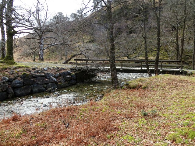
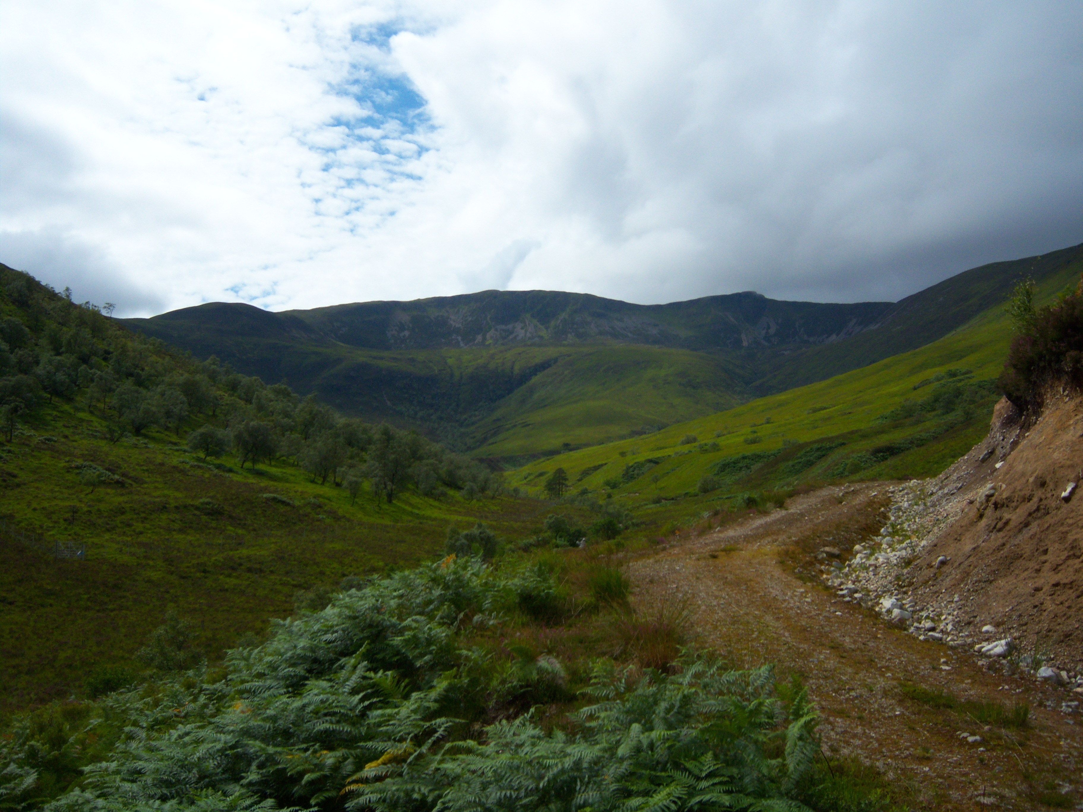
Nature enthusiasts will find Aryhoulan to be a haven for outdoor exploration. The nearby Loch Fyne provides opportunities for various water activities like fishing and boating. The surrounding hills and forests offer scenic hiking trails, allowing visitors to immerse themselves in the beauty of the Scottish countryside.
Although Aryhoulan is a small village, it is conveniently located near larger towns and cities such as Inveraray and Lochgilphead. These towns offer a range of amenities including shops, restaurants, and cultural attractions, ensuring that residents have access to essential services and entertainment options.
In conclusion, Aryhoulan is a picturesque village in Argyllshire, Scotland. With its stunning natural surroundings and close-knit community, it serves as an idyllic destination for those seeking tranquility and scenic beauty.
If you have any feedback on the listing, please let us know in the comments section below.
Aryhoulan Images
Images are sourced within 2km of 56.768144/-5.2486197 or Grid Reference NN0168. Thanks to Geograph Open Source API. All images are credited.


Aryhoulan is located at Grid Ref: NN0168 (Lat: 56.768144, Lng: -5.2486197)
Unitary Authority: Highland
Police Authority: Highlands and Islands
What 3 Words
///repaid.lowest.armrests. Near Fort William, Highland
Nearby Locations
Related Wikis
Stob Coire a' Chearcaill
Stob Coire a' Chearcaill (771 m) is a mountain in the Northwest Highlands, Scotland. It lies west of Loch Linnhe in Lochaber. The peak is a familiar sight...

Inchree
Inchree (Scottish Gaelic: Innis an Ruighe) is a small hamlet, situated at the northern end of the village of Onich. It is 7 miles south of the town of...

Corran, Lochaber
Corran (Scottish Gaelic: An Corran) is a former fishing village, situated on Corran Point, on the west side of the Corran Narrows of Loch Linnhe, in Lochaber...

Corran Ferry
The Corran Ferry crosses Loch Linnhe at the Corran Narrows, south of Fort William, Scotland. == Description == Operated by Highland Council, the Corran...

Beinn na Gucaig
Beinn na Gucaig (616 m) is a mountain in the Grampian Mountains of Scotland, located south of Fort William in Lochaber. The peak takes up much of the eastern...
Ardgour
Ardgour ( ) (Scottish Gaelic: Àird Ghobhar [aːrˠʃtʲ ˈɣo.əɾ]; meaning high place of goats) is an area of the Scottish Highlands on the western shore of...
Druimarben
Druimarben (Scottish Gaelic: Druim Earbainn) is a hamlet on the east shore of Loch Linnhe in Inverness-shire, Scottish Highlands and is in the Scottish...
Stronchreggan
Stronchreggan (Scottish Gaelic: Sròn a' Chritheagain) is a scattered coastal hamlet, on the north eastern shores of Loch Linnhe, and is situated directly...
Nearby Amenities
Located within 500m of 56.768144,-5.2486197Have you been to Aryhoulan?
Leave your review of Aryhoulan below (or comments, questions and feedback).