Aros

Settlement in Argyllshire

Scotland

Aros

Aros River estuary
Aros River estuary Credit: Eirian Evans

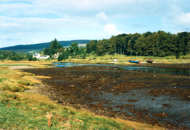
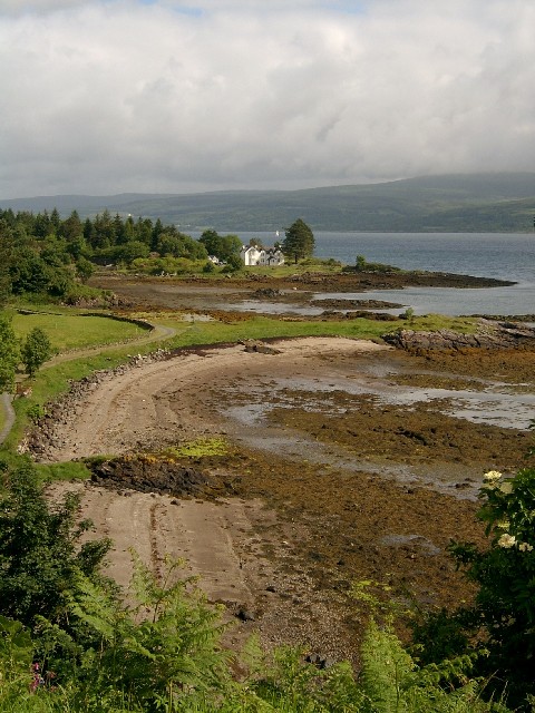
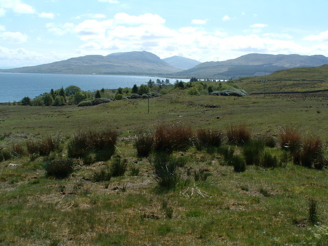
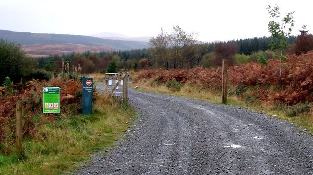
Aros, located in Argyllshire, Scotland, is a picturesque village nestled amidst the scenic beauty of the Scottish Highlands. Situated on the eastern shore of Loch Etive, Aros offers stunning views of the surrounding mountains and the tranquil waters of the loch. The village is approximately 12 miles northeast of Oban, making it easily accessible to both locals and tourists alike.

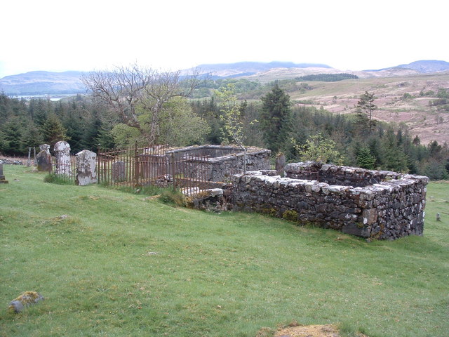
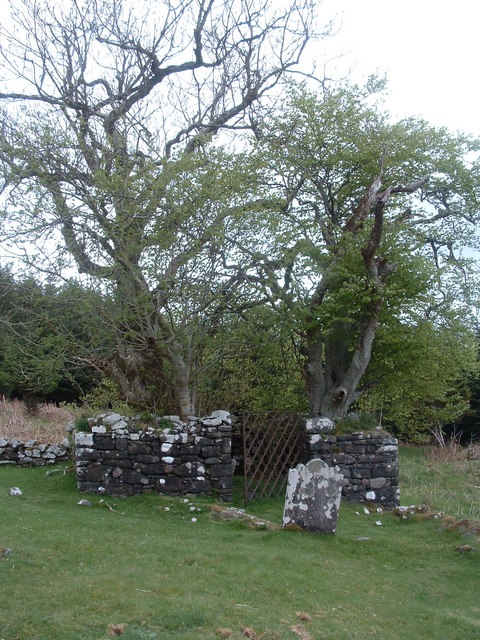
Aros is known for its rich history and cultural heritage, with traces dating back thousands of years. The region boasts several ancient sites, including standing stones and burial grounds, which attract history enthusiasts and archaeologists. The landscape around Aros is also home to a diverse range of flora and fauna, making it a paradise for nature lovers and wildlife enthusiasts.

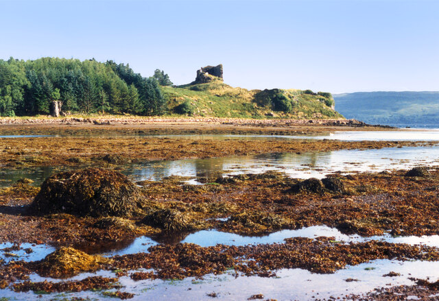
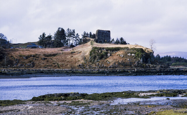
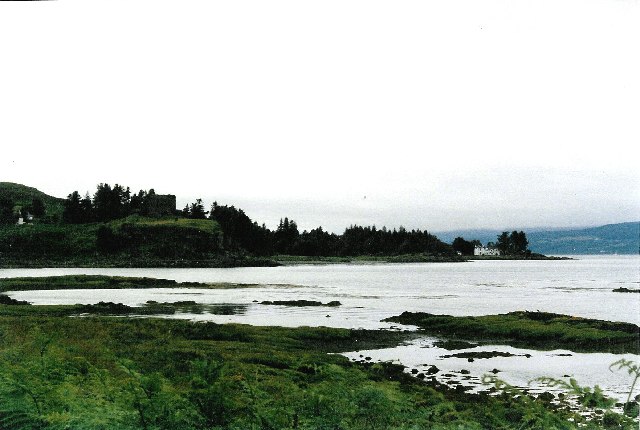
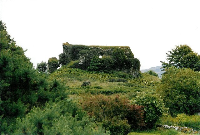
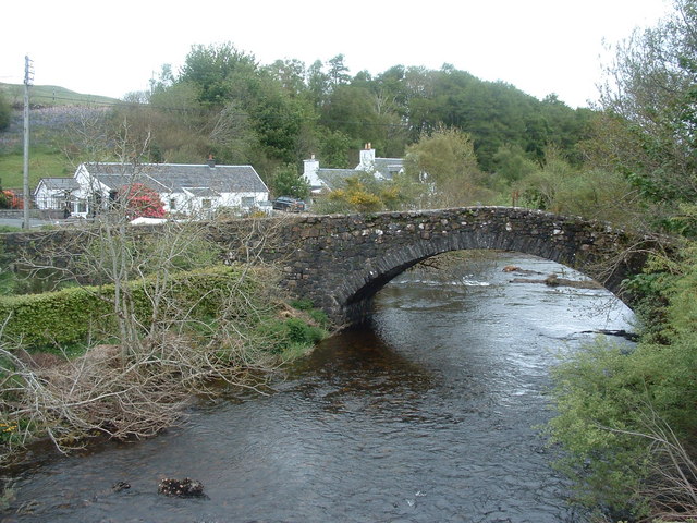
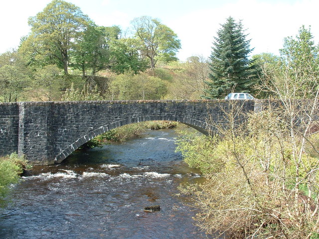
The village itself is a charming hamlet, with traditional stone cottages and a close-knit community. Aros offers a range of amenities, including a local pub, a small grocery store, and a post office. Visitors can also explore the nearby Aros Castle, a ruined 15th-century fortress, which provides insight into the area's medieval past.

Outdoor activities are plentiful in Aros, with opportunities for hiking, fishing, and boating in the surrounding area. Loch Etive provides ample opportunities for water sports and scenic cruises, allowing visitors to immerse themselves in the area's natural beauty.

Overall, Aros, Argyllshire offers a serene and idyllic setting, perfect for those seeking tranquility and a connection with nature, while also providing glimpses into Scotland's rich history and culture.

If you have any feedback on the listing, please let us know in the comments section below.

Aros Images

Images are sourced within 2km of 56.53179/-5.9754096 or Grid Reference NM5544. Thanks to Geograph Open Source API. All images are credited.

Aros River estuary
Aros River estuary
View across the River Aros Overlooking the Sound of Mull, the remains of Aros Castle date from the 13th century.
View across the River Aros
Overlooking the Sound of Mull, the remains of Aros Castle date from the 13th century.
Rocks and Seaweed at Aros The remains of Aros Castle are on the headland.
Wikipedia says this about it. "Aros Castle, also known as Dounarwyse Castle, is a ruined 13th-century castle near Salen on the Isle of Mull, Scotland. The castle overlooks the Sound of Mull. The castle was initially a stronghold of the Clan MacDougall."
Rocks and Seaweed at Aros
The remains of Aros Castle are on the headland. Wikipedia says this about it. "Aros Castle, also known as Dounarwyse Castle, is a ruined 13th-century castle near Salen on the Isle of Mull, Scotland. The castle overlooks the Sound of Mull. The castle was initially a stronghold of the Clan MacDougall."
Aros Castle The ruin of Aros Castle seen across the inlet through which the Aros River reaches the Sound of Mull.
Aros Castle
The ruin of Aros Castle seen across the inlet through which the Aros River reaches the Sound of Mull.
Low Tide at Aros The short estuary of the Aros River.
From a print.
Low Tide at Aros
The short estuary of the Aros River. From a print.
Girl Claire and Pavonia The fishing boats have been here since the 1970s.
Girl Claire and Pavonia
The fishing boats have been here since the 1970s.
The Salen Wrecks Compare with earlier versions to see the rate of deterioration!
The Salen Wrecks
Compare with earlier versions to see the rate of deterioration!
Aros Castle & the White House of Aros Seen from the roadside towards the southern edge of the square, these 2 landmarks mark the bottom of Glen Aros as it meets the Tobermory road.
Aros Castle & the White House of Aros
Seen from the roadside towards the southern edge of the square, these 2 landmarks mark the bottom of Glen Aros as it meets the Tobermory road.
Aros Castle The castle seen from behind, on the small road through Aros Mains.  Picture taken at the southern edge of the square, looking south-east.
Aros Castle
The castle seen from behind, on the small road through Aros Mains. Picture taken at the southern edge of the square, looking south-east.
The White House of Aros On Mull's east coast, taken from the ruined Aros Castle just outside the square.
The White House of Aros
On Mull's east coast, taken from the ruined Aros Castle just outside the square.
Old bridge at Aros As seen from new bridge
Old bridge at Aros
As seen from new bridge
Forestry Dept office and depot Information office and yard beyond containing a complete forestry repair kit.
Forestry Dept office and depot
Information office and yard beyond containing a complete forestry repair kit.
Chapel and graveyard Now surrounded by Salen forest, this burial ground only appears to have been "active" between 1840's - 1920's, judging by the dates on the stones.
Chapel and graveyard
Now surrounded by Salen forest, this burial ground only appears to have been "active" between 1840's - 1920's, judging by the dates on the stones.
Burial chamber Small chamber in the corner of the burial ground, now taken over by trees, but containing headstone in commemoration of the parish minister, name indistinct.
Burial chamber
Small chamber in the corner of the burial ground, now taken over by trees, but containing headstone in commemoration of the parish minister, name indistinct.
Aird Bhuailtear The OS map shows a footpath from this point heading to the left of the trees, to the white house at Aros, it doesn't seem to exist, there is a bulldozed farm track further east though
Aird Bhuailtear
The OS map shows a footpath from this point heading to the left of the trees, to the white house at Aros, it doesn't seem to exist, there is a bulldozed farm track further east though
The new bridge at Aros As seen from the old bridge
The new bridge at Aros
As seen from the old bridge
Boats at the old pier, Salen These three fishing boats have been tied up here at the disused pier to rot away. Odd how they look so attractive, when dumped cars and the like look so ugly.
Boats at the old pier, Salen
These three fishing boats have been tied up here at the disused pier to rot away. Odd how they look so attractive, when dumped cars and the like look so ugly.
Glen Aros - track entrance This is the gateway at the western end of the track through Glen Aros and along the shores of Loch Frisa. A sign on the gate says that it must remain closed and locked at all times. As you can see, it wasn't !
Glen Aros - track entrance
This is the gateway at the western end of the track through Glen Aros and along the shores of Loch Frisa. A sign on the gate says that it must remain closed and locked at all times. As you can see, it wasn't !
Show me another place!

Aros is located at Grid Ref: NM5544 (Lat: 56.53179, Lng: -5.9754096)

Unitary Authority: Argyll and Bute

Police Authority: Argyll and West Dunbartonshire

What 3 Words

///reform.greyhound.sliding. Near Salen, Argyll & Bute

Nearby Locations

Aros Cnoc a' Chiaraich

Related Wikis

Nearby Amenities

Located within 500m of 56.53179,-5.9754096
Source: PGS
Lat/Long: 56.5324717/-5.9676362
Source: PGS
Lat/Long: 56.5322964/-5.9683863
Source: PGS
Lat/Long: 56.5321282/-5.9699884
Source: PGS
Lat/Long: 56.5315812/-5.9709674
Source: PGS
Lat/Long: 56.5312359/-5.9720402
Source: PGS
Lat/Long: 56.5309361/-5.9711327
Source: PGS
Lat/Long: 56.5305154/-5.9702808
Source: PGS
Lat/Long: 56.5303463/-5.9687739
Telephone
Booth: KX100
Covered: booth
Lat/Long: 56.5309413/-5.9743955
Post Box
Post Box Type: lamp
Ref: PA72 123
Royal Cypher: scottish_crown
Lat/Long: 56.5309191/-5.9743124
Aros
Name Gd: Àras
Name Non: Árós
Place: hamlet
Lat/Long: 56.5326475/-5.9749319
Turning Circle
Lat/Long: 56.5345888/-5.977255
Power: pole
Lat/Long: 56.5329772/-5.9678773
Power: pole
Lat/Long: 56.5328291/-5.9691571
Power: pole
Lat/Long: 56.5324997/-5.9700615
Power: pole
Lat/Long: 56.5322964/-5.9708754
Power: pole
Lat/Long: 56.5316133/-5.9734104
Power: pole
Lat/Long: 56.5345505/-5.9776034
Power: pole
Lat/Long: 56.533822/-5.9766278
Power: pole
Lat/Long: 56.5330573/-5.975622
Power: pole
Lat/Long: 56.5322828/-5.9745573
Power: pole
Lat/Long: 56.5309959/-5.9734721
Power: pole
Lat/Long: 56.5305644/-5.9740037
Power: pole
Lat/Long: 56.5302387/-5.9745792
Power: pole
Lat/Long: 56.5302667/-5.9762222
Power: pole
Lat/Long: 56.5340502/-5.9773842
Power: pole
Lat/Long: 56.5302198/-5.9730925
Power: pole
Lat/Long: 56.5297543/-5.9719168
Power: pole
Lat/Long: 56.5292487/-5.9706479
The data included in this document is from www.openstreetmap.org. The data is made available under ODbL.

Have you been to Aros?

Leave your review of Aros below (or comments, questions and feedback).