Almondhill

Settlement in West Lothian

Scotland

Almondhill

Old milestone A view of the milestone 7 miles from Edinburgh on Boathouse Bridge Road west of the River Almond.   Boathouse Bridge over the river is now known as 'the bridge to nowhere' after the B9080 was cut by the airport runway.  It is on the route of the Northern Route turnpike from Edinburgh-Linlithgow-Falkirk-Glasgow
Old milestone Credit: John Riddell

Almondhill is a small village located in West Lothian, Scotland. Situated on the banks of the River Almond, it is nestled amidst picturesque countryside, offering residents and visitors a tranquil and scenic environment.

The village has a rich history, with evidence of human presence dating back to prehistoric times. It has been an important location throughout the centuries, serving as a crossing point over the river and a hub for trade and agriculture.

Today, Almondhill retains its rural charm with a population of around 500 residents. The village is primarily residential, consisting of a mix of traditional stone cottages and more modern housing developments. The local community is close-knit and friendly, with a strong sense of community spirit.

Despite its small size, Almondhill offers several amenities to its residents. These include a local primary school, a village hall, and a nearby community center. There are also a few local businesses, including a convenience store and a pub, providing essential services and a place for socializing.

The village is surrounded by stunning natural beauty, making it an ideal location for outdoor activities. The River Almond offers opportunities for fishing and kayaking, and the surrounding countryside is perfect for walking, cycling, and birdwatching. Additionally, nearby attractions such as Almondell and Calderwood Country Park provide opportunities for further exploration and outdoor recreation.

Almondhill's idyllic location, strong community spirit, and natural beauty make it a delightful place to live and visit in West Lothian.

If you have any feedback on the listing, please let us know in the comments section below.

Almondhill Images

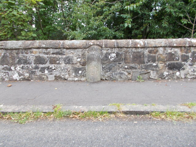
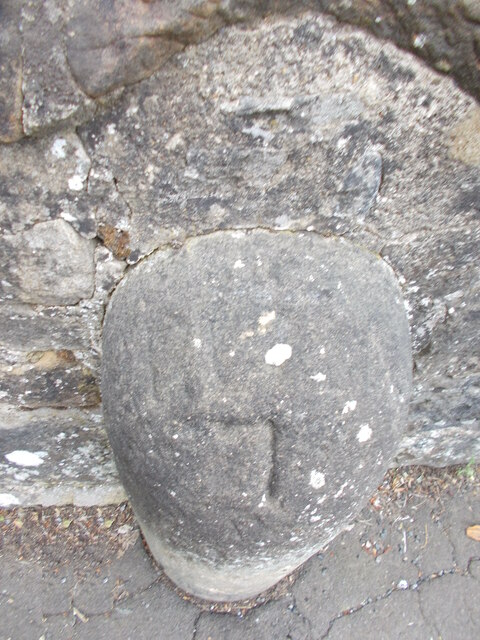
Images are sourced within 2km of 55.958701/-3.3930974 or Grid Reference NT1374. Thanks to Geograph Open Source API. All images are credited.

Old milestone A view of the milestone 7 miles from Edinburgh on Boathouse Bridge Road west of the River Almond.   Boathouse Bridge over the river is now known as 'the bridge to nowhere' after the B9080 was cut by the airport runway.  It is on the route of the Northern Route turnpike from Edinburgh-Linlithgow-Falkirk-Glasgow
Old milestone
A view of the milestone 7 miles from Edinburgh on Boathouse Bridge Road west of the River Almond. Boathouse Bridge over the river is now known as 'the bridge to nowhere' after the B9080 was cut by the airport runway. It is on the route of the Northern Route turnpike from Edinburgh-Linlithgow-Falkirk-Glasgow
Old milestone A close-up of the top of the 7 mile stone on Boathouse Bridge Road.   A very faint EDIN can be made out just above the clearer 7.
Old milestone
A close-up of the top of the 7 mile stone on Boathouse Bridge Road. A very faint EDIN can be made out just above the clearer 7.
Kirkliston Bowling Club
Back of the Newliston Hotel, Kirkliston
Main Street, Kirkliston The former A9.
Main Street, Kirkliston
The former A9.
Cleric's Hill, Kirkliston A maze of paths amongst jumbled up houses. There is a reason roofs have a ridge - were they trying to be different or simply disguising a back to back?
Cleric's Hill, Kirkliston
A maze of paths amongst jumbled up houses. There is a reason roofs have a ridge - were they trying to be different or simply disguising a back to back?
Green space, Kirkliston Between small houses with back to front roofs and the Niddry Burn. Once Gateside Farm's fields.
Green space, Kirkliston
Between small houses with back to front roofs and the Niddry Burn. Once Gateside Farm's fields.
Jumbled up houses, Maitland Hog Lane There is a reason roofs have a ridge!
Jumbled up houses, Maitland Hog Lane
There is a reason roofs have a ridge!
Edge of Kirkliston Houses beside the M9 on the site of Gateside Farm.
Edge of Kirkliston
Houses beside the M9 on the site of Gateside Farm.
M9 fences, Kirkliston
Path, Cotlaws Houses on the site of Gateside Farm, Kirkliston.
Path, Cotlaws
Houses on the site of Gateside Farm, Kirkliston.
Derelict house, King Edward's Way Old maps show Gateside as the site of King Edward's encampment in 1299. He must have taken one look at the back to front houses and thought again.
Derelict house, King Edward's Way
Old maps show Gateside as the site of King Edward's encampment in 1299. He must have taken one look at the back to front houses and thought again.
Door, King Edward's Way
Boulders, Kirkliston Preventing driving on to the grass behind the houses on the site of Gateside Farm. Some of the houses are far from the parking so there must be a temptation for those in the more far flung ones.
Boulders, Kirkliston
Preventing driving on to the grass behind the houses on the site of Gateside Farm. Some of the houses are far from the parking so there must be a temptation for those in the more far flung ones.
Path, Gateside The houses are scattered in former fields with limited vehicle access. There are many paths between them
Path, Gateside
The houses are scattered in former fields with limited vehicle access. There are many paths between them
Dam, Pikes Pool A reservoir which once served the now demolished distillery a short distance downstream. Now the centrepiece for an attractive park.
Dam, Pikes Pool
A reservoir which once served the now demolished distillery a short distance downstream. Now the centrepiece for an attractive park.
Pikes Pond and sluice A reservoir which once served the now demolished distillery a short distance downstream. Now the centrepiece for an attractive park.
Pikes Pond and sluice
A reservoir which once served the now demolished distillery a short distance downstream. Now the centrepiece for an attractive park.
Path, Back Braes Gently decaying steps in the park surrounding Pike's Pool in Kirkliston.
Path, Back Braes
Gently decaying steps in the park surrounding Pike's Pool in Kirkliston.
Show me another place!

Almondhill is located at Grid Ref: NT1374 (Lat: 55.958701, Lng: -3.3930974)

Unitary Authority: City of Edinburgh

Police Authority: Edinburgh

What 3 Words

///voltage.parked.toenail. Near Kirkliston, Edinburgh

Nearby Locations

Almondhill

Related Wikis

Kirkliston railway station

Kirkliston railway station served the village of Kirkliston, historically in the county of West Lothian, Scotland from 1866 to 1966 on the North British...

Kirkliston

Kirkliston is a small town and parish to the west of Edinburgh, Scotland, historically within the county of West Lothian but now within the City of Edinburgh...
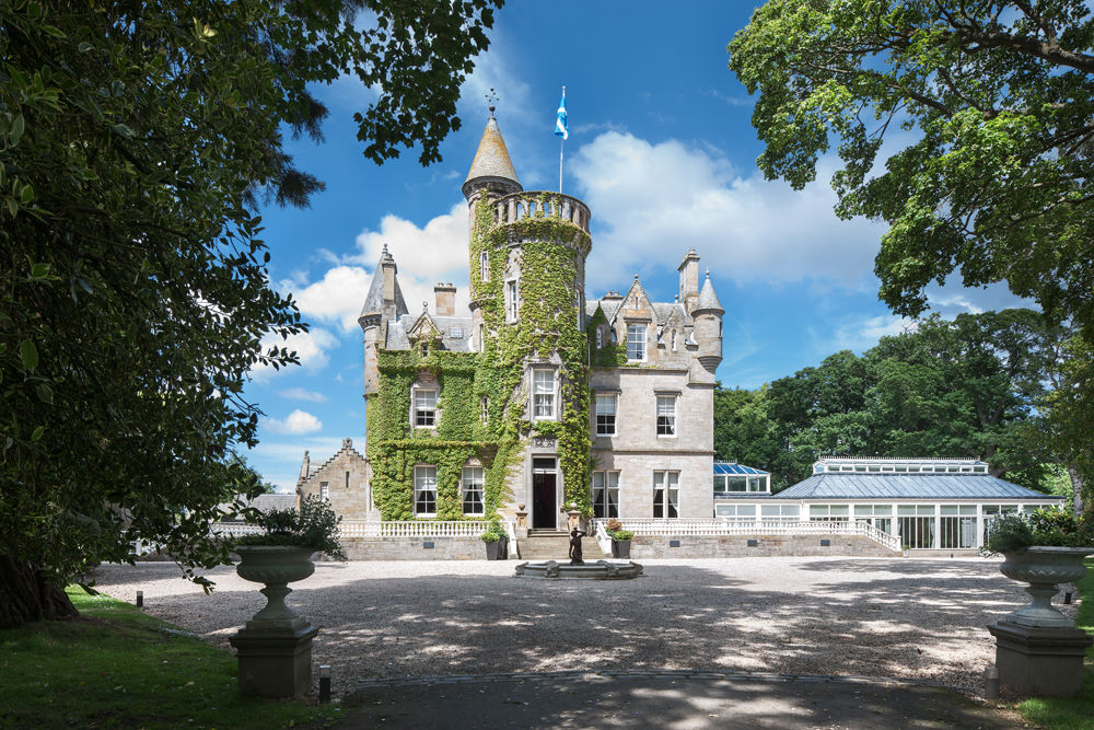
Carlowrie Castle

Carlowrie Castle was built in the Scottish Baronial style between 1852 and 1855 on the outskirts of Kirkliston, a town approximately 10 miles from Edinburgh...

RAF Turnhouse

Royal Air Force Turnhouse, or more simply RAF Turnhouse, is a former Royal Air Force Sector Station located in Edinburgh, Scotland. It is now Edinburgh...

Edinburgh Airport

Edinburgh Airport (Scottish Gaelic: Port-adhair Dhùn Èideann) (IATA: EDI, ICAO: EGPH) is an airport located in the Ingliston area of Edinburgh, Scotland...

Cat Stane

The Cat Stane, or Catstane, is an inscribed standing stone near Kirkliston, on the outskirts of Edinburgh, in Scotland. It bears a fragmentary inscription...

Ingliston Racing Circuit

Ingliston Racing Circuit is 1.030 mi (1.658 km) motor racing circuit that was built at the Royal Highland Showground at Ingliston, Edinburgh. The circuit...

Dundas Castle

Dundas Castle is a 15th-century castle, with substantial 19th-century additions by William Burn, in the Dalmeny parish of West Lothian, Scotland. The home...

Nearby Amenities

Located within 500m of 55.958701,-3.3930974
Turning Circle
Lat/Long: 55.9567345/-3.3997505
Turning Circle
Lat/Long: 55.9574105/-3.3990094
Turning Circle
Lat/Long: 55.9571511/-3.4005029
Traffic Calming: table
Lat/Long: 55.9575806/-3.3975379
Give Way
Direction: backward
Lat/Long: 55.9575834/-3.3955173
Traffic Calming: table
Lat/Long: 55.9605597/-3.3995408
Traffic Calming: table
Lat/Long: 55.9601316/-3.3979671
Traffic Calming: table
Lat/Long: 55.9595589/-3.3977272
Traffic Calming: table
Lat/Long: 55.9594405/-3.3993252
Traffic Calming: table
Lat/Long: 55.9599767/-3.3994994
Parking
Source: survey
Lat/Long: 55.9555827/-3.3904656
Traffic Calming: table
Lat/Long: 55.9580838/-3.3982478
Addr City: Kirkliston
Addr Housenumber: 2
Addr Street: Almondhill Road
Lat/Long: 55.9586348/-3.400749
Addr City: Kirkliston
Addr Housenumber: 26
Addr Street: MacKinnon Crescent
Lat/Long: 55.9592412/-3.4010132
Addr City: Kirkliston
Addr Housenumber: 27
Addr Street: MacKinnon Crescent
Lat/Long: 55.9591692/-3.4010261
Addr City: Kirkliston
Addr Housenumber: 4
Addr Street: Almondhill Road
Lat/Long: 55.9585841/-3.4005058
Addr City: Kirkliston
Addr Housenumber: 6
Addr Postcode: EH29 9BW
Addr Street: Almondhill Road
Lat/Long: 55.9585433/-3.4002522
Addr City: Kirkliston
Addr Housenumber: 110
Addr Street: Main Street
Lat/Long: 55.9562071/-3.3993819
Addr City: Kirkliston
Addr Housenumber: 112
Addr Street: Main Street
Lat/Long: 55.9562472/-3.3989418
Addr City: Kirkliston
Addr Housenumber: 114
Addr Street: Main Street
Lat/Long: 55.9562501/-3.3989011
Addr City: Kirkliston
Addr Housenumber: 116
Addr Street: Main Street
Lat/Long: 55.9562687/-3.3986222
Addr City: Kirkliston
Addr Housenumber: 12
Addr Street: Balcomie Gardens
Lat/Long: 55.9592656/-3.4008437
Addr City: Kirkliston
Addr Housenumber: 13
Addr Street: Balcomie Gardens
Lat/Long: 55.9592358/-3.4006937
Addr City: Kirkliston
Addr Housenumber: 14
Addr Street: Balcomie Gardens
Lat/Long: 55.9592146/-3.4005429
Addr City: Kirkliston
Addr Housenumber: 14
Addr Street: Housefield Drive
Lat/Long: 55.9603219/-3.4005099
Addr City: Kirkliston
Addr Housenumber: 15
Addr Street: Balcomie Gardens
Lat/Long: 55.9592049/-3.4003918
Addr City: Kirkliston
Addr Housenumber: 16
Addr Street: Balcomie Gardens
Lat/Long: 55.9590521/-3.4000657
Addr City: Kirkliston
Addr Housenumber: 17
Addr Street: Balcomie Gardens
Lat/Long: 55.9591458/-3.4000369
Addr City: Kirkliston
Addr Housenumber: 18
Addr Street: Balcomie Gardens
Lat/Long: 55.9592312/-3.400038
Addr City: Kirkliston
Addr Housenumber: 19
Addr Street: Balcomie Gardens
Lat/Long: 55.9593448/-3.4000779
Addr City: Kirkliston
Addr Housenumber: 20
Addr Street: Balcomie Gardens
Lat/Long: 55.9594428/-3.4001011
Addr City: Kirkliston
Addr Housenumber: 21
Addr Street: Balcomie Gardens
Lat/Long: 55.9595339/-3.4001375
Addr City: Kirkliston
Addr Housenumber: 22
Addr Street: Balcomie Gardens
Lat/Long: 55.959623/-3.400149
Addr City: Kirkliston
Addr Housenumber: 23
Addr Street: Balcomie Gardens
Lat/Long: 55.9597096/-3.4001769
Addr City: Kirkliston
Addr Housenumber: 24
Addr Street: Balcomie Gardens
Lat/Long: 55.959803/-3.4002302
Addr City: Kirkliston
Addr Housenumber: 25
Addr Street: Balcomie Gardens
Lat/Long: 55.9599947/-3.4001388
Addr City: Kirkliston
Addr Housenumber: 26
Addr Street: Balcomie Gardens
Lat/Long: 55.9599921/-3.4003079
Addr City: Kirkliston
Addr Housenumber: 27
Addr Street: Balcomie Gardens
Lat/Long: 55.9599923/-3.4004562
Addr City: Kirkliston
Addr Housenumber: 16
Addr Street: Housefield Drive
Lat/Long: 55.9603377/-3.4002976
Addr City: Kirkliston
Addr Housenumber: 1
Addr Street: Catelbock Close
Lat/Long: 55.9576129/-3.3958848
Addr City: Kirkliston
Addr Housenumber: 2
Addr Street: Catelbock Close
Lat/Long: 55.9576809/-3.3959805
Addr City: Kirkliston
Addr Housenumber: 3
Addr Street: Almondhill Cottages
Lat/Long: 55.9590806/-3.392925
Addr City: Kirkliston
Addr Housenumber: 4
Addr Street: Almondhill Cottages
Lat/Long: 55.9590947/-3.3927644
Addr City: Kirkliston
Addr Housenumber: 5
Addr Street: Almondhill Cottages
Lat/Long: 55.9591232/-3.3926593
Addr City: Kirkliston
Addr Housenumber: 57
Addr Street: Catelbock Close
Lat/Long: 55.9580508/-3.3959615
Addr City: Kirkliston
Addr Housenumber: 58
Addr Street: Catelbock Close
Lat/Long: 55.9579595/-3.3958413
Addr City: Kirkliston
Addr Housenumber: 6
Addr Street: Almondhill Cottages
Lat/Long: 55.9591666/-3.3925218
Addr City: Kirkliston
Addr Housenumber: 59
Addr Street: Catelbock Close
Lat/Long: 55.9578714/-3.3956837
Addr City: Kirkliston
Addr Housenumber: 60
Addr Street: Catelbock Close
Lat/Long: 55.9577968/-3.3955154
Addr City: Kirkliston
Addr Housenumber: 7
Addr Street: Almondhill Cottages
Lat/Long: 55.9592129/-3.3922334
Addr City: Kirkliston
Addr Housenumber: 8
Addr Street: Almondhill Cottages
Lat/Long: 55.959389/-3.392381
Barrier: cycle_barrier
Bicycle: yes
Foot: yes
Lat/Long: 55.9580211/-3.3961382
Addr City: Kirkliston
Addr Housenumber: 1
Addr Street: Almondhill Cottages
Lat/Long: 55.9589759/-3.3932084
Addr City: Kirkliston
Addr Housenumber: 2
Addr Street: Almondhill Cottages
Lat/Long: 55.9589934/-3.3931438
Addr Housenumber: 25
Addr Street: Lauson Place
Lat/Long: 55.9610222/-3.3983797
Addr Housenumber: 26
Addr Street: Lauson Place
Lat/Long: 55.9610066/-3.3986216
Addr Housenumber: 27
Addr Street: Lauson Place
Lat/Long: 55.9609958/-3.3987919
Addr Housenumber: 29
Addr Street: Lauson Place
Lat/Long: 55.9609511/-3.3991983
Addr Housenumber: 30
Addr Street: Lauson Place
Lat/Long: 55.9609005/-3.3994349
Addr Housenumber: 18
Addr Street: Lauson Place
Lat/Long: 55.9615716/-3.3983253
Addr Housenumber: 19
Addr Street: Lauson Place
Lat/Long: 55.9615663/-3.3980368
Waste Basket
Lat/Long: 55.9562049/-3.3975859
Material: wood
Power: pole
Lat/Long: 55.9615025/-3.3872277
Material: wood
Power: pole
Lat/Long: 55.9611151/-3.3876112
Material: wood
Power: pole
Lat/Long: 55.9603599/-3.3882482
Material: wood
Power: pole
Lat/Long: 55.9600274/-3.3890784
Material: wood
Power: pole
Lat/Long: 55.959613/-3.3901218
Material: wood
Power: pole
Lat/Long: 55.9592481/-3.3910337
Cables: 3
Frequency: 50
Material: wood
Power: pole
Transformer: distribution
Voltage Primary: 11000
Voltage Secondary: 400
Lat/Long: 55.9588791/-3.3919644
Addr City: Kirkliston
Addr Housenumber: 22
Addr Street: Catelbock Close
Lat/Long: 55.9582406/-3.3986143
Addr City: Kirkliston
Addr Housenumber: 23
Addr Street: Catelbock Close
Lat/Long: 55.9583336/-3.3987246
Addr City: Kirkliston
Addr Housenumber: 24
Addr Street: Catelbock Close
Lat/Long: 55.9584174/-3.3988372
Addr City: Kirkliston
Addr Housenumber: 25
Addr Street: Catelbock Close
Lat/Long: 55.9585342/-3.3989442
Addr City: Kirkliston
Addr Housenumber: 26
Addr Street: Catelbock Close
Lat/Long: 55.958643/-3.3991723
Addr City: Kirkliston
Addr Housenumber: 27
Addr Street: Catelbock Close
Lat/Long: 55.9589684/-3.3973091
Addr City: Kirkliston
Addr Housenumber: 31
Addr Street: Catelbock Close
Lat/Long: 55.9586595/-3.3983588
Addr City: Kirkliston
Addr Housenumber: 32
Addr Street: Catelbock Close
Lat/Long: 55.9585698/-3.3985966
Addr City: Kirkliston
Addr Housenumber: 40
Addr Street: Catelbock Close
Lat/Long: 55.9585704/-3.3965816
Addr City: Kirkliston
Addr Housenumber: 41
Addr Street: Catelbock Close
Lat/Long: 55.9584464/-3.396881
Addr City: Kirkliston
Addr Housenumber: 28
Addr Street: Catelbock Close
Lat/Long: 55.9588497/-3.3977538
Addr City: Kirkliston
Addr Housenumber: 30
Addr Street: Catelbock Close
Lat/Long: 55.9586871/-3.398069
Addr City: Kirkliston
Addr Housenumber: 29
Addr Street: Catelbock Close
Lat/Long: 55.9587229/-3.3979386
Addr City: Kirkliston
Addr Housenumber: 45
Addr Street: Catelbock Close
Lat/Long: 55.9581592/-3.397579
Addr City: Kirkliston
Addr Housenumber: 43
Addr Street: Catelbock Close
Lat/Long: 55.958266/-3.3971148
Addr City: Kirkliston
Addr Housenumber: 44
Addr Street: Catelbock Close
Lat/Long: 55.9581813/-3.3973936
Addr City: Kirkliston
Addr Housenumber: 42
Addr Street: Catelbock Close
Lat/Long: 55.9583596/-3.3969956
Addr City: Kirkliston
Addr Housenumber: 39
Addr Street: Catelbock Close
Lat/Long: 55.9587025/-3.3969242
Addr City: Kirkliston
Addr Housenumber: 38
Addr Street: Catelbock Close
Lat/Long: 55.9585614/-3.3972051
Addr City: Kirkliston
Addr Housenumber: 34
Addr Street: Catelbock Close
Lat/Long: 55.9583201/-3.3980136
Addr City: Kirkliston
Addr Housenumber: 35
Addr Street: Catelbock Close
Lat/Long: 55.9583566/-3.3977906
Addr City: Kirkliston
Addr Housenumber: 36
Addr Street: Catelbock Close
Lat/Long: 55.9584108/-3.3976109
Addr City: Kirkliston
Addr Housenumber: 37
Addr Street: Catelbock Close
Lat/Long: 55.9584804/-3.3974156
Addr City: Kirkliston
Addr Housenumber: 33
Addr Street: Catelbock Close
Lat/Long: 55.958242/-3.3982609
Addr City: Kirkliston
Addr Housenumber: 46
Addr Street: Catelbock Close
Lat/Long: 55.9580611/-3.3980031
Addr City: Kirkliston
Addr Housenumber: 47
Addr Street: Catelbock Close
Lat/Long: 55.9579309/-3.3978617
Addr City: Kirkliston
Addr Housenumber: 48
Addr Street: Catelbock Close
Lat/Long: 55.9578359/-3.3977159
Addr City: Kirkliston
Addr Housenumber: 49
Addr Street: Catelbock Close
Lat/Long: 55.9577142/-3.3975096
Addr City: Kirkliston
Addr Housenumber: 14
Addr Street: Catelbock Close
Lat/Long: 55.9574695/-3.3975892
Addr City: Kirkliston
Addr Housenumber: 16
Addr Street: Catelbock Close
Lat/Long: 55.9576536/-3.3978558
Addr City: Kirkliston
Addr Housenumber: 15
Addr Street: Catelbock Close
Lat/Long: 55.9575574/-3.3977192
Addr City: Kirkliston
Addr Housenumber: 17
Addr Street: Catelbock Close
Lat/Long: 55.9577395/-3.3979523
Addr City: Kirkliston
Addr Housenumber: 18
Addr Street: Catelbock Close
Lat/Long: 55.957828/-3.3980803
Addr City: Kirkliston
Addr Housenumber: 19
Addr Street: Catelbock Close
Lat/Long: 55.9579397/-3.3982257
Addr City: Kirkliston
Addr Housenumber: 20
Addr Street: Catelbock Close
Lat/Long: 55.9580313/-3.3983957
Addr City: Kirkliston
Addr Housenumber: 21
Addr Street: Catelbock Close
Lat/Long: 55.9581241/-3.3985118
Addr City: Kirkliston
Addr Housenumber: 50
Addr Street: Catelbock Close
Lat/Long: 55.9578425/-3.3972107
Addr City: Kirkliston
Addr Housenumber: 8
Addr Street: Catelbock Close
Lat/Long: 55.9575236/-3.3973026
Addr City: Kirkliston
Addr Housenumber: 7
Addr Street: Catelbock Close
Lat/Long: 55.9576101/-3.3970463
Addr City: Kirkliston
Addr Housenumber: 6
Addr Street: Catelbock Close
Lat/Long: 55.9576745/-3.3969157
Addr City: Kirkliston
Addr Housenumber: 5
Addr Street: Catelbock Close
Lat/Long: 55.9577488/-3.3966451
Addr City: Kirkliston
Addr Housenumber: 4
Addr Street: Catelbock Close
Lat/Long: 55.9577994/-3.3964795
Addr City: Kirkliston
Addr Housenumber: 51
Addr Street: Catelbock Close
Lat/Long: 55.9579032/-3.3970472
Addr City: Kirkliston
Addr Housenumber: 52
Addr Street: Catelbock Close
Lat/Long: 55.957959/-3.3968386
Addr City: Kirkliston
Addr Housenumber: 53
Addr Street: Catelbock Close
Lat/Long: 55.9579992/-3.3966639
Addr City: Kirkliston
Addr Housenumber: 56
Addr Street: Catelbock Close
Lat/Long: 55.9583113/-3.3961276
Addr City: Kirkliston
Addr Housenumber: 55
Addr Street: Catelbock Close
Lat/Long: 55.9581797/-3.3963406
Addr City: Kirkliston
Addr Housenumber: 54
Addr Street: Catelbock Close
Lat/Long: 55.9580861/-3.3964987
Addr City: Kirkliston
Addr Housenumber: 3
Addr Street: Catelbock Close
Lat/Long: 55.95786/-3.396247
Give Way
Direction: forward
Lat/Long: 55.9587181/-3.39315
Traffic Calming: hump
Lat/Long: 55.960497/-3.4004179
Eilston Road
Gas Insulated: yes
Location: indoor
Operator: SP Distribution
Power: substation
Ref: N7043378-1
Substation: minor_distribution
Lat/Long: 55.960405/-3.4001372
Addr Housenumber: 15
Addr Street: Lauson Place
Lat/Long: 55.9612247/-3.3983313
Addr Housenumber: 16
Addr Street: Lauson Place
Lat/Long: 55.9613272/-3.3983359
Addr Housenumber: 21
Addr Street: Lauson Place
Lat/Long: 55.9613478/-3.3980222
Addr Housenumber: 20
Addr Street: Lauson Place
Lat/Long: 55.9614454/-3.3979953
Addr Housenumber: 17
Addr Street: Lauson Place
Lat/Long: 55.9614506/-3.3983566
Addr Housenumber: 12
Addr Street: Lauson Place
Lat/Long: 55.961564/-3.398779
Addr Housenumber: 11
Addr Street: Lauson Place
Lat/Long: 55.9615784/-3.3989788
Addr City: Kirkliston
Addr Housenumber: 14
Addr Postcode: EH29 9FY
Addr Street: Lauson Place
Lat/Long: 55.9612544/-3.3990097
Addr City: Kirkliston
Addr Housenumber: 13
Addr Street: Lauson Place
Lat/Long: 55.9613827/-3.3990078
Addr Housenumber: 10
Addr Street: Lauson Place
Lat/Long: 55.9616109/-3.39919
Grit Bin
Lat/Long: 55.961486/-3.3993647
Grit Bin
Lat/Long: 55.9610971/-3.3992815
Addr Housenumber: 2
Addr Street: Lauson Place
Lat/Long: 55.9609695/-3.3998044
Addr Housenumber: 1
Addr Street: Lauson Place
Lat/Long: 55.9607964/-3.3997642
Grit Bin
Lat/Long: 55.9606009/-3.399476
Waste Basket
Lat/Long: 55.9605825/-3.3994706
Addr City: Kirkliston
Addr Housenumber: 1
Addr Street: Crawford Gait
Lat/Long: 55.9604258/-3.3993367
Addr City: Kirkliston
Addr Housenumber: 3
Addr Street: Crawford Gait
Lat/Long: 55.9603197/-3.3993722
Addr City: Kirkliston
Addr Housenumber: 18
Addr Street: Crawford Gait
Lat/Long: 55.9594363/-3.3995012
Addr City: Kirkliston
Addr Housenumber: 14
Addr Street: Crawford Gait
Lat/Long: 55.9596449/-3.399577
Addr City: Kirkliston
Addr Housenumber: 12
Addr Street: Crawford Gait
Lat/Long: 55.9597759/-3.3996193
Addr City: Kirkliston
Addr Housenumber: 10
Addr Street: Crawford Gait
Lat/Long: 55.959882/-3.3996361
Addr City: Kirkliston
Addr Housenumber: 8
Addr Street: Crawford Gait
Lat/Long: 55.9600064/-3.3996766
Addr City: Kirkliston
Addr Housenumber: 6
Addr Street: Crawford Gait
Lat/Long: 55.9601337/-3.3997133
Addr City: Kirkliston
Addr Housenumber: 4
Addr Street: Crawford Gait
Lat/Long: 55.9602921/-3.3997461
Addr City: Kirkliston
Addr Housenumber: 2
Addr Street: Crawford Gait
Lat/Long: 55.9603991/-3.3997214
Addr City: Kirkliston
Addr Housenumber: 16
Addr Postcode: EH29 9LB
Addr Street: Crawford Gait
Lat/Long: 55.9595459/-3.3995292
Addr City: Kirkliston
Addr Housenumber: 20
Addr Street: Crawford Gait
Lat/Long: 55.9593395/-3.3994745
Addr City: Kirkliston
Addr Housenumber: 22
Addr Street: Crawford Gait
Lat/Long: 55.9592307/-3.3994361
Addr City: Kirkliston
Addr Housenumber: 24
Addr Street: Crawford Gait
Lat/Long: 55.9591191/-3.3994001
Addr City: Kirkliston
Addr Housenumber: 26
Addr Street: Crawford Gait
Lat/Long: 55.9590021/-3.3993593
Addr City: Kirkliston
Addr Housenumber: 28
Addr Street: Crawford Gait
Lat/Long: 55.9588922/-3.3993369
Addr City: Kirkliston
Addr Housenumber: 30
Addr Street: Crawford Gait
Lat/Long: 55.9587686/-3.3992803
Addr City: Kirkliston
Addr Housenumber: 13
Addr Street: Crawford Gait
Lat/Long: 55.9590818/-3.398136
Addr City: Kirkliston
Addr Housenumber: 11
Addr Street: Crawford Gait
Lat/Long: 55.9590607/-3.3983839
Addr City: Kirkliston
Addr Housenumber: 9
Addr Street: Crawford Gait
Lat/Long: 55.9591122/-3.3986545
Addr City: Kirkliston
Addr Housenumber: 7
Addr Street: Crawford Gait
Lat/Long: 55.9590184/-3.398798
Addr City: Kirkliston
Addr Housenumber: 5
Addr Street: Crawford Gait
Lat/Long: 55.9590016/-3.3989936
Barrier: bollard
Lat/Long: 55.958858/-3.3982915
Addr Housenumber: 22
Addr Street: Lauson Place
Lat/Long: 55.9612472/-3.3980031
Addr Housenumber: 23
Addr Street: Lauson Place
Lat/Long: 55.961063/-3.3979118
Addr Housenumber: 24
Addr Street: Lauson Place
Lat/Long: 55.961048/-3.3981592
Addr Housenumber: 28
Addr Street: Lauson Place
Lat/Long: 55.960983/-3.398987
Addr Housenumber: 3
Addr Street: Lauson Place
Lat/Long: 55.9610704/-3.3997834
Almondhill Substation
Gas Insulated: yes
Location: indoor
Operator: SP Distribution
Power: substation
Substation: minor_distribution
Lat/Long: 55.9604033/-3.4001723
The data included in this document is from www.openstreetmap.org. The data is made available under ODbL.

Have you been to Almondhill?

Leave your review of Almondhill below (or comments, questions and feedback).