All Saints South Elmham

Settlement in Suffolk East Suffolk

England

All Saints South Elmham

St James Road
St James Road Credit: Helen Steed

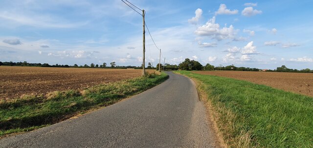
All Saints South Elmham is a small village located in the county of Suffolk, England. Situated in the picturesque Waveney Valley, it is part of the larger South Elmham cluster of villages. The village is known for its tranquil atmosphere and beautiful countryside surroundings.

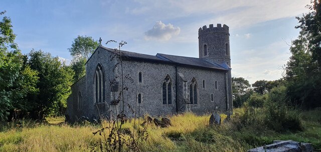
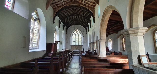
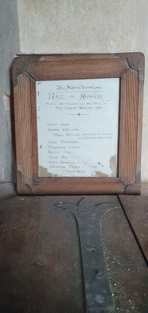
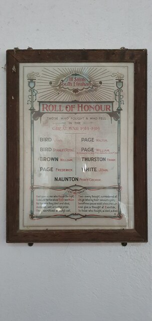
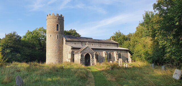
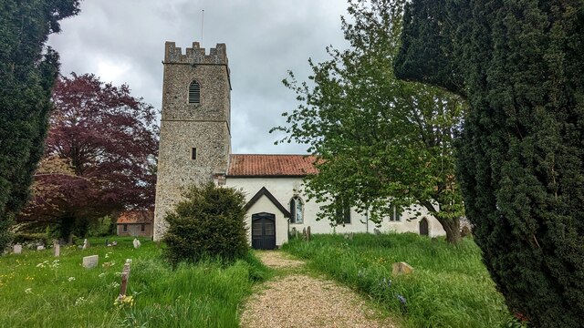
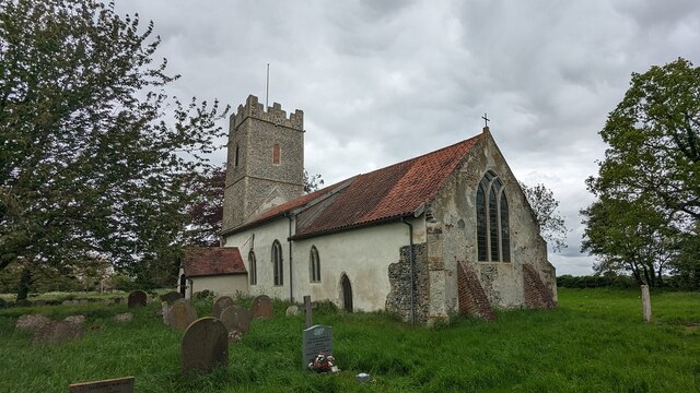
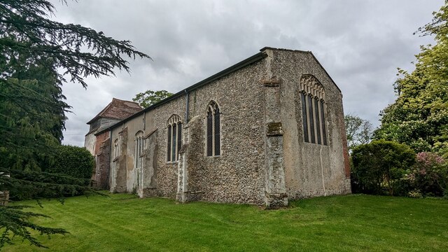
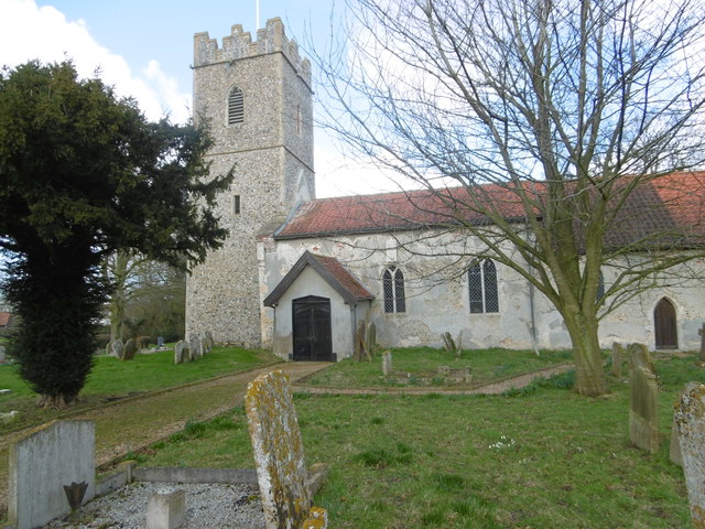
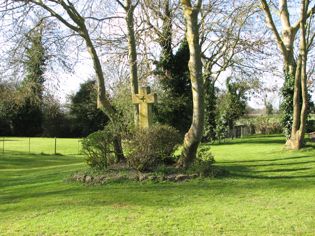
The All Saints South Elmham church, after which the village is named, is a significant historical landmark in the area. It dates back to the 13th century and features stunning medieval architecture. The church is well-maintained and regularly holds religious services and community events. It serves as a reminder of the village's rich heritage and provides a gathering place for the local community.

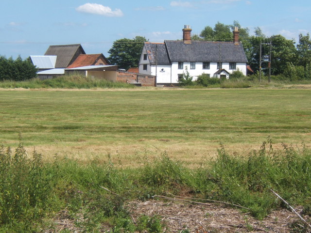
The village itself is characterized by its charming cottages, many of which are traditional thatched-roof houses. The streets are lined with well-manicured gardens and flower displays, adding to the village's idyllic charm. There is a small community shop and a pub, which serves as a popular meeting place for locals and visitors alike.

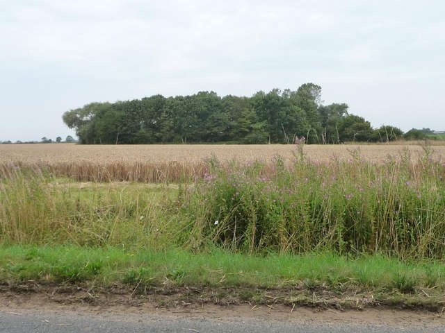
Surrounded by rolling hills and meadows, All Saints South Elmham offers ample opportunities for outdoor activities such as walking, cycling, and exploring the nearby nature reserves. The village is also close to the River Waveney, providing opportunities for boating and fishing.

Overall, All Saints South Elmham is a peaceful and picturesque village that offers a glimpse into rural English life. Its historical church, quaint cottages, and natural beauty make it a popular destination for those seeking a tranquil escape in the Suffolk countryside.

If you have any feedback on the listing, please let us know in the comments section below.

All Saints South Elmham Images

Images are sourced within 2km of 52.390876/1.4396828 or Grid Reference TM3482. Thanks to Geograph Open Source API. All images are credited.
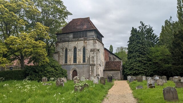
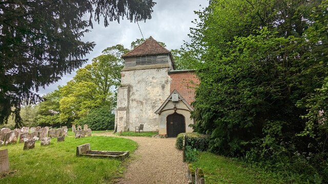
St James Road
St James Road
All Saints South Elmham church
Interior of All Saints South Elmham church
Original WW1 Roll of Honour inside All Saints South Elmham church
WW1 Roll of Honour inside All Saints South Elmham church
All Saints South Elmham church
Crinkle-crankle wall at Rumburgh The wall faces onto The Street near Whyteway
Crinkle-crankle wall at Rumburgh
The wall faces onto The Street near Whyteway
The wall is partially obscured by hedges To be found in a small development called The Forge, not surprisingly where the Rumburgh Blacksmith, Robert Green, once used to ply his trade.
The wall is partially obscured by hedges
To be found in a small development called The Forge, not surprisingly where the Rumburgh Blacksmith, Robert Green, once used to ply his trade.
Church of St. Michael, St Michael South Elmham <span class="nowrap"><a title="https://historicengland.org.uk/listing/the-list/list-entry/1352613?section=official-list-entry" rel="nofollow ugc noopener" href="https://historicengland.org.uk/listing/the-list/list-entry/1352613?section=official-list-entry">Link</a><img style="margin-left:2px;" alt="External link" title="External link - shift click to open in new window" src="https://s1.geograph.org.uk/img/external.png" width="10" height="10"/></span>
Church of St. Michael, St Michael South Elmham
Church of St. Michael and St. Felix, Rumburgh <span class="nowrap"><a title="https://historicengland.org.uk/listing/the-list/list-entry/1283749?section=official-list-entry" rel="nofollow ugc noopener" href="https://historicengland.org.uk/listing/the-list/list-entry/1283749?section=official-list-entry">Link</a><img style="margin-left:2px;" alt="External link" title="External link - shift click to open in new window" src="https://s1.geograph.org.uk/img/external.png" width="10" height="10"/></span>
Church of St. Michael and St. Felix, Rumburgh
The Priory Church of St Michael and St Felix, Rumburgh A moated church, all that remains of the Priory of St Michael and St Felix [founded 1047-64, suppressed 1528].
The Priory Church of St Michael and St Felix, Rumburgh
A moated church, all that remains of the Priory of St Michael and St Felix [founded 1047-64, suppressed 1528].
The moat, Priory Church of St Michael and St Felix [1] Looking east from the footbridge on the south side of the churchyard.
The moat, Priory Church of St Michael and St Felix [1]
Looking east from the footbridge on the south side of the churchyard.
The moat, Priory Church of St Michael and St Felix [2] Looking west from the footbridge on the south side of the churchyard.
The moat, Priory Church of St Michael and St Felix [2]
Looking west from the footbridge on the south side of the churchyard.
Woodland alongside the Beck, Rumburgh Looking south-west from the entrance to the Church of St Michael and St Felix.
Woodland alongside the Beck, Rumburgh
Looking south-west from the entrance to the Church of St Michael and St Felix.
South Elmham St Michael Church South Elmham St Michael Church is described by Pevsner as "Small, of nave and chancel, with an unbuttressed west tower, the battlements decorated with flushwork." The church is located at the north end of a large green on which the most prominent feature is a large water tower.

See <span class="nowrap"><a title="http://www.suffolkchurches.co.uk/selstmike.html" rel="nofollow ugc noopener" href="http://www.suffolkchurches.co.uk/selstmike.html">Link</a><img style="margin-left:2px;" alt="External link" title="External link - shift click to open in new window" src="https://s1.geograph.org.uk/img/external.png" width="10" height="10"/></span>   for more detailed information and photographs.
South Elmham St Michael Church
South Elmham St Michael Church is described by Pevsner as "Small, of nave and chancel, with an unbuttressed west tower, the battlements decorated with flushwork." The church is located at the north end of a large green on which the most prominent feature is a large water tower. See LinkExternal link for more detailed information and photographs.
Show me another place!

All Saints South Elmham is located at Grid Ref: TM3482 (Lat: 52.390876, Lng: 1.4396828)

Administrative County: Suffolk

District: East Suffolk

Police Authority: Suffolk

Also known as: All Saints' South Elmham

What 3 Words

///boarded.powering.thorax. Near Halesworth, Suffolk

Related Wikis

All Saints' South Elmham

All Saints' South Elmham is a village and former civil parish in the north of the English county of Suffolk. The parish was combined with St Nicholas South...

Rumburgh Priory

Rumburgh Priory was a Benedictine priory located in the village of Rumburgh in the English county of Suffolk. The priory was founded in about 1065 as a...

All Saints and St Nicholas, South Elmham

All Saints and St Nicholas, South Elmham is a civil parish in the north of the English county of Suffolk. It is 5 miles (8.0 km) south of the market town...

All Saints Church, South Elmham

All Saints Church is a redundant Anglican church in the village of All Saints' South Elmham, one of a group of villages jointly known as The Saints, in...

Wangford Hundred

Wangford was a hundred of Suffolk, England, consisting of 34,679 acres (140.34 km2).Wangford Hundred was an area of around twelve miles (19 km) from west...

Rumburgh

Rumburgh is a village and civil parish in the English county of Suffolk. It is 3.5 miles (5.6 km) north-west of the market town of Halesworth in the East...

St Michael South Elmham

St Michael South Elmham is a village and civil parish in the north of the English county of Suffolk. It is 4 miles (6.4 km) south of the market town of...

St Nicholas South Elmham

St Nicholas South Elmham is a place and former civil parish in the north of the English county of Suffolk. The parish was combined with All Saints' South...

Nearby Amenities

Located within 500m of 52.390876,1.4396828
All Saints, South Elmham
Place: village
Source: NPE
Wikidata: Q2389674
Lat/Long: 52.3897877/1.4396455
Bus Stop
Shelter
Naptan AtcoCode: 390060073
Naptan Bearing: NE
Naptan CommonName: Shelter
Naptan Indicator: o/s
Naptan Landmark: Shelter
Naptan NaptanCode: sufgmpdp
Naptan Street: St James Road
Naptan Verified: no
Shelter: yes
Source: naptan_import
Lat/Long: 52.3913313/1.4388331
Bus Stop
Shelter
Naptan AtcoCode: 390060074
Naptan Bearing: SE
Naptan BusStopType: CUS
Naptan CommonName: Shelter
Naptan Indicator: Adj
Naptan Landmark: Shelter
Naptan NaptanCode: sufgmpdt
Naptan Street: Mill Road
Naptan Verified: no
Source: naptan_import
Lat/Long: 52.3913608/1.4391562
Bus Stop
Shelter
Naptan AtcoCode: 390070967
Naptan Bearing: SW
Naptan BusStopType: CUS
Naptan CommonName: Shelter
Naptan Indicator: opp
Naptan Landmark: Shelter
Naptan NaptanCode: sufjmtgj
Naptan Street: St James Road
Naptan Verified: no
Source: naptan_import
Lat/Long: 52.3912929/1.4390186
Bench
Backrest: yes
Material: wood
Seats: 3
Lat/Long: 52.3913001/1.4388358
Artwork Type: sculpture
Designation: Roughly carved white stone, depicting several human heads and part bodies.
Tourism: artwork
Lat/Long: 52.3941201/1.4408337
Post Box
Ref: IP19 5501
Lat/Long: 52.3913347/1.4391363
The data included in this document is from www.openstreetmap.org. The data is made available under ODbL.

Have you been to All Saints South Elmham?

Leave your review of All Saints South Elmham below (or comments, questions and feedback).