Aird

Settlement in Inverness-shire

Scotland

Aird

Eilean Ard A small tidal island near the head of Loch Treaslane.
Eilean Ard Credit: John Allan

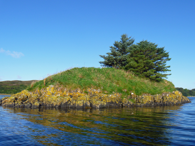
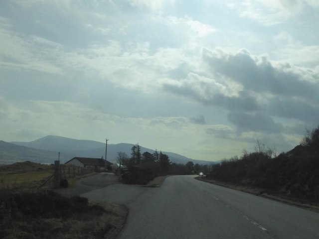
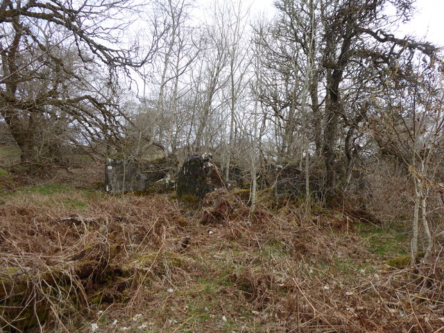
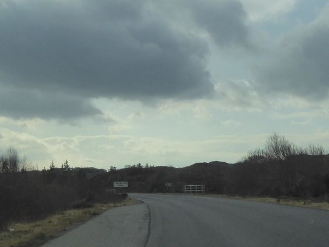
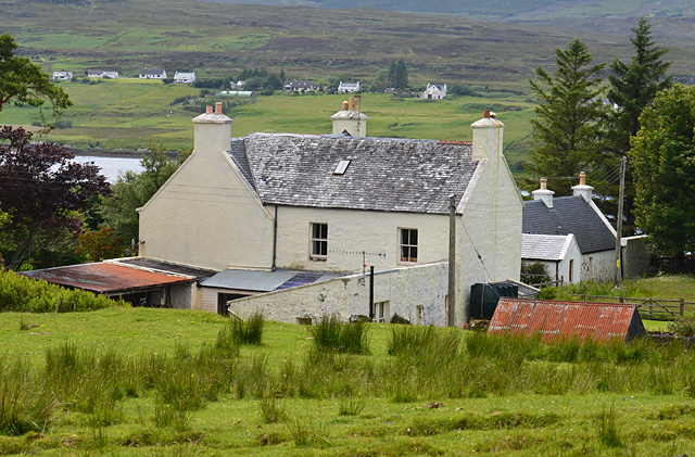
Aird is a small village located in the Inverness-shire region of Scotland. Situated on the west coast of Scotland, Aird is blessed with stunning natural beauty and breathtaking views of the surrounding mountains and sea. The village is nestled between the Great Glen and Loch Eil, offering residents and visitors alike access to a range of outdoor activities and picturesque landscapes.

Aird is known for its tranquility and peaceful atmosphere, making it an ideal destination for those seeking a retreat from the hustle and bustle of city life. The village is home to a tight-knit community, with a population of around 200 residents. The locals are friendly and welcoming, often engaging in traditional Scottish activities and events.

Visitors to Aird can explore the nearby Glenfinnan Viaduct, famous for its appearance in the Harry Potter films. The viaduct offers breathtaking views of the surrounding countryside and is a popular spot for photography enthusiasts and nature lovers.

For outdoor enthusiasts, Aird provides ample opportunities for hiking, cycling, and fishing. The village is also in close proximity to various historical landmarks and attractions, including the Glenfinnan Monument and the Glenfinnan Railway Museum.

Overall, Aird offers a peaceful and idyllic setting, with its natural beauty and charming community making it an attractive destination for both locals and tourists seeking a taste of rural Scottish life.

If you have any feedback on the listing, please let us know in the comments section below.
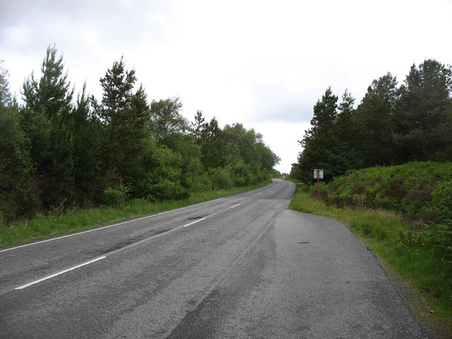
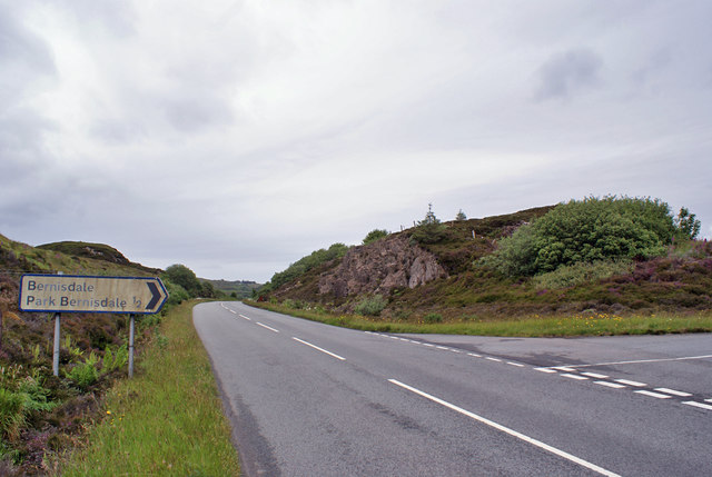
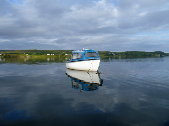
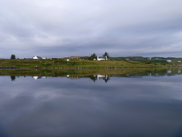
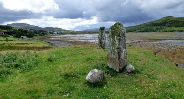
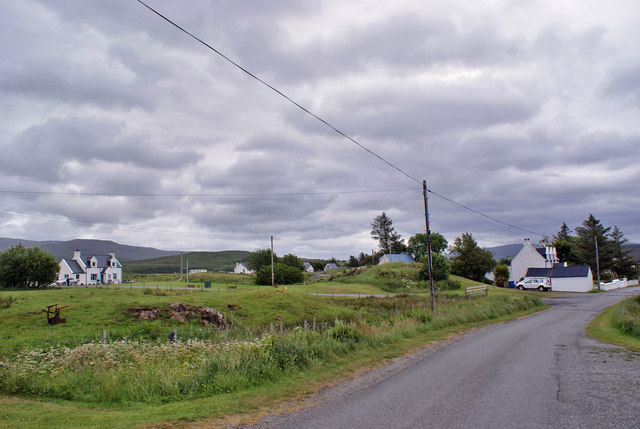
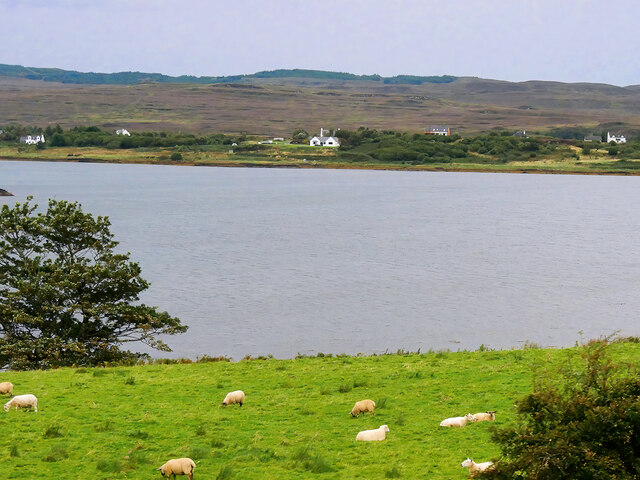
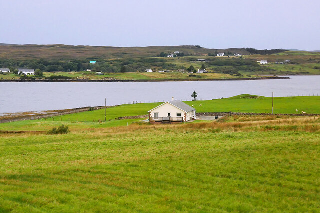
Aird Images

Images are sourced within 2km of 57.477719/-6.3423225 or Grid Reference NG3951. Thanks to Geograph Open Source API. All images are credited.

Eilean Ard A small tidal island near the head of Loch Treaslane.
Eilean Ard
A small tidal island near the head of Loch Treaslane.
A850 at Treaslane, Isle of Skye
Ruin of Treaslane House According to the OS Name Books (1876-1878) "This name applies to a good one storey farm-house situated on the southern side of Loch Snizort Beag ... in good repair and ... the property of Lauchlan MacDonald Esq. of Snizort".
Ruin of Treaslane House
According to the OS Name Books (1876-1878) "This name applies to a good one storey farm-house situated on the southern side of Loch Snizort Beag ... in good repair and ... the property of Lauchlan MacDonald Esq. of Snizort".
A850 crossing the Treaslane River
The A850 nearing Bernisdale
Bernisdale junction Looking north - a minor road junction off the A850.
Bernisdale junction
Looking north - a minor road junction off the A850.
Tern on a boat The guano on the boat suggests there is often more than one tern resting on it. The land beyond is Aird Bernisdale.
Tern on a boat
The guano on the boat suggests there is often more than one tern resting on it. The land beyond is Aird Bernisdale.
Terns on a boat The boat moored at the mouth of Loch Eyre is clearly a popular perching place for these birds. The land beyond is Aird Bernisdale.
Terns on a boat
The boat moored at the mouth of Loch Eyre is clearly a popular perching place for these birds. The land beyond is Aird Bernisdale.
Aird Point Houses near the end of Aird Point, seen across flat water on Loch Snizort.
Aird Point
Houses near the end of Aird Point, seen across flat water on Loch Snizort.
Loch Eyre sunset A spectacular sky seen over Loch Eyre as the sun drops behind Lyndale Point.
Loch Eyre sunset
A spectacular sky seen over Loch Eyre as the sun drops behind Lyndale Point.
Standing stones at Eyre Three stones are said to have once stood here, but only two now remain.
<span class="nowrap"><a title="https://stonerows.wordpress.com/gazetteer/region/western-isles/eyre-alignment/" rel="nofollow ugc noopener" href="https://stonerows.wordpress.com/gazetteer/region/western-isles/eyre-alignment/">Link</a><img style="margin-left:2px;" alt="External link" title="External link - shift click to open in new window" src="https://s1.geograph.org.uk/img/external.png" width="10" height="10"/></span>
Standing stones at Eyre
Three stones are said to have once stood here, but only two now remain. LinkExternal link
Old Milestone in Bernisdale, Portree parish Highland granite by the UC road (old A850), in parish of Portree (District), Bernisdale, just North of short connecting road to the A850, by low wall just North of large outbuilding at Veterinary Practice, East side of road.

Inscription once read:-
: (Portree / 7¼) : : (Tayinlone / 3) : 

Surveyed

Milestone Society National ID: HI_SKPODV07
Old Milestone in Bernisdale, Portree parish
Highland granite by the UC road (old A850), in parish of Portree (District), Bernisdale, just North of short connecting road to the A850, by low wall just North of large outbuilding at Veterinary Practice, East side of road. Inscription once read:- : (Portree / 7¼) : : (Tayinlone / 3) : Surveyed Milestone Society National ID: HI_SKPODV07
Bernisdale Bernisdale is a crofting township of many scattered dwellings, with its single-track access road now by-passed by the modern two-way A850.
Bernisdale
Bernisdale is a crofting township of many scattered dwellings, with its single-track access road now by-passed by the modern two-way A850.
Sheep Grazing near Loch Eyre Loch Eyre is a small sea loch which forms an inlet on the east side of Loch Snizort Beag.
Sheep Grazing near Loch Eyre
Loch Eyre is a small sea loch which forms an inlet on the east side of Loch Snizort Beag.
House at Eyre House above Loch Eyre, a small sea loch which forms an inlet on the east side of Loch Snizort Beag.
House at Eyre
House above Loch Eyre, a small sea loch which forms an inlet on the east side of Loch Snizort Beag.
Skerinish House The east elevation of the 19th century reworking of a Skye tacksman's house.
Skerinish House
The east elevation of the 19th century reworking of a Skye tacksman's house.
Midsummer midnight on Loch Eyre Around midsummer on clear nights it never gets really dark hereabouts.
Midsummer midnight on Loch Eyre
Around midsummer on clear nights it never gets really dark hereabouts.
Loch Snizort Beag Seen from the hill above Kensaleyre. On the horizon the mountains of Harris are visible.
Loch Snizort Beag
Seen from the hill above Kensaleyre. On the horizon the mountains of Harris are visible.
Show me another place!

Aird is located at Grid Ref: NG3951 (Lat: 57.477719, Lng: -6.3423225)

Unitary Authority: Highland

Police Authority: Highlands and Islands

What 3 Words

///airfields.soups.legend. Near Portree, Highland

Nearby Locations

Eilean Àrd Aird

Related Wikis

Treaslane

Treaslane (Scottish Gaelic: Triaslann) is a small remote scattered crofting hamlet on the Isle of Skye, Scotland. It overlooks the western entrance to...

Bernisdale

Bernisdale (Scottish Gaelic: Beàrnasdal) is a small township, near the head of Loch Snizort Beag, Isle of Skye in the Highlands and Islands and is in the...

Dun Cruinn

Dun Cruinn is a prehistoric site about 10 kilometres (6.2 mi) north-west of Portree, on the Isle of Skye, Scotland. It is on the Skerinish Peninsula, between...

Eyre, Skye

Eyre (Scottish Gaelic: Eighre) is a settlement on the eastern shore of Loch Snizort Beag on the northern coast of Skye in Scotland.The two Eyre standing...

Nearby Amenities

Located within 500m of 57.477719,-6.3423225
Source: PGS
Lat/Long: 57.4814811/-6.3405998
Turning Circle
Lat/Long: 57.4752504/-6.3406729
Turning Circle
Lat/Long: 57.4781985/-6.3359043
Barrier: cattle_grid
Lat/Long: 57.4758003/-6.3365117
Power: pole
Lat/Long: 57.4760614/-6.3367902
Parking
Source: survey
Lat/Long: 57.4796417/-6.3456713
Power: pole
Lat/Long: 57.4752338/-6.3357856
Power: pole
Lat/Long: 57.4757458/-6.3363975
Power: pole
Lat/Long: 57.4760975/-6.3368424
Power: pole
Lat/Long: 57.4764665/-6.3372571
Power: pole
Lat/Long: 57.4770553/-6.3379817
Power: pole
Lat/Long: 57.4776473/-6.3386823
Power: pole
Lat/Long: 57.4783042/-6.3394572
Power: pole
Lat/Long: 57.4788453/-6.3401095
Power: pole
Lat/Long: 57.4793702/-6.3407395
Power: pole
Lat/Long: 57.479908/-6.3413756
Power: pole
Lat/Long: 57.4804166/-6.3419876
Power: pole
Lat/Long: 57.4807456/-6.3430424
Power: pole
Lat/Long: 57.4810735/-6.3440831
Power: pole
Lat/Long: 57.4814014/-6.34516
Power: pole
Lat/Long: 57.480883/-6.3381518
Power: pole
Lat/Long: 57.4813213/-6.3380925
Power: pole
Lat/Long: 57.4808787/-6.3372722
Power: pole
Lat/Long: 57.4802662/-6.3377835
Power: pole
Lat/Long: 57.4791883/-6.3387135
Power: pole
Lat/Long: 57.478762/-6.3390718
Park Bernisdale
Name Gd: Pàirc Bheàrnasdail
Place: hamlet
Lat/Long: 57.4766576/-6.3358518
School House Bernisdale
Tourism: guest_house
Lat/Long: 57.4782578/-6.3417521
The data included in this document is from www.openstreetmap.org. The data is made available under ODbL.

Have you been to Aird?

Leave your review of Aird below (or comments, questions and feedback).