Adelphi

Settlement in Lancashire Preston

England

Adelphi

A6 North Road, Preston
A6 North Road, Preston Credit: Colin Pyle

Adelphi is a small village located in the county of Lancashire, England. Situated approximately 3 miles south of the city of Preston, Adelphi is a primarily residential area with a population of around 1,500 people.

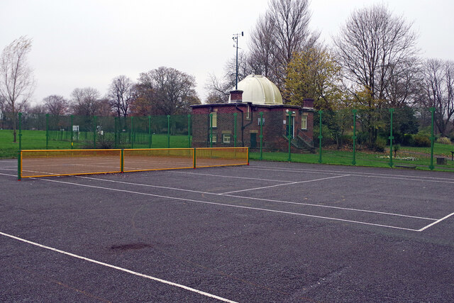
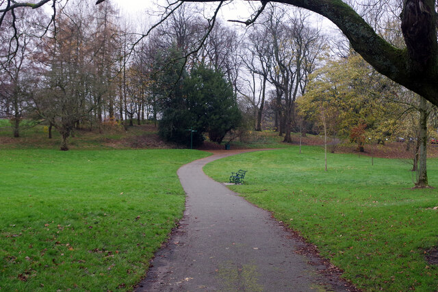
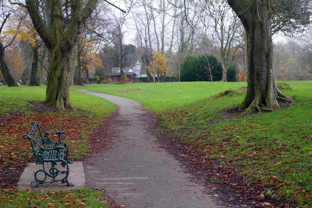
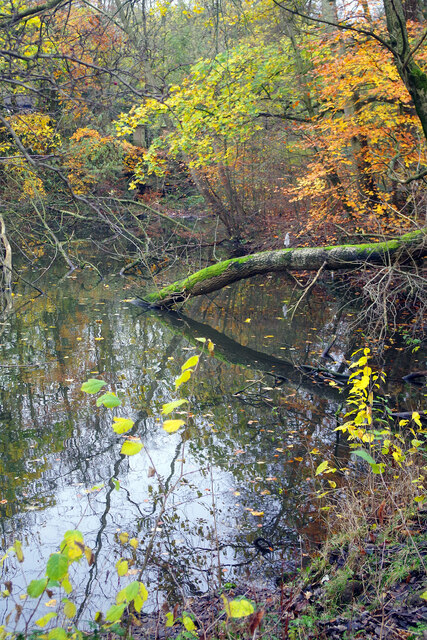
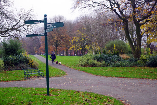
The village boasts a rich history, with records dating back to the Domesday Book of 1086. Over the years, Adelphi has evolved from an agricultural community into a thriving residential area. The village is known for its picturesque surroundings, with open green spaces and tree-lined streets providing a peaceful atmosphere for its residents.

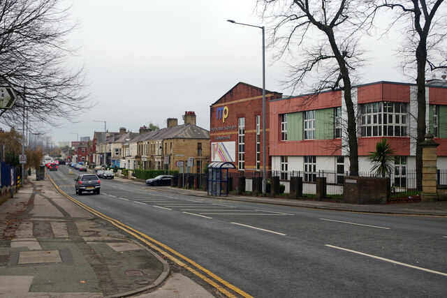
Adelphi has a range of amenities to cater to the needs of its population. The village has a primary school, offering quality education to local children. There are also several local shops and businesses, providing essential services to the community. For more extensive shopping and entertainment options, residents can easily access the nearby city of Preston.

Adelphi benefits from excellent transport links, making it an attractive location for commuters. The village is located close to the M6 motorway, providing convenient access to major cities such as Manchester and Liverpool. Preston train station is also easily accessible, offering direct connections to various destinations across the country.

Overall, Adelphi is a charming village with a strong sense of community and a range of amenities. Its proximity to larger urban areas, combined with its peaceful surroundings, makes it an ideal place to live for those seeking a balance between rural tranquility and urban convenience.

If you have any feedback on the listing, please let us know in the comments section below.
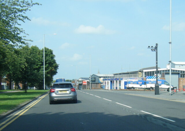
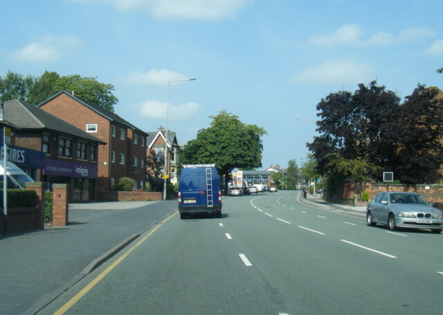
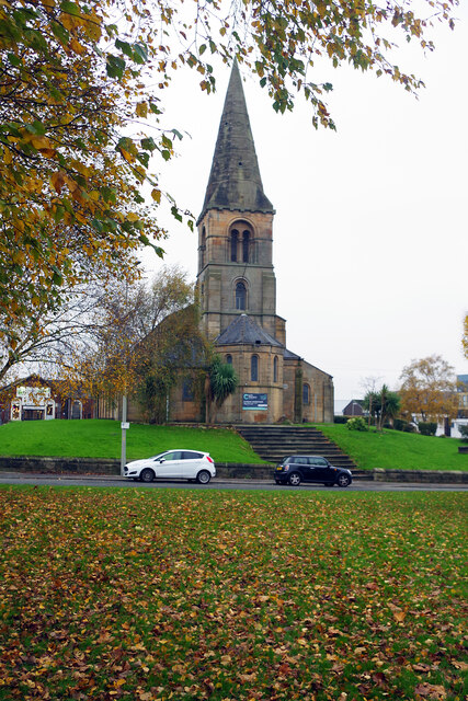
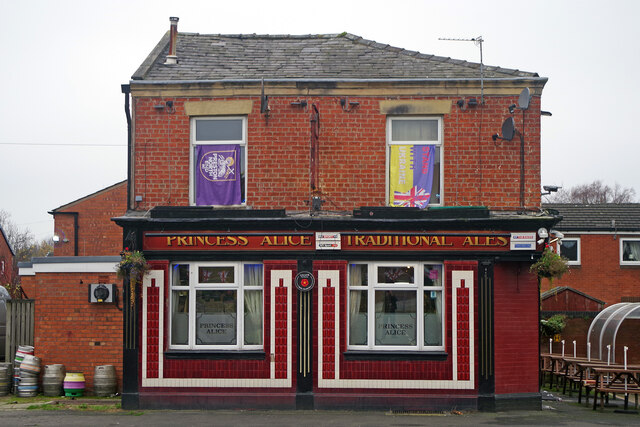
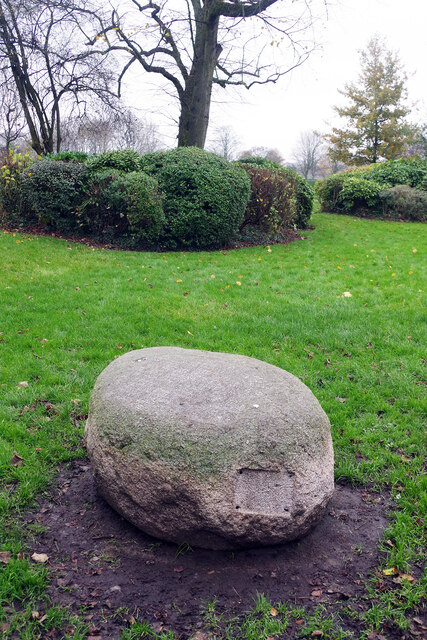
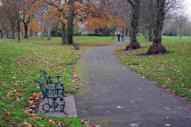
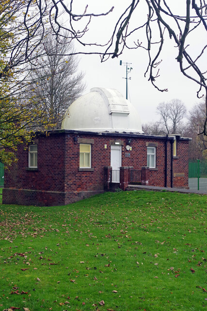
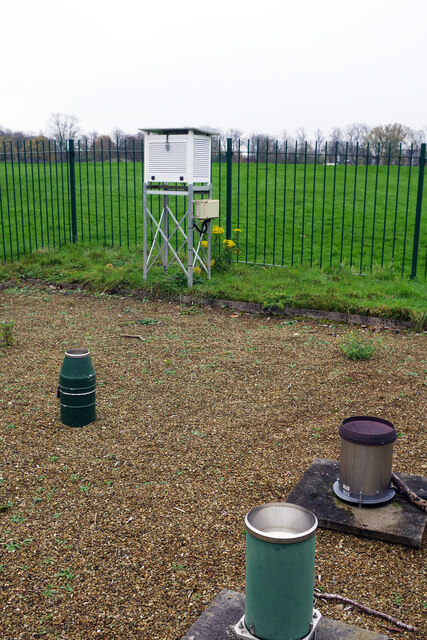
Adelphi Images

Images are sourced within 2km of 53.766185/-2.7086338 or Grid Reference SD5330. Thanks to Geograph Open Source API. All images are credited.

A6 North Road, Preston
A6 Garstang Road northbound in Fulwood
Industrial Units on Fylde Road View from Fylde Road Viaduct
Industrial Units on Fylde Road
View from Fylde Road Viaduct
Moor Park
Moor Park
Milestone Marker 56-01 F (between bridges 11-10), Lancaster Canal Milestone located by the side of the Lancaster Canal
This milestone is 1 miles from the centre of Preston and 56 miles from Kendal

Inscription reads:- 

Preston / 1 :: Garstang / 16 
Milestone Society National ID: LAN-01R
Milestone Marker 56-01 F (between bridges 11-10), Lancaster Canal
Milestone located by the side of the Lancaster Canal This milestone is 1 miles from the centre of Preston and 56 miles from Kendal Inscription reads:- Preston / 1 :: Garstang / 16 Milestone Society National ID: LAN-01R
St Thomas' Church, Preston This grade II listed church was designed by John Latham and built between 1837 and 1839. It was declared redundant by the Church of England in 1983 and is used by City Church Preston, part of a Pentecostal denomination.
St Thomas' Church, Preston
This grade II listed church was designed by John Latham and built between 1837 and 1839. It was declared redundant by the Church of England in 1983 and is used by City Church Preston, part of a Pentecostal denomination.
The Princess Alice, Preston The Princess Alice on Cambridge Walk is a traditional Victorian back-street pub that has survived despite all the redevelopment around it.
The Princess Alice, Preston
The Princess Alice on Cambridge Walk is a traditional Victorian back-street pub that has survived despite all the redevelopment around it.
Tom Benson Stone, Moor Park Unfortunately the stone seems to have lost its plaque but it is here to commemorate the achievements of Tom Benson, a long-distance walker. Benson was a local man who set a world record in 1986 by walking 415 miles non-stop around Moor Park. He did this when he was in his fifties.
Tom Benson Stone, Moor Park
Unfortunately the stone seems to have lost its plaque but it is here to commemorate the achievements of Tom Benson, a long-distance walker. Benson was a local man who set a world record in 1986 by walking 415 miles non-stop around Moor Park. He did this when he was in his fifties.
Moor Park High pressure conditions have created a bleak grey day in Preston, with no sign of the sun at all, but there is still some autumn colour in Moor Park at the end of November.
Moor Park
High pressure conditions have created a bleak grey day in Preston, with no sign of the sun at all, but there is still some autumn colour in Moor Park at the end of November.
Jeremiah Horrocks Observatory, Moor Park This observatory in the north-west part of Moor Park was designed by George James Gibbs, at the time the honorary curator of Preston Municipal Observatory, and officially opened in 1927 to coincide with a total eclipse of the sun. It was named after Jeremiah Horrocks, a 17th century English astronomer who was the first person to show that the Moon orbited around the Earth in an elliptical pattern. Today the building belongs to the University of Central Lancashire although light pollution prevents it from being used for serious astronomy.
Jeremiah Horrocks Observatory, Moor Park
This observatory in the north-west part of Moor Park was designed by George James Gibbs, at the time the honorary curator of Preston Municipal Observatory, and officially opened in 1927 to coincide with a total eclipse of the sun. It was named after Jeremiah Horrocks, a 17th century English astronomer who was the first person to show that the Moon orbited around the Earth in an elliptical pattern. Today the building belongs to the University of Central Lancashire although light pollution prevents it from being used for serious astronomy.
Moor Park Weather Station The weather station, in the north-west corner of Moor Park, is adjacent to the Jeremiah Horrocks Observatory.
Moor Park Weather Station
The weather station, in the north-west corner of Moor Park, is adjacent to the Jeremiah Horrocks Observatory.
Tennis court in Moor Park This public tennis court has been fitted with a vandal-proof and weather-resistant steel net. We are unlikely to see these at Wimbledon anytime soon, but in a location like this it makes a great deal of sense. Beyond the court is the Jeremiah Horrocks Observatory.
Tennis court in Moor Park
This public tennis court has been fitted with a vandal-proof and weather-resistant steel net. We are unlikely to see these at Wimbledon anytime soon, but in a location like this it makes a great deal of sense. Beyond the court is the Jeremiah Horrocks Observatory.
Moor Park This view shows the path round the northern side of the park. Moor Park was created when Preston Council enclosed 100 acres of Preston Moor making it the first municipal park in the new industrial towns of north-west England. Improvements were carried out between 1862 and 1865 by garden designer Edward Milner using the labour of unemployed cotton workers.
Moor Park
This view shows the path round the northern side of the park. Moor Park was created when Preston Council enclosed 100 acres of Preston Moor making it the first municipal park in the new industrial towns of north-west England. Improvements were carried out between 1862 and 1865 by garden designer Edward Milner using the labour of unemployed cotton workers.
Moor Park This path winds round the northern side of the park with North Lodge in the background. Moor Park was created when Preston Council enclosed 100 acres of Preston Moor making it the first municipal park in the new industrial towns of north-west England. Improvements were carried out between 1862 and 1865 by garden designer Edward Milner using the labour of unemployed cotton workers.
Moor Park
This path winds round the northern side of the park with North Lodge in the background. Moor Park was created when Preston Council enclosed 100 acres of Preston Moor making it the first municipal park in the new industrial towns of north-west England. Improvements were carried out between 1862 and 1865 by garden designer Edward Milner using the labour of unemployed cotton workers.
The Serpentine, Moor Park Autumn colours abound around this pond in the north-eastern section of Moor Park. The Serpentine was originally created in the 1830s but has changed its size and shape many times since. It is home to a variety of wetland birds.
The Serpentine, Moor Park
Autumn colours abound around this pond in the north-eastern section of Moor Park. The Serpentine was originally created in the 1830s but has changed its size and shape many times since. It is home to a variety of wetland birds.
Moor Park A lady walks her dogs along the southern side of Moor Park. Moor Park was created when Preston Council enclosed 100 acres of Preston Moor making it the first municipal park in the new industrial towns of north-west England. Improvements were carried out between 1862 and 1865 by garden designer Edward Milner using the labour of unemployed cotton workers.
Moor Park
A lady walks her dogs along the southern side of Moor Park. Moor Park was created when Preston Council enclosed 100 acres of Preston Moor making it the first municipal park in the new industrial towns of north-west England. Improvements were carried out between 1862 and 1865 by garden designer Edward Milner using the labour of unemployed cotton workers.
Deepdale Road, Preston Looking towards the city centre from outside Deepdale Stadium. On the right is Moor Park High School.
Deepdale Road, Preston
Looking towards the city centre from outside Deepdale Stadium. On the right is Moor Park High School.
Sir Tom Finney Tom Finney played for Preston North End between 1946 and 1960, making 433 football league and 40 FA cup appearances for the club, scoring 210 goals. He also made 76 England appearances, scoring 30 goals. His bronze statue, outside the club's Deepdale Stadium, was unveiled in 2004. The sculptor was Peter Hodgkinson and it is called 'The Splash', based on a photograph of Finney playing against Chelsea at Stamford Bridge in waterlogged conditions.
Sir Tom Finney
Tom Finney played for Preston North End between 1946 and 1960, making 433 football league and 40 FA cup appearances for the club, scoring 210 goals. He also made 76 England appearances, scoring 30 goals. His bronze statue, outside the club's Deepdale Stadium, was unveiled in 2004. The sculptor was Peter Hodgkinson and it is called 'The Splash', based on a photograph of Finney playing against Chelsea at Stamford Bridge in waterlogged conditions.
Show me another place!

Adelphi is located at Grid Ref: SD5330 (Lat: 53.766185, Lng: -2.7086338)

Administrative County: Lancashire

District: Preston

Police Authority: Lancashire

What 3 Words

///epic.trees.verbs. Near Preston, Lancashire

Nearby Locations

Adelphi Gallows Hill

Related Wikis

The Guild, Preston

The Guild is a grade II listed public house at 99 Fylde Road in Preston, Lancashire, England. It was built as the home of the cotton manufacturer William...

St Peter's Church, Preston, Lancashire

St Peter's Church is a redundant Anglican parish church in St Peter's Square, Preston, Lancashire, England. It is recorded in the National Heritage List...

St Thomas' Church, Preston

St Thomas' Church is in Lancaster Road, Preston, Lancashire, England. It has historically been an Anglican parish church, and now used by City Church...

Lancashire School of Business and Enterprise

Lancashire School of Business and Enterprise (previously known as Lancashire Business School) at the University of Central Lancashire (UCLan) is a business...

University of Central Lancashire

The University of Central Lancashire (abbreviated UCLan) is a public university based in the city of Preston, Lancashire, England. It has its roots in...

Maudland Bridge railway station

Maudland Bridge railway station was once the Preston terminus of the Longridge Branch Line, in Lancashire, England. It was located on Maudland Road, between...

Emmanuel Church, Preston

Emmanuel Church is in Brook Street, Preston, Lancashire, England. It is in the deanery of Preston, the archdeaconry of Lancaster, and the diocese of Blackburn...

Church of St Thomas of Canterbury and the English Martyrs, Preston

English Martyrs Church or its full name The Church of St Thomas of Canterbury and the English Martyrs is a Roman Catholic Parish church in Preston, Lancashire...

Nearby Amenities

Located within 500m of 53.766185,-2.7086338
Plungington
Place: suburb
Lat/Long: 53.7702846/-2.7115105
Mini Roundabout
Direction: clockwise
Lat/Long: 53.762095/-2.7072811
Traffic Signals
Lat/Long: 53.768154/-2.7046525
Traffic Signals
Lat/Long: 53.7679744/-2.7121931
Traffic Signals
Lat/Long: 53.7683696/-2.7101984
Crossing
Crossing: uncontrolled
Crossing Island: yes
Lat/Long: 53.7626385/-2.7060817
Traffic Signals
Crossing: traffic_signals
Lat/Long: 53.7656935/-2.7082467
Lamb and Packet
Disused Amenity: pub
Disused Operator: Thwaites
Lat/Long: 53.7622449/-2.7062711
Turning Circle
Lat/Long: 53.7699231/-2.7061106
Turning Circle
Lat/Long: 53.7701441/-2.7076236
Turning Circle
Lat/Long: 53.7706393/-2.707873
Turning Circle
Lat/Long: 53.7694708/-2.7066617
Noexit: yes
Lat/Long: 53.7699806/-2.7106137
Barrier: bollard
Bicycle: yes
Foot: yes
Lat/Long: 53.7687656/-2.71136
Barrier: bollard
Bicycle: yes
Foot: yes
Lat/Long: 53.7683976/-2.7140975
Barrier: bollard
Bicycle: yes
Foot: yes
Lat/Long: 53.7695532/-2.7120239
Barrier: bollard
Bicycle: yes
Foot: yes
Lat/Long: 53.7698984/-2.7106982
Barrier: bollard
Bicycle: yes
Foot: yes
Lat/Long: 53.7699831/-2.7075094
Barrier: bollard
Bicycle: yes
Foot: yes
Lat/Long: 53.7699121/-2.7087025
Traffic Signals
Crossing: traffic_signals
Lat/Long: 53.7652142/-2.7101584
Barrier: bollard
Bicycle: yes
Foot: yes
Lat/Long: 53.7648786/-2.7115083
Barrier: bollard
Bicycle: yes
Foot: yes
Lat/Long: 53.7648449/-2.7110931
Barrier: bollard
Bicycle: yes
Foot: yes
Lat/Long: 53.7670401/-2.7110683
Barrier: bollard
Bicycle: yes
Foot: yes
Lat/Long: 53.7666906/-2.710827
Barrier: bollard
Bicycle: dismount
Foot: yes
Lat/Long: 53.7680737/-2.709383
Traffic Signals
Lat/Long: 53.7678496/-2.7042173
Turning Circle
Lat/Long: 53.7655963/-2.701573
Adelphi
Place: neighbourhood
Source: OS_OpenData_StreetView
Lat/Long: 53.7657066/-2.7085185
Entrance: main
Lat/Long: 53.761694/-2.708282
Barrier: bollard
Bicycle: yes
Foot: yes
Lat/Long: 53.7626622/-2.709674
Post Box
Brand: Royal Mail
Brand Wikidata: Q638098
Check Date: 2021-01-25
Collection Times: Mo-Fr 09:00, Sa 07:00
Operator: Royal Mail
Operator Wikidata: Q638098
Post Box Design: type_b
Post Box Type: pillar
Ref: PR1 160
Royal Cypher: EIIR
Royal Cypher Wikidata: Q33102113
Lat/Long: 53.7638168/-2.7091979
Barrier: bollard
Lat/Long: 53.7629198/-2.708788
Barrier: yes
Bicycle: dismount
Foot: yes
Lat/Long: 53.7630031/-2.7088629
Fast Food
Ziba
Addr City: Preston
Addr Country: GB
Addr Housename: Ziba Takeaway
Addr Housenumber: 73
Addr Postcode: PR1 7EN
Addr Street: Plunginton Road
Cuisine: kebab
Fhrs Id: 71073
Source: local_knowledge
Lat/Long: 53.7698405/-2.7112395
Barrier: bollard
Lat/Long: 53.7627101/-2.7066778
PR1 Media Productions
Note: Video Production for websites and social media. North West England.
Phone: +44 7812 924 671
Website: https://www.pr1media.co.uk/
Lat/Long: 53.7631693/-2.710387
Mini Roundabout
Direction: clockwise
Lat/Long: 53.7623702/-2.7060523
Entrance: main
Lat/Long: 53.7635157/-2.707278
Entrance: main
Lat/Long: 53.7649364/-2.7085406
Crossing
Crossing: marked
Crossing Markings: yes
Crossing Ref: zebra
Lat/Long: 53.7649391/-2.7077192
Crossing
Crossing: traffic_signals
Crossing Island: no
Crossing Ref: pelican
Tactile Paving: yes
Lat/Long: 53.7632661/-2.7085617
Barrier: bollard
Lat/Long: 53.7642532/-2.712402
Bicycle Parking
Access: yes
Bicycle Parking: stands
Capacity: 8
Covered: no
Lat/Long: 53.7637203/-2.7087887
Turning Circle
Lat/Long: 53.7629656/-2.7136822
Barrier: bollard
Lat/Long: 53.7637969/-2.7141944
Barrier: bollard
Lat/Long: 53.7635987/-2.7140659
Barrier: bollard
Lat/Long: 53.7635571/-2.7139949
Barrier: bollard
Lat/Long: 53.76364/-2.7137252
Barrier: bollard
Bicycle: yes
Foot: yes
Motor Vehicle: no
Lat/Long: 53.7640707/-2.7097954
Crossing
Crossing: unmarked
Crossing Island: yes
Crossing Markings: no
Tactile Paving: no
Lat/Long: 53.763921/-2.7091803
Bench
Backrest: yes
Check Date: 2021-01-25
Lat/Long: 53.763078/-2.7087157
Bicycle Parking
Access: yes
Bicycle Parking: stands
Capacity: 4
Covered: no
Lat/Long: 53.7630922/-2.7086755
Bicycle Parking
Access: yes
Bicycle Parking: stands
Capacity: 6
Covered: no
Lat/Long: 53.7630772/-2.7087372
Bench
Backrest: yes
Check Date: 2021-01-25
Lat/Long: 53.7631533/-2.708772
Barrier: bollard
Lat/Long: 53.7631192/-2.7088686
Barrier: bollard
Lat/Long: 53.7630954/-2.7088512
Barrier: bollard
Lat/Long: 53.763078/-2.7088364
Barrier: bollard
Lat/Long: 53.7630502/-2.7088136
Barrier: bollard
Lat/Long: 53.7631049/-2.7085923
Barrier: bollard
Lat/Long: 53.7631284/-2.7086079
Barrier: bollard
Lat/Long: 53.7631508/-2.7086262
Barrier: bollard
Lat/Long: 53.7631699/-2.7086428
Barrier: bollard
Lat/Long: 53.7631946/-2.7086593
Post Box
Brand: Royal Mail
Brand Wikidata: Q638098
Collection Times: Mo-Fr 09:00; Sa 07:00
Operator: Royal Mail
Operator Wikidata: Q638098
Post Box Type: pillar
Ref: PR1 122D
Royal Cypher: EIIR
Royal Cypher Wikidata: Q33102113
Lat/Long: 53.7696336/-2.7049578
Post Office
Plungington Road Post Office
Addr City: Preston
Addr Housenumber: 44
Addr Postcode: PR1 7RB
Addr Street: Plungington Road
Brand: Post Office
Brand Wikidata: Q1783168
Opening Hours: Mo-Fr 08:30-17:30; Sa 09:00-14:00
Ref Pol Id: 8712
Source: pol_branch_list_2018-02
Website: https://www.postoffice.co.uk/branch-finder/2284278/plungington-road
Wheelchair: yes
Lat/Long: 53.768865/-2.7104059
Crossing
Crossing: traffic_signals
Crossing Ref: pelican
Lat/Long: 53.7666995/-2.7047809
Pub
Vinyl Tap
Addr City: Preston
Addr Housenumber: 28-30
Addr Postcode: PR1 7BE
Addr Street: Adelphi Street
Fhrs Id: 42215
Old Name: Variety;Hearts of Oak
Lat/Long: 53.7634823/-2.7065484
Barrier: bollard
Bicycle: yes
Foot: yes
Lat/Long: 53.767652/-2.706019
Barrier: bollard
Bicycle: yes
Foot: yes
Lat/Long: 53.7677134/-2.7053002
Barrier: bollard
Foot: yes
Lat/Long: 53.7699563/-2.7058626
Entrance: yes
Lat/Long: 53.7690317/-2.7052146
Barrier: bollard
Bicycle: yes
Foot: yes
Lat/Long: 53.7698962/-2.7078554
Crossing
Crossing: unmarked
Crossing Island: no
Lat/Long: 53.7670753/-2.7032032
Fast Food
Subway
Addr City: Preston
Addr Housenumber: 73
Addr Postcode: PR1 2XQ
Addr Street: Fylde Road
Brand: Subway
Brand Wikidata: Q244457
Brand Wikipedia: en:Subway (restaurant)
Contact Website: https://restaurants.subway.com/united-kingdom/en/preston/73-fylde-rd
Cuisine: sandwich
Fhrs Id: 78655
Takeaway: yes
Wheelchair: yes
Lat/Long: 53.7642014/-2.7100852
Frank Street
Bus: yes
Naptan AtcoCode: 250014203
Naptan Bearing: SE
Naptan BusStopType: MKD
Naptan CommonName: Frank Street
Naptan Indicator: by
Naptan Landmark: Frank St
Naptan LocalityCode: N0078525
Naptan NaptanCode: lanamjtw
Naptan Street: North Road
Naptan Verified: no
Public Transport: stop_position
Ref: lanamjtw
Lat/Long: 53.7671911/-2.7032047
Bus Stop
Aqueduct Street
Bench: yes
Bus: yes
Naptan AtcoCode: 2500DCL3120
Naptan Bearing: S
Naptan BusStopType: MKD
Naptan CommonName: Aqueduct Street
Naptan Indicator: opp
Naptan Landmark: Garstang Road/ Canterbury Hall
Naptan LocalityCode: N0078525
Naptan NaptanCode: landgpgp
Naptan Street: Garstang Road
Naptan Verified: no
Public Transport: platform
Ref: landgpgp
Shelter: yes
Lat/Long: 53.768543/-2.7047241
Aqueduct Street
Bus: yes
Naptan AtcoCode: 250020063
Naptan Bearing: N
Naptan BusStopType: MKD
Naptan CommonName: Aqueduct Street
Naptan Indicator: by
Naptan Landmark: Aqueduct St
Naptan LocalityCode: E0016132
Naptan NaptanCode: lanatmtp
Naptan Street: Garstang Road
Naptan Verified: no
Public Transport: stop_position
Public Transport Version: 2
Ref: lanatmtp
Lat/Long: 53.7693964/-2.7050858
Frank Street
Bus: yes
Naptan AtcoCode: 250020062
Naptan Bearing: NW
Naptan BusStopType: MKD
Naptan CommonName: Frank Street
Naptan Indicator: opp
Naptan Landmark: Frank Street
Naptan LocalityCode: N0078525
Naptan NaptanCode: lanatmtm
Naptan Street: North Road
Naptan Verified: no
Public Transport: stop_position
Public Transport Version: 2
Ref: lanatmtm
Lat/Long: 53.7666756/-2.7024047
Cafe
Cafe Emmanuel
Addr City: Preston
Addr Housename: Plungington Community Centre
Addr Postcode: PR1 7NB
Addr Street: Brook Street
Fhrs Id: 811679
Lat/Long: 53.7690419/-2.7120763
Bus Stop
Bus: yes
Naptan AtcoCode: 2500DCL3191
Naptan NaptanCode: landgtjt
Public Transport: platform
Lat/Long: 53.7682572/-2.7125001
Bus Stop
Bus: yes
Public Transport: platform
Lat/Long: 53.7682889/-2.7123284
Community Centre
Emmanuel Street Labour Club
Addr City: Preston
Addr Housenumber: 77
Addr Postcode: PR1 7HU
Addr Street: Emmanuel Street
Community Centre: club_home
Fhrs Id: 479518
Lat/Long: 53.7684633/-2.7115372
Restaurant
Bamboo
Addr City: Preston
Addr Housenumber: 25
Addr Postcode: PR1 7EP
Addr Street: Plungington Road
Cuisine: chinese
Fhrs Id: 41866
Lat/Long: 53.7684268/-2.7104348
Cafe
The Krazy Kitchen
Addr City: Preston
Addr Housenumber: 30
Addr Postcode: PR1 7RB
Addr Street: Plungington Road
Fhrs Id: 41505
Phone: +44 1772 888600
Lat/Long: 53.7685251/-2.7101934
S & J Convenience Store
Addr City: Preston
Addr Housenumber: 32
Addr Postcode: PR1 7RB
Addr Street: Plungington Road
Fhrs Id: 479029
Shop: convenience
Lat/Long: 53.7686012/-2.7102336
Pub
Arkwright's
Addr City: Preston
Addr Housenumber: 29-33
Addr Postcode: PR1 7EP
Addr Street: Plungington Road
Fhrs Id: 335314
Lat/Long: 53.7685267/-2.7104858
Fast Food
Pizza Hut Delivery
Addr City: Preston
Addr Housenumber: 36
Addr Postcode: PR1 7RB
Addr Street: Plungington Road
Brand: Pizza Hut Delivery
Brand Wikidata: Q107293079
Brand Wikipedia: en:Pizza Hut
Cuisine: pizza
Delivery: yes
Fhrs Id: 108723
Takeaway: only
Lat/Long: 53.7687233/-2.7103168
William Hill
Brand: William Hill
Brand Wikidata: Q4053147
Brand Wikipedia: en:William Hill (bookmaker)
Shop: bookmaker
Lat/Long: 53.7686741/-2.7105448
The Salvation Army
Brand: The Salvation Army
Brand Wikidata: Q188307
Brand Wikipedia: en:The Salvation Army
Shop: charity
Lat/Long: 53.7687772/-2.710349
Mark Walsh Estates
Office: estate_agent
Lat/Long: 53.7688295/-2.7103865
Post Box
Collection Times: Mo-Fr 17:15; Sa 11:15
Operator: Royal Mail
Operator Wikidata: Q638098
Post Box Type: pillar
Ref: PR1 79
Royal Cypher: EIIR
Royal Cypher Wikidata: Q33102113
Lat/Long: 53.7689199/-2.7103999
Restaurant
Tai Hing
Addr City: Preston
Addr Housenumber: 39
Addr Postcode: PR1 7EP
Addr Street: Plungington Road
Cuisine: chinese
Fhrs Id: 79294
Phone: +44 1772 562347
Lat/Long: 53.7687344/-2.7105796
Waste Basket
Lat/Long: 53.7687106/-2.7104911
Bus Stop
Bus: yes
Public Transport: platform
Lat/Long: 53.768755/-2.7105099
Fast Food
Turkish Kebab
Addr City: Preston
Addr Housenumber: 41
Addr Postcode: PR1 7EP
Addr Street: Plungington Road
Cuisine: kebab
Fhrs Id: 983887
Phone: +44 1772 378920
Lat/Long: 53.7688121/-2.7106333
Fast Food
Roasta
Addr City: Preston
Addr Housenumber: 43
Addr Postcode: PR1 7EP
Addr Street: Plungington Road
Fhrs Id: 1066619
Lat/Long: 53.7689421/-2.7107003
Gemsons
Office: accountant
Phone: +44 1772 204928
Lat/Long: 53.7689833/-2.7107218
International Compensation Bureau
Office: lawyer
Lat/Long: 53.7690102/-2.7107379
Happy Homes Estate Agents
Office: estate_agent
Lat/Long: 53.7690514/-2.7107674
Fast Food
Toni's
Addr City: Preston
Addr Housenumber: 51
Addr Postcode: PR1 7EP
Addr Street: Plungington Road
Cuisine: italian
Fhrs Id: 41349
Lat/Long: 53.7690863/-2.7107835
Fast Food
King Kod
Addr City: Preston
Addr Housenumber: 48
Addr Postcode: PR1 7RB
Addr Street: Plungington Road
Cuisine: fish_and_chips
Fhrs Id: 41501
Lat/Long: 53.7690308/-2.7105287
Bolton, Griffiths & Thompson
Healthcare: alternative
Healthcare Speciality: chiropractic
Phone: +44 1772 556520
Lat/Long: 53.76908/-2.7105501
Cafe
The Chicken Shop
Addr City: Preston
Addr Housenumber: 52
Addr Postcode: PR1 7RB
Addr Street: Plungington Road
Fhrs Id: 128530
Lat/Long: 53.769137/-2.7105823
Brimar
Office: estate_agent
Lat/Long: 53.769229/-2.7108908
Fruit & Veg Pound Shop
Addr City: Preston
Addr Housenumber: 57
Addr Postcode: PR1 7EN
Addr Street: Plungington Road
Fhrs Id: 369065
Shop: variety_store
Lat/Long: 53.7693003/-2.7109203
Melissa Marks
Shop: hairdresser
Lat/Long: 53.7692607/-2.7106735
Fast Food
Sandwich Stop
Addr City: Preston
Addr Housenumber: 56-58
Addr Postcode: PR1 7RA
Addr Street: Plungington Road
Cuisine: sandwich
Fhrs Id: 759081
Website: https://www.sandwichstop.net
Lat/Long: 53.7692972/-2.7106896
Money Transfer
Western Union
Brand: Western Union
Brand Wikidata: Q861042
Brand Wikipedia: en:Western Union
Lat/Long: 53.76934/-2.7107218
Preston TV Repairs & Sales
Craft: electronics_repair
Lat/Long: 53.7693844/-2.710754
Fast Food
Mom's Sandwich Bar
Addr City: Preston
Addr Housenumber: 60
Addr Postcode: PR1 7RA
Addr Street: Plungington Road
Cuisine: sandwich
Fhrs Id: 708327
Phone: +44 1772 316116
Lat/Long: 53.7694299/-2.7107848
Crossing
Crossing: traffic_signals
Crossing Ref: pelican
Lat/Long: 53.7694306/-2.7108948
Waste Basket
Lat/Long: 53.7695698/-2.7114167
Atm
Lat/Long: 53.7695252/-2.7111785
Telephone
Booth: KX100
Covered: booth
Lat/Long: 53.7695837/-2.7110611
Pharmacy
Numark Pharmacist
Dispensing: yes
Healthcare: pharmacy
Lat/Long: 53.769384/-2.7109914
Spar
Addr City: Preston
Addr Housenumber: 63-65
Addr Postcode: PR1 7EN
Addr Street: Plungington Road
Brand: Spar
Brand Wikidata: Q610492
Brand Wikipedia: en:Spar (retailer)
Fhrs Id: 78632
Shop: convenience
Lat/Long: 53.7693906/-2.7114221
Elite Home Improvements Ltd
Office: company
Phone: +44 1772 587539
Website: https://www.ehilimited.co.uk
Lat/Long: 53.769579/-2.7108197
Bosley's Barbers
Phone: +44 1772 251629
Shop: hairdresser
Lat/Long: 53.7696091/-2.7108358
Fadez Barber's Shop
Phone: +44 1772 556392
Shop: hairdresser
Lat/Long: 53.7696408/-2.7108573
Price Check
Addr City: Preston
Addr Housenumber: 70
Addr Postcode: PR1 7RA
Addr Street: Plungington Road
Fhrs Id: 726627
Shop: convenience
Lat/Long: 53.7696868/-2.7108868
Barrier: bollard
Foot: yes
Lat/Long: 53.7695038/-2.7106993
Waste Basket
Lat/Long: 53.7695948/-2.7106454
Waste Basket
Lat/Long: 53.7696035/-2.710412
Bench
Lat/Long: 53.7696019/-2.7106091
Bench
Lat/Long: 53.7696241/-2.7104268
The Salvation Army
Brand: The Salvation Army
Brand Wikidata: Q188307
Brand Wikipedia: en:The Salvation Army
Shop: charity
Lat/Long: 53.7698855/-2.711018
Fast Food
Tasty
Addr City: Preston
Addr Housenumber: 76
Addr Postcode: PR1 7RA
Addr Street: Plungington Road
Cuisine: chinese
Drive Through: yes
Fhrs Id: 335407
Phone: +44 1772 558288
Lat/Long: 53.7699198/-2.7110373
Restaurant
RK Dining
Addr City: Preston
Addr Housenumber: 75-77
Addr Postcode: PR1 7EN
Addr Street: Plungington Road
Cuisine: indian
Diet Vegetarian: yes
Fhrs Id: 552450
Phone: +44 1772 200525
Lat/Long: 53.7699363/-2.7113145
Royal Flush
Phone: +44 1772 386974
Shop: e-cigarette
Lat/Long: 53.7699541/-2.711061
James Carpets
Phone: +44 1772 379920
Shop: carpet
Lat/Long: 53.7699772/-2.7110683
Betfred
Brand: Betfred
Brand Wikidata: Q4897425
Brand Wikipedia: en:Betfred
Shop: bookmaker
Lat/Long: 53.7701738/-2.711203
Bus Stop
Bus: yes
Public Transport: platform
Lat/Long: 53.7701669/-2.7112752
Sunflowers
Shop: florist
Lat/Long: 53.7701599/-2.7115054
Pub
Plungington Tavern
Building: public
Lat/Long: 53.7702418/-2.7115581
James Cameron
Office: estate_agent
Lat/Long: 53.7702314/-2.7112576
CancerHelp
Shop: charity
Lat/Long: 53.7702972/-2.7112927
Caritas Care
Shop: charity
Lat/Long: 53.769537/-2.7112681
GB Meats
Addr City: Preston
Addr Housenumber: 71
Addr Postcode: PR1 7EN
Addr Street: Plungington Road
Fhrs Id: 587312
Shop: butcher
Lat/Long: 53.7696087/-2.7112938
Traffic Signals
Traffic Signals: signal
Traffic Signals Direction: backward
Lat/Long: 53.7689117/-2.7052426
Traffic Signals
Traffic Signals: signal
Traffic Signals Direction: forward
Lat/Long: 53.7690743/-2.7049829
Traffic Signals
Traffic Signals: signal
Traffic Signals Direction: backward
Lat/Long: 53.7687959/-2.7049207
Traffic Signals
Traffic Signals: signal
Traffic Signals Direction: backward
Lat/Long: 53.7689501/-2.7046827
Crossing
Crossing: uncontrolled
Crossing Island: yes
Lat/Long: 53.762308/-2.7058016
Access: no
Barrier: yes
Bicycle: dismount
Foot: yes
Lat/Long: 53.7648945/-2.7076902
Crossing
Button Operated: yes
Crossing: marked
Crossing Island: no
Crossing Markings: yes
Crossing Ref: toucan
Tactile Paving: yes
Traffic Signals Sound: yes
Traffic Signals Vibration: yes
Lat/Long: 53.7646023/-2.7109844
Artwork Subject: figurative
Artwork Type: sculpture
Material: stone
Tourism: artwork
Lat/Long: 53.7631267/-2.7087353
Crossing
Crossing: uncontrolled
Crossing Island: yes
Lat/Long: 53.7624325/-2.7064192
Mini Roundabout
Direction: clockwise
Lat/Long: 53.7624942/-2.7061502
Traffic Calming: hump
Lat/Long: 53.7637146/-2.7060012
Crossing
Crossing: traffic_signals
Crossing Ref: pelican
Kerb: lowered
Tactile Paving: yes
Lat/Long: 53.7643357/-2.7047136
Man Made: mast
Tower Type: communication
Lat/Long: 53.7645091/-2.7018138
Maudland Bridge
Abandoned Railway: station
Railway: site
Wikidata: Q6792330
Wikipedia: en:Maudland Bridge railway station
Lat/Long: 53.7627592/-2.7097599
Direction: W
Generator Method: photovoltaic
Generator Output Electricity: yes
Generator Solar Modules: 14
Generator Source: solar
Generator Type: solar_photovoltaic_panel
Location: roof
Power: generator
Lat/Long: 53.7686905/-2.7042306
Direction: W
Generator Method: photovoltaic
Generator Output Electricity: yes
Generator Solar Modules: 17
Generator Source: solar
Generator Type: solar_photovoltaic_panel
Location: roof
Power: generator
Lat/Long: 53.7688537/-2.7042782
Direction: E
Generator Method: photovoltaic
Generator Output Electricity: yes
Generator Solar Modules: 48
Generator Source: solar
Generator Type: solar_photovoltaic_panel
Location: roof
Power: generator
Lat/Long: 53.7688522/-2.7038102
Direction: E
Generator Method: photovoltaic
Generator Output Electricity: yes
Generator Solar Modules: 13
Generator Source: solar
Generator Type: solar_photovoltaic_panel
Location: roof
Power: generator
Lat/Long: 53.7686936/-2.7041428
Direction: E
Generator Method: photovoltaic
Generator Output Electricity: yes
Generator Solar Modules: 13
Generator Source: solar
Generator Type: solar_photovoltaic_panel
Location: roof
Power: generator
Lat/Long: 53.7688561/-2.7041944
Direction: E
Generator Method: photovoltaic
Generator Output Electricity: yes
Generator Solar Modules: 10
Generator Source: solar
Generator Type: solar_photovoltaic_panel
Location: roof
Power: generator
Lat/Long: 53.7688185/-2.7045411
Direction: E
Generator Method: photovoltaic
Generator Output Electricity: yes
Generator Solar Modules: 14
Generator Source: solar
Generator Type: solar_photovoltaic_panel
Location: roof
Power: generator
Lat/Long: 53.7686322/-2.7044861
Crossing
Crossing: uncontrolled
Crossing Island: yes
Lat/Long: 53.7621973/-2.7074639
Crossing
Crossing: uncontrolled
Crossing Island: yes
Lat/Long: 53.762368/-2.7058084
Crossing
Crossing: uncontrolled
Crossing Island: yes
Lat/Long: 53.7626072/-2.7059964
Crossing
Crossing: uncontrolled
Crossing Island: yes
Lat/Long: 53.7621819/-2.7060809
Crossing
Crossing: uncontrolled
Crossing Island: yes
Lat/Long: 53.7621953/-2.7059895
Crossing
Crossing: uncontrolled
Crossing Island: yes
Lat/Long: 53.7624936/-2.7064885
Crossing
Crossing: uncontrolled
Crossing Island: yes
Lat/Long: 53.7625913/-2.7078625
Crossing
Crossing: uncontrolled
Crossing Island: yes
Lat/Long: 53.7625677/-2.7079434
Crossing
Crossing: uncontrolled
Crossing Island: yes
Lat/Long: 53.7621723/-2.7070303
Crossing
Crossing: uncontrolled
Crossing Island: yes
Lat/Long: 53.7621178/-2.7069783
Crossing
Crossing: uncontrolled
Crossing Island: yes
Lat/Long: 53.7621455/-2.7075305
American Golf Store
Addr City: Preston
Addr Housenumber: 320-322
Addr Postcode: PR1 1RU
Addr Street: North Road
Shop: golf
Lat/Long: 53.7671471/-2.7024302
Dream Bed Specialist
Addr City: Preston
Addr Postcode: PR1 1RU
Addr Street: North Road
Shop: bed
Lat/Long: 53.7672438/-2.7024825
PureGym
Addr City: Preston
Addr Postcode: PR1 1NQ
Addr Street: North Road
Addr Unit: North Road Retail Park
Brand: PureGym
Brand Wikidata: Q18345898
Leisure: fitness_centre
Sport: fitness
Lat/Long: 53.7676711/-2.7026689
Evans Cycles
Addr City: Preston
Addr Postcode: PR1 1NQ
Addr Street: North Road
Addr Unit: 1 Norrth Road Retail Park
Brand: Evans Cycles
Brand Wikidata: Q5415901
Service Bicycle Repair: yes
Service Bicycle Retail: yes
Shop: bicycle
Wheelchair: yes
Lat/Long: 53.7675855/-2.703141
PPS Bathrooms
Addr City: Preston
Addr Postcode: PR1 1NR
Addr Street: Brookfield Street
Shop: bathroom_furnishing
Lat/Long: 53.7681261/-2.702913
Direct Window Co
Addr City: Preston
Addr Street: Southgate
Craft: window_construction
Lat/Long: 53.768069/-2.7029023
Post Box
Collection Times: Mo-Fr 09:00; Sa 07:00
Operator: Royal Mail
Operator Wikidata: Q638098
Post Box Type: pillar
Ref: PR1 119
Royal Cypher: EIIR
Royal Cypher Wikidata: Q33102113
Lat/Long: 53.7675768/-2.7048482
Nisa Local
Addr City: Preston
Addr Housenumber: 130
Addr Postcode: PR1 1JR
Addr Street: Moor Lane
Brand: Nisa Local
Brand Wikidata: Q16999069
Opening Hours: Mo-Sa 07:00-23:00; Su 08:00-22:00
Shop: convenience
Wheelchair: yes
Lat/Long: 53.7657179/-2.7044526
Pharmacy
Moor Park Pharmacy
Addr City: Preston
Addr Housenumber: 47
Addr Postcode: PR1 1LA
Addr Street: Garstang Road
Dispensing: yes
Healthcare: pharmacy
Wheelchair: yes
Lat/Long: 53.7702702/-2.7055952
School
Madrassa-Tul_Madina
Operator: Dar-ul-Madinah
Operator Type: religious
Religion: muslim
Wheelchair: yes
Lat/Long: 53.7699428/-2.7054946
Kindergarten
Bright Stars Nursery
Addr City: Preston
Addr Housenumber: 33-39
Addr Postcode: PR1 1LA
Addr Street: Garstang Road
Lat/Long: 53.7698525/-2.7054624
John V Barton
Addr City: Preston
Addr Housenumber: 29
Addr Postcode: PR1 1LA
Addr Street: Garstang Road
Office: accountant
Lat/Long: 53.7696519/-2.7053913
Addr City: Preston
Addr Housenumber: 27
Addr Postcode: PR1 1LA
Addr Street: Garstang Road
Shop: kiosk
Lat/Long: 53.7695957/-2.7053753
Ellen Court Partners Solicitors
Addr City: Preston
Addr Housenumber: 25
Addr Postcode: PR1 1LA
Addr Street: Garstang Road
Office: lawyer
Lat/Long: 53.7695402/-2.7053833
Click & Vape
Shop: e-cigarette
Lat/Long: 53.7651967/-2.7047463
Restaurant
The Queen Vic
Cuisine: fish_and_chips
Lat/Long: 53.7652704/-2.7047811
Access: private
Addr Flats: 73-81
Entrance: yes
Lat/Long: 53.7656575/-2.7049288
Access: private
Entrance: main
Wheelchair: yes
Lat/Long: 53.7662022/-2.7050052
Turning Circle
Lat/Long: 53.7687645/-2.709586
Entrance: main
Lat/Long: 53.7631582/-2.7074044
Entrance: yes
Lat/Long: 53.7653922/-2.7075255
Entrance: main
Lat/Long: 53.7628657/-2.7072034
Crossing
Crossing: uncontrolled
Crossing Island: yes
Lat/Long: 53.7619015/-2.7072073
Crossing
Crossing: uncontrolled
Crossing Island: yes
Lat/Long: 53.7618871/-2.707288
Crossing
Crossing: traffic_signals
Lat/Long: 53.763021/-2.705641
Fast Food
Spicy Grill
Addr City: Preston
Addr Housenumber: 96
Addr Postcode: PR1 2ED
Addr Street: Friargate
Cuisine: indian;pizza
Delivery: yes
Takeaway: yes
Website: https://www.myspicygrill.co.uk/
Lat/Long: 53.7621652/-2.7058444
Cafe
Scof
Addr City: Preston
Addr Housenumber: 98
Addr Postcode: PR1 2ED
Addr Street: Friargate
Delivery: yes
Takeaway: yes
Website: https://scof.business.site
Lat/Long: 53.7620893/-2.7057872
Fast Food
Thai Royal
Addr City: Preston
Addr Housenumber: 99
Addr Postcode: PR1 2ED
Addr Street: Friargate
Cuisine: thai
Delivery: yes
Takeaway: yes
Website: https://thairoyalpreston.com/
Lat/Long: 53.7620666/-2.7057512
Tesco Express
Addr Housenumber: 75
Addr Street: Moor Lane
Brand: Tesco Express
Brand Wikidata: Q98456772
Check Date: 2022-11-14
Fhrs Id: 1562636
Shop: convenience
Website: https://www.tesco.com/store-locator/preston/moor-lane
Lat/Long: 53.7670909/-2.7049729
The data included in this document is from www.openstreetmap.org. The data is made available under ODbL.

Have you been to Adelphi?

Leave your review of Adelphi below (or comments, questions and feedback).