Achantraid

Settlement in Ross-shire

Scotland

Achantraid

Seafield and Kishorn Port Viewed from the A896. The vessel is the ‘Voyageur Spirit’ a floating Storage / Production vessel. The Seafield Centre can be seen at the end of the track.
Seafield and Kishorn Port Credit: Richard Kay

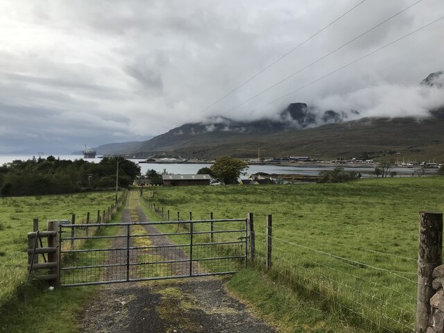
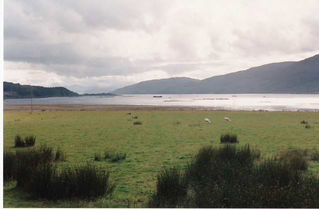
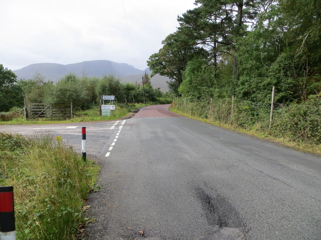
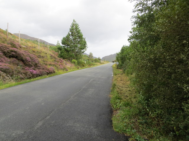
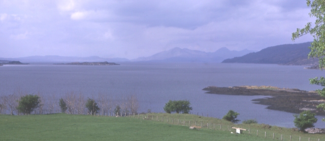
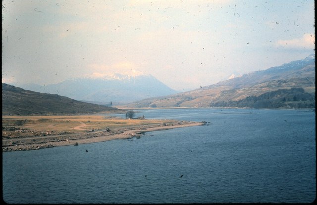
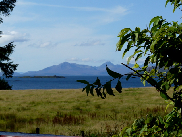
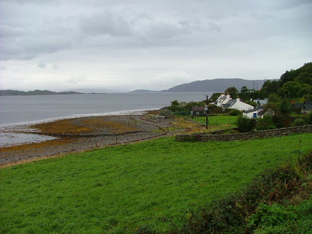
Achantraid is a small village located in the county of Ross-shire, Scotland. Situated on the western shores of the picturesque Loch Carron, the village offers breathtaking views of the surrounding mountains and the tranquil waters of the loch.

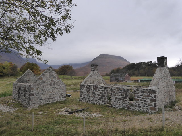
With a population of around 150 people, Achantraid is a close-knit community that benefits from its peaceful and idyllic setting. The village is primarily residential, with a mix of traditional stone cottages and modern houses. Many of the residents are employed in nearby towns such as Strathcarron and Kyle of Lochalsh, which provide amenities and services.

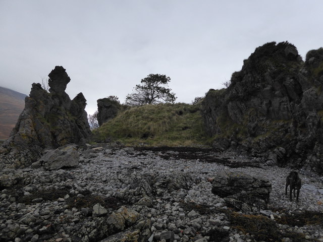
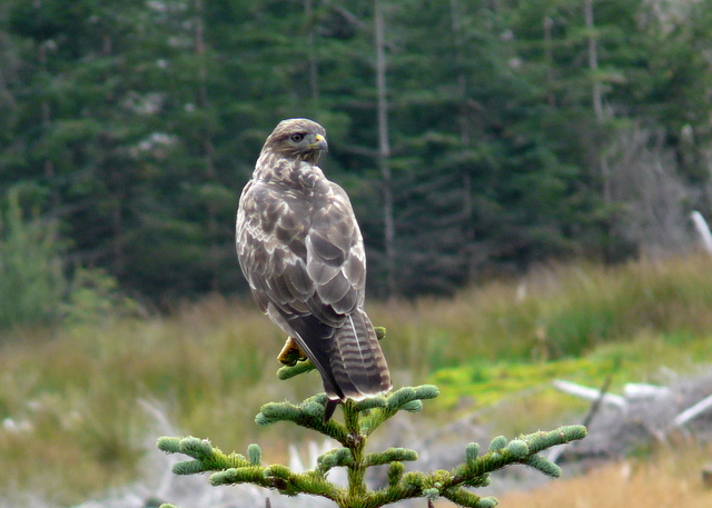
The main attraction of Achantraid is undoubtedly its natural beauty. The loch provides opportunities for fishing and boating, attracting both locals and tourists. The surrounding mountains and hills offer excellent hiking and walking trails, allowing visitors to immerse themselves in the stunning Scottish Highlands scenery. Wildlife enthusiasts will also find plenty to explore, with an array of bird species and occasional sightings of red deer and otters.

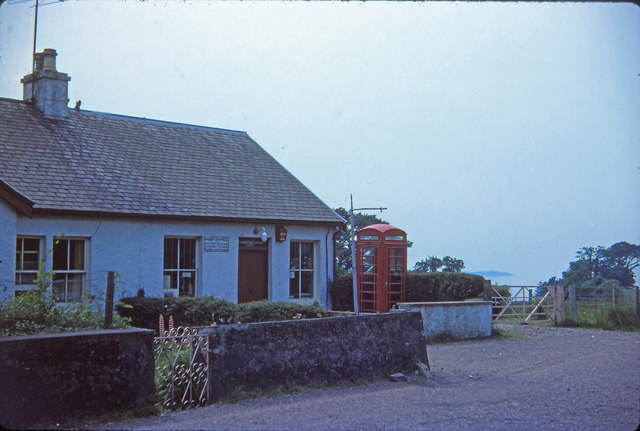
Although Achantraid is a quiet village, it benefits from its proximity to nearby towns, which provide essential services such as schools, medical facilities, and shopping options. The village also hosts a small community hall, where locals gather for social events and activities.

Overall, Achantraid is a charming Highland village that offers a peaceful and picturesque setting for residents and visitors alike. Its natural beauty and friendly community make it a desirable place to live or explore for those seeking a serene escape in the Scottish countryside.

If you have any feedback on the listing, please let us know in the comments section below.
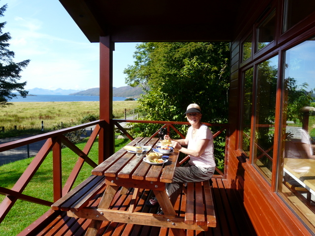
Achantraid Images

Images are sourced within 2km of 57.388694/-5.5958718 or Grid Reference NG8338. Thanks to Geograph Open Source API. All images are credited.

Seafield and Kishorn Port Viewed from the A896. The vessel is the ‘Voyageur Spirit’ a floating Storage / Production vessel. The Seafield Centre can be seen at the end of the track.
Seafield and Kishorn Port
Viewed from the A896. The vessel is the ‘Voyageur Spirit’ a floating Storage / Production vessel. The Seafield Centre can be seen at the end of the track.
Eroded rocks at Seafield, Kishorn
Ruined houses at Seafield,  Kishorn
Ruined houses at Seafield, Kishorn
Kishorn Post Office Kishorn Post Office in 1976
Kishorn Post Office
Kishorn Post Office in 1976
Loch Kishorn Another holiday photo - a rare one when it was not raining. Taken on film and scanned 25 years later.
Loch Kishorn
Another holiday photo - a rare one when it was not raining. Taken on film and scanned 25 years later.
Old Milestone by the A896, east of Sanachan, Lochcarron parish Stone post by the A896, in parish of Lochcarron (Highland District), East of Sanachan, on high banking in felled forestry.

Inscription once read:-
(Shieldaig)
(11)
(Lochcarron)
(5)

Surveyed

Milestone Society National ID: HI_LCTR04
Old Milestone by the A896, east of Sanachan, Lochcarron parish
Stone post by the A896, in parish of Lochcarron (Highland District), East of Sanachan, on high banking in felled forestry. Inscription once read:- (Shieldaig) (11) (Lochcarron) (5) Surveyed Milestone Society National ID: HI_LCTR04
Old Milestone by the A896, near Seafield House, Lochcarron parish Stone post by the A896, in parish of Lochcarron (Highland District), Seafield House, near yellow gates.

Inscription once read:-
(Shieldaig)
(10)
(Lochcarron)
(2)

Surveyed

Milestone Society National ID: HI_LCTR05
Old Milestone by the A896, near Seafield House, Lochcarron parish
Stone post by the A896, in parish of Lochcarron (Highland District), Seafield House, near yellow gates. Inscription once read:- (Shieldaig) (10) (Lochcarron) (2) Surveyed Milestone Society National ID: HI_LCTR05
Road (A896) heading towards Kishorn Looking north-westward from the junction with the road from Ardarroch.
Road (A896) heading towards Kishorn
Looking north-westward from the junction with the road from Ardarroch.
Road (A896) near Sanachan Looking eastward in the direction of Lochcarron.
Road (A896) near Sanachan
Looking eastward in the direction of Lochcarron.
Ruins of Courthill House at Kishorn
Loch Kishorn Looking across from the Bealach na Bà road across Loch Kishorn. The nearest promontory is just south of Courthill, and the next ones are at Ardarroch. The hill on the left is An Sgurr and further away, on the right, is Bad a' Chreamhna.
Loch Kishorn
Looking across from the Bealach na Bà road across Loch Kishorn. The nearest promontory is just south of Courthill, and the next ones are at Ardarroch. The hill on the left is An Sgurr and further away, on the right, is Bad a' Chreamhna.
Loch Kishorn Looking south-west from near Sanachan. The small island at left of centre is Kishorn Island, and in the background is the Isle of Skye.
Loch Kishorn
Looking south-west from near Sanachan. The small island at left of centre is Kishorn Island, and in the background is the Isle of Skye.
New Gate At Sanachan forestry plantation
New Gate
At Sanachan forestry plantation
Kishorn Seafood Bar Small, unpretentious, friendly, comfortable. And the seafood is great. What travel brochures call a 'hidden gem', but not for long, judging by its coverage on the websites.
Kishorn Seafood Bar
Small, unpretentious, friendly, comfortable. And the seafood is great. What travel brochures call a 'hidden gem', but not for long, judging by its coverage on the websites.
Kishorn estuary From the air, on a flight from Kishorn fabrication yard towards Loch Carron. The mountain in the far distance is Beinn Damh in <a href="https://www.geograph.org.uk/gridref/NG8850">NG8850</a>.
Kishorn estuary
From the air, on a flight from Kishorn fabrication yard towards Loch Carron. The mountain in the far distance is Beinn Damh in NG8850.
Watchful buzzard
Watchful buzzard
Loch Kishorn, from the seafood bar
The seafood bar at Loch Kishorn
Show me another place!

Achantraid is located at Grid Ref: NG8338 (Lat: 57.388694, Lng: -5.5958718)

Unitary Authority: Highland

Police Authority: Highlands and Islands

Also known as: Achintraid

What 3 Words

///quail.grounding.pump. Near Lochcarron, Highland

Related Wikis

Achintraid

Achintraid (Scottish Gaelic: Achadh na Tràghad) is a small one-time crofting township, situated at the north-eastern end of the sea loch Loch Kishorn,...

Ardarroch

Ardarroch is a small hamlet, located in what is commonly known as the Kishorn area, on the north east shore of Loch Kishorn, within the Strathcarron...

An Sgùrr (Lochcarron)

An Sgùrr is a hill in Scotland, occupying the broad peninsula between Loch Carron and Loch Kishorn. It has the appearance of a rough knoll, with small...

Loch Kishorn

Loch Kishorn (Scottish Gaelic: Ciseòrn) is a sea loch in the north-west Highlands of Scotland. Kishorn is a collective name used to refer to a group of...

Bad a' Chreamha

Bad a' Chreamha is a small hill in Scotland, occupying the broad peninsula between Loch Carron and Loch Kishorn. It consists of a long low ridge; the northwestern...

Ardaneaskan

Ardaneaskan (Scottish Gaelic: Àird nan Easgann) is a village on the north shore of Loch Carron in Strathcarron, Ross-shire, in Highland, and is within...
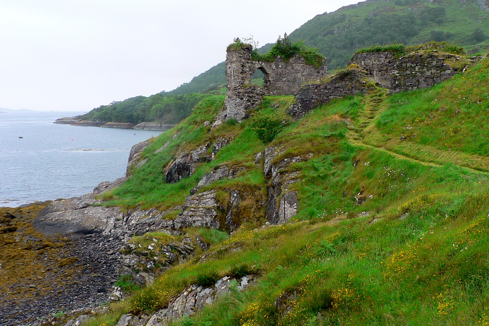
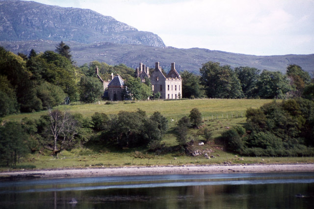
Strome Castle

Strome Castle is a ruined castle on the shore of Loch Carron in Stromemore, 3.5 miles south-west of the village of Lochcarron, on the headland between...

Stromeferry railway station

Stromeferry railway station is a station on the Kyle of Lochalsh Line, serving the village of Stromeferry in the Highlands, northern Scotland. Stromeferry...

Related Videos

Road Trip Drive With Music From Applecross On History Visit To Western Highlands Scotland

Tour Scotland 4K travel video, with Scottish bagpipes music, of a road trip drive on the North Coast 500 route from Applecross ...

Sgurr a Chaorachain

This mountain overlooks the tiny village of Ardarroch where our cabin is, also fascinating views of Loch Kishorn, Loch Carron, ...
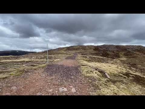
Nearby Amenities

Located within 500m of 57.388694,-5.5958718
Source: PGS
Lat/Long: 57.3927327/-5.5960798
Source: PGS
Lat/Long: 57.3923877/-5.5961192
Source: PGS
Lat/Long: 57.392098/-5.5964144
Source: PGS
Lat/Long: 57.3920001/-5.5963192
Source: PGS
Lat/Long: 57.3915295/-5.5971756
Source: PGS
Lat/Long: 57.3913134/-5.5972367
Source: PGS
Lat/Long: 57.3913831/-5.5969725
Source: PGS
Lat/Long: 57.3903727/-5.5947948
Source: PGS
Lat/Long: 57.390578/-5.594521
Created By: Merkaartor 0.12
Lat/Long: 57.3927823/-5.5930387
Created By: Merkaartor 0.12
Lat/Long: 57.3920597/-5.5931353
Created By: Merkaartor 0.12
Lat/Long: 57.3918081/-5.5933069
Created By: Merkaartor 0.12
Lat/Long: 57.3907067/-5.5937844
Created By: Merkaartor 0.12
Lat/Long: 57.3903375/-5.5942999
Created By: Merkaartor 0.12
Lat/Long: 57.3891513/-5.5954473
Created By: Merkaartor 0.12
Lat/Long: 57.386983/-5.599594
Post Box
Collection Times: Mo-Sa 09:15
Ref: IV54 234
Royal Cypher: scottish_crown
Source: survey
Lat/Long: 57.3886758/-5.5959463
Created By: Merkaartor 0.12
Lat/Long: 57.3912878/-5.5928241
Ford: yes
Lat/Long: 57.3864675/-5.5893799
Bus Stop
Mission Hall
Bench: no
Bin: no
Lit: yes
Naptan AtcoCode: 6700712352
Naptan Bearing: E
Naptan CommonName: Mission Hall
Naptan Indicator: o/s
Naptan Landmark: Mission Hall
Naptan NaptanCode: 45327683
Naptan Street: Ardaneaskan Road
Naptan Verified: no
Shelter: no
Source: naptan_import
Tactile Paving: no
Lat/Long: 57.386586/-5.601926
Bus Stop
Hotel Road End
Bench: no
Bin: no
Lit: yes
Local Ref: AT
Naptan AtcoCode: 6700713514
Naptan Bearing: NE
Naptan CommonName: Hotel Road End
Naptan Indicator: at
Naptan Landmark: Loch Kishorn Hotel
Naptan NaptanCode: 45328929
Naptan Street: Achintraid Road
Naptan Verified: no
Shelter: no
Source: naptan_import
Tactile Paving: no
Lat/Long: 57.3865851/-5.6019592
Ford: yes
Lat/Long: 57.3884345/-5.5955763
Achintraid
Alt Name: Achantraid
Name En: Achintraid
Name Gd: Achadh na Tràghad
Place: hamlet
Source: OS_OpenData_Streetview
Lat/Long: 57.3886516/-5.5947047
Material: wood
Power: pole
Lat/Long: 57.3904314/-5.5931004
Material: wood
Power: pole
Lat/Long: 57.3907311/-5.5937107
Material: wood
Power: pole
Lat/Long: 57.3917735/-5.5955497
Power: pole
Lat/Long: 57.3893209/-5.5936877
Power: pole
Lat/Long: 57.3893377/-5.5946737
Material: wood
Power: pole
Lat/Long: 57.3883386/-5.5953037
Material: wood
Power: pole
Lat/Long: 57.386209/-5.6014878
Power: pole
Lat/Long: 57.3864513/-5.5989006
Power: pole
Lat/Long: 57.3871305/-5.5975093
Material: wood
Power: pole
Lat/Long: 57.3875557/-5.5966383
Material: wood
Power: pole
Lat/Long: 57.3879978/-5.5961067
Material: wood
Power: pole
Lat/Long: 57.3882064/-5.5956367
Power: pole
Lat/Long: 57.3890353/-5.5927682
The data included in this document is from www.openstreetmap.org. The data is made available under ODbL.

Have you been to Achantraid?

Leave your review of Achantraid below (or comments, questions and feedback).