Barleyhole Rocks

Island in Berwickshire

Scotland

Barleyhole Rocks

Dowlaw Dean
Dowlaw Dean Credit: Rob Wallace

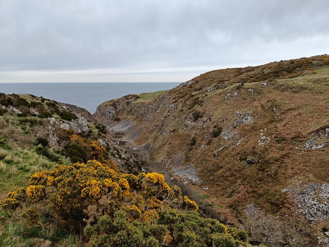
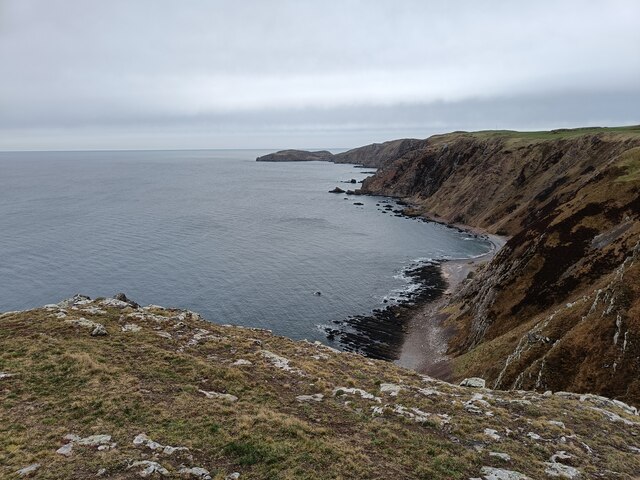
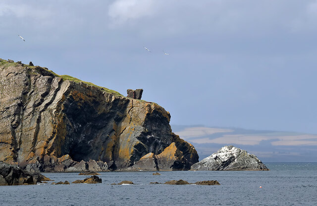
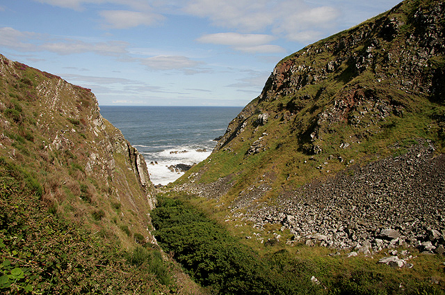
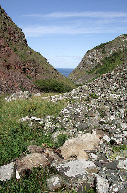
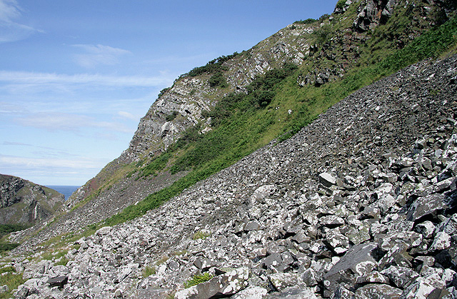
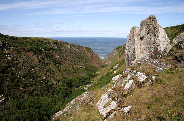
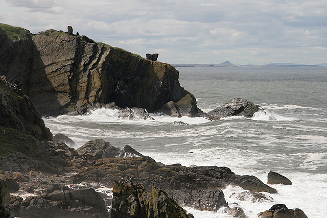
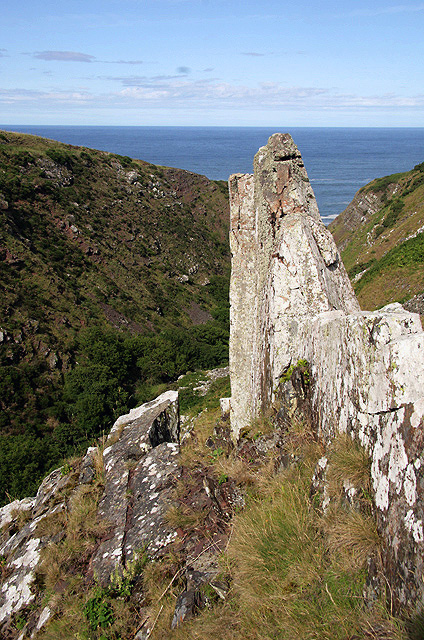
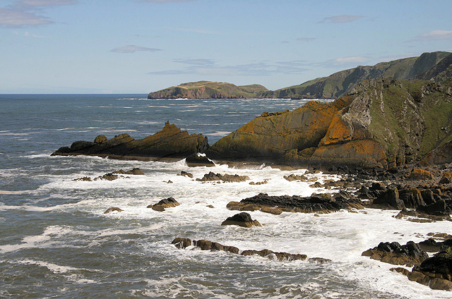
Barleyhole Rocks is a small island located off the coast of Berwickshire, Scotland. Situated in the North Sea, this rocky outcrop measures approximately 1.5 acres in size and is known for its striking geological features and abundant wildlife.

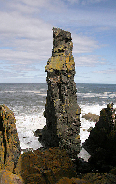
The island gets its name from the prominent barley-shaped hole found in one of the rocks, which is believed to have been formed through years of erosion by the crashing waves. This unique formation has become a popular attraction for visitors, drawing in nature enthusiasts and rock climbers alike.

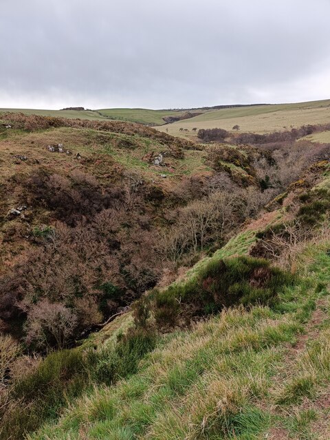
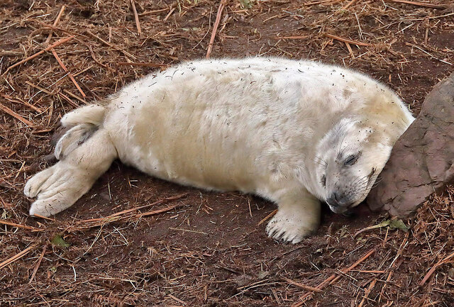
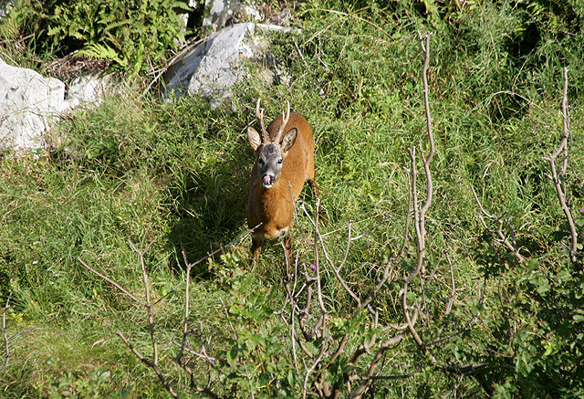
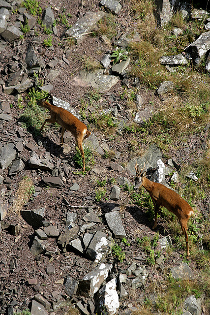
The rugged terrain of Barleyhole Rocks offers a diverse habitat for a variety of wildlife. Seabirds such as puffins, guillemots, and kittiwakes can be seen nesting on the cliffs, while seals frequently visit the surrounding waters. The island's remote location also provides a safe haven for marine life, including various species of fish and crustaceans.

Access to Barleyhole Rocks is limited due to its isolated location and rough seas. However, guided boat tours are available during the summer months, allowing visitors the opportunity to explore the island and appreciate its natural beauty. It is important to note that the island is a protected area, ensuring the preservation of its fragile ecosystem.

Overall, Barleyhole Rocks offers a unique experience for those seeking to immerse themselves in the untamed beauty of Scotland's coastal landscapes. Its geological features and diverse wildlife make it a hidden gem worth exploring for nature lovers and adventure seekers.

If you have any feedback on the listing, please let us know in the comments section below.

Barleyhole Rocks Images

Images are sourced within 2km of 55.922125/-2.1906945 or Grid Reference NT8869. Thanks to Geograph Open Source API. All images are credited.

Dowlaw Dean
Dowlaw Dean
Looking south and inland along Dowlaw Dean
Small pond with derelict building near Brander Heugh The small derelict building is the remains of a WW2 marker shelter for an aircraft firing range - more detail here: <a title="https://www.geograph.org.uk/photo/1762799" href="https://www.geograph.org.uk/photo/1762799">Link</a>
Small pond with derelict building near Brander Heugh
The small derelict building is the remains of a WW2 marker shelter for an aircraft firing range - more detail here: Link
Looking down from Brander Heugh towards Lumsdaine Shore
A snoozing grey seal pup at Lumsdaine Shore The seal was photographed with a telephoto lens from the hillside above the shore. Most of the grey seal pups were wiped out last year by Storm Arwen, but they were back to normal numbers this year.
A snoozing grey seal pup at Lumsdaine Shore
The seal was photographed with a telephoto lens from the hillside above the shore. Most of the grey seal pups were wiped out last year by Storm Arwen, but they were back to normal numbers this year.
The Berwickshire Coast at Meg Watson’s Craig This telephoto shot showing some remains of Fast Castle was taken from a boat. For a similar view of this area from the land, see <a href="https://www.geograph.org.uk/photo/2549015">NT8670 : The rocky Berwickshire coast</a>.
The Berwickshire Coast at Meg Watson’s Craig
This telephoto shot showing some remains of Fast Castle was taken from a boat. For a similar view of this area from the land, see NT8670 : The rocky Berwickshire coast.
Dowlaw Dean The Dowlaw Burn runs through this ravine into the North Sea.
Dowlaw Dean
The Dowlaw Burn runs through this ravine into the North Sea.
A roe deer in Dowlaw Dean As I carefully descended into the steep-sided ravine I disturbed two roe deer grazing by the Dowlaw Burn. This is a male deer looking defiantly up towards me.
A roe deer in Dowlaw Dean
As I carefully descended into the steep-sided ravine I disturbed two roe deer grazing by the Dowlaw Burn. This is a male deer looking defiantly up towards me.
Dowlaw Dean The Dowlaw Burn runs through this ravine into the North Sea. There has been a lot of rock fall from the southeast side of the ravine and the two sheep carcases in the foreground are proof of the treacherous nature of the unstable sides of the ravine.
Dowlaw Dean
The Dowlaw Burn runs through this ravine into the North Sea. There has been a lot of rock fall from the southeast side of the ravine and the two sheep carcases in the foreground are proof of the treacherous nature of the unstable sides of the ravine.
Roe deer in Dowlaw Dean As I carefully descended into the steep-sided ravine I disturbed a couple of roe deer grazing by the Dowlaw Burn. They watched me for a while and then climbed up the southeast side of the ravine. A female is on the left with a male on the right.
Roe deer in Dowlaw Dean
As I carefully descended into the steep-sided ravine I disturbed a couple of roe deer grazing by the Dowlaw Burn. They watched me for a while and then climbed up the southeast side of the ravine. A female is on the left with a male on the right.
Dowlaw Dean The Dowlaw Burn runs through this rocky ravine into the North Sea. There has been a lot of rock fall on the southeast side of the ravine.
Dowlaw Dean
The Dowlaw Burn runs through this rocky ravine into the North Sea. There has been a lot of rock fall on the southeast side of the ravine.
Dowlaw Dean The Dowlaw Burn runs through this ravine into the North Sea.
Dowlaw Dean
The Dowlaw Burn runs through this ravine into the North Sea.
The rocky Berwickshire coast This is a view towards Fast Castle Head with the fragmentary remains of Fast Castle silhouetted against a grey sky.
The rocky Berwickshire coast
This is a view towards Fast Castle Head with the fragmentary remains of Fast Castle silhouetted against a grey sky.
The Souter This 30m high sea stack is on the Berwickshire Coast near Dowlaw Dean. The ordinary climbing route up this small stack is graded HVS/E1 5a while another route called Squid Vicious is graded E5 6a. The first ascent was by Robin Campbell and Dave Bathgate in 1965.
The Souter
This 30m high sea stack is on the Berwickshire Coast near Dowlaw Dean. The ordinary climbing route up this small stack is graded HVS/E1 5a while another route called Squid Vicious is graded E5 6a. The first ascent was by Robin Campbell and Dave Bathgate in 1965.
Dowlaw Dean This rock outcrop is high on the southeast side of this ravine where the Dowlaw Burn runs into the North Sea.
Dowlaw Dean
This rock outcrop is high on the southeast side of this ravine where the Dowlaw Burn runs into the North Sea.
The Berwickshire coast This is a view from the headland on the northwest side of Dowlaw Dean towards Brander in the middle ground and St Abb’s Head in the background.
The Berwickshire coast
This is a view from the headland on the northwest side of Dowlaw Dean towards Brander in the middle ground and St Abb’s Head in the background.
A rusting wreck at Dowlaw This old threshing machine lies abandoned near the head of Dowlaw Dean.
A rusting wreck at Dowlaw
This old threshing machine lies abandoned near the head of Dowlaw Dean.
The coastline near the Souter Waves crash over the rocks near the Souter <a href="https://www.geograph.org.uk/photo/2549020">NT8670 : The Souter</a>.
The coastline near the Souter
Waves crash over the rocks near the Souter NT8670 : The Souter.
Show me another place!

Barleyhole Rocks is located at Grid Ref: NT8869 (Lat: 55.922125, Lng: -2.1906945)

Unitary Authority: The Scottish Borders

Police Authority: The Lothians and Scottish Borders

What 3 Words

///work.straddled.hired. Near Eyemouth, Scottish Borders

Related Wikis

Coldingham Loch

Coldingham Loch is a freshwater loch in the parish of Coldingham, in the Scottish Borders area of Scotland, in the former Berwickshire, between Coldingham...

St Abb's Head Lighthouse

St Abb's Head Lighthouse stands on the cliffs at the rocky promontory of St Abb's Head, near the village of St Abbs in Berwickshire. A signal station was...

St Abb's Head

St Abb's Head is a rocky promontory by the village of St Abbs in Scottish Borders, Scotland, and a national nature reserve administered by the National...

Mire Loch

Mire Loch is a man made freshwater loch situated on St Abb's Head in the Scottish Borders, just over a kilometre NW of the village of St. Abbs at grid...

Nearby Amenities

Located within 500m of 55.922125,-2.1906945
Barrier: kissing_gate
Lat/Long: 55.9205674/-2.19276
Admiralty Distance Pole
Man Made: tower
Lat/Long: 55.919158/-2.1880337
The data included in this document is from www.openstreetmap.org. The data is made available under ODbL.

Have you been to Barleyhole Rocks?

Leave your review of Barleyhole Rocks below (or comments, questions and feedback).