Maws Craig

Island in Kincardineshire

Scotland

Maws Craig

S entrance to a through cave at Powdam The tall triangle in line with the kayak bow is the S entrance to a cave which turns right and out on the far side. Only navigable at high tide and very low swell. Powdam is round the corner and left.
S entrance to a through cave at Powdam Credit: Nigel Feilden

Maws Craig is a small island located off the coast of Kincardineshire, Scotland. The island is situated in the North Sea, approximately 2 miles east of Stonehaven. It has a total area of about 4 acres and is primarily composed of rugged cliffs and rocky terrain.

The name Maws Craig originates from the Scottish Gaelic words "maw" meaning "gull" and "craig" meaning "rock." This is fitting as the island is known to be a popular nesting site for various seabirds, including gulls and puffins. The cliffs provide ideal conditions for these birds to breed and raise their young.

Access to Maws Craig is limited due to its remote location and the treacherous nature of the surrounding waters. However, it can be viewed from the mainland, particularly from the nearby Dunnottar Castle, which offers stunning panoramic views of the island and its rugged coastline.

The island has a rich history, with evidence of human occupation dating back to the Iron Age. It is believed to have been used as a defensive site due to its strategic position and the natural protection provided by the cliffs. Today, remnants of ancient structures and fortifications can still be observed.

Maws Craig is also a popular destination for wildlife enthusiasts and photographers, who visit to capture the beauty of the nesting birds and the dramatic landscape. Overall, Maws Craig offers a unique and scenic experience for those who appreciate nature and history.

If you have any feedback on the listing, please let us know in the comments section below.

Maws Craig Images

Images are sourced within 2km of 56.863276/-2.2323163 or Grid Reference NO8574. Thanks to Geograph Open Source API. All images are credited.

S entrance to a through cave at Powdam The tall triangle in line with the kayak bow is the S entrance to a cave which turns right and out on the far side. Only navigable at high tide and very low swell. Powdam is round the corner and left.
S entrance to a through cave at Powdam
The tall triangle in line with the kayak bow is the S entrance to a cave which turns right and out on the far side. Only navigable at high tide and very low swell. Powdam is round the corner and left.
E entrance to a through cave at Powdam Shows the sun shining through the S entrance. See <a href="https://www.geograph.org.uk/photo/6916374">NO8676 : S entrance to a through cave at Powdam</a>. Navigable near high tide with a very low swell. The S tunnel is narrow and the W wall leans E.
E entrance to a through cave at Powdam
Shows the sun shining through the S entrance. See NO8676 : S entrance to a through cave at Powdam. Navigable near high tide with a very low swell. The S tunnel is narrow and the W wall leans E.
Sill exposed on Darn Bay cliff The sill runs from half way up the left of the frame to the top of the cliff on the right in a very flattened S curve. Samples taken on 22 Dec 21 were consistent with lava. If this is an offshoot of the dyke shown on the BGS overlay about 100m to the left (W), then it is a 'North Britain Siluro-devonian Calc-alkaline Dyke Suite - Microgranite'. The rest of the cliffs are Gourdon conglomerate with interbedded sandstone layers.
Sill exposed on Darn Bay cliff
The sill runs from half way up the left of the frame to the top of the cliff on the right in a very flattened S curve. Samples taken on 22 Dec 21 were consistent with lava. If this is an offshoot of the dyke shown on the BGS overlay about 100m to the left (W), then it is a 'North Britain Siluro-devonian Calc-alkaline Dyke Suite - Microgranite'. The rest of the cliffs are Gourdon conglomerate with interbedded sandstone layers.
Coarse conglomerate in the cliffs above Darn Bay Some of the rounded stones are getting on for a metre across - compare the fence posts above. The BGS has 'Rob's Cove Conglomerate Member - Conglomerate'
Coarse conglomerate in the cliffs above Darn Bay
Some of the rounded stones are getting on for a metre across - compare the fence posts above. The BGS has 'Rob's Cove Conglomerate Member - Conglomerate'
Hallhill Farm A farm overlooking the sea by Todhead.
Hallhill Farm
A farm overlooking the sea by Todhead.
Red soil of the Mearns A tilled field by Kinneff showing the red soil of the Mearns and the blue of the sea in the distance, both portrayed in the literature on local author Lewis Grassic Gibbon.
Red soil of the Mearns
A tilled field by Kinneff showing the red soil of the Mearns and the blue of the sea in the distance, both portrayed in the literature on local author Lewis Grassic Gibbon.
Southern approach to Catterline Photographer is above the pavement surface of the minor road
Southern approach to Catterline
Photographer is above the pavement surface of the minor road
Stubble, Grange The haar just reveals piles of manure and an explanation for the mud.
Stubble, Grange
The haar just reveals piles of manure and an explanation for the mud.
Wheat, Kinneff Some fields here had been harvested, but this wheat was still green.
Wheat, Kinneff
Some fields here had been harvested, but this wheat was still green.
Kirkcorner A minor road at Kinneff in the wretched haar.
Kirkcorner
A minor road at Kinneff in the wretched haar.
Minor road, Kinneff The photographer is standing on the pavement surface of the minor road, and waiting for the haar to go.
Minor road, Kinneff
The photographer is standing on the pavement surface of the minor road, and waiting for the haar to go.
Large open tank, Wardhead
Haar Kinneff on the Kincardineshire coast during a prolonged period of coastal fog.
Haar
Kinneff on the Kincardineshire coast during a prolonged period of coastal fog.
Minor road near Whistleberry A prolonged period of haar.
Minor road near Whistleberry
A prolonged period of haar.
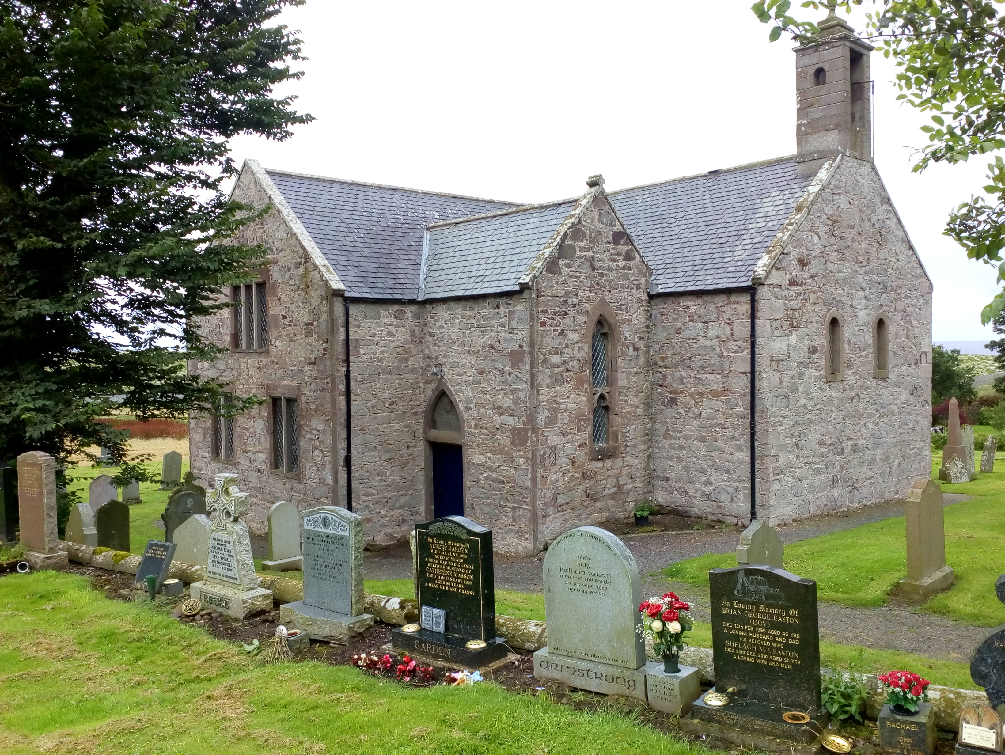
The Old Kirk, Kinneff
Old Kirk, Kinneff The church was largely rebuilt in 1738, but incorporates older parts.
Old Kirk, Kinneff
The church was largely rebuilt in 1738, but incorporates older parts.
Kinneff Kirk interior The church is famous for the part it played in the concealment of the Scottish crown jewels in 1652 to prevent them falling into the hands of Cromwell's army of occupation. They were hidden under the floor of the church, somewhere in front of the pulpit, and recovered after Charles II was restored to the throne in 1660.

See <a href="https://www.geograph.org.uk/photo/2179373">NT2573 : Restoring the Honours of Scotland tableau, Edinburgh Castle</a>
Kinneff Kirk interior
The church is famous for the part it played in the concealment of the Scottish crown jewels in 1652 to prevent them falling into the hands of Cromwell's army of occupation. They were hidden under the floor of the church, somewhere in front of the pulpit, and recovered after Charles II was restored to the throne in 1660. See NT2573 : Restoring the Honours of Scotland tableau, Edinburgh Castle
Rev. Grainger Monument, Kinneff Old Kirk Memorial commemorating the Rev. James Grainger and his part in saving the Scottish regalia (the 'Honours of Scotland') from Cromwell's army of occupation by concealing them beneath the church floor. It bears the rather overblown Victorian inscription,

"Behold the spot where Grainger's ashes lie,
Who from besieged Dunnottar safe conveyed
The insignia of Scotland's Royalty,
And in this hallowed ground in secret laid,
Where now he rests himself, Heaven shall bestow
Meet recompense on such desert as his;
He, who his country's honour saved below,
Now wields a sceptre in the Realms of Bliss."

True to form, the man gets all the credit, though it was in fact his wife who also risked imprisonment or worse by smuggling the Honours out of Dunnottar. See <a href="https://www.geograph.org.uk/photo/2179369">NT2573 : Saving the Honours of Scotland tableau, Edinburgh Castle</a>
Rev. Grainger Monument, Kinneff Old Kirk
Memorial commemorating the Rev. James Grainger and his part in saving the Scottish regalia (the 'Honours of Scotland') from Cromwell's army of occupation by concealing them beneath the church floor. It bears the rather overblown Victorian inscription, "Behold the spot where Grainger's ashes lie, Who from besieged Dunnottar safe conveyed The insignia of Scotland's Royalty, And in this hallowed ground in secret laid, Where now he rests himself, Heaven shall bestow Meet recompense on such desert as his; He, who his country's honour saved below, Now wields a sceptre in the Realms of Bliss." True to form, the man gets all the credit, though it was in fact his wife who also risked imprisonment or worse by smuggling the Honours out of Dunnottar. See NT2573 : Saving the Honours of Scotland tableau, Edinburgh Castle
Show me another place!

Maws Craig is located at Grid Ref: NO8574 (Lat: 56.863276, Lng: -2.2323163)

Unitary Authority: Aberdeenshire

Police Authority: North East

What 3 Words

///object.triangle.nylon. Near Inverbervie, Aberdeenshire

Related Wikis

Kinneff

Kinneff is a roadside hamlet in Aberdeenshire, Scotland, just north of Inverbervie. To the north lies another hamlet, Catterline. Kinneff also has a primary...

Bervie Water

Bervie Water (Scottish Gaelic: Uisge Bhiorbhaigh) is a river in Aberdeenshire, Scotland which rises in the Drumtochty Forest and flows across The Mearns...

Inverbervie railway station

Bervie railway station served the town of Inverbervie, Aberdeenshire, Scotland from 1865 to 1966 on the Montrose and Bervie Railway. == History == The...

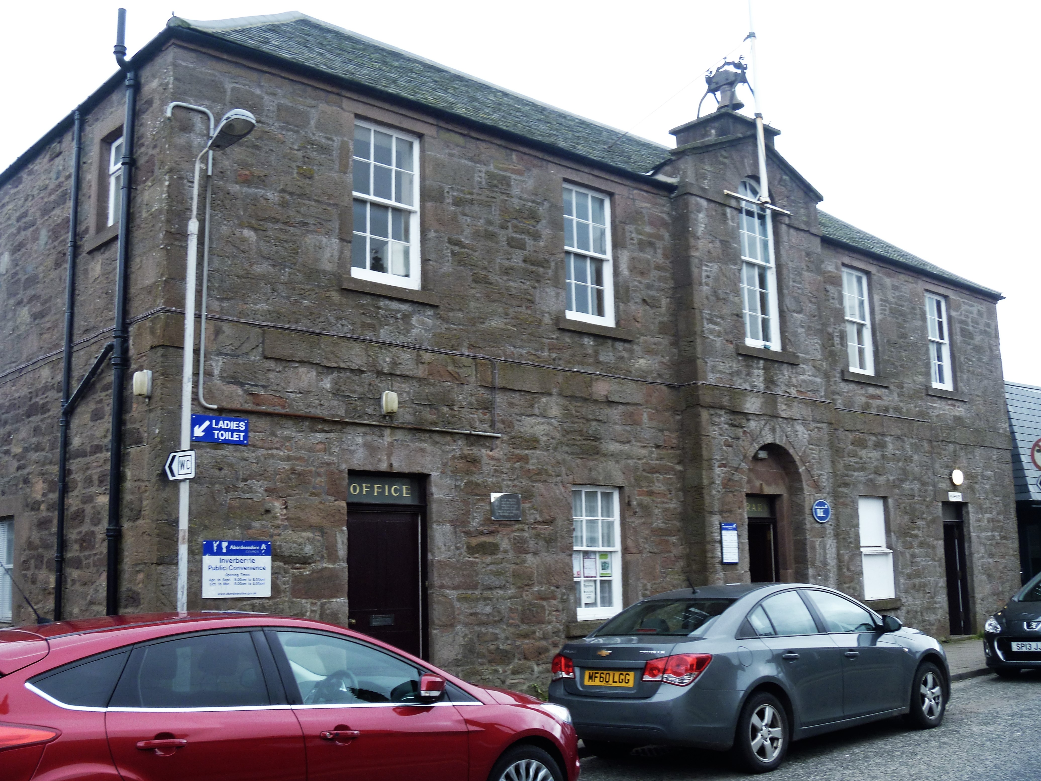
Inverbervie Town House

Inverbervie Town House is a municipal structure in Church Street in Inverbervie, Aberdeenshire, Scotland. The structure, which is primarily used as a public...

Inverbervie

Inverbervie (from Scottish Gaelic: Inbhir Biorbhaidh or Biorbhaigh, "mouth of the River Bervie") is a small town on the north-east coast of Scotland, south...

Catterline

Catterline is a coastal village on the North Sea in Aberdeenshire, Scotland. It is situated about 5 miles (8.0 km) south of Stonehaven; nearby to the...

Allardice Castle

Allardice Castle (also spelled Allardyce) is a sixteenth-century manor house in Kincardineshire, Scotland. It is approximately 1.5 kilometres north-west...

Gourdon railway station (NBR)

Gourdon railway station served the village of Gourdon, Aberdeenshire, Scotland from 1865 to 1951 on the Montrose and Bervie Railway. == History == The...

Nearby Amenities

Located within 500m of 56.863276,-2.2323163
Source: PGS
Lat/Long: 56.8602676/-2.2382797
Created By: almien_coastlines
Source: PGS
Lat/Long: 56.86053/-2.238288
Created By: almien_coastlines
Source: PGS
Lat/Long: 56.860657/-2.238052
Created By: almien_coastlines
Source: PGS
Lat/Long: 56.860783/-2.237815
Created By: almien_coastlines
Source: PGS
Lat/Long: 56.860781/-2.237348
Source: PGS
Lat/Long: 56.8608617/-2.2370719
Source: PGS
Lat/Long: 56.861306/-2.237277
Source: PGS
Lat/Long: 56.8615779/-2.237569
Source: PGS
Lat/Long: 56.8618077/-2.2378206
Source: PGS
Lat/Long: 56.8619888/-2.2373441
Created By: almien_coastlines
Source: PGS
Lat/Long: 56.862314/-2.236849
Created By: almien_coastlines
Source: PGS
Lat/Long: 56.862441/-2.236614
Source: PGS
Lat/Long: 56.8626404/-2.2364821
Source: PGS
Lat/Long: 56.8626764/-2.2364138
Source: PGS
Lat/Long: 56.8628383/-2.2358506
Source: PGS
Lat/Long: 56.862691/-2.2357107
Source: PGS
Lat/Long: 56.862408/-2.2351261
Source: PGS
Lat/Long: 56.8624333/-2.2345387
Created By: almien_coastlines
Source: PGS
Lat/Long: 56.86255/-2.233573
Created By: almien_coastlines
Source: PGS
Lat/Long: 56.862677/-2.233337
Source: PGS
Lat/Long: 56.8632764/-2.2327409
Source: PGS
Lat/Long: 56.8639922/-2.2323868
Source: PGS
Lat/Long: 56.8641742/-2.2336966
Source: PGS
Lat/Long: 56.8644167/-2.2341728
Source: PGS
Lat/Long: 56.8645841/-2.2332501
Source: PGS
Lat/Long: 56.8653685/-2.2331643
Source: PGS
Lat/Long: 56.8652087/-2.2327958
Created By: almien_coastlines
Source: PGS
Lat/Long: 56.865104/-2.232585
Created By: almien_coastlines
Source: PGS
Lat/Long: 56.865227/-2.231648
Created By: almien_coastlines
Source: PGS
Lat/Long: 56.865484/-2.231877
Source: PGS
Lat/Long: 56.8655828/-2.2315228
Source: PGS
Lat/Long: 56.8659555/-2.2312438
Source: PGS
Lat/Long: 56.8669891/-2.2307825
Source: PGS
Lat/Long: 56.8672471/-2.2304392
Created By: almien_coastlines
Source: PGS
Lat/Long: 56.867524/-2.230433
Kinneff
Place: hamlet
Lat/Long: 56.8648744/-2.2379517
Shield Hill
Alt Name: Shieldhill
Note: apparently the site of an old fishing village
Place: locality
Lat/Long: 56.8631928/-2.233221
Open Cadden
Place: locality
Lat/Long: 56.86447/-2.23369
Close Cadden
Place: locality
Lat/Long: 56.865121/-2.2330463
Crooked Haven
Natural: bay
Lat/Long: 56.8615138/-2.2358047
Swallow Cove
Natural: bay
Lat/Long: 56.8653142/-2.2311054
Power: pole
Lat/Long: 56.864512/-2.2397675
The data included in this document is from www.openstreetmap.org. The data is made available under ODbL.

Have you been to Maws Craig?

Leave your review of Maws Craig below (or comments, questions and feedback).