Clovie's Craigs
Island in Banffshire
Scotland
Clovie's Craigs
Clovie's Craigs is a picturesque island located in Banffshire, Scotland. Situated off the northeastern coast of the country, this island is known for its stunning natural beauty and rich history.
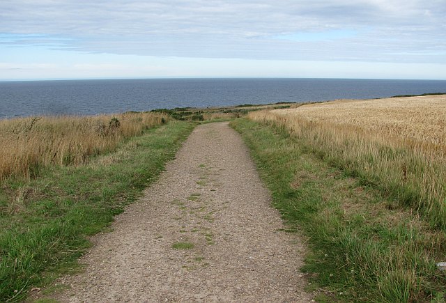
Covering an area of approximately 5 square kilometers, Clovie's Craigs is characterized by its rugged coastline, towering cliffs, and lush greenery. The island is a haven for nature enthusiasts, offering numerous opportunities for hiking, birdwatching, and wildlife spotting. Visitors can explore the island's network of trails that wind through its diverse landscapes, providing breathtaking views of the surrounding sea and mainland.
Clovie's Craigs is also home to a variety of wildlife, including seabirds, seals, and occasionally even dolphins and whales. The island's secluded beaches and rocky shores provide nesting grounds for a plethora of bird species, making it a popular destination for birdwatchers.
Historically, Clovie's Craigs has been inhabited since ancient times. Evidence of Bronze Age settlements and burial sites have been discovered on the island, adding to its cultural significance. Today, remnants of these ancient settlements can still be seen, adding an air of mystery and intrigue to the island's charm.
Access to Clovie's Craigs is possible via boat, with regular ferry services available from the nearby mainland. Once on the island, visitors can enjoy the tranquility and natural beauty that this hidden gem has to offer. Whether it is exploring its rugged landscapes, immersing oneself in its rich history, or simply enjoying the serenity of its surroundings, Clovie's Craigs is a must-visit destination in Banffshire.
If you have any feedback on the listing, please let us know in the comments section below.
Clovie's Craigs Images
Images are sourced within 2km of 57.70001/-2.9068471 or Grid Reference NJ4668. Thanks to Geograph Open Source API. All images are credited.


Clovie's Craigs is located at Grid Ref: NJ4668 (Lat: 57.70001, Lng: -2.9068471)
Unitary Authority: Moray
Police Authority: North East
What 3 Words
///nerves.turkeys.pops. Near Findochty, Moray
Nearby Locations
Related Wikis
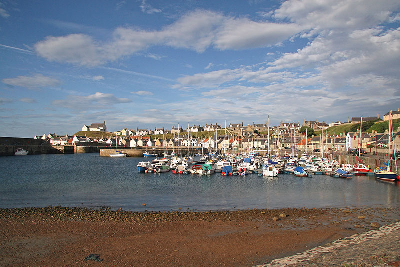
Findochty
Findochty (pronounced , Scots: Finichty, Scottish Gaelic: Am Fionn Ochdamh) is a village in Moray, Scotland, on the shores of the Moray Firth; historically...
Buckpool
Buckpool is a village on the coast of Moray, Scotland. Originally known as Nether Buckie, it is now effectively a part of the town of Buckie as the nearby...

Strathlene Golf Course
Strathlene at Findochty, near Buckie, is one of the oldest golf courses in Scotland. It was established in 1877 and is home to Strathlene Buckie Golf Club...
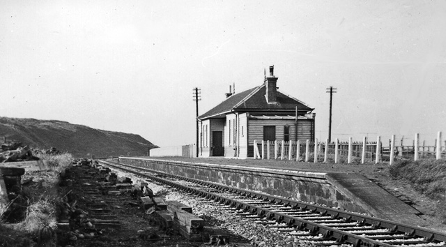
Findochty railway station
Findochty railway station was a railway station in the small fishing village of Findochty, Moray about 3 miles to the east of Buckie. The railway station...
Findochty Castle
Findochty Castle is a ruined 16th century L-plan tower house, near Findochty, Moray, Scotland, about 2.5 miles (4.0 km) north-east of Buckie, and about...
Strathlene
Strathlene is an area between Buckie and Findochty which has a caravan site facing onto the Moray Firth. At one time the Strathlene House Hotel, a former...
Tronach Castle
Tronach Castle was a castle, about 0.5 miles (0.80 km) east of Portknockie, Moray, Scotland, near the shore. == Description == The first Statistical Account...
Portessie railway station
Portessie railway station was a joint Highland Railway (HR) and Great North of Scotland Railway (GNoSR) station at the junction between the Moray Coast...
Nearby Amenities
Located within 500m of 57.70001,-2.9068471Have you been to Clovie's Craigs?
Leave your review of Clovie's Craigs below (or comments, questions and feedback).