Halliman Skerries
Island in Morayshire
Scotland
Halliman Skerries
Halliman Skerries is a group of small islands located off the coast of Morayshire, Scotland. It is situated in the Moray Firth, approximately 3 kilometers northeast of Burghead. The skerries consist of several rocky islets, with the largest one measuring around 1.2 hectares in area.
The islands are known for their stunning natural beauty and diverse wildlife. The rugged coastline features towering cliffs and sea caves, providing a habitat for numerous seabird species, including puffins, guillemots, and razorbills. These islands are a designated Special Protection Area, highlighting their importance for breeding seabirds.
Despite their small size, the skerries have a rich history. The remains of an ancient chapel and hermit's cell can be found on one of the islands, indicating that the area was inhabited in the past. The islands were also used as a hunting ground for seals and seabirds by local communities.
Access to Halliman Skerries is limited, as the islands are predominantly visited by boat or during guided tours. The turbulent waters surrounding the skerries make navigation challenging. However, for those lucky enough to visit, the islands offer a unique opportunity to experience the untamed beauty of Scotland's coastline and observe a thriving ecosystem in action.
In conclusion, Halliman Skerries, Morayshire, is a group of small islands off the coast of Scotland, renowned for their picturesque landscapes and abundant wildlife. With their historical significance and ecological importance, they provide a captivating destination for nature enthusiasts and those seeking a glimpse into Scotland's past.
If you have any feedback on the listing, please let us know in the comments section below.
Halliman Skerries Images
Images are sourced within 2km of 57.733148/-3.3212784 or Grid Reference NJ2172. Thanks to Geograph Open Source API. All images are credited.


Halliman Skerries is located at Grid Ref: NJ2172 (Lat: 57.733148, Lng: -3.3212784)
Unitary Authority: Moray
Police Authority: North East
What 3 Words
///disbelief.given.creamed. Near Lossiemouth, Moray
Nearby Locations
Related Wikis

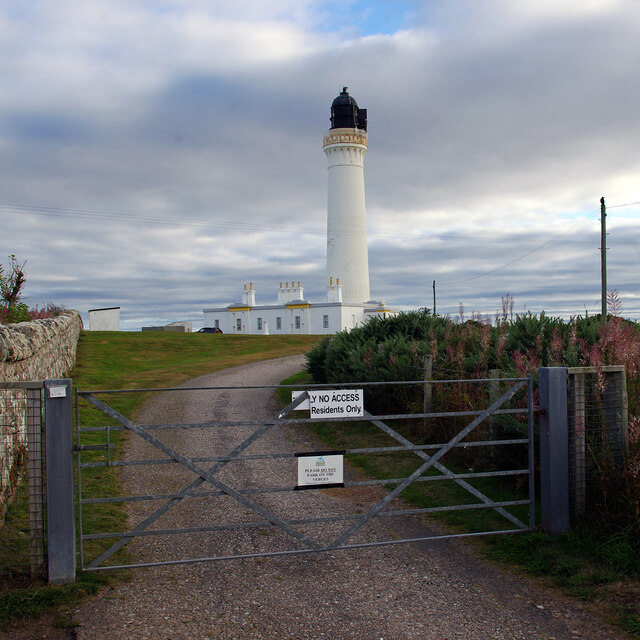
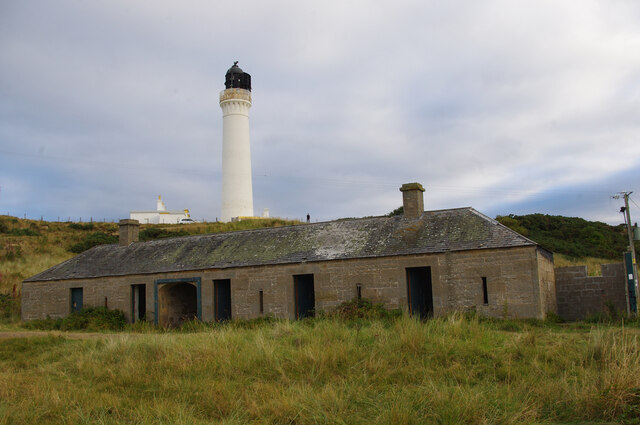
Covesea Skerries Lighthouse
Covesea Skerries Lighthouse, originally belonging to the Northern Lighthouse Board (NLB), is built on top of a small headland on the south coast of the...
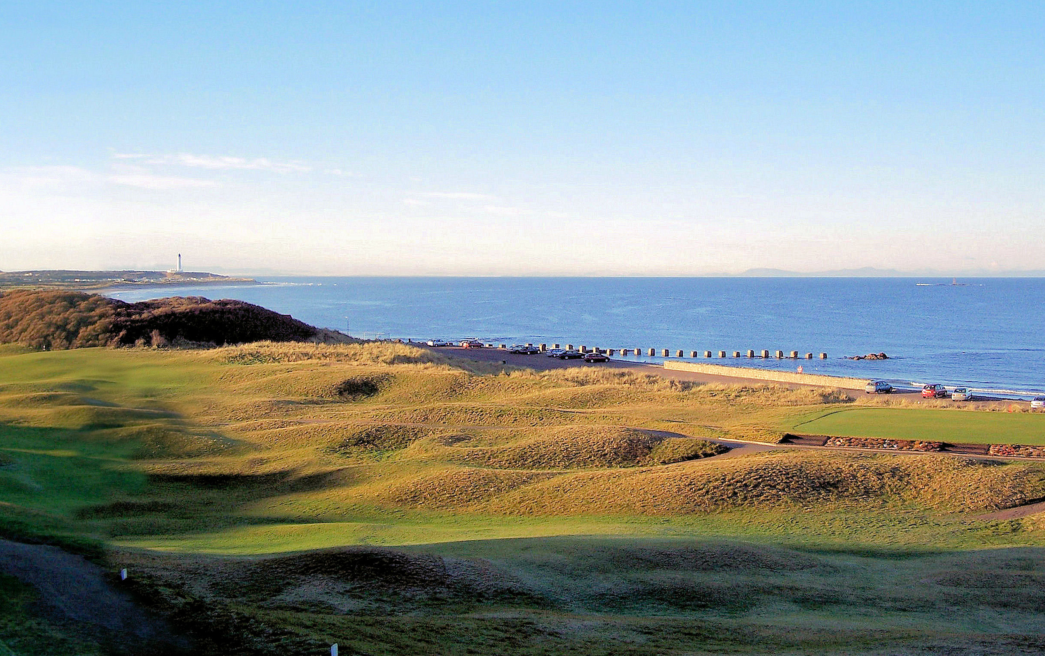
Moray Golf Club
Moray Golf Club is situated in Lossiemouth (on the south coast of the Moray Firth), Moray, Scotland. The club has two eighteen-hole courses appropriately...

Stotfield fishing disaster
The Stotfield fishing disaster was the first of several fishing disasters of the 19th century on the east coast of Scotland. A storm struck the Moray...
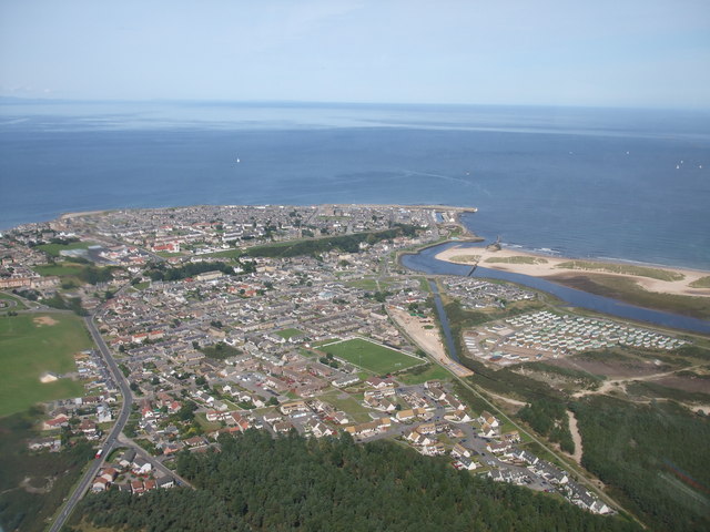
Lossiemouth
Lossiemouth (Scottish Gaelic: Inbhir Losaidh) is a town in Moray, Scotland. Originally the port belonging to Elgin, it became an important fishing town...
Lossiemouth High School
Lossiemouth High School is a secondary school in the coastal town of Lossiemouth, Moray, Scotland. The school's catchment area includes the nearby villages...

Lossiemouth Town Hall
Lossiemouth Town Hall is a municipal building in the High Street in Lossiemouth, Moray, Scotland. The building is currently used as a community events...
Kinneddar
Kinneddar is a small settlement on the outskirts of Lossiemouth in Moray, Scotland, near the main entrance to RAF Lossiemouth. Long predating the modern...
Lossiemouth railway station
Lossiemouth railway station served the town of Lossiemouth, Moray, Scotland from 1852 to 1964 on the Morayshire Railway. == History == The station opened...
Nearby Amenities
Located within 500m of 57.733148,-3.3212784Have you been to Halliman Skerries?
Leave your review of Halliman Skerries below (or comments, questions and feedback).