Craigdimas

Island in Fife

Scotland

Craigdimas

Beacons at Hawkcraig Point Apparently used by tankers coming into the Braehead Oil Terminal. The new steps are part of the Fife Coastal Path heading east from Aberdour to Burntisland.
Beacons at Hawkcraig Point Credit: M J Richardson

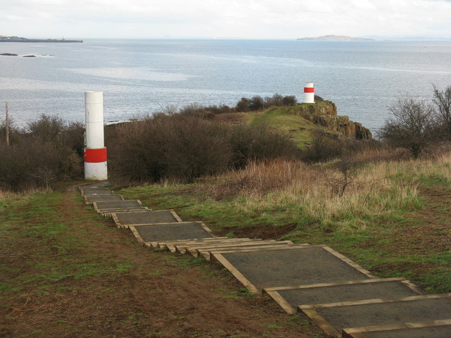
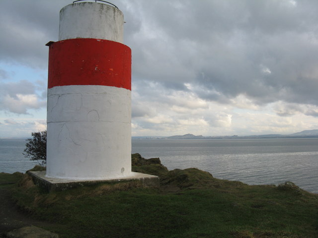
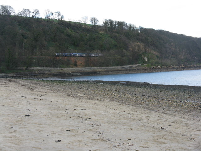
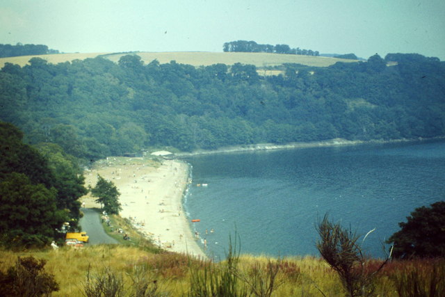
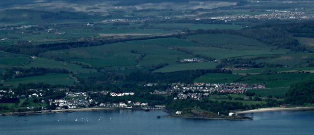
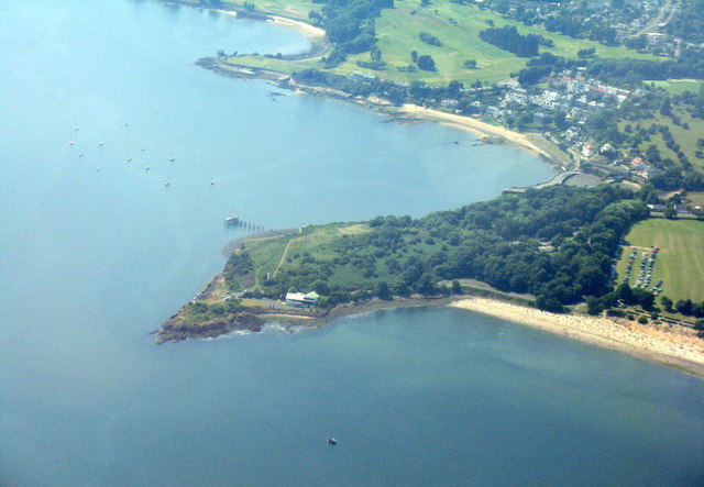
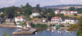
Craigdimas is a small island located off the coast of Fife, Scotland. Situated in the North Sea, it is part of the East Neuk region and boasts a unique charm that attracts visitors from near and far. The island covers an area of approximately 10 acres and is easily accessible by boat or ferry.

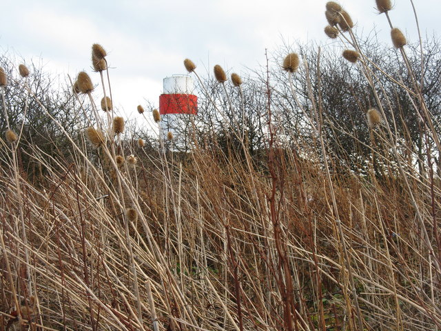
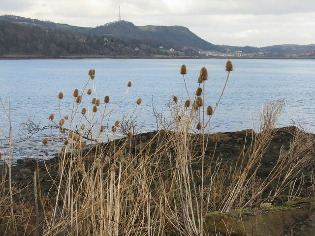
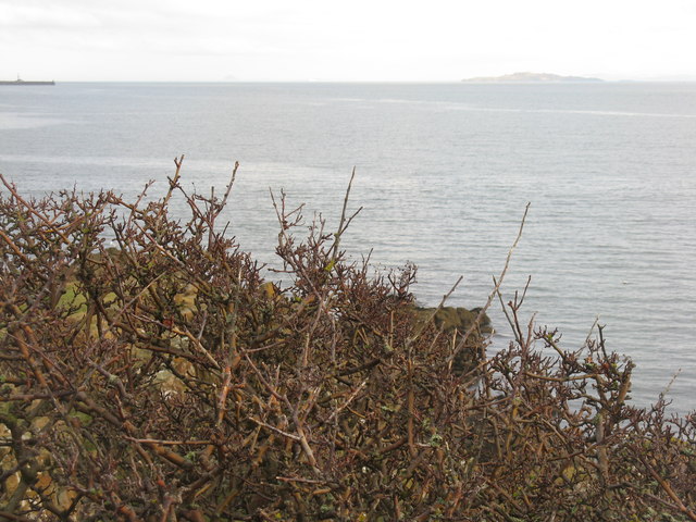
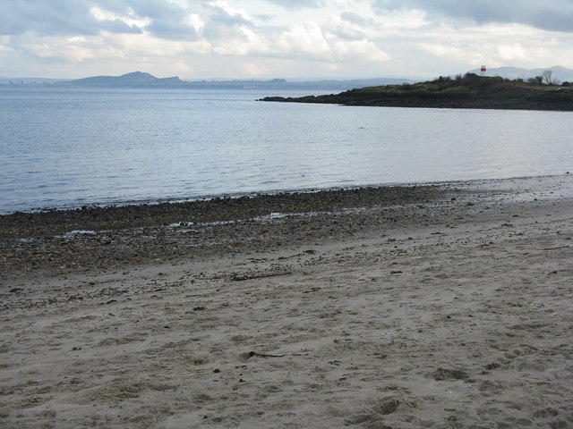
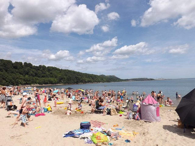
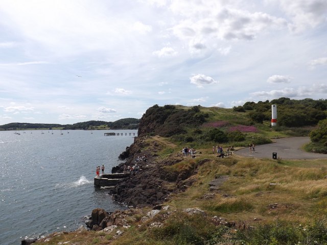
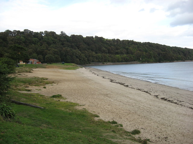
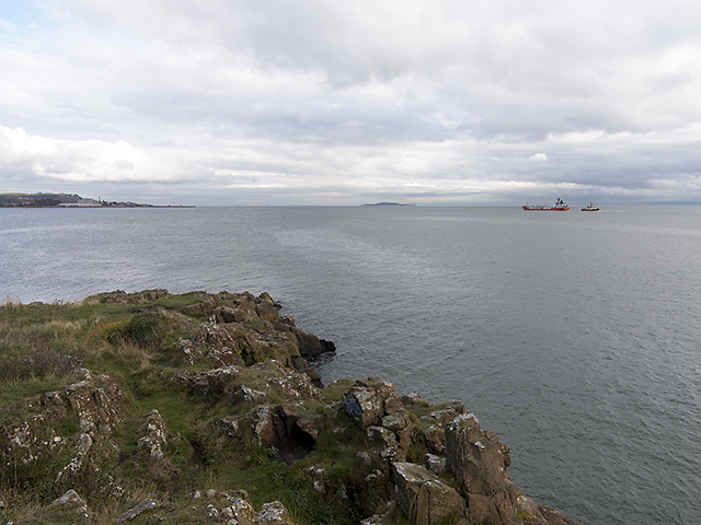
One of the island’s distinguishing features is its picturesque landscape, characterized by rugged cliffs and stunning panoramic views of the surrounding sea. It is also home to a diverse range of wildlife, including seabirds, seals, and even the occasional dolphin sighting, making it a haven for nature enthusiasts.

Craigdimas is steeped in history, with evidence of human habitation dating back to prehistoric times. The island is known for its ancient ruins, including the remnants of an old chapel and a Pictish settlement. These archaeological sites provide a glimpse into the island’s rich past and offer visitors a chance to explore its historical significance.

In terms of amenities, Craigdimas is relatively undeveloped, with no permanent residents or commercial establishments. This adds to its allure as a tranquil and secluded destination, perfect for those seeking a peaceful getaway. However, visitors can find basic facilities such as picnic areas and walking trails, ensuring a comfortable and enjoyable experience.

Overall, Craigdimas, Fife Island is a hidden gem that offers a unique blend of natural beauty and historical intrigue. Whether it's exploring ancient ruins, enjoying breathtaking views, or simply immersing oneself in the tranquility of the surroundings, this island promises an unforgettable experience for all who venture to its shores.

If you have any feedback on the listing, please let us know in the comments section below.

Craigdimas Images

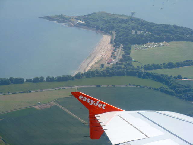
Images are sourced within 2km of 56.041935/-3.2983523 or Grid Reference NT1983. Thanks to Geograph Open Source API. All images are credited.

Beacons at Hawkcraig Point Apparently used by tankers coming into the Braehead Oil Terminal. The new steps are part of the Fife Coastal Path heading east from Aberdour to Burntisland.
Beacons at Hawkcraig Point
Apparently used by tankers coming into the Braehead Oil Terminal. The new steps are part of the Fife Coastal Path heading east from Aberdour to Burntisland.
Teasels at Hawkcraig Point With one of the two navigation beacons for Braefoot behind.
Teasels at Hawkcraig Point
With one of the two navigation beacons for Braefoot behind.
Hawkcraig and teasels Looking across Silversands Bay to the transmitter on The Binn, beyond Burntisland.
Hawkcraig and teasels
Looking across Silversands Bay to the transmitter on The Binn, beyond Burntisland.
Beacon at Hawkcraig Point One of two to assist tankers heading for Braefoot Oil Terminal. With Edinburgh and Arthurs seat 14 km across the Firth of Forth.
Beacon at Hawkcraig Point
One of two to assist tankers heading for Braefoot Oil Terminal. With Edinburgh and Arthurs seat 14 km across the Firth of Forth.
Wind-batterd hawthorn at Hawkcraig Point With Inchkeith in the distance.
Wind-batterd hawthorn at Hawkcraig Point
With Inchkeith in the distance.
Train under Hanging Craig Silversands Bay at Aberdour.
Train under Hanging Craig
Silversands Bay at Aberdour.
Hawkcraig Point from Silversands Looking across the Firth of Forth to Edinburgh.
Hawkcraig Point from Silversands
Looking across the Firth of Forth to Edinburgh.
Silversands Bay Popular east-facing beach on the Firth of Forth at Aberdour.
<span class="nowrap"><a title="http://en.wikipedia.org/wiki/Aberdour" rel="nofollow ugc noopener" href="http://en.wikipedia.org/wiki/Aberdour">Link</a><img style="margin-left:2px;" alt="External link" title="External link - shift click to open in new window" src="https://s1.geograph.org.uk/img/external.png" width="10" height="10"/></span>
Silversands Bay
Popular east-facing beach on the Firth of Forth at Aberdour. LinkExternal link
Aberdour from the air Hawkcraig Point is prominent, with Aberdour beyond and Wester Aberdour to the left.
Aberdour from the air
Hawkcraig Point is prominent, with Aberdour beyond and Wester Aberdour to the left.
Silversands Bay, Aberdour Absolutely mobbed today due to temperatures reaching 27 degrees Celsius.
Silversands Bay, Aberdour
Absolutely mobbed today due to temperatures reaching 27 degrees Celsius.
Hawk Craig from Hawkcraig Point The southernmost point at Silversands.
Hawk Craig from Hawkcraig Point
The southernmost point at Silversands.
Hawk Craig from above Burntisland With Aberdour beach and harbour beyond.
Hawk Craig from above Burntisland
With Aberdour beach and harbour beyond.
Silversands Bay Looking south from above Torry Hill, with Hawkcraig Point at the other end of the bay. A busy Thursday afternoon on the beach in the school holidays.
Silversands Bay
Looking south from above Torry Hill, with Hawkcraig Point at the other end of the bay. A busy Thursday afternoon on the beach in the school holidays.
Silversands Beach - Aberdour This beach reputedly has a blue flag and is renowned for good bathing.  The water looked pretty cold when I passed by.
Silversands Beach - Aberdour
This beach reputedly has a blue flag and is renowned for good bathing. The water looked pretty cold when I passed by.
The Happy Harrier The LPG tanker Happy Harrier, recently departed from Braefoot gas terminal (see Geograph image <a href="https://www.geograph.org.uk/photo/3679531">NT1883 : Gas terminal, Braefoot Bay</a>) en route for Port Jerome in France. The 3595 gross tonnes Happy Harrier was constructed in Tokyo, Japan in 1988 and is owned by Bsm-UK of Newcastle upon Tyne.
The Happy Harrier
The LPG tanker Happy Harrier, recently departed from Braefoot gas terminal (see Geograph image NT1883 : Gas terminal, Braefoot Bay) en route for Port Jerome in France. The 3595 gross tonnes Happy Harrier was constructed in Tokyo, Japan in 1988 and is owned by Bsm-UK of Newcastle upon Tyne.
View over Hawkcraig Point A view from Hawkcraig Point, with docks at Burntisland visible in the distance. The lpg tanker Happy Harrier can be seen in the Forth estuary having recently departed from Braefoot gas terminal en route for Port Jerome in France. For detail view see: <a href="https://www.geograph.org.uk/photo/3684534">NT2083 : The Happy Harrier</a>
View over Hawkcraig Point
A view from Hawkcraig Point, with docks at Burntisland visible in the distance. The lpg tanker Happy Harrier can be seen in the Forth estuary having recently departed from Braefoot gas terminal en route for Port Jerome in France. For detail view see: NT2083 : The Happy Harrier
Fife coastal path near Hanging Craig A view towards the Fife coastal path across Silversands Bay at Aberdour. This section of the path, running next to deciduous woodland, has fine views across the Forth estuary.
Fife coastal path near Hanging Craig
A view towards the Fife coastal path across Silversands Bay at Aberdour. This section of the path, running next to deciduous woodland, has fine views across the Forth estuary.
View over Black Sands at Aberdour from Hawkcraig Point
Show me another place!

Craigdimas is located at Grid Ref: NT1983 (Lat: 56.041935, Lng: -3.2983523)

Unitary Authority: Fife

Police Authority: Fife

What 3 Words

///mammoth.footpath.blunders. Near Aberdour, Fife

Nearby Locations

Craigdimas Car Craig

Related Wikis

Aberdour

Aberdour ( ; Scots: , Scottish Gaelic: Obar Dobhair) is a scenic and historic village on the south coast of Fife, Scotland. It is on the north shore of...

Inchcolm Abbey

Inchcolm Abbey is a medieval abbey located on the island of Inchcolm in the Firth of Forth in Scotland. The Abbey, which is located at the centre of the...

Inchcolm

Inchcolm (from the Scottish Gaelic "Innis Choluim", meaning Columba's Island) is an island in the Firth of Forth in Scotland. The island has a long history...

Aberdour railway station

Aberdour railway station is a railway station in the village of Aberdour, Fife, Scotland. The station is managed by ScotRail and is on the Fife Circle...

Nearby Amenities

Located within 500m of 56.041935,-3.2983523
Seamark Buoy Lateral Category: port
Seamark Buoy Lateral Colour: red
Seamark Buoy Lateral Shape: can
Seamark Buoy Lateral System: iala-a
Seamark Light Character: Fl
Seamark Light Colour: red
Seamark Light Period: 4
Seamark Name: No 6
Seamark Type: buoy_lateral
Lat/Long: 56.0380328/-3.2977025
Seamark Buoy Lateral Category: starboard
Seamark Buoy Lateral Colour: green
Seamark Buoy Lateral Shape: conical
Seamark Buoy Lateral System: iala-a
Seamark Light Character: Fl
Seamark Light Colour: green
Seamark Light Period: 4
Seamark Name: No 5
Seamark Type: buoy_lateral
Lat/Long: 56.0393762/-3.29875
Seamark Buoy Lateral Category: starboard
Seamark Buoy Lateral Colour: green
Seamark Buoy Lateral Shape: conical
Seamark Buoy Lateral System: iala-a
Seamark Light Character: Fl
Seamark Light Colour: green
Seamark Light Group: 2
Seamark Light Period: 5
Seamark Name: No 3
Seamark Type: buoy_lateral
Lat/Long: 56.0417909/-3.2919782
The data included in this document is from www.openstreetmap.org. The data is made available under ODbL.

Have you been to Craigdimas?

Leave your review of Craigdimas below (or comments, questions and feedback).