Car Craig

Island in Fife

Scotland

Car Craig

Oxcars lighthouse With a gull in the foreground and Leith docks in the background.
Oxcars lighthouse Credit: James Allan

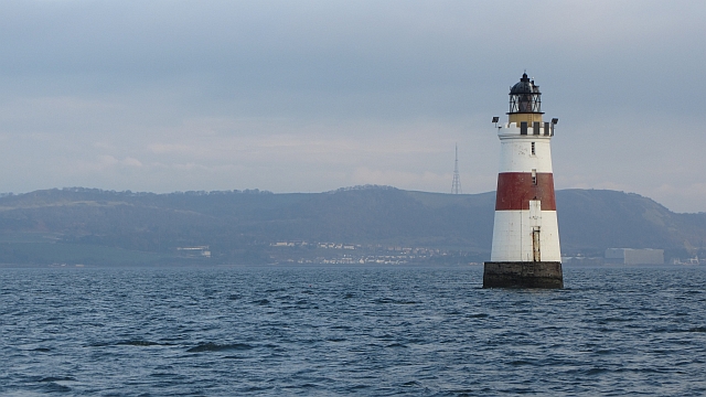
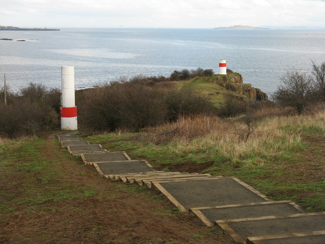
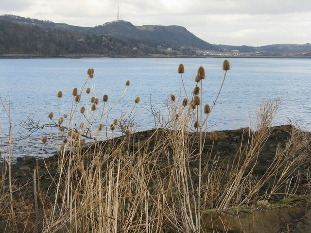
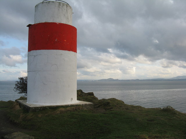
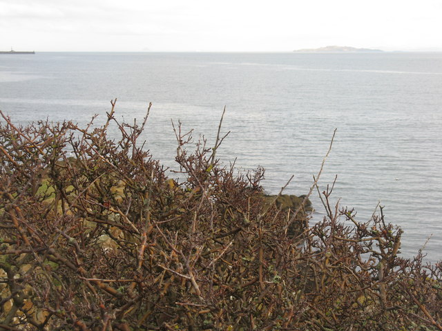
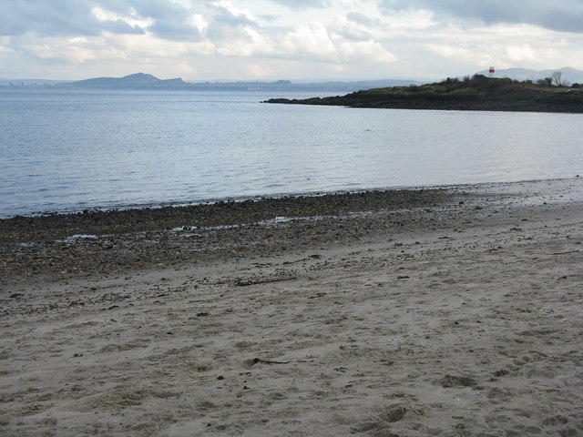
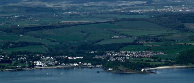
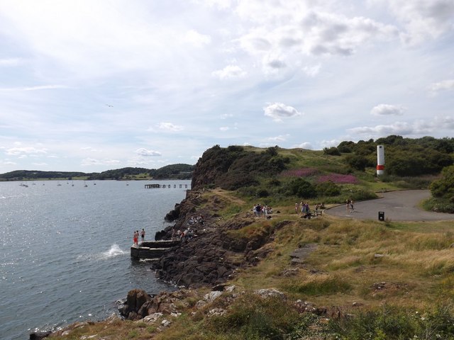
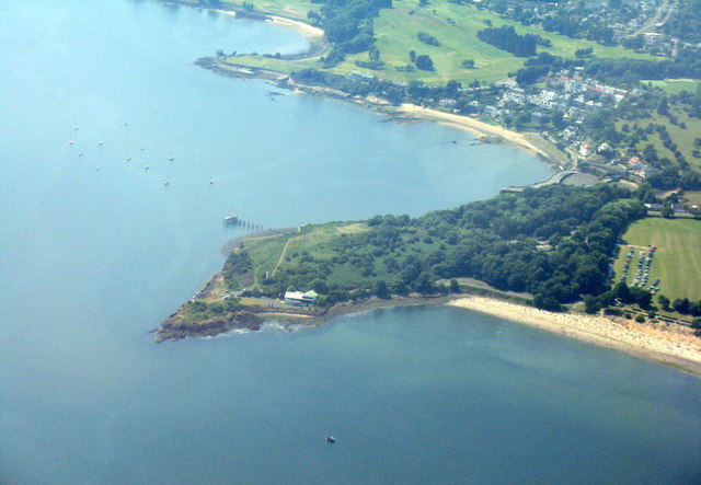
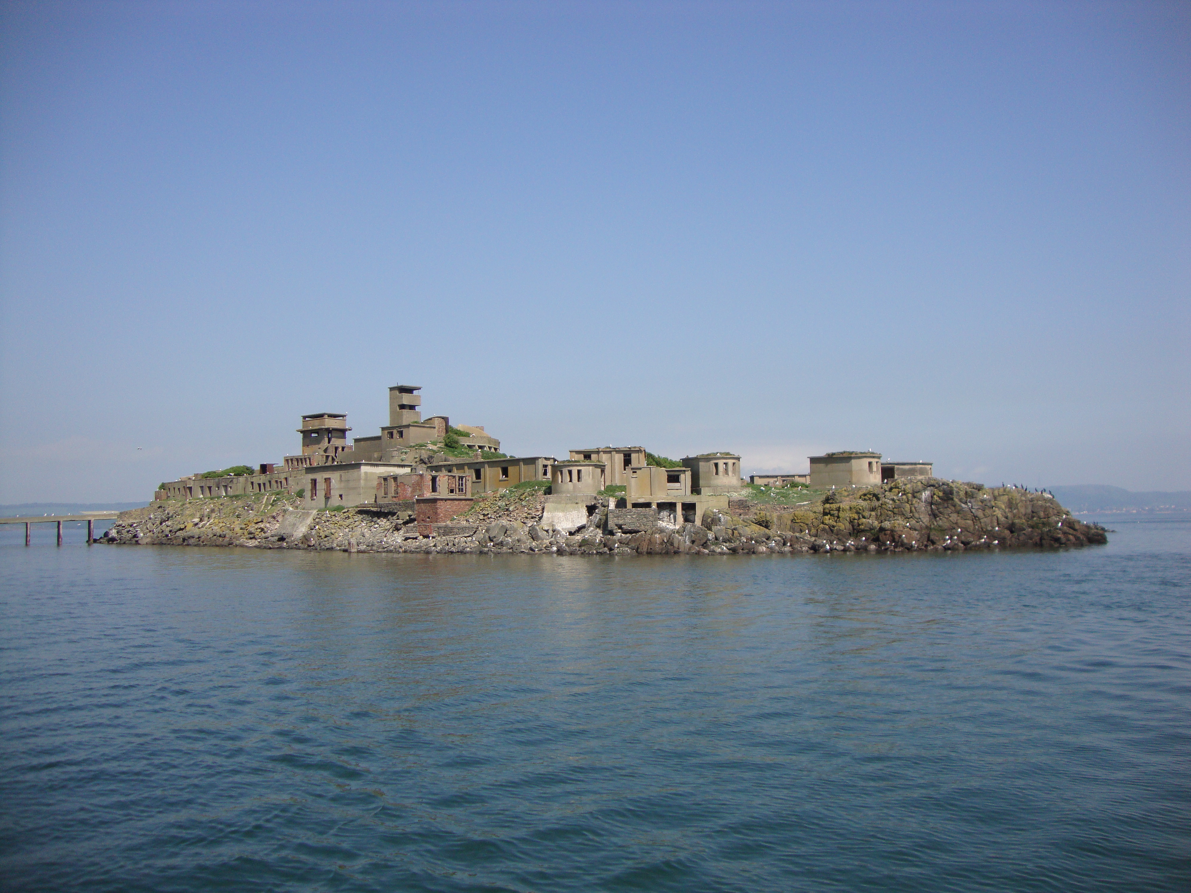
Car Craig is a small island located in the Firth of Forth, off the coast of Fife, Scotland. It is situated approximately 1.5 kilometers east of the town of Aberdour. The island has a unique rocky and rugged coastline, with steep cliffs rising from the sea.

Covering an area of around 0.4 hectares, Car Craig is relatively small in size. It is uninhabited and lacks any infrastructure or facilities. The island is privately owned and access is restricted to the public. However, it is often visited by boat enthusiasts, birdwatchers, and nature lovers due to its rich biodiversity.

The island is home to a variety of seabirds, including puffins, guillemots, and razorbills, which nest on the cliffs during the breeding season. The surrounding waters are teeming with marine life, making Car Craig an ideal spot for snorkeling and diving.

Car Craig also holds historical significance. It is believed to have been used as a lookout point during World War II due to its strategic location. Ruins of a small structure, possibly a watchtower or observation post, can still be seen on the island.

Overall, Car Craig is a picturesque and secluded island with stunning natural beauty and wildlife. Its rugged coastline, diverse bird population, and historical remnants make it a fascinating destination for those seeking a peaceful retreat or an adventure in nature.

If you have any feedback on the listing, please let us know in the comments section below.

Car Craig Images

Images are sourced within 2km of 56.033666/-3.2866317 or Grid Reference NT1983. Thanks to Geograph Open Source API. All images are credited.

Oxcars lighthouse With a gull in the foreground and Leith docks in the background.
Oxcars lighthouse
With a gull in the foreground and Leith docks in the background.
Oxcars Lighthouse The light is on a skerry which sits in the middle of the Firth of Forth, uncomfortably close to shipping lanes. The rock is submerged at high water and is not visible here.  The backdrop is The Bin, above Burntisland.
Oxcars Lighthouse
The light is on a skerry which sits in the middle of the Firth of Forth, uncomfortably close to shipping lanes. The rock is submerged at high water and is not visible here. The backdrop is The Bin, above Burntisland.
Deep channel marker buoy These mark the deep channel to the north of Oxcars. They are popular haulouts for seals.
Deep channel marker buoy
These mark the deep channel to the north of Oxcars. They are popular haulouts for seals.
Oxcars Lighthouse The lighthouse at high water with Edinburgh in the background.
Oxcars Lighthouse
The lighthouse at high water with Edinburgh in the background.
Beacons at Hawkcraig Point Apparently used by tankers coming into the Braehead Oil Terminal. The new steps are part of the Fife Coastal Path heading east from Aberdour to Burntisland.
Beacons at Hawkcraig Point
Apparently used by tankers coming into the Braehead Oil Terminal. The new steps are part of the Fife Coastal Path heading east from Aberdour to Burntisland.
Teasels at Hawkcraig Point With one of the two navigation beacons for Braefoot behind.
Teasels at Hawkcraig Point
With one of the two navigation beacons for Braefoot behind.
Hawkcraig and teasels Looking across Silversands Bay to the transmitter on The Binn, beyond Burntisland.
Hawkcraig and teasels
Looking across Silversands Bay to the transmitter on The Binn, beyond Burntisland.
Beacon at Hawkcraig Point One of two to assist tankers heading for Braefoot Oil Terminal. With Edinburgh and Arthurs seat 14 km across the Firth of Forth.
Beacon at Hawkcraig Point
One of two to assist tankers heading for Braefoot Oil Terminal. With Edinburgh and Arthurs seat 14 km across the Firth of Forth.
Wind-batterd hawthorn at Hawkcraig Point With Inchkeith in the distance.
Wind-batterd hawthorn at Hawkcraig Point
With Inchkeith in the distance.
Hawkcraig Point from Silversands Looking across the Firth of Forth to Edinburgh.
Hawkcraig Point from Silversands
Looking across the Firth of Forth to Edinburgh.
Oxcars and the Cow & Calves With the larger Inchmickery in the foreground. The boundary between Fife and the City of Edinburgh runs between Oxcars [with the light] and the Cow & Calves.
Oxcars and the Cow & Calves
With the larger Inchmickery in the foreground. The boundary between Fife and the City of Edinburgh runs between Oxcars [with the light] and the Cow & Calves.
Oxcars Lighthouse Oxcars Lighthouse, Cow and Calves and Inchmickery with a background of Edinburgh's skyline.
Oxcars Lighthouse
Oxcars Lighthouse, Cow and Calves and Inchmickery with a background of Edinburgh's skyline.
Deep water channel buoy Marks the main shipping route up the Firth of Forth with Burntisland in the background.
Deep water channel buoy
Marks the main shipping route up the Firth of Forth with Burntisland in the background.
Aberdour from the air Hawkcraig Point is prominent, with Aberdour beyond and Wester Aberdour to the left.
Aberdour from the air
Hawkcraig Point is prominent, with Aberdour beyond and Wester Aberdour to the left.
Oxcars lighthouse, Inchcolm and Braefoot Bay from the air St Colm's Abbey (ruins) can be seen on Inchcolm. LPG carrier "Temse" <span class="nowrap"><a title="http://www.shipspotting.com/gallery/photo.php?lid=1668701" rel="nofollow ugc noopener" href="http://www.shipspotting.com/gallery/photo.php?lid=1668701">Link</a><img style="margin-left:2px;" alt="External link" title="External link - shift click to open in new window" src="https://s1.geograph.org.uk/img/external.png" width="10" height="10"/></span> is berthed at Braefoot Bay gas terminal.
Oxcars lighthouse, Inchcolm and Braefoot Bay from the air
St Colm's Abbey (ruins) can be seen on Inchcolm. LPG carrier "Temse" LinkExternal link is berthed at Braefoot Bay gas terminal.
Cow & Calves, Oxcars lighthouse, Inchcolm and Braefoot Bay from the air St Colm's Abbey (ruins) can be seen on Inchcolm. LPG carrier "Temse" <span class="nowrap"><a title="http://www.shipspotting.com/gallery/photo.php?lid=1668701" rel="nofollow ugc noopener" href="http://www.shipspotting.com/gallery/photo.php?lid=1668701">Link</a><img style="margin-left:2px;" alt="External link" title="External link - shift click to open in new window" src="https://s1.geograph.org.uk/img/external.png" width="10" height="10"/></span> is berthed at Braefoot Bay gas terminal. Dalgety Bay is in the left distance.
Cow & Calves, Oxcars lighthouse, Inchcolm and Braefoot Bay from the air
St Colm's Abbey (ruins) can be seen on Inchcolm. LPG carrier "Temse" LinkExternal link is berthed at Braefoot Bay gas terminal. Dalgety Bay is in the left distance.
Hawk Craig from Hawkcraig Point The southernmost point at Silversands.
Hawk Craig from Hawkcraig Point
The southernmost point at Silversands.
Hawk Craig from above Burntisland With Aberdour beach and harbour beyond.
Hawk Craig from above Burntisland
With Aberdour beach and harbour beyond.
Show me another place!

Car Craig is located at Grid Ref: NT1983 (Lat: 56.033666, Lng: -3.2866317)

Unitary Authority: Fife

Police Authority: Fife

What 3 Words

///form.shiny.abode. Near Aberdour, Fife

Nearby Locations

Craigdimas Car Craig

Related Wikis

Inchcolm

Inchcolm (from the Scottish Gaelic "Innis Choluim", meaning Columba's Island) is an island in the Firth of Forth in Scotland. It was repeatedly attacked...

Inchcolm Abbey

Inchcolm Abbey is a medieval abbey located on the island of Inchcolm in the Firth of Forth in Scotland. The Abbey, which is located at the centre of the...
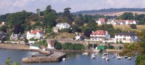
Aberdour

Aberdour ( ; Scots: , Scottish Gaelic: Obar Dobhair) is a scenic and historic village on the south coast of Fife, Scotland. It is on the north shore of...

Aberdour railway station

Aberdour railway station is a railway station in the village of Aberdour, Fife, Scotland. The station is managed by ScotRail and is on the Fife Circle...

Inchmickery

Inchmickery is a small island in the Firth of Forth in Scotland. It is about two miles (3.2 km) north of Edinburgh. Its name comes from the Scottish Gaelic...

St Bridget's Kirk

St. Bridget's Kirk is a ruined church on the outskirts of Dalgety Bay, Fife, Scotland. It is a shell of a medieval church, dating back at least as far...

Couston Castle

Couston Castle is an L-plan tower house dating from the late sixteenth or early seventeenth centuries, just north east of Dalgety Bay, at the edge of Otterston...
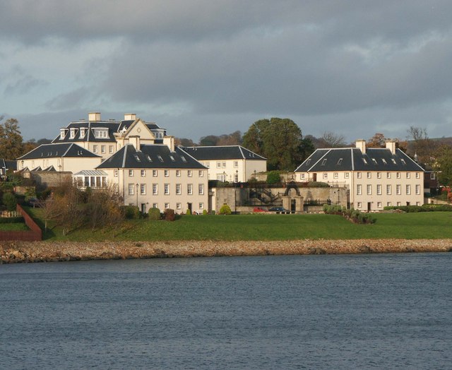
Donibristle

Donibristle (Scots: also Dunibirsle) was a house and estate in Fife, Scotland, on the coast of the Firth of Forth. Only the wings of the house remain,...

Have you been to Car Craig?

Leave your review of Car Craig below (or comments, questions and feedback).