Carreg Ddû

Island in Caernarfonshire

Wales

Carreg Ddû

Porth Dinllaen from the Lleyn Coastal Path
Porth Dinllaen from the Lleyn Coastal Path Credit: peter robinson

Carreg Ddû is a small island located off the coast of Caernarfonshire, Wales. Known for its rugged beauty and historical significance, it is a popular tourist destination. The island is located about 1.5 miles west of the town of Porthmadog and can be accessed by boat or by foot during low tide.

The name Carreg Ddû translates to "Black Rock" in English, which accurately describes the island's rocky terrain. The island is relatively small, spanning just over 7 acres, and is covered in lush vegetation, including heather and grasses. Its rocky coastline is dotted with caves and rock pools, making it a haven for marine life and a popular spot for snorkeling and diving.

Carreg Ddû has a rich history, with evidence of human habitation dating back to the Bronze Age. The island is home to the ruins of a medieval fort, which has provided archaeologists with valuable insights into the region's past. The fort is believed to have been built by the Welsh prince, Llywelyn the Great, during the 12th century.

Today, Carreg Ddû is managed by a local conservation organization, which works to preserve the island's natural beauty and protect its diverse wildlife. Visitors can explore the island's trails, take in the breathtaking views of the surrounding coastline, and learn about its fascinating history. It is important to note that due to the island's remote location and limited facilities, visitors are advised to come prepared with food, water, and appropriate clothing for outdoor activities.

If you have any feedback on the listing, please let us know in the comments section below.
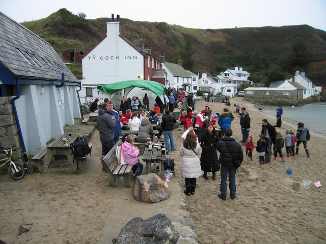
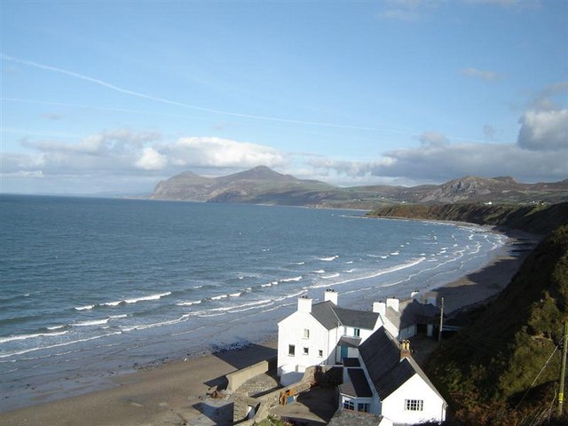
Carreg Ddû Images

Images are sourced within 2km of 52.948945/-4.5647584 or Grid Reference SH2742. Thanks to Geograph Open Source API. All images are credited.

Porth Dinllaen from the Lleyn Coastal Path
Triaglog coch / Red Valerian / Centranthus ruber
Cadwyn ar greigiau / Chain on the rocks
Cen ar y clogwyn / Lichen on the rocks The lichen may be sea ivory and yellow scales.   In the distant background, Yr Eifl rises above Nant Gwrtheyrn.
Cen ar y clogwyn / Lichen on the rocks
The lichen may be sea ivory and yellow scales. In the distant background, Yr Eifl rises above Nant Gwrtheyrn.
Cwch bychan ym Mhorth Dinllaen / A dinghy at Porth Dinllaen The cloud-topped mountain in the background is Yr Eifl.
Cwch bychan ym Mhorth Dinllaen / A dinghy at Porth Dinllaen
The cloud-topped mountain in the background is Yr Eifl.
New year's eve at Ty Coch Inn Porth Dinllaen The New Year celebrations started early here, this was lunch time!
New year's eve at Ty Coch Inn Porth Dinllaen
The New Year celebrations started early here, this was lunch time!
Caffi Porth Dinllaen Cafe opposite the entrance of the National Trust car park for Porth Dinllaen.
Caffi Porth Dinllaen
Cafe opposite the entrance of the National Trust car park for Porth Dinllaen.
Field of sheep at Morfa Nefyn Taken from near the NLI House, looking across the field to the National Trust car park, the waters of Porth Dinllaen and, in the distance the peak of Yr Eifl.
Field of sheep at Morfa Nefyn
Taken from near the NLI House, looking across the field to the National Trust car park, the waters of Porth Dinllaen and, in the distance the peak of Yr Eifl.
Lifeboat station, Porth Dinllaen The station and old jetty beyond.
Lifeboat station, Porth Dinllaen
The station and old jetty beyond.
Northern tip of Trwyn Porthdinllaen Looking across the tip of the peninsula, more or less north west.
Northern tip of Trwyn Porthdinllaen
Looking across the tip of the peninsula, more or less north west.
Above Morfa Nefyn beach The view seen in <a href="https://www.geograph.org.uk/photo/1427465">SH2840 : Morfa Nefyn beach facing Yr Eifl</a>; today the mountain, Yr Eifl,and neighbouring hills    are glimpsed through the morning mist.
Above Morfa Nefyn beach
The view seen in SH2840 : Morfa Nefyn beach facing Yr Eifl; today the mountain, Yr Eifl,and neighbouring hills are glimpsed through the morning mist.
Hazy sunshine on Morfa Nefyn beach A view also seen in <a href="https://www.geograph.org.uk/photo/79216">SH2840 : Beach at Morfa Nefyn</a>.
Hazy sunshine on Morfa Nefyn beach
A view also seen in SH2840 : Beach at Morfa Nefyn.
Walkers on Morfa Nefyn Beach The hills across the bay, which lie to the north east of Nefyn, are still faintly seen in the morning haze.
Walkers on Morfa Nefyn Beach
The hills across the bay, which lie to the north east of Nefyn, are still faintly seen in the morning haze.
Rock pool explorer Near Porth Dinllaen, Morfa Nefyn.Nothing much to be seen in the pool.
Rock pool explorer
Near Porth Dinllaen, Morfa Nefyn.Nothing much to be seen in the pool.
Porth Dinllaen On the Llyn Coast Path.
Porth Dinllaen
On the Llyn Coast Path.
Carreg Ddu A small rock off the peninsula at Porth Dinllaen.Gulls and a few cormorants in residence.
Carreg Ddu
A small rock off the peninsula at Porth Dinllaen.Gulls and a few cormorants in residence.
Wild flowers at Porth Dinllaen On the west side of the peninsula, looking towards Borth Wen.The flowers are Scilla verna, or Spring Squill, a spring flowering bulb found in Western Europe, Great Britain, in particular the west coast.
Wild flowers at Porth Dinllaen
On the west side of the peninsula, looking towards Borth Wen.The flowers are Scilla verna, or Spring Squill, a spring flowering bulb found in Western Europe, Great Britain, in particular the west coast.
Spring Squill at Porth Dinllaen A close up of the flowers, on the west side of the peninsula.Spring Squill, or Scilla verna,occurs in Western Europe, Great Britain (particularly the west coast) and Ireland (mainly along the east coast), reaching as far as the Faroe Islands and Norway. It is found in short dry grassy areas, usually near the sea.
Its star-like blue flowers are produced during the spring.
Spring Squill at Porth Dinllaen
A close up of the flowers, on the west side of the peninsula.Spring Squill, or Scilla verna,occurs in Western Europe, Great Britain (particularly the west coast) and Ireland (mainly along the east coast), reaching as far as the Faroe Islands and Norway. It is found in short dry grassy areas, usually near the sea. Its star-like blue flowers are produced during the spring.
Show me another place!

Carreg Ddû is located at Grid Ref: SH2742 (Lat: 52.948945, Lng: -4.5647584)

Unitary Authority: Gwynedd

Police Authority: North Wales

What 3 Words

///clubbing.trumped.regularly. Near Nefyn, Gwynedd

Related Wikis

Porthdinllaen Lifeboat Station

Porthdinllaen Lifeboat Station (Welsh Gorsaf Bad Achub Porthdinllaen) is a Royal National Lifeboat Institution (RNLI) operated lifeboat station in the...

Porthdinllaen

Porthdinllaen (in English sometimes Porth Dinllaen) is a small coastal village on the Llŷn Peninsula in the Dwyfor area of Gwynedd, Wales, built on a small...

Morfa Nefyn

Morfa Nefyn is a village on the northern coast of the Llŷn Peninsula in Gwynedd, Wales. It lies on the crossroads of the B4417 and B4412. The village has...

Edern, Gwynedd

Edern, formerly known as Edeyrn, is a village and until 1939 a civil parish, in the Welsh county of Gwynedd. It is about 1 km southwest of the larger village...

Nefyn

Nefyn (Welsh pronunciation: [ˈnɛvɨn], archaically anglicised as Nevin) is both a small town and a community on the northwest coast of the Llŷn Peninsula...

Ceidio

Ceidio is a former civil parish in the Welsh county of Gwynedd. It was abolished in 1934, and incorporated into Buan. == References ==

Garn Boduan

Garn Boduan is an Iron Age hillfort and hill near Nefyn, on the Llŷn Peninsula in Wales. In a survey in the 1950s the traces of over 170 round houses were...

Llandudwen

Llandudwen is a former civil parish in the Welsh county of Gwynedd. It was abolished in 1934, and divided between Buan and Tudweiliog. == References ==

Nearby Amenities

Located within 500m of 52.948945,-4.5647584
Source: PGS
Lat/Long: 52.9451784/-4.5646286
Created By: dmgroom_coastlines
Source: PGS
Lat/Long: 52.945903/-4.5636816
Source: PGS
Lat/Long: 52.9463444/-4.5640689
Created By: dmgroom_coastlines
Source: PGS
Lat/Long: 52.9468141/-4.5644376
Source: PGS
Lat/Long: 52.9471385/-4.5643968
Created By: dmgroom_coastlines
Source: PGS
Lat/Long: 52.9480914/-4.5637658
Created By: dmgroom_coastlines
Source: PGS
Lat/Long: 52.9483847/-4.5643434
Created By: dmgroom_coastlines
Source: PGS
Lat/Long: 52.9483162/-4.5650851
Created By: dmgroom_coastlines
Source: PGS
Lat/Long: 52.9483542/-4.5655675
Created By: dmgroom_coastlines
Source: PGS
Lat/Long: 52.9485347/-4.566132
Created By: dmgroom_coastlines
Source: PGS
Lat/Long: 52.9485492/-4.5667609
Source: PGS
Lat/Long: 52.9479722/-4.5678506
Source: PGS
Lat/Long: 52.946897/-4.5677421
Source: PGS
Lat/Long: 52.9458218/-4.5677971
Created By: dmgroom_coastlines
Source: PGS
Lat/Long: 52.9451908/-4.5680919
Bench
Backrest: yes
Colour: brown
Material: wood
Seats: 3
Lat/Long: 52.947481/-4.5671077
Bench
Backrest: yes
Colour: brown
Material: wood
Seats: 3
Lat/Long: 52.9477725/-4.5645885
Seamark Mooring Category: buoy
Seamark Mooring Colour: orange
Seamark Name: RNLI
Seamark Source: Bing
Seamark Type: mooring
Lat/Long: 52.945054/-4.5610267
Golf: pin
Lat/Long: 52.9474542/-4.5665122
Golf: pin
Lat/Long: 52.9473697/-4.5648897
Golf: pin
Lat/Long: 52.9451838/-4.5659992
The data included in this document is from www.openstreetmap.org. The data is made available under ODbL.

Have you been to Carreg Ddû?

Leave your review of Carreg Ddû below (or comments, questions and feedback).