Carreg Oysters

Island in Caernarfonshire

Wales

Carreg Oysters

Looking down on Porth Nefyn at low tide
Looking down on Porth Nefyn at low tide Credit: David Medcalf

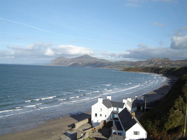
Carreg Oysters is a small island located off the coast of Caernarfonshire in North Wales. Situated in the Menai Strait, it is known for its abundance of high-quality oysters, making it a popular destination for seafood enthusiasts.

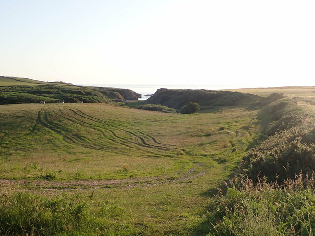
The island is approximately 1.5 miles long and half a mile wide, with a rugged and rocky coastline. It is accessible by boat or kayak, and visitors can enjoy stunning views of the surrounding mountains and sea.

Carreg Oysters has a long history of oyster farming, dating back to the 19th century. The nutrient-rich waters of the Menai Strait provide an ideal environment for oyster cultivation, resulting in oysters renowned for their rich flavor and creamy texture. Oyster beds are carefully managed by local farmers to ensure sustainability and protect the delicate ecosystem.

Visitors to Carreg Oysters can partake in oyster tasting sessions, where they can sample freshly harvested oysters and learn about the traditional methods of farming. The island also offers guided tours, providing insight into the oyster farming process and the importance of preserving the local marine environment.

In addition to oyster farming, Carreg Oysters is home to a diverse range of wildlife. Seals, dolphins, and various seabird species can often be spotted in the surrounding waters, adding to the island's natural beauty and appeal.

Overall, Carreg Oysters in Caernarfonshire is a must-visit destination for seafood enthusiasts and nature lovers alike, offering a unique and educational experience in a stunning coastal setting.

If you have any feedback on the listing, please let us know in the comments section below.

Carreg Oysters Images

Images are sourced within 2km of 52.942493/-4.5645552 or Grid Reference SH2741. Thanks to Geograph Open Source API. All images are credited.

Looking down on Porth Nefyn at low tide
Damaged house The unstable cliff has slumped into the back of this once-fine property. It looks as if it has been condemned and is unlikely to be rebuilt.
Damaged house
The unstable cliff has slumped into the back of this once-fine property. It looks as if it has been condemned and is unlikely to be rebuilt.
The path down the cliff face This path leads down to the cottages and fishermen's sheds at Porth Nefyn.
The path down the cliff face
This path leads down to the cottages and fishermen's sheds at Porth Nefyn.
Porth Nefyn breakwater The many boxes are crab pots which have been lifted for the winter. The fishing boat appears to be derelict and is slowly breaking up.
Porth Nefyn breakwater
The many boxes are crab pots which have been lifted for the winter. The fishing boat appears to be derelict and is slowly breaking up.
The slipway behind the breakwater There are several slipways at Porth Nefyn. This one is sheltered by the breakwater and is used by fishermen and the sailing club.
The slipway behind the breakwater
There are several slipways at Porth Nefyn. This one is sheltered by the breakwater and is used by fishermen and the sailing club.
Fine views beyond the breakwater Looking towards Yr Eifl hills across Porth Nefyn.
Fine views beyond the breakwater
Looking towards Yr Eifl hills across Porth Nefyn.
Modern art or industrial archaeology? A rusting pulley wheel and its skirt of seaweed make an intriguing picture.  The casting is embossed with the words "Jones" and "Walsall".
Modern art or industrial archaeology?
A rusting pulley wheel and its skirt of seaweed make an intriguing picture. The casting is embossed with the words "Jones" and "Walsall".
The west side of Penrhyn Nefyn Looking towards Porth Dinllaen.
The west side of Penrhyn Nefyn
Looking towards Porth Dinllaen.
The toe of Penrhyn Nefyn The small headland is made of a thick layer of insubstantial glacial till resting on a rock platform. It is slowly being eroded away.
The toe of Penrhyn Nefyn
The small headland is made of a thick layer of insubstantial glacial till resting on a rock platform. It is slowly being eroded away.
The rock platform at Penrhyn Nefyn No doubt this was once covered by the same layer of glacial till that forms the mass of the headland.
The rock platform at Penrhyn Nefyn
No doubt this was once covered by the same layer of glacial till that forms the mass of the headland.
The path at the tip of Penrhyn Nefyn The path is crumbling steeply on both sides - not a place to linger.
The path at the tip of Penrhyn Nefyn
The path is crumbling steeply on both sides - not a place to linger.
The beach at low tide
The cottages and buildings of Porth Nefyn
Nefyn harbour From the Coast Path
Nefyn harbour
From the Coast Path
Bench at the tip of Penrhyn Neftyn And a sea view to the Eifl headland
Bench at the tip of Penrhyn Neftyn
And a sea view to the Eifl headland
Rocky shore at Penrhyn Nefyn
Path down to Aber Geirch Aber Geirch - a small inlet west of Morfa Nefyn - the path runs from the campsite at Porthdinllaen Farm
Path down to Aber Geirch
Aber Geirch - a small inlet west of Morfa Nefyn - the path runs from the campsite at Porthdinllaen Farm
Socially-distanced queuing at Gwen's Chippy Order inside, then wait outside for the order to be given through the hatch
Socially-distanced queuing at Gwen's Chippy
Order inside, then wait outside for the order to be given through the hatch
Show me another place!

Carreg Oysters is located at Grid Ref: SH2741 (Lat: 52.942493, Lng: -4.5645552)

Unitary Authority: Gwynedd

Police Authority: North Wales

What 3 Words

///kidney.down.fells. Near Nefyn, Gwynedd

Related Wikis

Porthdinllaen

Porthdinllaen (in English sometimes Porth Dinllaen) is a small coastal village on the Llŷn Peninsula in the Dwyfor area of Gwynedd, Wales, built on a small...

Porthdinllaen Lifeboat Station

Porthdinllaen Lifeboat Station (Welsh Gorsaf Bad Achub Porthdinllaen) is a Royal National Lifeboat Institution (RNLI) operated lifeboat station in the...

Morfa Nefyn

Morfa Nefyn is a village on the northern coast of the Llŷn Peninsula in Gwynedd, Wales. It lies on the crossroads of the B4417 and B4412. The village has...

Edern, Gwynedd

Edern, formerly known as Edeyrn, is a village and until 1939 a civil parish, in the Welsh county of Gwynedd. It is about 1 km southwest of the larger village...

Nearby Amenities

Located within 500m of 52.942493,-4.5645552
Source: PGS
Lat/Long: 52.9383042/-4.5633508
Source: PGS
Lat/Long: 52.9385634/-4.5640312
Source: PGS
Lat/Long: 52.9390202/-4.5653872
Created By: dmgroom_coastlines
Source: PGS
Lat/Long: 52.939451/-4.565699
Source: PGS
Lat/Long: 52.9398398/-4.5659731
Source: PGS
Lat/Long: 52.9402089/-4.5666971
Source: PGS
Lat/Long: 52.9405809/-4.5671495
Source: PGS
Lat/Long: 52.9413418/-4.5669907
Created By: dmgroom_coastlines
Source: PGS
Lat/Long: 52.9416598/-4.5658286
Source: PGS
Lat/Long: 52.9415865/-4.5664207
Source: PGS
Lat/Long: 52.9420683/-4.5669773
Source: PGS
Lat/Long: 52.9426033/-4.5675963
Source: PGS
Lat/Long: 52.9429149/-4.5675595
Porth Dinllaen
Place: hamlet
Source: PGS;npe
Wikidata: Q3398844
Lat/Long: 52.9438343/-4.5677556
Created By: dmgroom_coastlines
Source: PGS
Lat/Long: 52.9440039/-4.5673085
Source: PGS
Lat/Long: 52.9442578/-4.5666885
Created By: dmgroom_coastlines
Source: PGS
Lat/Long: 52.944441/-4.566091
Source: PGS
Lat/Long: 52.9444388/-4.5656414
Source: PGS
Lat/Long: 52.9451784/-4.5646286
Created By: dmgroom_coastlines
Source: PGS
Lat/Long: 52.945903/-4.5636816
Source: PGS
Lat/Long: 52.9463444/-4.5640689
Created By: dmgroom_coastlines
Source: PGS
Lat/Long: 52.9468141/-4.5644376
Source: PGS
Lat/Long: 52.9458218/-4.5677971
Created By: dmgroom_coastlines
Source: PGS
Lat/Long: 52.9451908/-4.5680919
Source: PGS
Lat/Long: 52.9454206/-4.5695213
Source: PGS
Lat/Long: 52.9452506/-4.5696809
Source: PGS
Lat/Long: 52.9444434/-4.5703408
Toilets
Lat/Long: 52.9433254/-4.5677889
Trwyn Porth Dinllaen
Historic: ruins
Historic Civilization: prehistoric
Inscription: Earthwork remains of a large promontory fort
Name Cy: Porth Dinllaen
Name En: Porth Dinllaen
Lat/Long: 52.9444164/-4.5684451
Seamark Mooring Category: buoy
Seamark Mooring Colour: orange
Seamark Name: RNLI
Seamark Source: Bing
Seamark Type: mooring
Lat/Long: 52.945054/-4.5610267
Golf: pin
Lat/Long: 52.9392589/-4.5685259
Golf: pin
Lat/Long: 52.9395269/-4.5670889
Golf: pin
Lat/Long: 52.9419275/-4.5679439
Golf: pin
Lat/Long: 52.9451838/-4.5659992
Golf: pin
Lat/Long: 52.9426372/-4.5695311
Golf: pin
Lat/Long: 52.9390303/-4.5678741
The data included in this document is from www.openstreetmap.org. The data is made available under ODbL.

Have you been to Carreg Oysters?

Leave your review of Carreg Oysters below (or comments, questions and feedback).