Borth Wen

Bay in Caernarfonshire

Wales

Borth Wen

Path down to Aber Geirch Aber Geirch - a small inlet west of Morfa Nefyn - the path runs from the campsite at Porthdinllaen Farm
Path down to Aber Geirch Credit: Eirian Evans

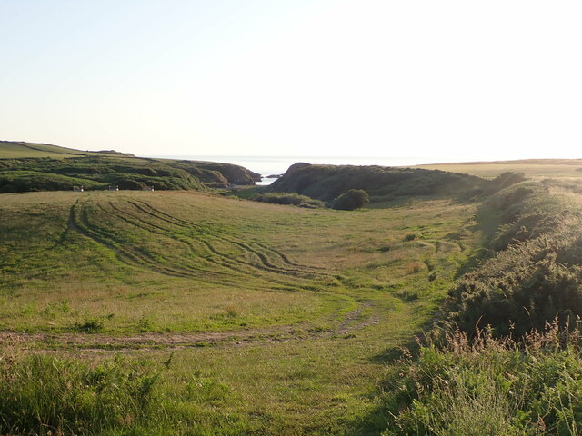
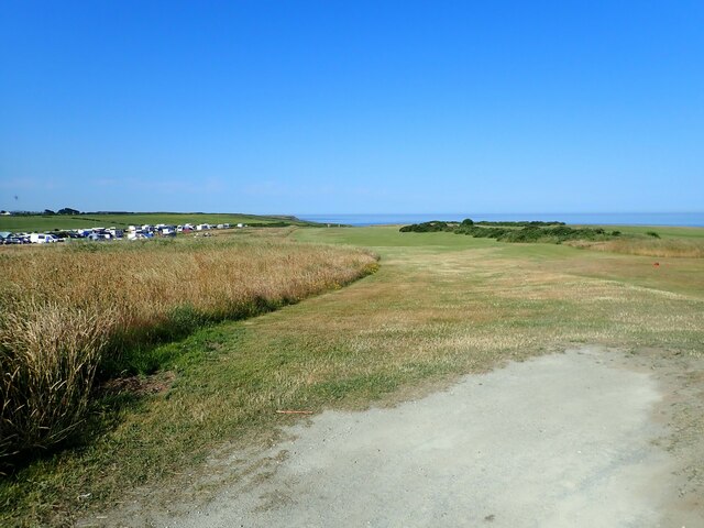
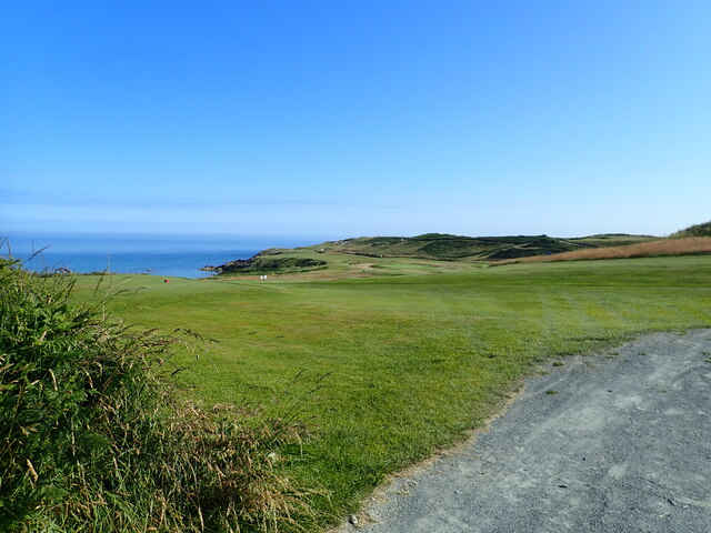
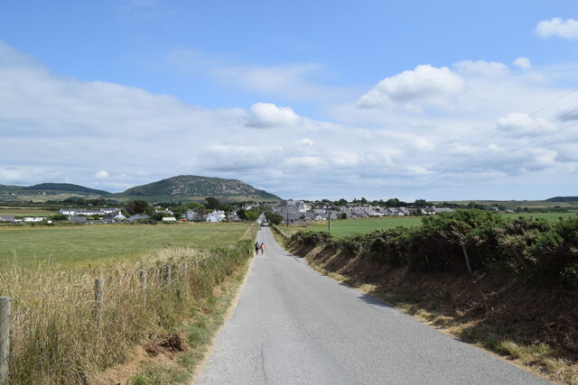
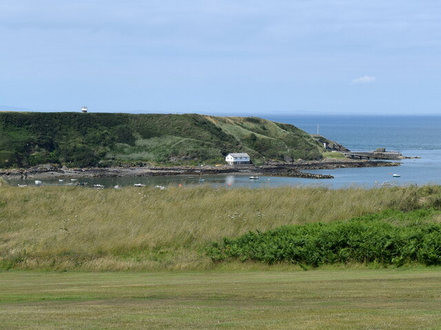
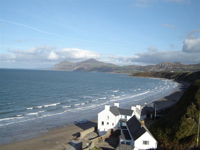
Borth Wen is a picturesque bay located on the northern coast of Caernarfonshire, Wales. Nestled between the towns of Rhosneigr and Aberffraw, this hidden gem boasts stunning natural beauty and a tranquil atmosphere that attracts locals and tourists alike.

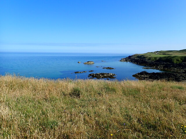
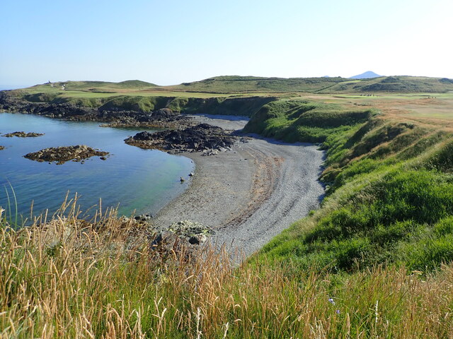
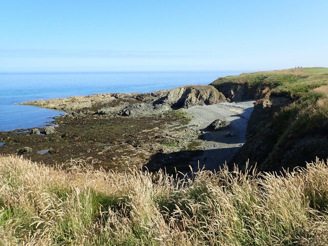
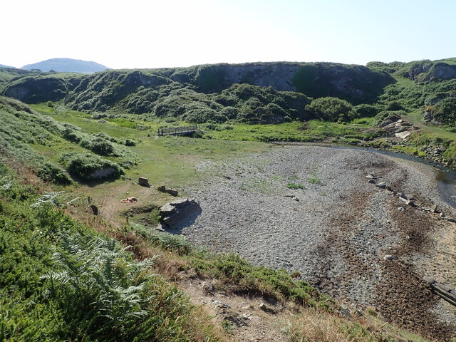
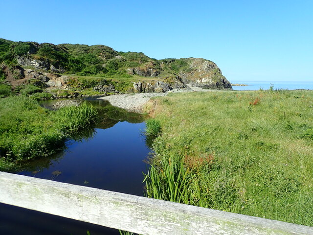
The bay is renowned for its pristine sandy beach, which stretches for approximately 2 kilometers and is backed by rolling dunes and lush grasslands. The beach is a popular spot for sunbathing, picnicking, and family-friendly activities such as sandcastle building and beach games. The crystal-clear waters of the bay are ideal for swimming, paddling, and even water sports like windsurfing and kiteboarding.

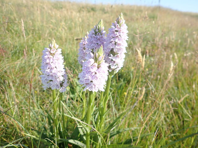
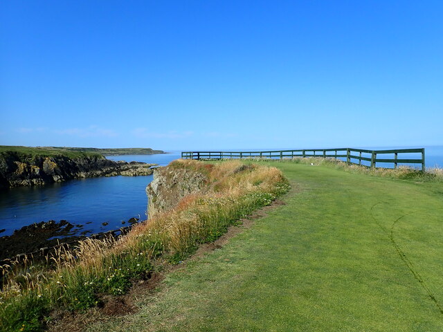
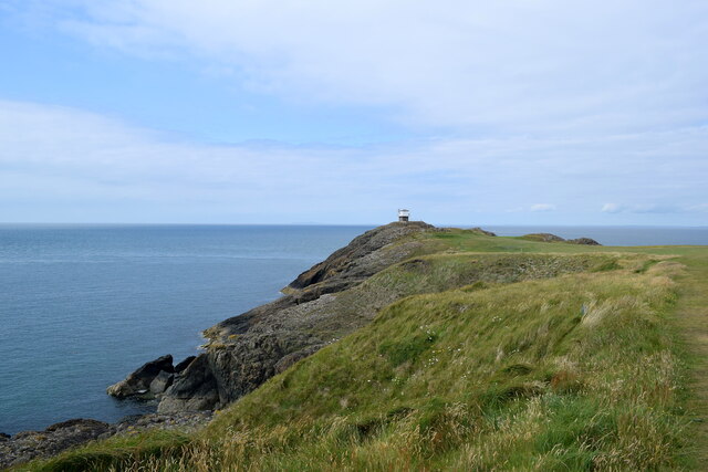
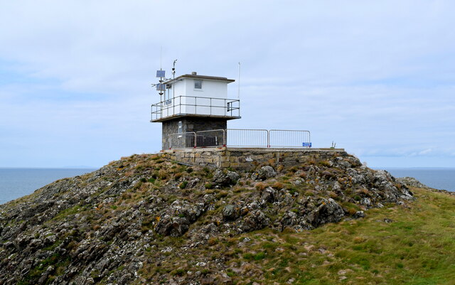
Borth Wen offers breathtaking views of the surrounding coastline, including the nearby Llanddwyn Island and Snowdonia National Park in the distance. The bay is also home to a diverse array of wildlife, making it a haven for birdwatchers and nature enthusiasts. Visitors may spot seabirds, wading birds, and even seals basking on the rocks.

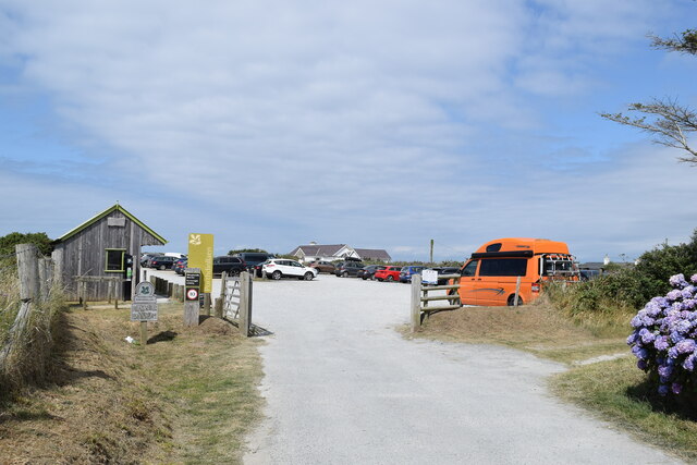
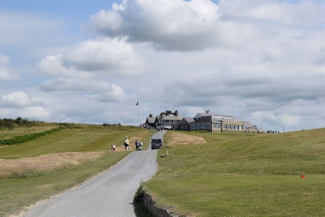
Facilities at Borth Wen are limited, which adds to its charm as an unspoiled natural haven. However, there are toilets and a small car park nearby for convenience. The bay is accessible via a coastal footpath, which provides a scenic walk along the coastline.

Whether you are seeking a peaceful retreat or an idyllic spot to soak up the sun, Borth Wen in Caernarfonshire offers a slice of paradise for nature lovers and beach enthusiasts alike.

If you have any feedback on the listing, please let us know in the comments section below.

Borth Wen Images

Images are sourced within 2km of 52.940548/-4.5721798 or Grid Reference SH2741. Thanks to Geograph Open Source API. All images are credited.

Path down to Aber Geirch Aber Geirch - a small inlet west of Morfa Nefyn - the path runs from the campsite at Porthdinllaen Farm
Path down to Aber Geirch
Aber Geirch - a small inlet west of Morfa Nefyn - the path runs from the campsite at Porthdinllaen Farm
Socially-distanced queuing at Gwen's Chippy Order inside, then wait outside for the order to be given through the hatch
Socially-distanced queuing at Gwen's Chippy
Order inside, then wait outside for the order to be given through the hatch
Nefyn Golf Links With the campsite at Porth Dinllaen Farm on the left.
Nefyn Golf Links
With the campsite at Porth Dinllaen Farm on the left.
Nefyn Golf Course
Nefyn Golf Course
Borth Wen A small rocky bay west of Porth Dinllaen
Borth Wen
A small rocky bay west of Porth Dinllaen
Borth Wen Shingle beach at Borth Wen. Nefyn golf course runs along the headland.
Borth Wen
Shingle beach at Borth Wen. Nefyn golf course runs along the headland.
Heath Spotted Orchid  Beside the Welsh Coast Path at Nefyn Golf Course
Heath Spotted Orchid
Beside the Welsh Coast Path at Nefyn Golf Course
Rocky reef and cove near Nefyn Golf Course
Extreme tee site On a rock outcrop to the north of Aber Geirch
Extreme tee site
On a rock outcrop to the north of Aber Geirch
Aber Geirch The estuary of the River Geirch. The Coast Path crosses it by the footbridge.
Aber Geirch
The estuary of the River Geirch. The Coast Path crosses it by the footbridge.
Crossing Aber Geirch on the Coast Path
National Trust car park, Morfa Nefyn
Long walk to Porth Dinllaen Cars are banned from Porth Dinllean with its beach-side inn, which necessitates a 1-km walk from the village.
Long walk to Porth Dinllaen
Cars are banned from Porth Dinllean with its beach-side inn, which necessitates a 1-km walk from the village.
Looking towards Porth Dinllaen... ...from about 1 km to the south.
Looking towards Porth Dinllaen...
...from about 1 km to the south.
Clubhouse, Nefyn Golf Club
Looking towards the lookout The coastguard lookout at Trwyn Porth Dinllaen can just be seen in the distance.  The rocks to the left are breccia from the Gwna group, being sedimentary bedrock formed between 635 and 508 million years ago during the Ediacaran and Cambrian periods.
Looking towards the lookout
The coastguard lookout at Trwyn Porth Dinllaen can just be seen in the distance. The rocks to the left are breccia from the Gwna group, being sedimentary bedrock formed between 635 and 508 million years ago during the Ediacaran and Cambrian periods.
Coastguard lookout, Trwyn Porth Dinllaen
Heading for port A fishing boat heads for Nefyn Harbour and passes the buoy marking Carreg y Cwislen (Whistle Rock).  Seal watchers can be seen to the right.
Heading for port
A fishing boat heads for Nefyn Harbour and passes the buoy marking Carreg y Cwislen (Whistle Rock). Seal watchers can be seen to the right.
Show me another place!

Borth Wen is located at Grid Ref: SH2741 (Lat: 52.940548, Lng: -4.5721798)

Unitary Authority: Gwynedd

Police Authority: North Wales

What 3 Words

///alarmed.headliner.snooping. Near Nefyn, Gwynedd

Related Wikis

Porthdinllaen

Porthdinllaen (in English sometimes Porth Dinllaen) is a small coastal village on the Llŷn Peninsula in the Dwyfor area of Gwynedd, Wales, built on a small...

Porthdinllaen Lifeboat Station

Porthdinllaen Lifeboat Station (Welsh Gorsaf Bad Achub Porthdinllaen) is a Royal National Lifeboat Institution (RNLI) operated lifeboat station in the...

Edern, Gwynedd

Edern, formerly known as Edeyrn, is a village and until 1939 a civil parish, in the Welsh county of Gwynedd. It is about 1 km southwest of the larger village...

Morfa Nefyn

Morfa Nefyn is a village on the northern coast of the Llŷn Peninsula in Gwynedd, Wales. It lies on the crossroads of the B4417 and B4412. The village has...

Nearby Amenities

Located within 500m of 52.940548,-4.5721798
Source: PGS
Lat/Long: 52.9390202/-4.5653872
Created By: dmgroom_coastlines
Source: PGS
Lat/Long: 52.939451/-4.565699
Source: PGS
Lat/Long: 52.9398398/-4.5659731
Source: PGS
Lat/Long: 52.9402089/-4.5666971
Source: PGS
Lat/Long: 52.9405809/-4.5671495
Source: PGS
Lat/Long: 52.9413418/-4.5669907
Created By: dmgroom_coastlines
Source: PGS
Lat/Long: 52.9416598/-4.5658286
Source: PGS
Lat/Long: 52.9415865/-4.5664207
Source: PGS
Lat/Long: 52.9420683/-4.5669773
Source: PGS
Lat/Long: 52.9426033/-4.5675963
Source: PGS
Lat/Long: 52.9429149/-4.5675595
Porth Dinllaen
Place: hamlet
Source: PGS;npe
Wikidata: Q3398844
Lat/Long: 52.9438343/-4.5677556
Source: PGS
Lat/Long: 52.9444434/-4.5703408
Source: PGS
Lat/Long: 52.9388441/-4.5738313
Created By: dmgroom_coastlines
Source: PGS
Lat/Long: 52.938695/-4.574365
Created By: dmgroom_coastlines
Source: PGS
Lat/Long: 52.938684/-4.575213
Created By: dmgroom_coastlines
Source: PGS
Lat/Long: 52.938673/-4.576061
Created By: dmgroom_coastlines
Source: PGS
Lat/Long: 52.938534/-4.576904
Created By: dmgroom_coastlines
Source: PGS
Lat/Long: 52.9384534/-4.5774986
Created By: dmgroom_coastlines
Source: PGS
Lat/Long: 52.9383141/-4.5784538
Toilets
Lat/Long: 52.9433254/-4.5677889
Trwyn Porth Dinllaen
Historic: ruins
Historic Civilization: prehistoric
Inscription: Earthwork remains of a large promontory fort
Name Cy: Porth Dinllaen
Name En: Porth Dinllaen
Lat/Long: 52.9444164/-4.5684451
Golf: pin
Lat/Long: 52.9392589/-4.5685259
Golf: pin
Lat/Long: 52.9381086/-4.5725389
Golf: pin
Lat/Long: 52.9377473/-4.5776341
Golf: pin
Lat/Long: 52.9373875/-4.5726232
Golf: pin
Lat/Long: 52.9386184/-4.5688236
Golf: pin
Lat/Long: 52.9375738/-4.5692243
Golf: pin
Lat/Long: 52.9395269/-4.5670889
Golf: pin
Lat/Long: 52.9419275/-4.5679439
Golf: pin
Lat/Long: 52.9426372/-4.5695311
Golf: pin
Lat/Long: 52.9390303/-4.5678741
The data included in this document is from www.openstreetmap.org. The data is made available under ODbL.

Have you been to Borth Wen?

Leave your review of Borth Wen below (or comments, questions and feedback).