Eilean an Aonaich

Island in Inverness-shire

Scotland

Eilean an Aonaich

Eilean Shona - Arien Cottage
Eilean Shona - Arien Cottage Credit: Richard Park

Eilean an Aonaich is a small island located in Inverness-shire, Scotland. It is situated in Loch Achaidh na h-Inich, a freshwater loch in the Highlands. The island is uninhabited and is primarily used for grazing by local farmers.

Eilean an Aonaich is relatively small in size, with an area of approximately 10 acres. It is surrounded by beautiful scenery, including rolling hills and forests, making it a peaceful and picturesque location. The island is accessible by boat, with a small jetty providing a landing point for visitors.

The island is home to a variety of wildlife, including birds such as herons, ducks, and swans. The surrounding waters of Loch Achaidh na h-Inich also support a diverse range of fish species, making it a popular spot for fishing enthusiasts.

Overall, Eilean an Aonaich is a tranquil and idyllic island in the heart of the Scottish Highlands, offering visitors a chance to escape the hustle and bustle of modern life and connect with nature in a serene and peaceful setting.

If you have any feedback on the listing, please let us know in the comments section below.

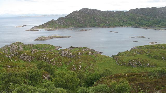
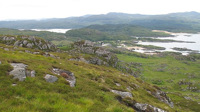
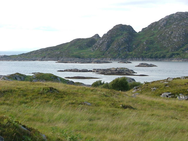
Eilean an Aonaich Images

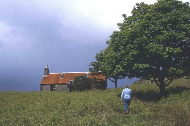
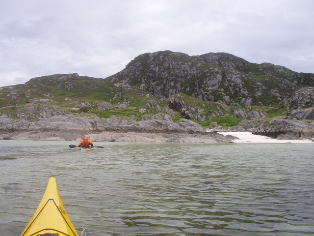
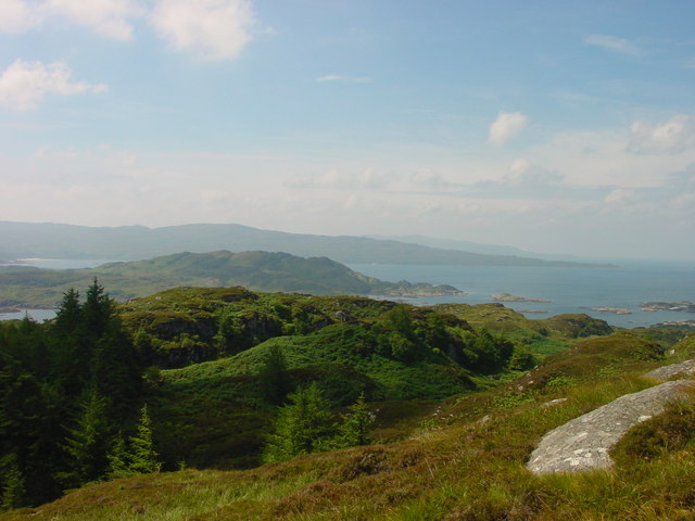
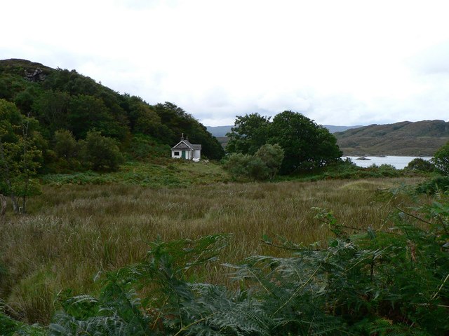
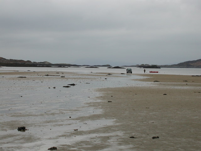
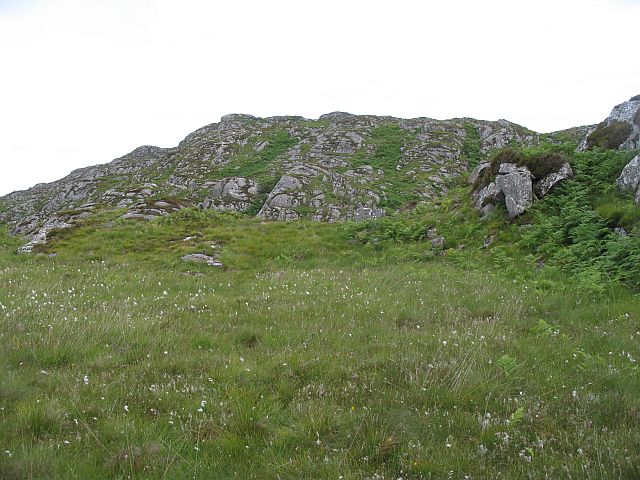
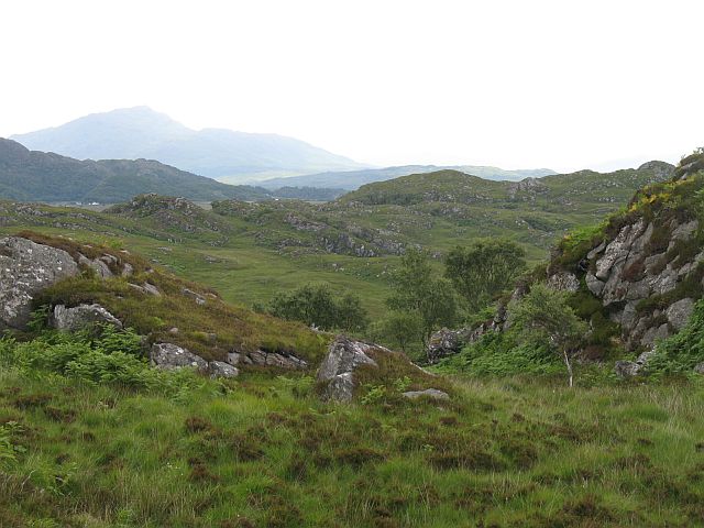
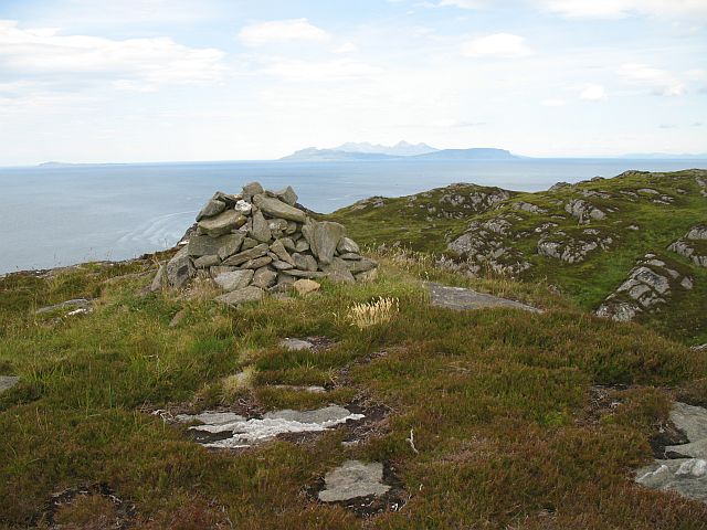
Images are sourced within 2km of 56.790711/-5.8822605 or Grid Reference NM6373. Thanks to Geograph Open Source API. All images are credited.

Eilean Shona - Arien Cottage
Lagoon off Shona. Shell sand Lagoon, off Aonach on Eilean Shona.
Lagoon off Shona.
Shell sand Lagoon, off Aonach on Eilean Shona.
Carn Mor View towards Carn Mor from atop Beinn a Bhaillidh on Eilean Shona
Carn Mor
View towards Carn Mor from atop Beinn a Bhaillidh on Eilean Shona
Old Cottage
Old Cottage
Low tide in the South Channel Loch Moidart Eilean Mhic Neill and other skerries looking West along the South Channel of Loch Moidart.
Low tide in the South Channel Loch Moidart
Eilean Mhic Neill and other skerries looking West along the South Channel of Loch Moidart.
Bare rock, Carn Mòr Rugged small hill above Ardtoe.
Bare rock, Carn Mòr
Rugged small hill above Ardtoe.
Rugged moorland, on Carn Mòr East of Carn Mòr is a rough area of small rocky hills and bogs. It is grazed by cattle.
Rugged moorland, on Carn Mòr
East of Carn Mòr is a rough area of small rocky hills and bogs. It is grazed by cattle.
Carn Mòr The southern summit of a small rugged hill with a fine view. Muck, Eigg and Rum in the distance.
Carn Mòr
The southern summit of a small rugged hill with a fine view. Muck, Eigg and Rum in the distance.
Rubha Mhic Artair / Farquhar's Point Headland at the mouth of Loch Moidart with Eilean Raonuill and Eilean Shona beyond. The north side of Carn Mòr is well wooded and very rugged.
Rubha Mhic Artair / Farquhar's Point
Headland at the mouth of Loch Moidart with Eilean Raonuill and Eilean Shona beyond. The north side of Carn Mòr is well wooded and very rugged.
On Carn Mòr Rugged hillside overlooking the beaches at Ardtoe/ Aird Tobha.
On Carn Mòr
Rugged hillside overlooking the beaches at Ardtoe/ Aird Tobha.
Slopes of Beinn a' Bhàillidh Steep and rugged slopes of Beinn a' Bhàillidh  on Eilean Shona. View across the South Channel towards Carn Mòr.
Slopes of Beinn a' Bhàillidh
Steep and rugged slopes of Beinn a' Bhàillidh on Eilean Shona. View across the South Channel towards Carn Mòr.
Wooded slopes, Carn Mòr Very rugged ground north of Carn Mòr.
Wooded slopes, Carn Mòr
Very rugged ground north of Carn Mòr.
Port na Lathaich Looking north across the South Channel of Loch Moidart to Eilean Shona.  This wild headland north of Ardtoe seems to be rarely visited by land, although the channel is a regular resting place for yachts.
Port na Lathaich
Looking north across the South Channel of Loch Moidart to Eilean Shona. This wild headland north of Ardtoe seems to be rarely visited by land, although the channel is a regular resting place for yachts.
Skerries in the South Channel, Loch Moidart At low tide the narrow channel seems to become much narrower at its mouth, where it meets the Sound of Arisaig.  Good charts are as essential for the yachtsman as a good map is for the walker.  And I lost my OS 1:25000 somewhere in this grid square!
Skerries in the South Channel, Loch Moidart
At low tide the narrow channel seems to become much narrower at its mouth, where it meets the Sound of Arisaig. Good charts are as essential for the yachtsman as a good map is for the walker. And I lost my OS 1:25000 somewhere in this grid square!
Rock formation All of Ardnamurchan is a paradise for geologists.  The forces that went into making this little outcrop can only be guessed at (or explained in detail by a geologist!)
Rock formation
All of Ardnamurchan is a paradise for geologists. The forces that went into making this little outcrop can only be guessed at (or explained in detail by a geologist!)
Lotos - former Norwegian Herring Lugger Under engine in the South Channel, the Lotos was built in 1910 as a herring fisher, but after the 30s spent the next 50 years as a freighter.  What did we do before Google?
Lotos - former Norwegian Herring Lugger
Under engine in the South Channel, the Lotos was built in 1910 as a herring fisher, but after the 30s spent the next 50 years as a freighter. What did we do before Google?
Cnoc nan Sguab This area is rugged country, and much of the low-lying land is peat bog - difficult enough to traverse in the summer, so I can only imagine what it's like in the winter.  I saw a small number of red deer, and unusually a fox, running through the bracken.
Cnoc nan Sguab
This area is rugged country, and much of the low-lying land is peat bog - difficult enough to traverse in the summer, so I can only imagine what it's like in the winter. I saw a small number of red deer, and unusually a fox, running through the bracken.
Show me another place!

Eilean an Aonaich is located at Grid Ref: NM6373 (Lat: 56.790711, Lng: -5.8822605)

Unitary Authority: Highland

Police Authority: Highlands and Islands

What 3 Words

///resorting.webcams.drum. Near Arisaig, Highland

Related Wikis

Eilean Shona

Eilean Shona (Scottish Gaelic: Eilean Seòna) is a tidal island in Loch Moidart, Scotland. The modern name may be from the Old Norse for "sea island". The...

Ardtoe

Ardtoe (Scottish Gaelic: Àird Tobha) is a place on the coast of Ardnamurchan, Lochaber, in the Highland council area of Scotland. It has sandy beaches...

Newton of Ardtoe

Newton of Ardtoe is a scattered crofting hamlet near Acharacle in Lochaber, Scottish Highlands and is in the council area of Highland.

Castle Tioram

Castle Tioram (; Scottish Gaelic: Caisteal Tioram, meaning "dry castle") is a ruined castle that sits on the tidal island Eilean Tioram in Loch Moidart...

Nearby Amenities

Located within 500m of 56.790711,-5.8822605
Source: PGS
Lat/Long: 56.786745/-5.8857431
Source: PGS
Lat/Long: 56.787074/-5.885574
Source: PGS
Lat/Long: 56.7872418/-5.8852105
Source: PGS
Lat/Long: 56.7872989/-5.8848575
Source: PGS
Lat/Long: 56.7873934/-5.8837293
Source: PGS
Lat/Long: 56.7872902/-5.8829449
Source: PGS
Lat/Long: 56.7873286/-5.8830511
Source: PGS
Lat/Long: 56.7870049/-5.8829797
Source: PGS
Lat/Long: 56.7869136/-5.8844544
Source: PGS
Lat/Long: 56.7866939/-5.8845988
Source: PGS
Lat/Long: 56.7916763/-5.8742356
Source: PGS
Lat/Long: 56.7917342/-5.8745346
Source: PGS
Lat/Long: 56.7917448/-5.8747651
Source: PGS
Lat/Long: 56.7919323/-5.8750774
Source: PGS
Lat/Long: 56.7919228/-5.8755373
Source: PGS
Lat/Long: 56.7916964/-5.8756327
Source: PGS
Lat/Long: 56.7914615/-5.8768333
Source: PGS
Lat/Long: 56.791676/-5.8771401
Source: PGS
Lat/Long: 56.7919533/-5.877397
Source: PGS
Lat/Long: 56.792033/-5.8776563
Source: PGS
Lat/Long: 56.7920352/-5.8779147
Source: PGS
Lat/Long: 56.792326/-5.8789228
Source: PGS
Lat/Long: 56.7925522/-5.8805486
Source: PGS
Lat/Long: 56.7924173/-5.8812168
Source: PGS
Lat/Long: 56.7923478/-5.8814015
Source: PGS
Lat/Long: 56.7921669/-5.8816552
Source: PGS
Lat/Long: 56.7921303/-5.881754
Source: PGS
Lat/Long: 56.7920339/-5.8820925
Source: PGS
Lat/Long: 56.7919363/-5.8823114
Source: PGS
Lat/Long: 56.7916651/-5.88262
Source: PGS
Lat/Long: 56.7916108/-5.8827006
Source: PGS
Lat/Long: 56.7915736/-5.8828202
Source: PGS
Lat/Long: 56.7914883/-5.8832217
Source: PGS
Lat/Long: 56.7913751/-5.8836701
Source: PGS
Lat/Long: 56.7916399/-5.8845308
Source: PGS
Lat/Long: 56.7917616/-5.8846628
Source: PGS
Lat/Long: 56.7918032/-5.8847469
Source: PGS
Lat/Long: 56.7918935/-5.885334
Source: PGS
Lat/Long: 56.7921254/-5.8858122
Source: PGS
Lat/Long: 56.7919782/-5.8862109
Source: PGS
Lat/Long: 56.7919601/-5.8864944
Aonach
Place: locality
Lat/Long: 56.7928423/-5.8838354
The data included in this document is from www.openstreetmap.org. The data is made available under ODbL.

Have you been to Eilean an Aonaich?

Leave your review of Eilean an Aonaich below (or comments, questions and feedback).