Cruach a' Choire

Hill, Mountain in Inverness-shire

Scotland

Cruach a' Choire

Rubha nan Clach Dearga
Rubha nan Clach Dearga Credit: Mick Garratt

Cruach a' Choire is a prominent hill located in Inverness-shire, Scotland. It is part of the Scottish Highlands and offers breathtaking views of the surrounding landscape. Standing at an elevation of 925 meters (3,035 feet), it is considered a Munro, a term used to describe mountains in Scotland over 3,000 feet.

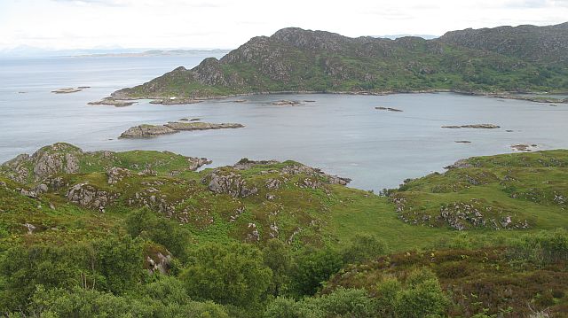
The hill is situated in a remote and rugged area, attracting adventure seekers and nature enthusiasts alike. Its location in the western part of Inverness-shire provides visitors with stunning vistas of the nearby Loch Ness and the Great Glen, a natural fault line that stretches across the country.

Cruach a' Choire is known for its diverse and unique flora and fauna. The hill is covered in heather, mosses, and various wildflowers, creating a vibrant and colorful landscape during the summer months. It is also home to a variety of bird species, including the iconic golden eagle, as well as red deer and pine martens.

Hiking and climbing are popular activities on Cruach a' Choire, with several routes available for all levels of experience. The most common starting point is from the village of Invermoriston, where a well-marked path leads up the hill. From there, visitors can follow the ridge and enjoy the panoramic views as they ascend.

Cruach a' Choire offers an incredible opportunity to immerse oneself in the natural beauty of the Scottish Highlands. Whether it be for a challenging hike or simply to admire the stunning scenery, this hill is a must-visit destination for outdoor enthusiasts.

If you have any feedback on the listing, please let us know in the comments section below.

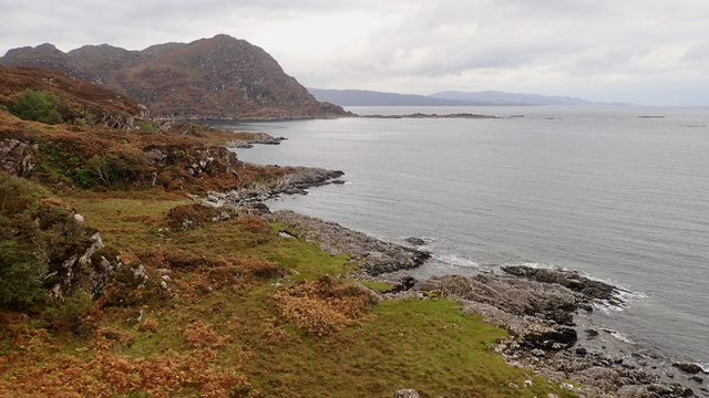
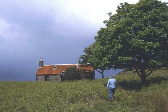
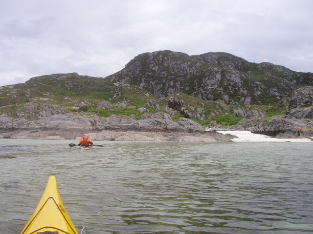
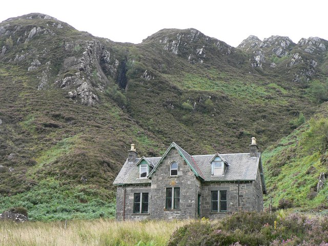
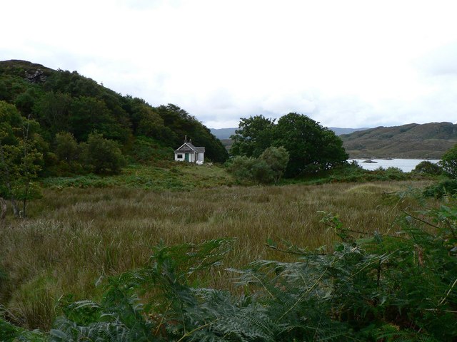
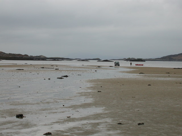
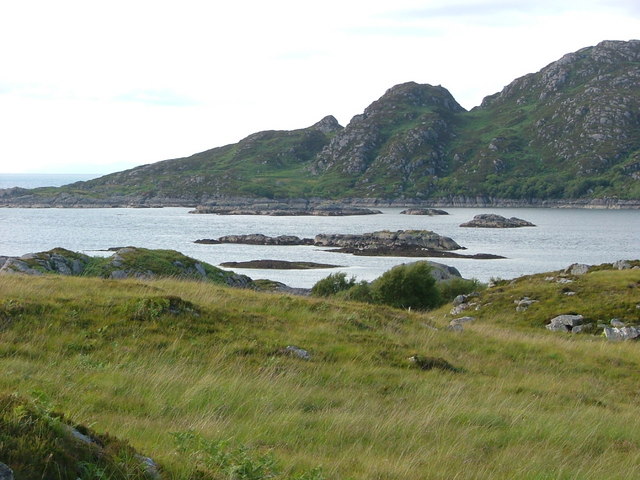
Cruach a' Choire Images

Images are sourced within 2km of 56.796566/-5.8799167 or Grid Reference NM6373. Thanks to Geograph Open Source API. All images are credited.

Rubha nan Clach Dearga
Eilean Shona - Arien Cottage
North Channel, Loch Moidart looking W, this shows the myriad of rocks and islets at the mouth of Loch Moidart. In the distance to the right is the Isle of Eigg.
North Channel, Loch Moidart
looking W, this shows the myriad of rocks and islets at the mouth of Loch Moidart. In the distance to the right is the Isle of Eigg.
Lagoon off Shona. Shell sand Lagoon, off Aonach on Eilean Shona.
Lagoon off Shona.
Shell sand Lagoon, off Aonach on Eilean Shona.
Old School on Shona Students used to have to come by boat to this school
Old School on Shona
Students used to have to come by boat to this school
Old Cottage
Old Cottage
Low tide in the South Channel Loch Moidart Eilean Mhic Neill and other skerries looking West along the South Channel of Loch Moidart.
Low tide in the South Channel Loch Moidart
Eilean Mhic Neill and other skerries looking West along the South Channel of Loch Moidart.
Rubha Mhic Artair / Farquhar's Point Headland at the mouth of Loch Moidart with Eilean Raonuill and Eilean Shona beyond. The north side of Carn Mòr is well wooded and very rugged.
Rubha Mhic Artair / Farquhar's Point
Headland at the mouth of Loch Moidart with Eilean Raonuill and Eilean Shona beyond. The north side of Carn Mòr is well wooded and very rugged.
Northwest slopes of Beinn a' Bhàillidh Looking down from near the highest point on Eilean Shona to the North Channel and the inlet that nearly divides the island.
Northwest slopes of Beinn a' Bhàillidh
Looking down from near the highest point on Eilean Shona to the North Channel and the inlet that nearly divides the island.
Beinn a' Bhàillidh The summit of Eilean Shona.
Beinn a' Bhàillidh
The summit of Eilean Shona.
Slopes of Beinn a' Bhàillidh Steep and rugged slopes of Beinn a' Bhàillidh  on Eilean Shona. View across the South Channel towards Carn Mòr.
Slopes of Beinn a' Bhàillidh
Steep and rugged slopes of Beinn a' Bhàillidh on Eilean Shona. View across the South Channel towards Carn Mòr.
Wooded slopes, Carn Mòr Very rugged ground north of Carn Mòr.
Wooded slopes, Carn Mòr
Very rugged ground north of Carn Mòr.
Beinn a'  Bhaillidh Summit The summit cairn and trig on Eilean Shona's highest point. The islands of Eigg and Rum are in the background.
Beinn a' Bhaillidh Summit
The summit cairn and trig on Eilean Shona's highest point. The islands of Eigg and Rum are in the background.
Port na Lathaich Looking north across the South Channel of Loch Moidart to Eilean Shona.  This wild headland north of Ardtoe seems to be rarely visited by land, although the channel is a regular resting place for yachts.
Port na Lathaich
Looking north across the South Channel of Loch Moidart to Eilean Shona. This wild headland north of Ardtoe seems to be rarely visited by land, although the channel is a regular resting place for yachts.
Skerries in the South Channel, Loch Moidart At low tide the narrow channel seems to become much narrower at its mouth, where it meets the Sound of Arisaig.  Good charts are as essential for the yachtsman as a good map is for the walker.  And I lost my OS 1:25000 somewhere in this grid square!
Skerries in the South Channel, Loch Moidart
At low tide the narrow channel seems to become much narrower at its mouth, where it meets the Sound of Arisaig. Good charts are as essential for the yachtsman as a good map is for the walker. And I lost my OS 1:25000 somewhere in this grid square!
Rock formation All of Ardnamurchan is a paradise for geologists.  The forces that went into making this little outcrop can only be guessed at (or explained in detail by a geologist!)
Rock formation
All of Ardnamurchan is a paradise for geologists. The forces that went into making this little outcrop can only be guessed at (or explained in detail by a geologist!)
Lotos - former Norwegian Herring Lugger Under engine in the South Channel, the Lotos was built in 1910 as a herring fisher, but after the 30s spent the next 50 years as a freighter.  What did we do before Google?
Lotos - former Norwegian Herring Lugger
Under engine in the South Channel, the Lotos was built in 1910 as a herring fisher, but after the 30s spent the next 50 years as a freighter. What did we do before Google?
Eilean na -Oitire Looking down on the islands in the North Channel at about half-tide.
Eilean na -Oitire
Looking down on the islands in the North Channel at about half-tide.
Show me another place!

Cruach a' Choire is located at Grid Ref: NM6373 (Lat: 56.796566, Lng: -5.8799167)

Unitary Authority: Highland

Police Authority: Highlands and Islands

What 3 Words

///afterglow.hope.ribcage. Near Arisaig, Highland

Related Wikis

Eilean Shona

Eilean Shona (Scottish Gaelic: Eilean Seòna) is a tidal island in Loch Moidart, Scotland. The modern name may be from the Old Norse for "sea island". The...

Ardtoe

Ardtoe (Scottish Gaelic: Àird Tobha) is a place on the coast of Ardnamurchan, Lochaber, in the Highland council area of Scotland. It has sandy beaches...

Castle Tioram

Castle Tioram (; Scottish Gaelic: Caisteal Tioram, meaning "dry castle") is a ruined castle that sits on the tidal island Eilean Tioram in Loch Moidart...

Newton of Ardtoe

Newton of Ardtoe is a scattered crofting hamlet near Acharacle in Lochaber, Scottish Highlands and is in the council area of Highland.

Nearby Amenities

Located within 500m of 56.796566,-5.8799167
Source: PGS
Lat/Long: 56.792326/-5.8789228
Source: PGS
Lat/Long: 56.7925522/-5.8805486
Source: PGS
Lat/Long: 56.7924173/-5.8812168
Source: PGS
Lat/Long: 56.7923478/-5.8814015
Aonach
Place: locality
Lat/Long: 56.7928423/-5.8838354
The data included in this document is from www.openstreetmap.org. The data is made available under ODbL.

Have you been to Cruach a' Choire?

Leave your review of Cruach a' Choire below (or comments, questions and feedback).