Sgeir nam Faochag

Island in Argyllshire

Scotland

Sgeir nam Faochag

Approaching Pennyghael On the A849
Approaching Pennyghael Credit: Andrew Abbott

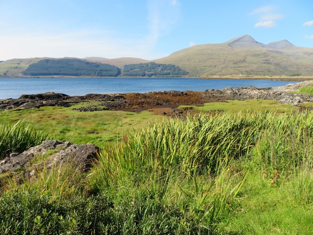
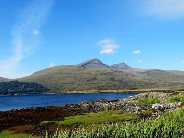
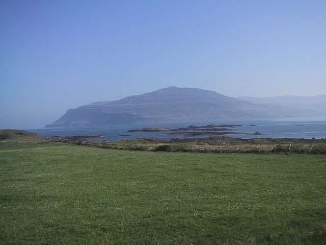
Sgeir nam Faochag, also known as the Skerry of the Seals, is a small uninhabited island located off the western coast of Argyllshire, Scotland. Situated in the Inner Hebrides, it is part of the wider Firth of Lorn marine area. The island is known for its abundant wildlife, particularly its seal population.

Covering an area of approximately 0.05 square kilometers, Sgeir nam Faochag is a rocky outcrop rising from the sea. It is characterized by its rugged and uneven terrain, with cliffs and rocky ledges surrounding its perimeter. The island is accessible only by boat, and caution should be exercised due to the potentially treacherous waters in the area.

The name Sgeir nam Faochag translates to "Skerry of the Seals" in Gaelic, which aptly describes the island's most notable feature. The surrounding waters are a haven for seals, and Sgeir nam Faochag serves as an important breeding ground and haul-out site for these marine mammals. Visitors to the island can often observe seals basking on the rocks or swimming in the surrounding waters.

In addition to its seal population, Sgeir nam Faochag attracts birdwatchers due to its significance as a nesting site for seabirds. Various species, including guillemots, razorbills, and kittiwakes, can be found nesting on the cliffs and crags of the island.

As an uninhabited island, Sgeir nam Faochag offers a unique opportunity for nature enthusiasts to experience a remote and untouched environment. Its rugged beauty and abundant wildlife make it a popular destination for wildlife photographers, researchers, and those seeking a tranquil escape amidst nature's wonders.

If you have any feedback on the listing, please let us know in the comments section below.

Sgeir nam Faochag Images

Images are sourced within 2km of 56.365321/-6.023849 or Grid Reference NM5126. Thanks to Geograph Open Source API. All images are credited.

Approaching Pennyghael On the A849
Approaching Pennyghael
On the A849
A849 beside Loch Sgridain The long single track road to Fionnphort and the ferry for Iona.
A849 beside Loch Sgridain
The long single track road to Fionnphort and the ferry for Iona.
Shore at Pennyghael
Shore at Pennyghael
Pennyghael Hotel
Pennyghael Hotel
Minor road descending to Pennyghael The road connects Pennyghael to Carsaig which is over a pass behind the camera position. Pennyghael, the settlement, is at the junction of this road and the A849; there's a building, presumably a large house, near to the road, also named Pennyghael.
Minor road descending to Pennyghael
The road connects Pennyghael to Carsaig which is over a pass behind the camera position. Pennyghael, the settlement, is at the junction of this road and the A849; there's a building, presumably a large house, near to the road, also named Pennyghael.
Slope above Leidle River Glen Leidle lies below the road where flows the Leidle River.
Ben More is the distant mountain.
Slope above Leidle River
Glen Leidle lies below the road where flows the Leidle River. Ben More is the distant mountain.
Pennyghael Heron A heron on the shore by Loch Scridain at Pennyghael.
Pennyghael Heron
A heron on the shore by Loch Scridain at Pennyghael.
Loch Scridain The easterly end of Loch Scridain at Pennyghael.
Loch Scridain
The easterly end of Loch Scridain at Pennyghael.
Pennyghael Bridge The road bridge at Pennyghael carrying the A849 over the Leidle.
Pennyghael Bridge
The road bridge at Pennyghael carrying the A849 over the Leidle.
Leidle Mouth The Leidle flowing into Loch Scridain at Pennyghael.
Leidle Mouth
The Leidle flowing into Loch Scridain at Pennyghael.
Shoreline by Rubha Buidhe Rough grassland and rock by the shore of Loch Scridain.
Shoreline by Rubha Buidhe
Rough grassland and rock by the shore of Loch Scridain.
Scridain View A view across the shoreline of Loch Scridain and the sea loch itself to the mass of Ben More, the aptly named big hill behind.
Scridain View
A view across the shoreline of Loch Scridain and the sea loch itself to the mass of Ben More, the aptly named big hill behind.
Forest and clearfell area near Cnoc nan Cub
End  of road and turning area in the forest above Pennyghael
End of road and turning area in the forest above Pennyghael
Old Milepost by the A849, west of Pennycross Blaydon casting by the A849, in parish of Kilfinichen & Kilvickeon (Mull District), West of Pennycross, on verge.

Inscription reads:-
: SALEN / 24 / MILES : : 1897 : : IONA FERRY / 14 / MILES :
Maker:-
: SMITH PATTERSON / BLAYDON :

Surveyed

Milestone Society National ID: AB_MLSAIF24
Old Milepost by the A849, west of Pennycross
Blaydon casting by the A849, in parish of Kilfinichen & Kilvickeon (Mull District), West of Pennycross, on verge. Inscription reads:- : SALEN / 24 / MILES : : 1897 : : IONA FERRY / 14 / MILES : Maker:- : SMITH PATTERSON / BLAYDON : Surveyed Milestone Society National ID: AB_MLSAIF24
Roadside trees and ferns at Pennyghael Birch and Dryopteris borreri, with Loch Scridain beyond.
Roadside trees and ferns at Pennyghael
Birch and Dryopteris borreri, with Loch Scridain beyond.
Power cables at Pennyghael Rough pasture and Birch woodland
Power cables at Pennyghael
Rough pasture and Birch woodland
Mixed woodland at Pennyghael Pine, Birch and Rowan.
Mixed woodland at Pennyghael
Pine, Birch and Rowan.
Show me another place!

Sgeir nam Faochag is located at Grid Ref: NM5126 (Lat: 56.365321, Lng: -6.023849)

Unitary Authority: Argyll and Bute

Police Authority: Argyll and West Dunbartonshire

What 3 Words

///worksheet.hugs.limits. Near Lochbuie, Argyll & Bute

Related Wikis

Pennyghael

Pennyghael (Scottish Gaelic: Peighinn nan Gàidheal) is a small village in the Ross of Mull, Argyll and Bute, Scotland. It is located along the A849 road...

Aird of Kinloch

Aird of Kinloch (Gaelic:An Àird) is a rocky outcrop between Loch Scridain and Loch Beg on the Isle of Mull, Argyll and Bute, Scotland. == References ==
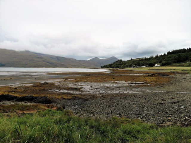
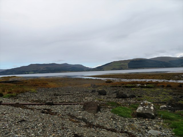
Loch Scridain

Loch Scridain is a 15-kilometre-long (9-mile) sea loch, with a west-south west aspect, on the western, or Atlantic coastline of the Isle of Mull, in the...

Tiroran

Tiroran is hamlet on the Isle of Mull in Argyll and Bute, Scotland. == History == In the late 18th century Tiroran House was associated with the McKinnon...

Nearby Amenities

Located within 500m of 56.365321,-6.023849
Source: PGS
Lat/Long: 56.3651453/-6.0228172
Created By: dmgroom_coastlines
Source: PGS
Lat/Long: 56.36548/-6.01853
Source: PGS
Lat/Long: 56.3659285/-6.0183089
Source: PGS
Lat/Long: 56.3659589/-6.0189972
Created By: dmgroom_coastlines
Source: PGS
Lat/Long: 56.36601/-6.01919
Source: PGS
Lat/Long: 56.3662037/-6.0185375
Created By: dmgroom_coastlines
Source: PGS
Lat/Long: 56.36663/-6.01844
Source: PGS
Lat/Long: 56.3668811/-6.0169694
Source: PGS
Lat/Long: 56.367262/-6.0172709
Pennyghael
Name Gd: Peighinn nan Gàidheal
Place: village
Wikidata: Q15059208
Wikipedia: en:Pennyghael
Lat/Long: 56.3645719/-6.0188641
Telephone
Booth: K6
Covered: booth
Lat/Long: 56.3643595/-6.0215837
Post Box
Collection Times: Mo-Fr 12:45; Sa 06:30
Operator: Royal Mail
Operator Wikidata: Q638098
Post Box Mounting: pier
Post Box Type: lamp
Ref: PA70 176
Royal Cypher: scottish_crown
Lat/Long: 56.3643793/-6.0215843
Smithy House B&B + Tea Room
Phone: +44 1681 704034
Tourism: guest_house
Lat/Long: 56.3643922/-6.0192021
Power: pole
Lat/Long: 56.3641492/-6.0161036
Power: pole
Lat/Long: 56.3636092/-6.0163933
Power: pole
Lat/Long: 56.3644381/-6.0172683
Power: pole
Lat/Long: 56.3647771/-6.0187097
Power: pole
Lat/Long: 56.3647538/-6.0194259
Power: pole
Lat/Long: 56.364658/-6.0200535
Power: pole
Lat/Long: 56.3645658/-6.0206699
Power: pole
Lat/Long: 56.3645388/-6.0217875
Power: pole
Lat/Long: 56.3645007/-6.0222487
Power: pole
Lat/Long: 56.3644516/-6.0228364
Power: pole
Lat/Long: 56.3644123/-6.0232799
Power: pole
Lat/Long: 56.3643632/-6.0237788
Power: pole
Lat/Long: 56.3643104/-6.0242822
Power: pole
Lat/Long: 56.3642379/-6.0251558
Power: pole
Lat/Long: 56.3641949/-6.0256237
Power: pole
Lat/Long: 56.36412/-6.0262757
The data included in this document is from www.openstreetmap.org. The data is made available under ODbL.

Have you been to Sgeir nam Faochag?

Leave your review of Sgeir nam Faochag below (or comments, questions and feedback).